Stagman Ridge (Mt Adams) 29-Aug-2011
Posted: August 30th, 2011, 4:56 pm
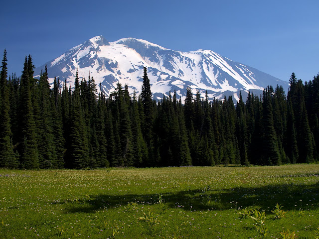
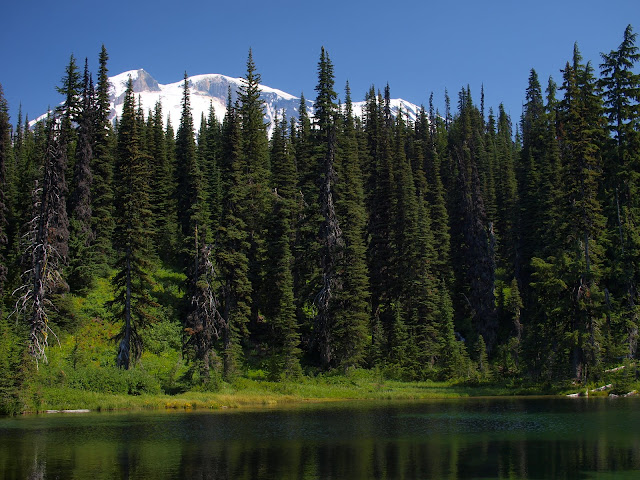
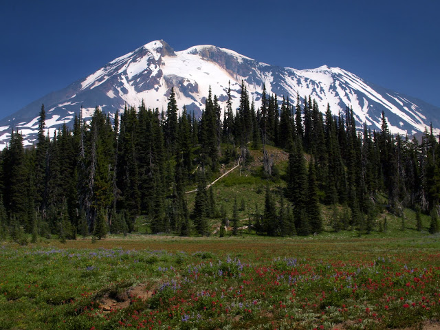
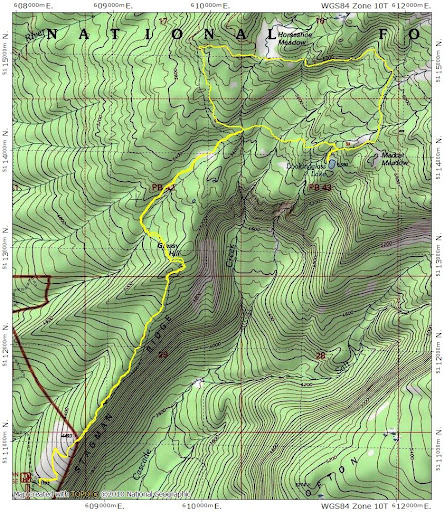
I had hoped to get out of town for a few days, but events conspired to allow me a staycation instead. So I decided to work on those hikes on my “to do” list that involve 2 or more hours driving from Portland. Last Monday’s hike was Stagman Ridge on the SW side of Adams. It’s the last hike in Bond’s Take a Hike Portland, but I haven’t seen it in many other guidebooks. Driving out from Portland, I went through a patch of drizzle, but the skies were clear at the TH. From there, I followed the Stagman Ridge trail (#12) almost directly along the ridge toward Adams. This – and all the trails I followed this day – were in OK to good shape and some even showed signs of recent maintenance (i.e., removal of blowdowns). At 5200’, I came to the first meadow and my first wide-screen view of Adams. Wow!
Just beyond the meadow, the #12 trail makes a sharp turn to the left, and there’s a little sign to the right.
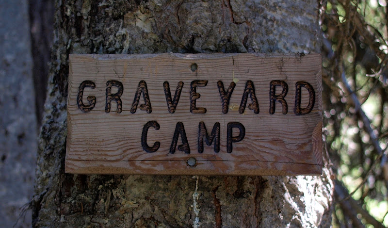
Somewhat ominous and not particularly accurate, since it marks the start of a good use trail over to Lookingglass Lake and not to any (readily evident) resting place of the departed. This use trail contours E at around 5400’, crossing several small streams,
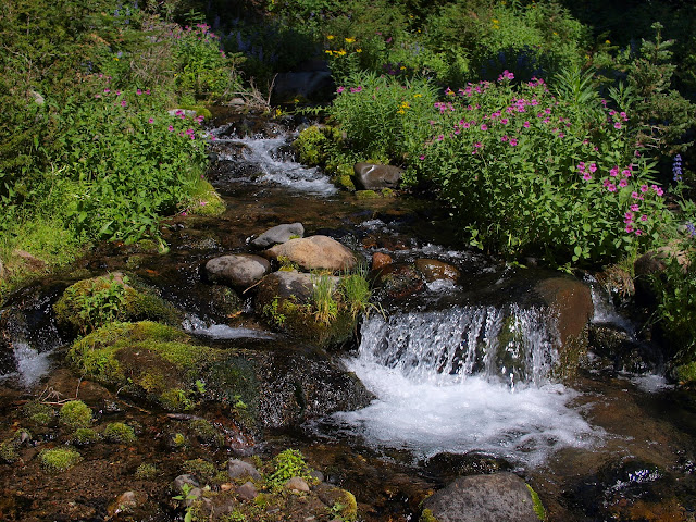
then crosses a large stream (2 logs were in place to make a bridge),
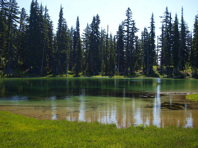
before taking you to a side trail down to Lookingglass Lake. There are good campsites on either side of the lake and it would make a first-rate destination for an overnight backpack.
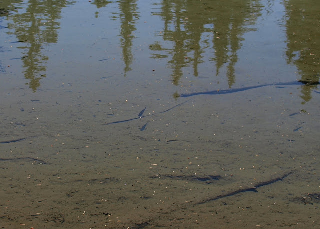
And, yes, there are fish in the lake.
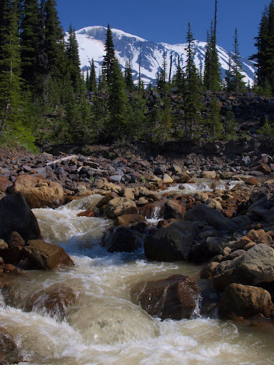
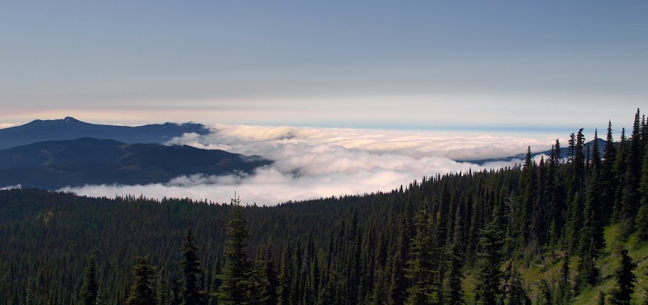
An official trail (#9A) continues E from above the lake, eventually connecting with the round the mountain trail (#9). From above the lake, I got a view of St. Helens, sitting in a soup of clouds pushing in from the NW.
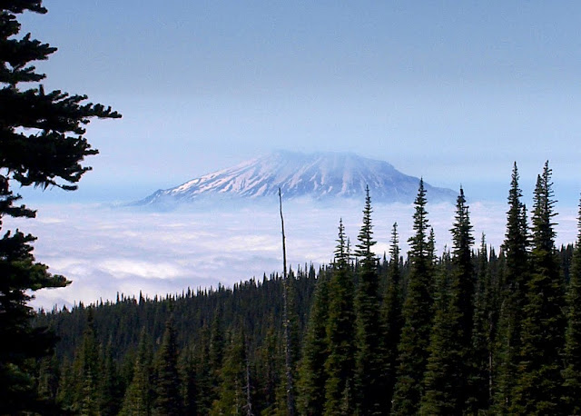
The RTM trail took me around a ridge with a good view of that roiling cloud layer trying to force its way into the interior.
That was followed shortly by Horseshoe Meadow and another grand view of Adams.
Just past the meadow, I followed a short section of the PCT (2000) back to the Stagman Ridge trail and hence to the TH. There is a short, steep, loose, dusty section of trail #12 between the PCT junction and the “Graveyard Camp” sign that I avoided having to climb up by doing a counter-clockwise loop. All told, a short loop (11.4 mi, 2400’ (including detour to the lake)) but a great way to see the W side of Adams up close.
Just beyond the meadow, the #12 trail makes a sharp turn to the left, and there’s a little sign to the right.
Somewhat ominous and not particularly accurate, since it marks the start of a good use trail over to Lookingglass Lake and not to any (readily evident) resting place of the departed. This use trail contours E at around 5400’, crossing several small streams,
then crosses a large stream (2 logs were in place to make a bridge),
before taking you to a side trail down to Lookingglass Lake. There are good campsites on either side of the lake and it would make a first-rate destination for an overnight backpack.
And, yes, there are fish in the lake.
An official trail (#9A) continues E from above the lake, eventually connecting with the round the mountain trail (#9). From above the lake, I got a view of St. Helens, sitting in a soup of clouds pushing in from the NW.
The RTM trail took me around a ridge with a good view of that roiling cloud layer trying to force its way into the interior.
That was followed shortly by Horseshoe Meadow and another grand view of Adams.
Just past the meadow, I followed a short section of the PCT (2000) back to the Stagman Ridge trail and hence to the TH. There is a short, steep, loose, dusty section of trail #12 between the PCT junction and the “Graveyard Camp” sign that I avoided having to climb up by doing a counter-clockwise loop. All told, a short loop (11.4 mi, 2400’ (including detour to the lake)) but a great way to see the W side of Adams up close.