Vista Ridge - Barrett Spur (and Fire!) - 8/28/11
Posted: August 29th, 2011, 10:22 pm
Sunday My 9-year old daughter and I took the Vista trail towards Cairn basin. The plan was to do the loop through Eden park, but as usual, once we reached timberline the lure of Barrett Spur was too great. So we slogged up the ridge, over snow fields here and there.
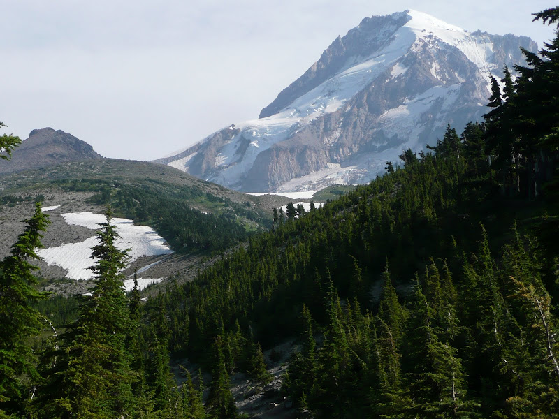
[Mt. Hood and Barrett Spur from the junction of the Vista Ridge and Timberline trails.]
As we started up the ridge we began to smell wood smoke. At first I thought it was just a campfire, but as it got stronger I began to realize that didn't make sense and started to get a little nervous. As we neared the top of the ridge we could begin to see a column of smoke rising to the east, towards Elk Cove. As we gained height we could see that the fire was well beyond Elk Cove, down in the Coe river canyon. About this time a helicopter came flying over from the west and circled the smoke column. Suddenly we saw it dump liquid on the fire. The helicopter spent the next few hours dumping water, circling over to a nearby lake (Lawrance?) to scoop up the water. Kinda cool to see such an operation in action, and made me feel a bit safer being up there. Has Anybody heard any details about this fire?
We met a large group of boys on their way down from Barrett Spur who were sliding down the big snow field towards Dollar lake.
We made it to the "Shoulder" just below Barrett Spur, but didn't have the legs or time to get all the way up Barrett. Instead we made our way down through the snow fields and flower meadows towards Cairn Basin. I didn't get us over far enough to reach the shelter by the time we hit the Timberline trail, but we were just as happy to have a slightly shorter path home.
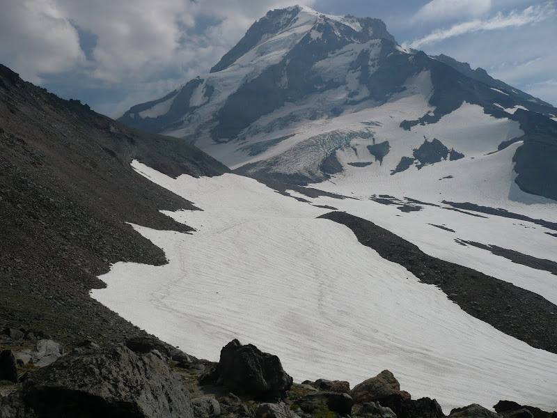
[The view from the "shoulder" below Barrett Spur.]
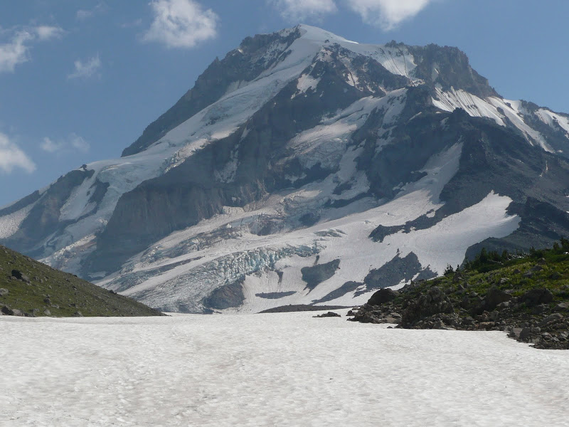
[Another view, from the snow fields below Barrett Spur.]
The avalanche lilies were past at the lower elevations, but it must have been an impressive display along the Vista Ridge trail a few weeks ago. Besides the avalanche lilies there were the usual suspects: Lupine, Indian paintbrush, Old man of the mtn, even some purple shooting stars along the first marshy creek crossing on the timberline trail towards Elk Cove. (Sadly, no flower photos this time.)
A beautiful day to be on the mountain!
[Mt. Hood and Barrett Spur from the junction of the Vista Ridge and Timberline trails.]
As we started up the ridge we began to smell wood smoke. At first I thought it was just a campfire, but as it got stronger I began to realize that didn't make sense and started to get a little nervous. As we neared the top of the ridge we could begin to see a column of smoke rising to the east, towards Elk Cove. As we gained height we could see that the fire was well beyond Elk Cove, down in the Coe river canyon. About this time a helicopter came flying over from the west and circled the smoke column. Suddenly we saw it dump liquid on the fire. The helicopter spent the next few hours dumping water, circling over to a nearby lake (Lawrance?) to scoop up the water. Kinda cool to see such an operation in action, and made me feel a bit safer being up there. Has Anybody heard any details about this fire?
We met a large group of boys on their way down from Barrett Spur who were sliding down the big snow field towards Dollar lake.
We made it to the "Shoulder" just below Barrett Spur, but didn't have the legs or time to get all the way up Barrett. Instead we made our way down through the snow fields and flower meadows towards Cairn Basin. I didn't get us over far enough to reach the shelter by the time we hit the Timberline trail, but we were just as happy to have a slightly shorter path home.
[The view from the "shoulder" below Barrett Spur.]
[Another view, from the snow fields below Barrett Spur.]
The avalanche lilies were past at the lower elevations, but it must have been an impressive display along the Vista Ridge trail a few weeks ago. Besides the avalanche lilies there were the usual suspects: Lupine, Indian paintbrush, Old man of the mtn, even some purple shooting stars along the first marshy creek crossing on the timberline trail towards Elk Cove. (Sadly, no flower photos this time.)
A beautiful day to be on the mountain!