Paradise Park/Hidden Lk Loop 17-Aug-2011
Posted: August 18th, 2011, 5:22 pm
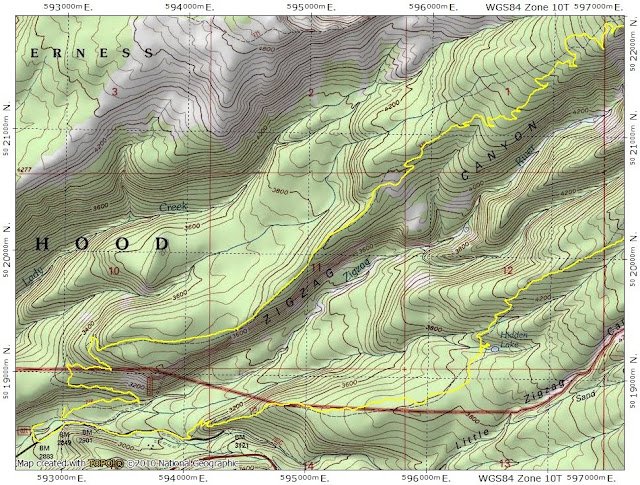
Probably because I bore easily, I’m always looking for new and interesting loop hikes with views. Lorain (Afoot & Afield Portland/Vancouver, 2nd edition, pg. 361) mentions a “giant loop” - up the Paradise Park trail (778), E on the PCT, and returning via the Hidden Lake trail (779) – which I did on Wednesday. The campsites at the Paradise Ridge TH are in pretty sorry condition, but the trail itself is wide, gentle, and largely free of obstructions all the way from the TH to the PCT.
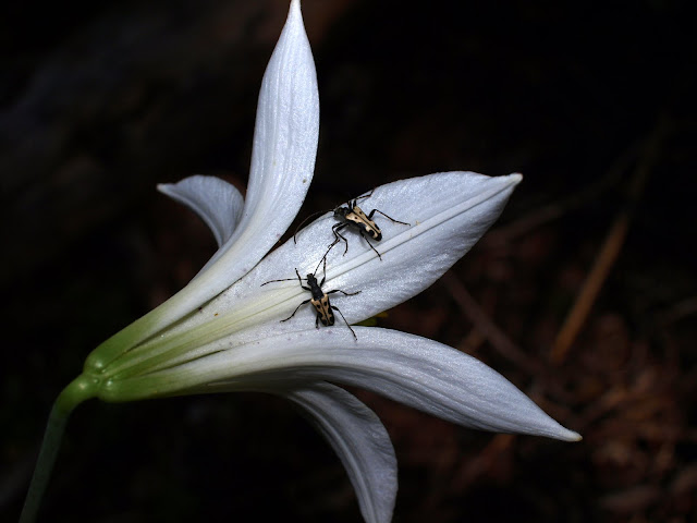
Mid-August and some flowers are still blooming – and attracting insect visitors.
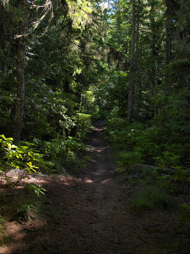
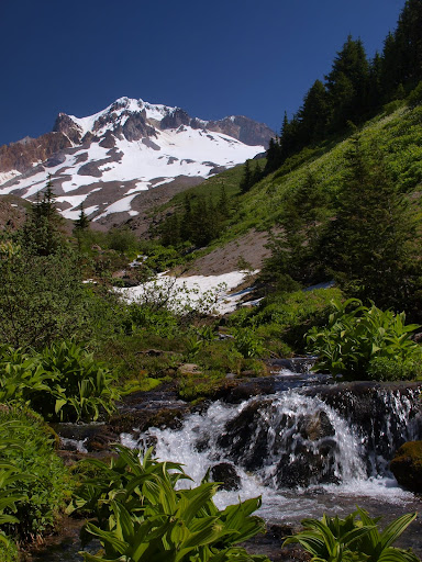
Most of the trail is in the woods – which is pleasant in its own right – but I didn’t get my first view of Hood (or much else) until mile 5 or so,
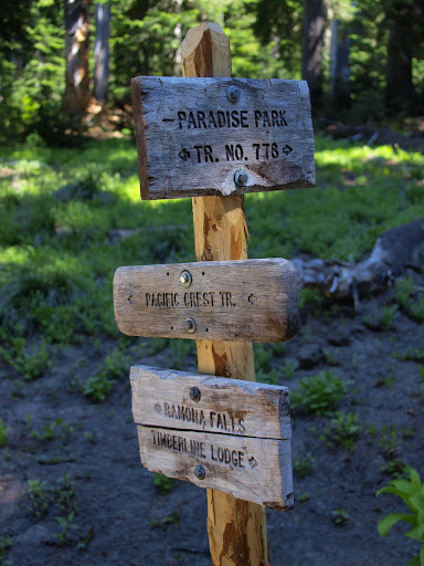
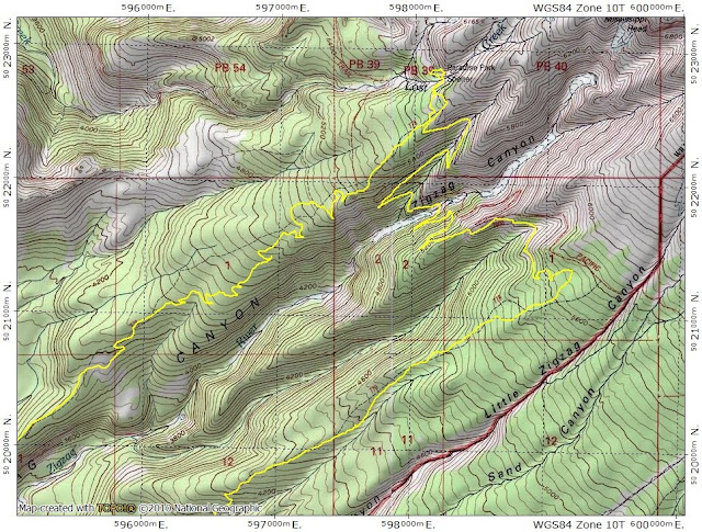
After about 6 mi, 778 crosses the PCT, climbs to trail 757, which then continues on to Paradise Park.
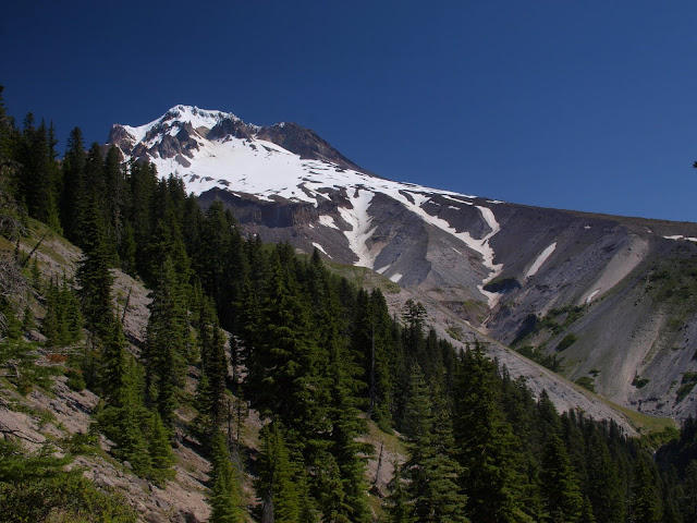
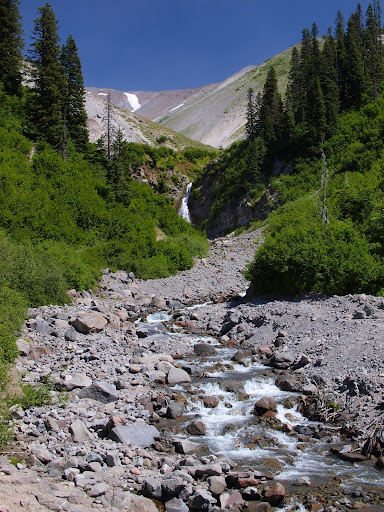
As with Yocum Ridge, after a long voyage through the forest, the trees just end suddenly and you are left with a gigantic full-on view of Hood.
My older map still shows a “Paradise Park Shelter” - but the newer Green Trail map doesn’t – which is understandable since this seems to about all that’s left of it.
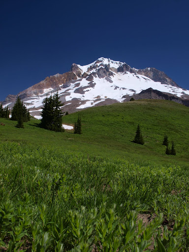
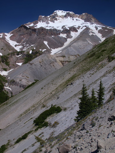
One thing I wouldn’t have seen if I’d stayed on the PCT are these large “meadows” between the tree line and the rocky upper reaches of Hood.
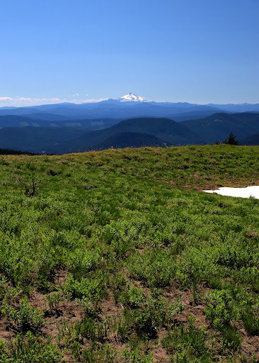
It being a totally clear day, I even got a view of Jefferson.
I headed back via trail 757 and then the PCT, which crosses Zigzag Canyon,
before climbing up to give a view of Hood’s Mississippi Head and the Zigzag Glacier above.
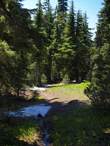
About a 1.5 mi after crossing Zigzag Canyon, the PCT reaches the junction with the Hidden Lake trail. This trail is completely in the forest all the way down to its TH and varies in quality between sketchy and OK down to Hidden Lake.
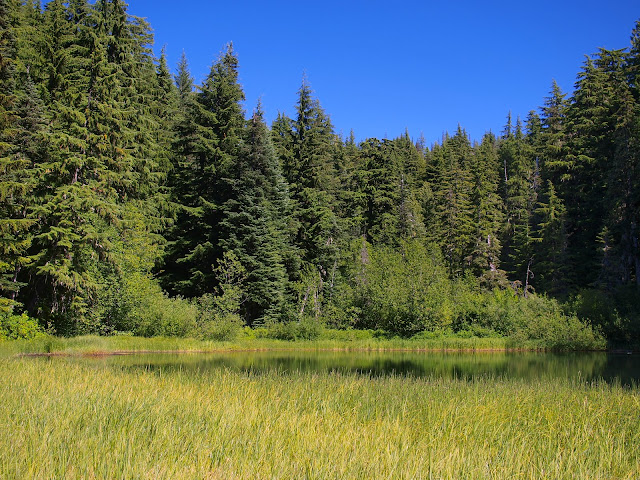
Between the lake and the TH it’s in much better shape – clearly the lake is the destination on this trail. The lake is, in fact, “hidden” in that it’s not at all visible from the trail and some bushwhacking is required even to get a look (it’s more accessible, and there are better camp sites, on the S side).
The TH is about 1.5 mi below the lake, and then it was another 0.7 mi down Forest Road 39 to my car at the Paradise TH. The hike up trail 778 in the morning under the forest canopy was very relaxing and the views, once I reached Paradise Park, outstanding. The only downside is that the return via 779 is all trees with no views – so I was a little “over forested” by the end of the day. But, overall, a pretty good loop hike - 16.5 mi, 3700’ gain.
Mid-August and some flowers are still blooming – and attracting insect visitors.
Most of the trail is in the woods – which is pleasant in its own right – but I didn’t get my first view of Hood (or much else) until mile 5 or so,
After about 6 mi, 778 crosses the PCT, climbs to trail 757, which then continues on to Paradise Park.
As with Yocum Ridge, after a long voyage through the forest, the trees just end suddenly and you are left with a gigantic full-on view of Hood.
My older map still shows a “Paradise Park Shelter” - but the newer Green Trail map doesn’t – which is understandable since this seems to about all that’s left of it.
One thing I wouldn’t have seen if I’d stayed on the PCT are these large “meadows” between the tree line and the rocky upper reaches of Hood.
It being a totally clear day, I even got a view of Jefferson.
I headed back via trail 757 and then the PCT, which crosses Zigzag Canyon,
before climbing up to give a view of Hood’s Mississippi Head and the Zigzag Glacier above.
About a 1.5 mi after crossing Zigzag Canyon, the PCT reaches the junction with the Hidden Lake trail. This trail is completely in the forest all the way down to its TH and varies in quality between sketchy and OK down to Hidden Lake.
Between the lake and the TH it’s in much better shape – clearly the lake is the destination on this trail. The lake is, in fact, “hidden” in that it’s not at all visible from the trail and some bushwhacking is required even to get a look (it’s more accessible, and there are better camp sites, on the S side).
The TH is about 1.5 mi below the lake, and then it was another 0.7 mi down Forest Road 39 to my car at the Paradise TH. The hike up trail 778 in the morning under the forest canopy was very relaxing and the views, once I reached Paradise Park, outstanding. The only downside is that the return via 779 is all trees with no views – so I was a little “over forested” by the end of the day. But, overall, a pretty good loop hike - 16.5 mi, 3700’ gain.