Herman/Benson/Eagle Traverse 21-Jun-2011
Posted: June 22nd, 2011, 10:31 am
Yesterday, Peder and I met at the outer Eagle Creek TH (near the “historic toilets”) to arrange a car shuttle. From Eagle Ck, he headed up Ruckel Ridge to explore the Benson Plateau, while I drove his car to the Herman Creek TH to take the PCT over to the Eagle-Benson trail and Eagle Creek. This allowed us both to enjoy “loop” hikes without actually having to make the tedious hike between the Herman and Eagle Creek THs. Peder also figured a hike involving me would guarantee bluebird weather (he was right - the gray gloom disappeared immediately after Troutdale). From the Herman Ck TH, I took the 406 and then the 406E trails over to the PCT. 95% of the trails on today’s hike were snow-free and all were sun-dappled.

There’s one spot on the PCT that provides an almost head-on view of the Greenleaf Basin,
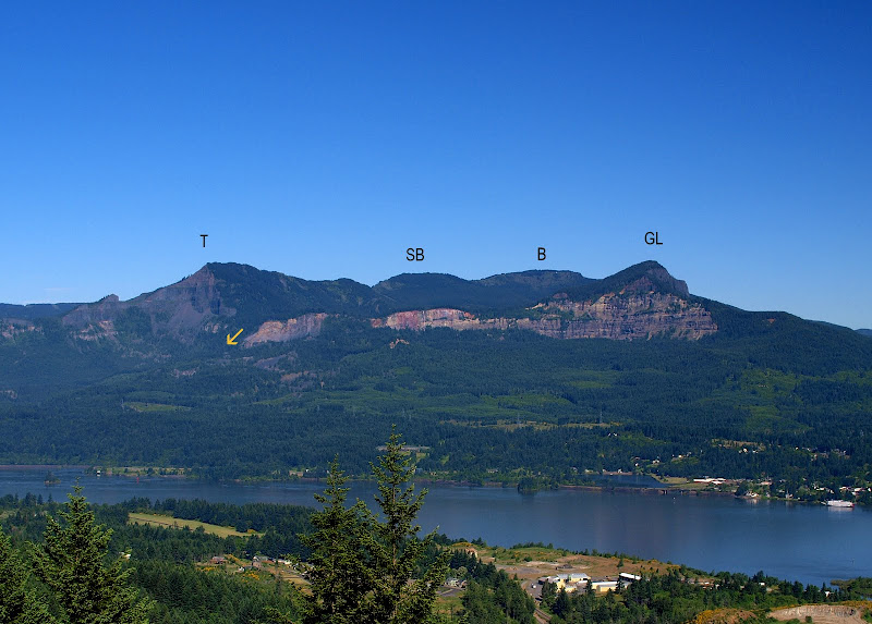
with Table (T), South Birkenfeld (SB), Birkenfeld (B), and Greenleaf (GL) ringing the Basin. The arrow shows the location of Greenleaf Falls, an exciting way into or out of the Basin.
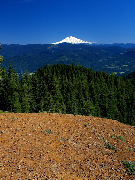
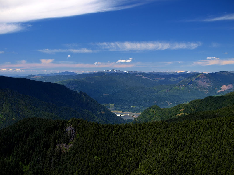
Higher up on the PCT are a couple of open areas, the lower of which provided a clear view of Adams.
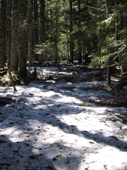
The only significant snow on the PCT where it crosses the Plateau was between its northern and southern junctions with the 405B trail. In only a few places did it obscure the trail entirely but the path of the PCT is hard to miss even if you can’t see the trail itself.
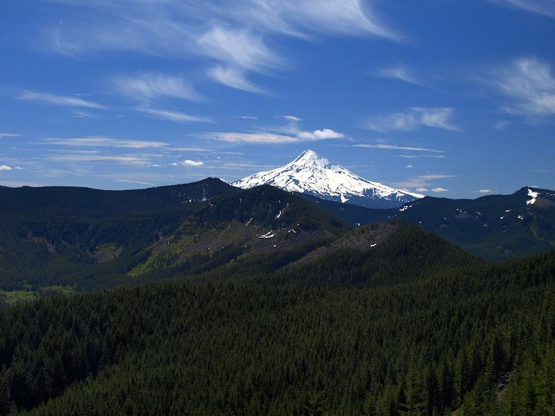
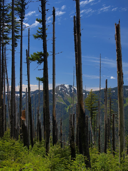
This section of the PCT skirts the E side of the Plateau and there’s one place where it comes close enough to the edge to provide a great view of Hood.
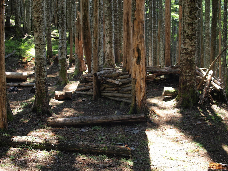
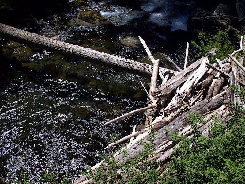
By the time I reached Camp Smokey (and lunch), all the snow was gone (there’s probably more farther S on the PCT). “Camp Smokey” is starting to look like “Fort Smokey” what with a palisade of timbers that’s been erected around one of the tent sites. Probably as a defense against Big Foot.
Smokey is where the Eagle-Benson (434) trail

starts its plunge to Eagle Creek. The last time I did the 434 was before it had been refurbished by at least two Mazamas trail maintenance trips. The middle section of the trail had experienced a fire and was a maze of brush and fallen trees with little or no trace of the trail for hundreds of feet. It was a long and tedious exercise in route finding. This time, however, thanks to the Mazamas, it was an easy descent to the creek. Climbing up it would be another matter, since it seems to have been built when switchbacks were in short supply and there are several long unshaded sections. Shortly after leaving Camp Smokey, there was a big view of Silver Star (still with snow),
and later, a view of Tanner Butte (also still with snow).
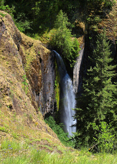
Near the end of the 434, you can get an oblique view of Wy'East Falls, which is probably a better view than you’d get if you bushwhacked up to the base of it from the Eagle Creek trail.
Soon I was on the Eagle Creek trail, dodging the crowds as I headed down to the TH. It had gotten a lot warmer by now (finally!) and Eagle Creek was starting to look pretty inviting.
But I opted for a cold one at home and kept hiking. At this point the car shuttle idea came into its own as I had absolutely no desire to walk back to the Herman Ck TH. All told, for 17 mi with 4300’ of gain, a great hike on a great day!

There’s one spot on the PCT that provides an almost head-on view of the Greenleaf Basin,
with Table (T), South Birkenfeld (SB), Birkenfeld (B), and Greenleaf (GL) ringing the Basin. The arrow shows the location of Greenleaf Falls, an exciting way into or out of the Basin.
Higher up on the PCT are a couple of open areas, the lower of which provided a clear view of Adams.
The only significant snow on the PCT where it crosses the Plateau was between its northern and southern junctions with the 405B trail. In only a few places did it obscure the trail entirely but the path of the PCT is hard to miss even if you can’t see the trail itself.
This section of the PCT skirts the E side of the Plateau and there’s one place where it comes close enough to the edge to provide a great view of Hood.
By the time I reached Camp Smokey (and lunch), all the snow was gone (there’s probably more farther S on the PCT). “Camp Smokey” is starting to look like “Fort Smokey” what with a palisade of timbers that’s been erected around one of the tent sites. Probably as a defense against Big Foot.
Smokey is where the Eagle-Benson (434) trail
starts its plunge to Eagle Creek. The last time I did the 434 was before it had been refurbished by at least two Mazamas trail maintenance trips. The middle section of the trail had experienced a fire and was a maze of brush and fallen trees with little or no trace of the trail for hundreds of feet. It was a long and tedious exercise in route finding. This time, however, thanks to the Mazamas, it was an easy descent to the creek. Climbing up it would be another matter, since it seems to have been built when switchbacks were in short supply and there are several long unshaded sections. Shortly after leaving Camp Smokey, there was a big view of Silver Star (still with snow),
and later, a view of Tanner Butte (also still with snow).
Near the end of the 434, you can get an oblique view of Wy'East Falls, which is probably a better view than you’d get if you bushwhacked up to the base of it from the Eagle Creek trail.
Soon I was on the Eagle Creek trail, dodging the crowds as I headed down to the TH. It had gotten a lot warmer by now (finally!) and Eagle Creek was starting to look pretty inviting.
But I opted for a cold one at home and kept hiking. At this point the car shuttle idea came into its own as I had absolutely no desire to walk back to the Herman Ck TH. All told, for 17 mi with 4300’ of gain, a great hike on a great day!