Observation Pk via Dry Ck & Big Hollow 12-June-2011
Posted: June 13th, 2011, 5:15 am
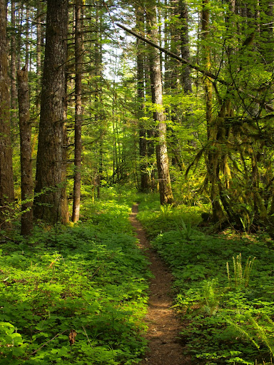
After spending Saturday doing Rose Festival activities (viewing the parade, visiting the ships, etc.), I had Sunday free to do a loop hike of Observation Peak by going up via the Dry Creek (194) and Big Hollow (158) trails and down via the Observation Peak trail (132). It was sunny when I started up the nearly level Dry Creek trail,
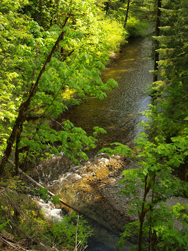
which afforded a nice view of Dry Creek, which was not running as high as I’d expected, given all the snow melt.
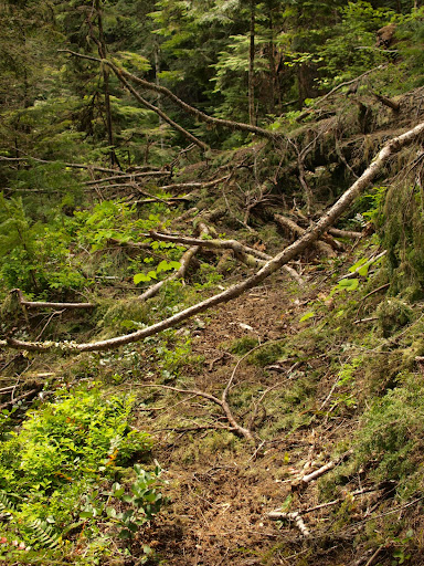
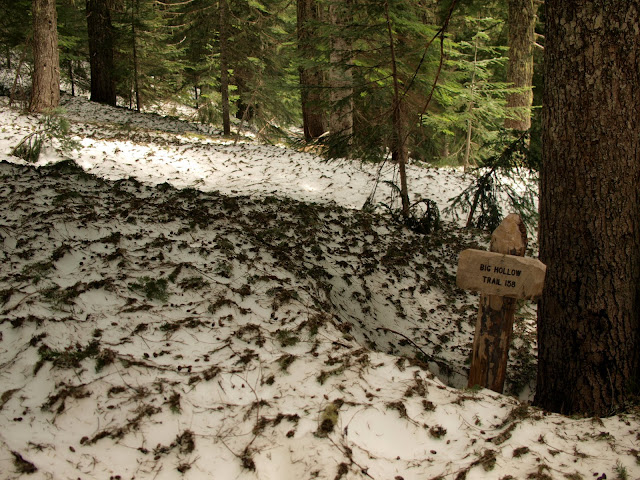
After about 4 mi, I reached the Big Hollow trail and headed up it. It was in pretty good condition except for 4 really big blowdowns that blocked it in awkward ways.
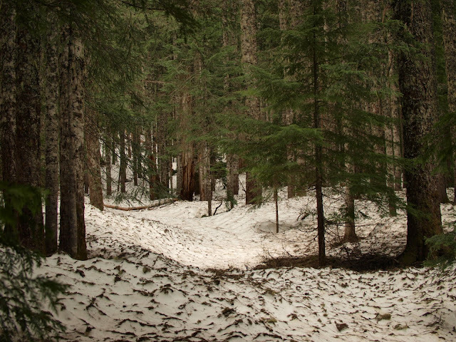
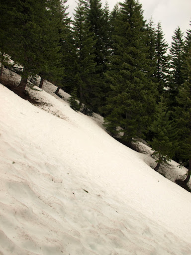
Two people passed me heading down who said they had turned around because of snow on the trail. I didn’t know quite what that meant until about the 3200’ level when the trail disappeared completely beneath 3-4’ of well consolidated snow. From then on the hike was on snow, guided by remembered landmarks and the GPS – there was no sign of the trail until I reached Howe Ridge.
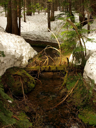
At the creek crossing at 3400’, the snow was deep enough to require actually climbing down to cross the creek.
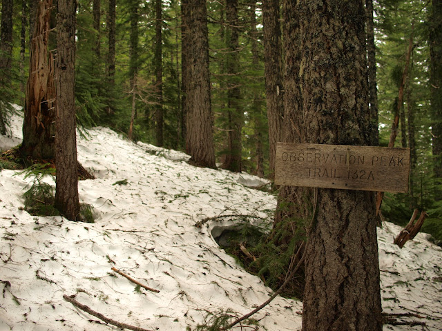
This snow was not very steep and was easy to walk on, so I reached the upper end of the Big Hollow trail in good time.
However, from there to the Observation Peak trail involved mostly side-hilling on fairly steep snow often poised over deep tree wells.
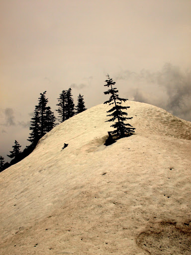
Fortunately, the snow thinned and leveled some as I headed up the peak, which was graced with its own small snow cap.
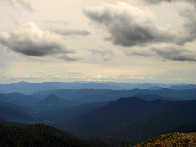
Unfortunately, by the time I reached the summit, the sun was gone and the clouds were rolling in. St Helens was somewhat visible,
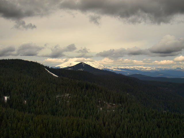
Adams was hiding,
and Hood seemed far away.
The hike down and back involved more side-hilling and route finding until I finally got out of the snow where the trail crosses Howe Ridge.
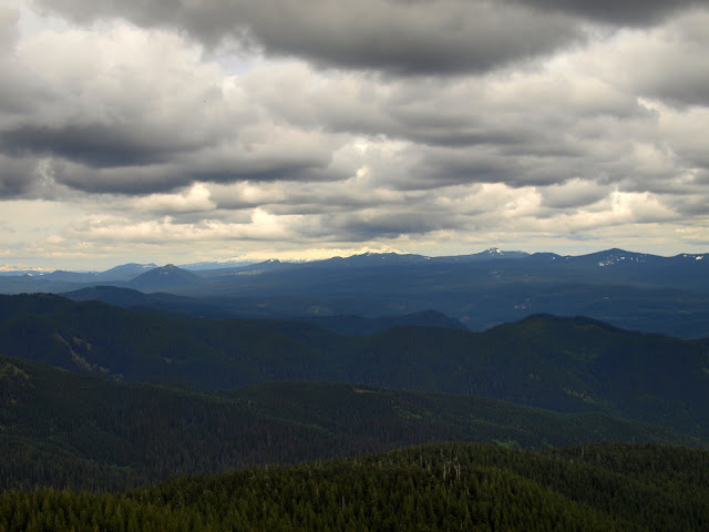
The snow and side-hilling made the hike longer (in time) than I’d planned and, because of the clouds, the views were less than the great ones I’ve come to expect from Observation. Still it was a good workout (15.2 mi, 3200’) and I made it back to the TH just as the rain started. This is definitely a hike to consider doing again AFTER the snow melts.
which afforded a nice view of Dry Creek, which was not running as high as I’d expected, given all the snow melt.
After about 4 mi, I reached the Big Hollow trail and headed up it. It was in pretty good condition except for 4 really big blowdowns that blocked it in awkward ways.
Two people passed me heading down who said they had turned around because of snow on the trail. I didn’t know quite what that meant until about the 3200’ level when the trail disappeared completely beneath 3-4’ of well consolidated snow. From then on the hike was on snow, guided by remembered landmarks and the GPS – there was no sign of the trail until I reached Howe Ridge.
At the creek crossing at 3400’, the snow was deep enough to require actually climbing down to cross the creek.
This snow was not very steep and was easy to walk on, so I reached the upper end of the Big Hollow trail in good time.
However, from there to the Observation Peak trail involved mostly side-hilling on fairly steep snow often poised over deep tree wells.
Fortunately, the snow thinned and leveled some as I headed up the peak, which was graced with its own small snow cap.
Unfortunately, by the time I reached the summit, the sun was gone and the clouds were rolling in. St Helens was somewhat visible,
Adams was hiding,
and Hood seemed far away.
The hike down and back involved more side-hilling and route finding until I finally got out of the snow where the trail crosses Howe Ridge.
The snow and side-hilling made the hike longer (in time) than I’d planned and, because of the clouds, the views were less than the great ones I’ve come to expect from Observation. Still it was a good workout (15.2 mi, 3200’) and I made it back to the TH just as the rain started. This is definitely a hike to consider doing again AFTER the snow melts.