Silver Star, S Ridge Loop 04-May-2011
Posted: May 5th, 2011, 5:45 am
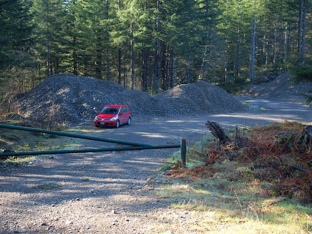
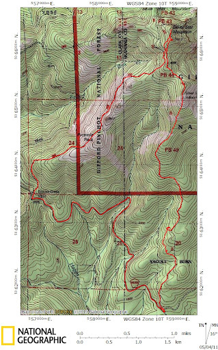
Having had to retreat from Silver Star a week ago because of a lack of snow shoes, Wednesday’s truly bluebird weather offered the opportunity to try it again (this time with the right gear). Lorain’s description of the South Ridge Loop sounded interesting so I decided to give that a try – as an alternative to the Grouse Vista TH. The South Ridge TH is actually a side road, with gate and piles of gravel, off the 1200 road about 2.5 mi from the junctions with the “STOP” signs.
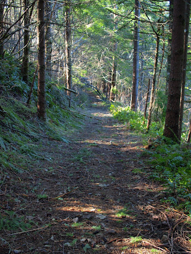
According to Lorain, I was supposed to go 0.3 mi up the dirt road to the left and then find an abandoned road/trail going off to the right. I missed it - probably because I was so overcome by all the sunlight – and continued up the main road. Although it eventually dead-ended, it did so only about 100’ below the road/trail I was supposed to be on. So, after little XC travel, I was back on track.
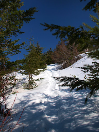
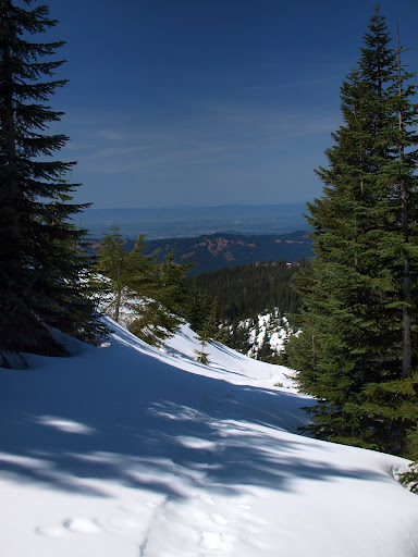
At about 2900’, the first snow appeared and soon covered the road, just as it was beginning to emerge from the trees (the snowshoes went on here and stayed on all the way over to the Grouse Vista TH).
There were some tracks, but not many – nothing like you’d find over at the Grouse Vista TH. At about 3200’, the trail turned a corner, giving me a big view of both Silver Star in the distance and the summit with the Indian pits to the right.
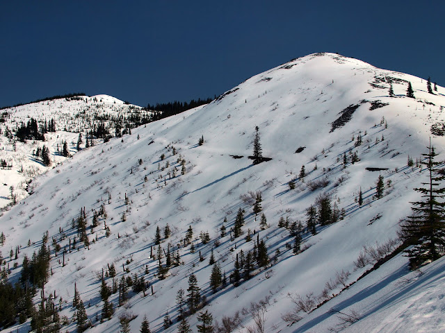
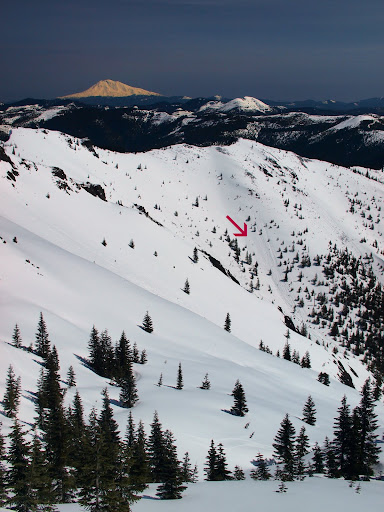
Rather than side-hill with snowshoes, I headed directly up the ridge past the Indian pits (well buried in snow). Once on top, I had a good view of Adams and of some large avalanche runs (arrow) coming off Silver Star’s E ridge. There’s a surprising amount of snow above 3500’ and it’s not all stable.
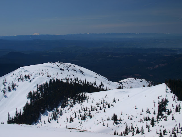
From Silver Star’s SE summit (“Star 2”), I could look back down almost the entire S ridge and see Jefferson well in the distance.
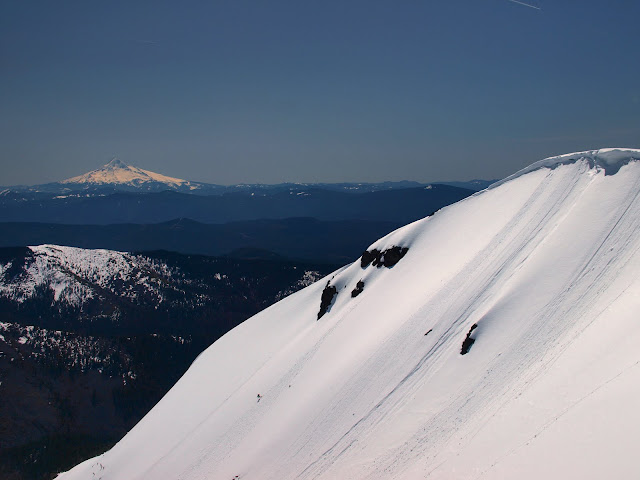
Big views of Helens and Rainier were available from Silver Star’s summit.
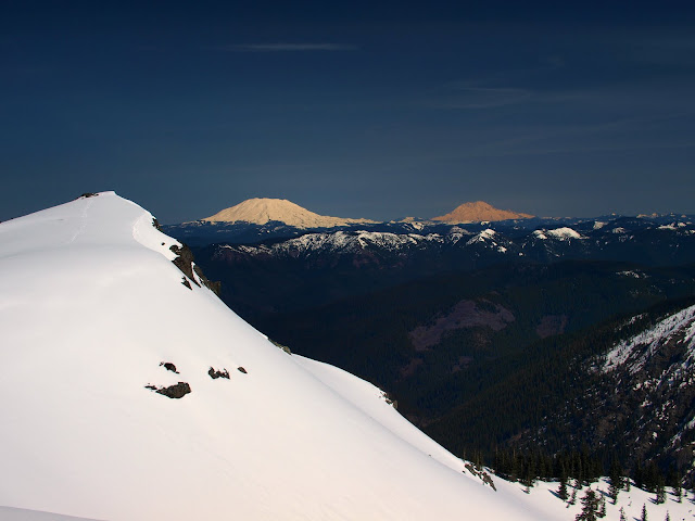
Hood was also in view, as were some impressive cornices and small avalanche runs from the summit ridge. I’d say be careful of the edge if you’re planning to hike Silver Star in the foreseeable future.
Based on some of the recent trip reports, I had expected to find the summit well-trodden but there were few other tracks in evidence when I got there. A lone skier and his dog were the only others on the summit this day. After a quick lunch, I headed down to intersect with the road up from Grouse Vista.
Hiking out required a lot of side-hilling with snowshoes, which was not very comfortable. But when I tried it without the shoes, I sank in to my thighs about every other step. So, shoes on, I made my way down to the Grouse Vista TH. I had to walk down the 1200 road to get back to my car but there was no traffic, it was sunny and warm, and there were views, so it was a pleasant walk. I really liked this loop - fewer people and big views - but next time I’ll park at Grouse Vista and hike down the road first. About 10 mi with 3000’ gain.
According to Lorain, I was supposed to go 0.3 mi up the dirt road to the left and then find an abandoned road/trail going off to the right. I missed it - probably because I was so overcome by all the sunlight – and continued up the main road. Although it eventually dead-ended, it did so only about 100’ below the road/trail I was supposed to be on. So, after little XC travel, I was back on track.
At about 2900’, the first snow appeared and soon covered the road, just as it was beginning to emerge from the trees (the snowshoes went on here and stayed on all the way over to the Grouse Vista TH).
There were some tracks, but not many – nothing like you’d find over at the Grouse Vista TH. At about 3200’, the trail turned a corner, giving me a big view of both Silver Star in the distance and the summit with the Indian pits to the right.
Rather than side-hill with snowshoes, I headed directly up the ridge past the Indian pits (well buried in snow). Once on top, I had a good view of Adams and of some large avalanche runs (arrow) coming off Silver Star’s E ridge. There’s a surprising amount of snow above 3500’ and it’s not all stable.
From Silver Star’s SE summit (“Star 2”), I could look back down almost the entire S ridge and see Jefferson well in the distance.
Big views of Helens and Rainier were available from Silver Star’s summit.
Hood was also in view, as were some impressive cornices and small avalanche runs from the summit ridge. I’d say be careful of the edge if you’re planning to hike Silver Star in the foreseeable future.
Based on some of the recent trip reports, I had expected to find the summit well-trodden but there were few other tracks in evidence when I got there. A lone skier and his dog were the only others on the summit this day. After a quick lunch, I headed down to intersect with the road up from Grouse Vista.
Hiking out required a lot of side-hilling with snowshoes, which was not very comfortable. But when I tried it without the shoes, I sank in to my thighs about every other step. So, shoes on, I made my way down to the Grouse Vista TH. I had to walk down the 1200 road to get back to my car but there was no traffic, it was sunny and warm, and there were views, so it was a pleasant walk. I really liked this loop - fewer people and big views - but next time I’ll park at Grouse Vista and hike down the road first. About 10 mi with 3000’ gain.