Labyrinth - snow and flowers 2/25/11
Posted: February 26th, 2011, 1:25 am
Today we explored Labyrinth area starting from the trailhead at west end of Rowland Lake. The hike we did is similar to Labyrinth Loop hike described in the Field Guide, except that we started at other trailhead and didn't make a whole loop.
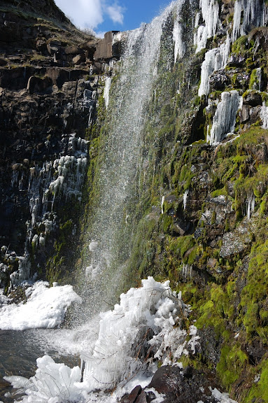
We started hiking west on abandoned road (former Hwy 8) which parallels Hwy 14. Not 10 minutes into the hike we passed a nice Lower Labyrinth Falls.
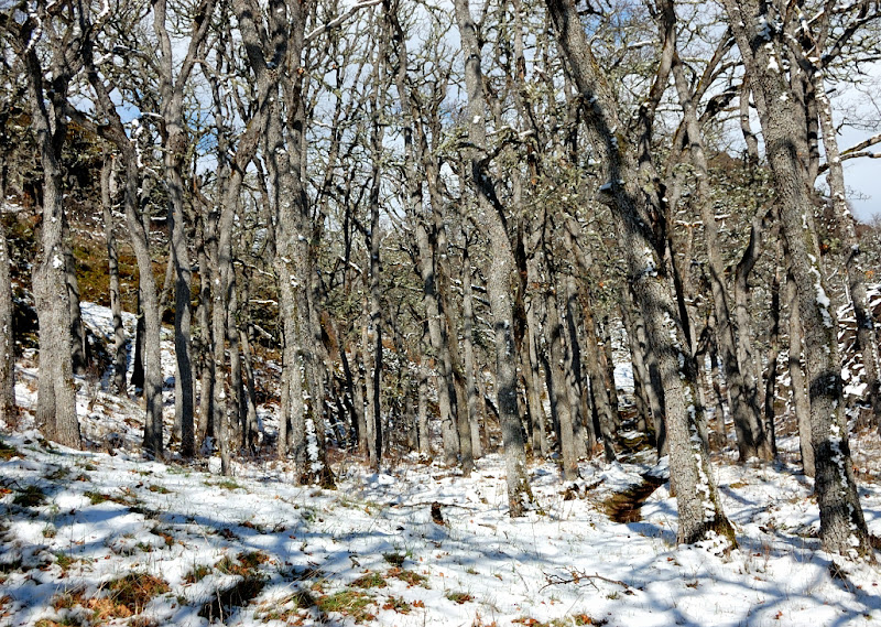
Soon we passed cliffs and took the first trail heading to the right. It does look like a bike trail, with pretty uneven grade and wide curves instead of switchbacks. We didn't meet any bikers or even hikers, which is surprising given this gorgeous weather. There was no snow to speak of until we got up to the higher hills.
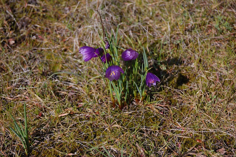
There were lots of early grass widows, which look good after yesterday's record cold night (well, today's night will be even colder, but I hope they survive it as well). Fair amount of those, and many more are still to come.
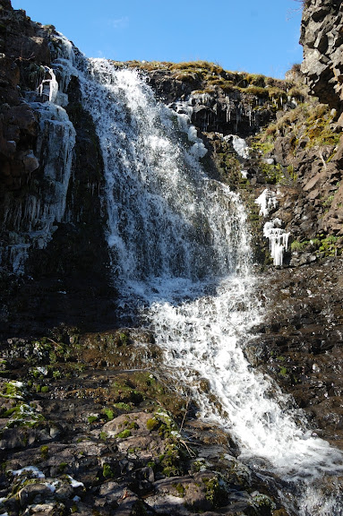
We followed Labyrinth Creek to the upper falls
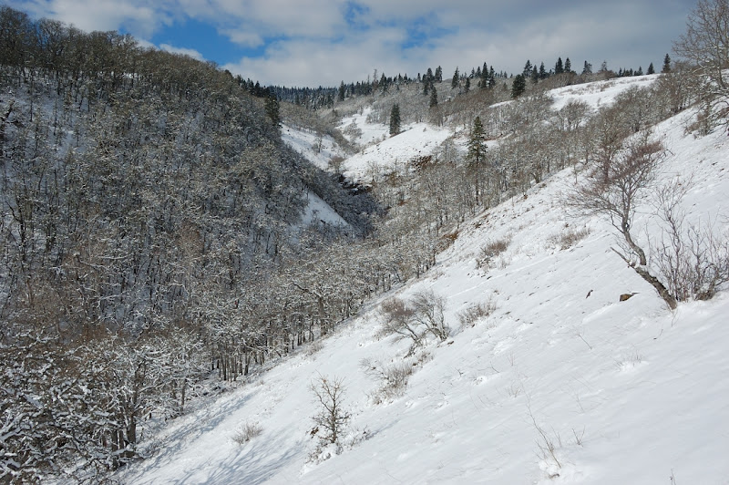
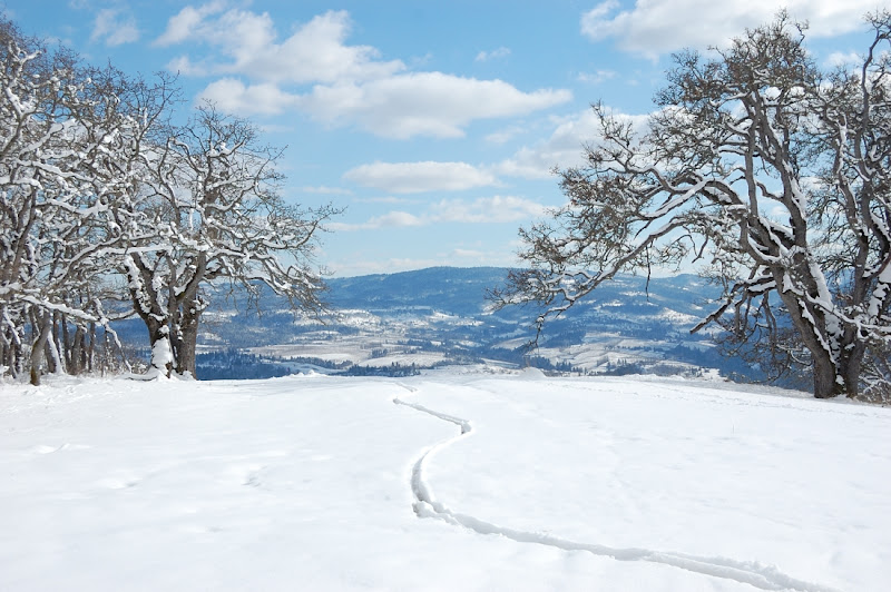
After a steep but brief climb we crossed the creek and followed the right side of creek's canyon. Though everything from now looked like winter, there was only a couple of inches of snow (5-6 inches higher up) so it won't last. The trail has completely melted out, which was helpful as neither of us hiked there before.
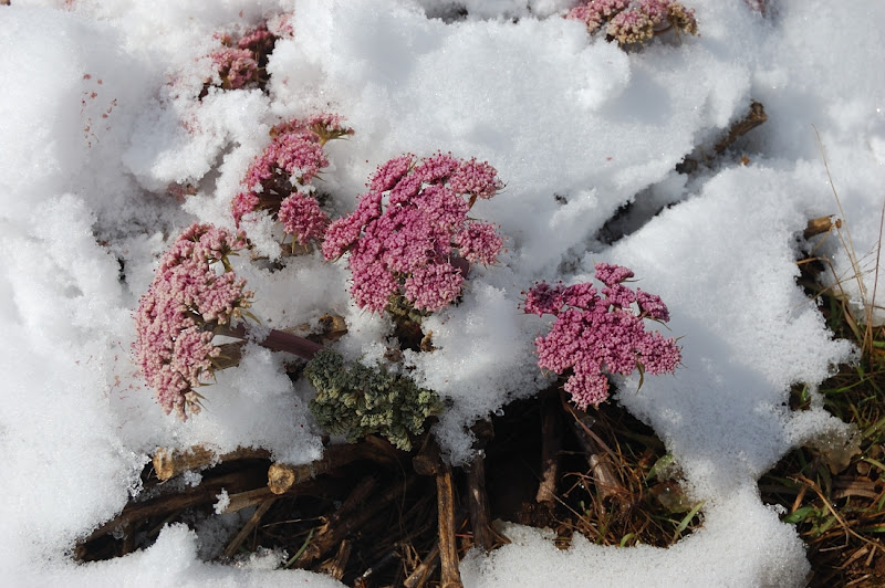
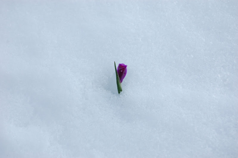
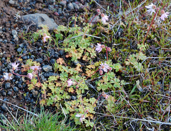
More flowers were showing up through snow.
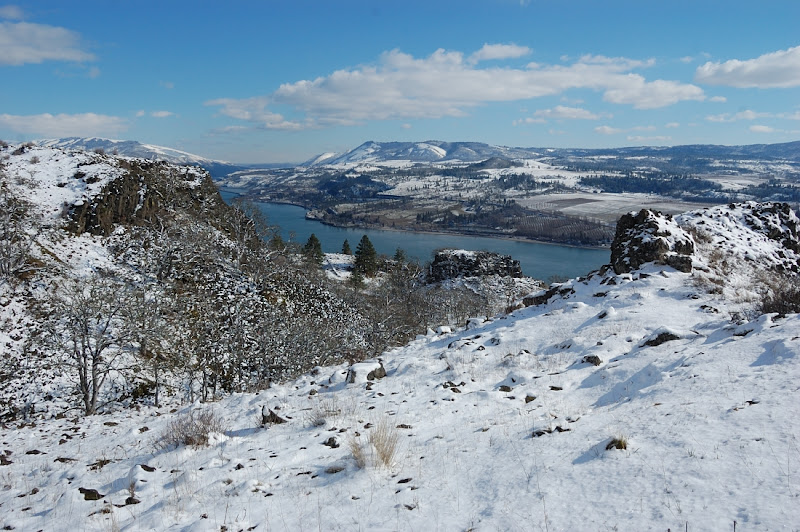
After a little more climb, we went to a road that parallels Columbia, and turned west. I really hoped to come to Coyote Wall and the map showed like it was a short hike from here.
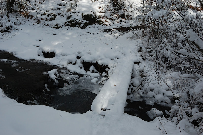
We crossed the creek once again on a narrow bridge.
And followed an old road.
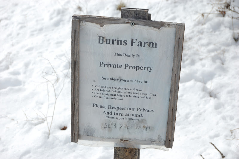
But too soon came to a property sign. A house was visible a couple of hundred yards from here, and the road run close by this house. Now reading the Field Guide it seems there is a way around this house, but with at least 3 roads there running in different directions it's still unclear which road we needed to take. The sign makes me believe we're not supposed to go straight on the main road, even though it's the most direct way to Coyote Wall. Can anyone clarify?
We decided to walk around the property and headed on another road downhill. Bike path we followed on the main road also turned downhill.
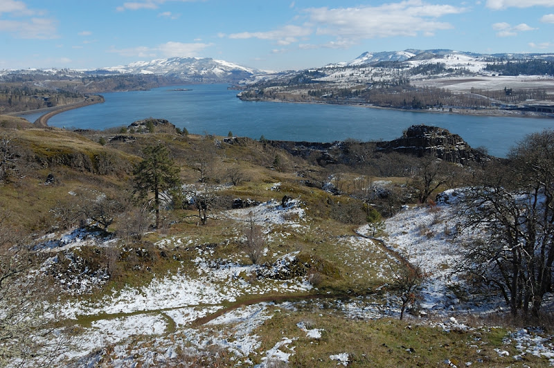
There was a good view to the river from the field below the house.
However, the road we took soon had another sign (this time from Forest Service). It went downhill to the south and at some point we headed off-road to the west to see Coyote Wall. However, my partner didn't want to do route-finding in deep snow so we soon turned back and took the way we came.
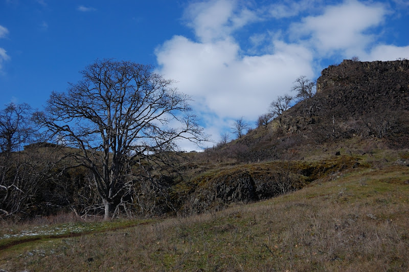
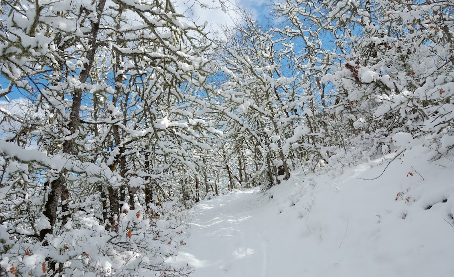
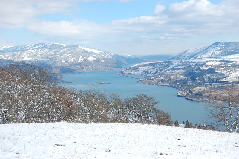
We had more of the views on the way back.
This adds to 3 kinds of flower we saw today.
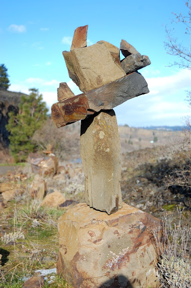
Near the lower falls we spotted several funny cairns that we overlooked on the way there.
It was a nice hike despite some confusion with the roads (it's Labyrinth after all). Great views, great snow, sunshine, and no ticks!
We started hiking west on abandoned road (former Hwy 8) which parallels Hwy 14. Not 10 minutes into the hike we passed a nice Lower Labyrinth Falls.
Soon we passed cliffs and took the first trail heading to the right. It does look like a bike trail, with pretty uneven grade and wide curves instead of switchbacks. We didn't meet any bikers or even hikers, which is surprising given this gorgeous weather. There was no snow to speak of until we got up to the higher hills.
There were lots of early grass widows, which look good after yesterday's record cold night (well, today's night will be even colder, but I hope they survive it as well). Fair amount of those, and many more are still to come.
We followed Labyrinth Creek to the upper falls
After a steep but brief climb we crossed the creek and followed the right side of creek's canyon. Though everything from now looked like winter, there was only a couple of inches of snow (5-6 inches higher up) so it won't last. The trail has completely melted out, which was helpful as neither of us hiked there before.
More flowers were showing up through snow.
After a little more climb, we went to a road that parallels Columbia, and turned west. I really hoped to come to Coyote Wall and the map showed like it was a short hike from here.
We crossed the creek once again on a narrow bridge.
And followed an old road.
But too soon came to a property sign. A house was visible a couple of hundred yards from here, and the road run close by this house. Now reading the Field Guide it seems there is a way around this house, but with at least 3 roads there running in different directions it's still unclear which road we needed to take. The sign makes me believe we're not supposed to go straight on the main road, even though it's the most direct way to Coyote Wall. Can anyone clarify?
We decided to walk around the property and headed on another road downhill. Bike path we followed on the main road also turned downhill.
There was a good view to the river from the field below the house.
However, the road we took soon had another sign (this time from Forest Service). It went downhill to the south and at some point we headed off-road to the west to see Coyote Wall. However, my partner didn't want to do route-finding in deep snow so we soon turned back and took the way we came.
We had more of the views on the way back.
This adds to 3 kinds of flower we saw today.
Near the lower falls we spotted several funny cairns that we overlooked on the way there.
It was a nice hike despite some confusion with the roads (it's Labyrinth after all). Great views, great snow, sunshine, and no ticks!