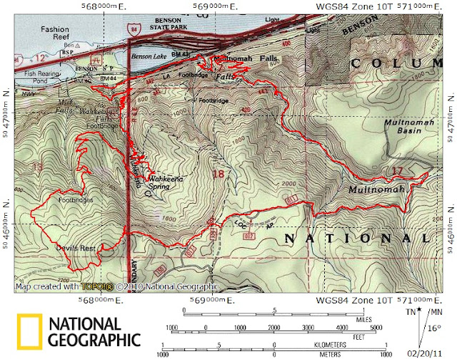
Devils Rest Loop 20-Feb-2011
Posted: February 20th, 2011, 3:10 pm
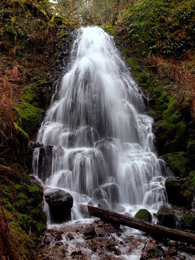
Although my legs were still a little twitchy after last Friday’s snowshoe over Table Mountain, I still wanted to get in another hike before the weather turned really foul (again). A loop over Devils Rest seemed just about right. The lower Angel’s Rest TH parking lot was already full as I passed it about 8:30am, and the ravens were busy pecking the rubbery bits off a roof rack at the Wahkeena Falls TH, so I ended up parking at Multnomah Falls. From there I walked back to the Falls TH hoping to get a picture of the marauding ravens but they were in hiding. So on up past Wahkeena Falls,
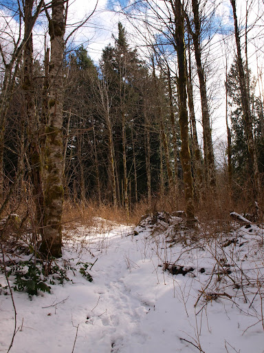
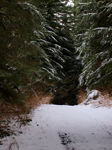
then the 415 trail W toward Angels Rest, and finally the use trail that heads toward Devils Rest from the 415 just beyond the foot bridge. Snow didn’t make a serious appearance until 1800’ but it had been well packed by lots of foot traffic. Early on, the weather even offered up a sunbreak or two.
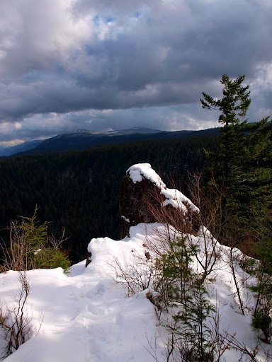
I went over Devils Rest and on down to the best viewpoint on the 420C trail, with good views of a troubled sky (goodbye sunbreaks), a snowy Table Mountain,
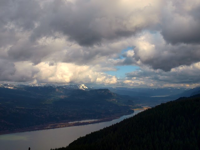
Franklin Ridge, and Yeon Mountain.
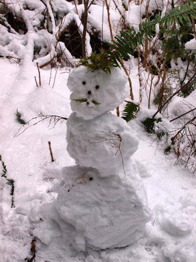
Despite the beaten down snow and all of the footprints, I didn’t see anyone between Wahkeena Falls and Multnomah Creek except for this little guy standing beside the 420C trail.
About 0.75 mi from Devils Rest, I cut S off the 420C on to the service road that leads into Multnomah Basin. Over here there were only 2 sets of tracks in the snow, which was pretty much gone from the road below 1600’.
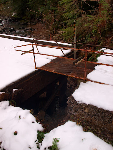
The road down to Multnomah Creek looked OK but there were a few spots where erosion was starting to show. The big surprise was at the bridge over Multnomah Creek, where the creek had eroded away about 3’ or so of the bank, leaving the bridge structure hanging in the air – the metal walkway had been thoughtfully provided for foot traffic.
After that it was down the Larch Mountain trail, through a surprising number of tourists on the paved portion (considering it was now overcast and occasionally spitting snow), past the espresso stand, and back to my car. 10 mi, 2400’ gain. Every parking lot was overflowing as I drove out to the freeway. Didn’t see the ravens again – they were probably too filled with windshield wipers and other rubber car parts to fly.
then the 415 trail W toward Angels Rest, and finally the use trail that heads toward Devils Rest from the 415 just beyond the foot bridge. Snow didn’t make a serious appearance until 1800’ but it had been well packed by lots of foot traffic. Early on, the weather even offered up a sunbreak or two.
I went over Devils Rest and on down to the best viewpoint on the 420C trail, with good views of a troubled sky (goodbye sunbreaks), a snowy Table Mountain,
Franklin Ridge, and Yeon Mountain.
Despite the beaten down snow and all of the footprints, I didn’t see anyone between Wahkeena Falls and Multnomah Creek except for this little guy standing beside the 420C trail.
About 0.75 mi from Devils Rest, I cut S off the 420C on to the service road that leads into Multnomah Basin. Over here there were only 2 sets of tracks in the snow, which was pretty much gone from the road below 1600’.
The road down to Multnomah Creek looked OK but there were a few spots where erosion was starting to show. The big surprise was at the bridge over Multnomah Creek, where the creek had eroded away about 3’ or so of the bank, leaving the bridge structure hanging in the air – the metal walkway had been thoughtfully provided for foot traffic.
After that it was down the Larch Mountain trail, through a surprising number of tourists on the paved portion (considering it was now overcast and occasionally spitting snow), past the espresso stand, and back to my car. 10 mi, 2400’ gain. Every parking lot was overflowing as I drove out to the freeway. Didn’t see the ravens again – they were probably too filled with windshield wipers and other rubber car parts to fly.


