Gannett Peak, Wind River Range, WY - August 1-4, 2008

This forum is used to share your experiences out on the trails.
User avatar
BCJ
Posts: 799
Joined: May 28th, 2008, 10:03 pm
Location: Hillsboro, OR

Gannett Peak, Wind River Range, WY - August 1-4, 2008

Post by BCJ » August 6th, 2008, 5:18 pm

I'll start with saying that this was the most amazing place I've ever been. With that, this will be a photo-heavy post as that is a much easier way to describe the beauty of the Wind Rivers.

My best friend/climbing partner, Ryan, and I are making an effort to climb the highest point in each of the 50 states. We started this last summer and had completed 15 of the states leading into this past weekend (OR, WA, ID, ME, NH, VT, NY, NJ, PA, MD, WV, DE, CT, MA and RI). The states in the Northeast were completed over four days last fall during the peak of the color change...it was beautiful, but 48 hours of driving in four days was a bit much. Our big goal for this year was to hit the most remote of the highpoints and what many call the most scenic; this is Gannett Peak, WY at 13,804'. The summit requires 40-50 miles of hiking and about 11,000' of elevation gain. According to the rankings, it is considered either the second or third-most difficult of the 50 states (McKinley is #1 and Rainier and Gannett have arguments for #2).

We drove from Hillsboro to Pinedale, WY and started the journey with the heaviest packs we've ever carried...each weighing over 50lbs due to the amount of food and technical climbing gear needed for five days. I'm normally an ultralighter but I didn't want to jeopardize the trip by underpacking so this was a big challenge for me.

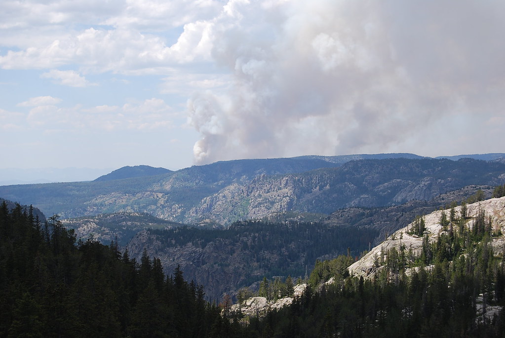
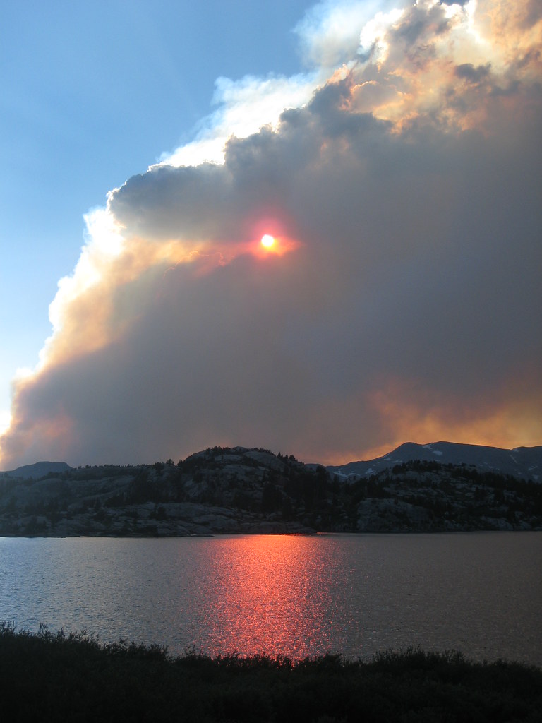
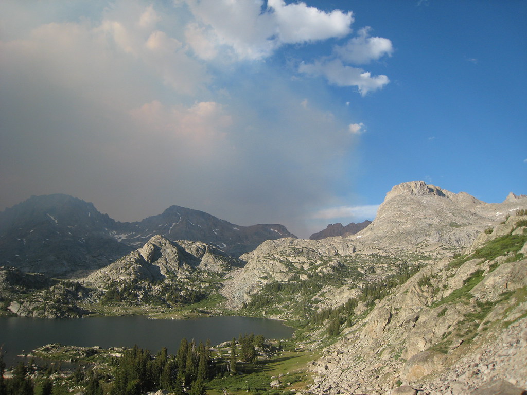
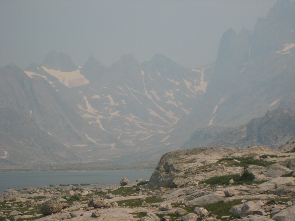
The first major point of interest on the trail is Photographer's Point; five miles in and the first place where views of Gannett (although just a small part of the summit is visible) and the other peaks around Titcomb Basin are outstanding. Unfortunately, a large wildfire burning just west of where we were was blowing smoke in which was an issue for the photography throughout the trip (the smoke shows up much more in the photos than it did in person).

Image

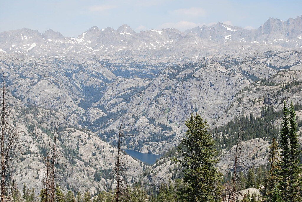
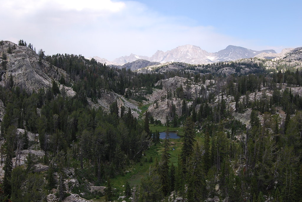
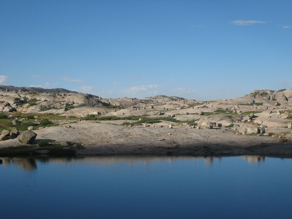
From here the trail just gets more and more beautiful as it passes by countless alpine lakes on its way to our goal of Island Lake (10,300') at the entrance of Titcomb Basin. We had about 13 miles and 2600' of gain the first day, but it seemed like much more than that since we came from sealevel to the trailhead at 9300'. One of the big themes of the adventure was up and down...the trail goes up and over pass after pass and never gives much time to relax. The weather was sunny and warm so we went for a swim in Seneca Lake a few miles before arriving at Island.

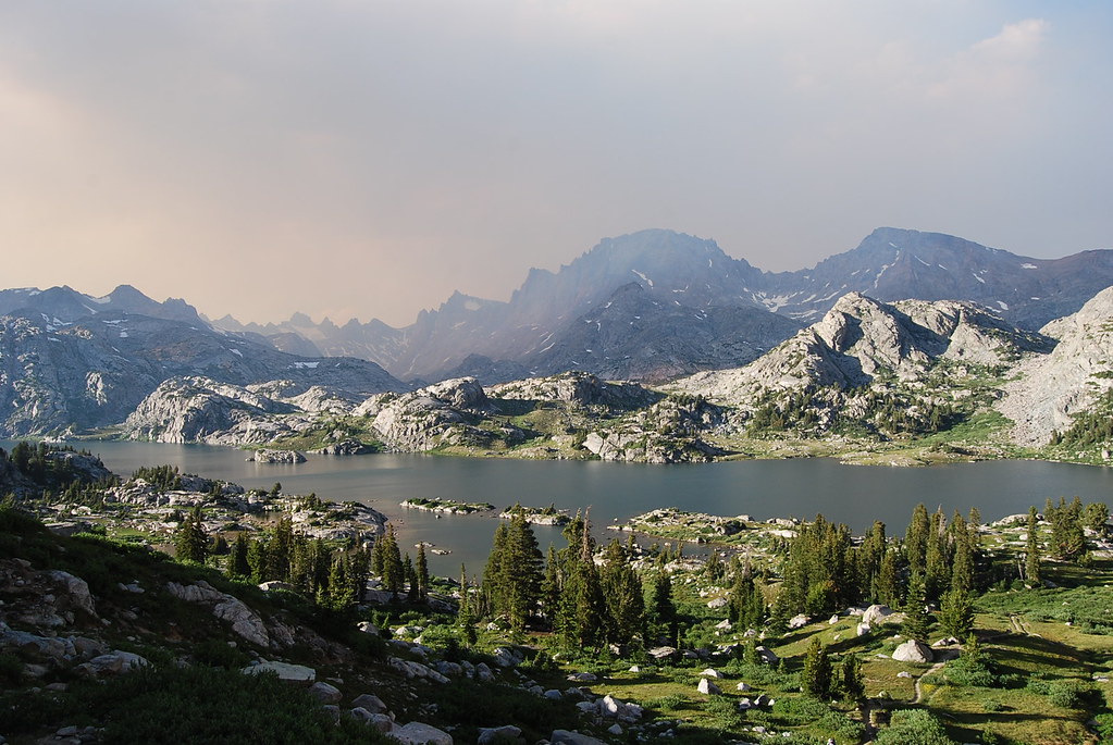
The first view of Island Lake is gorgeous and not even the heavy smoke could tarnish it.

Image

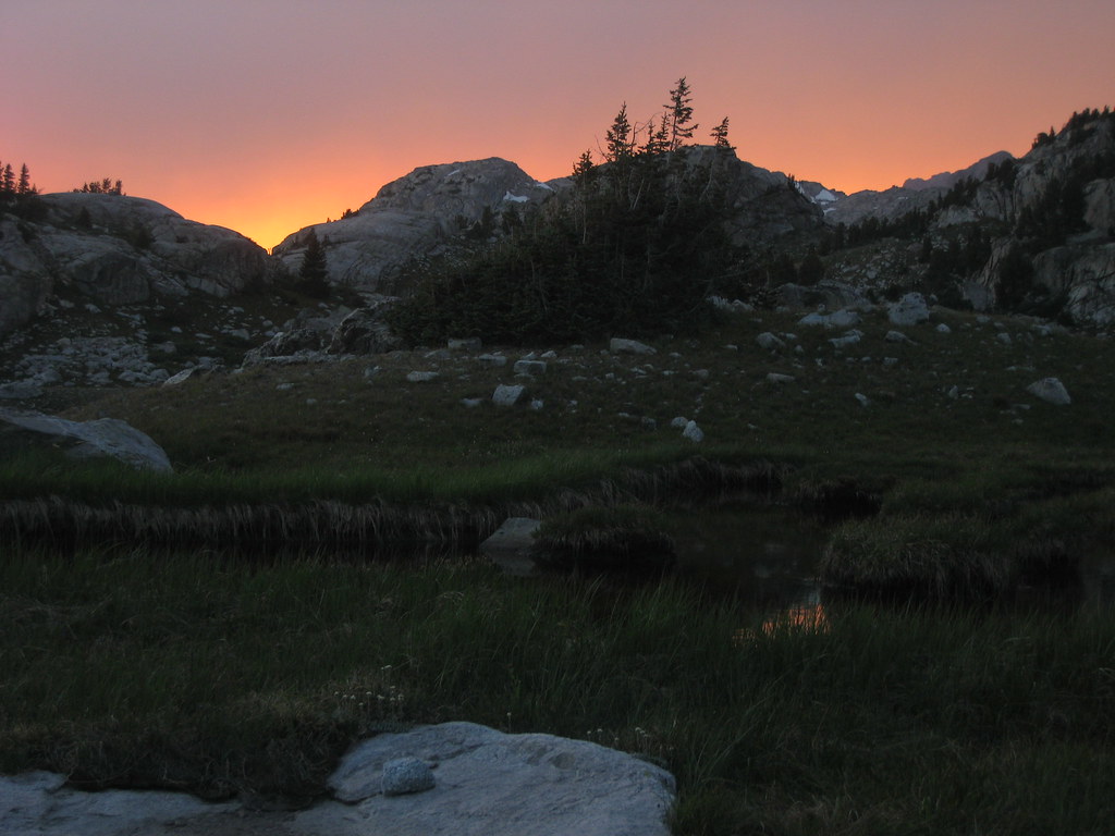
The difference between the smoky and clean air was striking...

Image

We made camp and enjoyed the scenery and relaxed in preparation for the next morning's hike up Titcomb Basin.

Image

Image

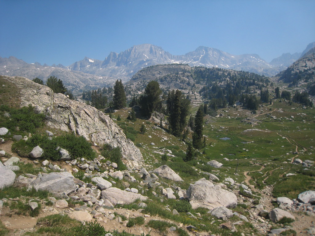
The next day was spent hiking up the most beautiful place I've ever seen, Titcomb Basin (some photos were taken on the way out, which is why some are smokier than others).

Image

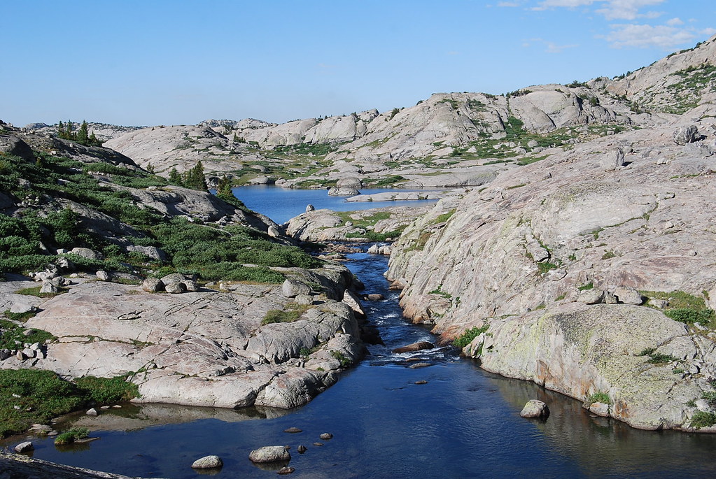
A golden trout jumped over my foot as I hopped across the boulders of this stream (this may be the best high-lake fishing on the planet)...

Image

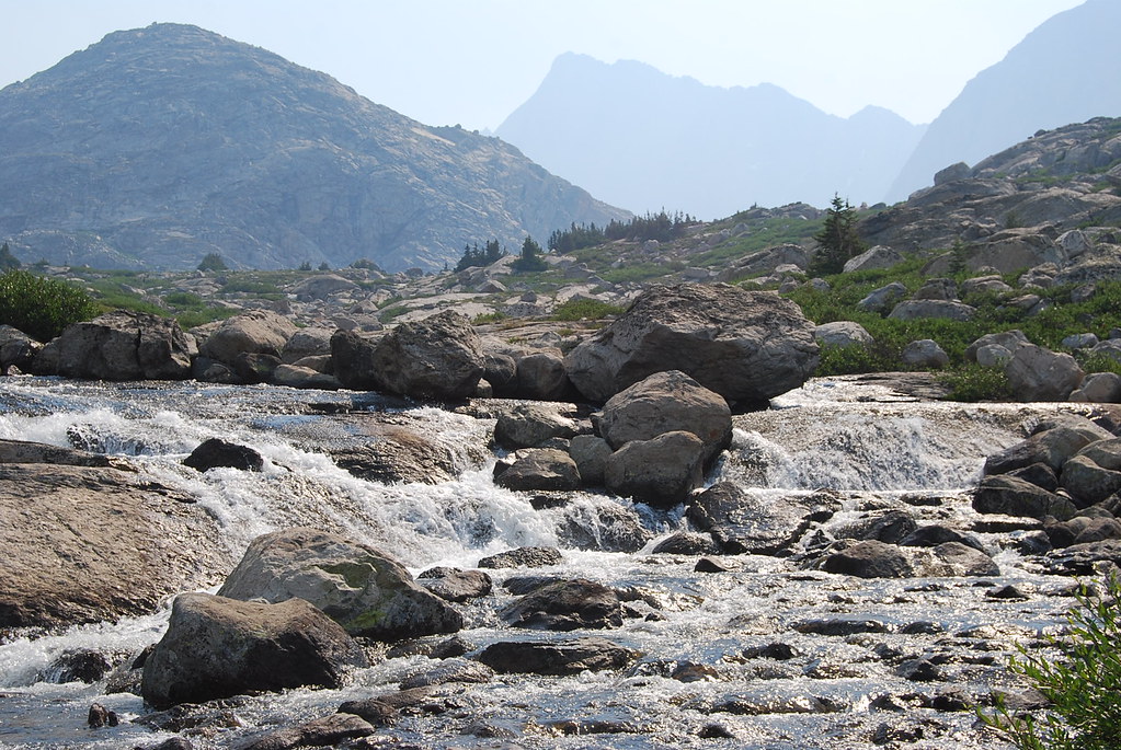
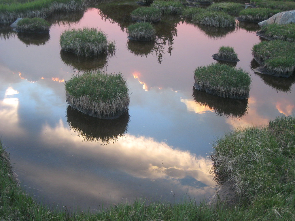
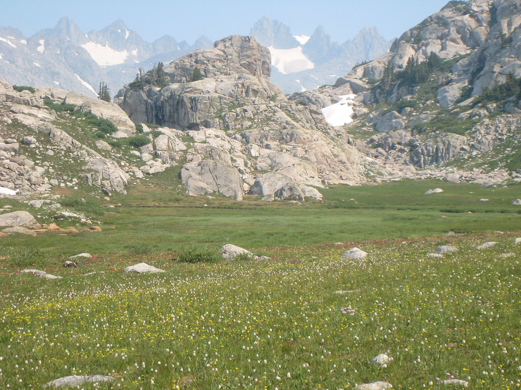
None of the photos due justice to the thickness and color of the wildflowers, which were everywhere...

Image

Image

Image

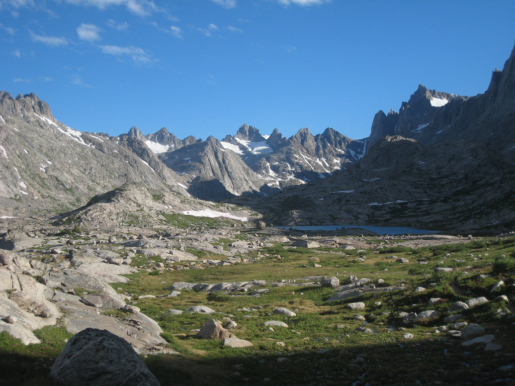
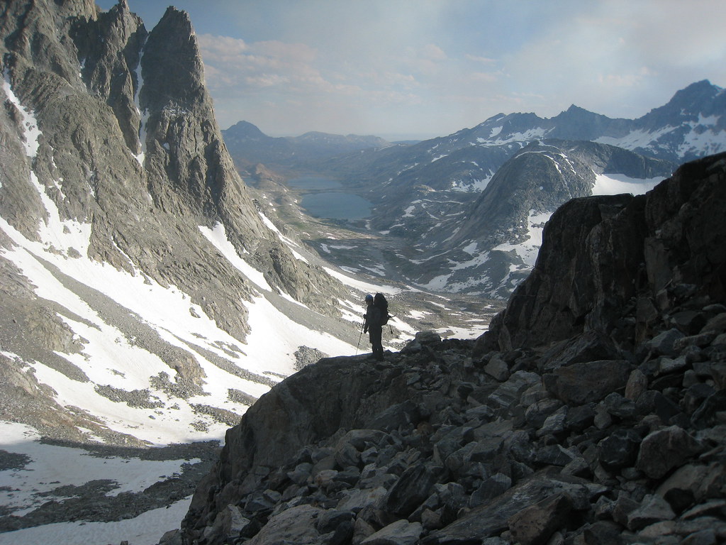
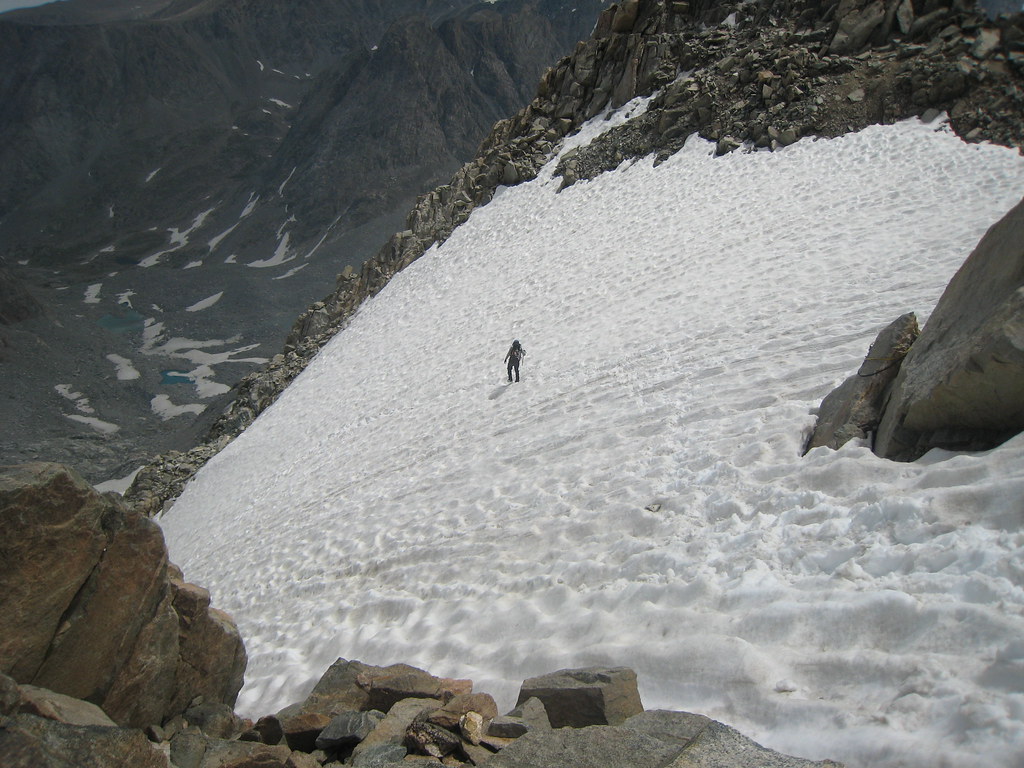
At the end of the basin was a steep pass that was essentially a steep class 3 scramble up loose talus and snow to where we made camp (it's the saddle above the "T" shaped snowfield to the right).

Image

View looking back down Titcomb Basin (Upper and Lower Titcomb Lakes viewable)...

Image

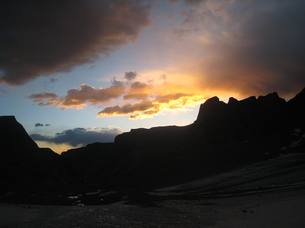
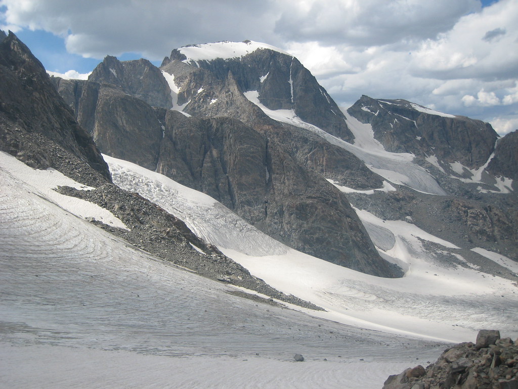
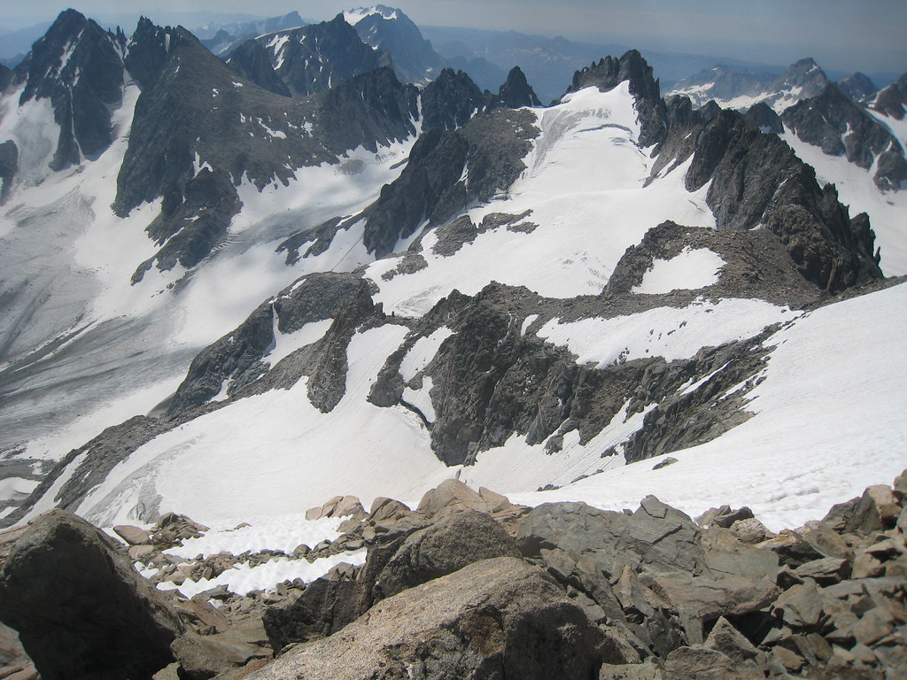
Atop Bonney Pass we made camp and got our first full views of Gannett (this shot was actually from below the pass once we had dropped down in the morning)...

Image

We set the alarm for 2am in order to get an early start, but the moonless night was perfectly dark so we decided to get going later and got another two hours of sleep. The climb involved dropping straight down 1200' before getting to the Dinwoody Glacier and then traversing across to make the climb up Gannett. The climbing was enjoyable up steep glaciers and 3rd to 4th class scrambling, often with a lot of exposure.

Image

This is the crux of the climb and much steeper than it appears in the photo as it drops out of the frame to the left (~55 degrees)...

Image

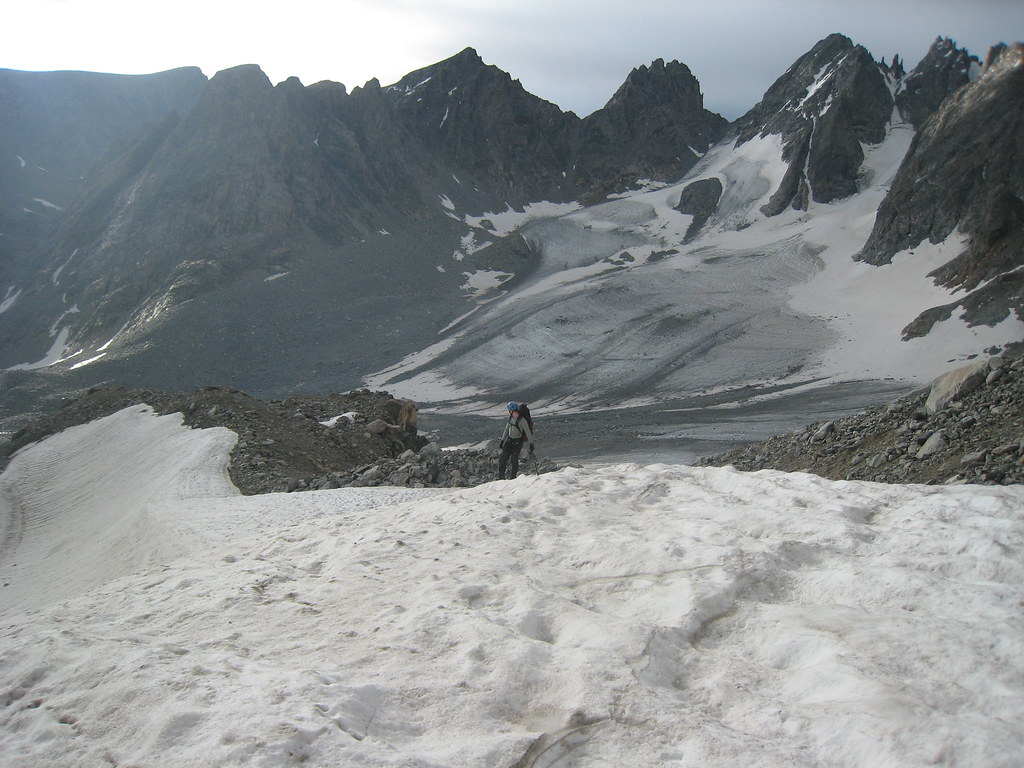
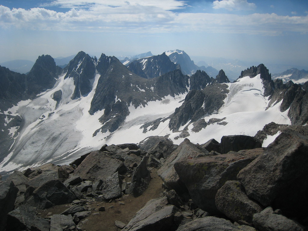
The saddle where we camped is visible in the upper left of the photo...
Image

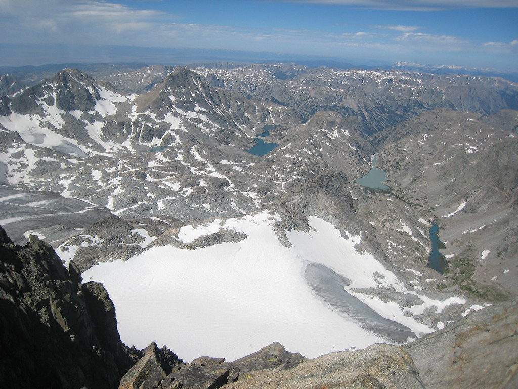
The views from the top were amazing (I'm leaving a lot of views out here in the interest of space)...

Image

Image

We hurried down, only seeing one group of three climbers on the entire route. The 1200' climb back up to the tent after getting down the mountain was tough...especially knowing that we were going to drop those 1200' on the other side after packing up. I wouldn't mind blasting that pass and eliminating the need to go up and over it without actually gaining any elevation.

We drove ourselves to the point of complete exhaustion and finally made camp in the dark at the bottom of the basin. We then went to Island Lake in the morning and spent a couple of hours relaxing and swimming in the lake from a small, sandy beach. The 13 miles out were very tiring and we were glad to get back to the car and burgers in Pinedale. We were originally planning on five days but accomplished what we needed to a day early. We are already planning on going back soon to fly fish for goldens in Titcomb Basin.

Amazing trip.
Last edited by BCJ on August 7th, 2008, 7:55 am, edited 1 time in total.

User avatar
backcountryhunter
Posts: 915
Joined: May 28th, 2008, 10:03 pm
Location: hiking the backcountry
Contact:

Re: Gannett Peak, Wind River Range, WY - August 1-4, 2008

Post by backcountryhunter » August 6th, 2008, 7:10 pm

You are a dawg!!!

I am so jealous!!

User avatar
chameleon
Posts: 1795
Joined: May 28th, 2008, 10:03 pm
Location: Oregon
Contact:

Re: Gannett Peak, Wind River Range, WY - August 1-4, 2008

Post by chameleon » August 6th, 2008, 8:18 pm

Great job! Wow, it brings me back several years to see all those places. Thanks for posting this report - Gannet and the Wind Rivers are very special - the "alps of america." And you're right about the fishing. When I was living in Lander, Wyoming I often went fishing for goldens high in the Winds, and am convinced that the largest golden trout alive is swimming in one of the lakes on the Wind River Indian Reservation that might only see a visitor every decade or two. Absolutely phenomonal fishing up there. I hope some time to get back in there and prove my theory...
-Zach

User avatar
AlexanderSupertramp
Posts: 1447
Joined: May 28th, 2008, 10:02 pm

Re: Gannett Peak, Wind River Range, WY - August 1-4, 2008

Post by AlexanderSupertramp » August 6th, 2008, 8:24 pm

Umm. Wow. What a trip. The picture with the little rock islands and the dusk sky reflection is my favorite.

User avatar
sparklehorse
Posts: 828
Joined: May 28th, 2008, 10:03 pm
Location: over the hill
Contact:

Re: Gannett Peak, Wind River Range, WY - August 1-4, 2008

Post by sparklehorse » August 7th, 2008, 11:22 pm

Great report and photos BCJ, I'm glad that trip worked out so well for you and congrats on reaching Gannett's lofty summit. If there's a trip to be made in the lower 48 states that embodies more adventure than that one I'd sure like to know about it! That just has "epic" written all over it.

The Winds are just simply awesome, I wish I were going back this year.

G
.
You have to milk the cow a lot to make a bit of cheese.
~Henri Cartier-Bresson

Smugmug / Facebook

User avatar
Paul
Posts: 787
Joined: May 28th, 2008, 10:03 pm

Re: Gannett Peak, Wind River Range, WY - August 1-4, 2008

Post by Paul » August 8th, 2008, 6:40 am

Oh. My. I HAVE to get out of the Northwest! Great report.
"If there are no dogs in Heaven, then when I die I want to go where they went."
- Will Rogers

User avatar
baker9903
Posts: 379
Joined: May 28th, 2008, 10:02 pm

Re: Gannett Peak, Wind River Range, WY - August 1-4, 2008

Post by baker9903 » August 8th, 2008, 8:45 am

Amazing! congratulations on your summit and a fantastic trip. Your photos are great. I understand the feeling when photos just do not convey the beauty of a place or event. thank you for your report. its definitely an inspiration to check out the wind rivers.

User avatar
Splintercat
Posts: 8334
Joined: May 28th, 2008, 10:03 pm
Location: Portland
Contact:

Re: Gannett Peak, Wind River Range, WY - August 1-4, 2008

Post by Splintercat » August 8th, 2008, 8:57 am

Great report & pics - but does this mean that you're going to climb McKinley..?? Wow! That's rugged!

-Tom :shock:

User avatar
BCJ
Posts: 799
Joined: May 28th, 2008, 10:03 pm
Location: Hillsboro, OR

Re: Gannett Peak, Wind River Range, WY - August 1-4, 2008

Post by BCJ » August 8th, 2008, 10:54 am

Thanks for the nice comments...it really was the highlight of my outdoors career to this point and definitely worth the drive from Hillsboro.

Splintercat...yes, we are planning on McKinley, but that will be the final peak so it's still a few years away. The biggest challenge there is the expense of climbing it and the time commitment.

Here are a few other shots of the trip (I took over 500 so choosing just a few is difficult)...

11,000-acre fire responsible for the smoky conditions...

Image

View along the way between Photographer's Point and Seneca Lake...

Image

View between Seneca Lake and Island Lake; on the map I thought this stretch would be quick and easy, but there are a lot of ups and downs and it took well over an hour...

Image

Clouds and smoke creating interesting lighting over Island Lake...

Image

Sunrise on the Dinwoody Glacier...

Image

User avatar
airdrum
Posts: 425
Joined: May 28th, 2008, 10:03 pm

Re: Gannett Peak, Wind River Range, WY - August 1-4, 2008

Post by airdrum » August 8th, 2008, 11:35 am

Woah, one of the best reports ever, that one is for the archives! That was awesome BCJ, absolutely incredible. I am very happy to see that much of your hike will be accessible to mere mortals like me, who don't deal with technical stuff. Would it be safe to say that up until the scramble to the saddle above the "T" Snowfield that it's a straight-forward hike?

It also looks like an area of spare brush where one could potentially wander off trail for a while, just exploring and enjoying the wilderness. Amazing pictures and description by the way, thank you so much for putting this together.

And now I understand more why Wyoming has the lowest population density of the lower 48!
Andy

Post Reply