Green Canyon/Salmon River Loop 3-July-2010
Posted: July 4th, 2010, 8:30 am
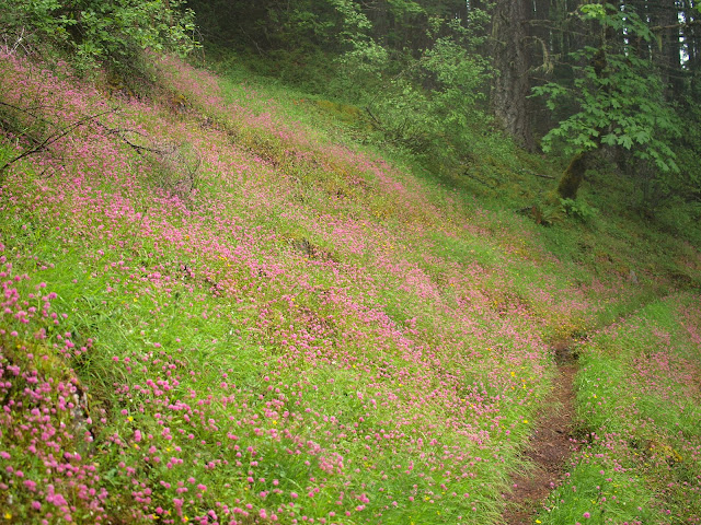
In the Lowe’s 1986 50 hiking Trails in Portland & Northwest Oregon, the Green Canyon Way trail that climbs from the Salmon River to Hunchback Mountain is described as "...only half completed ... and, because of lack of funds, may not even be finished in 1986." Apparently the funds were found (Ah, those were the days!) because the hike up Green Canyon Way now appears in both Afoot & Afield and Sullivan’s NW Oregon guide. Yesterday I did the loop up Green Canyon Way, along Hunchback Ridge to Devils Peak Lookout, then down past Kinzel Lake to the Salmon River Trail, then followed it back to my car at Green Canyon Campground. The Green Canyon Way trail (#793A) is well graded and in very good condition – those trail dollars spent back in ’86 really paid off. As I climbed, I passed through a few open meadows still carpeted with flowers.
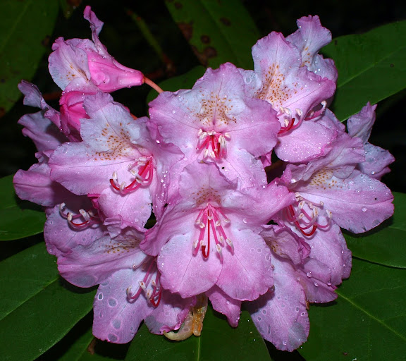
All along all the trails in this loop, rhodies were flowering or just starting to flower.
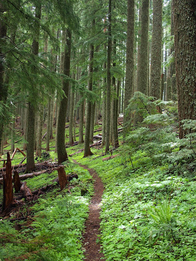
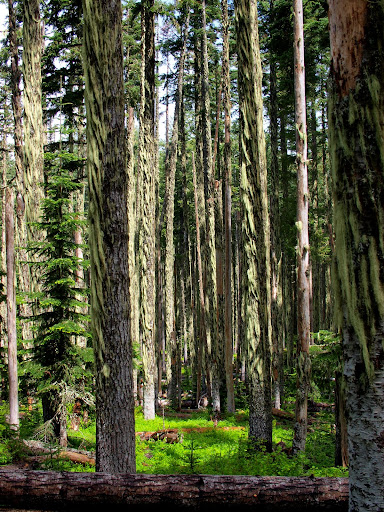
I started hiking under cloudy, overcast skies which, for the most part, stayed that way until mid-afternoon. The lower portions of this trail inhabit a temperate rainforest and this, in combination with no direct sunlight and some rain the night before, meant that I was wet from the waist down in no time (yes, I could have worn rain pants but I so desperately wanted to believe it's really summer...). There were occasional, tantalizing injections of sunlight into the forest, but these were short-lived.
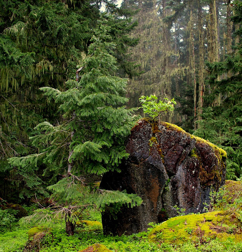
After 3.3 miles and about 2500’ of gain, the Green Canyon Way trail joins the Hunchback Mountain trail. Between here and the lookout, the Hunchback trail was plagued by numerous small and large fallen trees. I was certainly “hunchbacked” after crawling over, around, and under a bunch of them. Views were non-existent but I did capture this poetic moment of friendship between a rock and a tree.
A one point I passed through a stand of what looked to be dead or nearly dead trees – all candidates for future blowdowns and trail obstacles.
Further “hunching” got me to the lookout. The clouds still hadn’t parted, so there were no views of Hood or anything else.
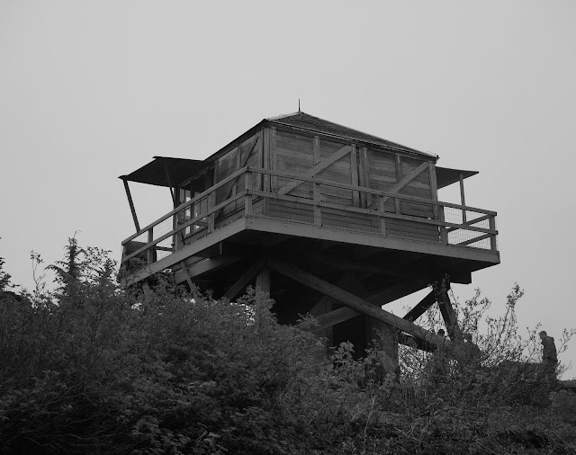
A party of 10 occupied the lookout (other folks were camped in the woodshed) and had apparently hauled a nearly inexhaustible supply of beer (and canned chili) up from their cars at Kinzel Lake. 10 people, beer, and canned chili in a confined space? It was time for me to head down to Kinzel Lake.
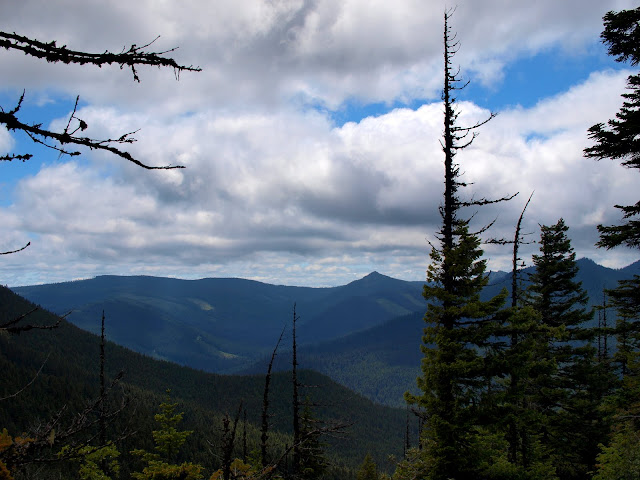
There is a side trail to the lake, but it’s not signed, so I unintentionally blasted past the lake on my way down. By now, the clouds were beginning to part and I could see out across the upper reaches of the Salmon River drainage.
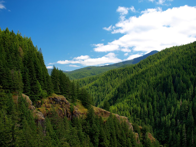
The Salmon River trail drops about 1000’ at a pleasant grade between the Kinzel Lake trail junction and the TH. Along the way, there were at least three viewpoints where I could look up and down the canyon.
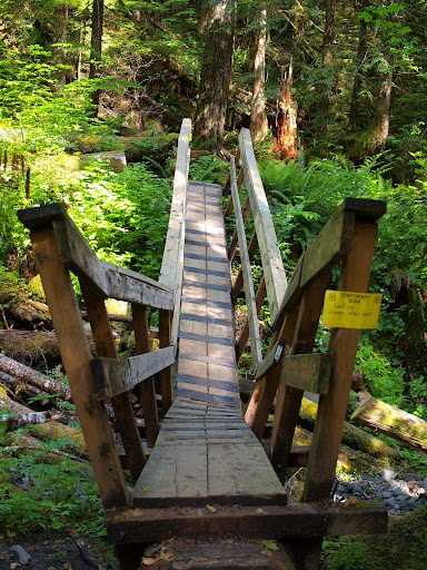
I came to this bridge thinking it had collapsed only to discover that it was intentionally built in a V-shape.
About 2 miles from the TH I passed Rolling Riffle Camp and began to get frequent views of the Salmon River.
Although the lookout was packed with chili-charged campers, and every campsite between the Kinzel Lake trail and the TH was occupied, I only encountered a few people actually on the trail and then only in the last 2-3 miles before the TH. I really enjoyed this hike – my only regret is that I didn’t do it on a clear day. It would be a great hike for a really hot day, since you are in the forest most of the day but finish up during the hottest part of the day next to a cool, refreshing river.
All along all the trails in this loop, rhodies were flowering or just starting to flower.
I started hiking under cloudy, overcast skies which, for the most part, stayed that way until mid-afternoon. The lower portions of this trail inhabit a temperate rainforest and this, in combination with no direct sunlight and some rain the night before, meant that I was wet from the waist down in no time (yes, I could have worn rain pants but I so desperately wanted to believe it's really summer...). There were occasional, tantalizing injections of sunlight into the forest, but these were short-lived.
After 3.3 miles and about 2500’ of gain, the Green Canyon Way trail joins the Hunchback Mountain trail. Between here and the lookout, the Hunchback trail was plagued by numerous small and large fallen trees. I was certainly “hunchbacked” after crawling over, around, and under a bunch of them. Views were non-existent but I did capture this poetic moment of friendship between a rock and a tree.
A one point I passed through a stand of what looked to be dead or nearly dead trees – all candidates for future blowdowns and trail obstacles.
Further “hunching” got me to the lookout. The clouds still hadn’t parted, so there were no views of Hood or anything else.
A party of 10 occupied the lookout (other folks were camped in the woodshed) and had apparently hauled a nearly inexhaustible supply of beer (and canned chili) up from their cars at Kinzel Lake. 10 people, beer, and canned chili in a confined space? It was time for me to head down to Kinzel Lake.
There is a side trail to the lake, but it’s not signed, so I unintentionally blasted past the lake on my way down. By now, the clouds were beginning to part and I could see out across the upper reaches of the Salmon River drainage.
The Salmon River trail drops about 1000’ at a pleasant grade between the Kinzel Lake trail junction and the TH. Along the way, there were at least three viewpoints where I could look up and down the canyon.
I came to this bridge thinking it had collapsed only to discover that it was intentionally built in a V-shape.
About 2 miles from the TH I passed Rolling Riffle Camp and began to get frequent views of the Salmon River.
Although the lookout was packed with chili-charged campers, and every campsite between the Kinzel Lake trail and the TH was occupied, I only encountered a few people actually on the trail and then only in the last 2-3 miles before the TH. I really enjoyed this hike – my only regret is that I didn’t do it on a clear day. It would be a great hike for a really hot day, since you are in the forest most of the day but finish up during the hottest part of the day next to a cool, refreshing river.