Angels Rest to Tanner Butte 23-24 June 2010
Posted: June 25th, 2010, 9:53 am
I had two days off mid-week – days that (finally) coincided with summer weather - and decided to do an overnight hike from Angels Rest to Tanner Butte. I wanted to try out some new gear and also check the state of the Moffett Creek trail. Yes, this was the long way to check a trail but why not? My wife dropped me off at the Angels Rest TH under warm and welcoming skies,
and I was soon passing Angels Rest,
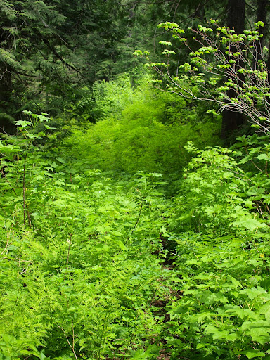
and heading E on the 415 & 420 trails to Multnomah Creek and then up Franklin Ridge to the Bell Creek Trail. I had done this trail a few weeks ago but was surprised by how much dense, lush vegetation had grown up over it since then.
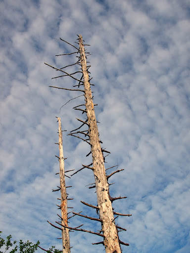
Most of the really wet parts of the trail had dried out and there’s no longer a stream running along it at its eastern end. From there, I continued heading E on the Horsetail Creek Trail toward Nesmith Point. There’s an old campsite above the middle fork of Horsetail Creek and I considered stopping there, but the day was still young so I pressed on. There are a couple of excellent viewpoints along the Horse Creek trail, between Yeon Mtn and Nesmith Point, so I got a view of Adams with thunderheads brewing.
Once the Horse Creek trail met the old road leading to Nesmith Point, I jogged south along the road to join my nominal “goal” - the Moffett Creek Trail (#430) and continued E on it. It’s very distinct and easy to follow until it reaches some powerline service roads in about 2.5 miles. A lack of signage, odd intersections with these roads, and a deterioration in the quality of the tread meant greater vigilence until I reached this forlorn and tattered little sign.
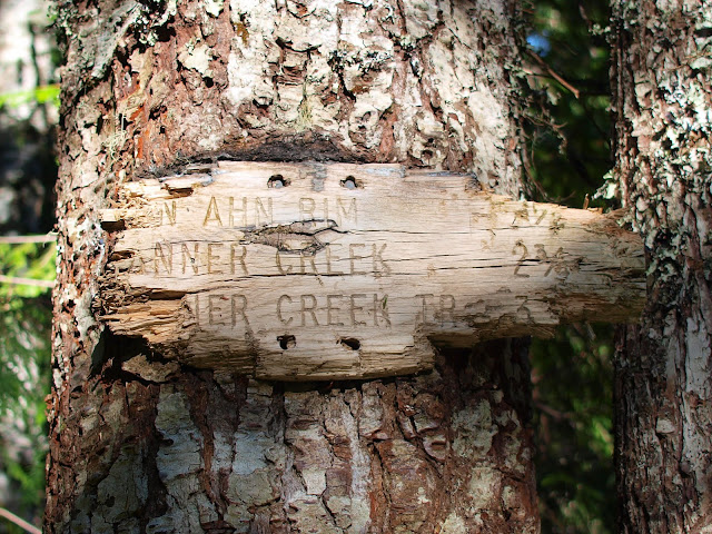
I didn’t know it then but the condition of this sign is a metaphor for the condition of the trail behind it. I went in search of Von Ahn Rim Camp but it was a no show. I did find a pond, now filled beyond capacity by the recent rains, and hosting substantial numbers of blood-crazed mosquitoes.
As much as I would have liked to have found the Rim Camp and camped near the pond, the clouds of mosquitoes pushed me back to a camp on one of the roads where there were somewhat fewer buzzing insects.
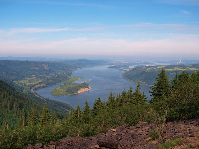
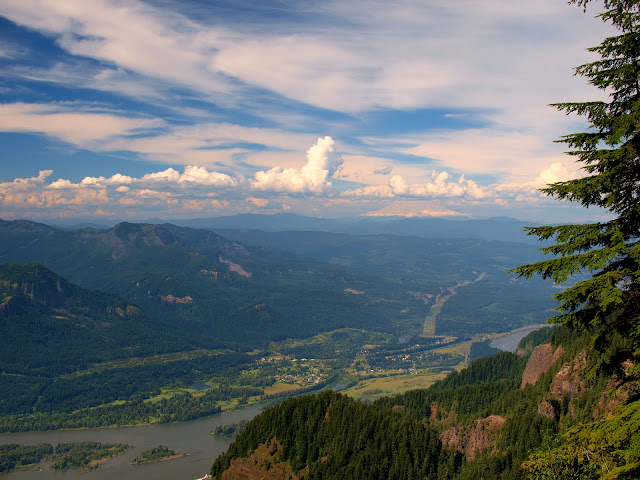
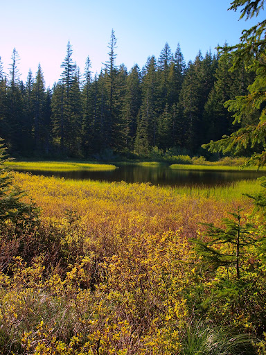
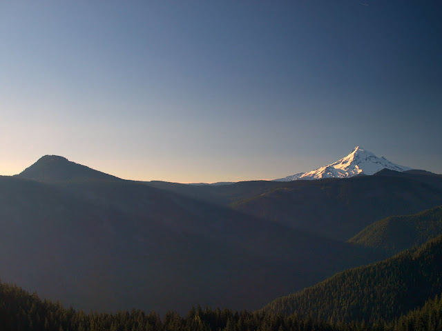
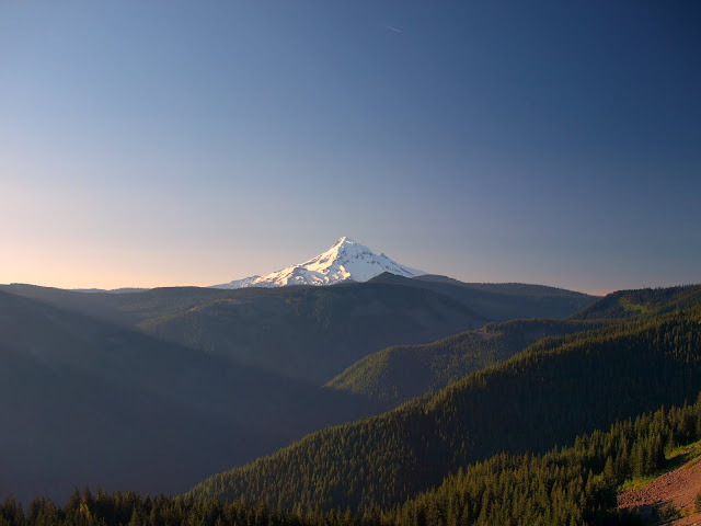
The next morning, I continued E on the Moffett trail, which, in many, many places, is little more than a glorified game trail. It’s not too hard to follow but you have to pay close attention. I remember reading a while back that it had been reopened or restored but any such efforts weren’t apparent. About a quarter mile past the pond, the trail suddenly opened to a view of Tanner Butte and Hood (and no clouds!).
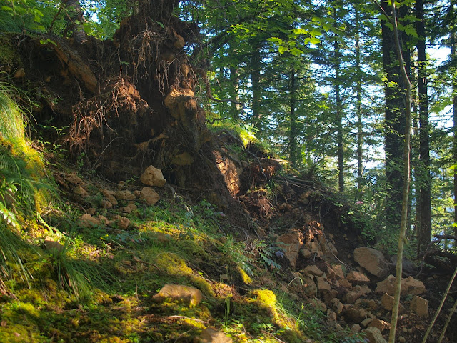
After this viewpoint, the trail passes a relatively new wilderness boundary sign (on a trail with otherwise minimal signage!), and starts dropping toward Tanner Creek - with its quality now ranging from game trail to not bad. There was a lot of overgrowth and some spots where a section of the trail had been removed by falling trees or small landslides.
Still it wasn’t hard to follow if I concentrated. The worst part was just before reaching Tanner Creek where the trail cuts through much more vegetation – and lots of Devils Club. Since there’s no official bridge over Tanner Creek, I descended in the sincere hope that I would be able to find a way across the creek and wouldn’t have to climb back up the Moffett. When I reached the creek, it wasn’t running as high and fast as recent rains might suggest but still seemed too much for wading particularly given that the rocks were slicker than glass with wet algae.

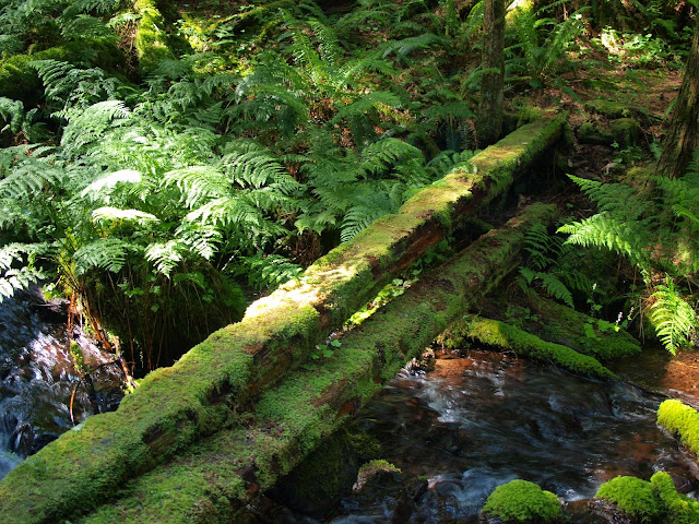
I was greatly relieved, therefore, to see a log crossing about 200’ downstream.
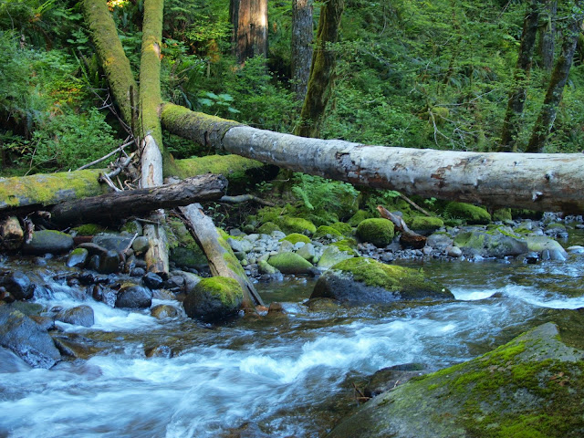
I tried to reach the log along the edge of the creek but the rocks were too treacherous, so it was back into and through the stream-side vegetation – with yet more Devils Club. After shimmying across the log, I thrashed up to the Tanner Creek Trail (#431). This trail proved to be wet, overgrown, damaged in spots, and in need to maintenance. This log bridge had a curiously spongy texture which was not reassuring.
I took the #431 N to the Tanner Cutoff Trail (#448) and followed it up to the Tanner Butte Trail (#401). The Moffett and Tanner Creek trails made the #448 look like a major highway. Except for having to pay close attention for the first ¼ mile after it left #431, it presented no real route finding issues. Some very nice person had even gone to the trouble of cutting away a blowdown that had been blocking the trail about halfway up – what a relief not to have to crawl! Once up on the ridge, I found a nice spot in the sun and took a nap – yes, it really is summer. After that it was down the Tanner Butte Trail, which looked amazingly wide and open compared to the trails since Bell Creek, toward home, and a cold Abita Turbodog beer.
Looking at a map, it’s easy to see that the Moffett, Tanner Creek, and Tanner Cutoff trail system is the only way to traverse the Columbia Wilderness between Nesmith Point and Tanner Butte on trails and within the wilderness. While I understand that the Moffett doesn’t necessarily go where a lot of people want to go (and no reliable bridge across Tanner Creek is a major issue), I worry that this route will just fade away from lack of use and the maintenance that use encourages. Hiking from one end of the Gorge to the other may not be for everyone, but if the Moffett goes, that would become a moot point.
and I was soon passing Angels Rest,
and heading E on the 415 & 420 trails to Multnomah Creek and then up Franklin Ridge to the Bell Creek Trail. I had done this trail a few weeks ago but was surprised by how much dense, lush vegetation had grown up over it since then.
Most of the really wet parts of the trail had dried out and there’s no longer a stream running along it at its eastern end. From there, I continued heading E on the Horsetail Creek Trail toward Nesmith Point. There’s an old campsite above the middle fork of Horsetail Creek and I considered stopping there, but the day was still young so I pressed on. There are a couple of excellent viewpoints along the Horse Creek trail, between Yeon Mtn and Nesmith Point, so I got a view of Adams with thunderheads brewing.
Once the Horse Creek trail met the old road leading to Nesmith Point, I jogged south along the road to join my nominal “goal” - the Moffett Creek Trail (#430) and continued E on it. It’s very distinct and easy to follow until it reaches some powerline service roads in about 2.5 miles. A lack of signage, odd intersections with these roads, and a deterioration in the quality of the tread meant greater vigilence until I reached this forlorn and tattered little sign.
I didn’t know it then but the condition of this sign is a metaphor for the condition of the trail behind it. I went in search of Von Ahn Rim Camp but it was a no show. I did find a pond, now filled beyond capacity by the recent rains, and hosting substantial numbers of blood-crazed mosquitoes.
As much as I would have liked to have found the Rim Camp and camped near the pond, the clouds of mosquitoes pushed me back to a camp on one of the roads where there were somewhat fewer buzzing insects.
The next morning, I continued E on the Moffett trail, which, in many, many places, is little more than a glorified game trail. It’s not too hard to follow but you have to pay close attention. I remember reading a while back that it had been reopened or restored but any such efforts weren’t apparent. About a quarter mile past the pond, the trail suddenly opened to a view of Tanner Butte and Hood (and no clouds!).
After this viewpoint, the trail passes a relatively new wilderness boundary sign (on a trail with otherwise minimal signage!), and starts dropping toward Tanner Creek - with its quality now ranging from game trail to not bad. There was a lot of overgrowth and some spots where a section of the trail had been removed by falling trees or small landslides.
Still it wasn’t hard to follow if I concentrated. The worst part was just before reaching Tanner Creek where the trail cuts through much more vegetation – and lots of Devils Club. Since there’s no official bridge over Tanner Creek, I descended in the sincere hope that I would be able to find a way across the creek and wouldn’t have to climb back up the Moffett. When I reached the creek, it wasn’t running as high and fast as recent rains might suggest but still seemed too much for wading particularly given that the rocks were slicker than glass with wet algae.
I was greatly relieved, therefore, to see a log crossing about 200’ downstream.
I tried to reach the log along the edge of the creek but the rocks were too treacherous, so it was back into and through the stream-side vegetation – with yet more Devils Club. After shimmying across the log, I thrashed up to the Tanner Creek Trail (#431). This trail proved to be wet, overgrown, damaged in spots, and in need to maintenance. This log bridge had a curiously spongy texture which was not reassuring.
I took the #431 N to the Tanner Cutoff Trail (#448) and followed it up to the Tanner Butte Trail (#401). The Moffett and Tanner Creek trails made the #448 look like a major highway. Except for having to pay close attention for the first ¼ mile after it left #431, it presented no real route finding issues. Some very nice person had even gone to the trouble of cutting away a blowdown that had been blocking the trail about halfway up – what a relief not to have to crawl! Once up on the ridge, I found a nice spot in the sun and took a nap – yes, it really is summer. After that it was down the Tanner Butte Trail, which looked amazingly wide and open compared to the trails since Bell Creek, toward home, and a cold Abita Turbodog beer.
Looking at a map, it’s easy to see that the Moffett, Tanner Creek, and Tanner Cutoff trail system is the only way to traverse the Columbia Wilderness between Nesmith Point and Tanner Butte on trails and within the wilderness. While I understand that the Moffett doesn’t necessarily go where a lot of people want to go (and no reliable bridge across Tanner Creek is a major issue), I worry that this route will just fade away from lack of use and the maintenance that use encourages. Hiking from one end of the Gorge to the other may not be for everyone, but if the Moffett goes, that would become a moot point.