Sedum Ridge Trail (Part Deux) 14-May-2010
Posted: May 15th, 2010, 7:16 am
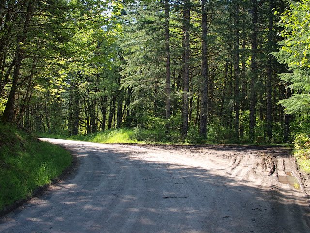
Although this doesn’t rise to the level of the 3 days of obsession that CherokeeDriver displayed to finally reach the summit of Archer Mountain, I just had to have another go at finding and hiking the Sedum Ridge Trail. Thanks to TH coordinates and a map from Pablo (http://www.portlandhikers.org/forum/vie ... 581&p=3208), finding the TH off CG 2000 was no problem. It’s 0.9 mi from the bridge on CG 2000 at Swift Creek Falls, at a large dirt pullout on the left (the only one along this part of the road).
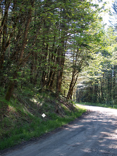
The trail starts directly across from the pullout but is very faint at first – it looks more like a game trail at this point. The inconspicuous sign mentioned in Afoot & Afield and photographed by Pablo was nowhere in sight.
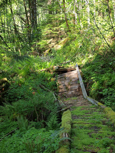
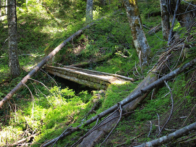
Since I would be coming out along the PCT, I drove up to where the PCT crosses CG 2070, parked there, and walked back down to the TH. Walking downhill during the cool of the morning seemed vastly preferable to climbing up to the car in the hot afternoon. I started on the “trail” with doubts but very soon – right on the other side of a fallen tree blocking the trail that I hadn’t bothered to crawl over the first time – I came to the first of four bridges on the trail. This was the “sign” that I’d found the Sedum Ridge trail.
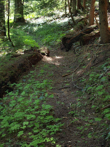
From this point the trail, while not always in great shape, was easy to follow.
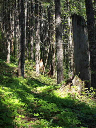
Under the forest canopy, there were sections of the trail that looked almost new; almost as good as the PCT in this area.
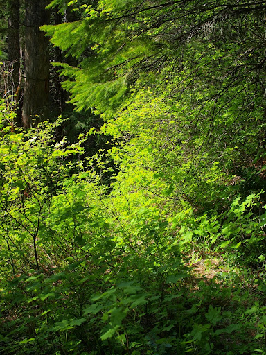
But where there were openings in the canopy, various shrubs had already started to reclaim it.
Fortunately, while there were a number of larger trees that had to be stepped over or around, there was only one really big blowdown blocking the trail.
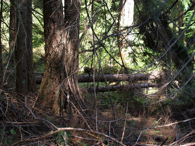
A bunch of smaller (1-3”) trees and limbs had fallen or been pushed across the trail, so I decided to pass on another climb of Mowich Butte and use that time (probably more than an hour all told) to clear limbs with my trusty folding saw. If I gauged the tension right, it wasn’t too hard to fell a 3” limb in less than a minute. Still, there were a lot of limbs to deal with. About 2.5 miles from the TH, I came to the remaining three bridges in quick succession. All were still in good shape for hikers – but may be getting a little spongy for horses – and only the last one was having an issue with fallen trees.
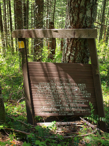
Shortly before reaching the junction with the PCT, I came across this sign marking the state lands – federal forest boundary. It’s lengthy message seems to promise more interest from the state than this trail has gotten in recent years.
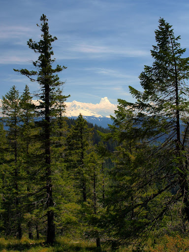
I had lunch at the PCT junction and then headed back to my car along the PCT. This is not a loop with a lot of views (I would have needed to go up to the Butte for that) but there was one opening in the trees that gave me a good look at Hood with an impressive thunderhead building next to it.
The loop up Sedum Ridge and down the PCT is a very pleasant hike (and one with good views if you do the side trip to Mowich Butte). Since the main part of the hike tops out at only 3000’ feet, it would be a good early season hike. Parking at the PCT and walking back down to the TH made for a cool start and an easy finish. But if more folks don’t take an interest in the Sedum Ridge trail I fear that it, and all the work that went into creating it, will simply fade away.
The trail starts directly across from the pullout but is very faint at first – it looks more like a game trail at this point. The inconspicuous sign mentioned in Afoot & Afield and photographed by Pablo was nowhere in sight.
Since I would be coming out along the PCT, I drove up to where the PCT crosses CG 2070, parked there, and walked back down to the TH. Walking downhill during the cool of the morning seemed vastly preferable to climbing up to the car in the hot afternoon. I started on the “trail” with doubts but very soon – right on the other side of a fallen tree blocking the trail that I hadn’t bothered to crawl over the first time – I came to the first of four bridges on the trail. This was the “sign” that I’d found the Sedum Ridge trail.
From this point the trail, while not always in great shape, was easy to follow.
Under the forest canopy, there were sections of the trail that looked almost new; almost as good as the PCT in this area.
But where there were openings in the canopy, various shrubs had already started to reclaim it.
Fortunately, while there were a number of larger trees that had to be stepped over or around, there was only one really big blowdown blocking the trail.
A bunch of smaller (1-3”) trees and limbs had fallen or been pushed across the trail, so I decided to pass on another climb of Mowich Butte and use that time (probably more than an hour all told) to clear limbs with my trusty folding saw. If I gauged the tension right, it wasn’t too hard to fell a 3” limb in less than a minute. Still, there were a lot of limbs to deal with. About 2.5 miles from the TH, I came to the remaining three bridges in quick succession. All were still in good shape for hikers – but may be getting a little spongy for horses – and only the last one was having an issue with fallen trees.
Shortly before reaching the junction with the PCT, I came across this sign marking the state lands – federal forest boundary. It’s lengthy message seems to promise more interest from the state than this trail has gotten in recent years.
I had lunch at the PCT junction and then headed back to my car along the PCT. This is not a loop with a lot of views (I would have needed to go up to the Butte for that) but there was one opening in the trees that gave me a good look at Hood with an impressive thunderhead building next to it.
The loop up Sedum Ridge and down the PCT is a very pleasant hike (and one with good views if you do the side trip to Mowich Butte). Since the main part of the hike tops out at only 3000’ feet, it would be a good early season hike. Parking at the PCT and walking back down to the TH made for a cool start and an easy finish. But if more folks don’t take an interest in the Sedum Ridge trail I fear that it, and all the work that went into creating it, will simply fade away.