Dublin Lake / Tanner Cutoff Loop 27-March-2010
Posted: March 28th, 2010, 7:35 am
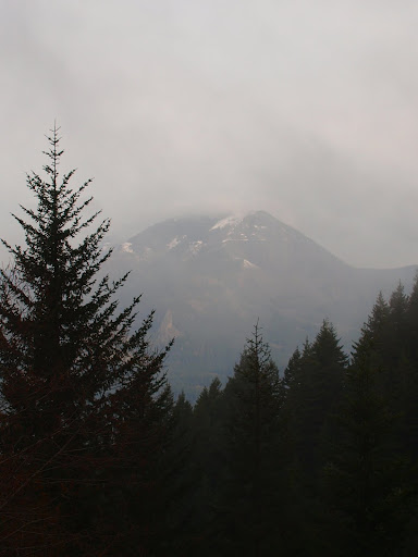
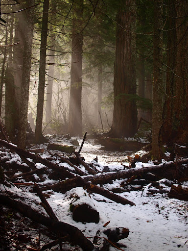
Having spent much of last week in San Francisco, I felt lucky to be back in Oregon in time to experience what looked to be our one sunny day for the foreseeable future. A loop hike to Dublin Lake and down the Tanner Cutoff Trail (#448) had been on my list for awhile, so that was it then. I got an early start – figuring that hoards of other hikers would be equally enthused to be out enjoying the sun – only to find myself the only car at the Tooth Rock TH. This solitude was prescient – I saw no one else until much later in the afternoon. It was a clear day at the TH but a band of clouds and fog was waiting for me as I started up the Tanner Butte trail proper. This part of the trail doesn’t have many viewpoints, but there was a view of Table (once again with some snow) through the mists.
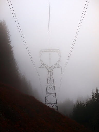
Shortly after I crossed under some decorative features provided by the BPA, also shrouded in the mists.
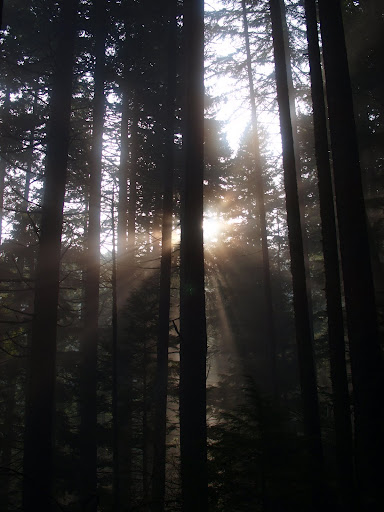
By the 2000’ level, however, the sun was gaining the upper hand and the clouds were beginning to dissipate.
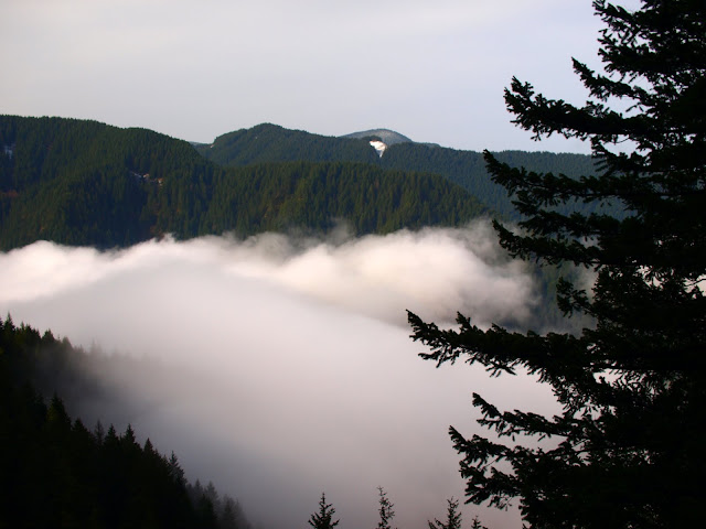
There was a point on the trail at about 2400’ where it was possible to traverse out into an open area and see the clouds descending into the Gorge.
The tree fungi (my favorite alternative to flowers) weren’t much in evidence today but these liverworts(?) were pretty cool looking.

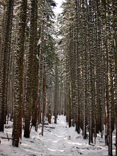
The trail up to the informal campsite (and turnoff for the extremely vague Wauna Point trail) at about 2800’ was in excellent condition. From here on it would get narrower and a little more encroached on by vegetation but never hard to follow (a number of yellow flags also helped with following the trail). Also thanks to the volunteers who did trail maintenance on the fallen trees between here and 3000’! A sprinkling of snow started about 3200’ and got thicker as I climbed but it never got more than 0.5-1’ deep – just mostly wet, heavy, and mushy.
The fun started as the trail gradient eased at around 3600’. By now the sun was well up and, while it wasn’t doing much to warm the air, it was loosening the snow in the trees, while came raining down on me in all sizes from raindrops to snow cones. I had to put on rain gear to run this gauntlet of snow-laden trees.
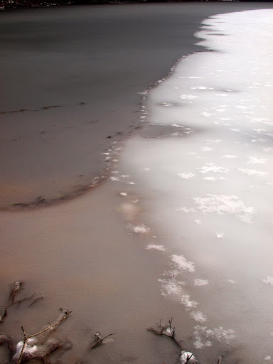
The open shore of Dublin Lake provided a sanctuary from this snowy rainfall, so I stopped there for a break and a snack.
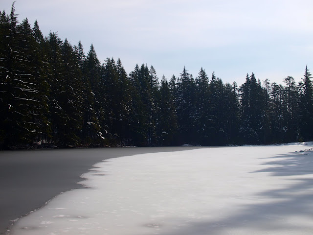
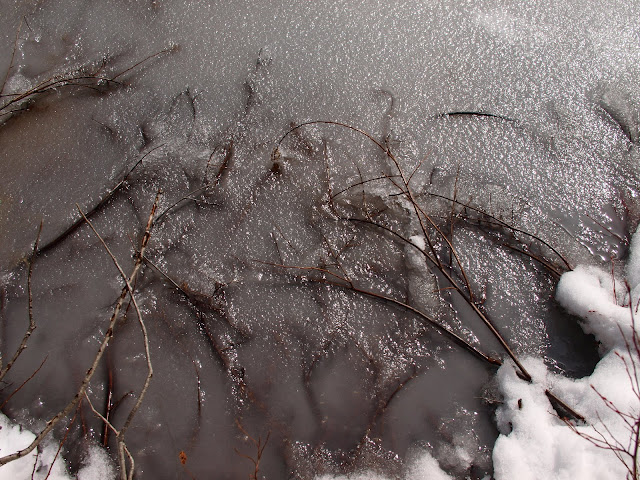
The lake was covered with a thin slurry of ice and snow – glops of wet snow falling off the trees went right through it.
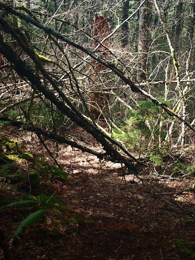
After leaving the lake, I looped back to the TH via the Tanner Cutoff Trail (#448). The last time I was on this trail was maybe 15 years ago and even then I thought it was not in good shape. Sorry to say that nothing seems to have been done to change this in the intervening years. Most of it is hardly better than a good use trail. In several places around the 2800’ level, it is completely choked with blowdown.
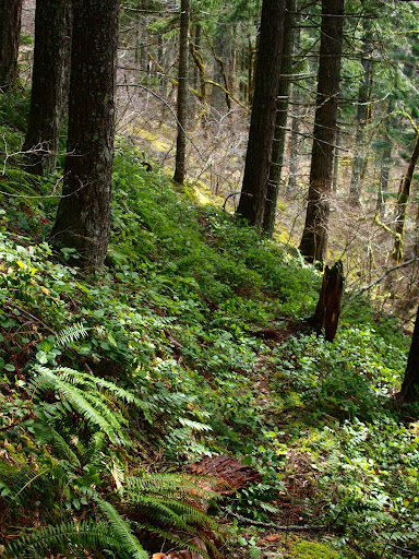
There are sections in the middle where it is very faint and others were it just blends into the undergrowth.
The worst problems are just before it junctions with the Tanner Creek trail – if it weren’t for some strategically placed flagging (and the fact that coming down makes it easier to see whatever trail there is) – I would have had to resort to XC routefinding. Someone trying to come up the 448 from Tanner Creek would really need to pay attention and watch for flagging so as not to miss it. I’d say it’s been more than awhile since anyone gave this trail the maintenance it deserves as an important connecting trail.
The hike back up and down the road to the TH was pleasant but a little tedious. Aside from a solitary mountain biker on the road, a father/son campout along Tanner Creek, and some wandering hikers near the TH, I saw no one else the whole day. Sullivan lists this loop as 14.3 mi with 4250’ gain. Aside from my worries about the future of the 448, it was a good day in the woods.
Shortly after I crossed under some decorative features provided by the BPA, also shrouded in the mists.
By the 2000’ level, however, the sun was gaining the upper hand and the clouds were beginning to dissipate.
There was a point on the trail at about 2400’ where it was possible to traverse out into an open area and see the clouds descending into the Gorge.
The tree fungi (my favorite alternative to flowers) weren’t much in evidence today but these liverworts(?) were pretty cool looking.
The trail up to the informal campsite (and turnoff for the extremely vague Wauna Point trail) at about 2800’ was in excellent condition. From here on it would get narrower and a little more encroached on by vegetation but never hard to follow (a number of yellow flags also helped with following the trail). Also thanks to the volunteers who did trail maintenance on the fallen trees between here and 3000’! A sprinkling of snow started about 3200’ and got thicker as I climbed but it never got more than 0.5-1’ deep – just mostly wet, heavy, and mushy.
The fun started as the trail gradient eased at around 3600’. By now the sun was well up and, while it wasn’t doing much to warm the air, it was loosening the snow in the trees, while came raining down on me in all sizes from raindrops to snow cones. I had to put on rain gear to run this gauntlet of snow-laden trees.
The open shore of Dublin Lake provided a sanctuary from this snowy rainfall, so I stopped there for a break and a snack.
The lake was covered with a thin slurry of ice and snow – glops of wet snow falling off the trees went right through it.
After leaving the lake, I looped back to the TH via the Tanner Cutoff Trail (#448). The last time I was on this trail was maybe 15 years ago and even then I thought it was not in good shape. Sorry
There are sections in the middle where it is very faint and others were it just blends into the undergrowth.
The worst problems are just before it junctions with the Tanner Creek trail – if it weren’t for some strategically placed flagging (and the fact that coming down makes it easier to see whatever trail there is) – I would have had to resort to XC routefinding. Someone trying to come up the 448 from Tanner Creek would really need to pay attention and watch for flagging so as not to miss it. I’d say it’s been more than awhile since anyone gave this trail the maintenance it deserves as an important connecting trail.
The hike back up and down the road to the TH was pleasant but a little tedious. Aside from a solitary mountain biker on the road, a father/son campout along Tanner Creek, and some wandering hikers near the TH, I saw no one else the whole day. Sullivan lists this loop as 14.3 mi with 4250’ gain. Aside from my worries about the future of the 448, it was a good day in the woods.