Portland's 4T Trail of Urban Adventure 20-Mar-2012
Posted: March 21st, 2010, 9:56 am
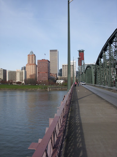
The 4T trail is a Metro government effort to get folks to try all of Portland’s transportation options (trail, tram, trolley, train) plus see some of the city plus get a little exercise (http://library.oregonmetro.gov/files/tr ... ytrain.pdf). We took a swipe at our carbon footprint on Saturday by not driving to a hike in the Gorge (although the temptation was immense) and giving the 4T a try instead. It’s a 30 minute walk from our inner SE dwelling, across the Hawthorne Bridge,
to the closest MAX stop,
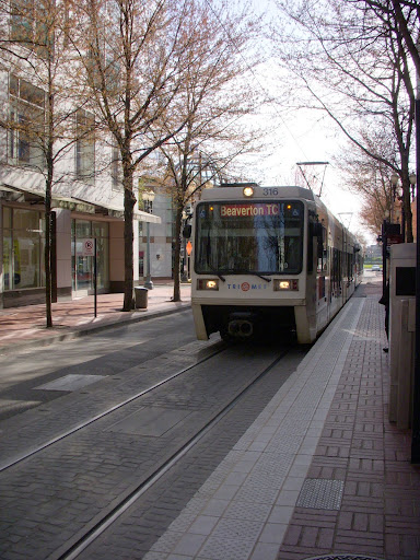
where we caught the train for a ride to the Washington Park MAX station. Once out of the station, we had to find the Marquam Trail. It’s just to the west of the station but access to it is not obvious – our choice was to either walk up SW Knight to where it intersects the Wildwood or down the street and through a parking lot – we went with the parking lot. Once found, it quickly ends at an intersection of streets and freeway off and on ramps – where to next can be a bit of a mystery as signage is minimal (but better than before). We crossed the freeway bridge, playing dodge-car with drivers frantic to get to the zoo,
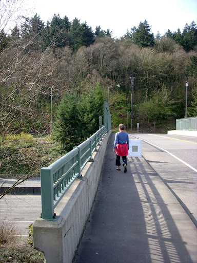
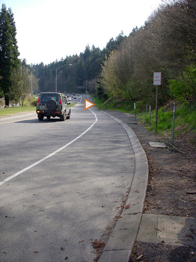
then went left down the freeway on ramp – the trail isn’t visible at this point but it’s about 100’ down the ramp on the right (at the arrow) – to the continuation of the Marquam Trail.
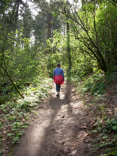
This is the longest section of actual trail – about 0.5 mi – on the 4T route and as good an urban trail as those in Forest Park proper.
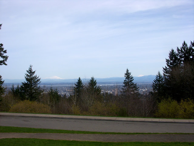
The trail deposited us on SW Patton where there were some 4T signs directing us to Council Crest Park where the view was big – St Helens, Rainier, Adams, Hood were all visible.
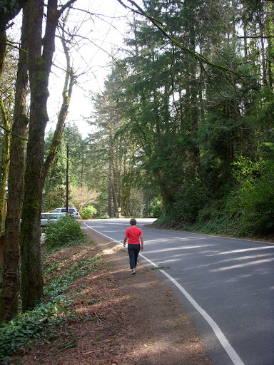
From the crest we headed due E to intercept the Marquam Trail again as it descended toward OHSU. There are two options ahead – the forest walking trail and the urban shortcut – we went with the shortcut, which took us along SW Fairmont, Marquam Hill, and Gibbs Streets
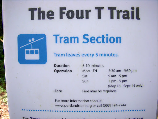
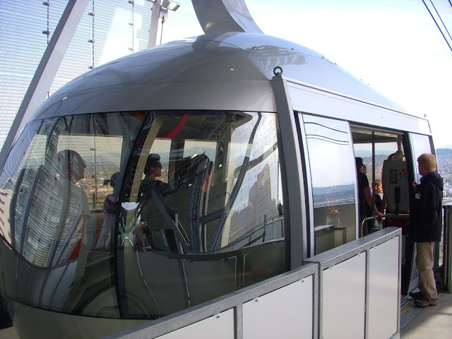
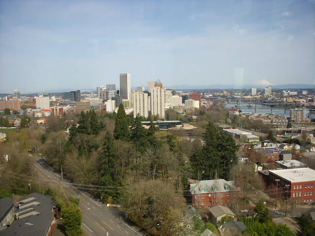
to the tram station at OHSU. The tram ride is free going down ($4 RT) and provides sweeping views of the city (and of people’s backyards in Lair Hill).
The tram dropped us at the OHSU Commons trolley stop
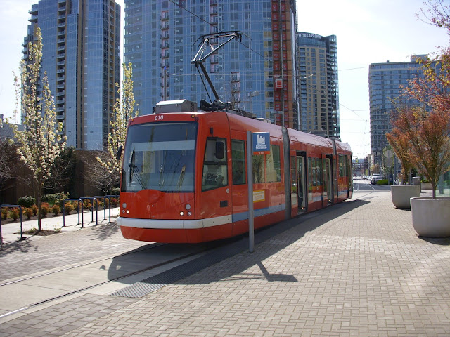
and we took the trolley back into the city. The “official” 4T ends at the SW 10th & Taylor stop, but we stayed on until the Pearl, where we finished our 4T adventure with a short hike to the Rogue Brewery. After suitable refreshment appropriate for an urban adventure of this magnitude, we did a short hike to the nearest bus stop and let the #4 bus get us home.[/size]
to the closest MAX stop,
where we caught the train for a ride to the Washington Park MAX station. Once out of the station, we had to find the Marquam Trail. It’s just to the west of the station but access to it is not obvious – our choice was to either walk up SW Knight to where it intersects the Wildwood or down the street and through a parking lot – we went with the parking lot. Once found, it quickly ends at an intersection of streets and freeway off and on ramps – where to next can be a bit of a mystery as signage is minimal (but better than before). We crossed the freeway bridge, playing dodge-car with drivers frantic to get to the zoo,
then went left down the freeway on ramp – the trail isn’t visible at this point but it’s about 100’ down the ramp on the right (at the arrow) – to the continuation of the Marquam Trail.
This is the longest section of actual trail – about 0.5 mi – on the 4T route and as good an urban trail as those in Forest Park proper.
The trail deposited us on SW Patton where there were some 4T signs directing us to Council Crest Park where the view was big – St Helens, Rainier, Adams, Hood were all visible.
From the crest we headed due E to intercept the Marquam Trail again as it descended toward OHSU. There are two options ahead – the forest walking trail and the urban shortcut – we went with the shortcut, which took us along SW Fairmont, Marquam Hill, and Gibbs Streets
to the tram station at OHSU. The tram ride is free going down ($4 RT) and provides sweeping views of the city (and of people’s backyards in Lair Hill).
The tram dropped us at the OHSU Commons trolley stop
and we took the trolley back into the city. The “official” 4T ends at the SW 10th & Taylor stop, but we stayed on until the Pearl, where we finished our 4T adventure with a short hike to the Rogue Brewery. After suitable refreshment appropriate for an urban adventure of this magnitude, we did a short hike to the nearest bus stop and let the #4 bus get us home.[/size]