Table Mountain Traverse 15-Feb-2010
Posted: February 15th, 2010, 6:38 pm
Today, with the weather cooperating so wonderfully, I decided to do a traverse of Table Mountain, ascending via its NW ridge and descending via Heartbreak Ridge. I started at Bonneville Hot Springs then took the use trail, the old road, another use trail, and part of the PCT up to the junction with the West Ridge trail. Rather than just head up to the summit from there, I continued NW on the PCT. The weather was good, mostly sunny, but clouds and fog still clung to the valley floors as I came around the west side of Table.
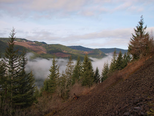
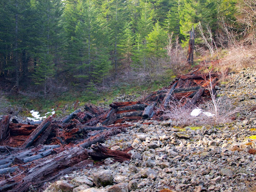
Eventually the PCT will cross two dirt roads under the power lines before reaching a third road. Before reaching this third road, there is a large collapsed log structure that looks like someone built a substantial bridge or causeway across a broad gully for some unobvious reason – looks like a challenge for the Gorge historians.
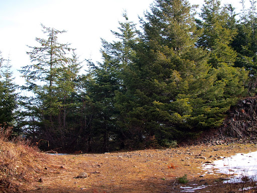
At the third road, I turned right and followed it to the top of the ridge and a 3-way road junction (which isn’t that obvious). The road to follow SE starts right behind the trees in the center of this photo.
This road was still covered in snow (the only section of the entire hike with any snow) and there was some brush down but it was easy to follow. There were numerous animal tracks, including the ones below, but no human footprints. This route probably fell out of favor as a loop once the Heartbreak Ridge trail re-opened.

When the road ends, a small use trail continues SE along the crest of the ridge (it goes back and forth across the ridge and sometimes disappears but never goes more than 10 feet from the ridgeline, so it’s easy to re-acquire). Just before this trail reaches the summit of Table, there are two short steeper sections,
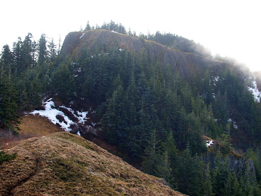
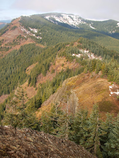
and then you’re on the summit, looking down along the entire ridge, where the trail is a faint line near some snow patches in the center right of this view.
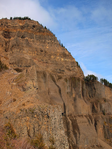
I traversed Table and took the “new” Heartbreak Ridge Trail back to the PCT. Since I’ve usually done Table when it’s snow covered, this is the first time I’ve ever seen this trail, much less actually walked on it. The advantage of this route is that (except for the boulder field section) it’s easier on the knees and you get a great view of the shear face of Table.
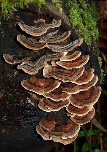
There was nothing special about the hike back to the car except for a cool tree fungus
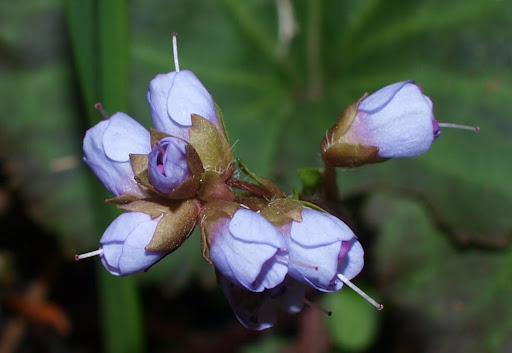
and a tiny flower (the buds are 1/8” long) blooming on the forest floor.
Another great day on the trail...
Eventually the PCT will cross two dirt roads under the power lines before reaching a third road. Before reaching this third road, there is a large collapsed log structure that looks like someone built a substantial bridge or causeway across a broad gully for some unobvious reason – looks like a challenge for the Gorge historians.
At the third road, I turned right and followed it to the top of the ridge and a 3-way road junction (which isn’t that obvious). The road to follow SE starts right behind the trees in the center of this photo.
This road was still covered in snow (the only section of the entire hike with any snow) and there was some brush down but it was easy to follow. There were numerous animal tracks, including the ones below, but no human footprints. This route probably fell out of favor as a loop once the Heartbreak Ridge trail re-opened.
When the road ends, a small use trail continues SE along the crest of the ridge (it goes back and forth across the ridge and sometimes disappears but never goes more than 10 feet from the ridgeline, so it’s easy to re-acquire). Just before this trail reaches the summit of Table, there are two short steeper sections,
and then you’re on the summit, looking down along the entire ridge, where the trail is a faint line near some snow patches in the center right of this view.
I traversed Table and took the “new” Heartbreak Ridge Trail back to the PCT. Since I’ve usually done Table when it’s snow covered, this is the first time I’ve ever seen this trail, much less actually walked on it. The advantage of this route is that (except for the boulder field section) it’s easier on the knees and you get a great view of the shear face of Table.
There was nothing special about the hike back to the car except for a cool tree fungus
and a tiny flower (the buds are 1/8” long) blooming on the forest floor.
Another great day on the trail...

