Munra Point 31-Jan-2010
Posted: January 31st, 2010, 6:29 pm
5:45am - nothing outside my bedroom window except mist, fog, gloom, and possibly rain. 6:15am - cat signals urgent need for food (she’s not fat but would very much like to be) so staying in bed is no longer an option (resistance is futile, etc.). So - get up, feed the cat, go hiking. I had been intrigued by Tom’s post of a “new” trail at Munra Point and headed there to check it out. The drive out I-84 was made in mist and fog, with occasional rain squalls, and it was raining very lightly when I arrived at the Wahclella Falls trailhead. The 400 trail up from the trailhead to the old dirt road has seen some recent maintenance, as has a short section of the 400 just beyond the road – both are in very good condition. However, from there to the Munra Point trail junction the 400 has seen no recent maintenance but is nonetheless in good condition. Despite the recent construction along I-84, the Munra Point trail still starts at the old “not maintained” sign,
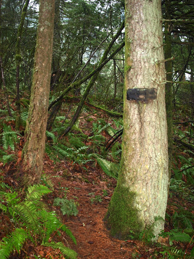
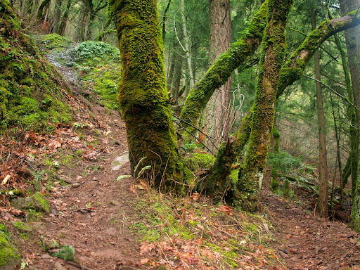
and is still the same up through the rocky switchbacks that go below and along the short cliff face. Beyond that, there were two sections of the old use trail that were steep slopes, muddy and slippery when wet, and a pain to downclimb at all times. The “new” trail that Tom mentions cuts right from just before the first of these steep slopes. In this picture, the “old” trail cuts up to the left while the new trail contours off to the right.
The new trail then contours, switchbacks, and climbs around the old steep sections before reconnecting with the existing trail just before it reaches the crest of the ridge. Someone put a lot of work into this new trail, and it really does improve the scramble up to the ridge, but I doubt it’s any kind of “official” Forest Service effort. It’s a good start but would need more work, and some trail design guidance, to reach its full potential.
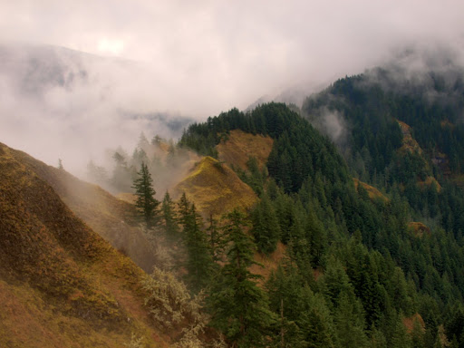
By the time I reached the ridge, the rain had stopped and the clouds were beginning to break-up.
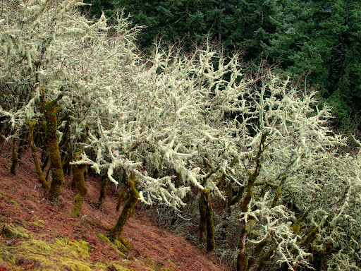
The subdued diffuse light coming through the clouds really highlighted the tree moss.
The trail up the ridge itself was in good shape, just a little wet and slippery in spots. The chimney just below the summit, with its few 3rd class moves, was really wet but the handholds and footholds are generally good.
The summit was shrouded in mist
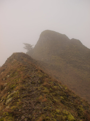
as was the ridge running south from the summit.
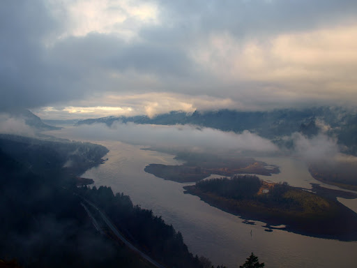
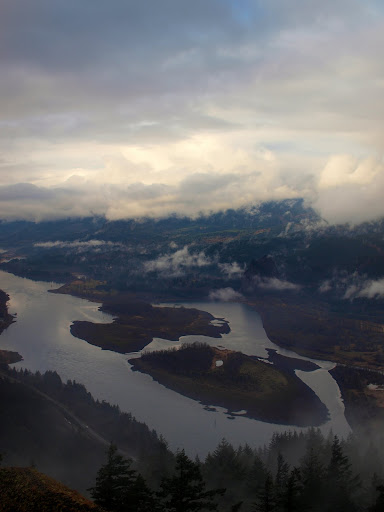
The view to the west from the summit itself was pretty amazing, with the constantly shifting clouds lit by the sun from the east.
It was windy and brisk on the summit, but surprisingly warm given it’s still winter. Last year at this time, Munra Point was a snow climb in its upper reaches and the chimney was chocked with ice. The hike back was quick and I was home in time for lunch (mine, not the cat’s)
and is still the same up through the rocky switchbacks that go below and along the short cliff face. Beyond that, there were two sections of the old use trail that were steep slopes, muddy and slippery when wet, and a pain to downclimb at all times. The “new” trail that Tom mentions cuts right from just before the first of these steep slopes. In this picture, the “old” trail cuts up to the left while the new trail contours off to the right.
The new trail then contours, switchbacks, and climbs around the old steep sections before reconnecting with the existing trail just before it reaches the crest of the ridge. Someone put a lot of work into this new trail, and it really does improve the scramble up to the ridge, but I doubt it’s any kind of “official” Forest Service effort. It’s a good start but would need more work, and some trail design guidance, to reach its full potential.
By the time I reached the ridge, the rain had stopped and the clouds were beginning to break-up.
The subdued diffuse light coming through the clouds really highlighted the tree moss.
The trail up the ridge itself was in good shape, just a little wet and slippery in spots. The chimney just below the summit, with its few 3rd class moves, was really wet but the handholds and footholds are generally good.
The summit was shrouded in mist
as was the ridge running south from the summit.
The view to the west from the summit itself was pretty amazing, with the constantly shifting clouds lit by the sun from the east.
It was windy and brisk on the summit, but surprisingly warm given it’s still winter. Last year at this time, Munra Point was a snow climb in its upper reaches and the chimney was chocked with ice. The hike back was quick and I was home in time for lunch (mine, not the cat’s)