1.23.10 Eagle Creek / Benson Plateau / Ruckle Ridge

This forum is used to share your experiences out on the trails.
User avatar
cascadehiker
Posts: 378
Joined: April 20th, 2009, 8:51 am
Location: Vancouver, WA

1.23.10 Eagle Creek / Benson Plateau / Ruckle Ridge

Post by cascadehiker » January 24th, 2010, 2:57 pm

This loop has been on my radar for sometime now, and with the meager snowpack why not try it in the middle of winter? Didn't arrive at the Eagle Creek TH until about 10:45am, so I knew I'd have to keep moving all day. It was hard not to want to stop every other minute to snap pictures.
picture 008.jpg
picture 009.jpg
picture 032.jpg
picture 033.jpg
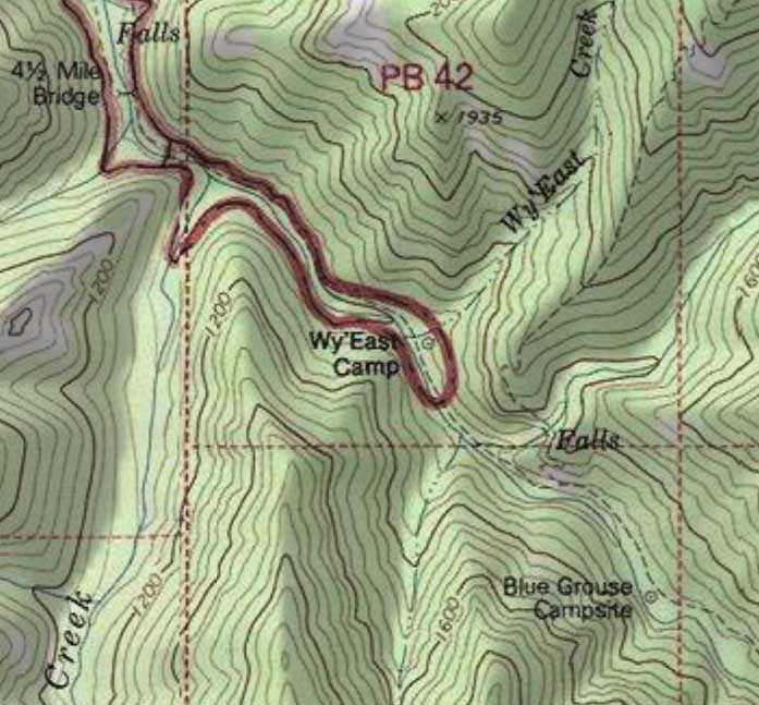
After crossing High Bridge I passed an old timer who pointed out to me the bridge that washed out a few years back. I wished I'd taken a picture of it. I felt bad. The guy was so full of useful info and was really interested in the trip I had planned out that day. But I really didn't have much time to chit chat. Had to keep moving! I knew the 3,000+ ft climb in 3 miles up to the plateau would slow my pace. About half way up I thought to myself "who was the genius who pioneered this trail, and which asylum did he get sent to?". Can't remember very many switchbacks. Awesome views back down to the Eagle Creek drainage
picture 041.jpg
picture 042.jpg
Occasionally I'd come to a panoramic viewpoint where I could start to see the snowline on the surrounding ridges. The first dusting of snow came right at 3,000ft.
picture 046.jpg
It became quite apparent that the inch or two of snow was from the prior night. No other footprints were seen until I reached Camp Smokey at the junction with the PCT.
picture 053.jpg
I was fortunate enough to follow these footprints across Benson Plateau. With the 2 inches of fresh snow (with maybe a 6 inch snowpack in places) and flat terrain, these footprints helped to keep me headed in the right direction.

As I headed down Ruckle Ridge, I passed the two hikers (female from NY and a guy from FL) and stopped to chat for a few. I didn't tell them, but their tracks in the snow proved very very helpful. Thanks guys! By now my knees were feeling each and every step as I descended Ruckle Ridge. I realize now that the trek up from Eagle Creek is probably easier than coming up Ruckle.
picture 057.jpg
Couldn't have asked for better weather in mid January. And choosing Saturday over Sunday was the right choice!

Stats: 15.6 miles / 4,900 feet elevation gain / 5 hrs, 56 minutes
"Man who catch fly with chopstick accomplish anything" - Mr Miyagi

User avatar
mattisnotfrench
Posts: 1318
Joined: May 28th, 2008, 10:03 pm
Location: SE Portland
Contact:

Re: 1.23.10 Eagle Creek / Benson Plateau / Ruckle Ridge

Post by mattisnotfrench » January 24th, 2010, 3:30 pm

cascadehiker wrote:
picture 041.jpg
What falls is this? I've always wondered.
Author of Extraordinary Oregon!, PDX Hiking 365, 101 Hikes in the Majestic Mount Jefferson Region, and Off the Beaten Trail. Website: www.offthebeatentrailpdx.com

User avatar
cascadehiker
Posts: 378
Joined: April 20th, 2009, 8:51 am
Location: Vancouver, WA

Re: 1.23.10 Eagle Creek / Benson Plateau / Ruckle Ridge

Post by cascadehiker » January 24th, 2010, 3:36 pm

very good question! My map doesn't even give the name for the creek. It's a big waterfall though, so it should have a name. It's the last falls on your left before taking a left onto the Eagle Creek/Benson connector. Anybody know?
picture 037.jpg
"Man who catch fly with chopstick accomplish anything" - Mr Miyagi

User avatar
weathercrazy
Posts: 1478
Joined: May 28th, 2008, 10:03 pm
Location: Battle Ground, Washington
Contact:

Re: 1.23.10 Eagle Creek / Benson Plateau / Ruckle Ridge

Post by weathercrazy » January 24th, 2010, 4:01 pm

Wow is that glass under the Bridge of Gods or is that actually the Columbia River? Don't usually see it that smooth...any time of the year...any time of the day!

User avatar
Don Nelsen
Posts: 4382
Joined: May 28th, 2008, 10:03 pm
Location: Vancouver, WA

Re: 1.23.10 Eagle Creek / Benson Plateau / Ruckle Ridge

Post by Don Nelsen » January 24th, 2010, 4:08 pm

weathercrazy wrote:Wow is that glass under the Bridge of Gods or is that actually the Columbia River? Don't usually see it that smooth...any time of the year...any time of the day!
I was up at Herman Creek yesterday and on the way back marvelled at how smooth the Columbia was - totally glass! I daydreamed about waterskiing - you could hit 100 on water like that!

dn
"Everything works in the planning stage" - Kelly

"If you don't do it this year, you will be one year older when you do" - Warren Miller

User avatar
pyles_94
Posts: 1163
Joined: May 28th, 2008, 10:03 pm
Location: Portland Area
Contact:

Re: 1.23.10 Eagle Creek / Benson Plateau / Ruckle Ridge

Post by pyles_94 » January 24th, 2010, 4:28 pm

Jamey Pyles

User avatar
Splintercat
Posts: 8334
Joined: May 28th, 2008, 10:03 pm
Location: Portland
Contact:

Re: 1.23.10 Eagle Creek / Benson Plateau / Ruckle Ridge

Post by Splintercat » January 24th, 2010, 5:58 pm

Nice report & photos, CascadeHiker! I've been wanting to do that trail since hearing that there had been some recent volunteer work to take care of some of the maintenance backlog -- I think I saw something posted in our Trail Rx area on that. But I'm confused the the map -- and the intriguing view of WyEast Falls from up on the trail. On this map, the falls and trail are shown on an unnamed creek, east of WyEast Creek:

Image

Is that right? It also looks like the Eagle-Benson Trail crosses the unnamed stream just above WyEast Falls, so that's interesting, too -- can you see the top of the falls from the stream crossing?

Adding this to my long list of trips in the queue... I actually hiked this trail about 30 years ago, but don't remember it at all -- only that we used it as a "shortcut" to reach Wahtum Lake on one of those ill-conceived fiasco-type trips you do when you're a young and foolhardy... as opposed to OLD and foolhardy!

:)

User avatar
Sore Feet
Posts: 743
Joined: May 28th, 2008, 10:03 pm
Location: Seattle, WA
Contact:

Re: 1.23.10 Eagle Creek / Benson Plateau / Ruckle Ridge

Post by Sore Feet » January 24th, 2010, 7:02 pm

Yes the falls are marked on the right stream; its the unnamed one and not Wy'east Creek (which has been almost dry both times I've been up there). I believe the trail is marked in roughly the right area but that I don't remember paying much attention to.

User avatar
cascadehiker
Posts: 378
Joined: April 20th, 2009, 8:51 am
Location: Vancouver, WA

Re: 1.23.10 Eagle Creek / Benson Plateau / Ruckle Ridge

Post by cascadehiker » January 25th, 2010, 10:52 am

Splintercat, I didn't see the top of the falls, but I believe one could bushwack 100 ft or so downstream from the creek crossing to locate it.
"Man who catch fly with chopstick accomplish anything" - Mr Miyagi

User avatar
Splintercat
Posts: 8334
Joined: May 28th, 2008, 10:03 pm
Location: Portland
Contact:

Re: 1.23.10 Eagle Creek / Benson Plateau / Ruckle Ridge

Post by Splintercat » January 25th, 2010, 12:48 pm

Thanks -- and it looks like that viewpoint of the falls (in your photo) isn't all that far from the stream crossing, albeit up a steep trail!

Tom

Post Reply