I got back about a week and a half ago from a backpacking trip of the Grand Canyon Rim-to-Rim. I went with friends Rob, Maria, and DavidL. What an extraordinary place! Not quite a "Portland hike" but thought I'd go ahead and share some of my experience here.
June 1 – Arrival at Grand Canyon South Rim, spend the night at Yavapai Lodge
• I get to view the Canyon for the very first time in person. Daunting to see how deep it is, but am even more flabbergasted how wide it is given we have to get all the way across with our backpacks.
• Thrilled and surprised to spot two endangered California Condors soaring nearby on the first time to the Grand Canyon. They glide off the cliff updrafts and end up perching on the South Side as we watch.
• I hardly getting any sleep that night. Just too much expectation for the upcoming day I guess.

6/1 Daunting view across to Bright Angel Canyon and the North Rim. We have to cross all that, wow!

6/1 Perching California Condors
June 2 – Backpack Day 1, Descent to Colorado River
Grand Canyon South Rim to Colorado River (Bright Angel Campground) via South Kaibab Trail
4780 feet (1457 m) elevation loss / 6.8 miles (10.9 km)
• Wake up at 3:15 AM to catch 4 AM hikers shuttle from the Backcountry Information Center to South Kaibab Trailhead
• Dropped off and on the trail at 4:30 AM. Sky is bright enough we don’t need headlamps although sunrise isn’t until about 5:15. Day hikers, having to both reach the river and get back up, race ahead as we take up the rear at a slower pace.
• Reach “Ooh Ahh Point” just as sun is rising to the east. What a proper name for this point of the trail. Amazing to see how far the reaches of the canyon persist to the west as the sun reaches the extents and protrusions of the landscape.
• All day it seems to us 2-3 hours later than it really is given the early start and early warming conditions. At 7 AM for example it already feels like it must be 10 AM but our watches tell us otherwise.
• Panoramic views offered almost the whole way down keeping our eyes and often cameras busy.
• 8-10 feet tall Utah Agave plants sprout across the landscape as we traverse the relatively flat terrain leading to Skeleton Point, named for the bones once seen of several pack mules that fell off the trail. Having never seen these large plants before they are a wonder to see up close
• Switchbacks below Skeleton Point zig and zag all over, but turn out to be more fun than agony.
• Lizards seemingly are on steroids as the desert sun kick-starts their systems. They fly across the rocks
• Heats really kicks in as we drop elevation getting closer to the Colorado River. We relish the stretches of shade still sporadically offered by the high canyon walls
• Colorado River is an almost emerald green color, but with flowing streaks of tan with the sediment it carries
• Reach the black Kaibab Suspension Bridge over the Colorado River around 10:30 AM. A small tunnel was blasted out of the rock to connect the descending trail to the bridge.
• Even with afternoon 100+ degree temperatures at Bright Angel Campground we stay cool with a strong dry breeze and napping in the shade of Cottonwood Trees along Bright Angel Creek. Dunking our shirts in the creek helps a lot too.
• I learn Backpacker’s Pantry Turkey, Mashed Potatoes, Gravy, and Stuffing meal is about as tasty as moist toilet paper. Incidentally I’ve carried some toilet paper so could’ve just utilized that for the meal and saved myself some weight. Of course I’ve bought the two, not one, serving size of the meal which takes me 30-40 minutes to force down since I don’t want to continue carrying the dead weight for 2 more days!
• Temperature is in the upper 80s F when we go to sleep, but a hard first day has a way of knocking us out anyways.

6/2 The Chimney - Photo by RobM

6/2 Sunrise from Ooh Aah Point

6/2 Bathed in orange

6/2 Cedar Ridge and Cheops Pyramid in background

6/2 Approaching O'Neill Butte (right)

6/2 "The Red and Whites" switchbacks (lower right)

6/2 Utah Agave strike it up

6/2 Oh yes, the switchbacks.

6/2 Spiny Desert Lizard

6/2 South Rim gaining height on us.

6/2 Maria (bottom), DavidL, and I - Photo by RobM

6/2 DavidL, Brahma and Zoroaster Temples

6/2

6/2 S. Kaibab Trail Intersection with Tonto Trail

6/2 Mule parade

6/2 River edging closer

6/2 Traverse through Tapeats Sandstone

6/2

6/2

6/2 Kaibab Suspension Bridge

6/2 To the tunnel and bridge

6/2

6/2

6/2 The green Colorado tanned with sediment flow

6/2 Cottonwoods and shade at Bright Angel Campground

6/2 Yep, and that's in the shade.

6/2

6/2 Kaibab Suspension Bridge from banks of the Colorado

6/2

6/2 Camp night 1, Bright Angel Campground
June 3 – Backpack Day 2, Day 1 of 2 ascending to Grand Canyon North Rim
Bright Angel Campground to Cottonwood Campground via North Kaibab Trail
1600 feet (488m) elevation gain / 7.3 miles (11.8 km)
• Up once again at 3:15 AM, and again manage to get on the trail around 4:30 AM or so.
• Views are more restricted as the trail takes us through the narrow lower stretches of Bright Angel Canyon. Still striking to behold and an experience contrary from the day before.
• Old telegraph lines, now designated a historical landmark, follow along the trail and creek as we ascend.
• Gradually gain some views behind us to the South Rim as we progress upward. The Rim is unmistakably higher and further away than the day before.
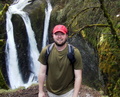
• Maria continues on to Cottonwood camp as DavidL, Rob, and myself take a short detour to Ribbon Falls. The reds of the rock and the bold mossy greens at the fall’s base really pop out at us. A large contoured formation is being created from the sediment and minerals carried over by the falling water.
• The falls are mostly still in the shade and with the mist off the falling water DavidL’s portable thermometer reads a very comfortable 65 degrees Fahrenheit in contrast to the heat gaining strength out along the main trail.
• Spot some tadpoles in a small puddle of water in the rock. Hope they fully develop before their small oasis evaporates.
• We learn a new hat trick, filling our hats with cold creek water and dumping the contents over our heads. It’s so refreshing David and I crank out the last 1.5 miles to camp in under 30 minutes even with the hot temperatures of the 10:30 AM desert sun. We utilize the hat trick several times the rest of the day as we take it easy around camp.
• At camp we hear and spot a park service helicopter bringing in some equipment to a nearby ridge. The camp entertainment factor ratchets up about an hour later when the helicopter returns to a helispot not more than 100 yards from our tent site to pick up about 5 Qwest employees, all of them set to fly with flight helmets on. They must have been working on some communication equipment
• David L’s falcon-eyes spot the North Rim Lodge high up on a ridge overlooking the Bright Angel Canyon. Its sight teases us throughout the day, especially in the evening after sunset when we can look up and can see light beaming from its big windows. In one day we’ll be up there!

6/3 Tight lower portion Bright Angel Canyon

6/3 Datura

6/3 Prickly Pear

6/3 DavidL and Clement Powell Butte

6/3 South Rim in the distance

6/3 Historic Telegraph Line

6/3 DavidL and Ribbon Falls

6/3 Mini-pool on top of fall's sedimentary base

6/3 Tadpoles in desert puddle

6/3 Great Basin Collared Lizard (a gravid female, i.e. carrying eggs)

6/3 Banana Yucca

6/3

6/3

6/3 Looking back on trail leading into Cottonwood Camp

6/3 "Cottonwood", yep, good name for camp

6/3 Park service helicopter bringing in equipment

6/3 North Rim Lodge just visible from camp

6/3 The easy way out

6/3 Load master at work (note heat off helicopter)

6/3 Spoiled backpackers

6/3 Evident wash zone

6/3 Taunting light before bedtime

6/3
June 4 – Backpack Day 3, Day 2 of 2 ascending to Grand Canyon North Rim
Cottonwood Campground to Grand Canyon North Rim Lodge continuing on North Kaibab Trail
4170 feet (1271 m) elevation gain / 8.3 miles (13.4 km)
• Rob and Maria get up an hour earlier than David and I and are on the trail at 3:30 A.M. to take advantage of cooler conditions. David and I get up at the now “normal” 3:15 AM and are trekking out around 4:30 AM.
• With at least two water stops along the way we carry less water this day.
• For the first time on our trip we see something new…high clouds in the sky. It is a sign of changes in store for the day.
• Very captivating going up to see how the color of the geologic rock layers we traverse are reflected in the coloring of the trail: for example lime green for Bright Angel Shale limestone, reds of Redwall Limestone, or whites of the uppermost Kaibab Formation
• Trail takes us off Bright Angel Canyon into Roaring Springs Canyon, named for the year-round spring which we surprisingly learn provides water for both the North Rim and South Rim visitors and employees. For the South Rim the water is piped all the way down to the Colorado River and pumped all the way back up.
• Roaring Springs Canyon is very dramatic with high walls and steep drop-offs. Several times we wonder how the trail is going to manage to get us through this terrain. It’s a far different experience from the previous two days, and “epic” in scale and views.
• High clouds and the elevation gain help to keep us cool. The trees get taller and larger as we get closer to the top.
• Mule rides are taken about halfway down this trail, and there’s plenty of evidence on the trail to remind us of that, especially by way of our noses! Holding your breath and backpacking uphill aren’t very compatible. We pass two groups of mule riders as we head up.
• Within about a mile of the top we start seeing people coming down the trail with jackets on. What a contrast to the previous couple days!
• Arriving at the trailhead it’s odd to be back in a world of cars, but that doesn’t stop us from mowing down a couple slices of pizza back at the lodge deli.
• Meet a triathlete from TN who did the South to North Rim that day in 11.5 hours. Wow!
• Clouds and wind continue to build in the afternoon as we take it easy at the lodge, resting in our cabin, or taking in a couple park ranger presentations. By 5 PM it’s nearly clouded in and raining, and soon the cold and strong winds carry in snow! The road coming in to the park has to be temporarily closed due to downed trees.
• The storm breaks just before sunset and we are given an amazing sunset, one a ranger later says is “about as good as they come around here.” The Canyon almost looks like it is on fire with clouds whisping like smoke off the minarets and cliffs of the Canyon.
• We don’t hold back for dinner at the North Rim Lodge. David and I try the American bison steak at medium rare as strongly suggested by the server and it is something to behold. Highly recommended!
• The evening is very chilly after the storm passed through. We are extremely thankful to be in a cabin for the night instead of a tent.

6/4

6/4 Roaring Springs

6/4 DavidL, Roaring Springs Canyon

6/4 Watch your step!

6/4

6/4

6/4

6/4 Primrose

6/4 Nearing Supai Tunnel

6/4

6/4 Supai Tunnel

6/4 Noticeably larger vegetation near the top including Ponderosa

6/4 Flaming sunset

6/4

6/4

6/4 Da Lodge

6/4 Da cabin
June 5 – Free day for North Rim exploration
• DavidL and I get up early for sunrise. It is partly cloudy from the system that passed through the day before, but we are still treated to a pretty sunrise. The shifting shadows that the Canyon forms continually change the views and experience.
• For the day David and I head out to hike the Widforss Trail out to Widforss Point, about 10 miles round trip with some ups and downs along the way
• It is surprising how open the forest is giving evidence of fairly recent fires, which can be seen in some stretches where many of the tree stands have been blackened.
• The storm has knocked over some trees onto the trail including “matchstick” aspen
• A brother and sister duo from Pennsylvania we meet on the trail kindly offer to give us a ride back to the lodge so we don’t have to walk the 2 miles from the trailhead. With roughly 35+ miles on our feet over the last few days we gladly accept.
• We are treated to outstanding visibility at all viewpoints with the rain and snow of the previous day. A park service display on pollution asks how many peaks in the diagram can we see…we can see every single one including Bill Williams Mountain about 70 miles away.

6/5 Beats sleeping in

6/5

6/5

6/4 Lodge chandelier

6/5 Bright Angel Canyon

6/5 Harvey Meadow

6/5 Aspen

6/5 Transept Canyon

6/5 Pedestal

6/5

6/5

6/5 Widforss Point Overlook

6/5 Mount Humphreys

6/5 Last night sunset
June 6 – Shuttle ride back to south rim
• We leave the North Rim at about 7 AM via shuttle and arrive at the South Rim around 11:15 AM. A fun ride seeing more of the terrain which surrounds Grand Canyon National Park.
I feel very fortunate to have gotten to go on this trip. It was a lot to take in. I definitely gained some memories of a lifetime!