Blue Lake and Gifford Peak - 9/26/09
Posted: October 1st, 2009, 6:58 am
Last weekend Greg and I visited Indian Heaven Wilderness, hiking to Blue Lake from the Thomas Lake trailhead. I had tried this hike three years ago and failed. I didn't know better and I went in July when the mosquitoes were dreadful. But the reason I had to turn back was because of too much snow between Rock Lake and Blue Lake. I lost the trail and although I was able to follow my footsteps back, I figured it wasn't a good idea to try and continue through the snow.
On this beautiful fall day, though, Greg and I made it to the lake. What a beautiful hike! When we started out at the trailhead a little before 10, there were more than 20 cars there already and more arriving every minute. But for all that, we didn't encounter many people on our hike in. Most of the people we saw were hiking in as we were hiking out.
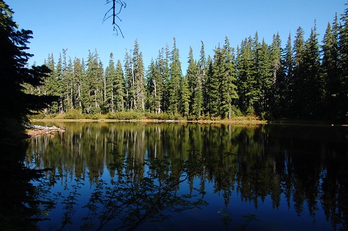
Lovely little Dee Lake in the morning light.
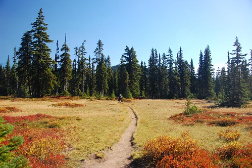
Hiking through a meadow. Last time I was here, this was all swampy.
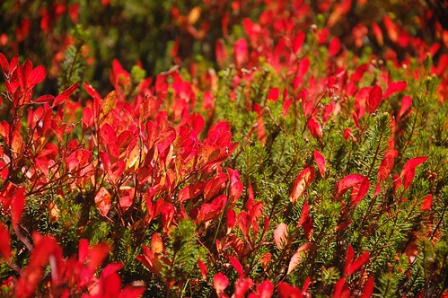
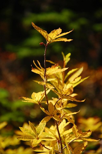
The fall colors were pretty awesome!
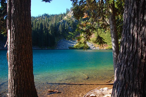
We ate lunch at Blue Lake. It was very satisfying to be here. My unfinished hike from three years ago has been hanging over my head this whole time and it was great to finally finish it! It was a little windy here, but we still enjoyed the scenery. There were some people already camped here and we later encountered quite a few more backpackers on their way in.
After Blue Lake we bushwhacked up nearby Gifford Peak. The way Sullivan describes it, you hike back past Lake Sahalie Tyee and up the hill on the trail until you reach the highest point. Then you head up the steep hill to Gifford Peak. We saw no trail whatosever on this first part and we just pushed our way through. Once we were a little higher, though, we found a faint trail and followed that up. It was difficult to follow at times, but we always managed to find it again.
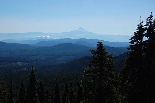
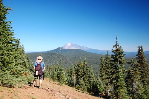
We came out of the forest at a viewpoint, and then climbed one more rocky ridge to the summit of Gifford Peak. Pretty awesome views up there! We could see Mt. Hood to the south...
...and Mt. Adams to the northwest, including East Crater and Lemei Rock.
We had a peek at Mt. St. Helens through the trees at one point, but never a full unobstructed view.
Going back down was okay, except for that really steep part near the main trail. It was difficult to not fall ass over teakettle going down that, but we made it down without incident and hiked back to the car. The trailhead lot was full and there were cars parked all up and down the road!
I know that Road 65 is closed a few miles north of here because the bridge over Rush Creek is out. Does anyone know when this happened and when (or if) it might be replaced? Looking at the map, I would think it would be easier to drive around on 30 and come down Road 65 from the north. Less time on gravel roads. But I have maps that are five years old indicating the missing bridge, so I'm guessing that if the bridge has been out that long without replacement, it's never going to be replaced.
On this beautiful fall day, though, Greg and I made it to the lake. What a beautiful hike! When we started out at the trailhead a little before 10, there were more than 20 cars there already and more arriving every minute. But for all that, we didn't encounter many people on our hike in. Most of the people we saw were hiking in as we were hiking out.
Lovely little Dee Lake in the morning light.
Hiking through a meadow. Last time I was here, this was all swampy.
The fall colors were pretty awesome!
We ate lunch at Blue Lake. It was very satisfying to be here. My unfinished hike from three years ago has been hanging over my head this whole time and it was great to finally finish it! It was a little windy here, but we still enjoyed the scenery. There were some people already camped here and we later encountered quite a few more backpackers on their way in.
After Blue Lake we bushwhacked up nearby Gifford Peak. The way Sullivan describes it, you hike back past Lake Sahalie Tyee and up the hill on the trail until you reach the highest point. Then you head up the steep hill to Gifford Peak. We saw no trail whatosever on this first part and we just pushed our way through. Once we were a little higher, though, we found a faint trail and followed that up. It was difficult to follow at times, but we always managed to find it again.
We came out of the forest at a viewpoint, and then climbed one more rocky ridge to the summit of Gifford Peak. Pretty awesome views up there! We could see Mt. Hood to the south...
...and Mt. Adams to the northwest, including East Crater and Lemei Rock.
We had a peek at Mt. St. Helens through the trees at one point, but never a full unobstructed view.
Going back down was okay, except for that really steep part near the main trail. It was difficult to not fall ass over teakettle going down that, but we made it down without incident and hiked back to the car. The trailhead lot was full and there were cars parked all up and down the road!
I know that Road 65 is closed a few miles north of here because the bridge over Rush Creek is out. Does anyone know when this happened and when (or if) it might be replaced? Looking at the map, I would think it would be easier to drive around on 30 and come down Road 65 from the north. Less time on gravel roads. But I have maps that are five years old indicating the missing bridge, so I'm guessing that if the bridge has been out that long without replacement, it's never going to be replaced.