
When: 9/8/23-9/9/23
Who: Just me (Born2BBrad)
Opening picture:

-----------------------------------------------------------------------------------
General Information
When I did the SE Wallowas/Boner Flat trip in late August, there was an ambitious itinerary that did not fully materialize. The sections not completed were: Climb Cusick Mountain, descend to Honeymoon Basin, climb up to Peak 9143, follow the ridge east from Peak 9143, find the trail down to the North Fork of the Middle Fork Imnaha River (NFMFIR) and follow that trail to where it meets the Boner Flat Trail.
This trip report will be an addendum to the trip report written for that trip. Only a few people will care about the information provided here, as it pertains to an obscure area rarely visited by human beings.
Miles: 33.3
Elevation Gain: 6870’
Google Earth overview:

Topographical overview:

----------------------------------------------------------------------------------
Research and Preparation
My own CalTopo and Google Earth research. A previous trip to Boner Flat. One mention in Fred Barstad’s Hiking Oregon’s Eagle Cap Wilderness.
----------------------------------------------------------------------------------
Trip Narrative and Pictures
This trip reports begins at where the NFMFIR Trail splits from the Boner Flat Trail at 6335’. I did see the trail on my trip to Boner Flat and made a mental note that it existed. That was the direction I had planned to come back.
NFMFIR Trail could be seen on Google Earth almost the entire way, all the way up to the ridge that leads to Peak 9143. The trail could not be seen in the few forested sections. A track was traced over the trail in Google Earth, converted to a GPX file, then copied to my GPS.
At the junction where the Boner Flat Trail splits from the NFMFIR Trail at 6335’, both paths are fairly obvious. Left goes to Boner Flat and right follows the NFMFIR.
Trail junction:

About 25 feet up the NFMFIR Trail is a sign on a tree with an arrow pointing left towards the Boner Flat Trail with the word “TRAIL”. Almost everyone who comes to the area will likely be heading to Boner Flat, so that is a way of keeping people on track.
Trail sign

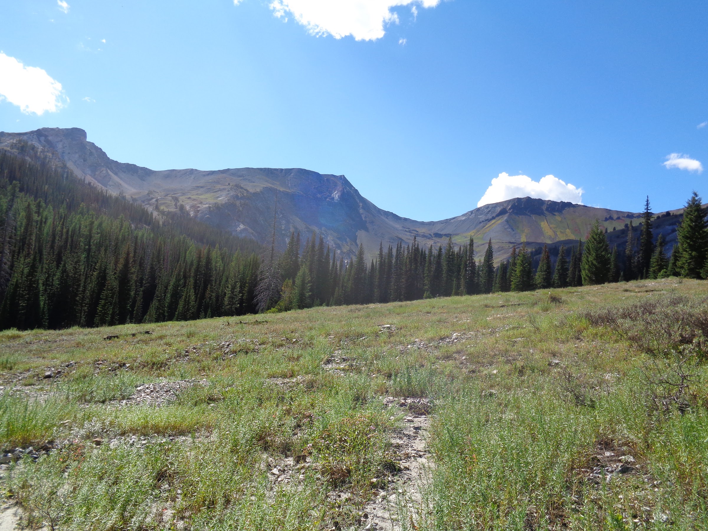
The first half mile the trail goes through a mix of forest and meadows, with the trail mostly easy to follow.
Start of the trail:

After just over half a mile is a hunters camp. Amenities included flat, open areas to place tents, campfire ring, log chairs and carcass hanging tree branches.
Hunters Camp:

At the hunters camp is where I completely lost the trail. It was the beginning of a half-mile section of thick forested cover, with no meadows. The route plotted took me across the river, as that was my guess using Google Earth. Spoiler alert: that was not the way to go. On the way back I found a better route that, while still going through the thick forested section and losing the trail, it was easier terrain.
While fighting my way through the forest on the south side of the river, I spotted a meadow on the other side. Thinking that a meadow would be easier than a forest, I crossed back to the north side of the river. Bingo! Not only was there a meadow, but in the meadow was a tiny cairn, which led me to a very faint trail.
Meadow across the river:

Tiny cairn and faint trail:

At that point the forest thinned and the terrain was mostly open meadows. The trail was mostly visible, but still disappeared many times. Having my Google Earth GPS track helped immensely.
Another tiny cairn and faint trail:

Getting higher, the views really opened up:
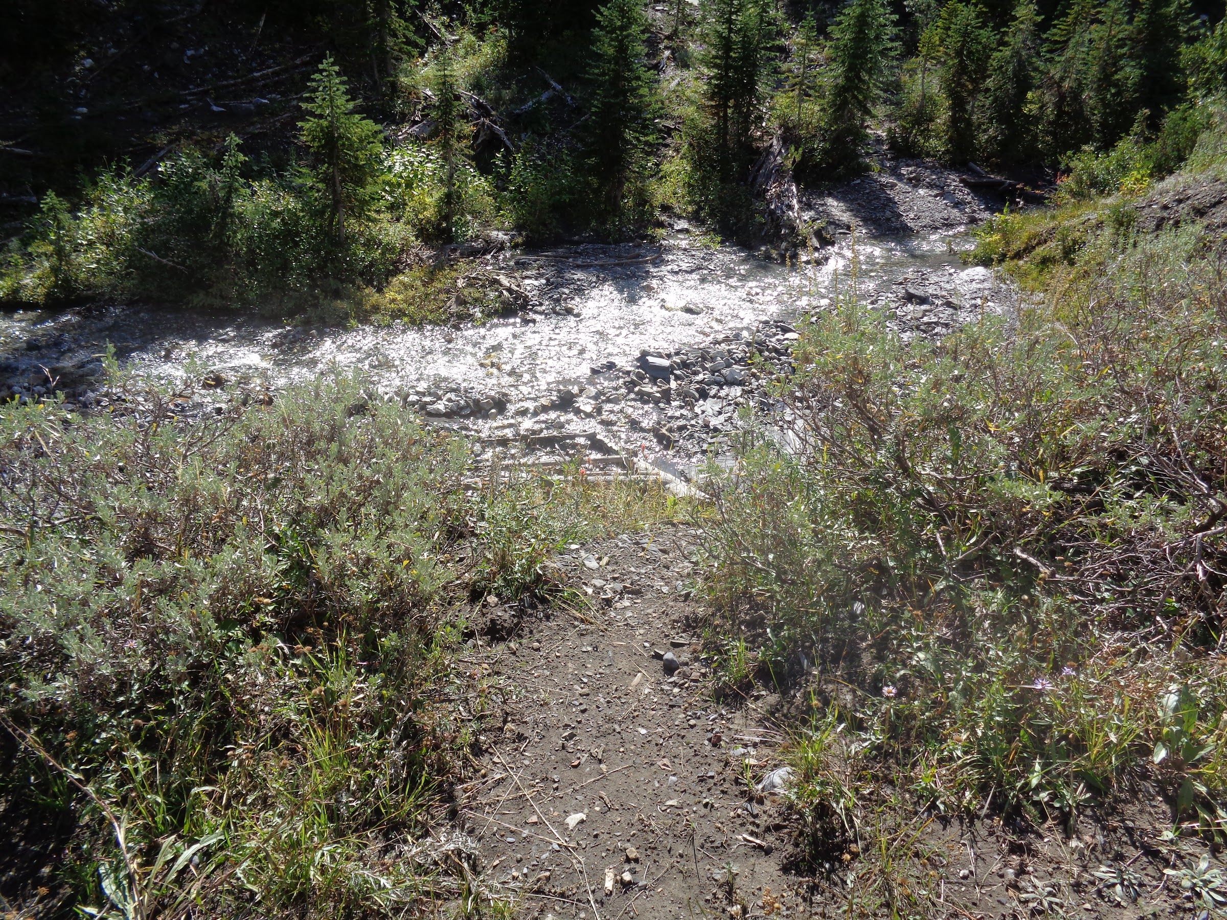
To get to the ridge that goes east from Peak 9143, the NFMFIR must be crossed. At that point it is an easy rock hop in late summer.
The river crossing:
Someone else came that way recently:

After crossing the river, the trail climbs 450’ in about a mile to the ridgeline, going through alpine/subalpine terrain. The trail is mostly easy to follow, but gets mixed up with multiple animal trails. It was nice to have a GPX track to follow, as that helped me avoid getting off track on the animal trails.
Following the trail to the ridge:

Getting higher:

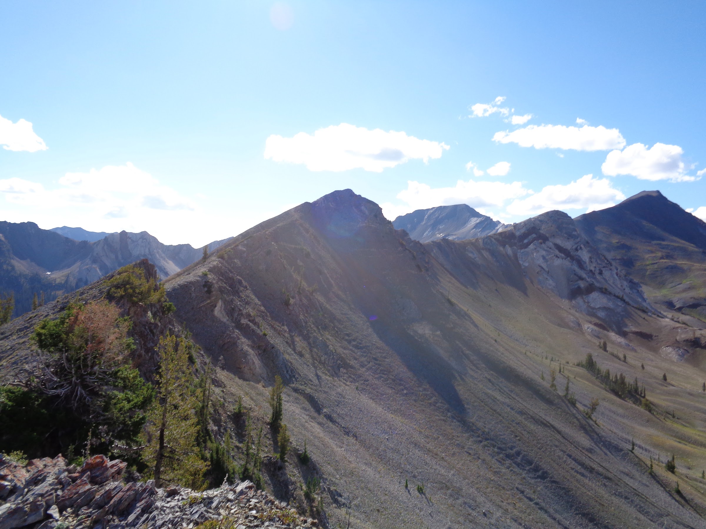
View from the ridgeline:

Hi Mom! Look at me!

There is something interesting to note about the trail at the point it reaches the ridgeline. It was noticed on Google Earth that the trail is visible for another two thirds of a mile going down towards the South Fork of the Middle Fork Imnaha drainage. After two thirds of a mile, it cannot be seen and disappears. Once at the ridgeline I confirmed it continued, but I did not continue to follow it. Maybe an exploration for another trip?
The trail continues:

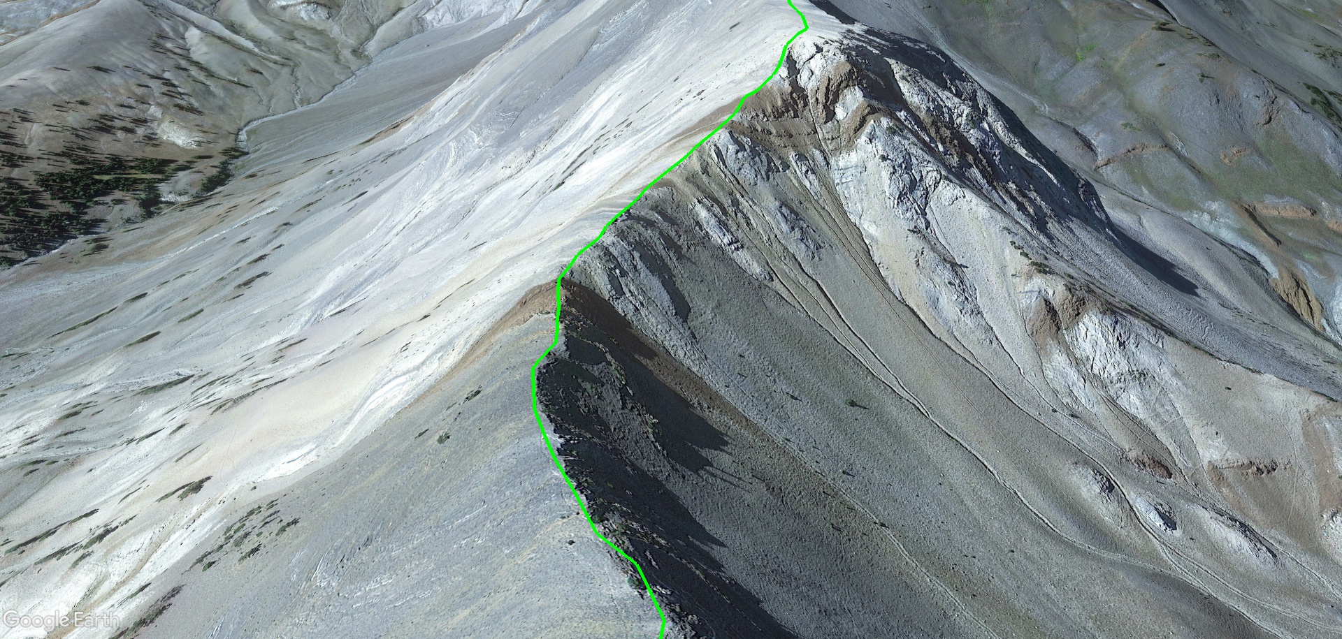
The plan for this trip was not to follow the ridge to Peak 9143. That will be for another time. However, some intel was gathered. I followed the ridge up 100’ to get a better view of some of the ridgeline for anything that might stop me. From that point it looked doable for my skill level.
Looking up the ridgeline:
The following pictures are some Google Earth images for the ridge leading to Peak 9143. Zooming in, tilting, and scrolling did not find anything that would stop me from trying to take that route in the future.


After spending some time on the ridgeline, I hiked back to the river crossing and set up camp. The next day I hiked back to the TH, then drove home.
----------------------------------------------------
Final Notes
• No cell reception the entire trip.
• No special permits. Just a NW Forest Pass and a self-issued wilderness permit.
• Route finding skills and a GPS are necessary for the NFSFIRT after the junction with the Boner Flat Trail.
• Few water sources along the NFMFIRT.
• Almost 100% sun exposure in the alpine/subalpine areas. More shade in the forested sections.
• No mosquitoes at all.
Link to pictures on Google Photos:
Link 1
Link 2
Keep on hiking,
Brad


