
When: 9/25/22
Who: Just me (at first)
Opening picture:

-----------------------------------------------------------------------------------
General Information
Route:
• Bird Lake TH (5585’) up Bird Lake Trail to Round the Mountain Trail (6185’)
• Right (east) on Round the Mountain Trail to Trail of Flowers (6090’)
• Trail of Flowers to Hellroaring Viewpoint Trail (6290’)
• Hellroaring Viewpoint Trail to Sunrise Camp Trail (6500’)
• Sunrise Camp Trail to Iceberg Lake (7625’)
• Iceberg Lake to Sunrise Camp (8300’)
Miles: GPS says 12.4 but CalTopo says 10.65
EG: GPS says 3170’ but CalTopo says 2975’
Drive time from The Dalles: 1.75 hours
Google Earth overview:

Topographical overview (purple line):

Elevation profile:

----------------------------------------------------------------------------------
Trip Narrative and Pictures
This will be a companion trip report to the one I did for the 2022 Mt. Adams 360 report.
The main purpose of this trip was to research, plan, hike, then report back about a better route from Sunrise Camp to the moraine above Iceberg Lake. I was unhappy with my route the two previous times and knew there was a better route.
Comments on the Mt. Adams 360 TR helped. The Oregon Hikers field guide page helped (thanks Bobcat). Jime’s TR about his trip to Iceberg Lake helped too.
Pay box at Mirror Lake:

There was another pay box at Bird Lake.
Multiple variations of hikes can be done in this area, some shorter, some longer. There are loop options too. The beginning of the Bird Lake Trail did not have a sign of any kind, but it was fairly easy to find.
Crooked Creek Falls:

Bird Creek Trail/RTMT Jct:

RTMT/TOF Jct:

TOF/Hellroaring Viewpoint Trail Jct:

On the way to Hellroaring Viewpoint:
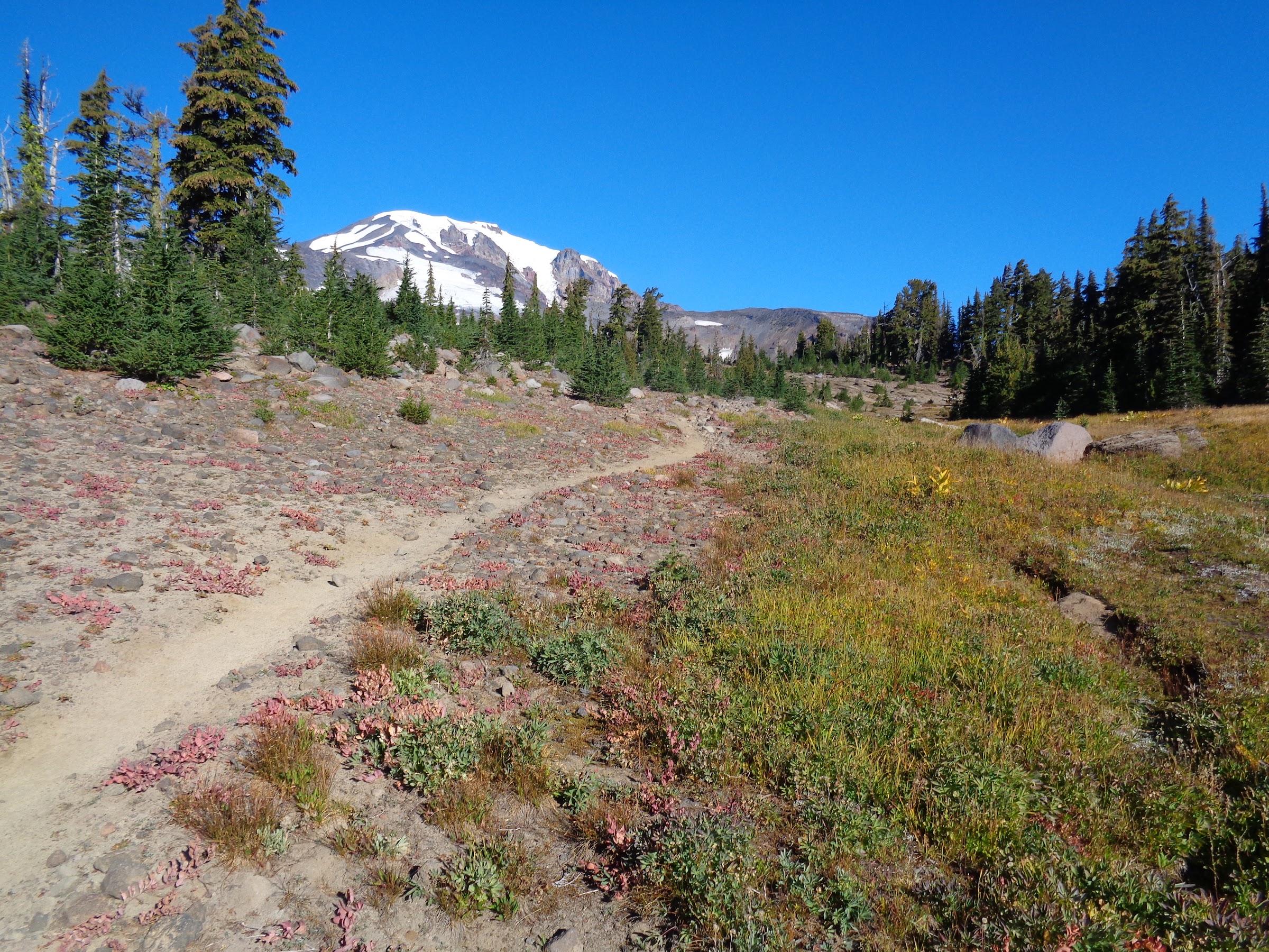
Hellroaring Viewpoint:

Lots of people congregating there on the way back.
At Hellroaring Viewpoint I was surprised by a woman who had camped up there the night before. The Yakama nation discourages people from back country camping anywhere other than Sunrise Camp and Avalanche Valley. They cannot police the entirety of Tract D, so people could get away with camping where they shouldn’t be. Just because you can get away with it doesn’t mean you should.
Nice spot to camp:

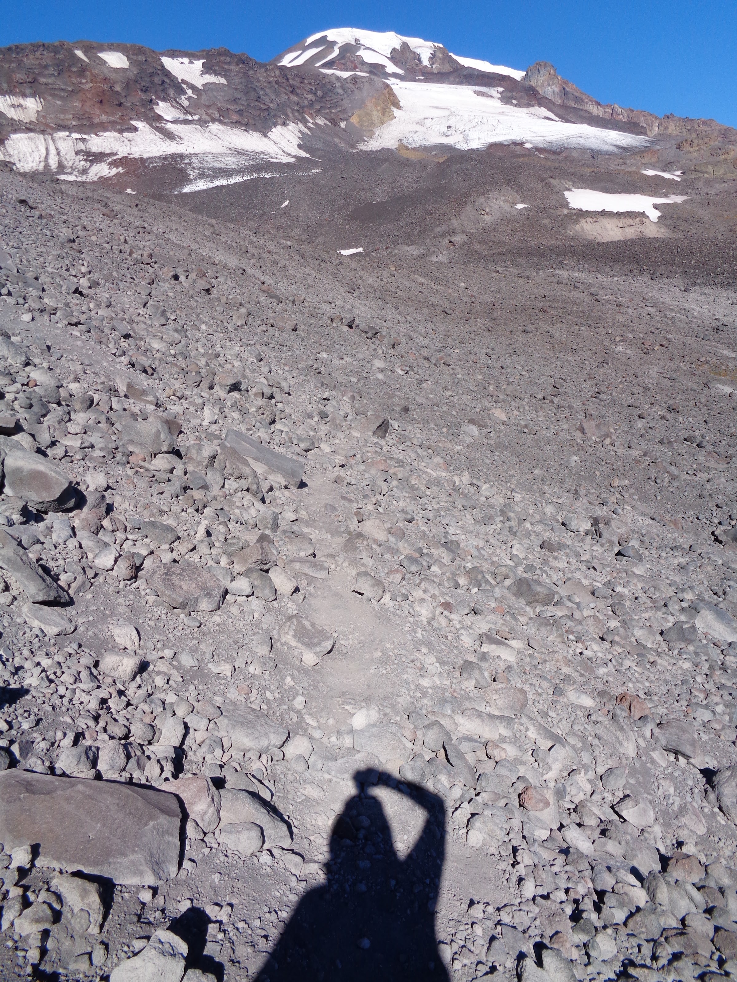
Climbing higher, getting closer to the moraine:

There is a trail going up the moraine that leads to a spot I call “The Notch”. The notch is a short, flat spot. The trail continues up the moraine spine another 100 feet or so until it reaches a boulder just below the right side of the spine with an orange X painted on it. Another 20 feet above that the trail contours right, mostly level, across the side of the moraine over to Iceberg Lake. The contoured trail is perceptible the entire way and the terrain is quite stable. I can absolutely guarantee that trail is many times better than the way I previously came up the moraine on my Mt. Adams 360 trip.
Looking back at the notch:

Boulder with an orange X:

Trail contouring to Iceberg Lake:
Iceberg Lake:

As I was contouring towards Iceberg Lake, I noticed a hiker and two dogs catching up to me. They caught up to me at Iceberg Lake. It was another guy named Brad who thought I was his friend he was planning on meeting up with. He had also planned to go to Sunrise Camp. Brad had gone this route over to Sunrise Camp and confirmed the way I had planned to go was the correct way. We continued on together.
Heading towards Sunrise Camp:

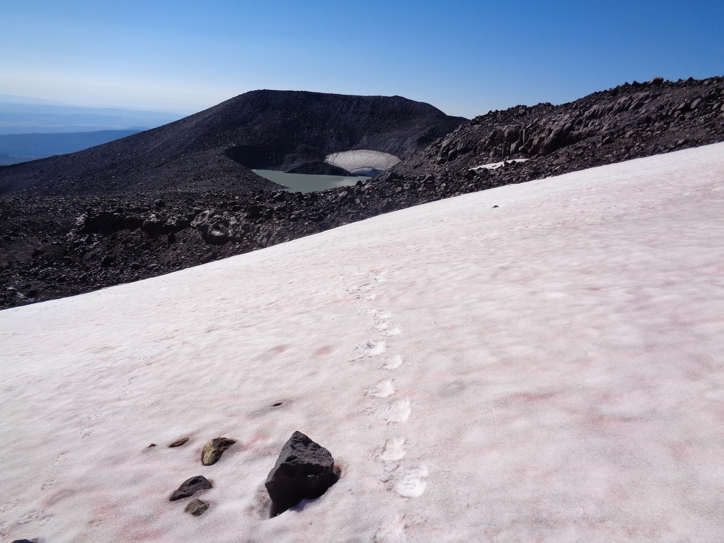
The route from Iceberg Lake to Sunrise Camp can be different depending on the time of year. With more snow it would be easier than crossing boulders. Much of the snow had melted. There was much more snow three weeks prior. The amount of snow on this trip did not warrant the use of microspikes. There is sort of a path sometimes through the boulders. Note: on the way back we took a slightly different route, which wasn’t as good. Still, it was way better than the route on my Mt. Adams 360 trip.
Crossing a snow field, looking back at Iceberg Lake:
At the first snow field Brad looked up a couple hundred feet to the left and saw his friend he had been looking for, Randy. Randy had picked a much more difficult route, so came down and joined us. As all three of us continued, we soon were at a point where we met up with my GPS tracks from the two previous times I had come down from Sunrise Camp. We all mostly followed those tracks the rest of the way.
Only a couple hundred feet to go:

Sheltered camp spots at Sunrise Camp:

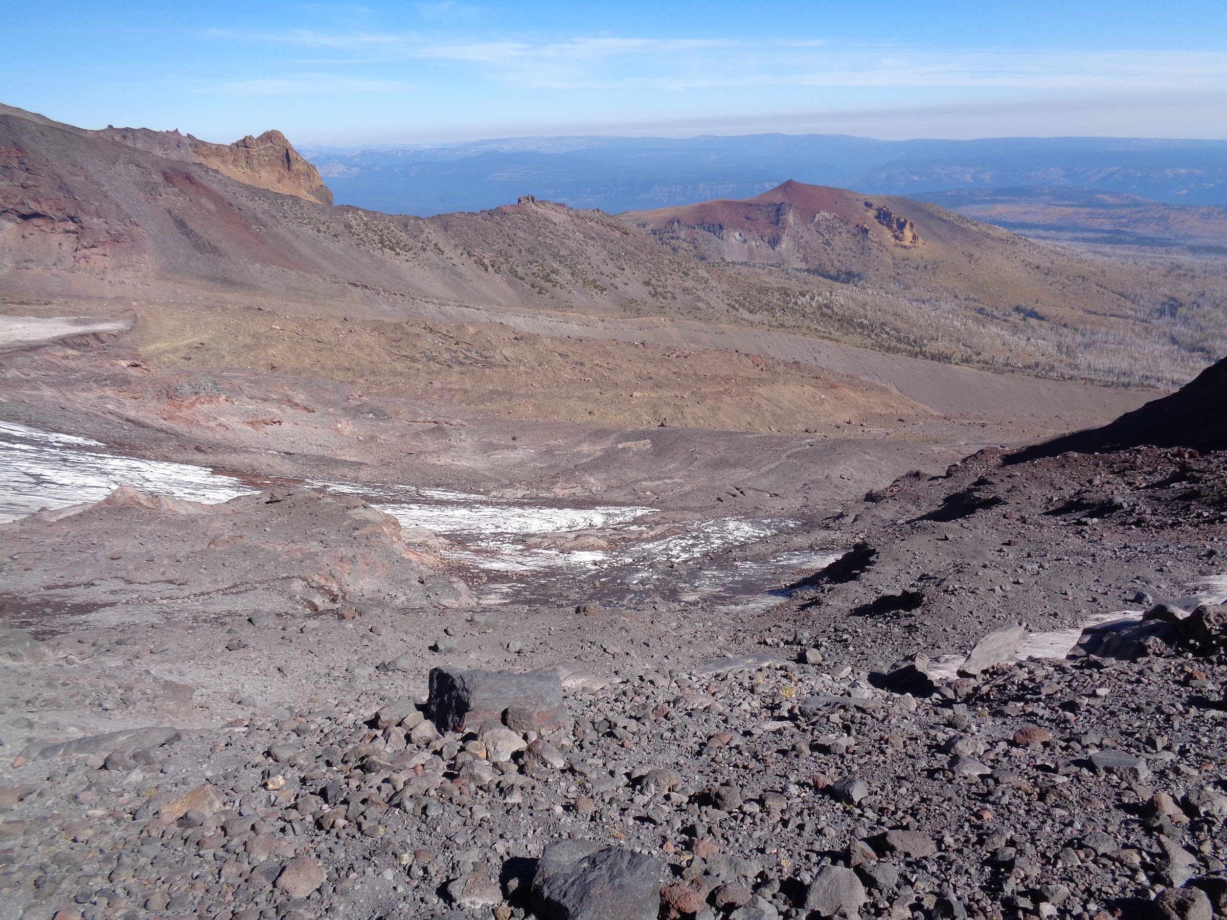
Mazama Glacier:

Looking north from Sunrise Camp high spot:
It was a bit windy at Sunrise Camp, which prompted Brad to mention it was too windy to fly his drone. That’s probably good, as I am not a fan of drones out in nature. Due to people flying drones being a relatively new trend, The Yakama Nation has not officially created rules about that. That may change.
While at Sunrise Camp, Brad’s dogs started barking. I looked up at the end of the Ridge of Wonders and saw a mountain goat. It didn’t like the dogs barking at it and ran off on terrain that only a mountain goat could. That prompted the dogs to start to run after the mountain goat. Dog are nimble, but no dog could handle that kind of terrain. I had visions of one or both dogs getting hurt. Fortunately, Brad was able to get them to come back. Disaster averted.
The Yakama Nation allows people to bring their dogs. However, if the dogs cannot be kept under control they should be leashed. Chasing after mountain goats is an example of dogs not being under control.
Mountain goat on Ridge of Wonders:

The dogs returning from their adventure:

The return trip back to Iceberg Lake and the moraine was uneventful. We mostly followed the same route.
Iceberg Lake on the way back:

Trail back to moraine and notch:

For the third time coming down the Sunrise Camp trail, I lost the trail and had to refer to my GPS. The trail braids sometimes. Sometimes it goes through tightly spaced trees. The split at the junction of the Sunrise Camp Trail and Hellroaring Viewpoint Trail can easily be missed. Pay close attention.
----------------------------------------------------
Final Notes
• Fee required for Yakama land. Refer to my Mt. Adams 360 TR for that.
• GPS and route finding skills helpful. Especially for the part from Iceberg Lake to Sunrise Camp, and for staying on the Sunrise Camp Trail/Hellroaring Viewpoint Trail. A map is helpful for the overall route and trails.
• Lots of water sources. None from Hellroaring Viewpoint/Sunrise Camp Trail until Iceberg Lake.
• Mostly full sun the entire way. Some shade where trees are still alive.
• No bugs this time of year.
• The road to Bird Lake can be done by a standard passenger car.
Link to pictures on Google Photos:
Link 1
Link 2
Hike it before it burns,
Brad


