
When: 6/1/22-6/2/22
Who: Just Me (Born2BBrad)
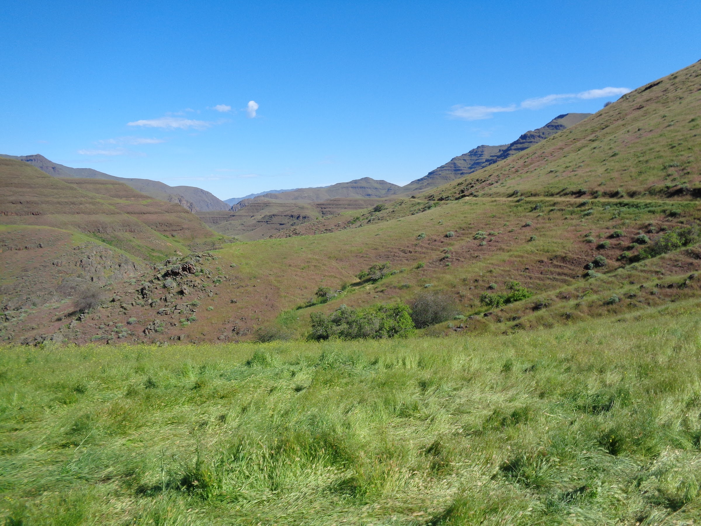
Opening picture:

-----------------------------------------------------------------------------------
General Information
Route:
• Nee-Me-Poo TH (1825’) up Nee-Me-Poo Trail to Lone Pine Saddle (2695’) down to Dug Bar (1050’)
• Western Rim National Recreation Trail (WRNRT) at Dug Bar to Deep Creek Trail (1725’)
• Deep Creek Trail to off-trail ridge (3175’)
• Off-trail ridge to Square Mt. (4798’)
• Square Mt. to WRNRT (4580’)
• WRNRT south to unnamed saddle above source of Little Deep Creek (4885’)
• Camped at saddle
• South on WRNRT from unnamed saddle to Fingerboard Saddle (4545’)
• Cow Creek Trail from Fingerboard Saddle to road at Cow Creek (2700’)
• Road along Cow Creek (Cow Creek Trail) to Dug Bar Road (1485’)
• Dug Bar Road to Nee-Me-Poo TH
Miles: 31 (many on mucky, cow trampled trails)
EG: 7500’
Drive time from The Dalles: 6 hrs 45 minutes
People encountered: 0 on the trail until McClaran Ranch
References:
Fred Barstad “Hiking Hells Canyon & Idaho's Seven Devils Mountains”. Even though this book was published in 2001, it still has relevant and detailed information.
USFS Wallowa Mountains/Hells Canyon Trail Information. Interactive and way more informative than I thought it would be.
Wallowa Mountains Hells Canyon Trails Association work party reports and trail updates here and here.
Google Earth video tour:
Link to video on YouTube
Google Earth overview:

Topographical overview:
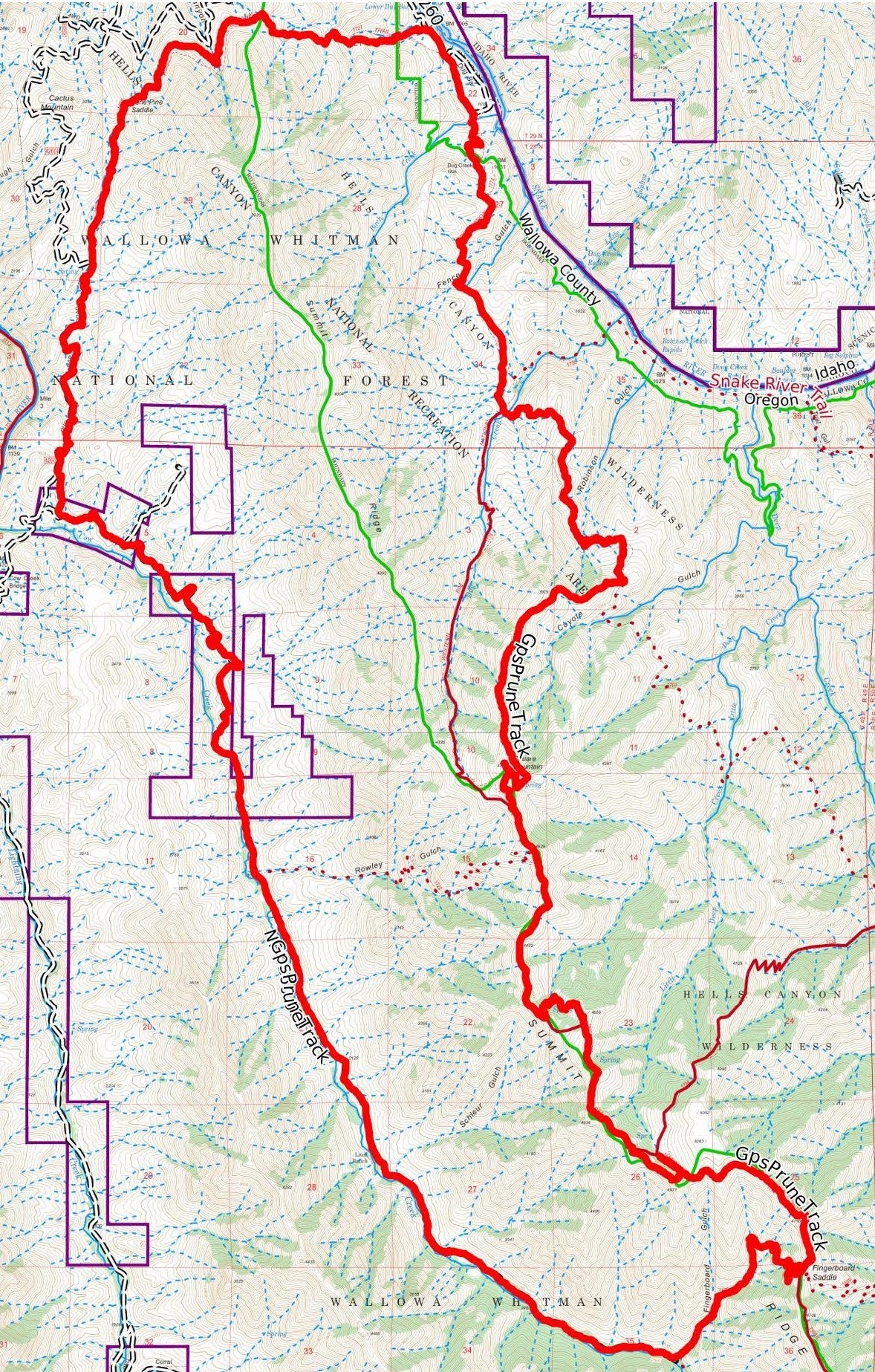
Elevation profile:

----------------------------------------------------------------------------------
Research and Preparation
The north side of Hells Canyon was my focus this time. An interesting looking route was detected, but part of it passed through some private property. Using Wallowa County property maps, the owners were identified as the McClaran Ranch. They were contacted and it was confirmed they allow backpackers to cross their land. The Forest Service confirmed this too. That was great, since that allowed for a loop.
As with most of my Hells Canyon trips, CalTopo and Google Earth were used extensively. CalTopo to identify where trails were supposed to be and Google Earth to see if I could see them. The Forest Service interactive website and Wallowa Mountains Hells Canyon Trails Association work party reports helped too.
Trails with no record of maintenance that could not be seen from Google Earth were avoided, especially one specific trail that went up a brushy ravine.
As with my last trip, the trip had been planned for several weeks, waiting for a break in the weather. There haven’t been as many stretches of good weather this spring without rain. Finally a break in the weather was forecasted for two good weather days. It was good timing, as the day before and day after my trip it rained heavily there.
----------------------------------------------------------------------------------
Trip Narrative and Pictures
So, who is getting tired of my long-winded Hells Canyon trip reports? I’m not tired of finding new places there and more plans are in the works. It’s a large, remote area that doesn’t get many detailed status reports, so somebody has to do it.
As I often do, I drove to the TH the day before and slept in Hotel Subaru. The Nee-Me-Poo TH has one single place to park a car, that fortunately was flat.
Nee-Me-Poo TH:

Due to the early morning light, and my excitement, I was on the trail at 5:30AM. The early bird gets the worm, but an early start to a hike gets the miles. That sounded better in my head.
The Nee-Me-Poo Trail follows a ravine up to Lone Pine Saddle, which does not have a single pine tree on the actual saddle. There are a couple pines near the saddle. The Nee-Me-Poo Trail is the route the Nez Perce used to flee the U.S Army in 1877. It’s a sad story described here, and here.
These posts were all along the trail:

Looking back towards the TH:
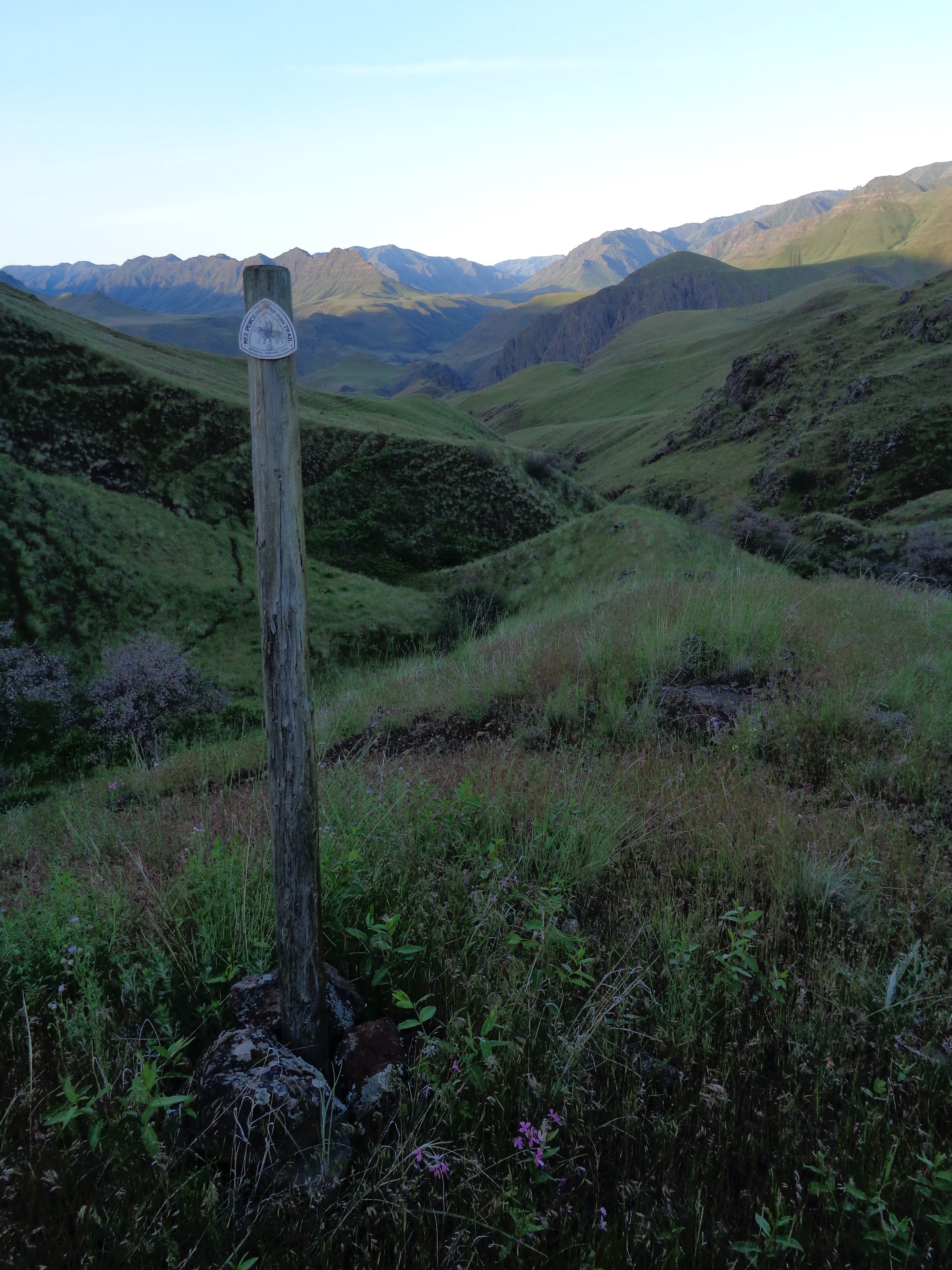
View from Lone Pine Saddle:

After reaching Lone Pine Saddle, the trail goes downhill all the way to Dug Bar next to the Snake River. A couple of mini saddles are passed along the way, in addition to several ravines.
Coming down from Lone Pine Saddle (Dug Bar Road below):

Piped spring in Big Canyon:

From mini saddle looking back at Cactus Mt.:

Snake River from mini saddle:

On Dug Bar Road almost at Dug Bar:

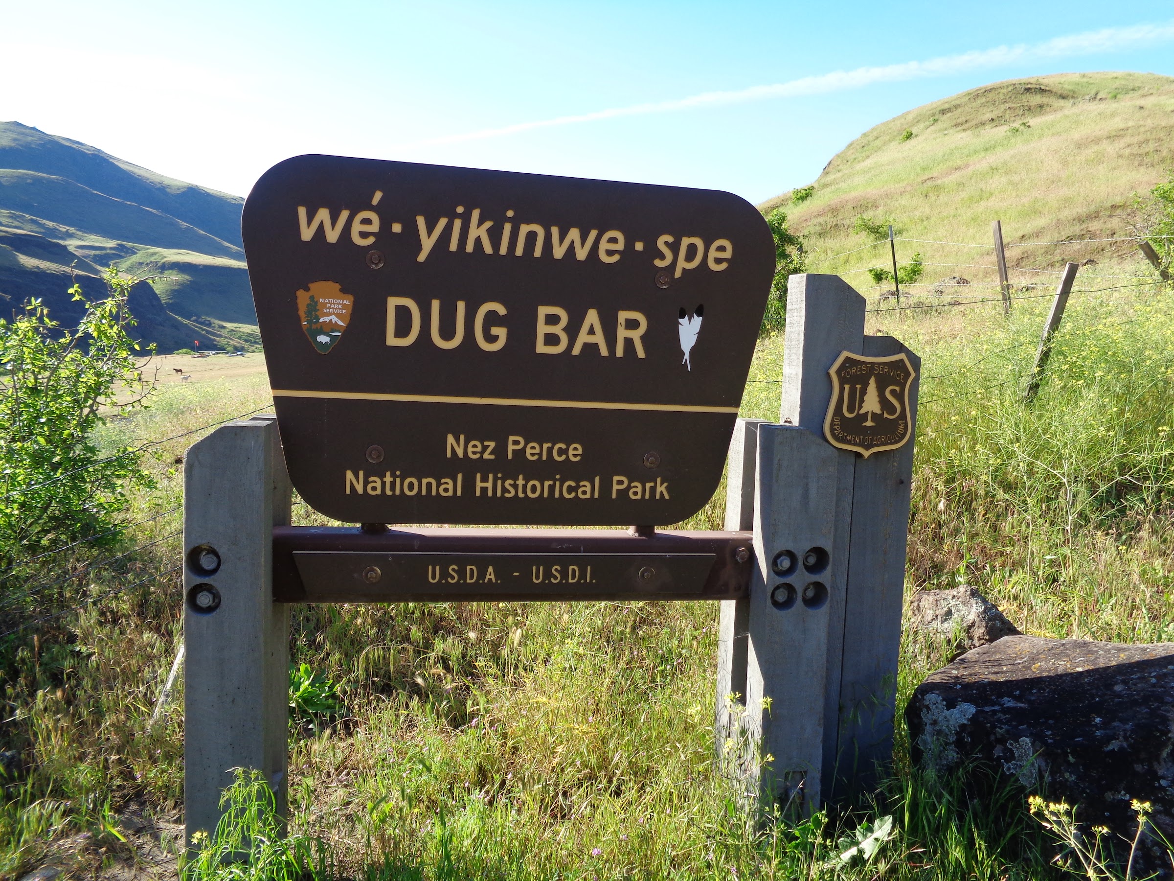
At Dug Bar:
A few planes at Dug Bar:

I was told that the cattle ranchers use spotter planes to find their cattle sometimes.
Dug Bar Ranch:

Dug Bar and Dug Bar Ranch are owned by the Forest Service, but leased to McClaran Ranch.
At Dug Bar Ranch, I had to find the start of the WRNRT. Not much information was found about exactly where the trail starts. Maps showed that it is near the ranch house. Somewhere I read you have to go through a fence or two at the ranch house. There are no signs there pointing the way, but I figured it out.
This is the fence you have to pass through:
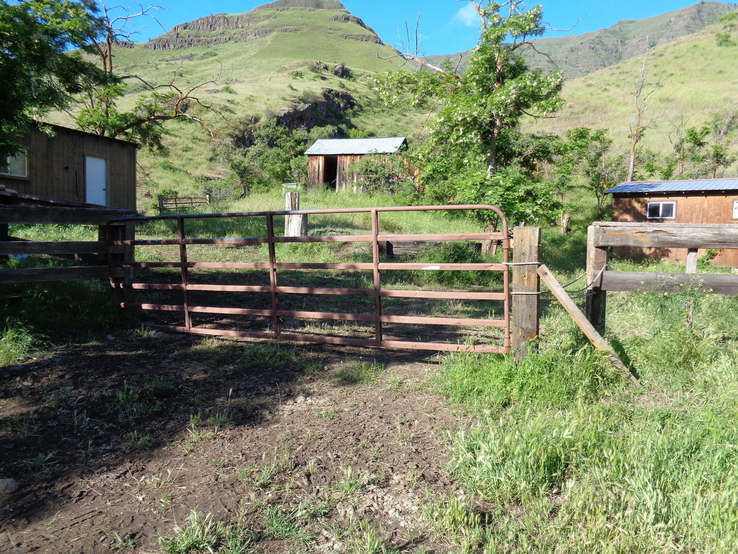
Once through the first fence, you have to pass between a couple buildings, pass through another fence, cross Birch Creek, and then pass through another fence.
The last fence to pass through at Dug Bar Ranch:

Again, no signs to lead the way.
This sign after the ranch was no help:

It was lying on the ground next to the trail, and all it said was, “Trail.” Thanks for stating the obvious.
Looking back at Dug Bar, the red plane is taking off:

The trail after Dug Bar was great at first:

I was thinking, “If the trail is this easy to follow and in good condition like this, the trip will be great.”
Then the trail got worse:

Sure, the trail was easy to follow, but it started to become a mucky, braided mess. For the time being, it wasn’t too bad.
For some reason, I thought that cattle grazing wasn’t allowed in wildernesses. Boy was I wrong. Some history and thoughts about that here, here, and here. I don’t eat beef, and grazing on public land is one of the reasons why.
WRNRT junction with the Deep Creek Trail:
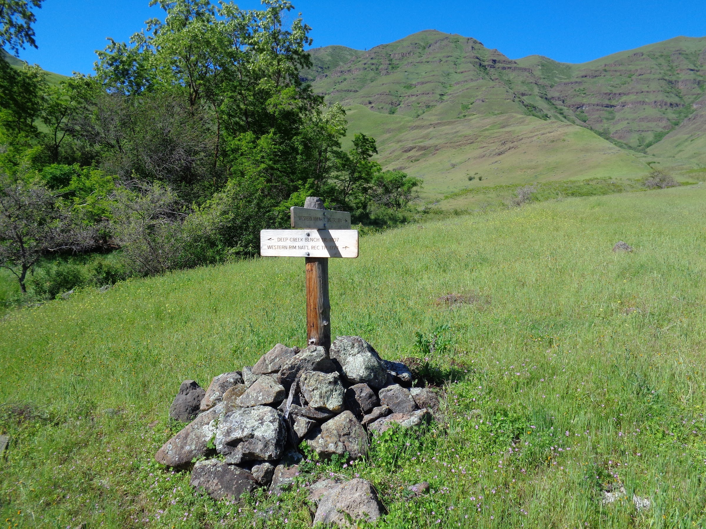
Previous research indicated that the WRNRT, after the junction with the Deep Creek Trail, had no history of maintenance. In addition, looking at Google Earth showed the trail fades away and goes into a brushy ravine. Getting to the junction confirmed this. I found no evidence of the WRNRT, even though the cairn sign pointed the way. Since the Deep Creek Trail was very discernable, mainly due to cow traffic, that’s the way I went.
Shortly after the taking the Deep Creek Trail, it crosses Dug Creek, then begins gaining elevation at a steeper rate.
No problem crossing Dug Creek:

Heading uphill on the Deep Creek Trail:
The trail seemed to be getting muckier:

Looking back:

First pine trees in a while:
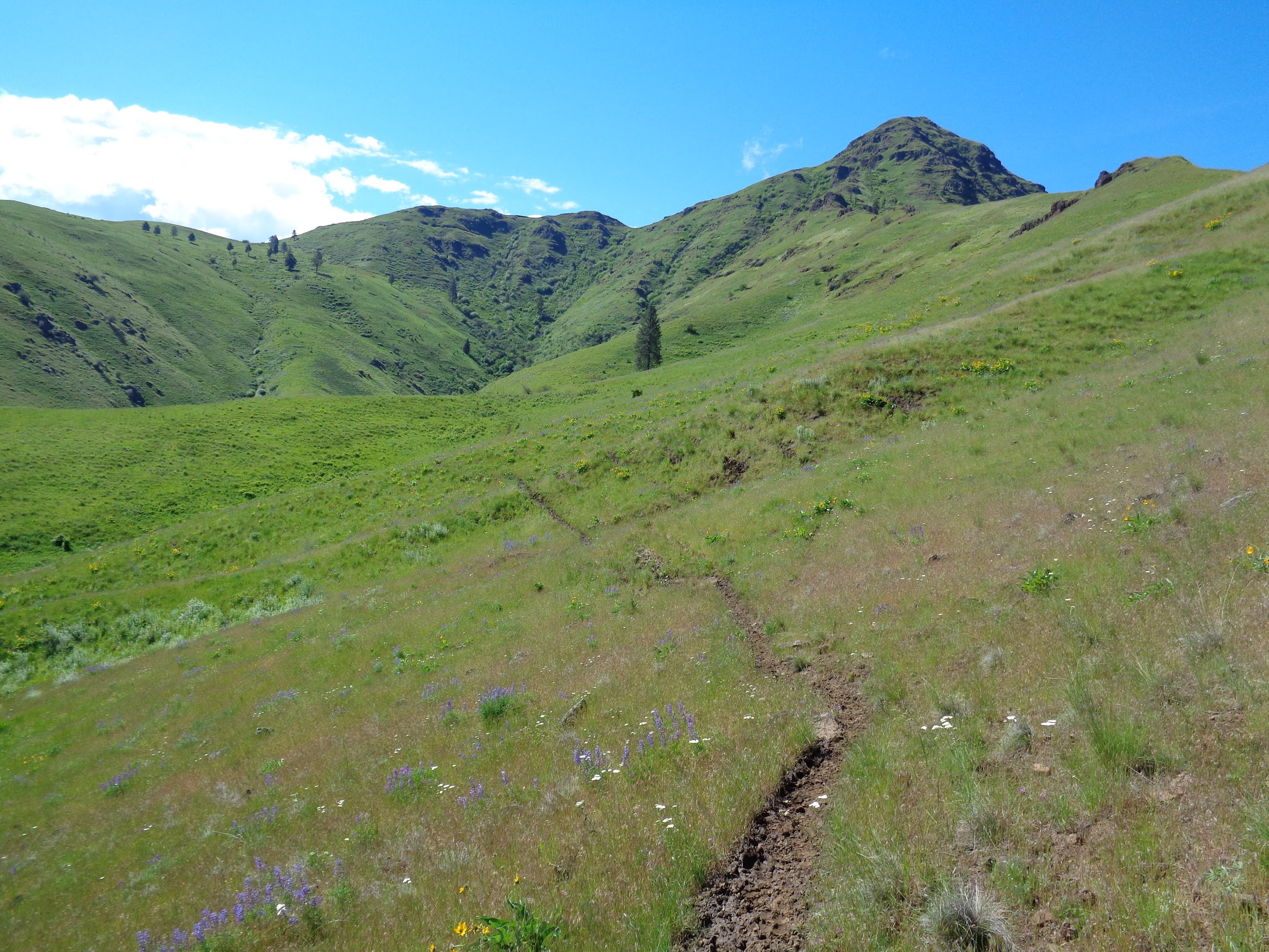
Since joining the Deep Creek Trail, it was becoming a difficult, mucky mess, and I was growing weary of it. There was a specific ridge I had planned to take off trail to Square Mt., south of Coyote Gulch, that looked fairly easy. I was so tired of the mucky mess, I decided to depart early from the trail on a different ridge that I had scouted from Google Earth.
The point where I departed from Deep Creek Trail:

Up this ridge and to the left:

I’m happy to not be on the trail:

Lots of animal trails on the way up:
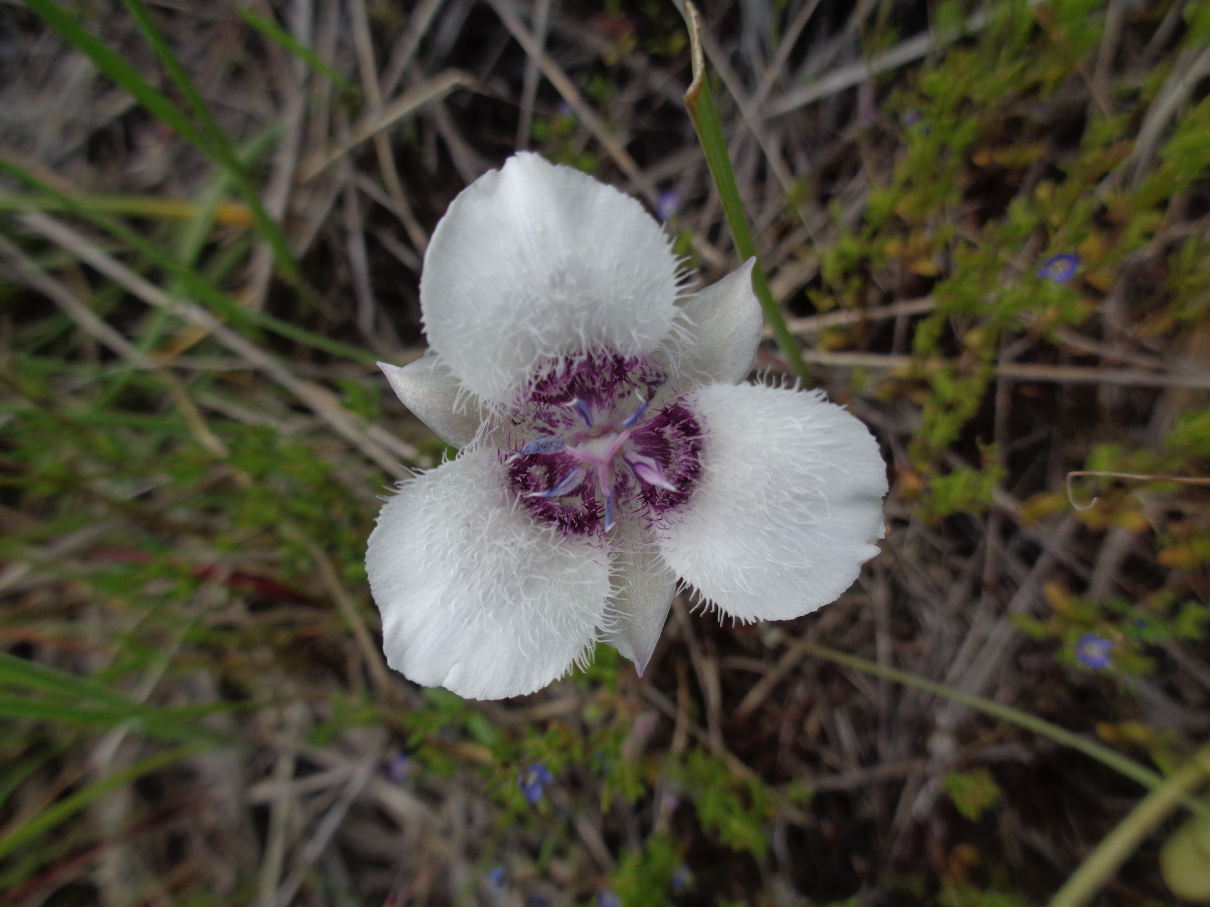
Mariposa lily:
Prairie star:

Looking back down the ridge:

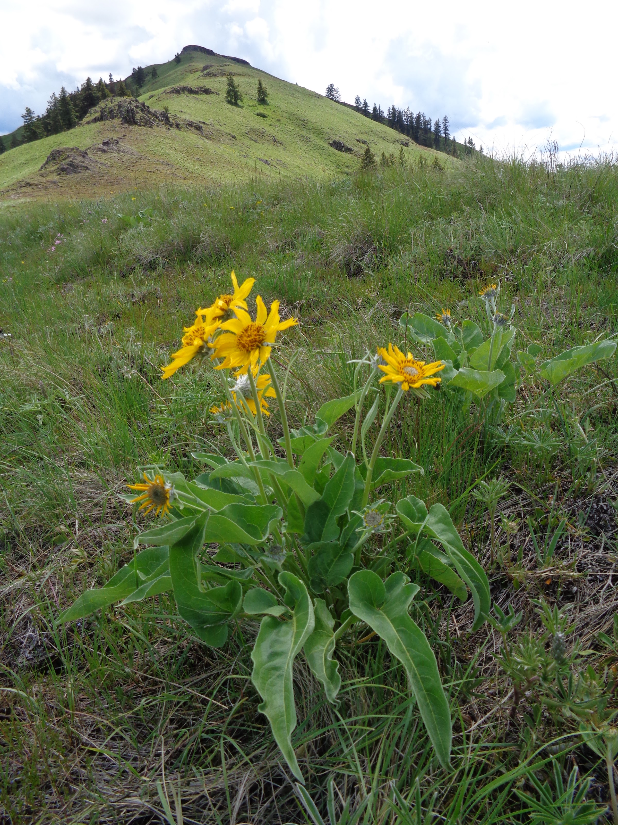
Balsamroot near the top:
As I was nearing the top of Square Mt., a more defined trail began to appear, almost as if it had a purpose. It was contouring around the mountain. Then I remembered that there was supposed to be a spring on the other side. I was getting low on water, so I followed the trail, and indeed it went to a spring.
There was a water trough, and a pipe. Unfortunately, the spring itself was not piped and no water was flowing into the trough. To make matters worse, all around the spring it was a mucky, feces strewn mess, from cows. The water was seeping out of the ground, making it difficult to collect, which I did not try. Too much feces. Another spring was not far away.
Contouring trail with a purpose:
Mucky spring:

The next objective was to finish the climb up to Square Mt. Guess what I found at the top? Cows. They just gave the the typical stupid cow stare as I walked past them. I wanted to ask, “Why the long face?”
Feces and methane dispensers:

Square Mt. 360 video:
Link to video on YouTube
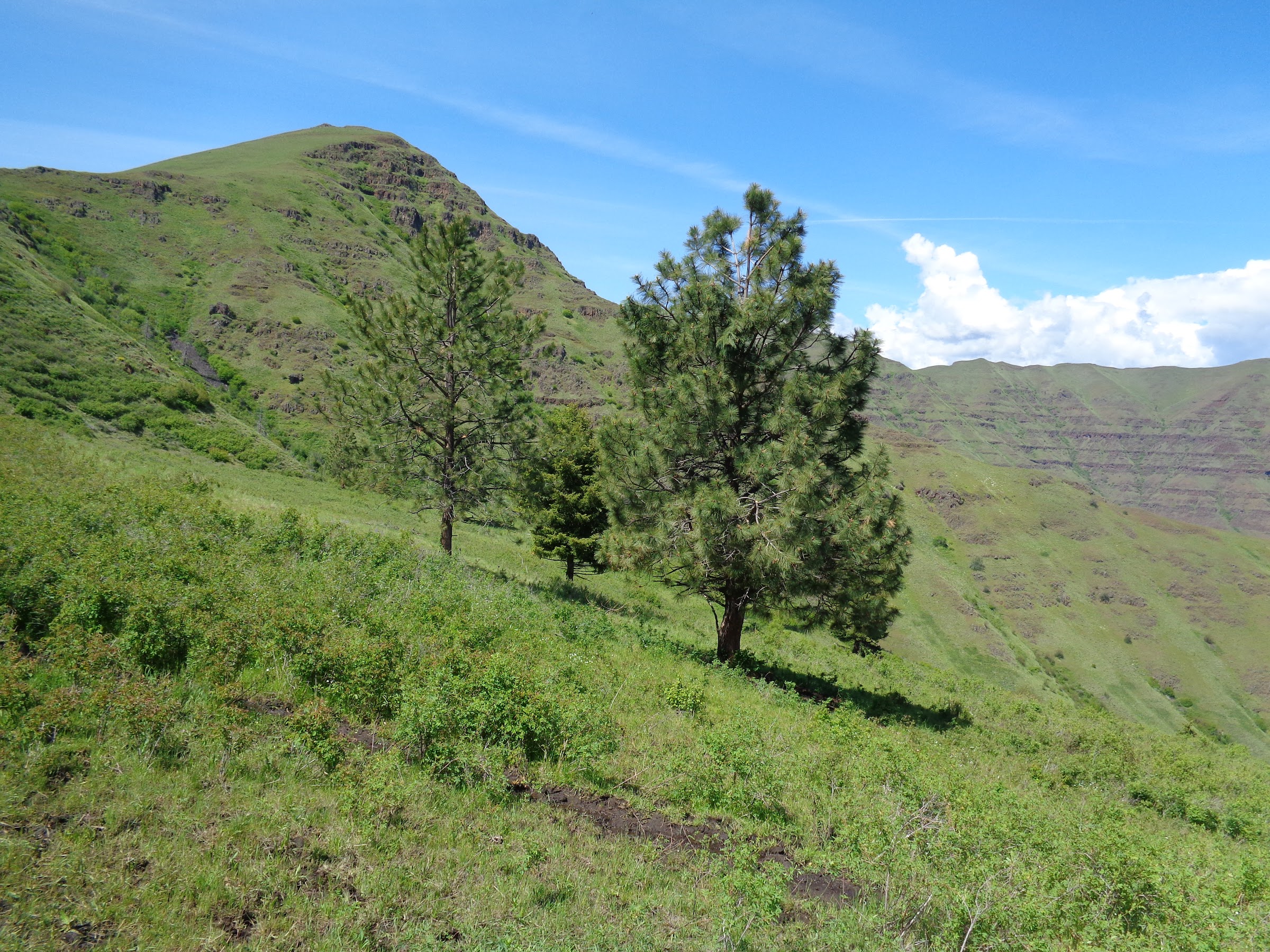
After texting a picture to my wife and calling her, I dropped down to the WRNRT, which was just below the summit. At that point the trail is once again discernable.
Going south on Summit Ridge:

The WRNRT follows Summit Ridge 50 more miles, all the way to P.O. Saddle. I wasn’t going that far, though. My next objective was to find the spring shown on the map. As I neared the spring, there were animal trails heading downhill through the brush in the direction of where the spring was supposed to be. It was quite the bushwhack, but after descending 370 feet, I found a good water source that did not have any cow pies around it. Even so, I double purified my water and let it purify much longer than I normally do.
Bad picture of a good water source:

After filling up on water, I noticed a gap crossing the stream and a trail heading back uphill through what appeared to be easier terrain. It was much easier than bushwhacking, but how was I to know that way was better?
Trail leading away from the spring:

With a full bladder of water, I had to hike steeply back up to Summit Ridge. My goal for the day was to try and make it to Lord Flat, a place I hade been to before. Lord Flat has plenty of camp spots and a couple springs. However, the difficult, mucky trail had sucked much energy from me. I decided to get to the source of Little Deep Creek and make a decision there. In Fred Barstad’s book, he said, “This valley is one of the best places to camp along the WRNRT.” So that was a possibility.
Looking over at Little Deep Creek valley:

On the way to Little Deep Creek was some of the worst trail conditions so far. Again, this was mostly due to cattle trampled tread. Some places were so bad I had to go off the trail for long stretches. By the time I got to Little Deep Creek, I was pretty tired and decided to find the fabled “best places to camp”. I looked and looked, but found no good place to camp where it was described. Cow pies were everywhere a tent could possibly be laid. The creek had feces next to and in it from where it seeps from the ground to as far as I could see. Good thing I had enough clean drinking water. This would have been one of the worst places I had ever camped, had I camped there. Instead, I went up to the mini saddle on the rim. There I found a nice spot where I could at least be five feet from the nearest cow pie.
Camp spot on the rim:

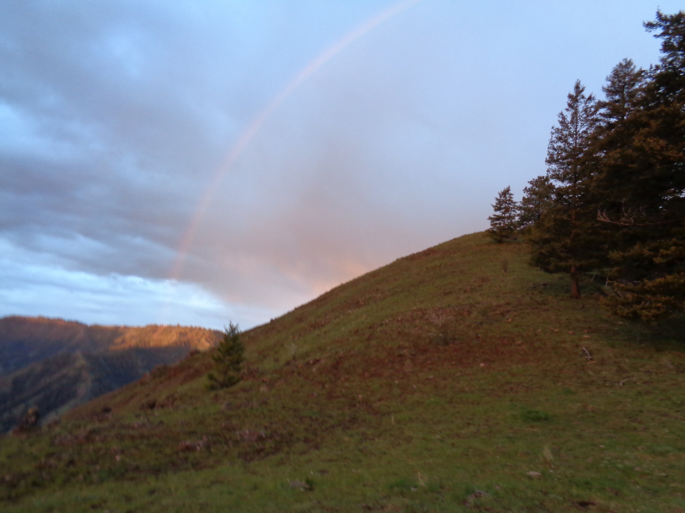
After 17 miles and 6300’ EG, I went to bed early (for me on a backpacking trip) and slept well. My plan for the next day was to wake up at first light and be on the trail very early so I could make it home that evening. I was on the trail at 5:00AM that day, with a few drippety-drops in the air. Fortunately, the weather cleared up and there was no more precipitation.
Rainbow in the morning:
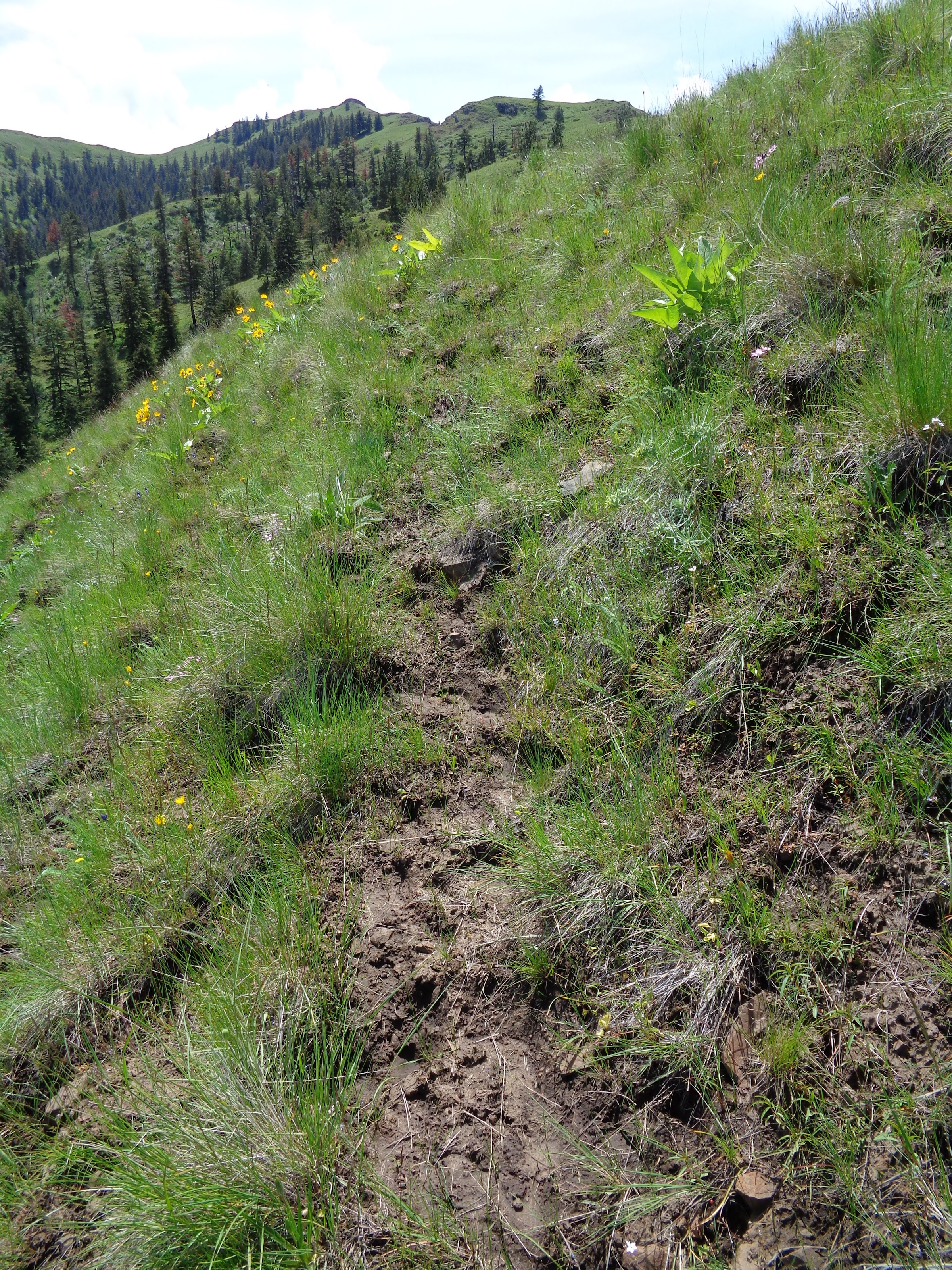
Unfortunately, the next section of the trail was the worst of the entire trip. There was almost no way of avoiding the deep muck. I had to strategically place each footstep to avoid the deepest muck. It was slow going. I would never make it home that evening at that pace.
Bad picture of a bad section of trail:

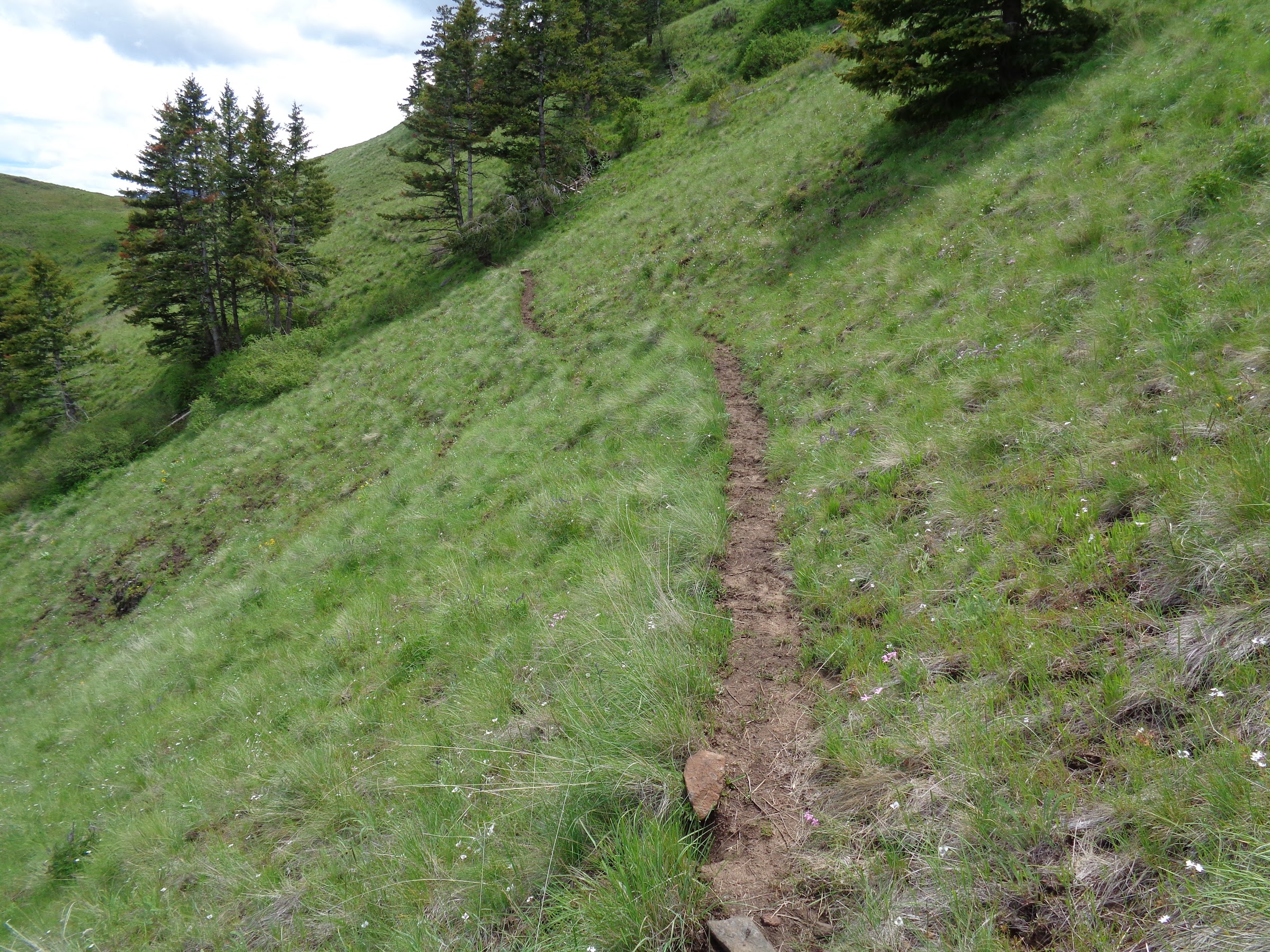
This went on for almost a mile until the trail got back on the top of the rim where the ground was more firm and rocky.
Much better trail:

I took the WRNRT to Fingerboard Saddle. The plan was to take the Cow Creek Trail down to Cow Creek. At that point there was supposed to be a road all the way to Dug Bar Road.
Cairn at Fingerboard Saddle:

There was a record of maintenance done on this section of the Cow Creek Trail in May of 2017, so I was hopeful for a good trail. The trail was in great condition, and was not trampled by cows. While the hillside itself was steep, the trail gently switchbacked down.
Cow Creek Trail switchbacking down from Fingerboard Saddle:

And then the trail got to Fingerboard Gulch. Apparently, the cows go straight up and down the gulch, avoiding the gentle switchbacks. It was back to a mucky trail again.
Trail through Fingerboard Gulch:

Once the trail reached Cow Creek, there indeed was a road. Even though cows go that way, it was never a mucky mess. The first section of the road was forested and had a soft tread. The road follows raging Cow Creek closely most of the way to Dug Bar Road.
Cow Creek Road next to Cow Creek:

The forest canopy along the road opened up to become increasingly grassy, with an occasional meadow.
Meadow along Cow Creek Road:

Cow Creek Road passes through Litch Ranch. Litch Ranch is owned by the forest service but is leased to McClaran Ranch. No one was there when I passed through.
Approaching Litch Ranch:

Ranch house and outbuildings (note satellite dish):

Cow Creek Road continues:
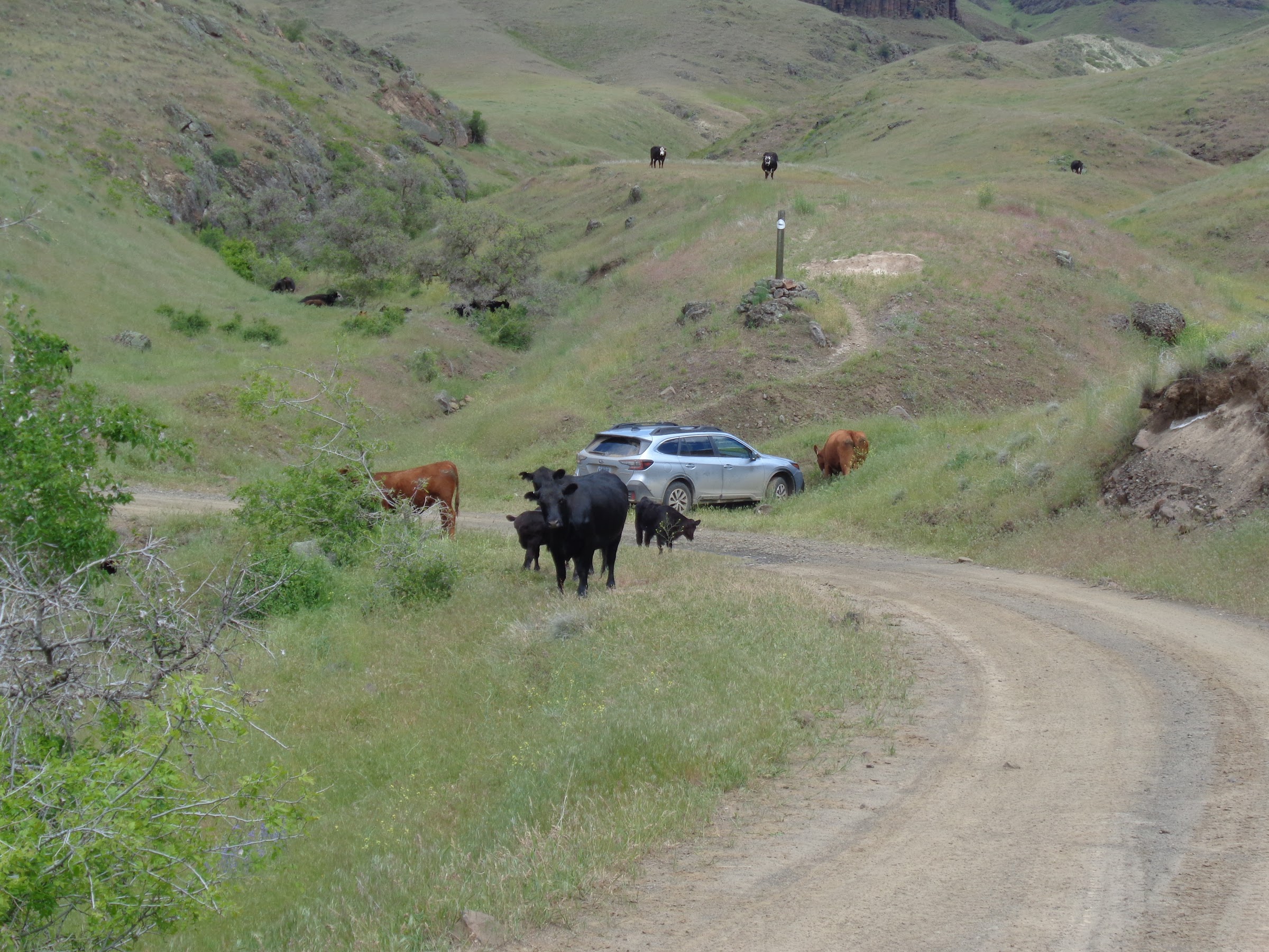
When I was a mile and a half away from Cow Creek Ranch and Dug Bar Road, I started hearing lots of cows mooing and people yelling. Rounding the next corner, I saw a cattle drive, going slowly down hill a half mile away. I was going faster than they were, and had no intention of walking through a cattle drive. So I took a long break to let them get far ahead of me.
Salt licks in a bucket:

The cows were still blocking the road at Cow Creek Ranch, so I stopped and chatted with one of the ranch hands in an OHV. She confirmed McClaran Ranch allows hikers to pass through their private property. She gave me a little information on the ranch business, trails, history of the area and much more. She said I could cut through the cows or bypass them on a hill. I bypassed them on a hill.
Cows on the road ahead:

This is what I bypassed:

Short video of a cattle drive:
Link to video on YouTube
After bypassing the cows on the hillside, I made my way to Dug Bar Road. Then it was 1.75 miles back on the road to my car.
Dug Bar Road walking:

Not sure what kind of flower this is:

Guess what was all around my car at the TH? Cows. They had rubbed their noses on some of my windows and smeared mucus on them. Good thing they weren’t there the night I slept in my car. I never would have gotten any sleep.
Cows all around my car:
Example of a rough section on Dug Bar Road:

----------------------------------------------------
Trail Condition Details
Nee-Me Poo Trail:
• USFS Wallowa Mountains/Hells Canyon Trail Information website notes maintenance done in May of 2022.
• While the trail was in good condition, there was grass growing over the trail in many places.
• Never overgrown so much the trail could not be seen.
• No brush blocked the trail. No washouts.
• Posts were placed along the trail to help identify it.
• GPS or map never needed.
• Very little poison ivy. All could be avoided
WRNRT to Deep Creek Trail:
• USFS Wallowa Mountains/Hells Canyon Trail Information website notes maintenance done in June of 2021.
• This portion of the WRNRT is used by cattle ranchers, so it is very discernable.
• Many parts of the trail in very bad condition due to cattle. A mucky, feces scattered mess.
• No brush blocked the trail. No washouts.
• GPS and map referenced a few times, but not really needed.
• Very little poison ivy. All could be avoided.
Deep Creek Trail to off-trail ridge:
• See comments for WRNRT to Deep Creek Trail, except muckier and even more cattle trampled.
Off-trail ridge to Square Mt.:
• Much better than I thought it would be.
• Better than the Deep Creek Trail.
• Animal trails most of the way.
• Minor side-hilling.
• GPS and map referenced a few times, but not really needed.
• No poison ivy at all.
WRNRT below Square Mt. to saddle above source of Little Deep Creek:
• No record of recent maintenance.
• This portion of the WRNRT is used by cattle ranchers, so it is very discernable.
• Many parts of the trail in very bad condition due to cattle. A mucky, feces scattered mess. Many places so horrendously bad I had to get off the trail to get around the mess.
• No brush blocked the trail. No washouts.
• GPS and map referenced a few times, but not really needed.
• No poison ivy at all.
WRNRT from saddle above source of Little Deep Creek to Fingerboard Saddle:
• No record of recent maintenance.
• This portion of the WRNRT is used by cattle ranchers, so it is very discernable.
• Many parts of the trail in very bad condition due to cattle. A mucky, feces scattered mess. Many places so horrendously bad I had to get off the trail to get around the mess. One section was the worst of the worst.
• No brush blocked the trail. No washouts.
• GPS and map referenced a few times, but not really needed.
• No poison ivy at all.
Cow Creek Trail from Fingerboard Saddle to Cow Creek.
• USFS Wallowa Mountains/Hells Canyon Trail Information website notes maintenance done in May of 2017.
• The start of the trail was fantastic. The best of the trip.
• Then I got to the creek in the ravine. That’s where the cows go up and down. Same horrible mucky, feces scattered mess as up on the WRNRT.
• GPS and map referenced a few times, but not really needed.
• No poison ivy at all.
Cow Creek Trail to Cow Creek Ranch:
• It’s a road that is used by cattle ranchers.
• Great condition, even though cattle pass through.
• Forested and soft at first, then grassy with views most of the rest of the way.
• Follows raging Cow Creek closely most of the way.
• Fair amount of poison ivy on the side of the road, but easily avoidable.
Dug Bar Road from Cow Creek Ranch to Nee-Me-Poo TH
• It’s a road cars drive on, although very few cars.
----------------------------------------------------
Final Notes
• Cell reception on Square Mountain. Enough to speak, text and send a picture. Some reception at various spots along the WRNRT.
• No permits of any kind are required for parking, hiking or backpacking.
• Route finding skills helpful if attempting this route. A map and GPS are helpful to stay on trails.
• Many water sources, but not many very good du to cow pies everywhere. I double purified the water I got.
• If the weather is sunny, this trip would be almost 100% sun exposure. Except in the short, forested section along Cow Creek.
• Poison ivy was always avoidable.
• Ticks are a concern too, but I soaked my clothes in permethrin and did not see a single one.
• Be aware of rattlesnakes. This trip was warm enough for them to be out, so I wore snake gaiters when I was below 2500’, except along Cow Creek because the road was wide.
• Slept in hotel Subaru again.
• Dug Bar Road from where it becomes gravel to Nee-Me-Poo TH was manageable in a Subaru Outback, but sometimes I had to crawl along carefully. A passenger car could not make it. Many spots with death cliffs. When I was out there, I spoke with two people who said the road past Nee-Me-Poo to Dug Bar is worse. They said a person in a Subaru could make it, but they probably wouldn’t want to do it.
• Fresh cow pies are very slippery.
• Due to the mucky trail conditions of the trail much of the way, I wouldn’t want to take this route again.
Link to pictures on Google Photos:
Link 1
Link 2
Go to Hell, Hells Canyon that is!
Brad


