
When: 2/9/22
Who: Just Me (Born2BBrad)
Opening picture:

-----------------------------------------------------------------------------------
General Information
Route:
• Doug’s Beach at Hwy 14
• Bench above highway to left side of ridge end
• Up ridge through Devils Hole (whatever that is) to private property line
• Up and down, skirting below DBSP northern boundary line
• Squeezed the corner from DBSP into DNR land
• Down to trail that comes up from Lyle Cherry Orchard
• Cross under power lines to forested trail to Centerville Hwy
• Cross Centerville Hwy, hop fence into more DNR land
• XC up a meadow to oak forested trail (old road)
• Old road through oak forest across gently rolling ridge
• Hop fence to get to open meadow
• Up and down some ravines to Centerville Hwy
• Bushwhack up to power line road then Lyle Ridge
• Lyle Ridge to Lyle Loop Trail
• Lyle Loop Trail to Cherry Orchard Trail to official TH
Miles: 10.5, some of them XC and difficult
EG: 3350
People encountered: 1 near TH
References: Bobcat’s TRs
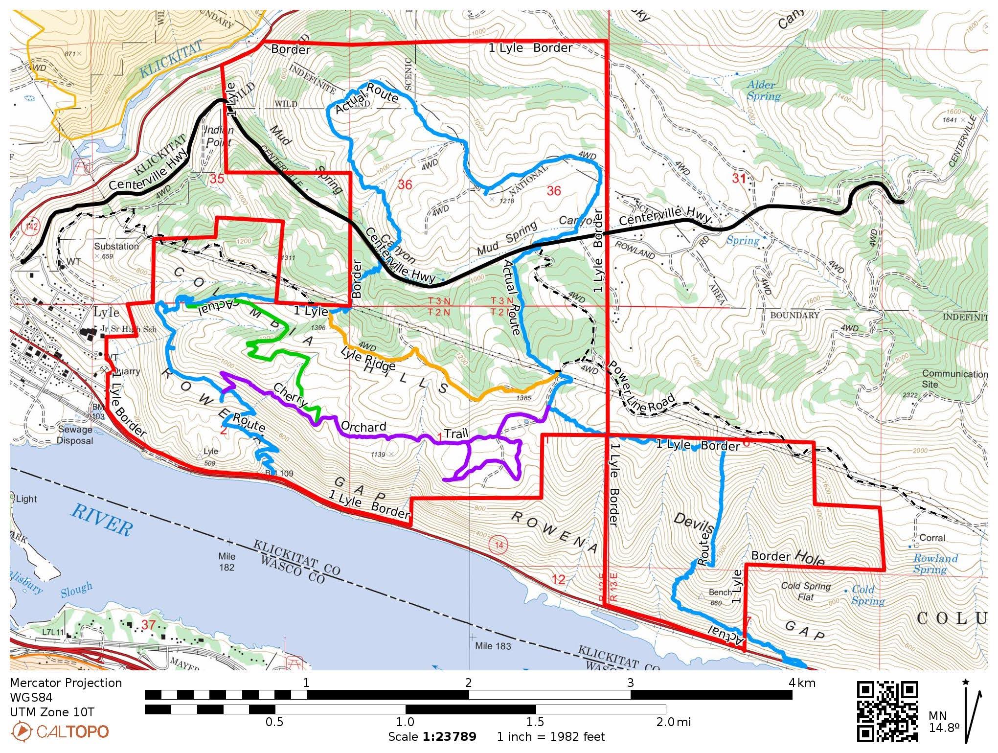
Google Earth overview:

Red: Border of public access lands
Blue: My route
Purple: Section of Cherry Orchard Trail
Green: Section of Lyle Loop Trail
Orange: Section of Lyle Ridge Trail
Topographical overview:
Elevation profile:

Google Earth video tour:
Link to video on YouTube
----------------------------------------------------------------------------------
Trip Narrative and Pictures
Not many people have ever heard of Washington’s Doug’s Beach State Park (DBSP). Those who have mostly know it for the access to the Columbia River, used by kite boarders and wind surfers. Fun fact: according to Wikipedia, Washington State Parks acquired the land through a land swap with the Department of Natural Resources. It bears the name of windsurfer Doug Campbell, who helped popularize the sport at this spot.
In addition to the strip of DBSP land accessing the Columbia River, there are hundreds of acres north of Hwy 14 going up into the Columbia Hills. While doing research using various sources, it was discovered there was a way to connect the NW corner of DBSP to DNR land. The DNR land has hundreds of connecting acres. In addition, that DNR land is adjacent to the Friends of the Gorge Lyle Cherry Orchard land. Hmmm.
Using the Klickitat County GIS property map website, lands open to the public were mapped. Once again, Google Earth and CalTopo were used to map out existing trails and best XC routes to come up with a proposed route to explore as much of lands open to the public as possible.
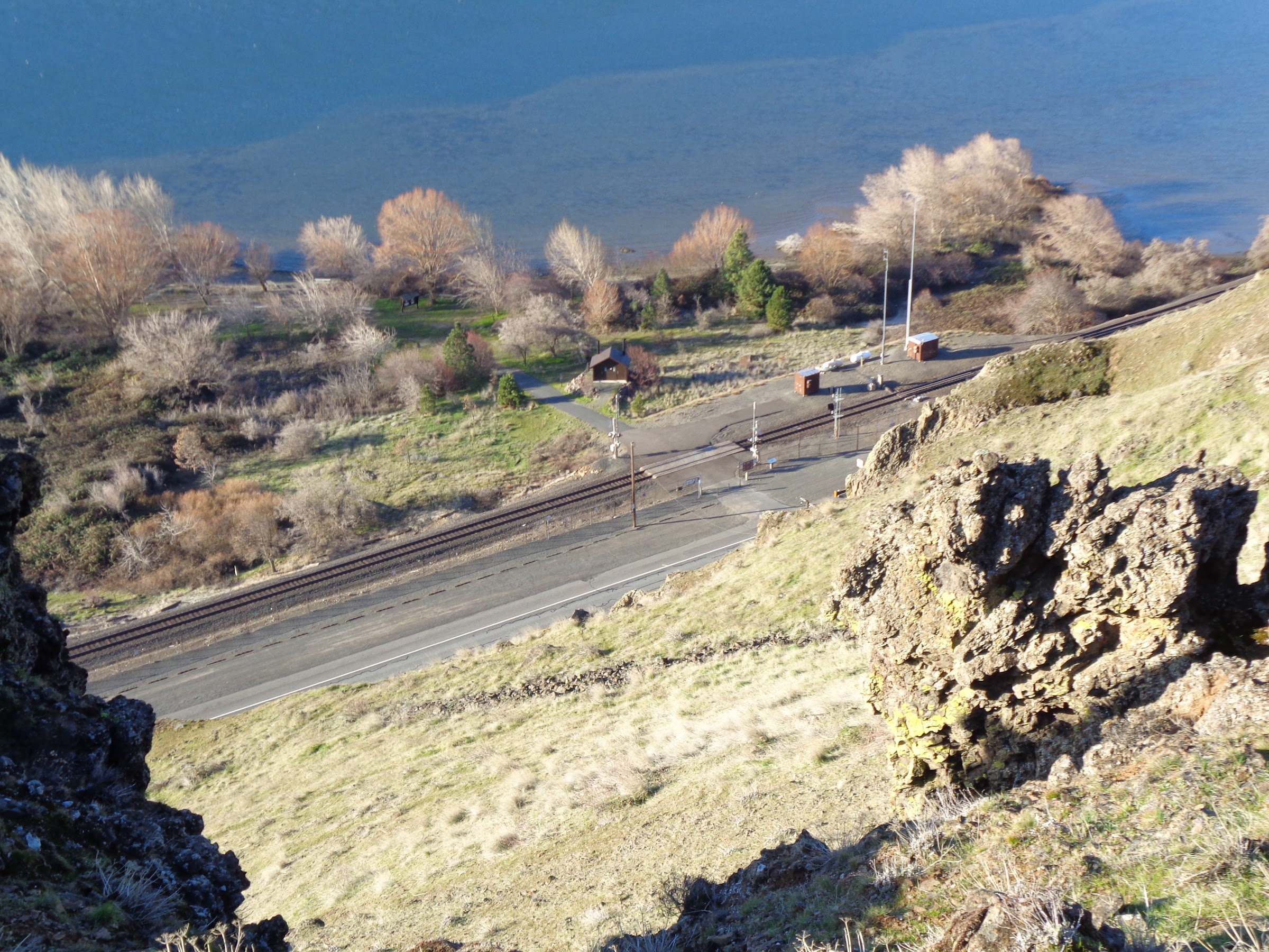
A shuttle was arranged, with my wife following me to the Lyle Cherry Orchard TH, where I dropped off my car. She then dropped me off a few miles east down the road, just after the DBSP parking area.
Technically, the very beginning of the hike started on a corner of BNSF land on the north side of Hwy 14. Since that doesn’t cross the RR tracks, BNSF probably wouldn’t object.
A short road walk is required:

Just above the highway is a bench with animal trails. The bench goes up and down a bit, going over rocks and through poison oak, with there always being animal trails.
On the bench:

Dozens of grass widows were seen:

A couple Columbia desert parsley too:

Patches of poison oak too:

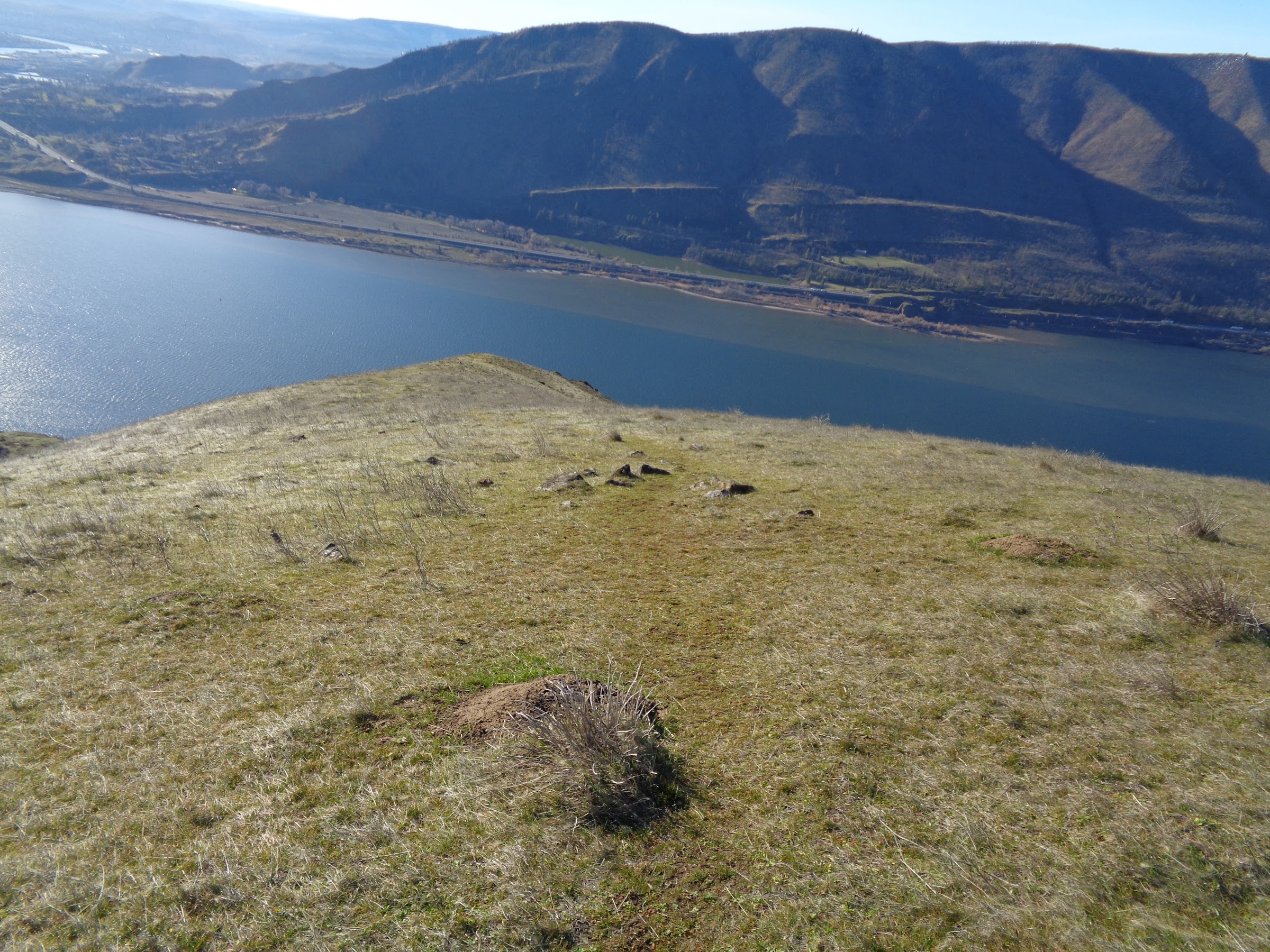
My planned route would go up the central ridge of DBSP. But to get on the ridgeline would not be easy. There were lots of impassible cliffs and steep, loose rock. However, a steep grassy slope was spotted from Google Earth. It was very steep, but not dangerously scrambly.
Start the steep ascent above the DBSP access to the Columbia River:
Up this draw and then to the right:

Looking back (notice the river channel):

Finally on the ridgeline:
There was an animal trail almost all the way up:

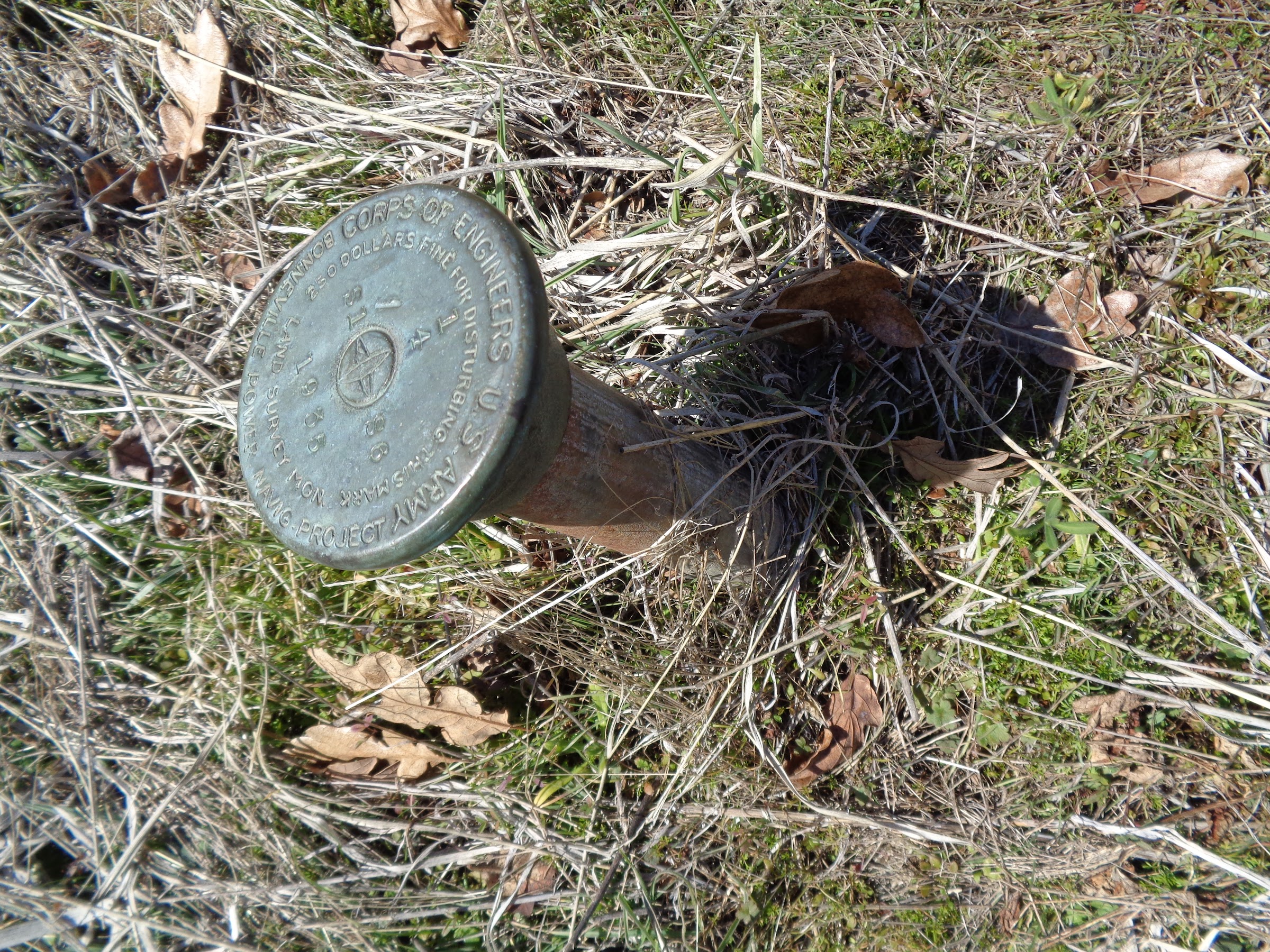
Evidence of past grazing was found:

While hiking through DBSP, there was a minor concern of being accosted by Joe Schreiner with a gun. There was an incident in December of 2011 that was in the back of my mind:
I think the Schreiner’s think of the upper reaches of DBSP as their land, since it’s surrounded on three sides by their land. There are no fences blocking their cattle so they get hundreds of acres of free grazing. Fortunately, I did not encounter anyone up there, but I made sure to stay within DBSP.adamschneider wrote: ↑March 25th, 2019, 8:38 pmHere's some more details about that "extremely unfriendly" landowner I mentioned. When I posted on the Oregon Wildflowers Facebook page about having gone to DBSP this weekend, someone reported this personal experience from December 2011:
So... yikes. That said, I don't know if this belligerence has been an ongoing thing, either before or after the 2011 incident, or if this one terrifying story accounts for the bulk of the hiking community's nervousness about Doug's Beach State Park. I'd like to think that the Schreiners have been at least somewhat chastened by Joe's conviction, but who knows.I was carrying a GPS so we were certain we were on Doug's Beach SP land. We were sitting, eating lunch, when the adjacent private landowner pointed a rifle at us and verbally threatened to shoot us if we didn't leave immediately...
It took us 3 years, but Klickitat County finally prosecuted Joe Schreiner for assault. It wasn't an employee, it was the landowner himself. He took an Alford Plea and was sentenced to time in jail and no gun ownership for 10 years. He hired a big-time defense attorney and claimed that he thought we were butchering a cow that we had rustled.
The really baffling thing is that Schreiner Farms still hasn't put up "No Trespassing" signs. In response to this issue, someone else added:You'd think a proper set of signs (on their own land) would be a whole lot cheaper than a defense lawyer! On the other hand, if this guy was accusing lunching hikers of butchering purloined cows ("Hey! Where'd you get that beef jerky?!"), he may not have the firmest grasp on common sense.He did have signs up along SR14...Posted on RR lands and State Park lands, which to my knowledge have now been removed.
There was a boot print on the ridge (Chip?):

Near the private property line, the route requires a steep descent down and then up the far end of a ravine. This was to avoid private property. While steep, the footing was good and it was mostly grassy. Many animal trails were crossed.
Down to the left:
Cross the ravine:

Follow some animal trails for a bit:

Over to the corner that meets DNR:

Technically, this is the corner:
At the corner where DBSP meets DNR, it was easy to crawl through the fence. Off with the pack, under one wire and above another. At that location, climbing over the fence would have been much harder.
A slight climb to a high point was necessary to reach a descent point to get to the trail that comes up from Lyle Cherry Orchard.
Nice view of Mt. Adams from the high point:

Site of the former cherry orchard:

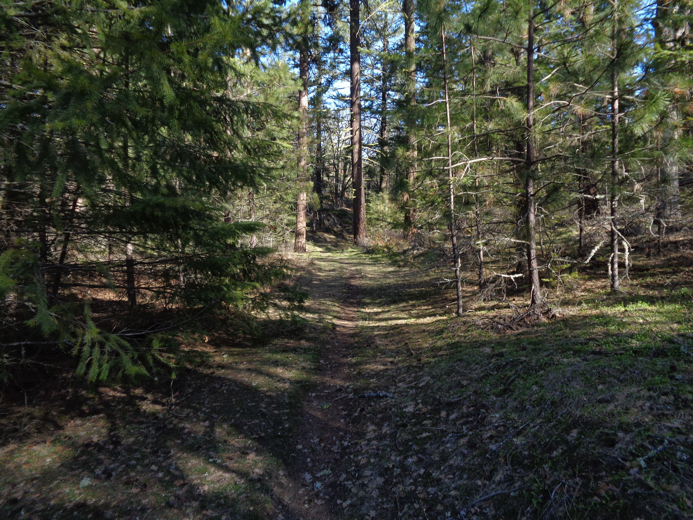
The trail that comes up from Lyle Cherry Orchard passes through a mini forest of ponderosa pine and Douglas fir trees. I always found it interesting these exist here, where few evergreen trees grow. It must be because there is more shade there from the hillsides.
Trail through a mini forest:
The trail meets up with a gravel power line road. At that point there is an option of following a road up Lyle Ridge, the westerly point of the Columbia Hills. While that route is highly recommended, it was not on my plan that day. On previous trips, and on CalTopo, a trail was noticed going down towards Centerville Hwy. That trail was followed. It was a very nice trail, going thought a Douglas fir forest, all the way to Centerville Hwy.
Trail going down:

It was a very nice trail:

Someone does maintenance there:

The trail meets up with the gated power line road where it starts at Centerville Hwy. Centerville Hwy was crossed at this point. The section of DNR land on the north side of Centerville Hwy did not have any noticeable access point, like a TH or place to park, so a fence was hopped. It was mostly oak woodland and meadows.
This fence was hopped:

Go up through a meadow:

From Google Earth and on CalTopo Forest Service base layer, a road was spotted going through much of that section of DNR land. That was found right where it was supposed to be. It was an old road that gets very little use. That road section turned out to be quite a lovely stroll. A gently rolling ridge through oak an ponderosa trees.
Start of the old road:

Mineral salt lick:

A nice woodsy stroll:

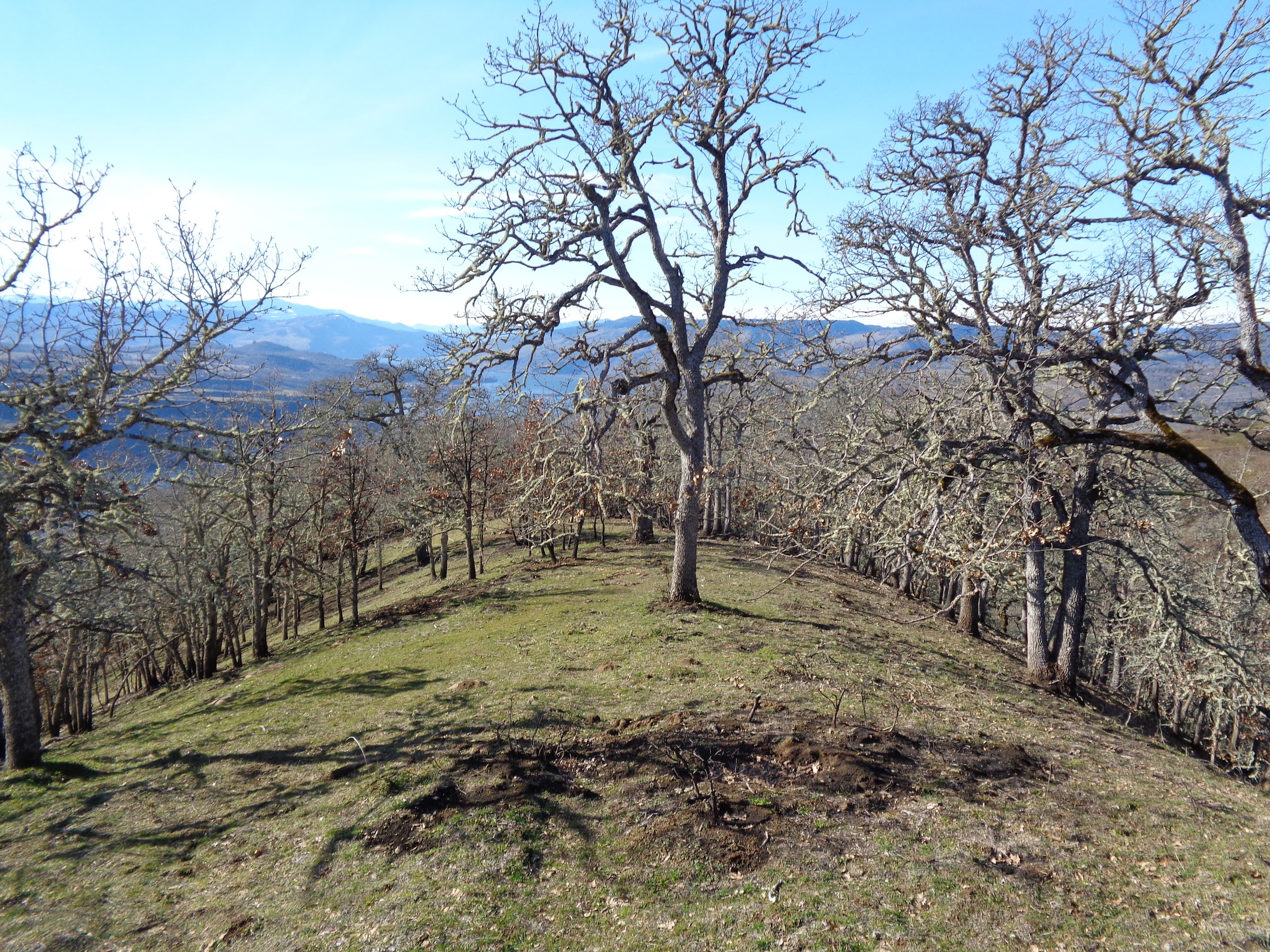
The old road splits and continues on. However, there was this fairly large meadow spotted from Google Earth that looked interesting. So I deviated from the road, hopping another fence, towards the meadow. The view from the meadow was worth going there:
Found an old hunter’s tree stand along the way:

View from the meadow:

The next part of the route required crossing Centerville Hwy again. But before that some more side-hilling up and down a couple ravines and ridges was necessary, as well as hopping a couple more fences.
Side-hilling down this:

Do you think this fence has been here a while?

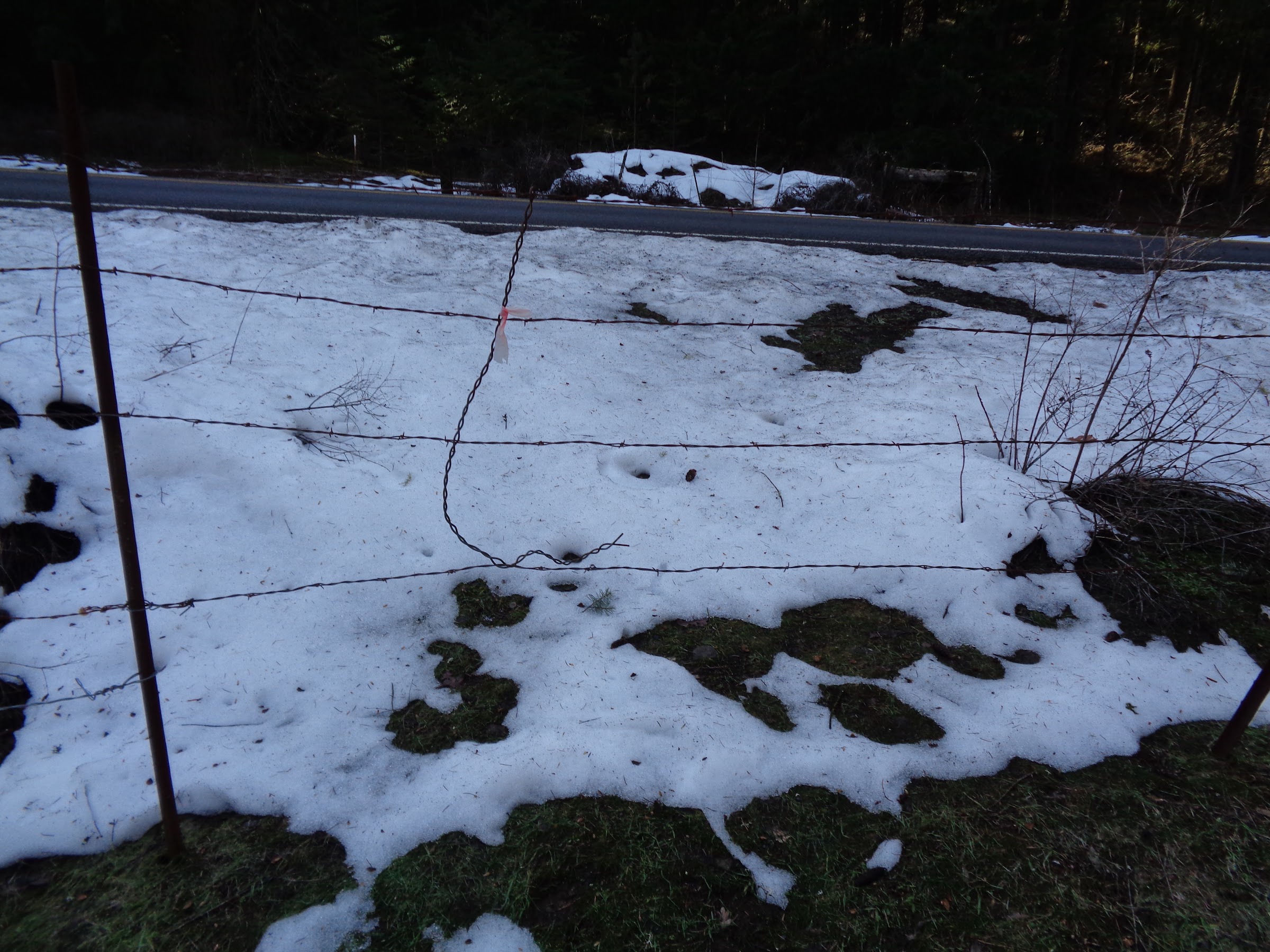
At least this fence at the highway could be crawled under:
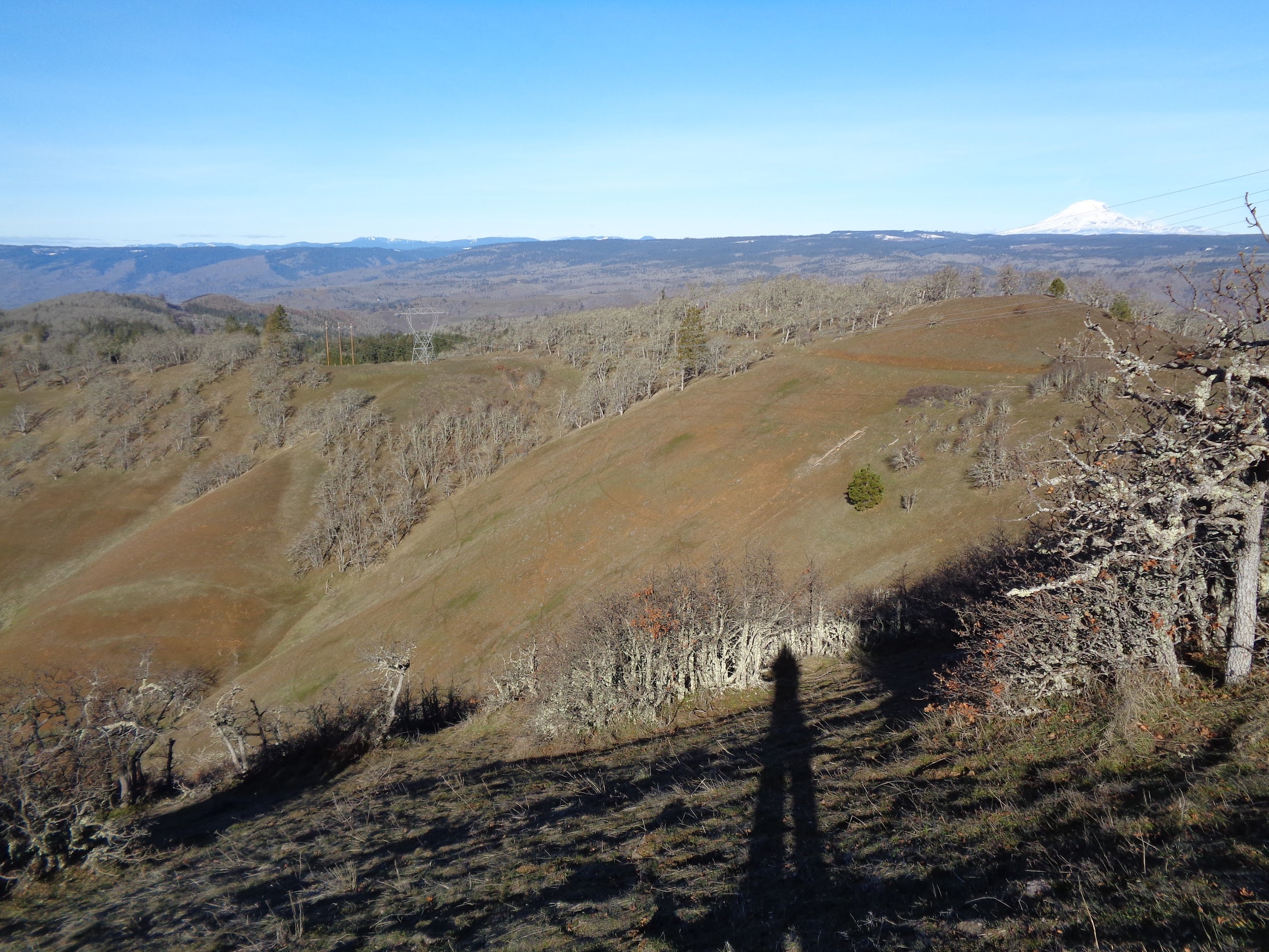
After crossing back over Centerville Hwy, the route called for some forested bushwhacking, sometimes steeply, up to a powerline road, then to Lyle Ridge. It wasn’t too bad, but some sections were overgrown with brush. Also, it was thick with poison oak.
Bushwhacking terrain:

Finally on Lyle Ridge:

As said before, Lyle Ridge is highly recommended. It’s mostly on DNR and Friends of the Gorge land, but it is not an official trail, although it should be. At a certain point, the road on the ridge goes downhill off the ridge onto private property. At that point, just follow the ridge all the way until it meets the official Lyle Loop Trail. The ridge has an animal trail the entire way.
Just follow the ridge:
The ridge comes to a clearing:

Video of view from clearing:
Link to video on YouTube
Then meets up with the Lyle Loop Trail:

On July 12th 2021 there was a fire that burned 90 acres of Friends’ Lyle Cherry Orchard acres. It was a fast moving fire with low to moderate damage. Most of the oak trees survived. The Lyle Loop Trail acted as a fire break in places. In the picture above, pay close attention to the difference in growth on either side of the trail. The ground has recovered nicely, but you can tell the left side was burnt.
Image from Friends of the Gorge website:

The Lyle Loop trail is a well-engineered trail:

When driving east on I-84, you may have looked across the Columbia River, up on the hill above the town of Lyle and seen a white “LYLE” sign. The Lyle loop trail goes 100 feet below that sign. Of course, I had to go check it out. The letters are large, maybe 10-12 feet tall, made of painted sheet metal and plywood. I though about rearranging them to say “YELL”, but though better of it.
Lyle sign from the trail:

At the sign, hiking pole for perspective:

Nearing the upper bench:

360 video from upper bench viewpoint:
Link to video on YouTube
Great trail work through the rocks:

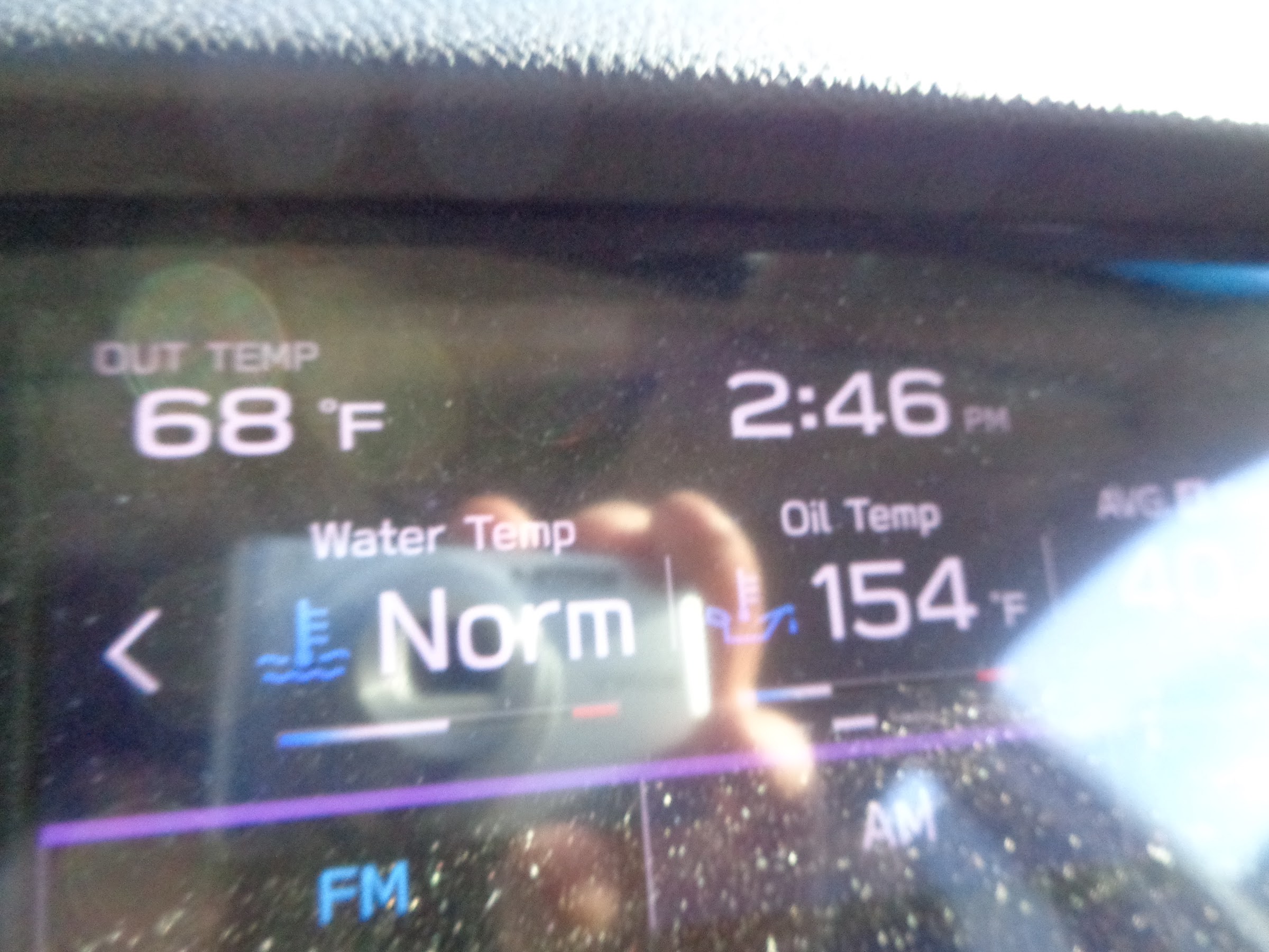
This is how warm is got on that day, a February 9th:
----------------------------------------------------
Final Notes
• Cell reception for most of the trip, sometimes 5G.
• No pass required to park at the official Lyle Cherry Orchard TH, but a Discovery Pass is required for Doug’s Beach off of Hwy 14.
• Much route finding skills required if attempting this route. A map and GPS are absolutely necessary to avoid private property.
• Lots of side-hilling. My right ankle is still a little sore.
• If I were to do something like this again, there is one thing I would do different. On the DNR land north of Centerville Hwy, I would still go all the way out to the open field. However, I would backtrack to the first highway crossing to avoid the excess side-hilling and the forested bushwhacking. Longer distance, but much easier hiking.
• Fun fact: Locals in The Dalles call the Columbia Hills the Klickitats.
Link to pictures on Google Photos:
Link 1
Link 2
Hike away!
Brad


