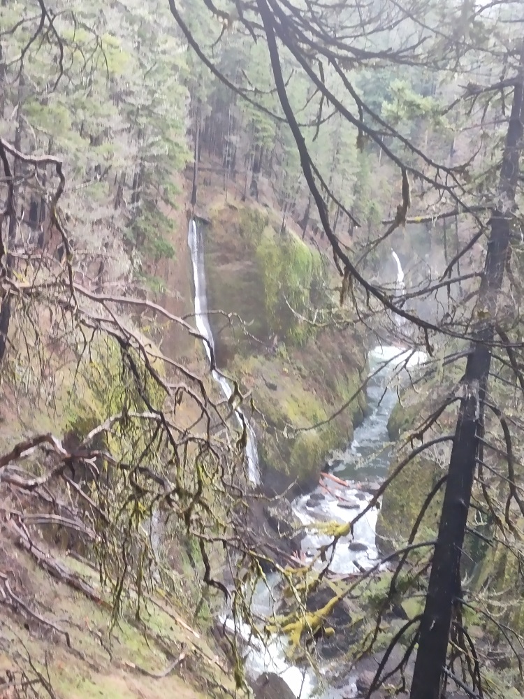
I finally got back to Eagle Creek, first time since reopening. A cloudy and mild weekend day and at 9am was able to park very close to the trailhead, less than 10 cars at that point. Most of the camps between 4 and 5 miles in are gone. The main Wy'east campsite is marked as closed. Not sure where people camped or if mnaybe it's just less popular for camping now, as I didn't visit during the camping season.
Waterfalls galore
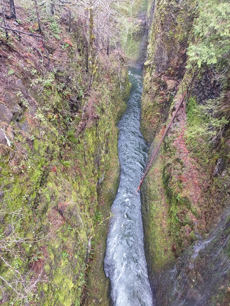
Looking down from High Bridge
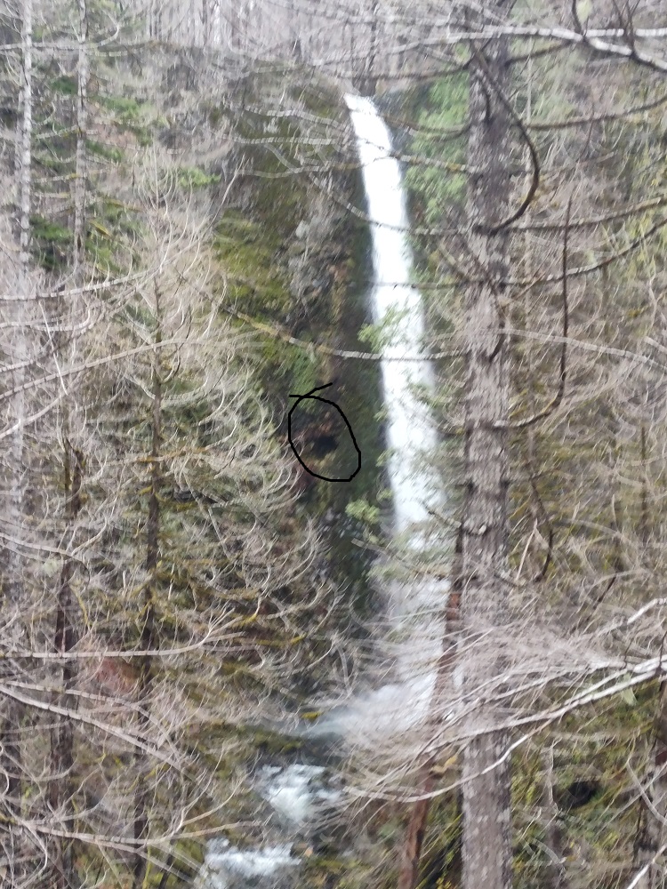
Tunnel Falls - the entrance is circled
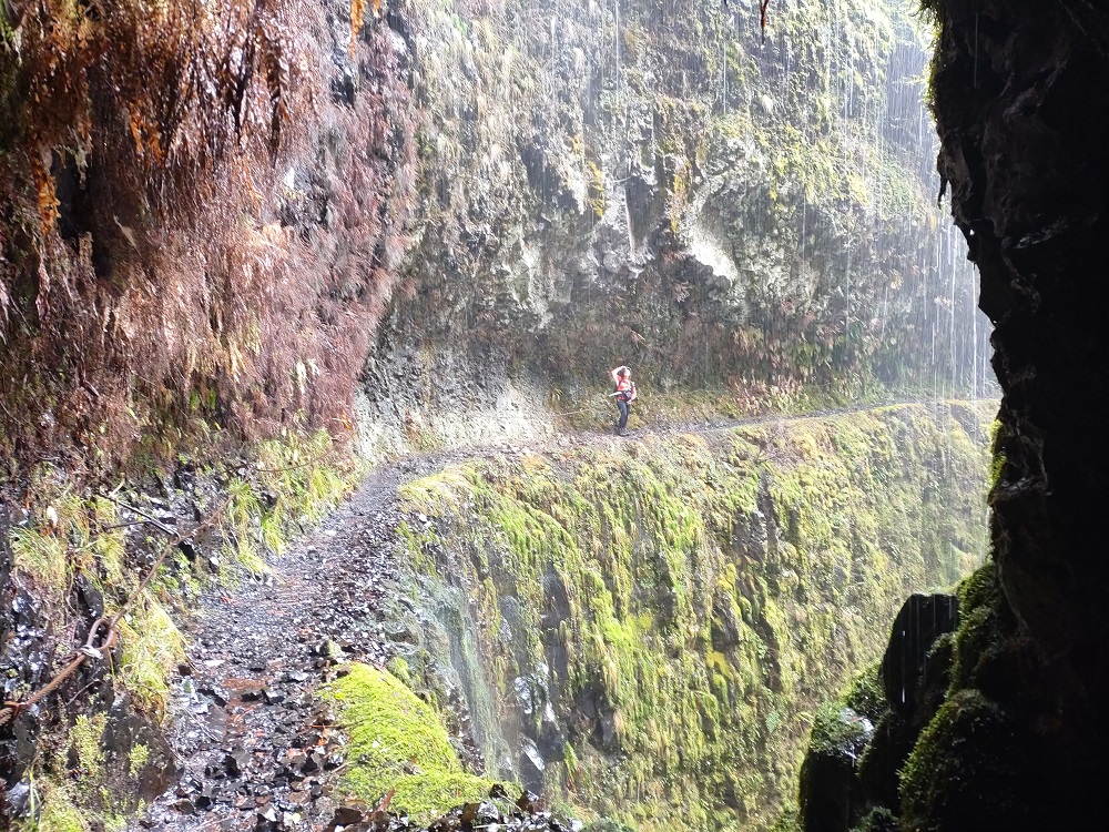
Spray on the far side
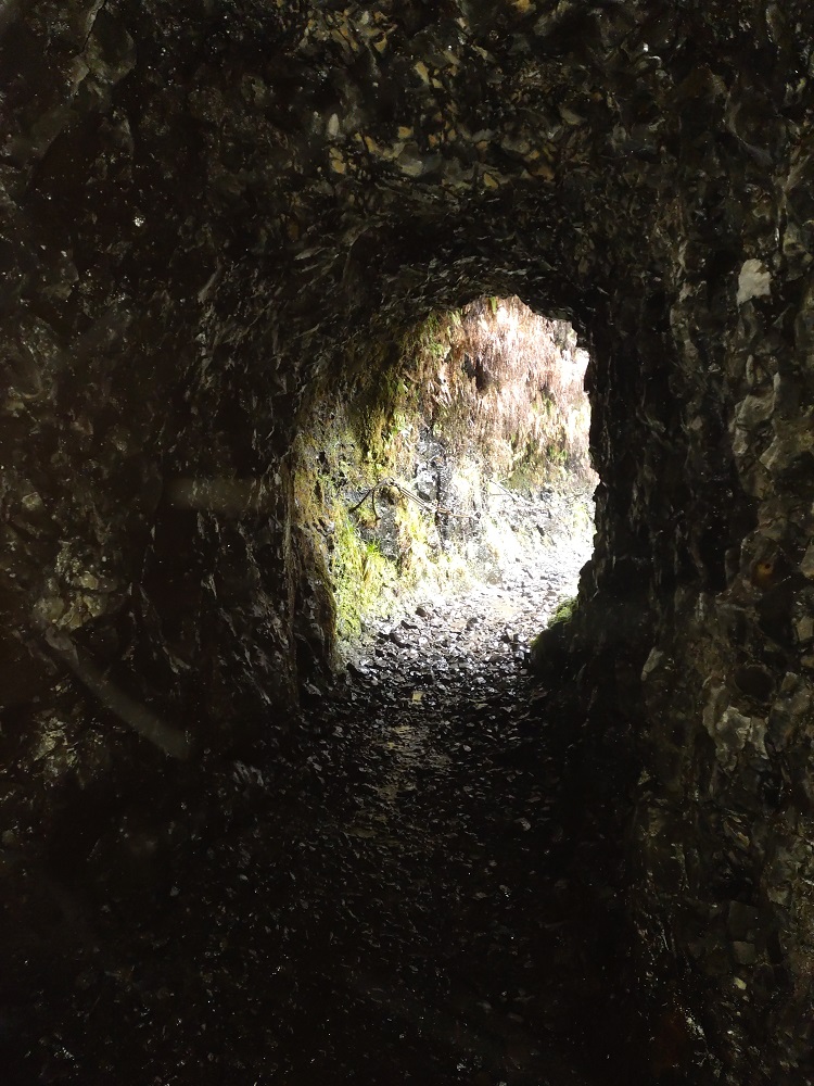
Looking back at the upper entrance
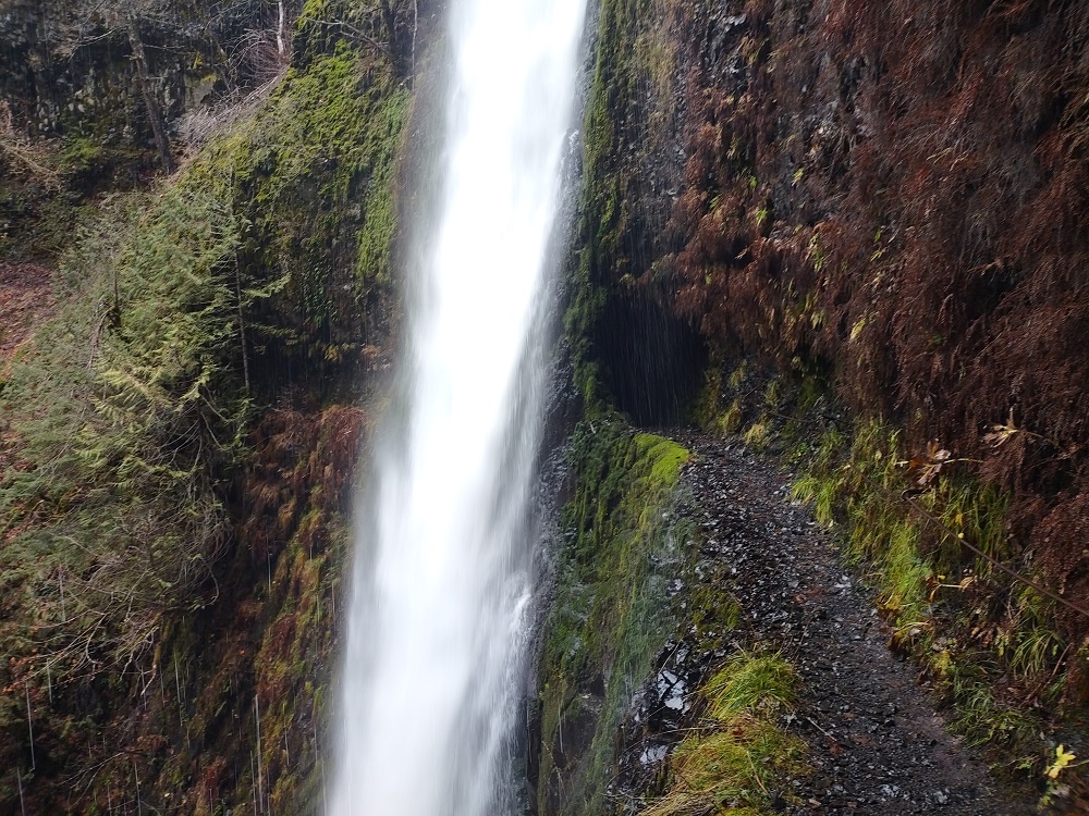
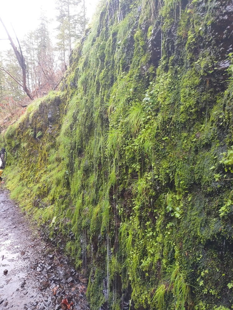
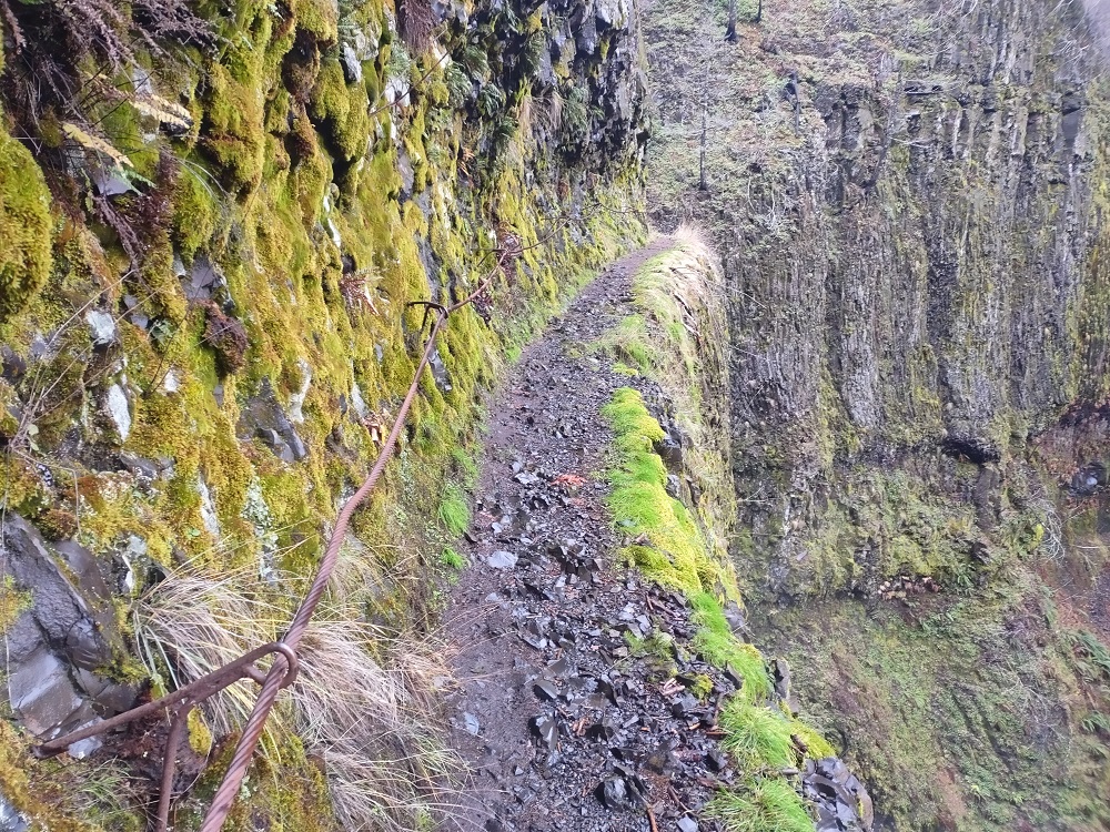
Sheer constructed trail right after
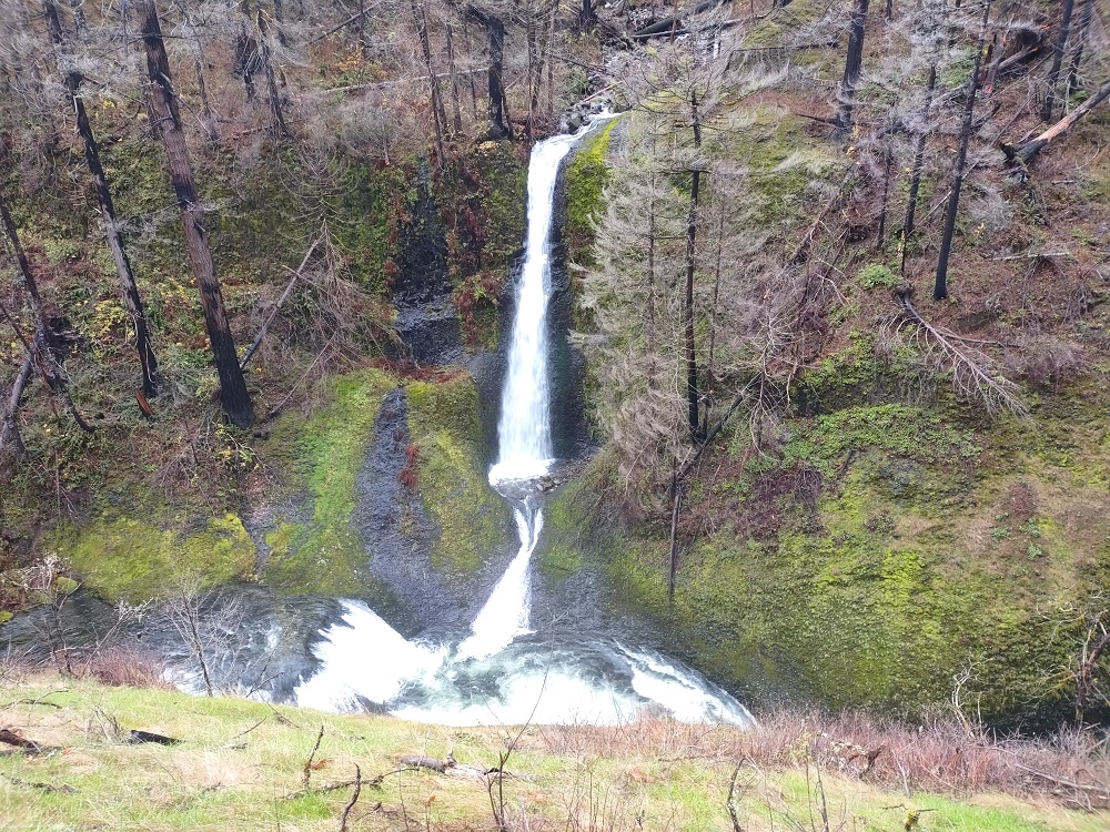
And our final destination a little over 6 miles in, Twister Falls
Return to Eagle Creek
Re: Return to Eagle Creek
Thank you for sharing the pictures. It's encouraging the November rains haven't created a major slide.
- mountainkat
- Posts: 110
- Joined: March 4th, 2015, 6:12 pm
Re: Return to Eagle Creek
Thanks for the update.
Wy'East camp is still there. I worked on the trail some. We decommissioned the Wy'east camp area that was right next to the trail. However, there is a user trail to a large camp area above the decommissioned area, and a user trail to some campsites closer to the creek.
Also, at the camp before Wy'East that is creek side, we did some clearing and improved the user trail for it.
- Splintercat
- Posts: 8334
- Joined: May 28th, 2008, 10:03 pm
- Location: Portland
- Contact:
Re: Return to Eagle Creek
Thanks for posting, Dean! I haven't been back yet, myself -- encouraging that a weekend day wasn't a zoo this time of year! Your third photo is notable in that the tributary falls on the left marks the location of what used to be the Metlako overlook (what's left of it is the pile of boulders at the base of the falls). Unlike the cliff collapse at Punchbowl Falls, this one began before the Gorge fire, and thus unrelated to the loss of soil cover.
Nice report!
Tom
Nice report!
Tom
Re: Return to Eagle Creek
mountainkat - Well, I interpret Wy'east camp as the one right next to the trial. There used to be a sign on a tree there.
Tom - The biggest slide I saw was next to the parking lot.
- Splintercat
- Posts: 8334
- Joined: May 28th, 2008, 10:03 pm
- Location: Portland
- Contact:
Re: Return to Eagle Creek
Thanks for the inspiration, Dean -- I went up there on Sunday. As you predicted, not overwhelmingly crowded in the AM (more so by the early afternoon). I only went as far as Skoonichuk Falls... the burn definitely gets more intense at that point. Lots of people making their way down to the confusingly-signed Lower Punch Bowl, only to be frustrated that you can't see Punch Bowl Falls anymore. Truth be told, most people didn't see it this time of year BEFORE the cliff collapse, as it took wading about 20 into Eagle Creek and just above the knees in VERY cold water to get the photo! But it is true that getting a photo now is even more challenging... that said, there's a nice view of Lower Punch Bowl Falls from the spur trail on the way down -- a nice consolation prize!
Tom
Tom
Re: Return to Eagle Creek
Funny thing. I think the first time I hiked Eagle Creek, 15 years ago, I went down there. I don't think I've been since.
I do sometimes make the detour to the viewing point from above.
I'm hoping that the camps along the main trail that are above 7.5 Mile Camp, the ones that are shortly before the junction, are still usable. I won't know for myself till I backpack up there some time next Spring.
I do sometimes make the detour to the viewing point from above.
I'm hoping that the camps along the main trail that are above 7.5 Mile Camp, the ones that are shortly before the junction, are still usable. I won't know for myself till I backpack up there some time next Spring.
- adamschneider
- Posts: 3717
- Joined: May 28th, 2008, 10:02 pm
- Location: SE Portland
- Contact:
Re: Return to Eagle Creek
What happened to the Punch Bowl view?Splintercat wrote: ↑December 8th, 2021, 6:47 pmLots of people making their way down to the confusingly-signed Lower Punch Bowl, only to be frustrated that you can't see Punch Bowl Falls anymore.
- Splintercat
- Posts: 8334
- Joined: May 28th, 2008, 10:03 pm
- Location: Portland
- Contact:
Re: Return to Eagle Creek
Described in detail in this blog post from 2018:
Cliff Collapse at Punch Bowl Falls!
It hasn't changed much since the aerials in the blog post were taken... some of the smaller debris has been removed after a couple of winters of runoff, logs rearranged, but still very raw. Even in low water, you will need to scale the boulders that rolled into the "gateway" to the Punch Bowl, proper.
-Tom
- adamschneider
- Posts: 3717
- Joined: May 28th, 2008, 10:02 pm
- Location: SE Portland
- Contact:
Re: Return to Eagle Creek
Got it. But, um, Tom, you might want to check your "rights" and "lefts" in a couple of those photo descriptions.Splintercat wrote: ↑December 9th, 2021, 1:05 pmDescribed in detail in this blog post from 2018:
Cliff Collapse at Punch Bowl Falls!