Goat Rocks
Posted: September 14th, 2021, 2:19 pm
I have wanted to return to Goat Rocks for years, with a focus on the Goat Lake side. This trip had a short 4.5 mile hike up the Goat Ridge trail to camp in upper Jordan Basin for two nights. The first day had great sunny weather, and then lots of clouds moved in for days 2 and 3.
I would add that coming from the south, Google said to take road 2329 around the north of Mt Adams and continue north from there. Instead, I took roads 23 and 21. It was about 10 miles longer, but half the miles of unpaved and nothing as rough as 2329 is.
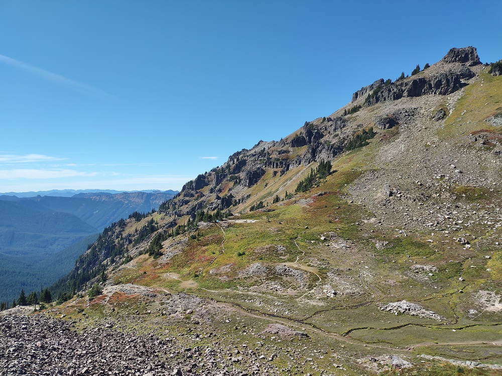
Views start to open up about three miles in

Western pasque flower is always very common up here

Camp will be in the valley that the trail is approaching in the upper right

The bare spot in the middle is a dried pond and my tent is blue and just to the left of it
A little closer view of it - a very dramatic location. I arrived at 12:15 and was the first to set up camp in the area

The goal that afternoon was to hike to Hawkeye Point (over 7400 feet), above Goat Lake. This view of Goat Rocks was on the way. Jordan Basin is the best camp for Hawkeye Point, but not for getting to the PCT

And in the other direction was Mt. Rainier

The switchbacks of the final climb. It was about 1200 feet above camp and 1.5 miles away, a steep hike

Looking down at Goat Lake and across at Goat Rocks

Another view of Rainier, and of things to come (the clouds)

Dusk sunlight on more western pasque flower seed heads

In the morning thick clouds had moved in, but the forecast was for partial clearing, so I was hiking to the PCT

Goat Lake under the clouds

On the PCT and Goat Rocks from a different angle

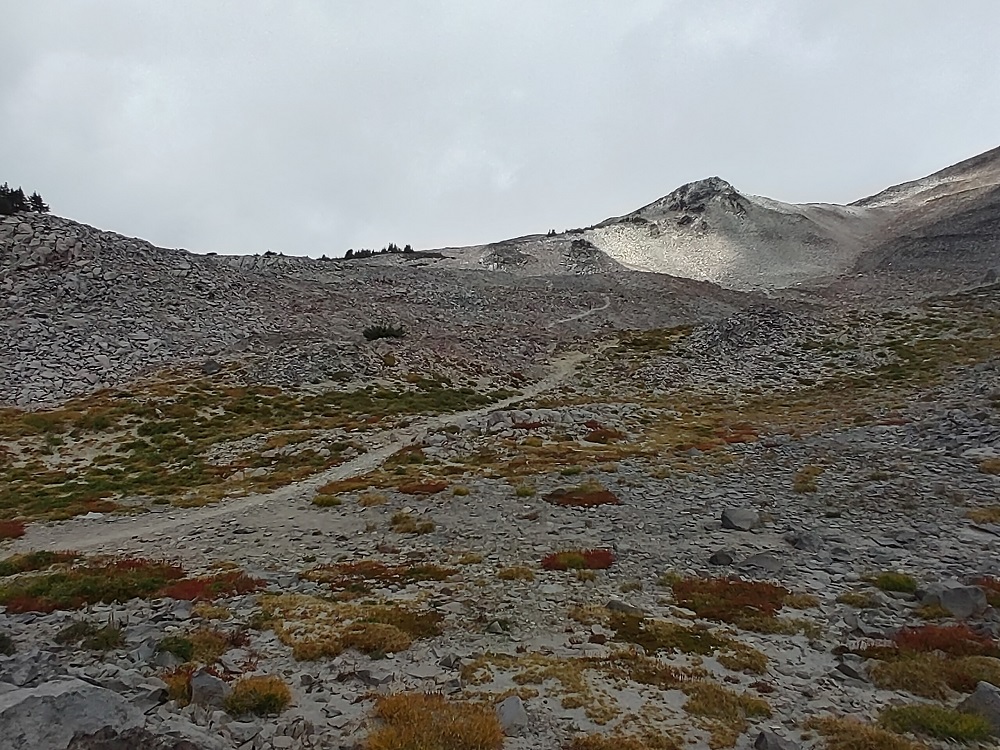
My highest spot for the day, the PCT heading over 7000 feet
And a marmot in the field

On the way back. Goat Lake is in that depression on the right, the trail then continues left over the pass at the far left, and my camp is just past and below that

The valley below Goat Lake - there is no trail down there

That's Hawkeye Point overlooking Goat Lake, over a thousand feet above

Looking back at Goat Rocks as clouds move in - Snowgrass Flats is on the far right

Back to camp - others had moved in - by evening it would be a solid fog bank - and five groups camped (one arrived after dark by headlamp)

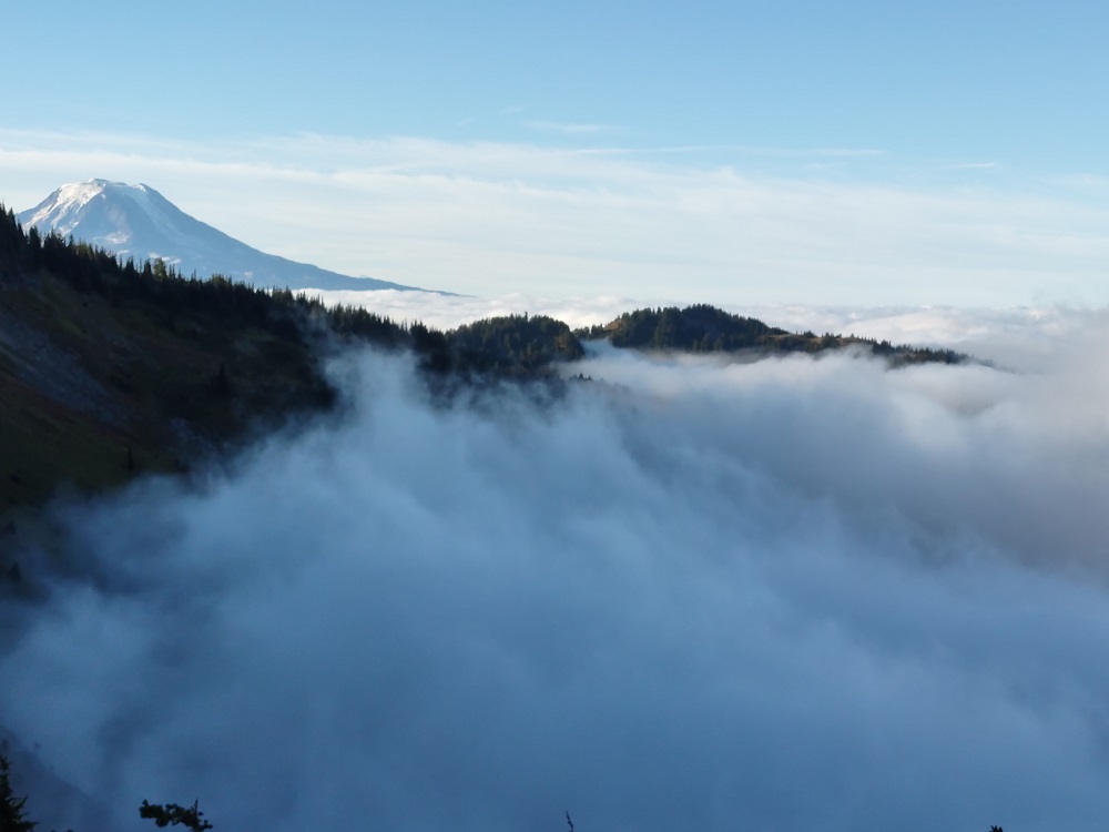
In the morning the valley was clear up high, with the fog bank just below camp, and Mt Adams also Above the Clouds
I would add that coming from the south, Google said to take road 2329 around the north of Mt Adams and continue north from there. Instead, I took roads 23 and 21. It was about 10 miles longer, but half the miles of unpaved and nothing as rough as 2329 is.
Views start to open up about three miles in
Western pasque flower is always very common up here
Camp will be in the valley that the trail is approaching in the upper right
The bare spot in the middle is a dried pond and my tent is blue and just to the left of it
A little closer view of it - a very dramatic location. I arrived at 12:15 and was the first to set up camp in the area
The goal that afternoon was to hike to Hawkeye Point (over 7400 feet), above Goat Lake. This view of Goat Rocks was on the way. Jordan Basin is the best camp for Hawkeye Point, but not for getting to the PCT
And in the other direction was Mt. Rainier
The switchbacks of the final climb. It was about 1200 feet above camp and 1.5 miles away, a steep hike
Looking down at Goat Lake and across at Goat Rocks
Another view of Rainier, and of things to come (the clouds)
Dusk sunlight on more western pasque flower seed heads
In the morning thick clouds had moved in, but the forecast was for partial clearing, so I was hiking to the PCT
Goat Lake under the clouds
On the PCT and Goat Rocks from a different angle
My highest spot for the day, the PCT heading over 7000 feet
And a marmot in the field
On the way back. Goat Lake is in that depression on the right, the trail then continues left over the pass at the far left, and my camp is just past and below that
The valley below Goat Lake - there is no trail down there
That's Hawkeye Point overlooking Goat Lake, over a thousand feet above
Looking back at Goat Rocks as clouds move in - Snowgrass Flats is on the far right
Back to camp - others had moved in - by evening it would be a solid fog bank - and five groups camped (one arrived after dark by headlamp)
In the morning the valley was clear up high, with the fog bank just below camp, and Mt Adams also Above the Clouds