Howdy,
My hiking partner and I left the Pollalie trailhead just after 6am on 8/29. Cool morning, no clouds, some fire smoke, great trail conditions for a trip up Lamberson Spur with a return via the Elk Meadows trail. Very similar conditions to 2020's outing.
Distance: >= 17 miles (Many chances to putter around).
Elevation at the trailhead: ~2880
Elevation at the high point: ~7330
Total elevation gain for the route: 4900
From the clearing 3.75 miles from the trailhead.
The gps track I downloaded from Caltopo shows the trail extending another 7/10s or beyond, but this is no longer true. Good luck finding a trail more than a few hundred yards. Since the fire... the main challenge between the clearing and the upper spur has been the many downed trees. New growth leaves us with the following for a mile or so:
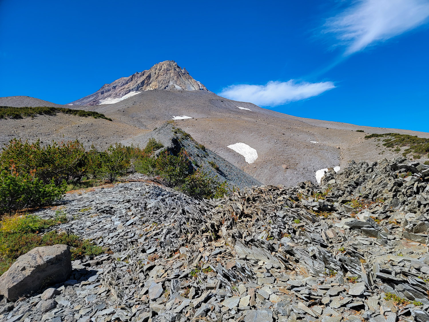
Enjoy working through the deadfall while pushing through a dense barrier of 5-12ish foot adolescent trees. Starting the upper spur. From here to the Timberline Trail is amazing, fun off-trail hiking:
Looking up the remainder of our climb:
Looking down from just below the Timberline Trail. Water available not far from here.
Heading toward toward the top of Lamberson Butte. Thought about scrambling to the high point, but we were tight on time. Traffic was steady on the TT. Nice mix of round-the-mountain hikers, day hikers, runners... Everybody we spoke with was having a good day.
The four miles from Elk Meadows back to the Lamberson Spur junction were in great shape. Only one pair of trees to go over/around. Trail was a bit brushy in spots, but hard to complain given the earlier treewhacking.
Crossing the creek at ~14.2 miles, ~.6 miles from the junction with Bluegrass Ridge. The log looks fairly broken on the underside, but didn't budge for me or my partner.
This is one of my absolute favorite outings on the mountain, but I am not sure I will do it again. The combination of dense new growth and downed timber past the clearing makes for a rough go. But... I probably said something similar last year. So little trail remains for that close to mile that I think you'd have to call opening up any way through new construction.
Happy hiking!
--Rob
Lamberson Spur, passing of a favorite -- 08/29/21
-
- Posts: 55
- Joined: July 14th, 2020, 1:42 pm
Re: Lamberson Spur, passing of a favorite -- 08/29/21
You really should do it again, clockwise next time.
- Splintercat
- Posts: 8333
- Joined: May 28th, 2008, 10:03 pm
- Location: Portland
- Contact:
Re: Lamberson Spur, passing of a favorite -- 08/29/21
Nice report, Rob! In your photo looking down from the Timberline Trail -- did you follow the crest of the ridge with the scarp/talus along its north side? I've never seen a plan for where the Lamberson Spur Trail was intended to connect to the TT before construction was unceremoniously stopped (back in the late 70s or early 80s, I think), but this ridge top seems like the natural location. I'm wondering if there were any gendarmes blocking the way -- from above (I was just looking down at this a couple weeks ago from the TT) it seems like there might be.
Thanks!
Tom
Thanks!
Tom
Re: Lamberson Spur, passing of a favorite -- 08/29/21
Great to see a Lamberson Spur report!
After the first easy rise, the ridge constricts to a line of gendarmes, with steep slopes covered by mats of manzanita. I followed the south side of the ridge below the actual crest. After the gendarmes, it's plain sailing up to Timberline.
A few years ago I found what appeared to be the end of the original trail (cut logs, etc.) on an unburned section of the bench at the east end of the ridge (approx. 45.3838; -121.6293).Splintercat wrote: ↑September 12th, 2021, 6:58 pmdid you follow the crest of the ridge with the scarp/talus along its north side?
After the first easy rise, the ridge constricts to a line of gendarmes, with steep slopes covered by mats of manzanita. I followed the south side of the ridge below the actual crest. After the gendarmes, it's plain sailing up to Timberline.
Re: Lamberson Spur, passing of a favorite -- 08/29/21
Tom- when I did this route a few years ago around 6300ft I descended south off the ridge proper, due to steepness and annoying tree cover, and then followed the drainage and came back up to the ridge just above 6800ft right near that very unique scarp with its vertical array of plate like rock. Such a cool spot. Around 6200 feet are a series of rocky outcroppings/gendarmes bobcat shows above, on the ridge that require some scrambling on/over/in and skirting below, but still you can still be close to the ridge. I was just on that scarp edge at 6900 feet earlier this week- I came off trail from the Gnarl Ridge-Timberline Trail Junction. Trip Report and some photos coming up when I get it done.
Around 6870ft and quarter mile down from the Timberline Trail:
- Splintercat
- Posts: 8333
- Joined: May 28th, 2008, 10:03 pm
- Location: Portland
- Contact:
Re: Lamberson Spur, passing of a favorite -- 08/29/21
Thanks, Pinecone - that's a cool perspective of the mountain!
-Tom
-Tom