Another favorite hike that I haven't done in a few years -- on the dry side of Mount Hood! This hike also passes the high point on the Timberline Trail, at just over 7,000 feet. One big change in recent years? The "permanent" snowfields that used to be part of hiking this section of trail are nearly gone, now. More climate change happening right in front of us. The result is a couple of rough sections where there never was a trail, since it was designed to travel over snow that once filled some of the ravines -- I documented them and will be putting a TKO proposal together to build a better tread through these areas.
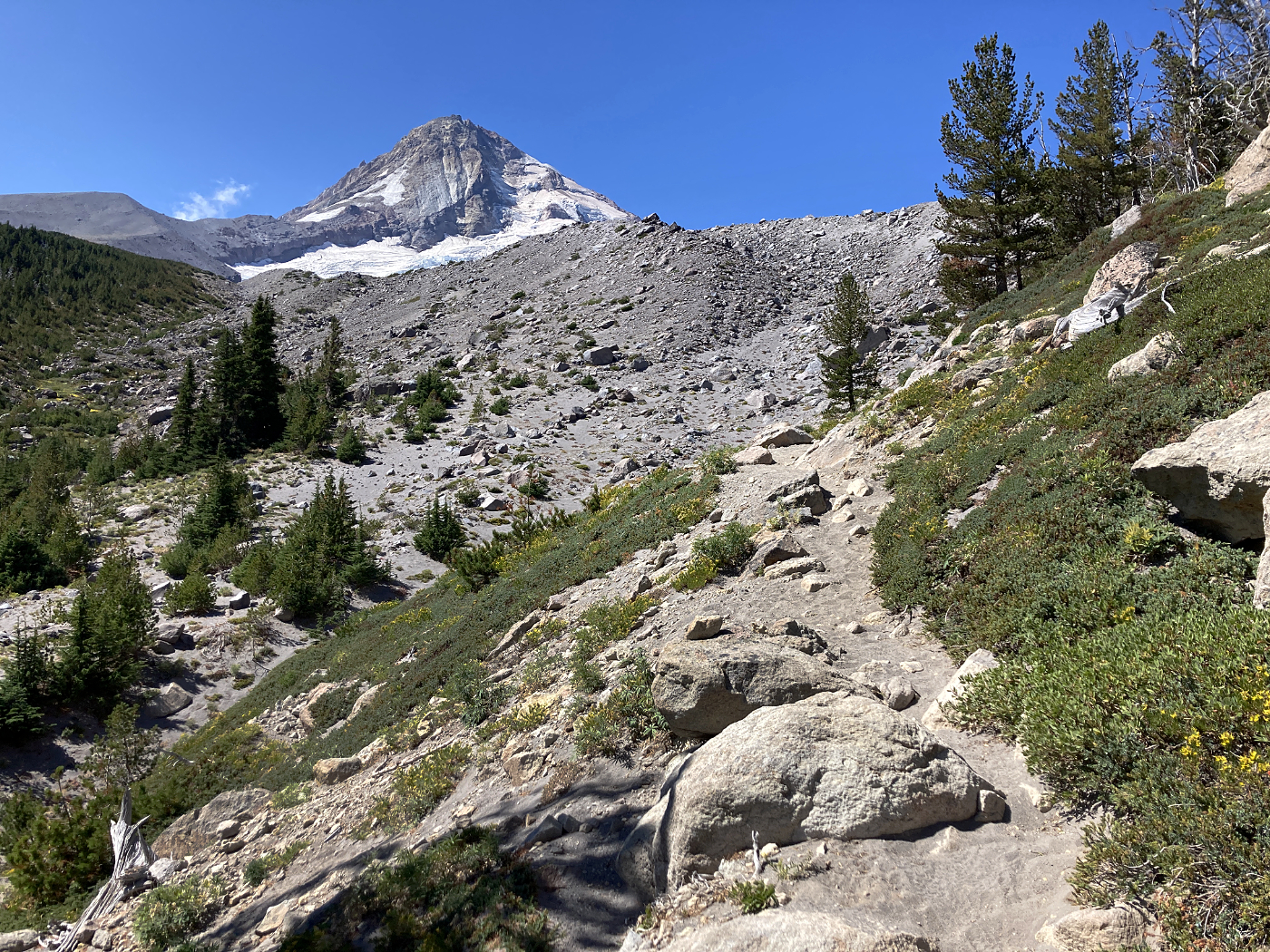
From the start, here's Tilly Jane Canyon as you head up toward the mountain from Cloud Cap:
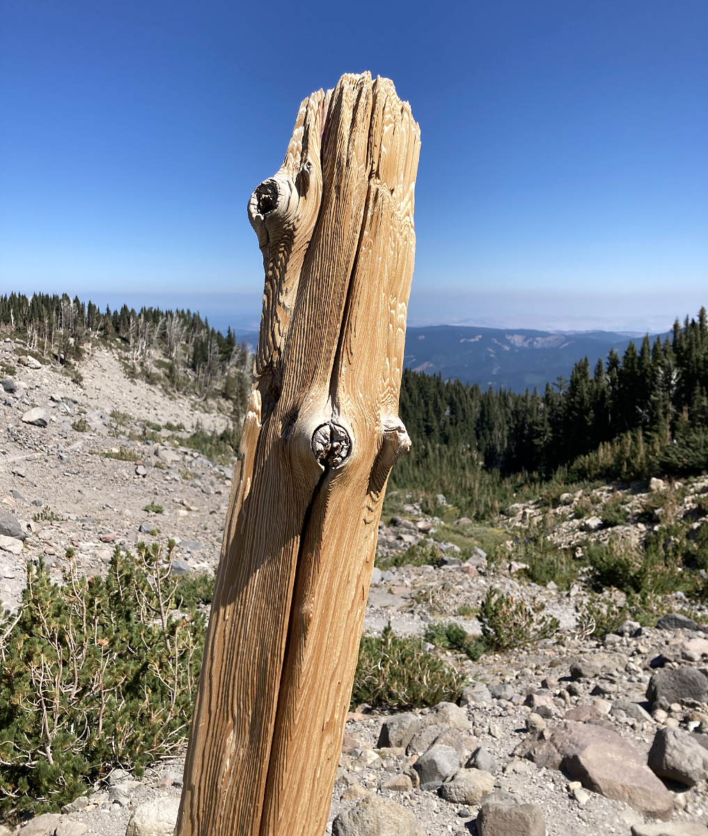
One of the weathered old 4x4 posts that top the wayfinding cairns along this part of the Timberline Trail:
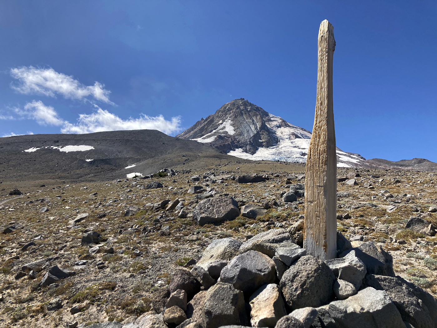
Mount Hood and a cairn post that has been carved to a toothpick by blowing ice and sand:
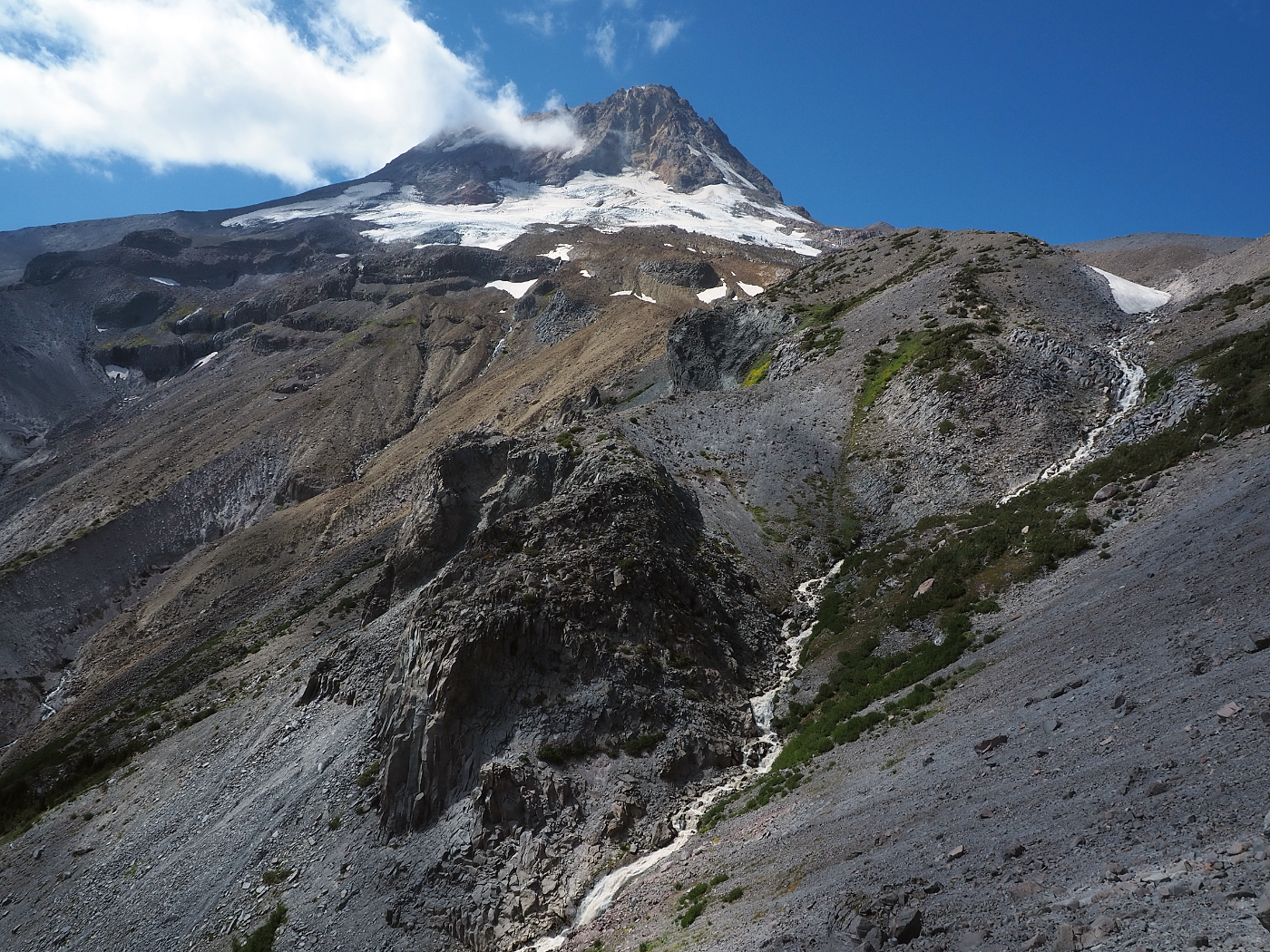
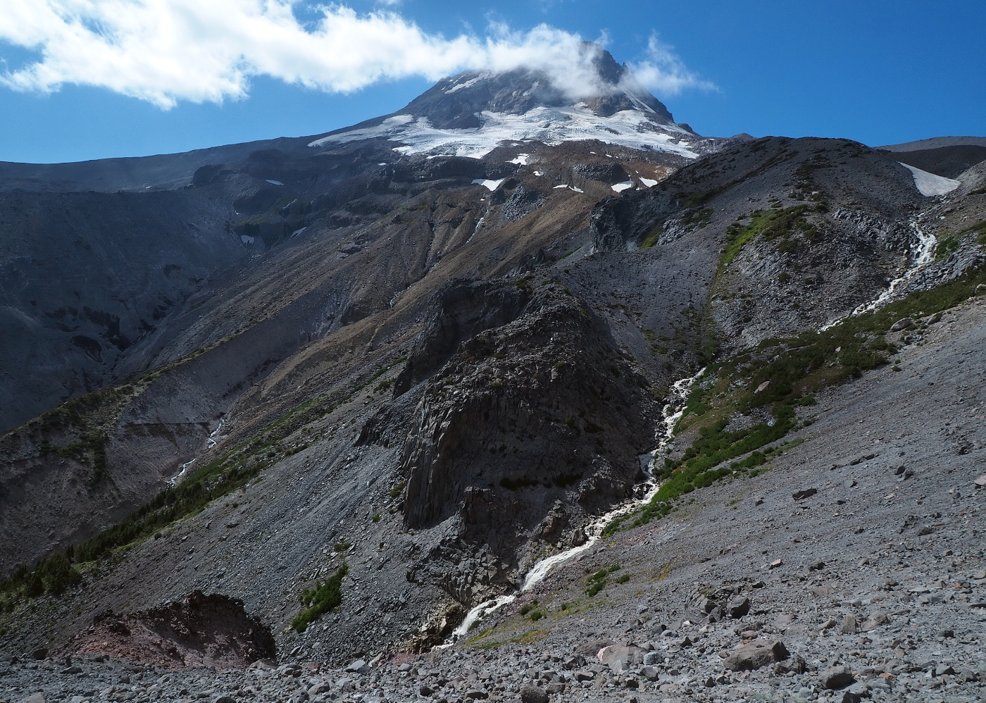
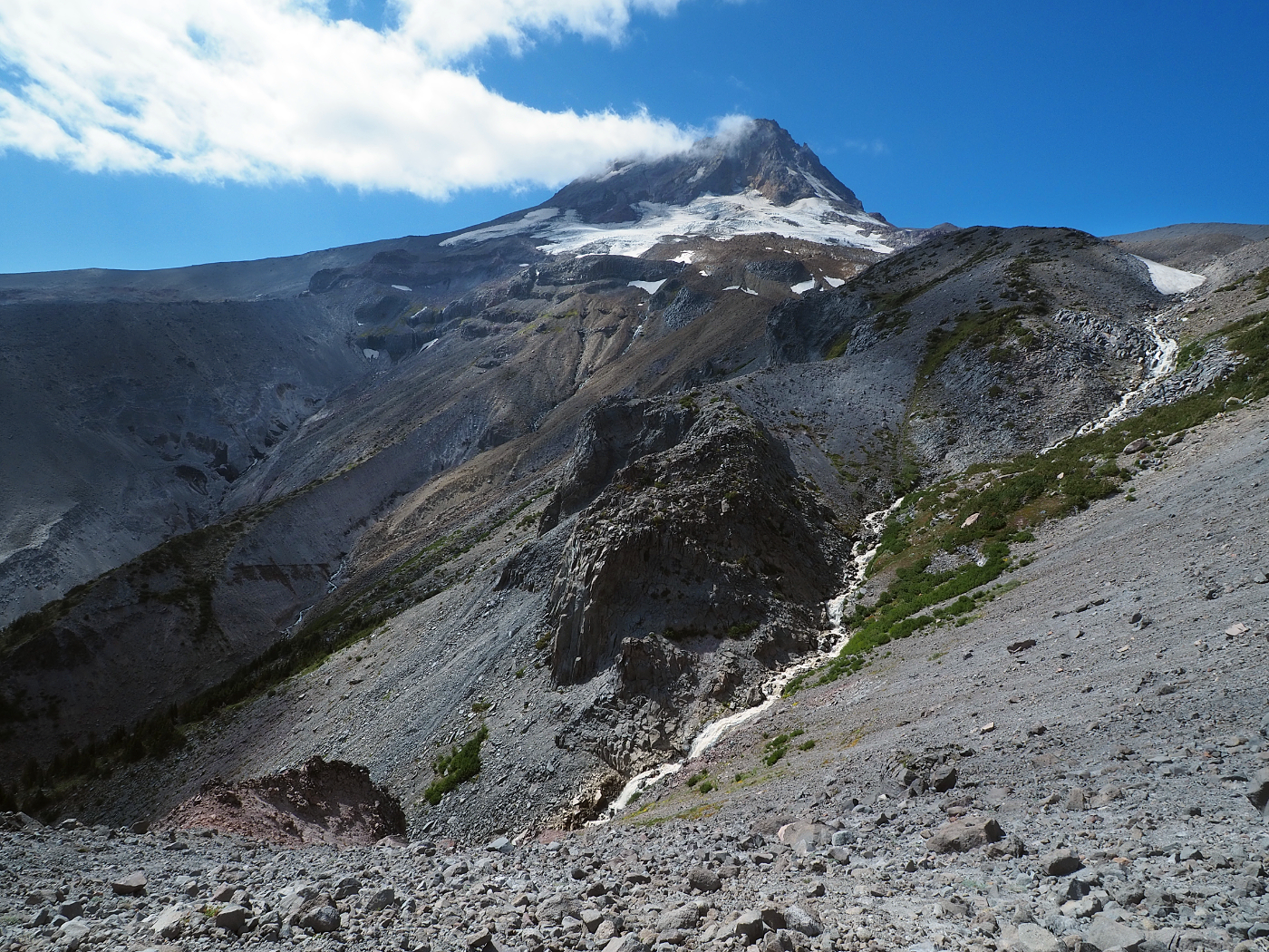
Mount Hood briefly disappears from view behind Cooper Spur as you hike south toward Gnarl Ridge, and when it reappears you're looking at the east face:
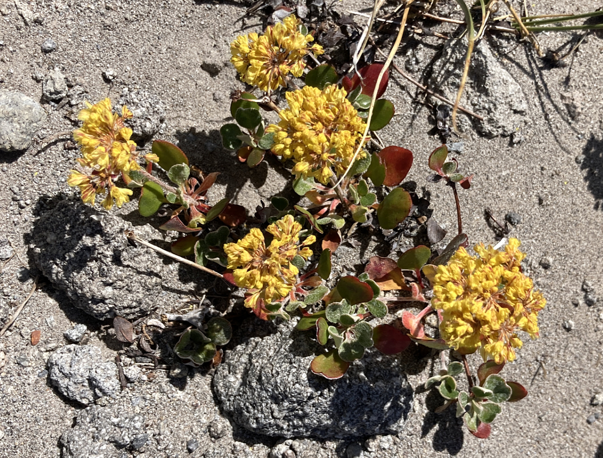
Buckwheat blooming way, way above the tree line:
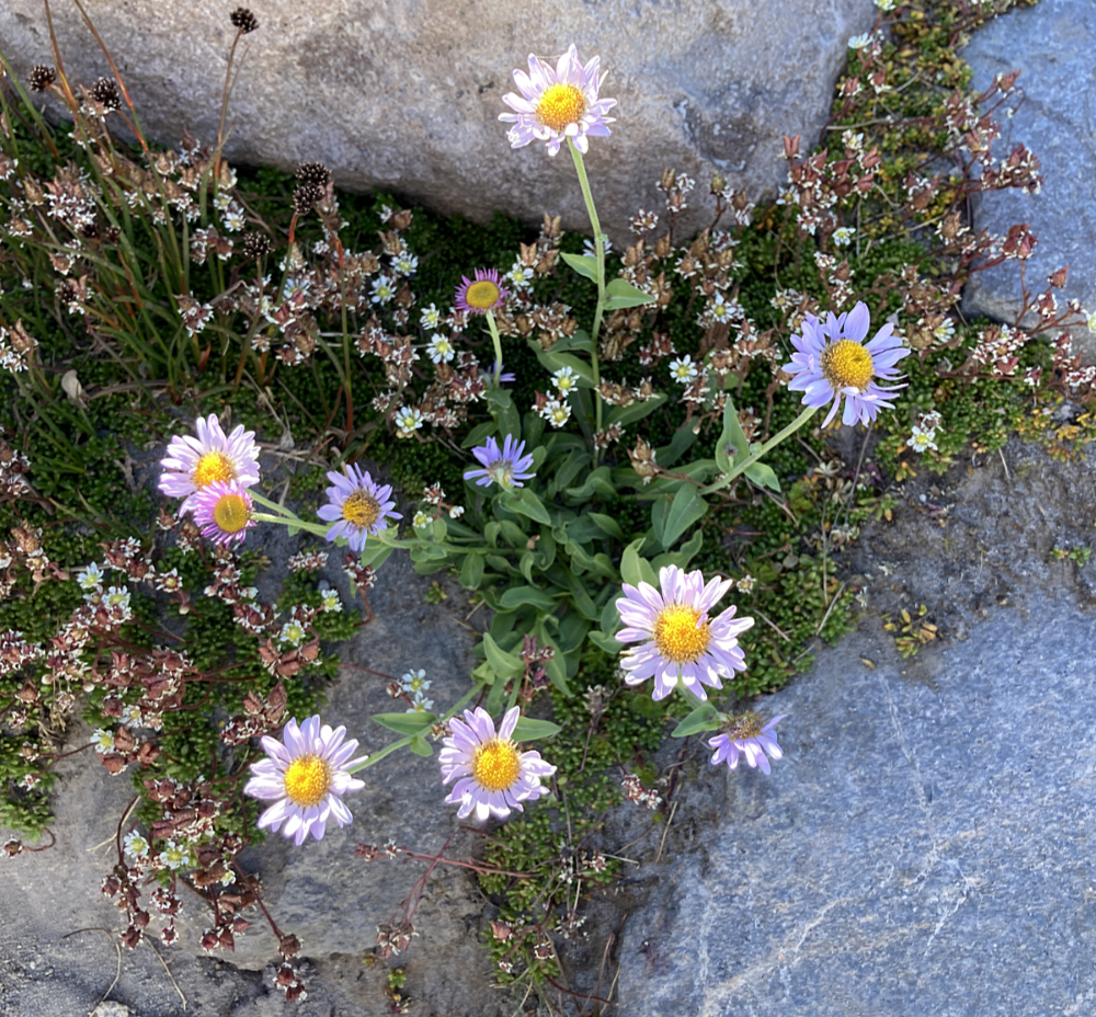
Asters growing along one of the snowmelt streams near the high point on the Timberline Trail:
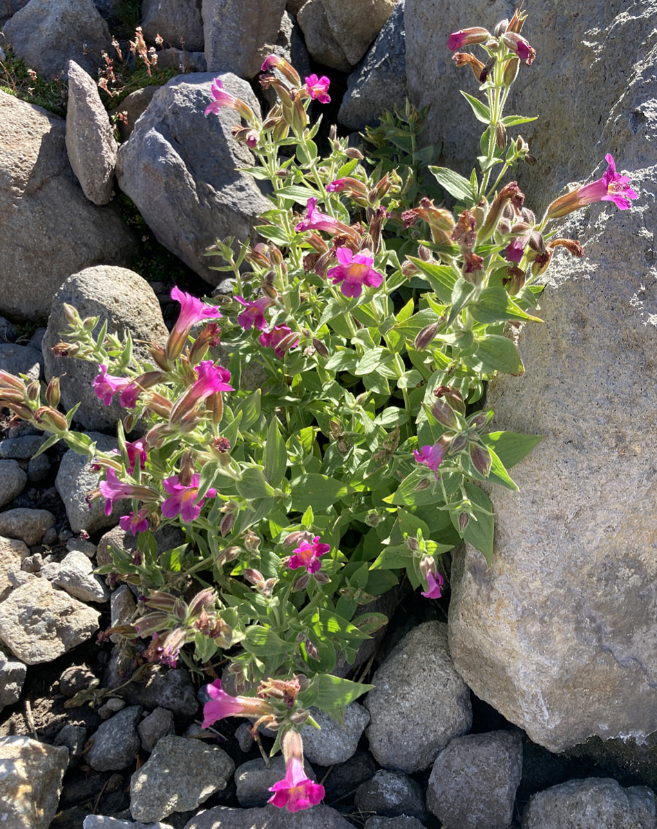
Lewis' Monkeyflower, also growing along a snowmelt seep:
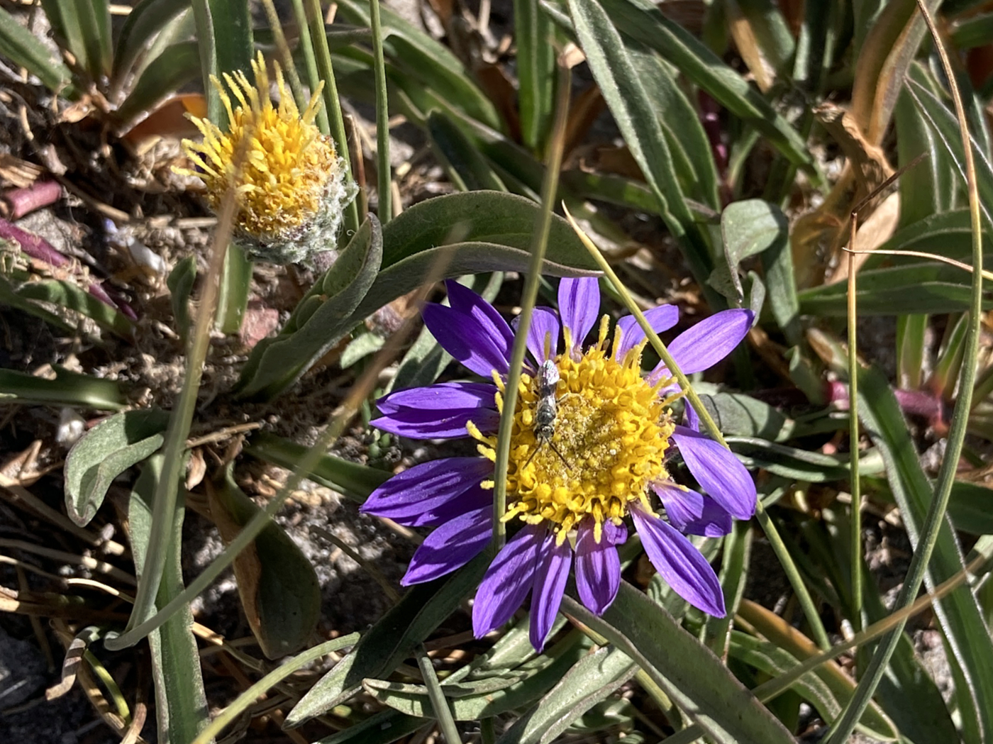
Alpine aster near the high point on the Timberline Trail:
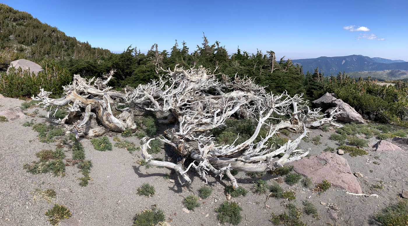
Ancient Mountain Hemlock creeping along the top of Gnarl Ridge:
The big view from the crest of Gnarl Ridge into Newton Canyon:
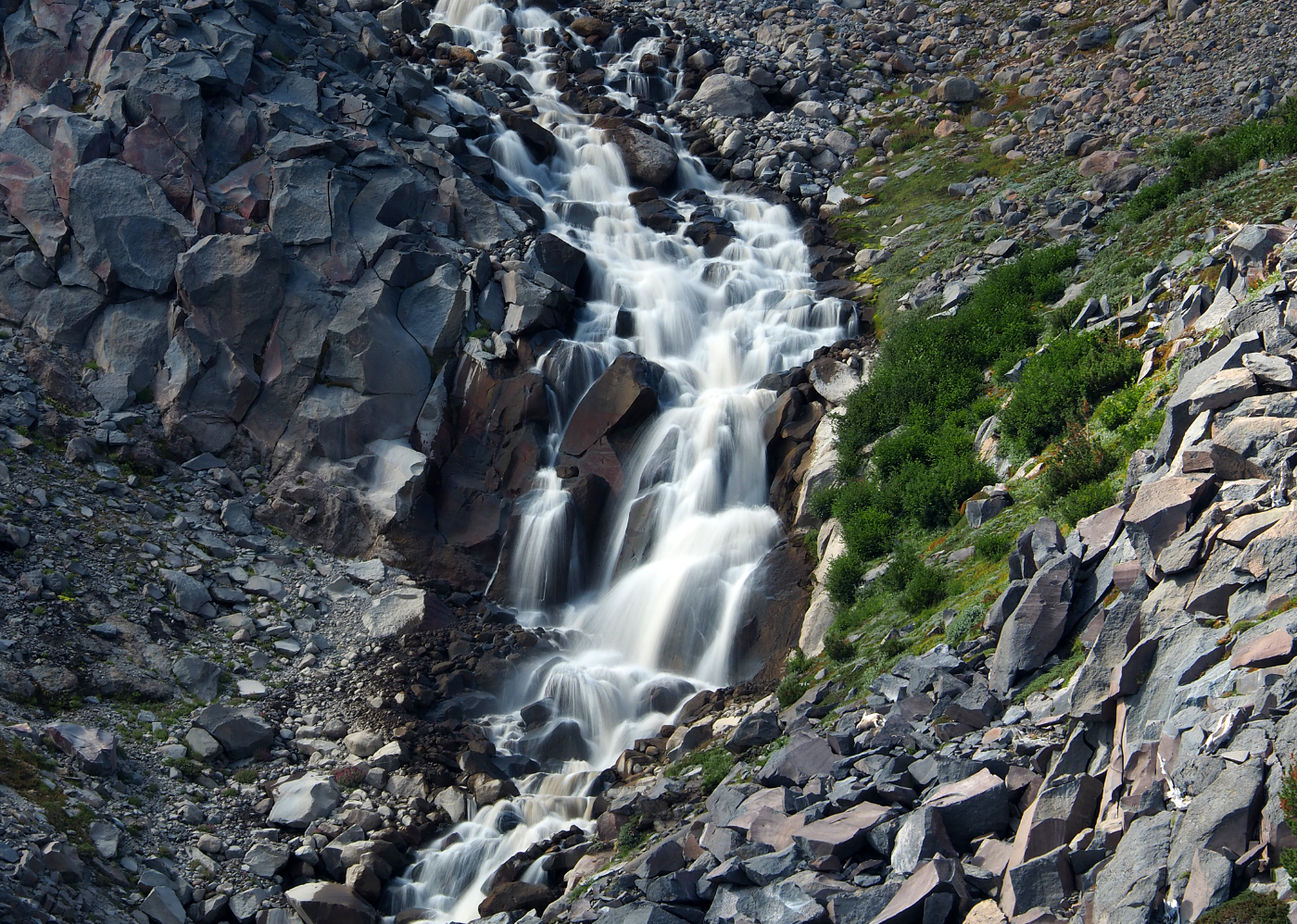
One of the many cascades along the north branch of Newton Creek where it drops into the canyon:
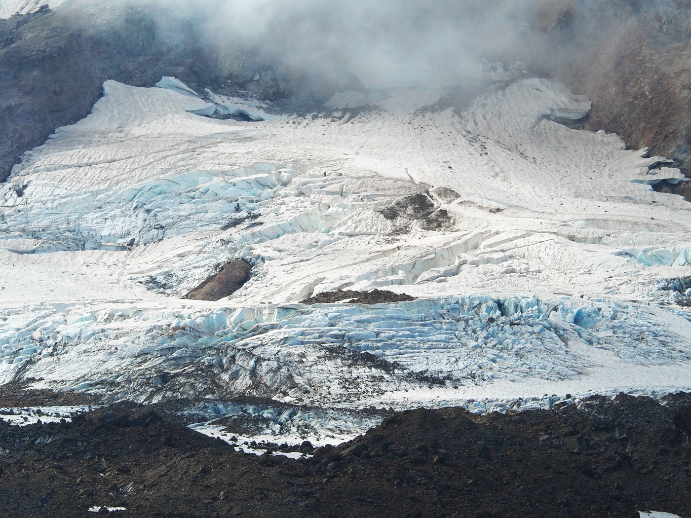
Close-up view of the crevasses and icefalls on the Newton Clark Glacier:
Wider view of the abyss from Gnarl Ridge:
...and the very widest view with my 9mm ultra-wide lens! Lots to see here, no lens can really capture it all...
There are a couple of very small water sources just south of the high point at this time of year, plus a spring in Tilly Jane Canyon. Otherwise, this is a dry trip that is almost entirely above the tree line, so it's best done on a cool day.
-Tom
Cloud Cap to Gnarl Ridge (August 23)
- Splintercat
- Posts: 8333
- Joined: May 28th, 2008, 10:03 pm
- Location: Portland
- Contact:
- Don Nelsen
- Posts: 4380
- Joined: May 28th, 2008, 10:03 pm
- Location: Vancouver, WA
Re: Cloud Cap to Gnarl Ridge (August 23)
Tom,
Excellent photos, and thanks for the TR!
Amazing how the posts erode over time. I was exploring atop Mummy Mt. in Nevada a few years ago marveling how the long dead and fallen bristlecone pines were eroding into artistic shapes. (30 miles WNW of Las Vegas, 11,530' elev.) I've read that it can take a thousand years or more before they completely disappear. Looks like those posts won't last that long.
"Everything works in the planning stage" - Kelly
"If you don't do it this year, you will be one year older when you do" - Warren Miller
- Waffle Stomper
- Posts: 3707
- Joined: May 28th, 2008, 10:03 pm
Re: Cloud Cap to Gnarl Ridge (August 23)
I love this trip report, it's been awhile since I have done that hike.
"When we try to pick out anything by itself, we find it hitched to everything else in the Universe." - John Muir
- Splintercat
- Posts: 8333
- Joined: May 28th, 2008, 10:03 pm
- Location: Portland
- Contact:
Re: Cloud Cap to Gnarl Ridge (August 23)
Thanks, Janice! Seemed longer to me this time... possibly because I'm just getting too damned old..?I love this trip report, it's been awhile since I have done that hike.
Don, my wife and I FINALLY made it to the Bristlecones in the White Mountains a couple of years ago -- and yes, I had the same reaction to those ancient, fallen trees that continue to be carves and sculpted. The fact that they don't have time to oxidize is the giveaway that it's an ongoing and fairly aggressive "sanding" process, and the same holds true for some of the Whitebarks on Gnarl Ridge, of course.
Tom
Re: Cloud Cap to Gnarl Ridge (August 23)
I was hoping you'd have an observation to share. I'm curious about such things.Splintercat wrote: ↑August 31st, 2021, 8:49 pmThis hike also passes the high point on the Timberline Trail, at just over 7,000 feet. One big change in recent years? The "permanent" snowfields that used to be part of hiking this section of trail are nearly gone, now.
Re: Cloud Cap to Gnarl Ridge (August 23)
That's lovely. Are you willing to share a higher resolution copy?Splintercat wrote: ↑August 31st, 2021, 8:49 pm...and the very widest view with my 9mm ultra-wide lens! Lots to see here, no lens can really capture it all...