I've wanted to do this trail for years, and it finally came together. The trail is mostly pretty flat, but it is also mostly in the forest. You don't see the lake at all for seven miles and after that, just bits and snatches. There is about a half mile section south of Devils Creek where the trail follows the lake shore. For the most part, enjoyment of the lake comes from following a side trail down to the area where lakeside camps are. Most lakeside camps are used by people who got a boat ride in, but they can be reserved by hikers too. And there are some camps that are not lakeside. These obviously lack views but have better creek water in some cases and usually a lot more privacy, as shore camps are often right next to each other.
I spent five days, with my four camps at Roland Ck (forest camp), two nights at Lightning Creek boat camps, and my last night at May Creek Stock Camp (forest camp). I hiked up Desolation Peak to the lookout made famous by Jack Kerouac in between my two nights at Lightning.
First glimpse of the lake! Just after Roland Creek.
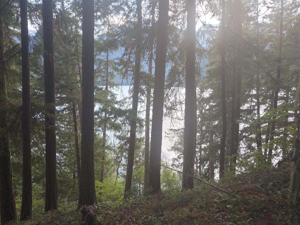
I went for a stroll from my Roland Ck camp after dinner and got this first real view about 3/4 of a mile past camp
Taking a break at Rainbow Point camp area
Typical camp at Rainbow Point
A section of trail near the lake
A short distance north of Rainbow the trail has it's one section right at the lakeshore
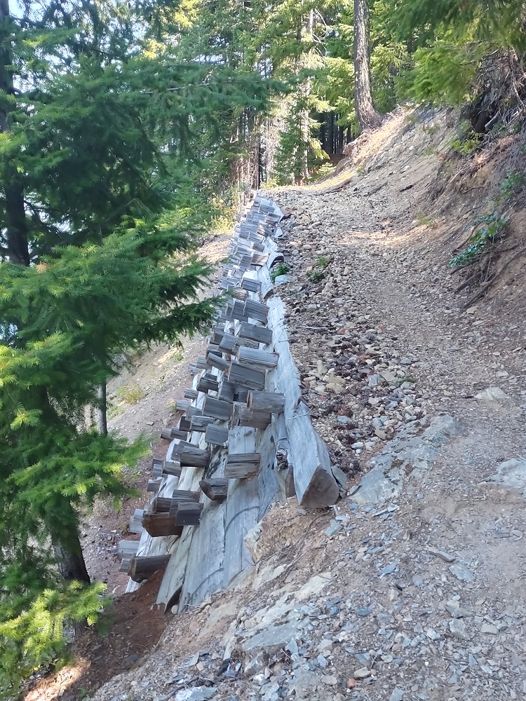
Heavy trail construction next to the lake, I can see why trail builders didn't do too much of this
Big suspension bridge at Devils Creek
Devils Creek inlet, the actual creek is not accessible
Another suspension bridge over Lightning Creek inlet
Peaks just peaking over the lower hills
Lightning Creek Boat Camp #3 (there are 4 + the group camp). Note the large bear food locker - one for each camp.
Lightning Creek boat dock, 20 yards from my camp
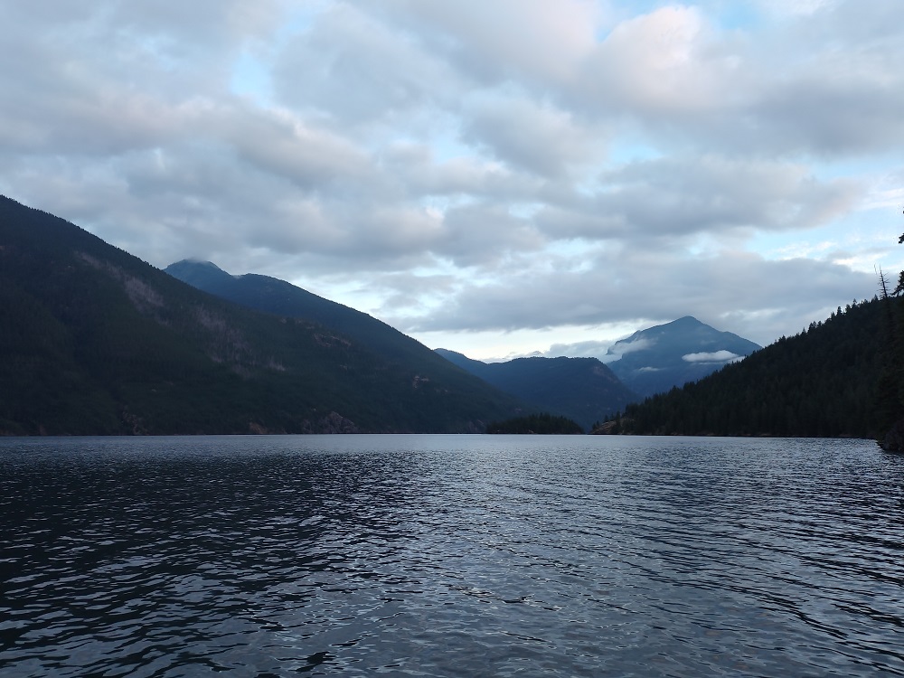
Looking south at sunset
A little marine layer an sunrise, low temps never were below 60 deg
Start of my hike up Desolation Peak (gaining 4500 feet), looking at Cat Island, note the boat ramp on the right
Still some clouds on the peaks as I hike up and up and up
Desolation Camp about 1000 feet below the summit - no water available here
Jack Mountain from Desolation Camp
First view of the lookout on the summit - I'm almost there!
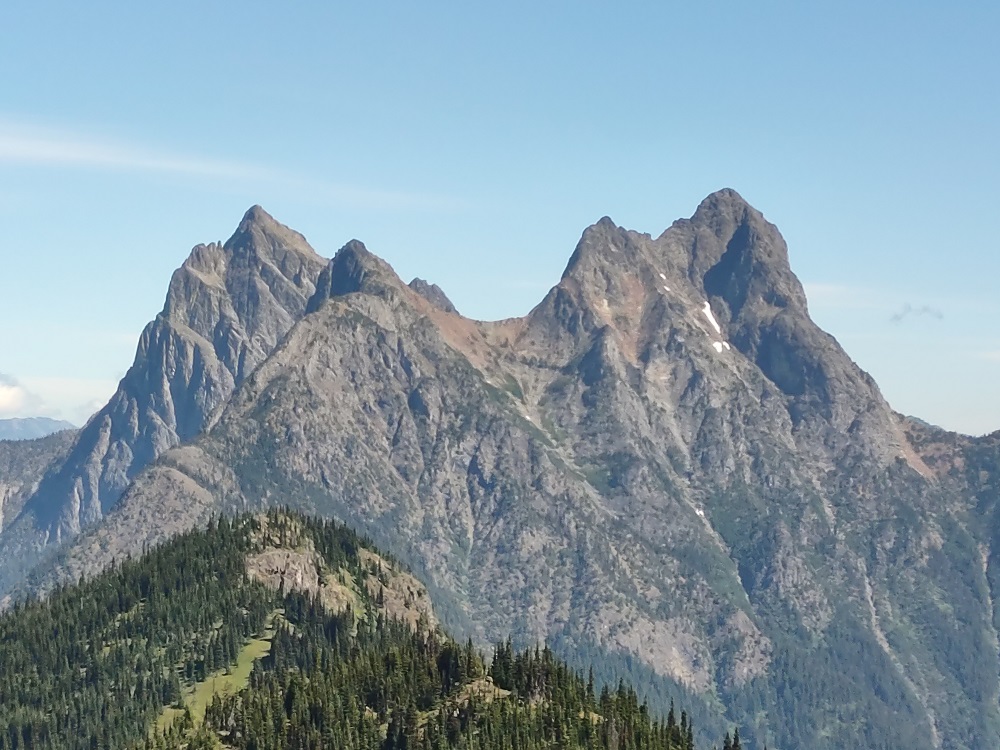
Imposing Hozomeen Mountain, just to the north
Peaks to the northwest
The lookout with Hozomeen. It took me just over four hours to hike the 6.7 miles up
More of Ross Lake
Loo with a View - looking east at Skagit Peak
That evening back at camp, being entertained by this family
The next day (my birthday, by the way), I slept in and had a leisurely morning. What a coffee view to start the day.
Last camp at May Ck was not on the lakeshore, but I could walk a half mile to a cozy spot
Ross Lake East Bank Trail - North Cascades NP
Last edited by drm on July 23rd, 2021, 6:55 am, edited 1 time in total.
Re: Ross Lake East Bank Trail - North Cascades NP
[I don't know why the photos aren't working. I've done this a hundred times before with no problem. I've confirmed that the image urls are correct (I'm a web developer by trade, I know this stuff). You can see it all on my personal trip report at http://static.deanmyerson.org/Ross-Lake-NOCA.html]
Fixed - added a free SSL certificate to my website.
Last edited by drm on July 22nd, 2021, 1:33 pm, edited 1 time in total.
Re: Ross Lake East Bank Trail - North Cascades NP
I don't suppose you found any balloons...my birthday
- Waffle Stomper
- Posts: 3707
- Joined: May 28th, 2008, 10:03 pm
Re: Ross Lake East Bank Trail - North Cascades NP
Well worth the trip to your personal trip report. Beautiful. I'm glad smoke wasn't an issue.
"When we try to pick out anything by itself, we find it hitched to everything else in the Universe." - John Muir
- retired jerry
- Posts: 14424
- Joined: May 28th, 2008, 10:03 pm
Re: Ross Lake East Bank Trail - North Cascades NP
nice pictures (on your link)
I've done canoe trips there several times over the years. Great area
Re: Ross Lake East Bank Trail - North Cascades NP
No smoke where I was. I could see low-lying smoke to the east from the top of Desolation Peak. The fire to the east had closed SR 20, forcing me to drive to and fro through Seattle - I usually take US 97 up the east side. Apparently people are not expecting that road to open any time soon. Well, it closes for almost dix months every year from snow, so winter isolation came early this year.
Most campers along the way have taken a boat in. Some use their own, others pay Ross Lake Resort for a water taxi ride. One group walked in and took a boat out. The water can get quite choppy, especially in the afternoon, so you have to be careful if you're going long distance in a kayak or canoe.
Re: Ross Lake East Bank Trail - North Cascades NP
Hey Dean, the pictures are working! Nice trip, I think I actually stayed at Rainbow Point back in maybe 2014? There weren't many sites available (August, I think) so we took what we could get. We took our canoe up Devil's Inlet to the dam of debris at the end - it's neat back in there. It is sorta "funny" boating around the shallows at the point and seeing all the zillions of stumps just under the surface from when they cut down the forest to flood that valley when they built the Ross dam.
#pnw #bestlife #bitingflies #favoriteyellowcap #neverdispleased
Re: Ross Lake East Bank Trail - North Cascades NP
Great trip report, Dean, I've often thought of getting up to Ross Lake but hearing that the trail is mostly away from the lake has me reconsidering. Really enjoyed all the info you provided and the great photos.
And happy birthday, you must be getting younger.
Skip
And happy birthday, you must be getting younger.
Skip
Re: Ross Lake East Bank Trail - North Cascades NP
Yes, this is a real issue for some people. If you want to hike more next to the lake, you might consider the Lakeshore Trail along Lake Chelan to the south, out of Stehekin. It's not as flat, but the lake is visible more of the time. And the eight mile loop of Paulina Lake south of Bend is one of the best lake loops around, though it is not a backpacking route.
- Don Nelsen
- Posts: 4382
- Joined: May 28th, 2008, 10:03 pm
- Location: Vancouver, WA
Re: Ross Lake East Bank Trail - North Cascades NP
A fine TR Dean! Thanks for the excellent photos, too.
I've driven by Ross several times and wanted to get back up there but closer opportunities always got in the way. You are helping to make my lengthy to-do list even longer.
dn
I've driven by Ross several times and wanted to get back up there but closer opportunities always got in the way. You are helping to make my lengthy to-do list even longer.
dn
"Everything works in the planning stage" - Kelly
"If you don't do it this year, you will be one year older when you do" - Warren Miller