The Timberline Loop Contrarian

This forum is used to share your experiences out on the trails.
User avatar
drm
Posts: 6152
Joined: May 28th, 2008, 10:03 pm
Location: The Dalles, OR
Contact:

The Timberline Loop Contrarian

Post by drm » August 16th, 2020, 7:03 am

So I'm the apostle of CCW with the TL. Never done it CW and doubt I ever will. I just can't for the life of me see why I would want to finish such a magnificent route with that horrid sandy climb at the end when you can virtually glissade down it CCW. And same goes for the sandy area above Cloud Cap.

For this trip I went out of Cloud Cap. The drive is admittedly pretty bad, especially the last few miles up that road. But the itinerary was perfect for a 3 day route for me. I like to frontload the mileage so the last day is short. And from Cloud Cap going CCW you can do a lot of miles with only modest uphill. A couple 500 footers related to the Eliot Yo-Yo and the Coe, but basically it is mostly flat or downhill for 16 or 17 miles to a vast array of campsites stretching from Ramona Falls to Rushing Water Creek.

Which gets me to the other thing, I like to arrange for my big uphills to be early in the day, not at the end. This loop allows for the well graded and well shaded climb to Paradise Park to be first thing in the morning. It was no problem motivating to do the little extra up to do the Paradise Park variation. Then I camped on the south end of Mt Hood Meadows, which has some great spots with water.

And then I get to finish with the alpine bonanza of Gnarl Ridge and another downhill glissade to my car at Cloud Cap. I haven't done my full trip report, but you've all seen enough TL photos. Here are a few standouts. Here's to TL free-thinkers! :roll:

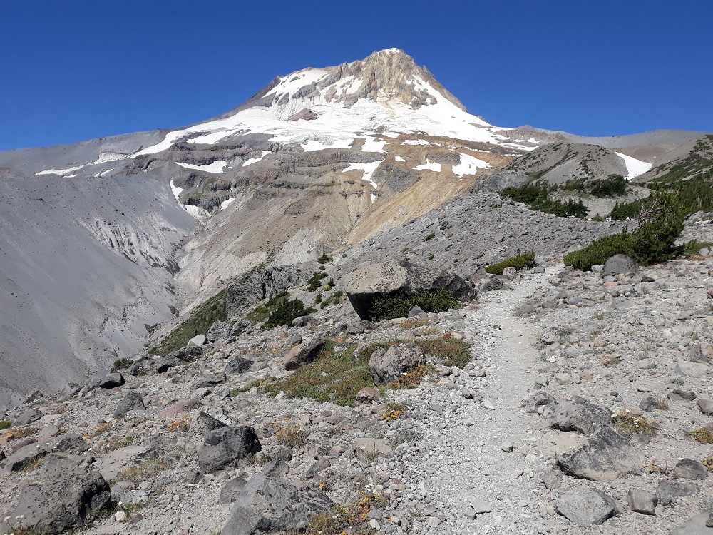
It was definitely hazy, but the north side is always pretty
Image

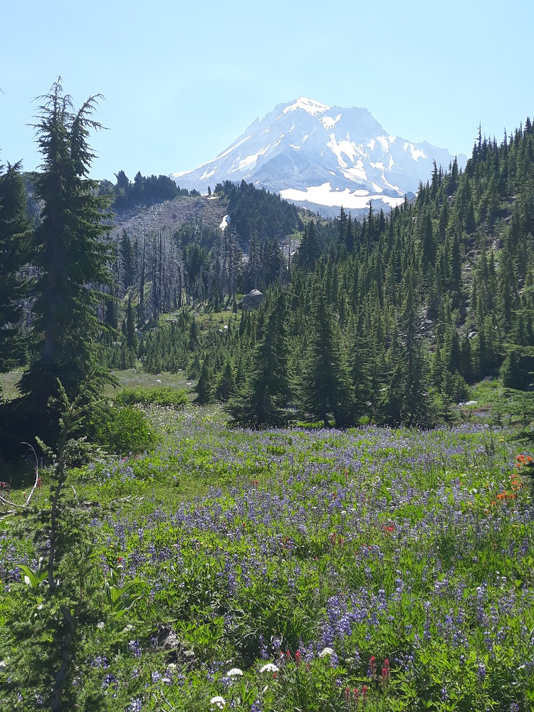
Mid-morning break spot in Paradise Park
Image

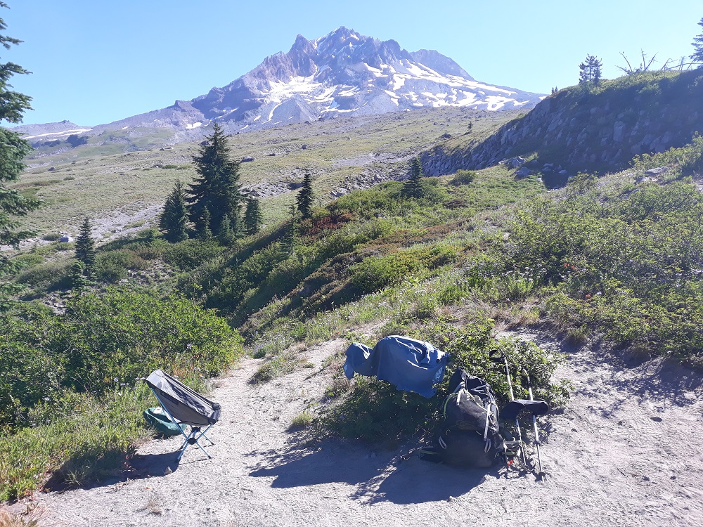
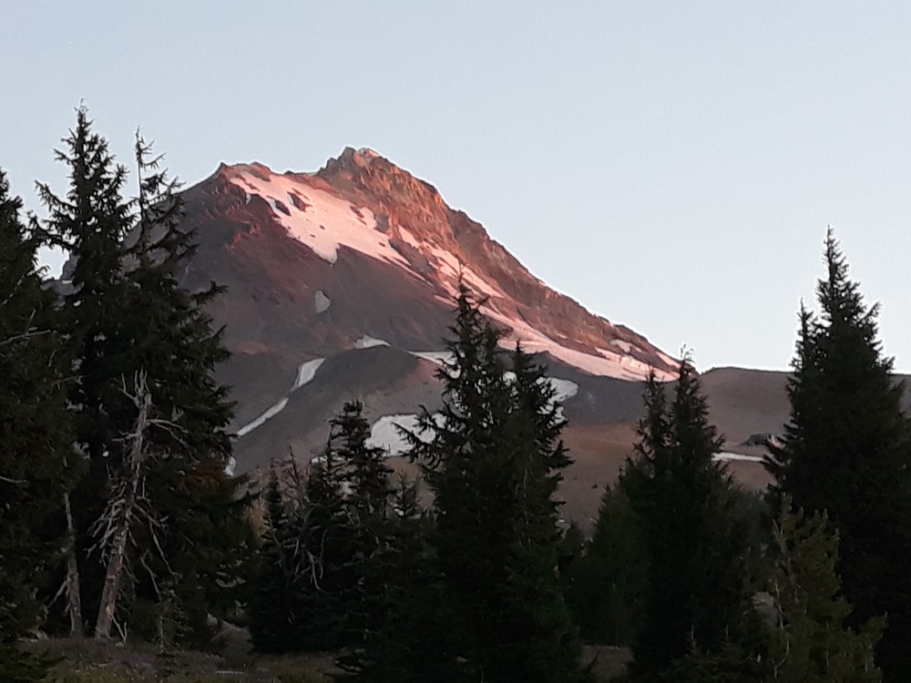
First light from my camp in Mt Hood Meadows
Image

High on Gnarl Ridge, one of the great alpine hikes, and it was windy enough to beat the heat
Image

User avatar
texasbb
Posts: 1175
Joined: July 26th, 2008, 8:16 pm
Location: Tri-Cities, WA

Re: The Timberline Loop Contrarian

Post by texasbb » August 16th, 2020, 11:54 am

The one time I planned a solo of Timberline I planned it pretty much the way you did. Work stepped in and I didn't get to do it, but I liked the Cloud Cap start, especially for someone who lives on this side of the mtn.

The one time I tried Timberline, one of my group blew out a knee and we bailed out after one night, but that time we were sheeple and started out CW from the Lodge.

I like your reasons.

User avatar
adamschneider
Posts: 3716
Joined: May 28th, 2008, 10:02 pm
Location: SE Portland
Contact:

Re: The Timberline Loop Contrarian

Post by adamschneider » August 16th, 2020, 12:10 pm

I didn't know there was that much of a "consensus" about doing it clockwise... although I guess it makes sense if the trailhead is Timberline Lodge, because that climb out of Zigzag Canyon is annoying even on a Paradise Park day hike.

From Cloud Cap, though, either way seems equally sensible to me.

User avatar
drm
Posts: 6152
Joined: May 28th, 2008, 10:03 pm
Location: The Dalles, OR
Contact:

Re: The Timberline Loop Contrarian

Post by drm » August 16th, 2020, 12:51 pm

I have no problem with a Timberline Lodge start, I did it from there last time, and would probably prefer it if I was doing a four day route. And that drive to Cloud Cap really is a pain, would be nice to avoid.

From what I've read, people like CW in order to avoid climbing from the Sandy up. But it is one of the best graded and shaded uphills and a great footbed the whole way. OTOH, the climb from the White River crossing to Timberline is almost as much EG and the footbed is terrible and it is mostly in the sun. And it's at the very end if starting at Timberline.

Maybe some people just like to suffer. :lol:

User avatar
TwoPaw
Posts: 113
Joined: July 28th, 2013, 10:30 am
Location: Portland

Re: The Timberline Loop Contrarian

Post by TwoPaw » August 16th, 2020, 3:20 pm

You know, why not take it further and make your own CCW clock and be contrarian 24/7 at home! Just print out your own custom clock face to paste over the one you have, and reverse the poles on the motor.

Your routing makes sense to me except maybe that drive up to Cloud Cap - the road wasn't all that bad when I drove it a couple years ago. Has it gotten worse?

Any estimate of how many folks are circling Hood CW based on your experience?

Since I've dayhiked Mt. Hood to death I doubt I'll ever go around in one go. But if I did: CW or CCW? Might take awhile to resolve that one.

User avatar
drm
Posts: 6152
Joined: May 28th, 2008, 10:03 pm
Location: The Dalles, OR
Contact:

Re: The Timberline Loop Contrarian

Post by drm » August 16th, 2020, 6:20 pm

TwoPaw wrote:
August 16th, 2020, 3:20 pm
You know, why not take it further and make your own CCW clock and be contrarian 24/7 at home! Just print out your own custom clock face to paste over the one you have, and reverse the poles on the motor.
That's a great idea! My own custom printed clock face would of course have to be Mt Hood taken from above. Has anybody ever seen a photo of Hood from straight above? Oh, I guess Google maps has that, but it really isn't recognizable.

User avatar
ghsmith76
Posts: 137
Joined: May 2nd, 2011, 1:32 pm
Location: Grand Junction, CO
Contact:

Re: The Timberline Loop Contrarian

Post by ghsmith76 » August 17th, 2020, 11:09 am

I have wanted to a CCW route as well, however, I always seem to have a friend I want to make sure gets the ultimate Paradise Park experience which works out well for an afternoon start from Timberline.
GHSMITH76
Blog:AdventureContinues.org

User avatar
drm
Posts: 6152
Joined: May 28th, 2008, 10:03 pm
Location: The Dalles, OR
Contact:

Re: The Timberline Loop Contrarian

Post by drm » August 17th, 2020, 12:00 pm

ghsmith76 wrote:
August 17th, 2020, 11:09 am
I have wanted to a CCW route as well, however, I always seem to have a friend I want to make sure gets the ultimate Paradise Park experience which works out well for an afternoon start from Timberline.
Yes, if you want to camp in Paradise Park, CW works better. But that means going up both big sandy and loose hills - not just White River south side, but the hill above Cloud Cap too. CCW means you go down both.

I got my full trip report up: http://static.deanmyerson.org/mt-hood-t ... -2020.html

smithsummit
Posts: 55
Joined: July 14th, 2020, 1:42 pm

Re: The Timberline Loop Contrarian

Post by smithsummit » August 17th, 2020, 1:33 pm

I'm a big fan of counter-clockwise for the Timberline Trail. For me, the whole section (23 miles-ish) from Gnarl Ridge to Ramona Falls is best done CCW. As another person pointed out... the climb from Sandy River to the Paradise Park trail is pretty well shaded, steady (but not too steep), and the tread is excellent. My last time doing the entire trail was an "in a day" effort in July 2019 and I would not have wanted to do Meadows to Timberline in the late afternoon heat.

Cheers,

Rob

User avatar
drm
Posts: 6152
Joined: May 28th, 2008, 10:03 pm
Location: The Dalles, OR
Contact:

Re: The Timberline Loop Contrarian

Post by drm » August 17th, 2020, 2:34 pm

I should mention that there was not a single down tree across the trail on the north side of the mountain - between Gnarl Ridge and the cutoff near Bald Mtn. Not a single one. Once you get on the Muddy Fork side of the cutoff and through Paradise Park, there are occasional trees, but not too many and none tough to get around. Bugs were almost non-existent too, not completely, but almost.

Post Reply