Olympic NP - Dosewallips
Posted: July 24th, 2020, 6:22 am
I visited Olympic National Park - Dosewallips River main stem for five days and four nights in July 17-21. It was cloudy the first day and sunny after that, getting warmer every day. This is on the (relatively) dry east side of the park. I went up the main fork of the Dosewallips, not the west fork. Dosewallips is pronounced "doseywallpis."
The road in to the trailhead used to go almost 20 miles to a car campground. But a flood in 2003 washed the road out and now you have to walk 6.5 miles on the old gravel road, sometimes a single track, to get to the old trailhead. Here is an old road sign two miles in.

Lots of nice creeks going in

These long valleys in the Olympics require walking many miles in the forest before you get views. If you find that boring, you should go elsewhere. After getting on the regular trail, there was miles of this

And miles of this; walking where you can stretch your legs and keep your pace, whatever that is.

I camped in the forest at Deception Creek after 14 miles. On day 2, it starts to open up and that means lots of wildflowers


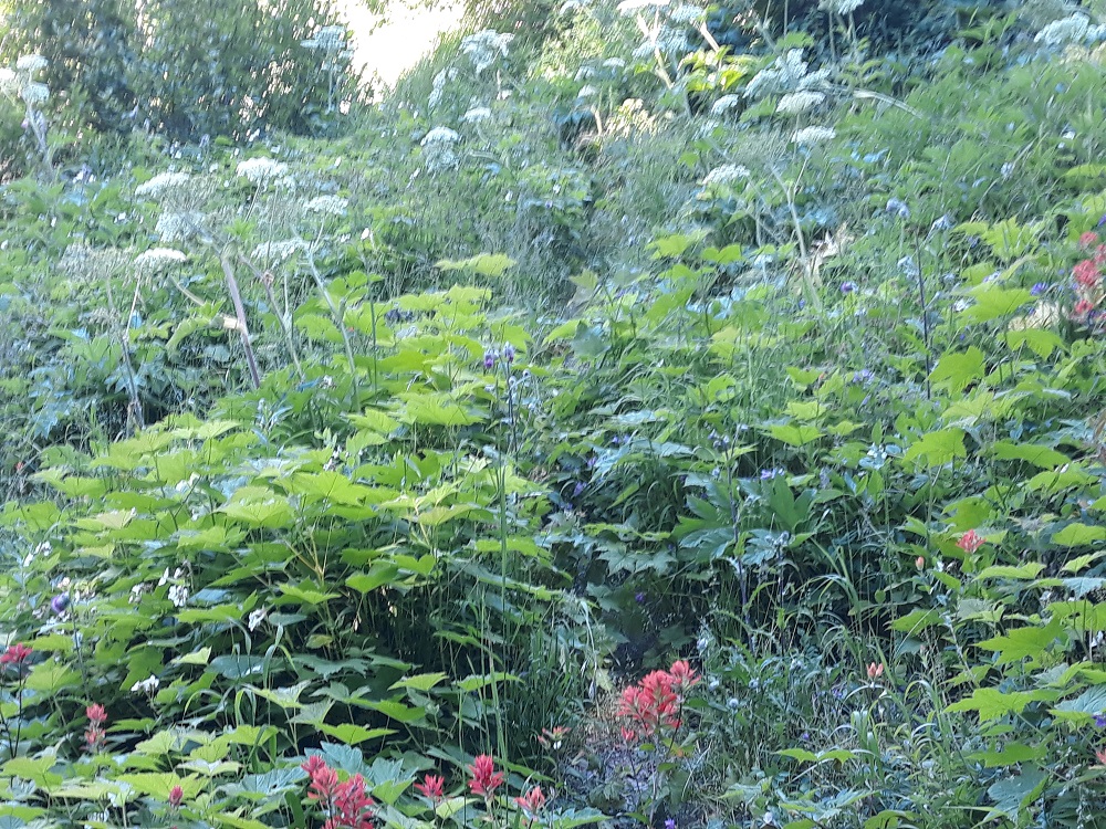
But unfortunately also very brushy sections of trail like these. The trail is well worn under all this, but the ground is not even, so you must go very slow to keep from tripping. Very tedious.

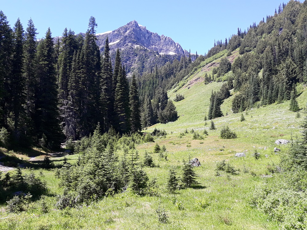
You also start getting some views

Various kinds of bridges, this over Butler Creek

This is Dose Meadows (pronounced Dosey), where I camped for night 2, with Mt. Claywood above. Camp was at the edge of the trees to the left, about 4500' elevation.
After setting up camp and relaxing a bit, I left for an afternoon hike up to Hayden Pass (~5700+), with more views

Lots of avalanche lilies

Approaching the pass


One of the small sections of snow left, with deep footsteps

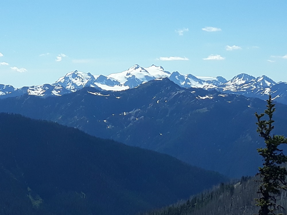
From the pass, I scampered up this knob for the best views

Looking south

Looking back at the Dosewallips Valley

Looking due west at Mt. Olympus
Walking back to camp through meadows

The Dosewallips River behind camp

The next day: even the east side of the Olympics has huge trees. Note the trekking pole for scale

After a failed attempt to hike up to Gray Wolf Pass due to too many trees down on the trail, I backtracked to Bear Camp for the night, with this view
The next day it was 10 miles back out to Dose Forks camp. In the evening I took a short stroll on the West Fork trail to the high bridge

Looking down in the gorge below

And on the final day out on the old road, funny they don't get rid of these signs of old

Here is the washout that closed the road. There is another trail above it all if water is too high.

Next to the road there is a cut log

Here is a closeup of that marker in the middle: the tree was born in 1570! The other marker said died in 2020

The road in to the trailhead used to go almost 20 miles to a car campground. But a flood in 2003 washed the road out and now you have to walk 6.5 miles on the old gravel road, sometimes a single track, to get to the old trailhead. Here is an old road sign two miles in.
Lots of nice creeks going in
These long valleys in the Olympics require walking many miles in the forest before you get views. If you find that boring, you should go elsewhere. After getting on the regular trail, there was miles of this
And miles of this; walking where you can stretch your legs and keep your pace, whatever that is.
I camped in the forest at Deception Creek after 14 miles. On day 2, it starts to open up and that means lots of wildflowers
But unfortunately also very brushy sections of trail like these. The trail is well worn under all this, but the ground is not even, so you must go very slow to keep from tripping. Very tedious.
You also start getting some views
Various kinds of bridges, this over Butler Creek
This is Dose Meadows (pronounced Dosey), where I camped for night 2, with Mt. Claywood above. Camp was at the edge of the trees to the left, about 4500' elevation.
After setting up camp and relaxing a bit, I left for an afternoon hike up to Hayden Pass (~5700+), with more views
Lots of avalanche lilies
Approaching the pass
One of the small sections of snow left, with deep footsteps
From the pass, I scampered up this knob for the best views
Looking south
Looking back at the Dosewallips Valley
Looking due west at Mt. Olympus
Walking back to camp through meadows
The Dosewallips River behind camp
The next day: even the east side of the Olympics has huge trees. Note the trekking pole for scale
After a failed attempt to hike up to Gray Wolf Pass due to too many trees down on the trail, I backtracked to Bear Camp for the night, with this view
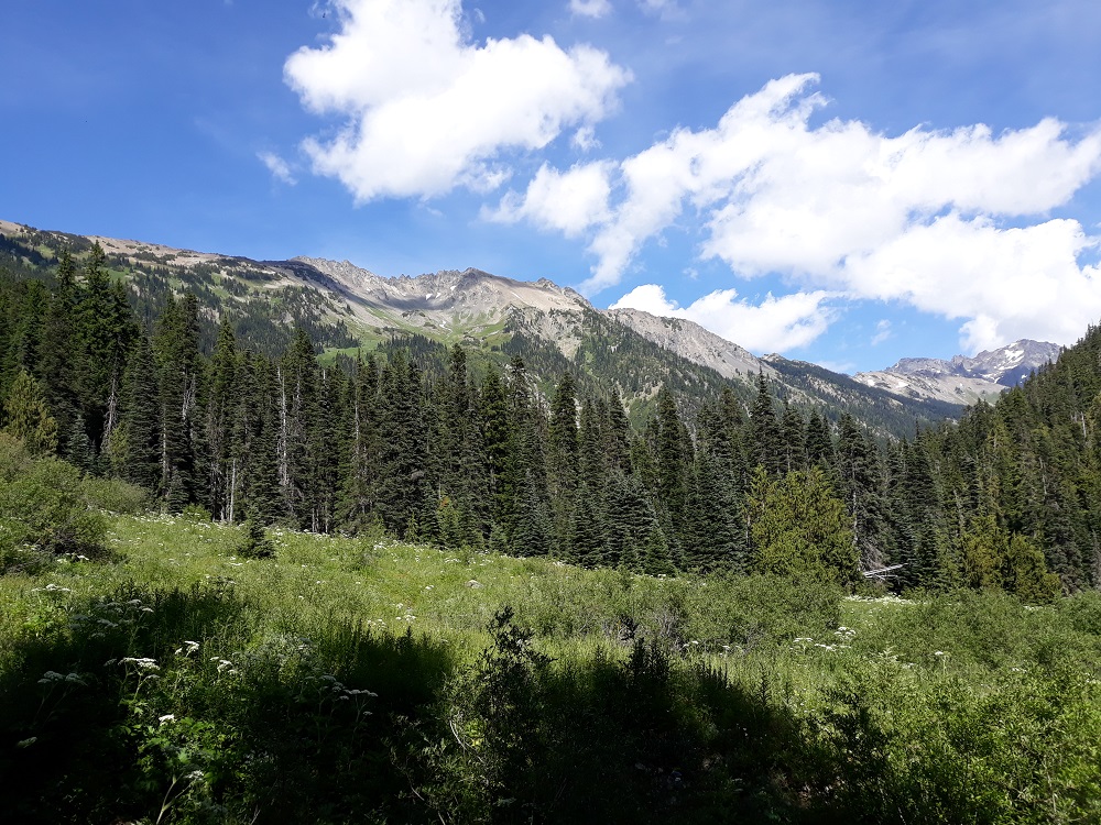
The next day it was 10 miles back out to Dose Forks camp. In the evening I took a short stroll on the West Fork trail to the high bridge
Looking down in the gorge below
And on the final day out on the old road, funny they don't get rid of these signs of old
Here is the washout that closed the road. There is another trail above it all if water is too high.
Next to the road there is a cut log
Here is a closeup of that marker in the middle: the tree was born in 1570! The other marker said died in 2020