2020-07-11 Saturday
After crossing Siskiyou Pass on Highway 199, the climate changed
and the vegetation became much more lush. I felt excited because of
this natural beauty, and the scenery only got better on Knopke Creek
Road. The road is rugged and passes through steep terrain. It is
surprisingly narrow in places. I drove much of the road at 10 MPH and
arrived at the Sanger Peak trailhead much later than anticipated.
There are no signs at Sanger Peak but the parking area, peak, and
trail are clearly visible. The trail was surprisingly nice. From
the trailhead and the first section of the trail i had a very clear
view of the Pacific Ocean. Due to the proximity of the ocean and the
elevation of the peak, the ocean had a disconcerting effect of
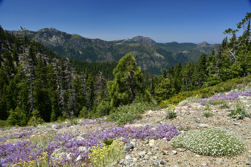
looming over the mountains in the west. I saw red, yellow, and blue
wildflowers, mostly succulents. I saw a thick, iron telegraph wire
run down from the peak.
Near the top, the trail hugs the top edge of a 800' drop facing
north. I felt uncomfortable at a washout in the trail and turned back
before reaching the summit.
Later, back in the parking lot, other hikers told me there used to be
a lookout on the peak, and the wire that i saw was for
communications. They said that they were part of a volunteer crew in
the 1970's, and they cleaned up after the removal of the lookout on
Mt. McLoughlin. They said that if you look down from the top of
Sanger Peak you can see a bunch wood and broken glass. It looks as
though someone just pushed the lookout over the edge.
I hid my bike behind some rock outcroppings for my return trip.
There were two vehicles camped at the Sanger Peak parking lot. There
were four vehicles parked at Sanger Lake with hyper-patriotic flags
and vanity plates. There were about 30 vehicles parked at the
Young's Valley trailhead. I was shocked to see so many vehicles.
They overflowed the parking area and lined the road. I almost
decided to turn around and go somewhere else instead of doing the
hike that i planned.
For some reason my smart watch failed to charge on the drive in. I
must have plugged it in wrong. The battery is nearly depleted, so i
left the watch behind. Instead i took a digital pedometer. It has a
lithium ion "coin" battery and is rated to last for a year.
Rather than sleep in my van at the trailhead as originally planned, i
chose to hike part way in.
I passed half a dozen parties hiking out. I asked a father and son
pair about Raspberry Lake. They told me it was crowded but there
were two camp sites free. I decided to stay the first night
somewhere else.
I stopped at Craker Meadows, explored the place, took photos, found a
nice campsite, and decided to set up camp there. I tied my food up
in a tree and pitched the tent.
I found an enchanting flat patch of grass surrounded by cedars, in
turn surrounded by standing water, which was surrounded by meadow.
There i took my boots and socks off, sprayed on bug repellent,
relaxed, and thoroughly enjoyed myself. I heard bass frogs croaking,
owls hooting, and wind blowing through cedars, firs, and pines. I
meditated in this spot. I returned to camp to write in my journal.
I explored more of Craker Meadows and found 4 fence posts with bits
of barbed wire hanging on them. Perhaps they are remnants of a
makeshift corral. I don't know.
Back at camp i picked up a palm-sized, spherical wood burl as a
souvenir.
Around 8 PM i watched the sun set and felt the temperature drop 10
degrees pretty quickly. I had the area all to myself. I heard a
loud, high cry of a bird that i do not recognize. The frogs, owls,
and wind are eerily quiet. As it became dark and the temperature
continued to drop, i felt like heading to bed.
2020-07-12 Sunday
Last night it was colder than i expected. My weather forecast
projected lows at 55F for my whole hike. Consequently, i only
brought my wool sweater and emergency rain poncho. That forecast
must have been for a lower elevation. My sleeping bag is rated for
30F but i think it has lost much loft in the last 16 years. Now i
plan to leave my gear behind and walk 1 mile back to the van to fetch
my coat.
The walk to the van warmed me right up. I saw blackberry,
strawberry, and thimbleberry blossoms. I saw green "black caps" and
currants. I counted 23 vehicles at the trailhead. I refilled my
water bottles and got my coat.
1/4 mile from Craker Meadow i found a briskly flowing creek. I drank
both of my water bottles and refilled them.
To my surprise, there is a sign at the Black Butte Trail junction.
Somewhere i read that this junction is easy to miss, and i expected
to have to mark it. Not so!
Young's Valley is quite beautiful. I expected to follow the road
grade all the way to the chrome mine. There are many more trail
junctions than shown on the map or mentioned in trail descriptions.
They are marked with wooden posts tied with green ribbons.
Consequently i became confused and turned right at a Y junction where
both directions were road grades.
Due to this wrong turn i "explored" Young's Valley. There is a
standing log bridge that was once driven over. The creek was full of
water. At the end of Young's Valley there are many nice camp sites.
I saw 20 to 30 tents set up there. This is a popular camping spot!
It must be why so many people are parked at the trailhead.
Once i realized that i had taken a wrong turn, i back-tracked to the
Y junction and went left instead.
Just past the Twin Valley trailhead is an impressive piece of road
engineering. It was a culvert constructed from boulders and old
growth logs, covered with rocks and dirt, making it possible to drive
over Clear Creek. At this location there are camp sites on both
sides of Clear Creek with obvious parking spots. Interesting to
think that people used to drive here to camp!
Bell Echo camp is located at the bottom of a cliff face and there are
large boulders strewn about. I would not want to camp there. I
found an eyeglasses repair kit and put it in my pocket. There were
many insects so i moved on.
Shortly past Bell Echo camp was another briskly flowing creek.
In a large burn area before the chrome mine, there was not much shade
but plenty of wildflowers.
From the trail i saw ruins from the Cyclone Gap Mine. I was only
able to find scant information about this mine online. See excerpts
below [1].
Past the chrome mine the trail became much more steep and narrow. I
was cautious about my footing because it was steep terrain, i was
going downhill, my legs were fatigued, the trail itself was steep, and
it had loose gravel in places.
About 1/4 mile before Raspberry Lake there were two stream crossings
near each other. The first was only a trickle. The second, closer
to the lake, is more appropriate for filtering drinking water.
I felt relieved to finally reach Raspberry Lake. When i arrived, i
had one neighbor. It was not crowded at all.
I pitched my tent, started some "sun tea" chai brewing, and went for
a swim in the lake. It was warmer than i expected but cool enough to
be thoroughly refreshing. I found 44 cents in loose change on the
ground where i pitched my tent. I hung my shorts and towel to dry
and did a little exploring. Crossing to the west side of the lake
drainage creek, i found a burn area with no real trails to speak of.
It is steep terrain all over. There are a couple of camp sites in
this area.
My right shoulder is sore and my legs are fatigued. I normally do
more conditioning and practice hikes before tackling one of this
difficulty.
I put away my towel and hung my my shorts on a nail to finish drying.
I hoped that a breeze might help dry out my shorts.
I hung up my food. I donned a bug net and wrote in my journal while
sitting on a boulder. I meditated on this boulder.
I explored the east side of the lake and discovered that my neighbor
has left. Now i have Raspberry Lake all to myself! I sat on the
high rocks in the warmth of the evening sun and enjoyed some peace
and quiet.
2020-07-13 Monday
1:50 AM: It is much warmer than last night. I am not sleeping well
because of noise from a wind storm. The weather forecast did not
call for a wind storm. My guess is that Copper Mountain is "scooping
down" higher velocity wind from a higher altitude. I woke in the
middle of the night and massaged sore leg muscles. While i was doing
that, i heard a large tree fall over near camp. It sounded like
thunder. Scary! The sound came from the burn area across the lake
drainage creek.
I managed to fall back asleep. At 5:30 AM i woke and the wind storm
is still flapping the tent around. I hope it doesn't interfere with
my steep hike out. The wind is blowing to the north, so at least it
will be at my back. I feel grateful to have my coat to block out the
wind chill in the morning.
I had to anchor the tent with rocks to keep it from blowing away
while i folded it. The tent footprint was especially tedious.
The wind kept me cool as i climbed out from Raspberry Lake. I
stopped at the creek on the trail to refill my water bottles. I
explored the Cyclone Gap chrome mine ruins, but did not feel like
scrambling down to inspect them more closely. I stopped at Young's
Valley to drink water and eat a snack of vegetable chips.
The Black Butte Tie trailhead is on a wide road grade. About 100
yards in, a fork to the right heads straight up a hill. This is not
on my map, so i stayed on the road grade to the left.
The first "river crossing" was dry. Just past this crossing there is
a fork in the trail, as shown on the parking lot map, but missing
from my map. To my surprise the sign points left for "E Fork". My
map shows the junction of the East Fork Illinois River trail #1274
going from the base of Polar Bear Mountain to the Sanger Canyon trail.
However, i found the junction and sign at the base of Bear Cub
Mountain, an entirely different location than i had expected!
I took a risk and followed the sign to the left, even though that was
not my original plan and this trail is missing from my map. I
thought perhaps i would see another juncture heading east, for the
trail i originally planned to take from Polar Bear Mountain. I kept
an eye out for it, but never found it.
After returning from the trip, i followed up and found that i had a
2016 version of the Polar Bear Mountain USFS quad, which shows the
trail in the wrong place. The most recent USFS quad shows the trail
in the right place.
I saw many old growth cedar trees, setting a somber mood. The trail
is absolutely beautiful and some kind soul placed cairns to help
guide hikers through tricky spots.
I saw coyote poop on the trail, and it was furry. I saw bear poop on
the trail and looked grassy, or perhaps some other plant like onions?
At some point i crossed over to a different climate zone and
everything looked more dry. The berries were more ripe in this area.
My first river crossing was at 12:30 PM. I drank all my remaining
water and refilled my bottles. I dipped my feet in the river and was
back on the trail by 1 PM.
There was a lot of windfall on the trail, and the trail criss-crossed
the river many times. I really enjoyed the wildness of this trail,
but it wore me out and i hiked way slower than usual. It felt like
an adventure taking a risk on a trail not shown on the map, but i
felt reassured by the sign and by the fact that the trail stuck
pretty close the the river. I figured in the worst case scenario, i
could camp, and then back-track the next day. Or, i could continue
onward through the whole trail and ask friends in Takilma to drive me
back to my van.
At 2 PM i found an unmarked juncture going to a camp site next to a
river crossing. On a lark i turned on my phone GPS and it worked! I
had confirmation that i was at Sanger Creek, where i originally
planned to camp tonight. I felt relieved to know where i was again.
I scouted out a place to hang my food. I pitched my tent. I found a
dried ginger root on the ground and tossed it in the fire ring. It is
fun to speculate what it could have been intended for: Chinese
cooking from scratch, a digestive herbal tea, or perhaps brought by
mistake.
I changed into my shorts, waded in the river, and relaxed in the
shade for a while. I saw a huge salamander about a foot long with
gills frilled out underwater. I believe it was a neotenic coastal
giant salamander, similar to the one shown in the photos below [2].
It acted completely unafraid of me. I felt as though i had
encountered a rare being.
There is an azalea bush between my tent and the river. When the
breeze blows the right way, the wonderful scent drifts my direction.
There is a huge California Sister butterfly resting on my boot. I
saw two more flying in the distance. The butterfly danced all over
my boots, and then went down into them! I think it is "puddling"
minerals from my sweat.
I refilled my water and started a bottle of chai for tomorrow's
breakfast. I hung my food and reviewed my notes for tomorrow's hike.
I feel less fatigued than last night. My right shoulder is a little
swollen from bearing too much weight while navigating rugged terrain.
Tomorrow i should tighten my backpack hip belt.
I sang for a while. Then the mosquitoes came out and i headed into
my tent.
2020-07-14 Tuesday
I slept well last night. In the middle of the night i had a clear
view of the milky way. The moon was not visible from my location. I
had vivid dreams. It got colder last night and i was grateful to
have my coat with me.
I refilled my water bottles, packed my tent, and got ready to hike.
I spotted a sign on the other side of the river. I will have to
cross the river before i can read it.
I put my phone and backup battery in a ziploc bag. I put on my back
pack and crossed the river bare foot in my shorts. I was glad to
have my hiking stick. Then i went back and brought my boots and
pants across. I dried my feet with a towel. I put duct tape on the
hot spots. I put on two pairs of socks to help protect my feet.
Then i set off.
By the way, the sign on the other side simply said "Trail". Helpful!
From the name Sanger Canyon, on the eastern exposure, i expected it
to be dry, hot, and sunny. While Sanger Creek does flow through a
canyon, that canyon is located in the bottom of what appears to be a
small glacial valley. So the trail goes through a relatively broad,
flat area. Many old growth cedar trees live in this valley, giving
it a cool, somber mood comparable to the redwoods. There are many
tributaries flowing into Sanger Creek, making the hike more lush and
wet than i expected. I could probably spend a week in Sanger Canyon
just immersing myself in nature. But then it would be painful to
return to "ordinary" life.
I saw bear poop along the trail. It contained berry seeds and what
looked like cherry pits. I saw many overturned stones along every
trail i hiked, except for the steep, rocky parts around Cyclone Mine
and Raspberry Lake. My theory is that bears turned these stones over
looking for insects to eat.
At the end of Sanger Canyon is the top half of a large USFS
Wilderness sign. The bottom half is gone. At this point, the map
shows a road, but this road grade is far too rough to drive on. It
makes for a nice trail.
The second creek crossing has a collapsed bridge constructed from
old-growth cedar logs, iron cable, and railroad spikes. Hikers have
beaten a foot path down to the creek and back up. There are a few
logs still in place, but they do not look trustworthy to cross on
foot. It is something to imagine that trucks used to carry loads of
logs across that bridge.
The third creek crossing was a briskly flowing creek. I refilled my
water bottles at this creek.
Just past the creek was a small, artificial pond bed, presumably for
fighting forest fires. There is a 2 or 3 inch black PVC pipe run
partially underground from the creek to the pond. No water is flowing
through it and the pond is dry.
I explored Whisky Lake. On my way out i encountered a SUV loaded
with 6-8 elderly women. They stopped and were getting out of the
vehicle. I briefly chatted with the driver. Her presence gave me an
earthy, hippy feel. She asked whether there were any other vehicles
already parked at the lake, and i answered no. She told me that they
planned to eat lunch there. I felt a little overwhelmed by all of
their activity. I wished them an enjoyable lunch and i got back on
the road.
At the intersection to Camp Chicago there is a marker of old tires
and other trash. The road grade down to Camp Chicago looks overgrown
with fir seedlings. Another vehicle passed me near here.
At the next intersection, there was a small camper vehicle, plus an
SUV running idle with the parking lights on. It continued to run idle
as i passed and started hiking up toward Sanger Peak.
This road up to Sanger Peak is extremely rough. I saw several spots
where people got stuck and dug their tires into the earth. I saw
another old-school wooden culvert. This was a steep climb with very
little shade. I had excellent views of Illinois Valley and had a
little phone reception. I responded to a text message from a family
member who asked whether i was home yet.
At 12:43 PM i reached the Sanger Peak trailhead. I sat on a large
stone in the shade of a dwarf tree and i drank a bottle of water to
rest. My bike was still there.
I rode my bike carefully to maintain control. It is steep terrain
and i did not want to go over the edge.
I saw an ambulance at Sanger Lake with a stretcher on one side. Out
of curiosity, i biked up to it and found a man working intently on
something with his hands. I said hi but he did not respond. So i
spoke more loudly and said hi again. He was so startled that he
dropped what he was doing and nearly jumped up. He said that from
his perspective, it felt as though i had magically materialized out
of nowhere. I asked whether he was part of a search and rescue
operation. He said no, and explained that he had bought the
ambulance a couple of weeks ago and planned to convert it into a
camper. He introduced himself and said that he enjoys extreme sports
including rock climbing and kayaking. The ambulance has 4WD and high
suspension. He explained that they are built to be "bomb proof", a
rock climbing term for fail-proof. For example, it is constructed
with the latest technology and a steel cage so it can roll around
without damaging the vehicle. He said this is motivated by
litigation. If something happens to prevent a patient from getting
urgently needed medical care, then they will sue the paramedic, the
driver, and everyone up the chain all the way to the vehicle
manufacturer. I think he said that his was a Ford ambulance
manufactured in Pennsylvania.
I returned to the van, loaded the bike, drove back to Sanger Peak,
loaded the pack, and then drove home.
Click the Google Photos link below [3] for more photos.
By the way, you can find excellent photos of this area just prior to
the Natchez wildfire in the blog post below [4].
[1] Cyclone Gap Mine information
Ruth Robertson worked the Cyclone Gap mine, leading California
producer of chromite in quantity and value in 1952; 2,289 tons of
lump ore averaging 49.6 percent Cr2O3 was consigned to the
Grants Pass, Oreg., Depot
From:
http://digicoll.library.wisc.edu/cgi-bi ... isize=text
Mr Robertson:
I operate two properties, Cyclone Gap, at a high elevation, where I
am only able to work 5-1/2 months a year.
The other one is on the Illinois River in Oregon, which I work the year round.
Mr. Redwine: But you are the largest single producer in California?
Mr. Robertson: Yes, nearly 10,000 tons out of the Cyclone Gap mine.
Mr. Janssen: ... Mr. Robertson is mining it at 800 feet [deep].
From:
https://books.google.com/books?id=Bsffa ... g=RA1-PA64
[2] neotenic coastal giant salamander
https://www.flickr.com/photos/chadmlane/39622040091
https://www.flickr.com/photos/chadmlane/24753899027
[3] Google Photos link for more photos from my hike
https://photos.app.goo.gl/3FuN3URFfc8mUvzb8
[4] Blog post with photos of this area just prior to the Natchez burn
https://vanmarmot.org/2018/07/10/presto ... -jul-2018/