
As before, I suspect that this post is already a little overlong, but if you’d like even more, expanded entries are already up on my blog.
Thanks for reading!
July 31, 2019: Mica Lake to East Fork Milk Creek
So here’s the thing about crossing the Milk Creek drainage on the PCT: it sucks. At least, I remember it sucking. When I came through a few years ago on the PCT, it was in the middle of a long, hot day, and the overgrown, eroded switchbacks almost killed me. My friend cried at the bottom, I presume at the thought of going back up.
I haven’t been looking forward to it.
So we sleep in and I do some serious procrastinating packing things up, then take too long at breakfast and try to convince Krista it might be a good idea to, like… maybe set up a zip line across?
But eventually the time comes, and we start, reluctantly, down into the canyon.
*
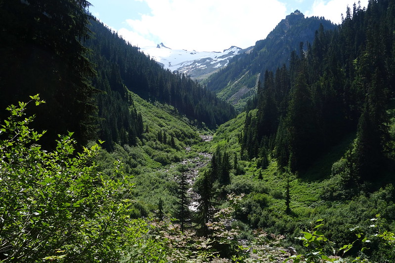
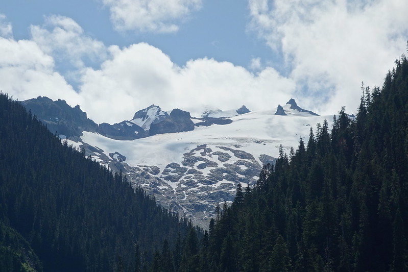
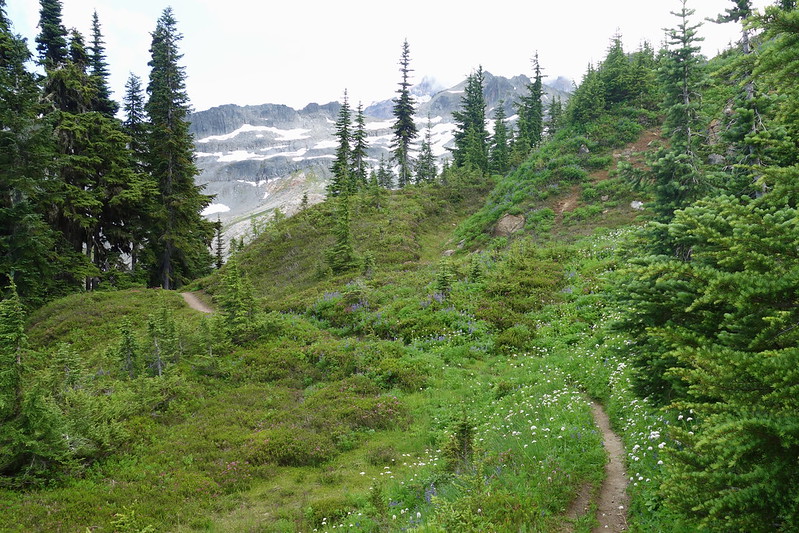
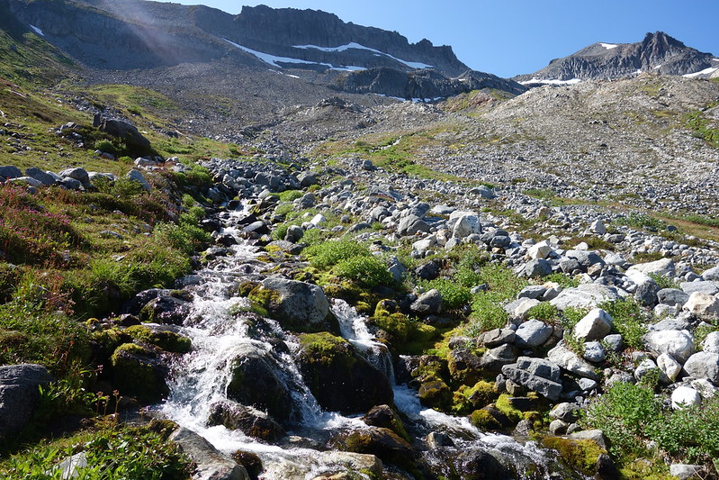
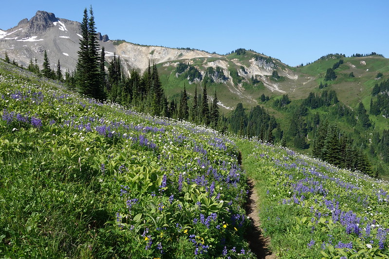
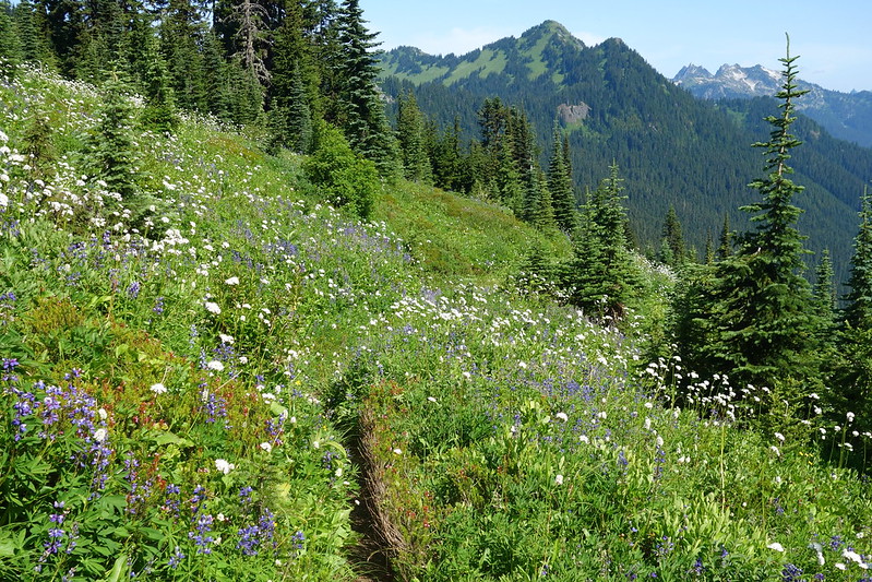
For the first few hundred feet down after leaving Mica Lake, the trail switchbacks gently through open meadows of blooming heather and lupine, crossing small streams and a minor fork of Milk Creek. We stop for water, and a last view of the lumbering old Milk Lake Glacier.

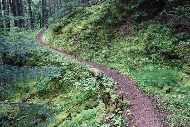
Then it’s steeply down through thick forest. I put Daydream Nation on my headphones and cruise, happy to have someone else here—to have Krista here—to share the ugh.

*
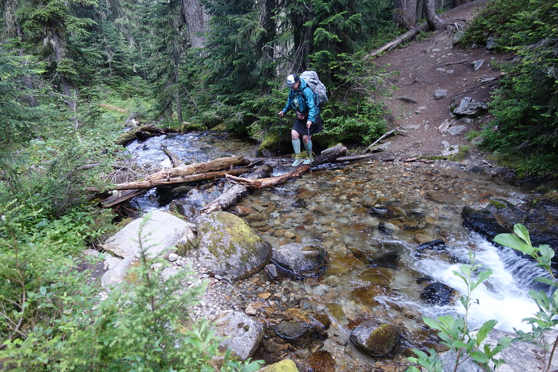
A thousand feet below the lake, the trail leaves the trees to cross an overgrown avalanche track and the outlet streams that flow from the Milk Lake Glacier. It’s hot and muggy but also somehow threatening to rain. We hurry through the track to find shade on the other side, then down another few thousand feet, as the trees give way to willow and the trail finally finds the creek.
We stop for a while at the crossing, eat snacks and watch another glacier—the Ptarmigan this time—lurch at the head of the valley.
Krista looks puzzled. “This has been fine.” I told her it’d be terrible.
*
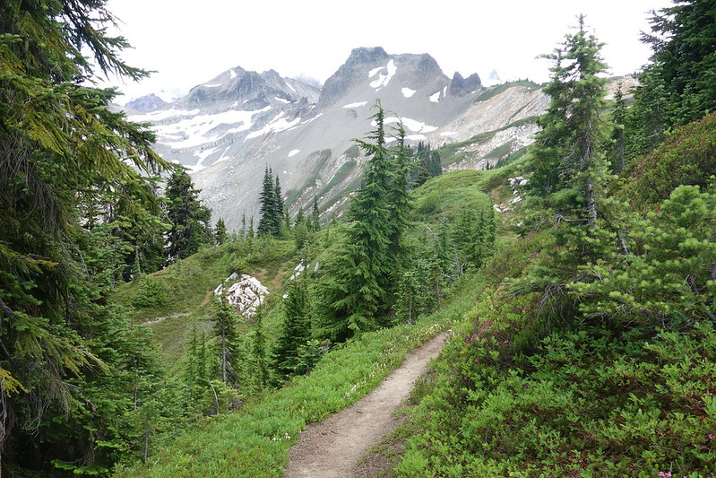
The way up is a bit less fine, at least at first. The way’s rocky and overgrown to the junction with the old, long-abandoned Milk Creek Trail, but then mysteriously things gets better the further we climb. Someone’s straightened out the tread since the last time I was here, and the brush, though bad, is nowhere near the jungle I remember it being.
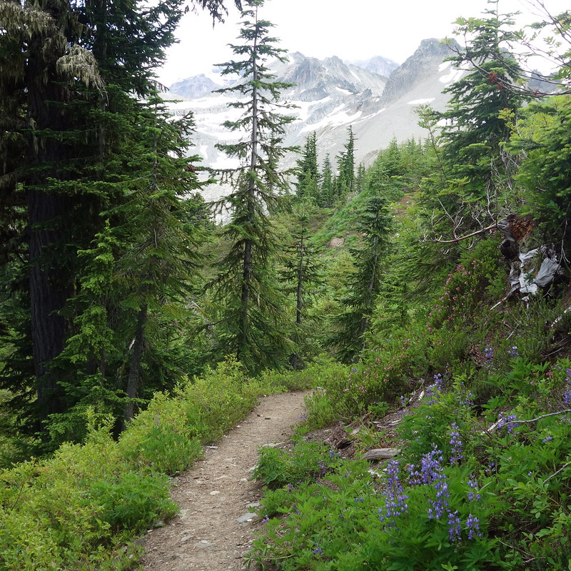
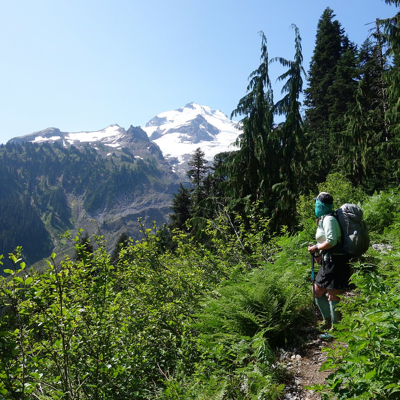
We climb through the early afternoon heat into the cool old forest that clings to the northern slopes of the Milk Creek valley, then through increasingly open meadows to the unnamed pass that separates the main and east forks of Milk Creek.
At the top, I feel as confused as Krista was at the bottom. It just… wasn’t that bad.

*
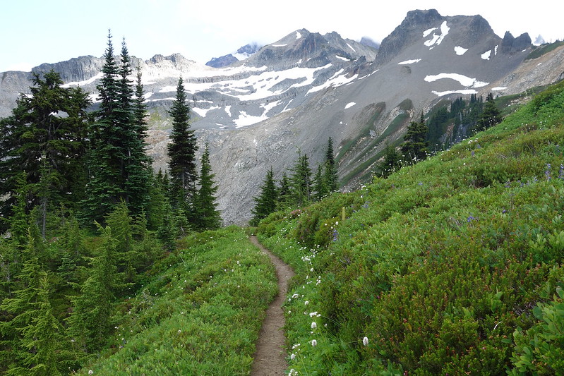
We stop near the pass for lunch, and to think through the rest of the day. We’d been imagining making it another dozen miles, down to the Suiattle River, but neither of us really feel like pushing, and anyway my favorite basin in the world—the East Fork Milk Creek—is just a few miles away. So we decide on another easy afternoon, finish up our leisurely lunch, and start to wander, more ponderously this time, north along the ridge.
As we go, I think about how different this time felt from last. And I wonder what’s changed. Krista’s here, which of course helps, but there’s something more too. Last time I was so concerned with keeping to my schedule. All I really thought about was the campsite at the end of the day. I checked my maps constantly, wondering how many miles I had to go. This time, I didn’t look at my maps once. I just walked.
I don’t know where, but somewhere in the last few years I stopped thinking so much about the end of the day, stopped ceaselessly comparing where I am to where I want to be, and started just walking—sometimes faster, sometimes slower, sometimes with more joy, or less—but just walking, and trying to be content. And weirdly, often succeeding.
*
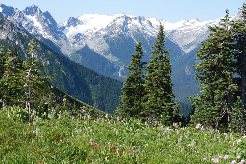
After a few miles we drop into the East Fork Basin, and it’s every bit as beautiful as I remembered. More so, maybe, as this time I get to see the whole thing through Krista’s eyes too.

We set up camp a few hundred feet below the trail, near the confluence of several minor forks of the creek, then watch a surreally slow sunset on Kennedy Peak and the snowy ridges that seem to stretch out in every direction. The clouds clear near last light, and the stars appear. Then the moon, bright enough that we don’t need out headlamps for one last evening stroll—one last bit of beautiful walking, just for walking’s sake.

August 1, 2019: East Fork Milk Creek to Miner’s Creek
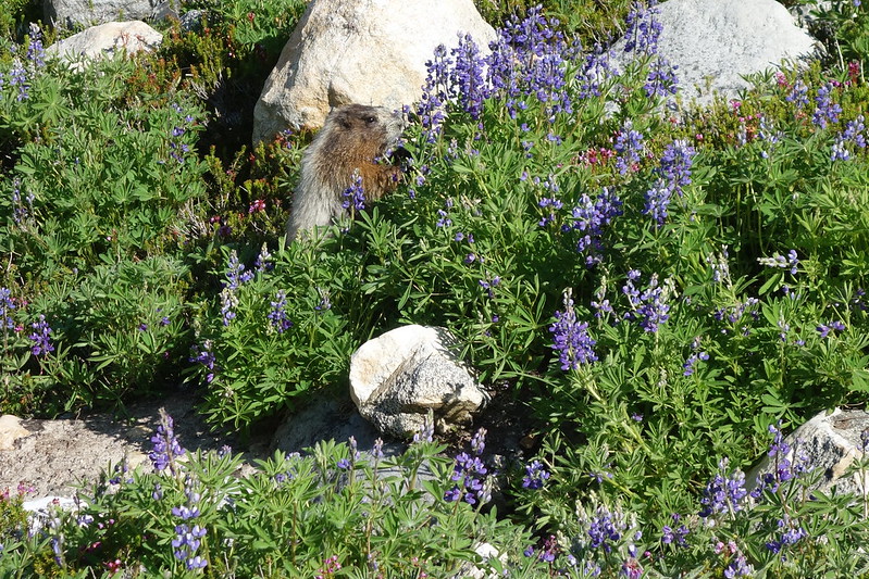
The marmots are up before us, whistling at each other from one side of the basin to the other. I can hear Krista rustling around in her tent, making sounds uncannily like the ones she makes at home when she’s looking for an alarm to turn off.
Then we’re up and walking out of the basin as our noisy neighbors scurry through the blooming lupine, nibbling at the flowers. And pikas too: at least a dozen scurry through the talus above, gathering golden blades of grass for winter.

*
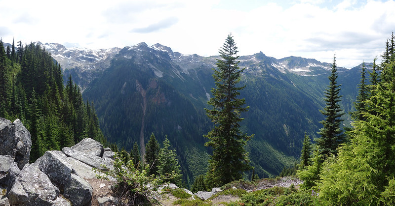
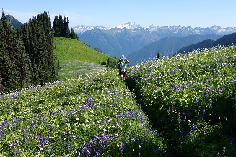
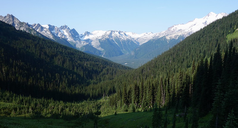
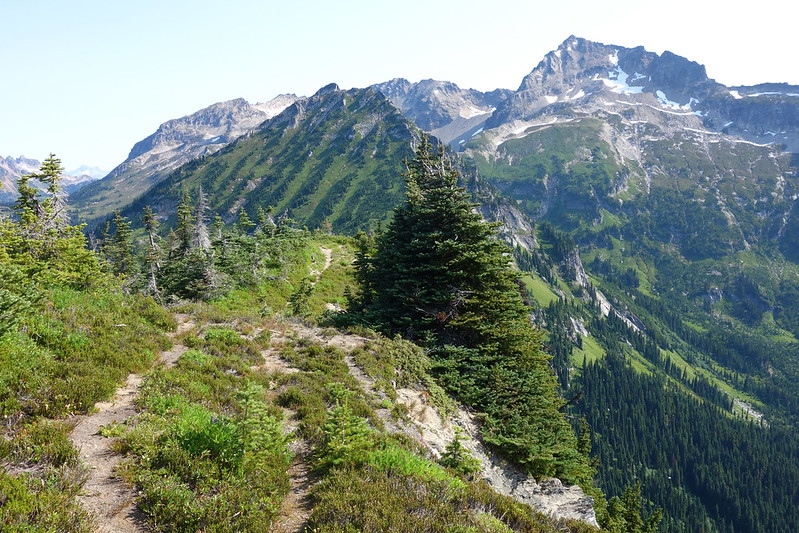
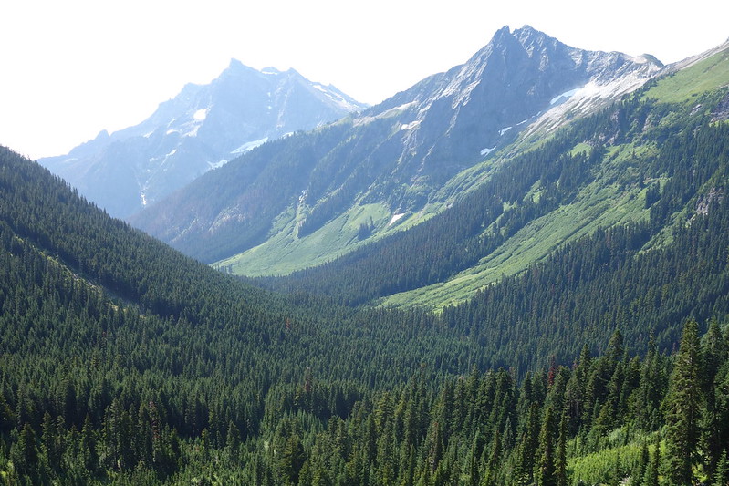
After leaving our basin, the PCT climbs slightly to Grassy Ridge—a long green expanse that stretches north from Glacier Peak all the way down to where Milk Creek flows into the Suiattle River.
The ridge is alive with birds and bees and blooming flowers, every foot full of frantic spring. To the east, the Suiattle’s unthinkably vast valley extends halfway around the mountain, from the south side at Glacier Gap, where I stood several afternoons ago, to the northern floodplains where we’ll sleep tonight.
We each take a hundred pictures.


*
We cross Grassy Ridge too quickly—I imagine that spending anything short of a whole life here would be passing it too quickly—then switchback steeply into an ancient forest of cedar and pine. Once in shade and moss, the trail becomes broad and easy. The miles come quickly, and we walk nearly side-by-side, talking about everything and nothing at once.

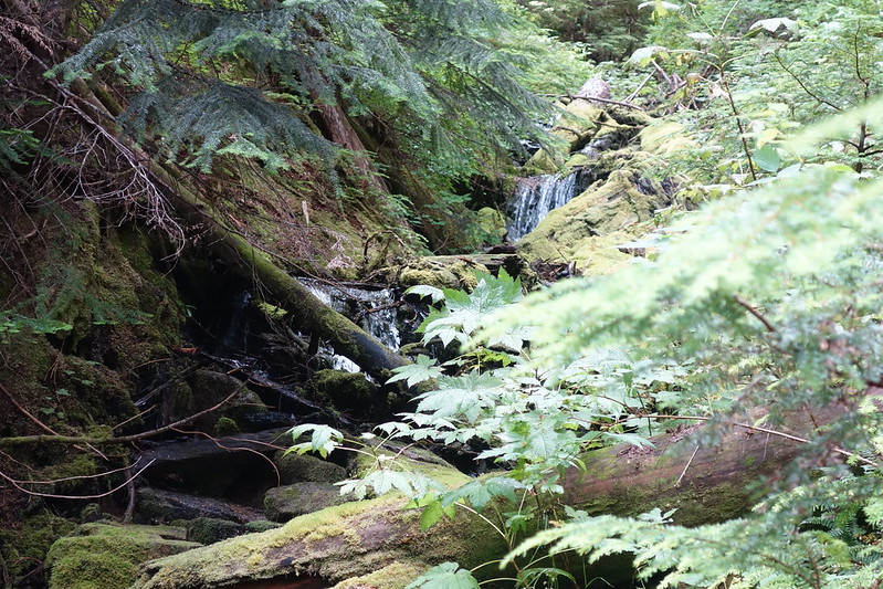
We stop at a small feeder stream above Vista Creek to eat and filter some water. The main waterways here—Vista Creek, and the Suiattle just below—are too full of glacial silt to drink or filter from, so one has to use the smaller streams that tumble down from the ridge every couple miles. We sit happily at our little strip of water for an hour, planning the rest of the day.
The old PCT crossed Vista Creek here, then crossed the Suiattle near its confluence with Dusty Creek. But the old crossing washed out in 2003, in the same spectacular set of floods that broke the bridge over Kennedy Creek, and the trail now follows the old growth valley several miles downstream, to cross at a new, over-built bridge just a few miles up from the end of the Suiattle River Road. Some thru hikers still use the old trail—it’s quite a bit shorter, and sometimes there’s a log to help one across the river—but we elect for the new trail’s old growth and easy miles.
*
The next several hours are enchanted: dappled shade and gentle rolling hills. We stop at every small stream to top off water, and to listen to the valley’s old cedars swaying in the warm gentle breeze.
For the second time today, I wish we could just stop and live here.


*
We reach the new bridge in the late afternoon, cross, then start back up the opposite bank, maybe three miles through the lowering light up to Miner’s Creek.

Here and there, campers are crowded into well-established sites—more people than either of us have seen for a week. A group of Girl Scouts are camped above the trail, surrounded by golden slide alder, singing old folk songs as their dinners soak. A fabulous old man in neon short shorts and a tank top stops to tell me about bushwhacking to the head of this valley when he was my age, about the mile-wide forested flat he found there, surrounded on three sides by creaking glaciers. Fifteen minutes later, three fishermen crowd around a small fire at the edge of the floodplain, passing a handle of cheap whiskey.

*
We reach Miner’s Creek at dusk and find the whole place mysteriously empty. Perfect. We set up our tents and hang our food and collect water for the night, then cook dinner by last light.
Krista drifts to sleep not long after, but I stay out in the gathering dark to watch the stars fight their way through the light evening clouds, and to listen to the sound of Miner’s Creek flowing into the Suiattle.
*
There’s something about a wild river, about the waters that freeze on unseen glaciers miles away, then thaw and flow through abandoned cold canyons and lonely sunny chutes to arrive at us here, at the edge of the wilderness. Then the waters go on, these to the Sauk, then the Skagit, then finally to Skagit Bay, Puget Sound, and the Pacific Ocean, almost 200 river miles from where we’ll sleep tonight to the water’s song. There’s something about hearing a whole world rush by, about Heraclitus and change, how movement marks time. About the new currents that have made crags into canyons, then built new moraines and mountains in their place.
August 2, 2019: Miner’s Creek to Small Creek
I slept last night with the stars, and without my rainfly. But I wake with a wet forehead to the sound of water hitting the ground. It’s raining. Very big drops. So I rush around, packing up my quilt and pad and tent and talking at Krista, who’s still happily asleep in her waterproof tarp. Or, at least: she was happily asleep until I started bugging her.
*
The rain stops while the ground is still just flecked with wet, and we start up Miner’s Ridge in something almost like sun. Well, sun mixed with cloud and fog. Every season all at once. It feels like this—this mix of drops of remaining rain in the trees and shining green on the ground and everywhere stark lines of light—is somehow the ridge’s natural condition.
*
As the PCT switchbacks up the ridge, I think about the wilderness here that almost wasn’t.
Early in the 20th Century, seventeen mining claims were patented for copper deposits just west of where we are now. The claims were huge: in total a bit over 500 patented acres and 3000 addition acres of unpatented starts.
For fifty years, access issues prevented any of the claims from being meaningfully developed beyond a few crude cabins, but the encroachment of logging roads into the Suiattle Valley in the 1950s made open-pit strip mines a real possibility.
In the early 1960s, Kennecott Copper, which had consolidated ownership for most of the patented claims on Miner’s Ridge, proposed a half-mile long strip mine near Plummer Mountain, a bit west of where the PCT crosses the divide at Suiattle Pass. Several groups—principally the Sierra Club and the nascent North Cascades Conservation Council (NC3)—came together to oppose the move. The Sierra Club bought ads in The New York Times and several other national papers, chastising Kennecott for threatening “an open pit visible from the moon.” Supreme Court Justice William O. Douglas, working with the Club, led hikes up the Suiattle to show people what was at stake. And NC3, led largely by Harvey Manning—later of hiking guide fame—fought a ground war against corporate interests, waging battles in junior high gyms and local chambers of commerce. At one meeting, Manning chastised the Executive Director of the Bellingham Chamber of Commerce so intensely that the man eventually had an emotional breakdown, and admitted that his public statements on the matter had been wholly written by the Puget Sound Pulp and Timber Company.
The Sierra Club and NC3 initially attempted to head-off mining here by including Glacier Peak in the then-proposed North Cascades National Park, but strong industry lobbying prevented the Park from extending south much beyond the Stehekin River. Instead, after a long fight with the Forest Service over boundaries, the groups won a partial victory with the declaration of the Glacier Peak Wilderness—the wilderness that we’ve been walking through for the last week. The new wilderness effectively halted logging in the Suiattle Valley, and, perhaps more importantly for present purposes, it also stopped any new roads from being built in the area, making mining in the wilderness unprofitably expensive. But the wilderness declaration did not entirely foreclose the possibility of future mining, as it allowed both existing claims in the area to proceed unrestrained and new claims to be patented until 1983. If copper got expensive enough, or roadless extraction got cheap enough, it would be in Kennecott’s interest to make mining work, lack of roads notwithstanding.
Kennecott held onto its mines here until the mid-80s, but, after a decade of collapsing copper prices, it sold them to the Chelan Public Utility District, which planned to use the land as a snow depth monitoring site. But the area was not permanently saved from mining until 2010, when the Wild Sky Wilderness Act facilitated a land-swap: the Forest Service acquired the old mining claims from Chelan PUD as a conservation easement, and in exchange the Forest Service gave Chelan PUD for a much smaller, 1.8 acre remote snow telemetry site and permission to land helicopters there a few times a year.
*
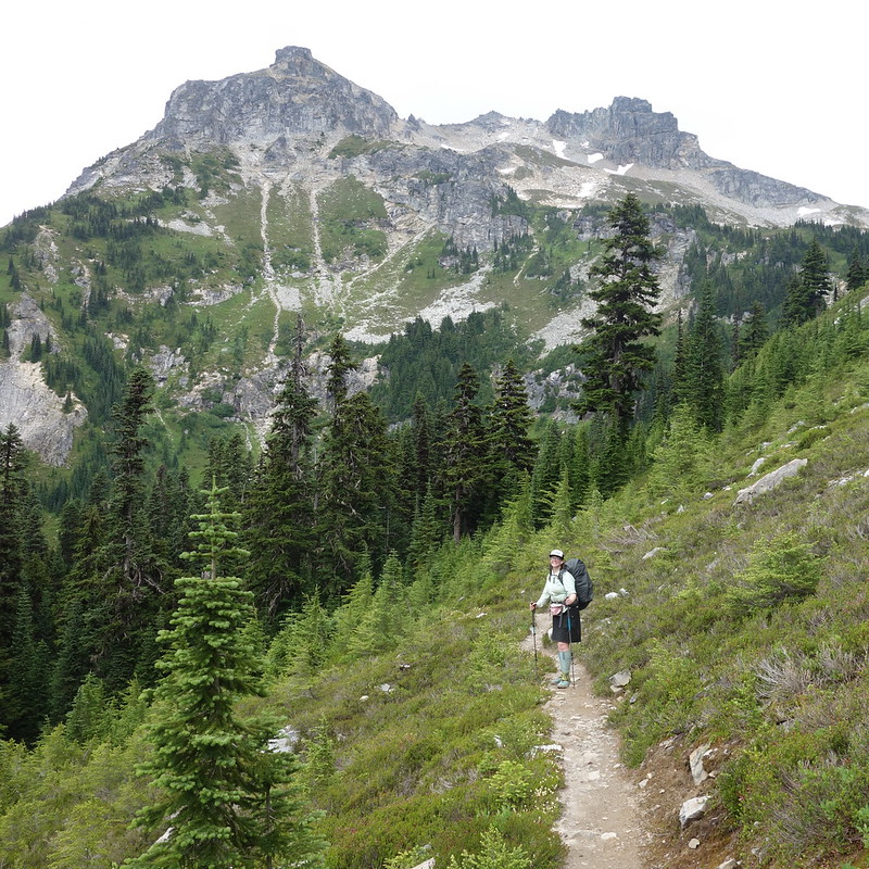
The clouds lift further as we climb up the ridge. Two ultrarunners pass, shouting happy hellos. Then we pass a solo woman, out for a week from Stevens to Stehekin. “It’s so incredible out here.”

We stop at the Buck Creek Pass Trail junction for a snack, and watch several large groups—mostly young guys with huge packs and fishing poles—turn up the trail, all midway through the Spider Gap - Buck Creek Pass Loop.
As we’re packing up to go, we meet a slightly older Irish guy, who’s been hiking north on the PCT since Crater Lake. He tells us about hiking the trail last year. He started in Campo with his wife, intent on doing the whole thing together. They had an enchanted walk through the desert, made it through the deep Sierra snow and thick northern Californian mosquitoes. But then, in Crater Lake, “she got sick.” That’s all he says. “She got sick.” She got sick and never made it home. “So, I’m finishing it this year, alone.” His eyes look heavy. I have absolutely no idea what to say. My eyes feel heavy too.
I try to stay cheerful for the rest of our talk, but tear up as I watch him walk away—watch his mud-soaked legs and tattered old green raincoat. I wonder if it’s the coat he wore last year, before she got sick. I look over at Krista and her eyes are wet too. We sit back down for a bit, together.
*
The Buck Creek Pass Trail leaves the PCT a couple miles before of Suiattle Pass, then climbs a few thousand steep feet along a minor fork of Miner’s Creek to Middle Ridge—a forested finger that stretches west from Fortress Mountain down to the Suiattle.


*
We reach the top of Middle Ridge in a light drizzle and stop for lunch at an overgrown camp nestled into a small grove of windswept alders. Then we follow the muddy trail down a thousand feet and across a surprisingly sketchy unnamed stream-crossings to a set of beautiful camps hacked into the hillside above Small Creek, where we set up quickly against the rain.

Small Creek, it turns out, has swollen with rain to a medium-sized river, and we spend the afternoon and evening playing along its banks, doing all the last night things: eating all the random things in the bottoms of our food bags, drinking the last of the bourbon, looking through all the pictures we’ve taken. Taking turns leaning on our heads on the other’s shoulder.
*
Our last sunset’s a muted affair—just a little filtered light on the small creek that’s really a river—but it’s magisterial in its own way. And our evening feels much the same. We boil our little dinners, take a small stroll, hang the food, and watch bats swoop along the west buttress of Fortress Mountain, catching mosquitoes.


How lucky we are to be here, and to have been here for a week of sunsets. How lucky to have gotten to see it separately, then together—to get to tell each other stories, and to have stories that we can tell together.
And how lucky we are that people had the foresight, more than fifty years ago now, to protect this place for us, for all of us. To protect its sunsets and skeeters, the deep valleys and fields full of marmots. The blooming ridges and frozen cols. The companionable riverside camps, where two scraggily hikers can spend a night as the richest folks in the world, together.
August 3, 2019: Small Creek to Chiwawa River Road
Our last day!
We wake up at six, already imagining piles of cheap small-town Chinese food, eat a fast last breakfast, and hurry up the easy mile and a half to Buck Creek Pass.
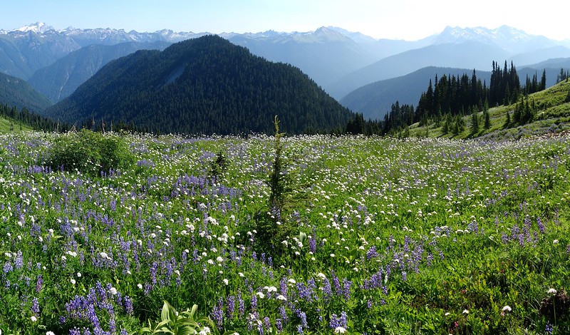
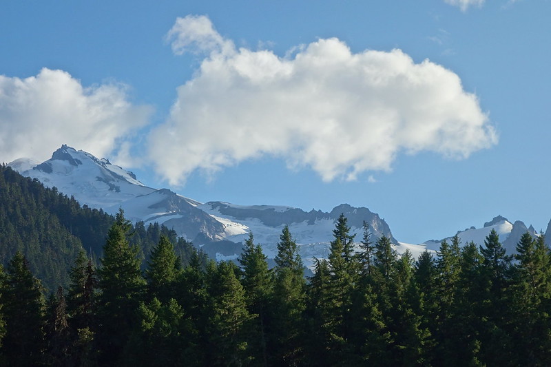
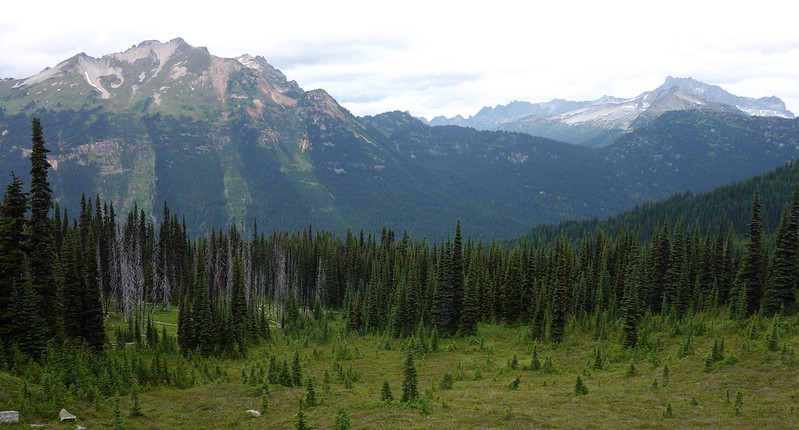
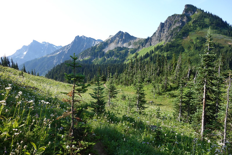
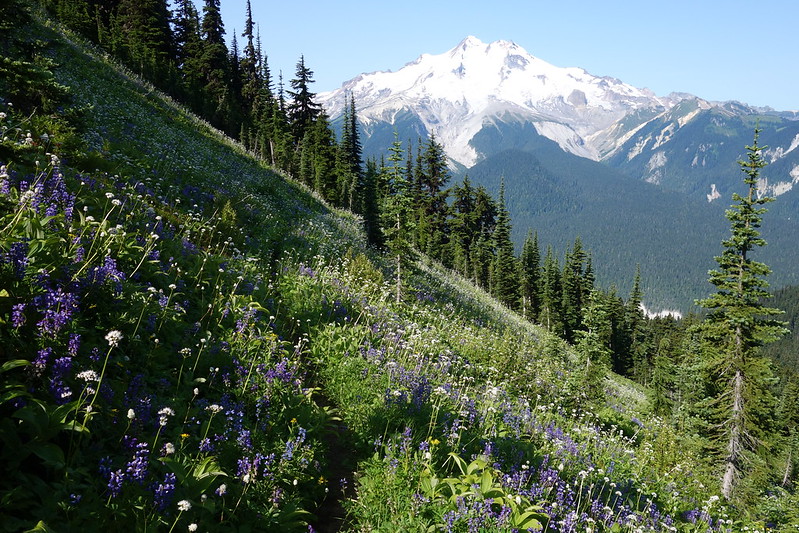
It’s beautiful. The Buck Creek area may be the most popular in the entire Glacier Peak Wilderness, and I get it: the Suiattle Valley’s horseshoe bend stretches beneath endless blooming ridges, and above it all Glacier Peak’s icy glaciers creak and shine in the early morning sun.
*
At the pass, I peel off from the main trail for a “quick” side trip up to Liberty Cap and High Pass. The route switchbacks up Liberty Cap’s northern shoulder, then flits for a few miles from one side of the ridge to the other, sometimes overlooking Glacier Peak, sometimes the Entiat and Chelan Mountains beyond. I end up taking something like two dozen pictures of Glacier Peak, saying goodbye.
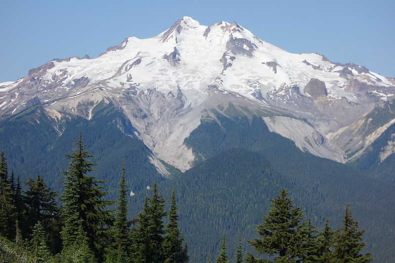


I get turned around by a steep snowfield above Triad Lake that I just don’t have the stomach to deal with, then jog back to the main trail, this time trying to stay on top of the ridge, summiting Rally Cap, then Liberty. I stop on top of the latter, eat my last Snickers, and spend twenty minutes just watching the mountain.


I feel a little like I did at the end of my Olympic traverse a couple years ago: I’ve been here for what seems like so long, walked for so many miles, but I still feel a little like a stranger—like I’m just starting to understand the place.
*
When I first started hiking or whatever it is I do, I had this weird goal of walking every official or once-official trail on the Oregon side of the Columbia Gorge. And I did it, though it took something like three years and fifty-odd trips. I feel like that, or probably more than that, is what it takes to really know a place. You must see it in all its seasons, walk crowded trails and faded footpaths, get lost in the snow, limp home by headlamp.
Watching the blooming flowers blow in the wind beneath Glacier Peak, I think, as I have several times this trip, about how big the world is. You could walk here for years and never really see the whole thing. Like the Olympics, like the Gorge. You could spend a whole life here.
*
But, of course, I’m already half an hour past my planned turn-around time, so I scurry back down to Buck Creek Pass, then weave through throngs of weekend hikers—I think it’s Saturday?—down to Buck Creek.


*
The day gets hotter and way gets buggier as the trail descends, and I eventually find Krista taking a rest near the Chiwawa River crossing, out of water. I’ve been out of water for a while too, so we stop at the River, put our legs in, and take one last long rest, each drinking several liters.
“Sweets,” she says out of nowhere. “This has been a really wonderful trip.” It has.

*
The last few miles to the trailhead feel a little tedious—a bunch of ups and downs, and a bunch of black flies—but after more sweat and swearing than I’d like to admit, we eventually make it back to the Buck Creek Trailhead. It’s so strange to see cars when you haven’t for a while, or to smell perfume.
From the trailhead, we still have a few miles of road-walking to do, but they pass relatively quickly. We stop in the shade from time to time to watch the river or wave at the nervous drivers, trying to navigate the road in low-clearance Carollas. Then suddenly we’re back at the car, unceremoniously parked at a small pull-out near Willow Creek.
We did it.
*
We pile into the car and drive back along the bumpy road to Lake Wenatchee, then the unthinkably fast highway east to Leavenworth and Wenatchee.
Just short of town, we stop along the Wenatchee River for a swim. It’s sunny and the beach is full of tourists with blow-up floating beds and coolers of Coors. I jump in and stay under for as long as I can hold my breath, then walk out in a daze. The world feels new.
*
Wenatchee is hazy and parched in the late-afternoon sun. We limp into a gleaming chain hotel, take two hours’ worth of showers between us, and order a truly absurd amount of Chinese food—a family feast advertised to feed four. When Krista goes in to pick it up, she asks for four place-settings, because she’s worried that they’ll know it’s just for us, and rightly take us to be irredeemable gluttons. Then she absolutely loses it as she’s leaving, laughs until her face runs red. We’re both still laughing when we make it back to the hotel, and laughing still, an hour later, when we nearly finish the whole damn thing.
“Is it possible to thru hike a Chinese restaurant? Because I think we just did.”


