Making tracks on Defiance - 2/18/19
Posted: February 18th, 2019, 9:31 pm
I got to the Starvation TH at 8am and two guys were walking back to their car. They said the trail was "closed." They encountered maybe a ranger and a Highway Patrol person (??) who told them this, despite there not being any signs noting any kind of closure. This didn't make any sense... maybe the 2 guys were confused, and it was a closure of the bike path west of the trail since they're doing active construction on it? How would they have encountered Hwy Patrol, and how would Hwy Patrol know anything about trail closures?
But first, a PSA. I met another guy in the parking lot. This guy was very nice, so this is not anything about him personally. However, there was snow down to the trailhead. The little path out of the parking lot that goes west along the highway had a fair amount of snow on it. Any forecasts or road conditions updates would make it clear that there is a LOT of snow in the Gorge. Mt. Defiance is 5000 ft above the parking lot, give or take. Until I talked to him, this very nice guy had snowshoes, but was going to leave them in the car. He had microspikes, but was going to leave them in the car. He had a GPS, but he was going to leave it in the car. He did not have a paper map or compass. He did not give the impression of being familiar with the area. His goal was to go "to the top."
In light of the recent rescue on Defiance (in which the unlucky hiker seemed mostly prepared and was plenty tough enough to somehow not get frostbite despite wet feet in a snow bivy?!), the editors of this TR would like to remind everyone (assuming people are actually reading this forum rather than Facebook) that winter conditions are more challenging. It is difficult to navigate normal Gorge trails in the snow. Be prepared! Know what kind of conditions to expect and bring the proper gear! And always carry an analog compass even if your map is on your phone! </PSA>
Anyway, since I'd already driven all the way out there, and had my heart set on wallowing in some powder high on Defiance, I decided to go see if this bizarro closure was legit. Down the way, there were no signs, no rangers, no people whatsoever, so I left the bike path and headed up the trail. Starvation Cutoff is closed due to a landslide, so I took the long way - after passing Hole in the Wall I turned left and headed east to traverse back over to Starvation, because loops are better.
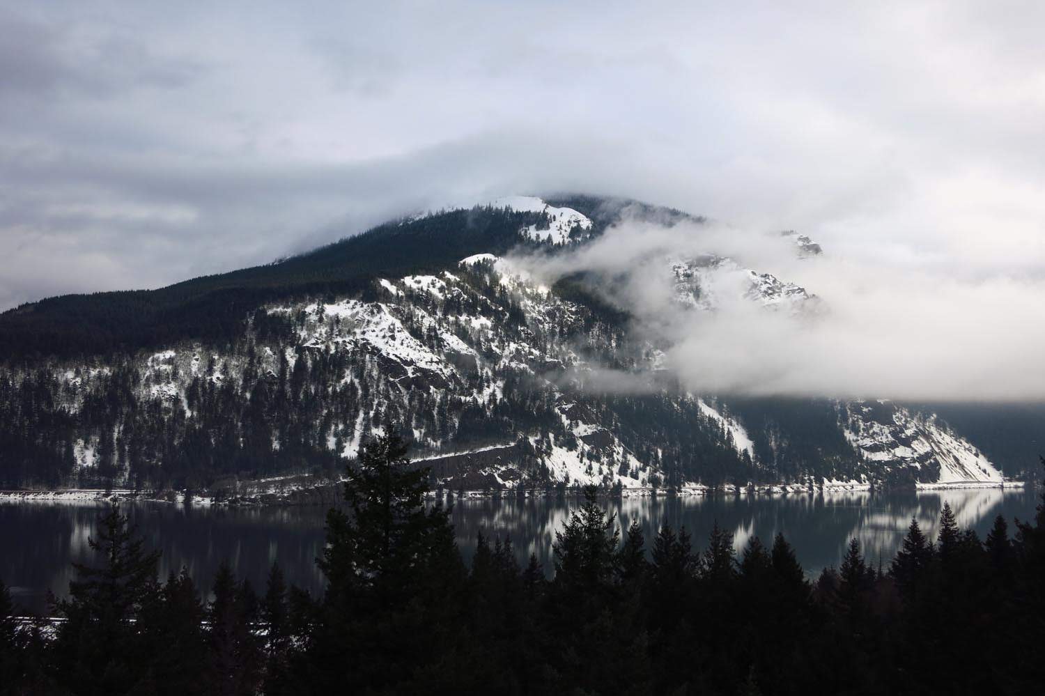
There were moody clouds across the river on Dog.
There were a couple of exposed seeming spots on the way up to Cabin Creek Ridge, but there was a very beaten in bootpath through the snow, so it was no problem. Crossing Warren Creek was kind of a pain, then more somewhat exposed slopes but with a beaten in bootpath, until I crested Cabin Creek Ridge and found that the trail vanished. Literally. Snow slump over a death cliff.

The bootpath turned right and headed up Cabin Creek Ridge, so I followed through the soft snow. Up higher it turned left and contoured east around the ridge, at which point I stopped to deploy my ice axe. But looking across at Starvation, it was so far away, and I would still have to drop to cross Cabin Creek before going back up the hill, and this snow was taking forever, and as I had no idea whether the Starvation Cutoff was even passable as a bail route due to potential snow slumps over the narrow parts of the trail over cliffs (the landslide "closure" is almost at the bottom and is a non-event, especially with snow), continuing on seemed like digging deeper into a hole you'd have to extract yourself from, so I decided to descend back to the Defiance trail and go up that way, which is what I should have done originally. (But loops!)

The snow was both deep and soft, ugh. Snowshoes went on right past Lancaster Falls. There was a nice bootpath to follow up this way as well. Up where the old logging road crosses the trail at ~1300 ft the bootpath and I agreed that it would be best to not try to sidehill on the west side but rather to go straight up the ridge. It's funny - with all the switchbacks on the lower portion of the Defiance trail, you forget it's a ridge! This winter "direttissima" was pretty great.

The lower part of the direct ridge was icy and crusty, I think from wind. It took a nice line up along the edge of the ridge, which yielded some great views as the sun started to come out.
Last bit up to the middle flat section of the Defiance trail at 2250 ft.

I crossed the flat "breather" part of the ridge, after which the bootpath took some weird turns. The actual trail is over here, so I followed it.

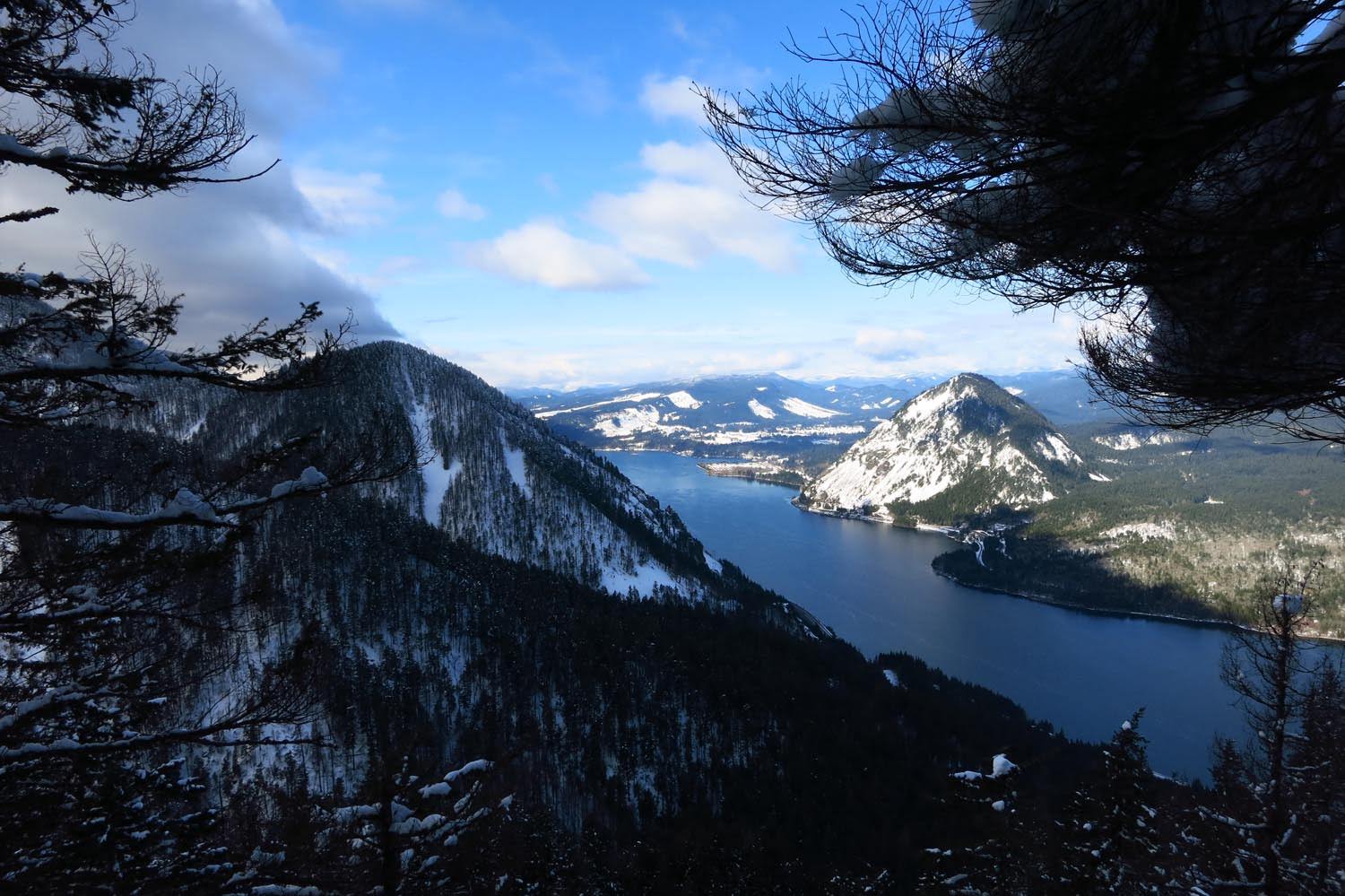
I found myself alongside a viewpoint to the east, and the sun was out. This is looking at the headwall that looms over the end of Starvation Ridge.

Up around 2300 ft the bootpath gave up the ghost. I wandered back and forth to see if I'd missed a turn, but it looked like the previous group had turned around and headed back. After this I was breaking trail on my own.


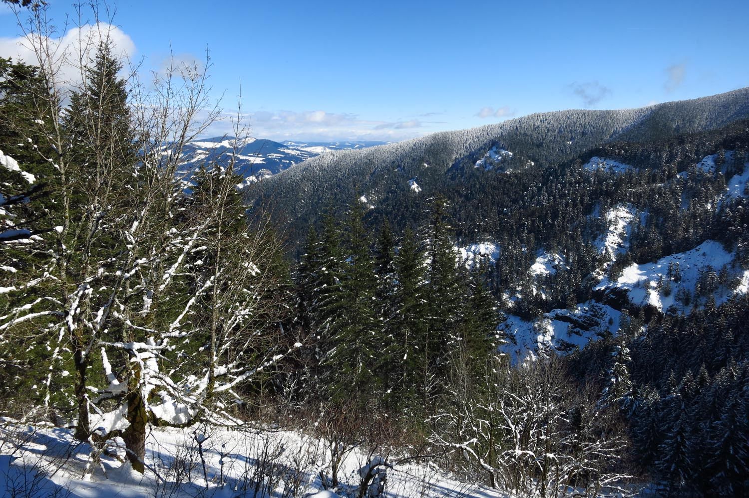
It was brutal. The snow was over my ankles even with snowshoes. Actual depth is multiple feet. The trail is invisible so you have to choose your own adventure. The snow had improved to be a little drier and more powdery, but breaking trail was exhausting. I had to rest every couple dozen steps, then every dozen, then every half dozen. I managed about 1500 ft of progress before I hit my turnaround time of 2pm. The shenanigans at Cabin Creek Ridge had sucked a lot of time, so I was only at 3800 ft. It was getting a lot colder, and the trees were blasted with spindrift and rime. I was trying to at least get to the viewpoint overlooking the Lindsey Gap, but I could see that the sunshine from before was gone and it was getting darker and more ominous. I was totally drained. It was time to go down.
Turnaround spot:

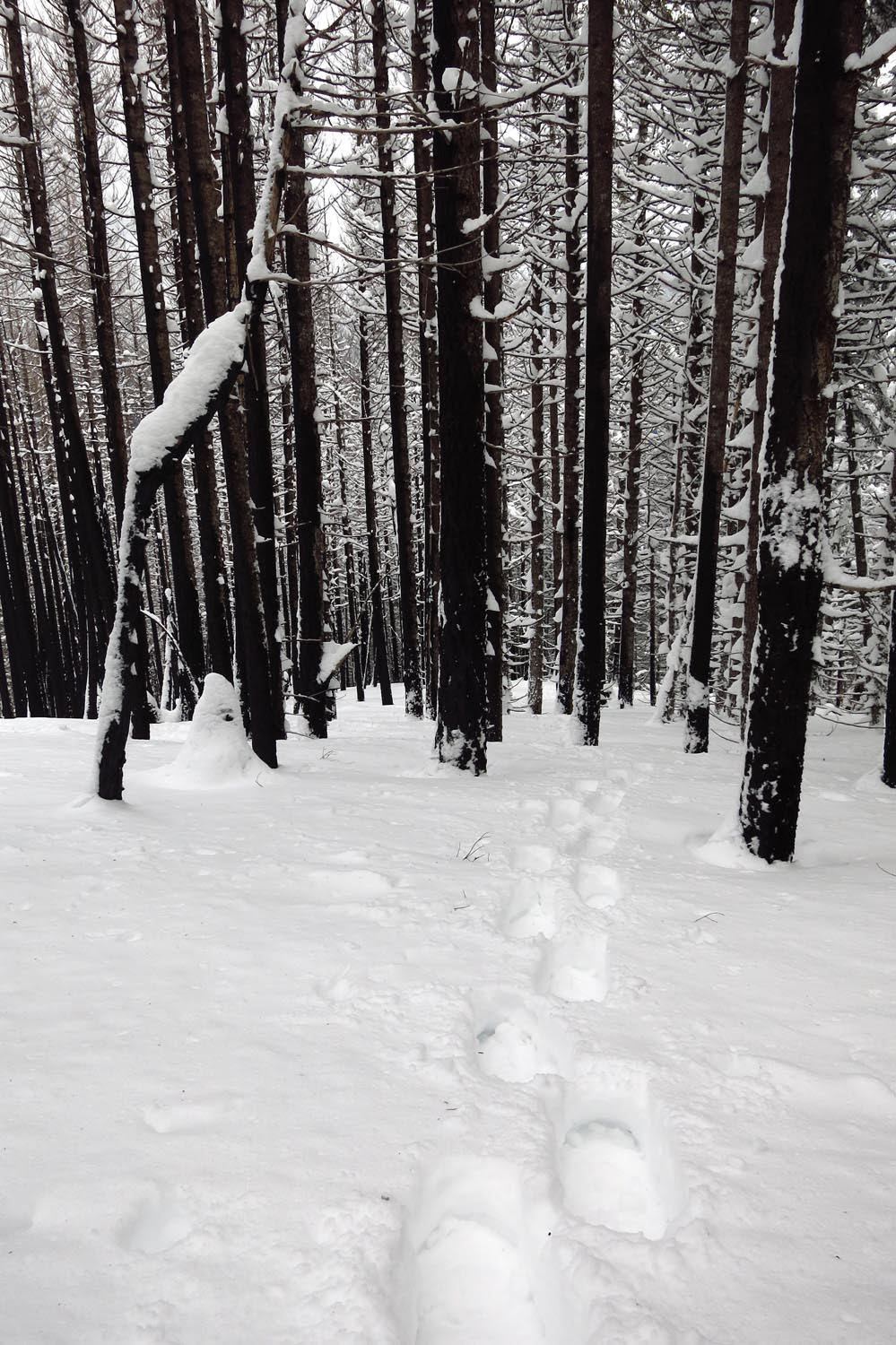
Following my tracks down. I think without snowshoes I would've sunk above my knees.
I made it back down to the "breather" flats in 30 minutes, so I guess my turnaround time was a bit too conservative. I'm not sure how much more oomph I had to keep going up there though. There was less sunny weather at the lower viewpoint this time.

Descending the direct ridge.

Nothing else to report about the descent - it was a slog, and the lower snow back when the trail heads east had gotten slushier over the course of the day. I got back down to Lancaster Falls in a little under 2 hrs, took off my snowshoes on the bike path cause they were hurting my feet and proceeded to plod slowly through the slippery slush back to the TH.
WHAT WHAT WHAT! This fence was not there at 8am when I left the TH!

Apparently the 2 guys in the morning weren't pulling my leg. I have no idea what kind of "hazardous materials" one might encounter on the Defiance trail. The only person I encountered on the way back was a guy taking photos of Cabin Creek Falls down at the bottom. No rangers, no Hwy Patrol. As far as I can tell, the Defiance trail was open for business all weekend before this. On the drive back I saw what looked like convicts being made to pick trash out of the plowed snow on the side of eastbound 84, but this was probably a mile west of the Starvation TH at least, and being that they were on the highway itself it's inexplicable that such a thing would be used as justification to close the entire trail. I'm calling BS on this, but caveat emptor.
If anyone makes it to the top of Defiance, I am kind of hoping the snow is above the top of the buildings, so please post pictures. The trail is now broken to 3800 ft for you.
But first, a PSA. I met another guy in the parking lot. This guy was very nice, so this is not anything about him personally. However, there was snow down to the trailhead. The little path out of the parking lot that goes west along the highway had a fair amount of snow on it. Any forecasts or road conditions updates would make it clear that there is a LOT of snow in the Gorge. Mt. Defiance is 5000 ft above the parking lot, give or take. Until I talked to him, this very nice guy had snowshoes, but was going to leave them in the car. He had microspikes, but was going to leave them in the car. He had a GPS, but he was going to leave it in the car. He did not have a paper map or compass. He did not give the impression of being familiar with the area. His goal was to go "to the top."
In light of the recent rescue on Defiance (in which the unlucky hiker seemed mostly prepared and was plenty tough enough to somehow not get frostbite despite wet feet in a snow bivy?!), the editors of this TR would like to remind everyone (assuming people are actually reading this forum rather than Facebook) that winter conditions are more challenging. It is difficult to navigate normal Gorge trails in the snow. Be prepared! Know what kind of conditions to expect and bring the proper gear! And always carry an analog compass even if your map is on your phone! </PSA>
Anyway, since I'd already driven all the way out there, and had my heart set on wallowing in some powder high on Defiance, I decided to go see if this bizarro closure was legit. Down the way, there were no signs, no rangers, no people whatsoever, so I left the bike path and headed up the trail. Starvation Cutoff is closed due to a landslide, so I took the long way - after passing Hole in the Wall I turned left and headed east to traverse back over to Starvation, because loops are better.
There were moody clouds across the river on Dog.
There were a couple of exposed seeming spots on the way up to Cabin Creek Ridge, but there was a very beaten in bootpath through the snow, so it was no problem. Crossing Warren Creek was kind of a pain, then more somewhat exposed slopes but with a beaten in bootpath, until I crested Cabin Creek Ridge and found that the trail vanished. Literally. Snow slump over a death cliff.
The bootpath turned right and headed up Cabin Creek Ridge, so I followed through the soft snow. Up higher it turned left and contoured east around the ridge, at which point I stopped to deploy my ice axe. But looking across at Starvation, it was so far away, and I would still have to drop to cross Cabin Creek before going back up the hill, and this snow was taking forever, and as I had no idea whether the Starvation Cutoff was even passable as a bail route due to potential snow slumps over the narrow parts of the trail over cliffs (the landslide "closure" is almost at the bottom and is a non-event, especially with snow), continuing on seemed like digging deeper into a hole you'd have to extract yourself from, so I decided to descend back to the Defiance trail and go up that way, which is what I should have done originally. (But loops!)
The snow was both deep and soft, ugh. Snowshoes went on right past Lancaster Falls. There was a nice bootpath to follow up this way as well. Up where the old logging road crosses the trail at ~1300 ft the bootpath and I agreed that it would be best to not try to sidehill on the west side but rather to go straight up the ridge. It's funny - with all the switchbacks on the lower portion of the Defiance trail, you forget it's a ridge! This winter "direttissima" was pretty great.
The lower part of the direct ridge was icy and crusty, I think from wind. It took a nice line up along the edge of the ridge, which yielded some great views as the sun started to come out.
Last bit up to the middle flat section of the Defiance trail at 2250 ft.
I crossed the flat "breather" part of the ridge, after which the bootpath took some weird turns. The actual trail is over here, so I followed it.
I found myself alongside a viewpoint to the east, and the sun was out. This is looking at the headwall that looms over the end of Starvation Ridge.
Up around 2300 ft the bootpath gave up the ghost. I wandered back and forth to see if I'd missed a turn, but it looked like the previous group had turned around and headed back. After this I was breaking trail on my own.
It was brutal. The snow was over my ankles even with snowshoes. Actual depth is multiple feet. The trail is invisible so you have to choose your own adventure. The snow had improved to be a little drier and more powdery, but breaking trail was exhausting. I had to rest every couple dozen steps, then every dozen, then every half dozen. I managed about 1500 ft of progress before I hit my turnaround time of 2pm. The shenanigans at Cabin Creek Ridge had sucked a lot of time, so I was only at 3800 ft. It was getting a lot colder, and the trees were blasted with spindrift and rime. I was trying to at least get to the viewpoint overlooking the Lindsey Gap, but I could see that the sunshine from before was gone and it was getting darker and more ominous. I was totally drained. It was time to go down.
Turnaround spot:
Following my tracks down. I think without snowshoes I would've sunk above my knees.
I made it back down to the "breather" flats in 30 minutes, so I guess my turnaround time was a bit too conservative. I'm not sure how much more oomph I had to keep going up there though. There was less sunny weather at the lower viewpoint this time.
Descending the direct ridge.
Nothing else to report about the descent - it was a slog, and the lower snow back when the trail heads east had gotten slushier over the course of the day. I got back down to Lancaster Falls in a little under 2 hrs, took off my snowshoes on the bike path cause they were hurting my feet and proceeded to plod slowly through the slippery slush back to the TH.
WHAT WHAT WHAT! This fence was not there at 8am when I left the TH!
Apparently the 2 guys in the morning weren't pulling my leg. I have no idea what kind of "hazardous materials" one might encounter on the Defiance trail. The only person I encountered on the way back was a guy taking photos of Cabin Creek Falls down at the bottom. No rangers, no Hwy Patrol. As far as I can tell, the Defiance trail was open for business all weekend before this. On the drive back I saw what looked like convicts being made to pick trash out of the plowed snow on the side of eastbound 84, but this was probably a mile west of the Starvation TH at least, and being that they were on the highway itself it's inexplicable that such a thing would be used as justification to close the entire trail. I'm calling BS on this, but caveat emptor.
If anyone makes it to the top of Defiance, I am kind of hoping the snow is above the top of the buildings, so please post pictures. The trail is now broken to 3800 ft for you.


