Day 1: Car shuttling and a short evening hike
Friday afternoon traffic out of the city is always miserable. It seems even worse in the summer when you are trying to get your hike on and get to the trail. We got to Cascade Locks and ate dinner at the East Wind Drive-In (bacon burger and shake!). One car was shuttled out to Warren Gap road where the PCT crosses, and then we drove back to the Bridge of the Gods and parked the second car in the pull-out just on the Washington side of the bridge. A quick 200-yard walk west along Hwy 14 and we were on the trail around 6:30pm. The trail closely parallels the highway for almost two miles before heading north and away from traffic.


Another couple miles through the forest and some clear cuts and we arrived at our night destination, Gillette Lake.

Distance traveled: 4.2 miles
Day 2: Uphill, cloudy skies, and then sun
The previous day’s sunny skies were replaced with an overcast layer that seemed to threaten rain. A quick breakfast was eaten with some hot coffee and we were on the trail again by 7am. This day, the trail was going to throw significant elevation gain at us as we worked our way out of the gorge and around the flanks of Table mountain.

We all got very wet on fog-soaked vegetation hanging over the trail until we got past Table mountain and back to the clear cut areas behind it. By noon, the cloud layer began to loosen up to the east but the west, towards St Helens, did not look good.


As the afternoon crept on, the clouds continued to dissolve until it was blue sky and the temps started to climb.

Out of the corner of my eye, I spotted aflash of pink, which revealed itself to be a little trail joke in a stump. While I strictly adhere to LNT, I was still amused at seeing this.

By 3:30pm, we reached Rock creek. The water was cool and inviting and there were some really great camp spots to be had. It was still somewhat early but there would not be another water source or flat area for many miles and there was a lot more elevation gain ahead so we called it a day and relaxed creek-side. It was a great spot to have some whiskey and dry off in the sun from a dip.


Distance: 15.6 miles
Elevation Gain: 4190 ft

Day 3: Clear skies and hot weather
The last day was beautiful blue skies and cool temperatures in the morning. Perfect hiking conditions. We were up at 7am, ate and then started up four miles of sustained elevation gain. Pretty much all the climbing for the day happened in the first six miles and I’m glad it happened in the morning rather than the afternoon.


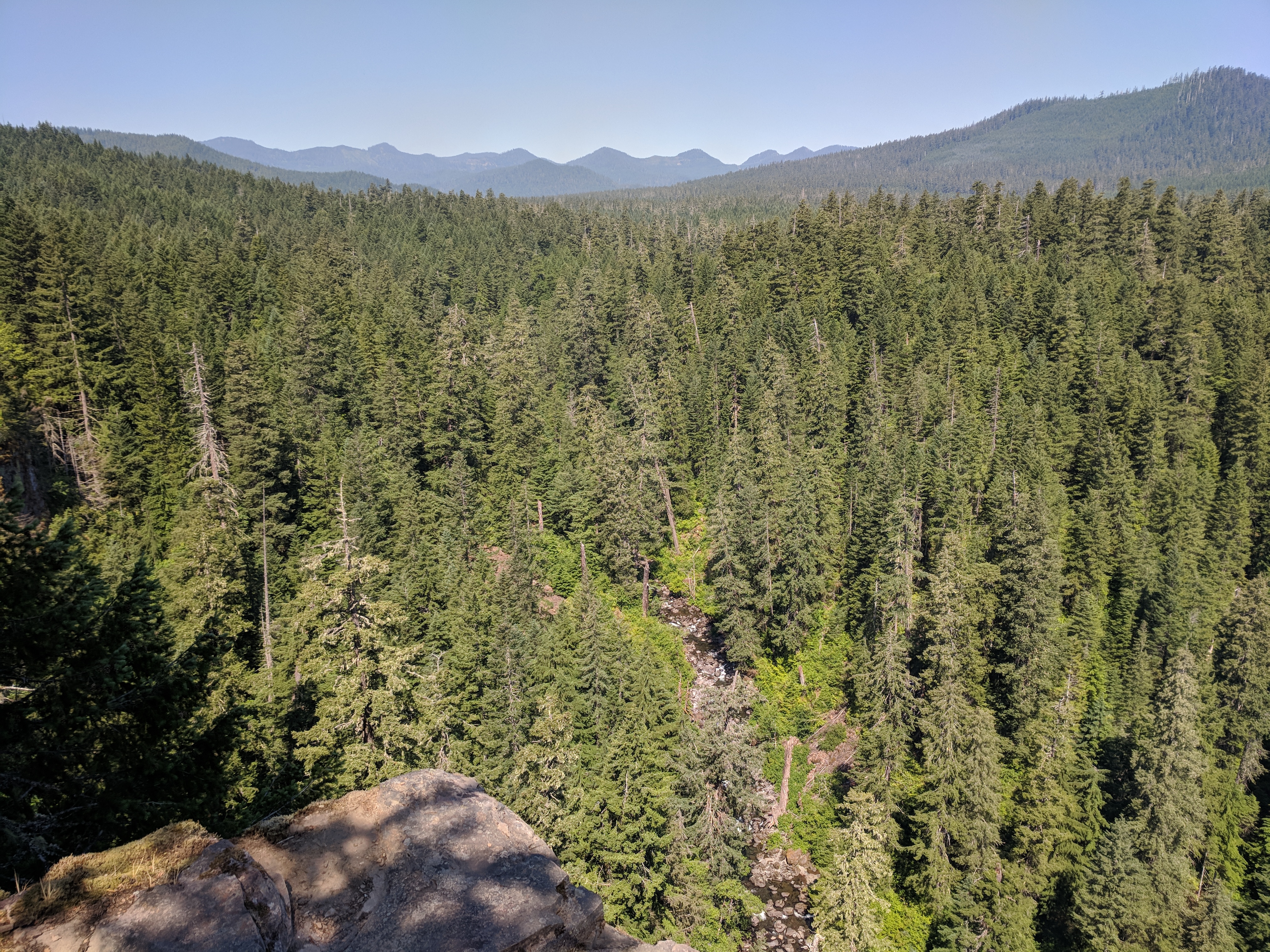
At the point where the climbing stopped and the trail finally leveled, there was a steep user trail up to the top of an unnamed peak there. It was a fantastic view!


Once we took some pictures and had a rest, we headed back down to the trail and down towards Trout creek. There is a great overlook above the creek that let us know we were getting close to a water source and a place to soak our feet.

A couple hundred feet of elevation drop and about a mile and a half and we reached Trout creek where we stopped to snack, rest, get some cool water and soak feet.


Recharged, we headed off to finish the last bit of trail before getting back to our car by crossing the Wind river.


It was getting very hot by the time we got to the car so we headed off to Stevenson for burgers and beer before driving back to Portland.
Distance: 15.1 miles
Elevation Gain: 2631 ft
