
It was a 9.1 mile hike with 1240 feet of elevation gain. There was tons of blowdown, (too much to count), but easily hopped or crossed over, with a few requiring some detours. Overall, the trail was very well graded, not crowded, and had a fantastic world-class view from the top. We saw absolutely no one during the hike, and had the peak to ourselves. No snow except for a small patch.
Opening Photo:
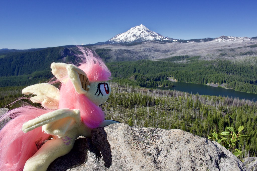
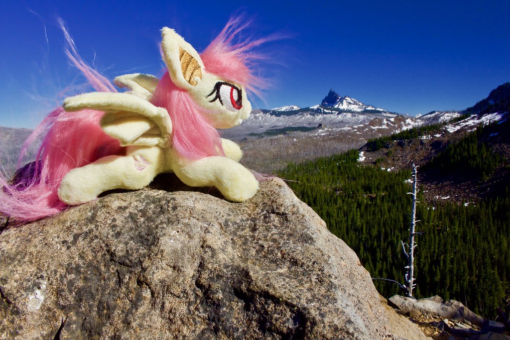
Flutterbat at the summit. (The strong wind made me nervous for this pic!
Map and Elevation Profile:
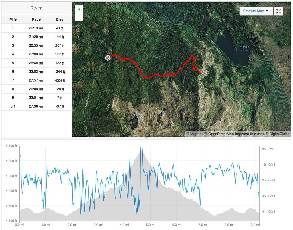
Marion Mountain via Pine Ridge Trail.
Trip Report:
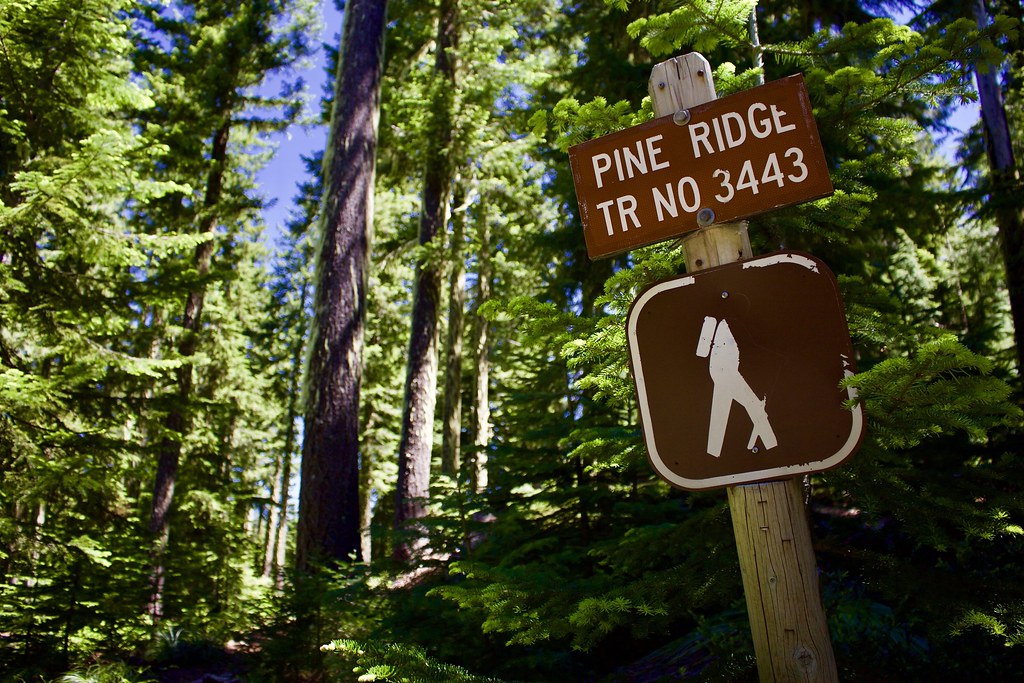
We started our hike at the Pine Ridge Trailhead off of FR 2261 just past the Camp Pioneer boy scout camp. It is paved all the way, save for the last 100 feet of good gravel.
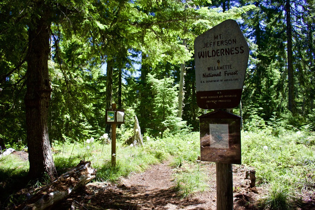
In the first 0.3 miles, we passed the (rather fancy-looking) wilderness sign and junction with several branching trails. (Four or five way junction). The only other named trail here is the Turpentine Trail (which we hiked a short while later.)
A few of the north-bound trails lead to the boy's camp.
The faded trail between the Turpentine Trail and the Pine Ridge Trail (westbound) is an old section of the Pine Ridge Trail that led to a slightly lower trailhead along the same road as the current trailhead, (now blocked by a gate).
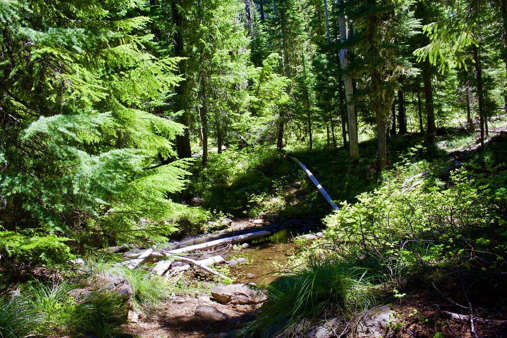
In 0.6 miles, we passed the Turpentine Lake Trail (although we never saw the junction). Then in 1.7 miles, the trail led to a crossing of Turpentine Creek.
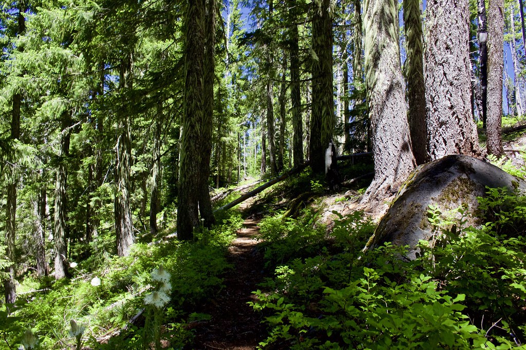
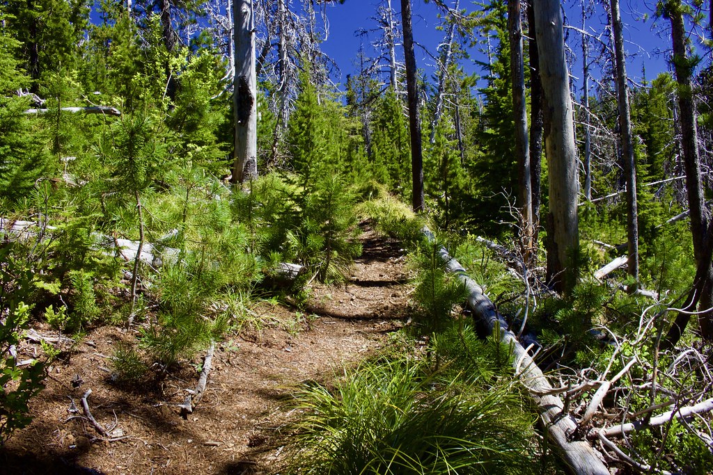
Then, at around 2.4 miles, the forest started to thin out and transition into a forest with lodgepole pine dominating the scene.
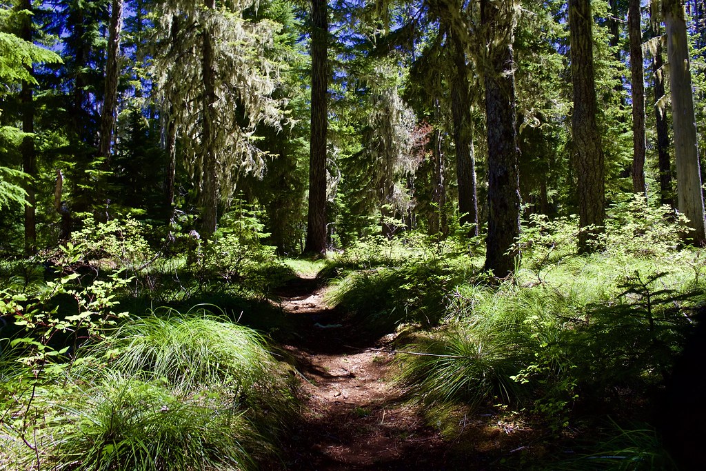
Beargrass and huckleberry dominated the forest floor.
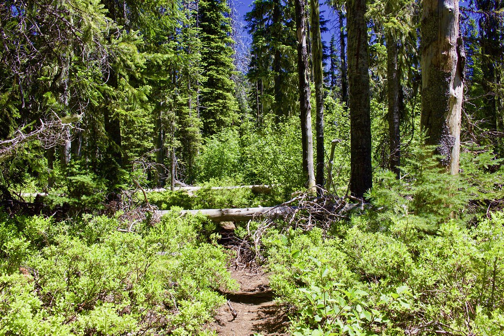
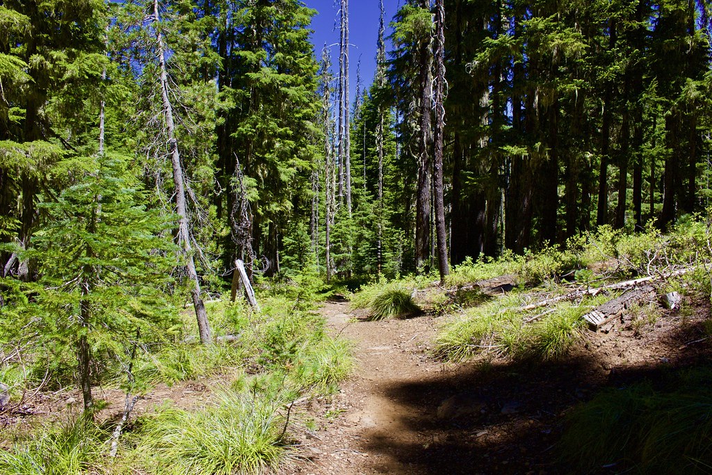
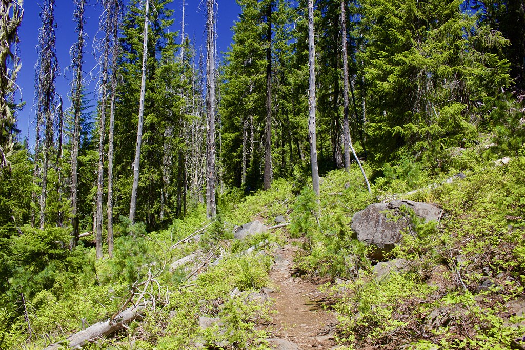
All throughout the trail, there was tons of small blowdown, but it didn't really slow down our pace. Here is an example of one of them.
The trail was very well graded and never got steep. (You can see some blowdowns in this photo.)
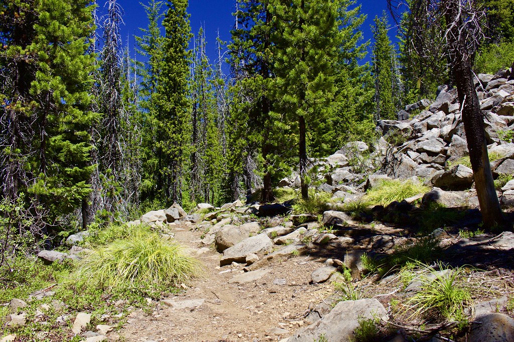
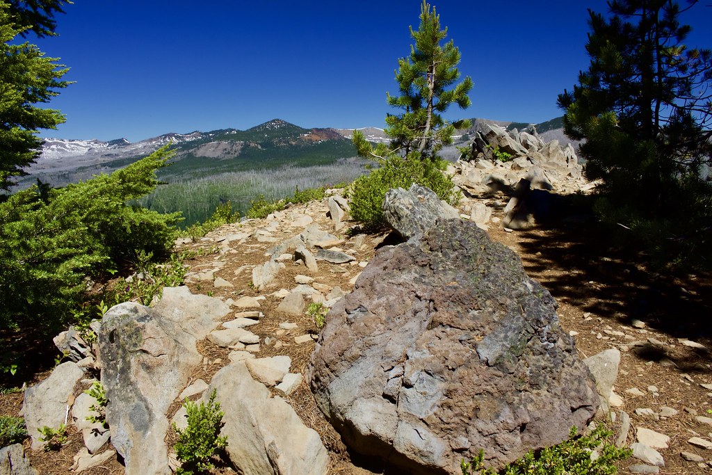
2.8 miles in, the trail rounded around some boulder fields.
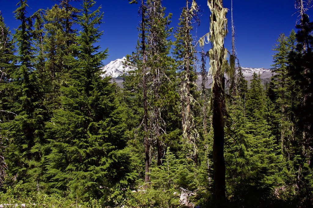
Just before the Marion Mountain Trail junction, Mount Jefferson came into better view.
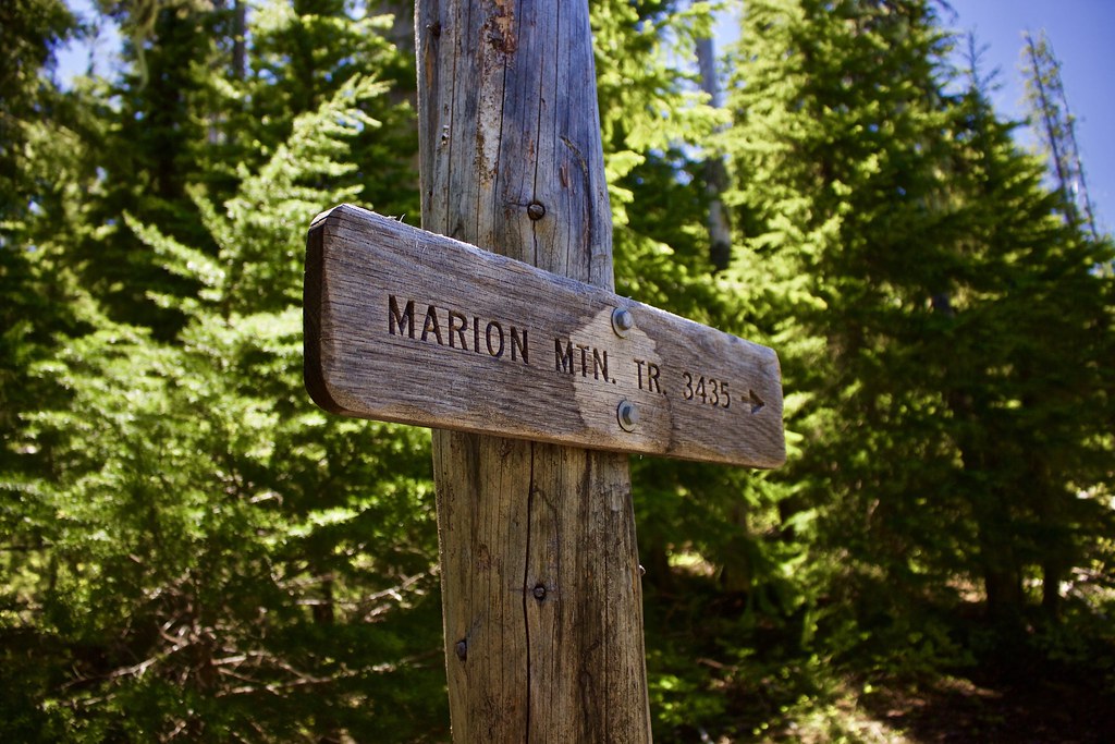
Then in 3.8 miles, we got to the junction with the Marion Mountain Trail #3435.
Once on Trail #3435, it started a steeper climb up the north face of the mountain, (but it never gets uncomfortably steep).
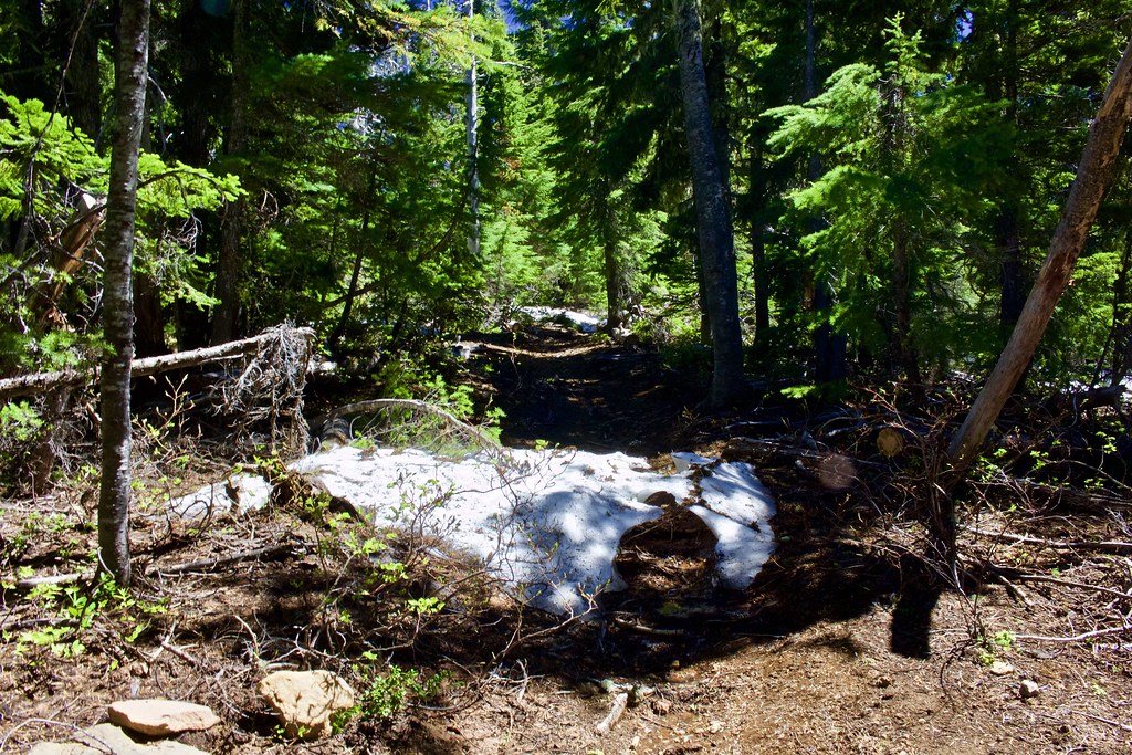
This is the only snow we saw on the trail.
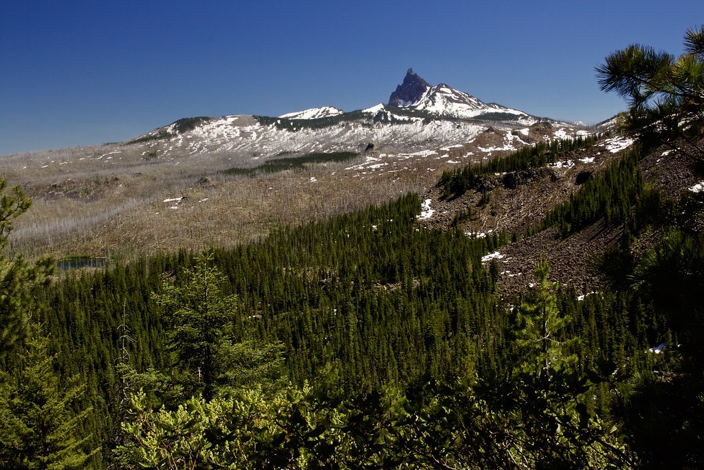
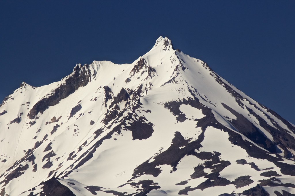
Nearing the top, the rugged northwest face of Three Fingered Jack came into view!
The top.
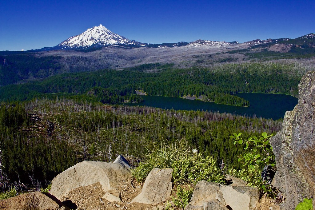
Mount Jefferson came into full view, rising above the deep blue waters of Marion Lake below.
(Photo's exposure comp. was messed up; forgot to raise it up.)
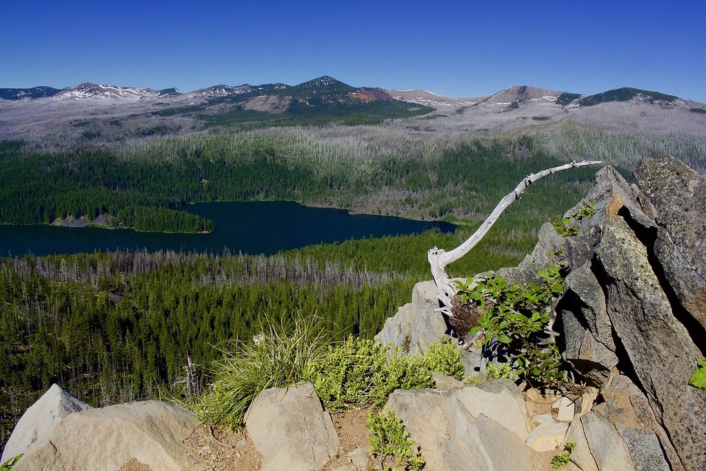
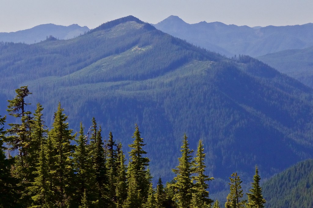
Rockpile Mountain, various other peaks, and the spine of the PCT along the far ridge to the east.
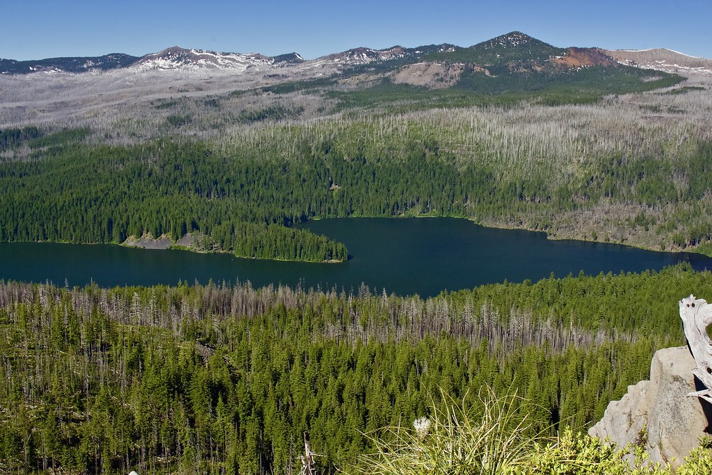
Marion Lake below.
The pointy summit of Jefferson.
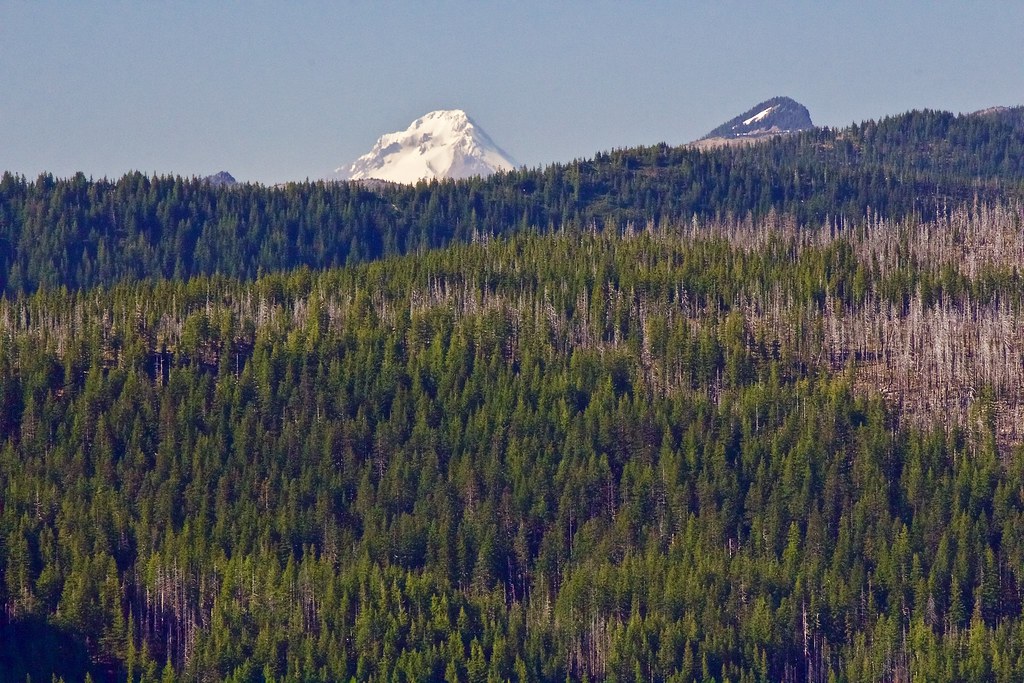
Off to the side of Jefferson, Mount Hood peeked its head above the ridge.
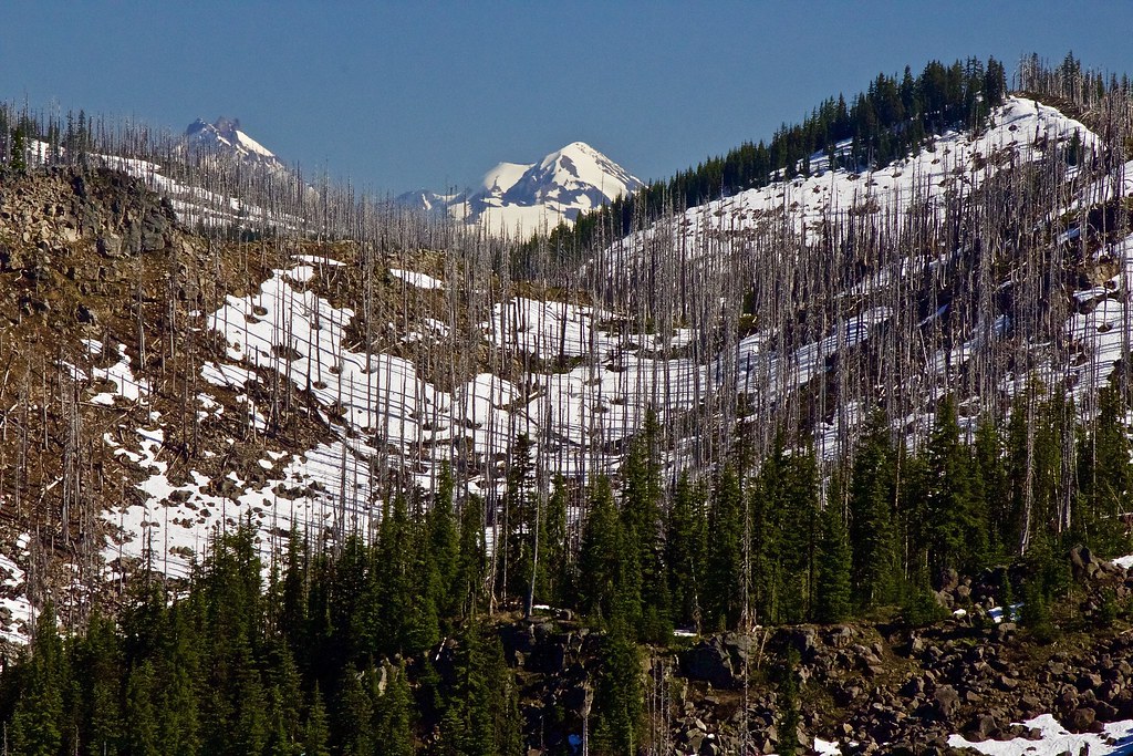
To the south, the snowy peaks of the Three Sisters poked their head above the burnt ridgeline.
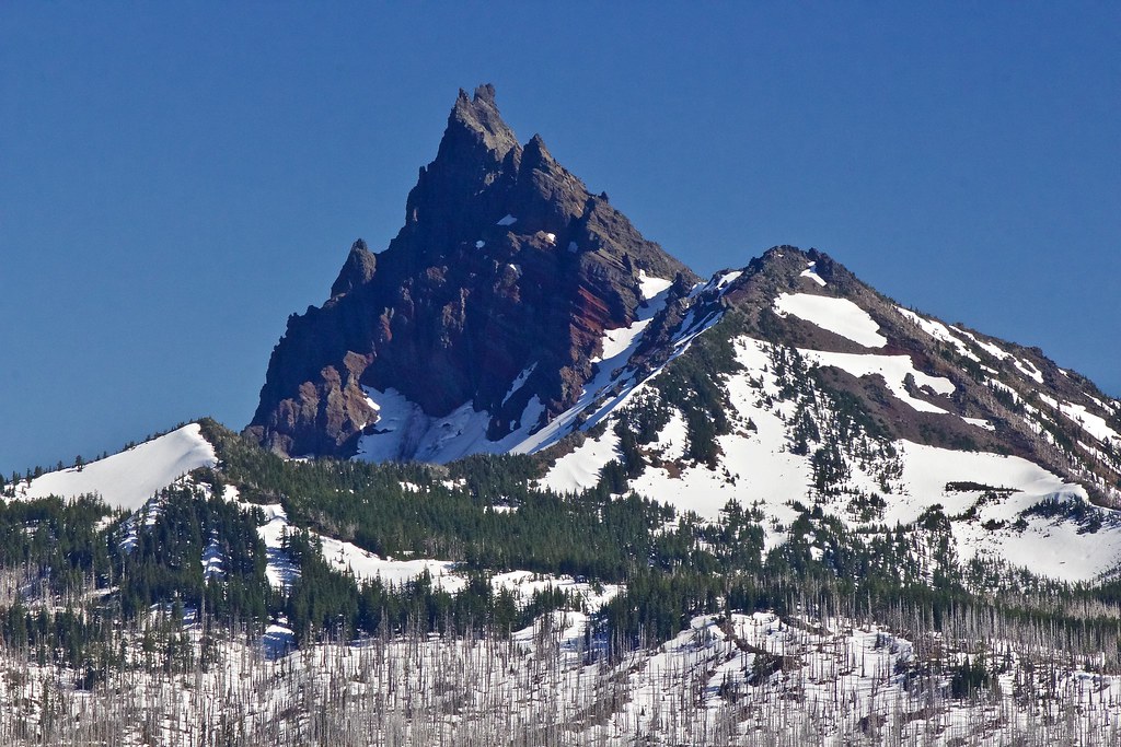
The incredibly jagged face of Three Fingered Jack.
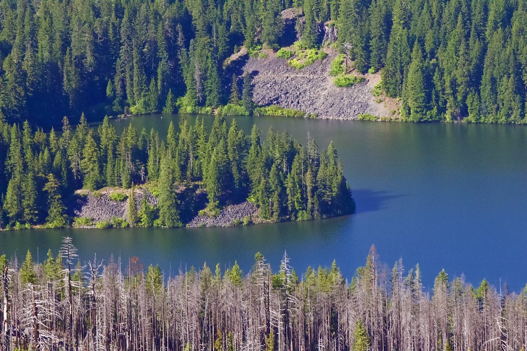
Marion Lake close-up of the peninsula.
Looking northwest towards Mount Bruno (big peak in center) and Battle Ax mountain (right, pointy peak in background).
The wind was of "slight" concern here.
Chillin' with the view.
GPS Track:
http://gpsfly.org/g/7334
Mini Trip Reports
And just a few more brief reports on other trails I've hiked, but may or may not have time to write one up before I leave for the John Muir Trail in California.
Mt. Jefferson Wilderness:
Turpentine Trail - Duffy Lake, Mowich Lake, Jorn Lake - Blue Lake Trail - Pine Ridge Trail (via Pine Ridge TH)
20.7 mile loop. 3100 ft. gain. Extremely difficult due to Turpentine Trail; not recommended for inexperienced routefinders. GPS Track.
June 25-26.
Turpentine Trail - practically impassable without a GPS track (which we had). Hundreds(!) of logs across the Turpentine Trail, many which are difficult. Snowbrush and ferns on the trail. We came knowing what to expect, however.
Duffy Lake Trail - Little snow up to the pass above Mowich Lake. 5 foot steep drifts from the pass down to Jorn Lake. We used spikes. Mosquitos along this trail at dusk.
Blue Lake Trail - Few downed logs up to the Saddle Mtn saddle. Many logs down once you get down off the saddle and before you get back into the green forest. Most of the trail is in burn, but the views are worth it. No snow.
Pine Ridge Trail - same conditions as our previous hike. Mosquitos at dusk.
Be aware that most of this loop is in a previous burn.
Bull of the Woods Wilderness:
Big Slide Lake via Pansy Creek Trail.
11.2 miles round trip. 3,252 ft. gain. Moderate.
July 9-10.
Some small snow patches on the Dickey Creek Trail on the tight switchbacks. One very large blowdown across the trail, which required a very challenging 80 ft. climb up the steep ridge to get around the log. But on the way back, we realized there was a much easier way to get over the log on the downhill side, about 7 feet off the trail.
No mosquitos at Pansy Lake. Moderate mosquitos at Big Slide Lake and on the Dickey Creek Trail. The lake is very beautiful and has an out of the way feeling. We saw no one at Big Slide Lake.
North Cascades National Park and Mount Baker Wilderness:
Artist Point hikes, Picture Lake, and Horseshoe Bend
June 29 - July 3.
9 feet of snow at Artist Point. Road is plowed all the way to Artist Point.
3 feet of snow at Picture Lake in drifts.
Good trail on the Horseshoe Bend Trail (follows the North Fork Nooksack River).
Mount Adams Wilderness:
Stagman Ridge Trail to Lookingglass Lake and Horseshoe Meadow.
11.5 mile Lollipop loop. 2,394 ft. gain. Challenging due to wildfire, rough trail, and a particularly difficult, high-flowing glacial creek crossing near Lookingglass Lake on the Graveyard Camp Trail.
July 15th.
Mosquitos at trailhead, at Bottle Camp/creek valley below Grassy Hill, and Horseshoe Meadow.
Deep snowdrifts along the Round the Mountain Trail.
Horseshoe Meadow - is still damp from recent snowmelt. The meadow has a "padded down" look and still needs time to green up. Will be a while before flowers start to bloom.
Stagman Ridge Trail - is exploding with wildflowers of all kinds. Probably at least 15 different varieties.
Lookingglass Lake - doesn't have much wildflowers yet.(?). First time to this lake for me.
Graveyard Camp Trail - has some minor blowdowns. Trail is rough and disappearing in places (especially around creek-beds.) Lots of nice little creeks along this trail. The crossing of an unnamed branch of Cascade Creek just before you get to Lookingglass Lake Trail #9A is very challenging early on this year, but we added some large rocks next to the log to make the first jump a little easier. The water is high and fast moving, with a 3 foot "falls" below the crossing. Make sure to cross early on in the day.
Be aware that a previous burn from 2012 consumed most of this area (20,000 acres), but the wildflowers and views make it worth it.
Overall, it was a great hike!
If I can squeeze a hiking trip before the Sierras, I'm planning on heading back up to Mt. Adams in the same region next week. I can't wait to be back.


