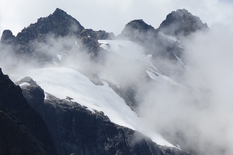
Opening picture: Buckner Mountain, from near Park Creek Pass, North Cascades National Park
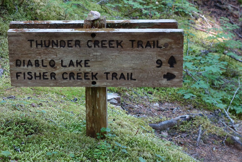
So, despite the title, this isn't exactly about the PCT: instead of finishing Section K the normal way, following Bridge Creek to Rainy Pass, I cut east a few miles north of the High Bridge Ranger Station, followed an old road along the Stehekin River for a bit, took the Park Creek Trail to Park Creek Pass, then followed Thunder Creek down to the North Cascades Highway at Diablo Lake. There are a few inconveniences with this route - most importantly, you've got to get a National Park permit for camping between High Bridge and Diablo Lake - but, from everything I've seen, it's much much prettier than the PCT proper.
Day 23 (Aug. 8): Nero in Stehekin
Stehekin is basically paradise.
After filling up with hikers, the bus bounded down a rocky road - one of the only real roads in town - along the Stehekin River, past old farms and ranches and cars with no license plates. We stopped at the bakery and all jumped off to buy several thousand calories each worth of pizza and cake and pastries and coffee. I'm pretty sure I saw someone cry.
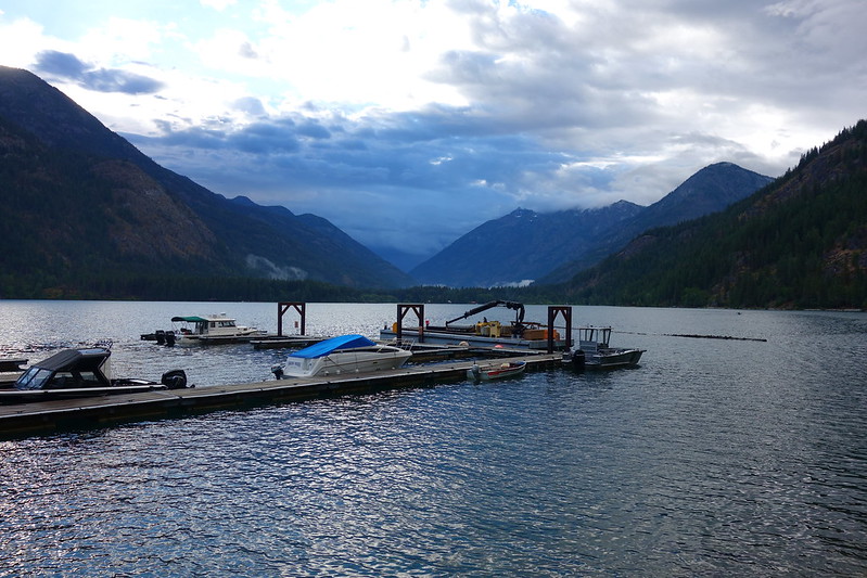
Then it was a few more bumpy miles into "town" - a short row of buildings along the northern tip of Lake Chelan: a Post Office the size of a studio apartment; a two room restaurant; a tiny store; an inn with a couple dozen rooms; and the most beautiful Ranger Station I've ever seen. I ran around for a while doing errands - getting one of the last rooms at the inn, a North Cascades permit at the Ranger Station, and a resupply Krista sent to the Post Office - before settling in to do laundry at the outdoor laundromat.
There were a bunch of other hikers there, queued up to use the only washing machine, and we made an afternoon of it, drinking beer and trading food, feeling feral. A storm rolled in over the lake and we jumbled under the overhang, but it didn't last long, and we sat around the shambling table until late afternoon, watching the sky go from blue to purple and back again.
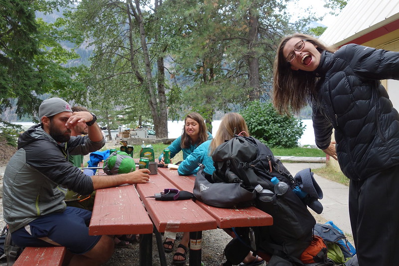
Eventually it started to rain again, harder and more persistently, so we all ran to our rooms to shower, then to the restaurant, to eat burgers and ice cream, laughing like kids at someone's sixth birthday party.
Day 24 (Aug. 9): Stehekin / High Bridge Ranger Station to Park Creek
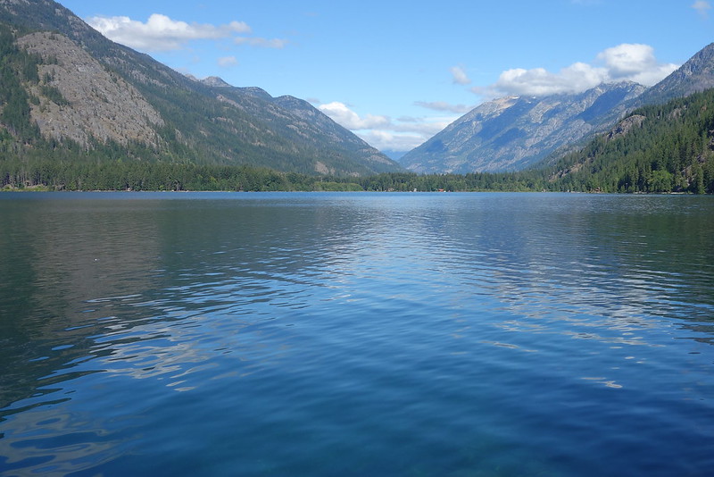
North Cascades National Park: Old Wagon to Upper Stehekin to Park Creek (10.1 miles)
I woke up late the next day, made coffee and oatmeal in my room, then rambled around town for a while, killing time until the noon shuttle.
The shuttle was full of day trippers, heading up to High Bridge to take short strolls up Agnes Gorge or along the PCT to Coon Lake. But we stopped at the bakery all the same, and I jumped off again to buy a few thousand last minute calories.
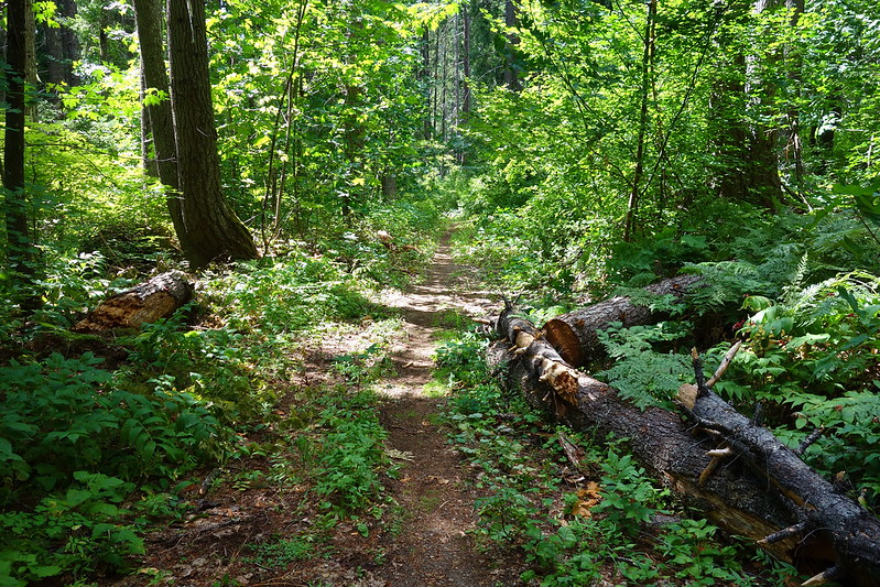
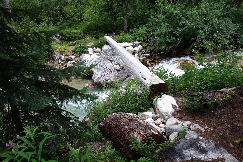
The trail north of High Bridge was weirdly rough - dusty, hot, and buggy - and I felt clumsy and slow. I got passed by a jaunty octogenarian with a bright orange fanny pack. Maybe something to do with the birthday party last night? But eventually I made it past Coon Lake to Bridge Creek, and turned off the PCT for the first time in four hundred miles, to follow the Stehekin River to Park Creek.
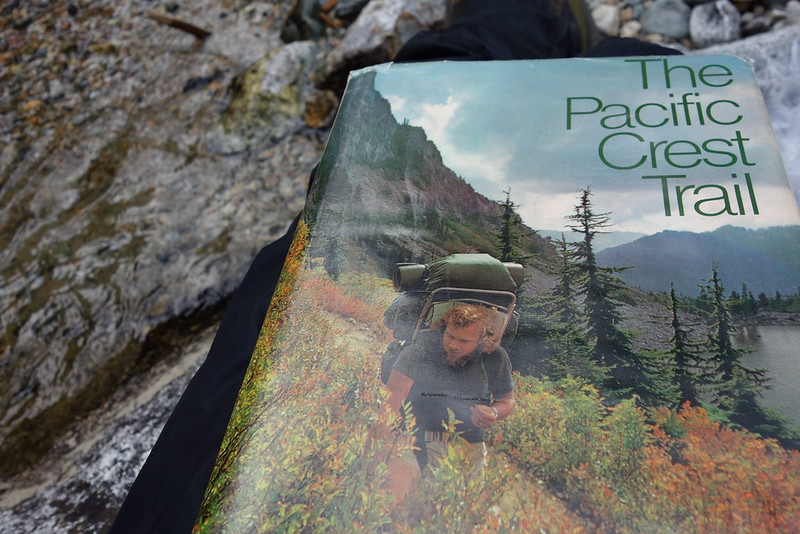
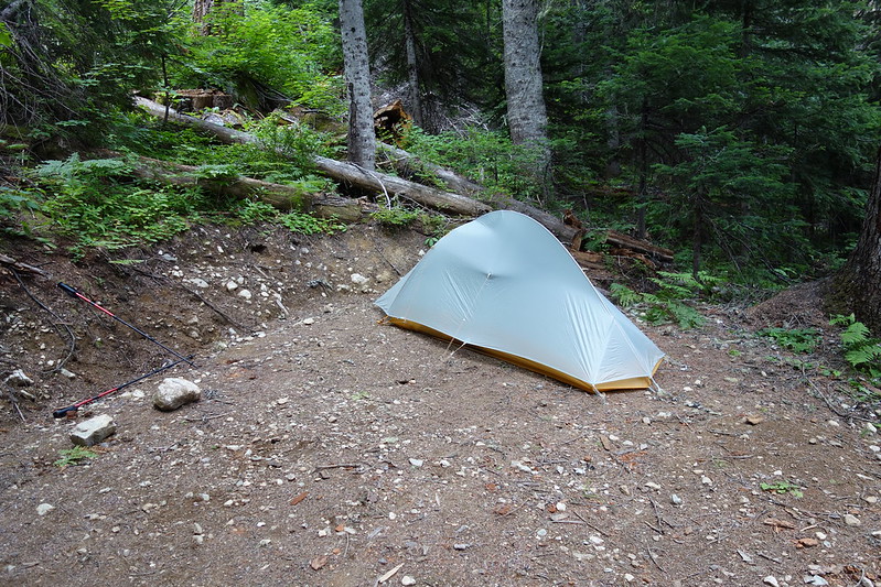
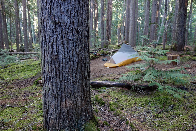
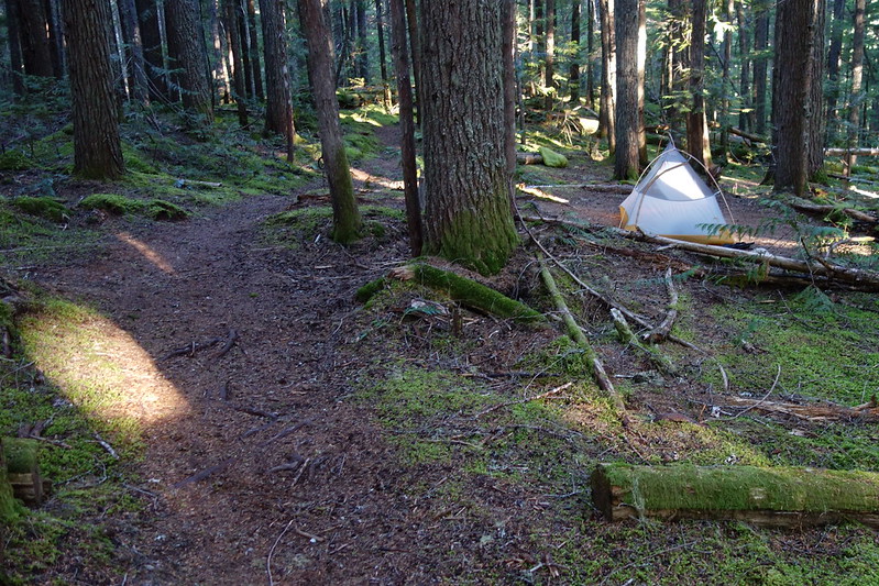
Camp that night was a beautiful old site a couple miles up Park Creek, with a bear wire and a half dozen massive stumps to sit on. It was only early afternoon when I got there, so I spent a few hours sitting by the creek, reading an old book about the PCT I found in the hiker box in Stehekin.
Making dinner and everything that night, I started to feel a pang of sadness, a pang of the end. It was my second to last night: the second to last time setting up the tent, fussing with food and filtering water. It made it all seem impossibly dear, even - or maybe especially - the stuff that'd become sort of blah over the last few weeks. Funny how that happens.
Day 25 (Aug. 10): Park Creek to Junction Camp
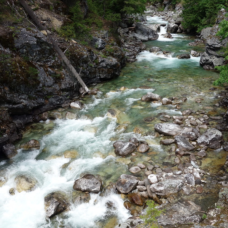
North Cascades National Park: Park Creek to Thunder Creek (14.8 miles)
I stayed up late reading my book in the tent, and woke up early to brambly footsteps in the huckleberry slope above my tent. I looked out in the just dawn grey to see two black blobs twenty feet away. I put on my glasses, and... bears! Two of them: an adult and child, walking through, utterly unconcerned with me or my tent. I stared for a while as they bit at the bushes, feeling like I'd been let in on the world's best secret. The adult was bigger than me, but moved through the bushes with a lightness - and, I almost want to say, a playfulness - that I'd never imagined.
I stared for what must have been fifteen minutes, smiling and at the edge of tears, until they caught wind or got sick of being on display, and ran up the hill, looking back only once, not scared or angry, but with what almost seemed like curiosity.
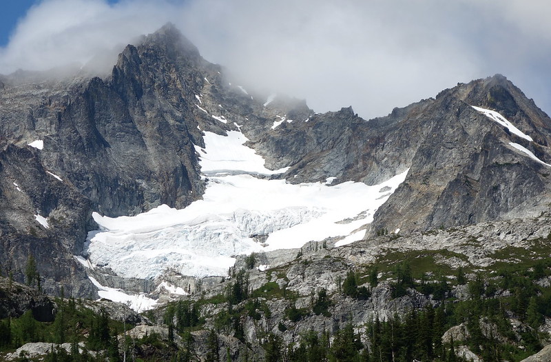
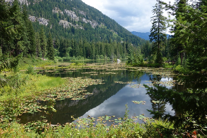
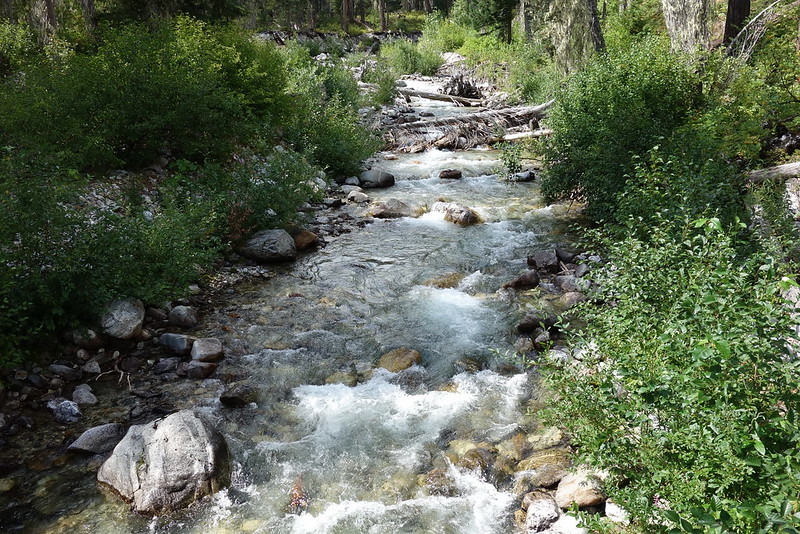
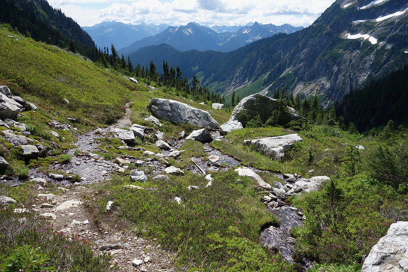
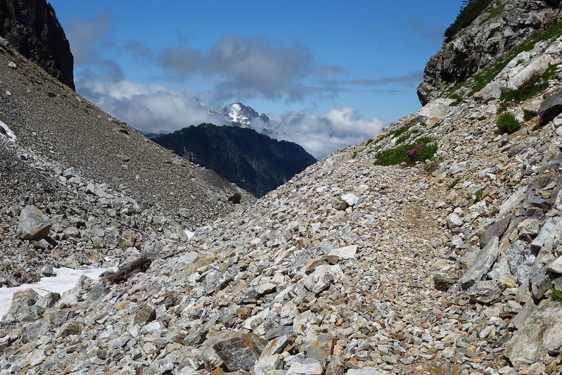
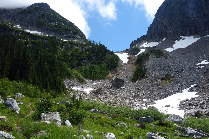
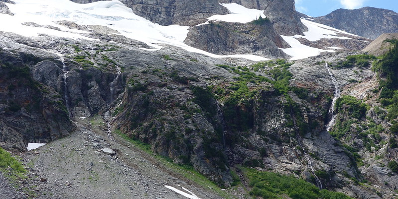
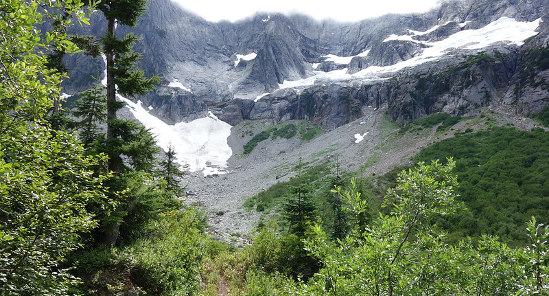
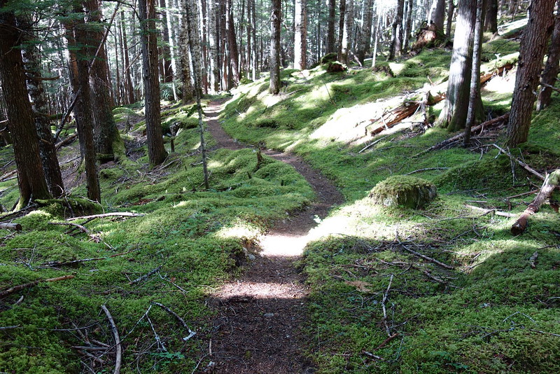
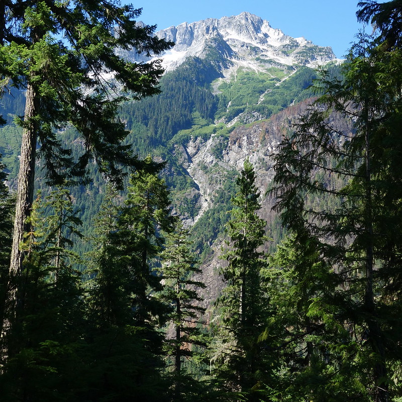
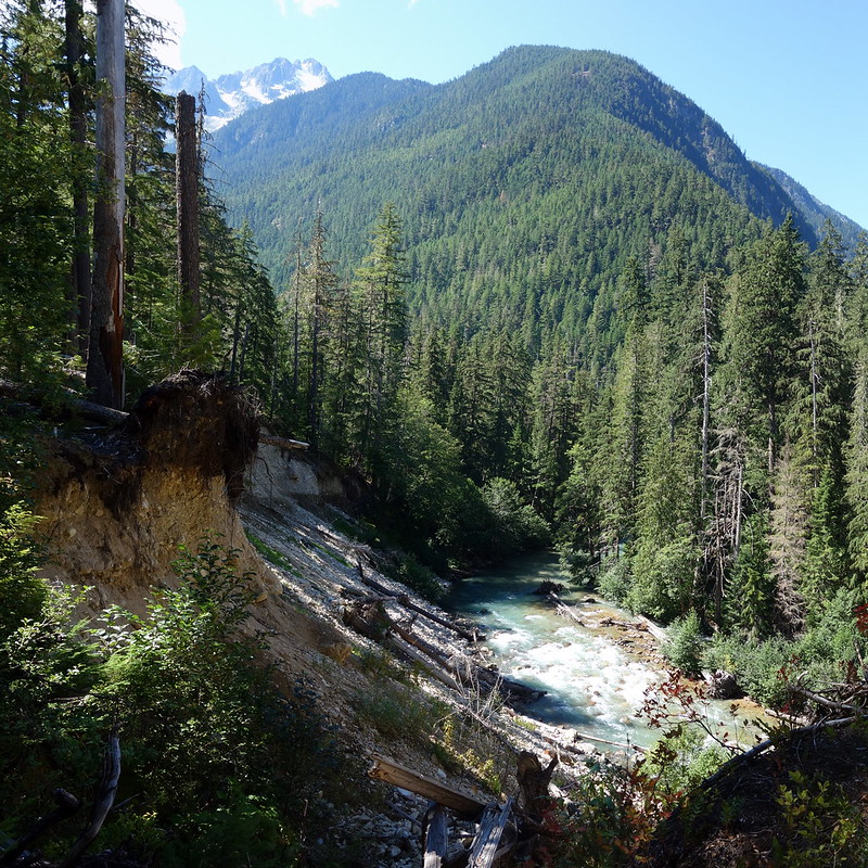
The first few miles of the day were uneventful, following Park Creek past a few old camps and through a new burn. But eventually the trail broke from the trees, into a massive basin below Buckner Mountain. The switchbacks up to Park Creek Pass were sort of rough - eroded tread with tons of blowdown - but the views were so good that I barely noticed.
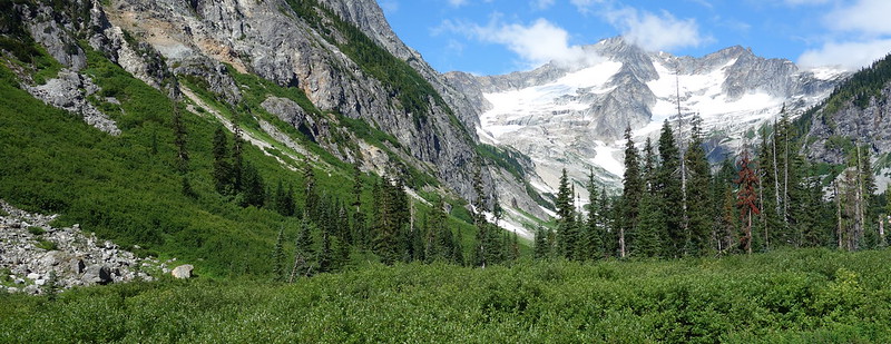
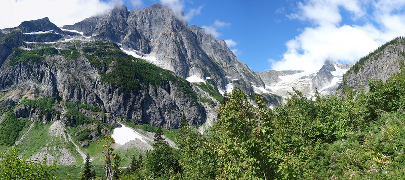
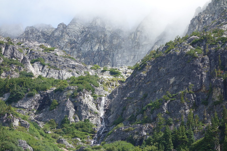
Park Creek Pass is a tiny notch in a rocky ridge that runs between Buckner Mountain and Storm King. The trail turns steeply up, out of the bright green meadows at the base of Buckner Peak, and into fields of talus that lead to Thunder Basin.
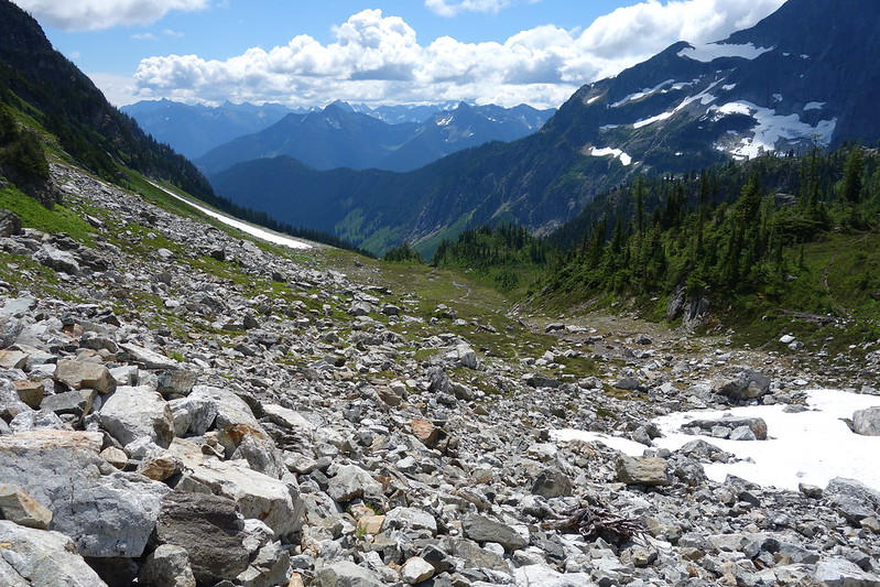
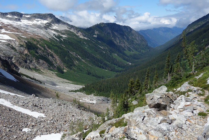
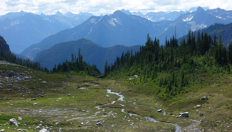
I took a rest near the top, perched precariously among basketball sized boulders, and had a quick lunch, looking back and forth down Park and Thunder Creeks, between past and future. Then it was down a series of rocky, overgrown switchbacks to Thunder Basin.
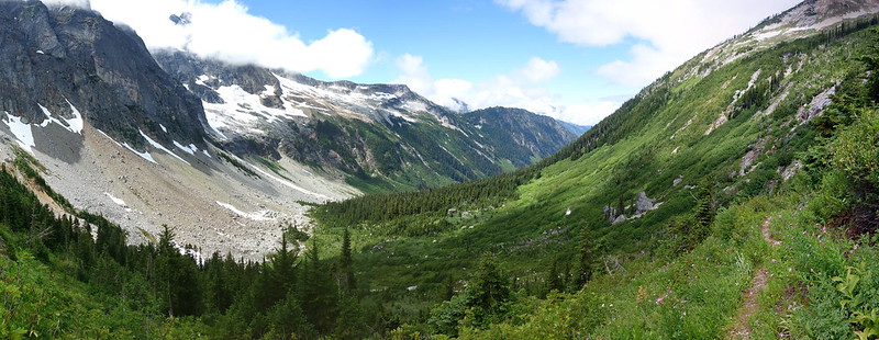
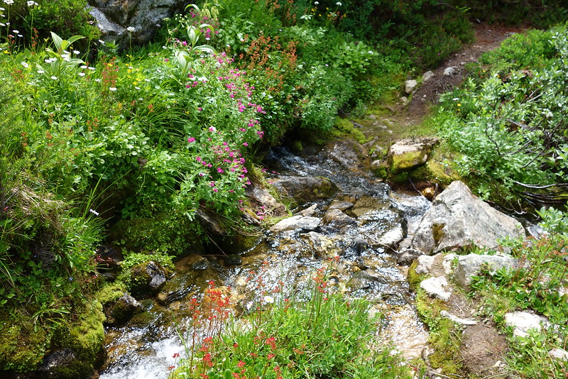
Thunder Basin felt like a park gone wild - like someone had planted acres of gardens, dug miles of intricate irrigation canals, then left, and left the place untouched for centuries to grow on its way.
It was also thick with flies. Every time I stopped they swooped, diving with manic glee at every bit of exposed skin, particularly my ears. Not sure what was going on there.
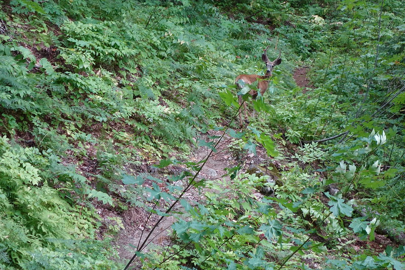
Halfway through the basin, I turned a corner and was suddenly staring straight at a young deer with antlers still in velvet. Like the bears earlier, he seemed serenely unconcerned with me.
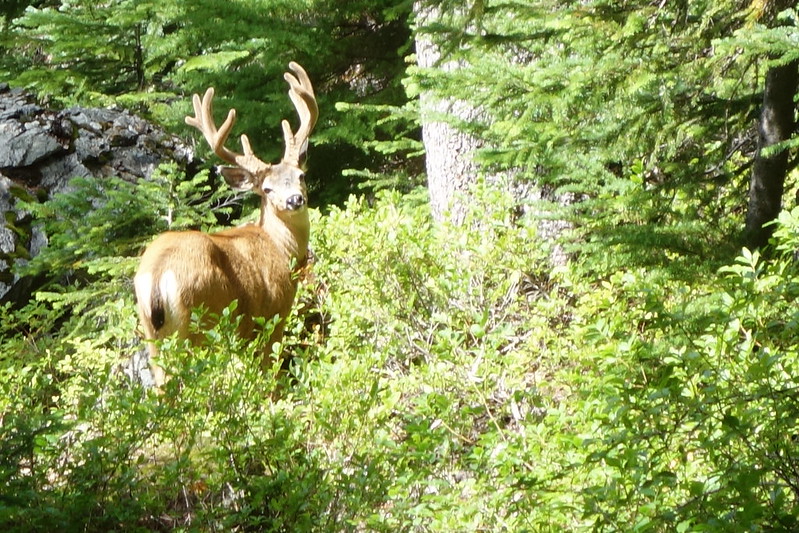
So unconcerned, in fact, that he didn't budge, even as I continued cautiously on, beating my trekking poles together and doing my earnest best to seem threatening, like John Wayne or something. John Wayne? I don't know. Who are deer scared of? Apparently not me. "Buddy, you're no John Wayne."
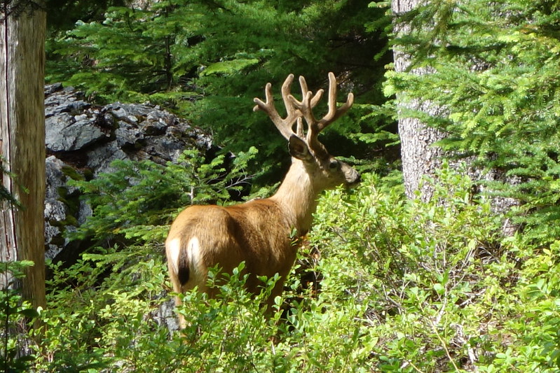
Worst of all, after a while he stopped even looking at me, and just went back to snacking on something in the bushes. I bushwhacked around, giving him as wide of a birth as possible, but no sooner had I passed then I heard a joyful trotting, and looked back to see my Buck Buddy following ten or fifteen feet behind. "Come on! Give me a break!" By this time, I was legitimately trying to reason with him, but alas. Then I switched tactics and tried to do my best Jimmy Cagney. But wait, are deer scared of Jimmy Cagney?
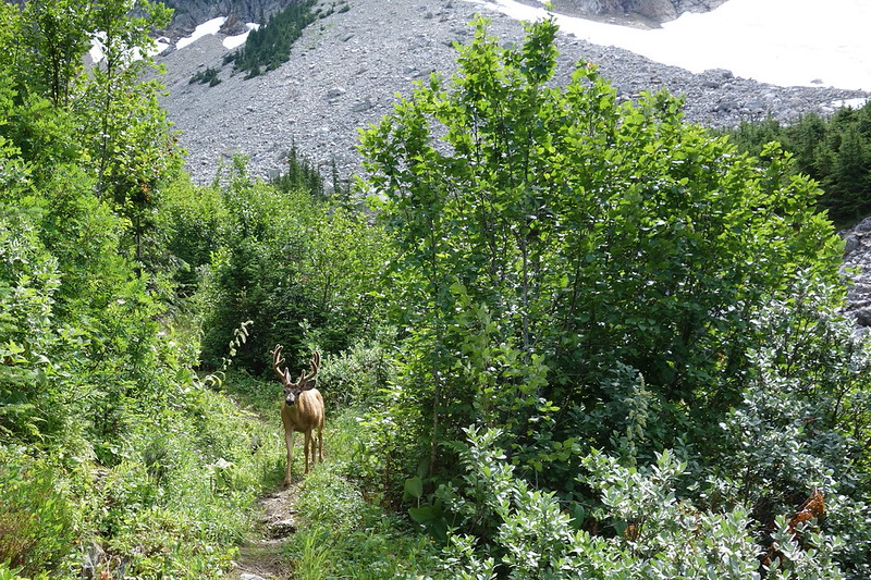
Apparently not him either. We went on like this for nearly a mile: him flitting untroubled to and fro, stopping for snacks, frolicking down the switchbacks, playing in the streams; me white-knuckled, sweating and nervous, wondering if there was such a thing as cannibal deer.
Eventually we reached a lower meadow, and he trotted out - happy, it seemed, for the passing lane. Oh. It's not that he was following me down my trail. It's that I was getting in the way of his.
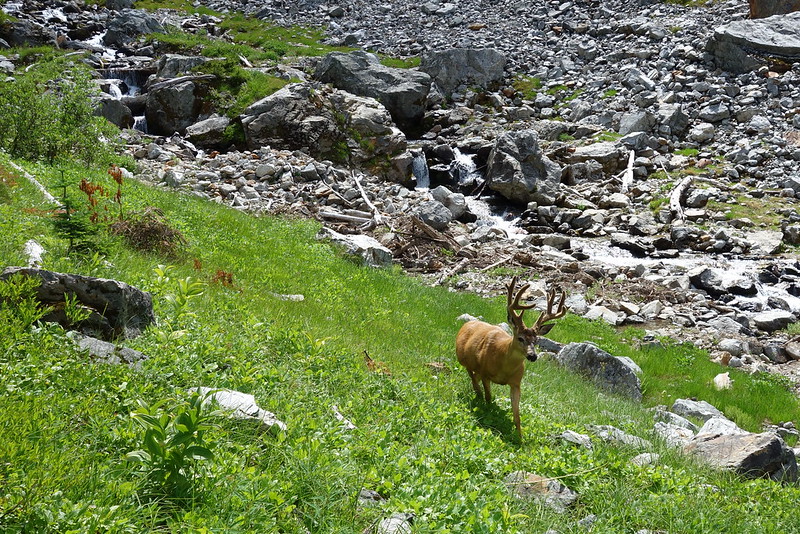
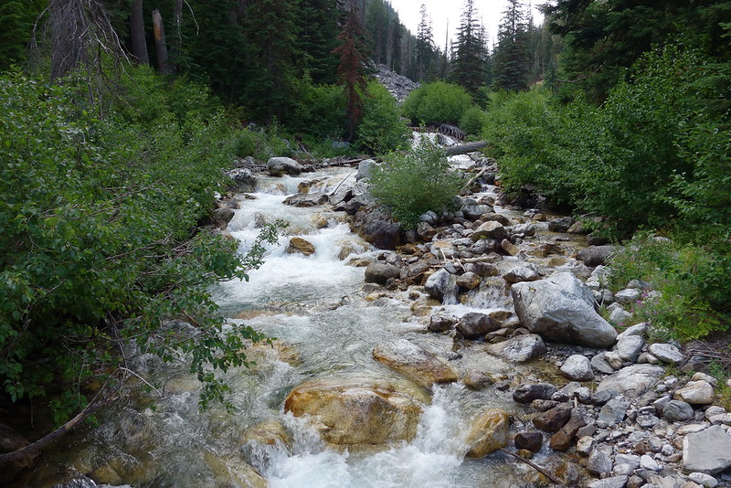
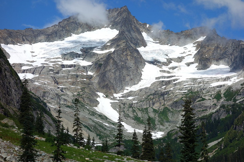
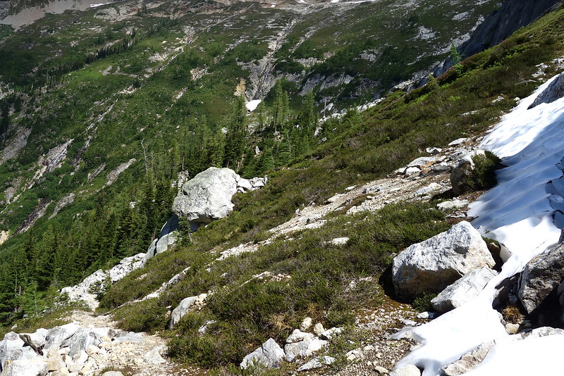
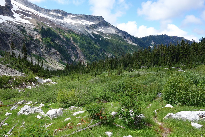
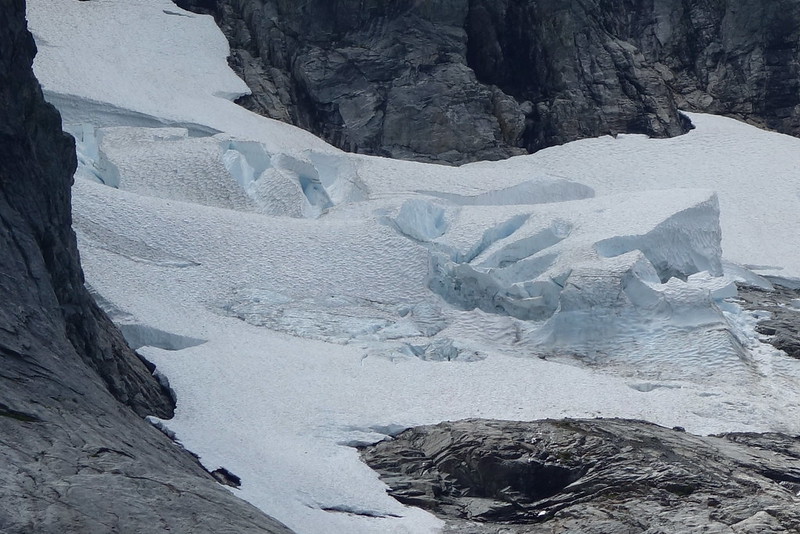
Freed of my terror, I stopped for a bit to placate the flies - I guess everyone deserves a snack - and take a few pictures of the glaciers above. It would be a beautiful place to stay, provided you're not beset by the same sorts of ungulate anxiety that was getting to me.
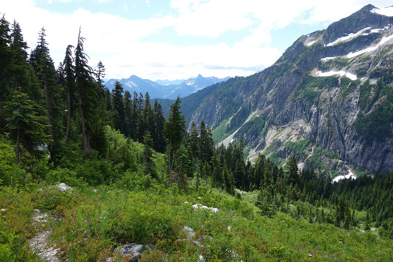
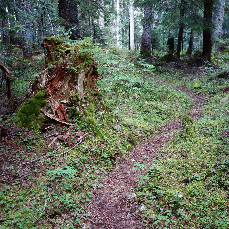
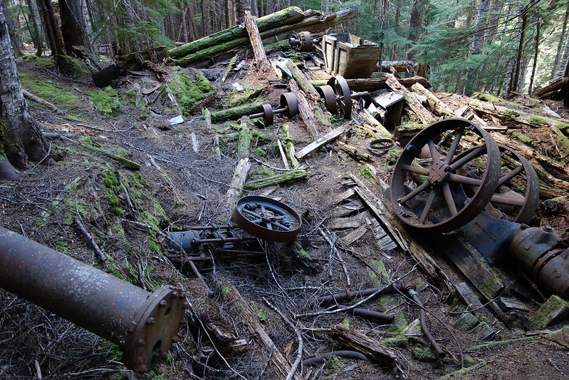
After the flies and I had had our fill, we continued together into the woods, down a few thousand pleasant feet to the old Skagit Queen Mine, and up an unexpected, and very unpleasant, thousand feet back up to Fisher Creek.
The walking was easy, and so my mind wandered more widely. The woods were pretty but anonymous, and I thought of the gorge. Of home. I thought of my first day, climbing sadly out from Panther Creek, through trees a lot like this. It's funny: that first week was so hard. I thought every day of being done. I spent every night dreaming of home. And I missed home now too, but it was different: deeper but less desperate.
My last camp was an enormous site near the confluence of Fischer and Thunder Creeks. The Ranger in Stehekin had given me the horse camp, and so I had massive meadows all to myself: a half dozen fire pits, three or four kitchen sites, and enough space for an army of tents. But it was just me. Just me changing into warm clothes for the night. Just me rambling over to filter water. Just me cooking dinner, making a night of it, drinking the last of my bourbon, staring at the sky and stars. Just me saying some words to the "close and holy darkness," retiring to my tent one last time, and sleeping to the joyous sounds of surrounding streams.
Day 26 (Aug. 11): Junction Camp to Diablo Lake
North Cascades National Park: Thunder Creek (9.9 miles)
My last day, I slept in. Or, at least: I tried to sleep in. The sun filtered through the trees and dappled the forest with just enough light to force me out of bed and into one of the clearings to make one last breakfast.
Krista and I had planned to meet at Diablo Lake around 7:30, and I only had ten miles to go, so I wasted as much time as I could, eating breakfast, exploring the camps, visiting the palatial backcountry bathroom, and just generally being pleasantly inefficient.
As I finally packed up, I said goodbye to all of my gear in turn: to my quilt, which I still unreservedly loved; to my pad, which still seemed impossibly posh; and to my tent, which I'd sort of grown to hate. It felt weird, and a little triumphant, to put it all away for the last time. Like I was already at the end.
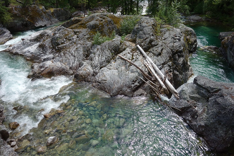
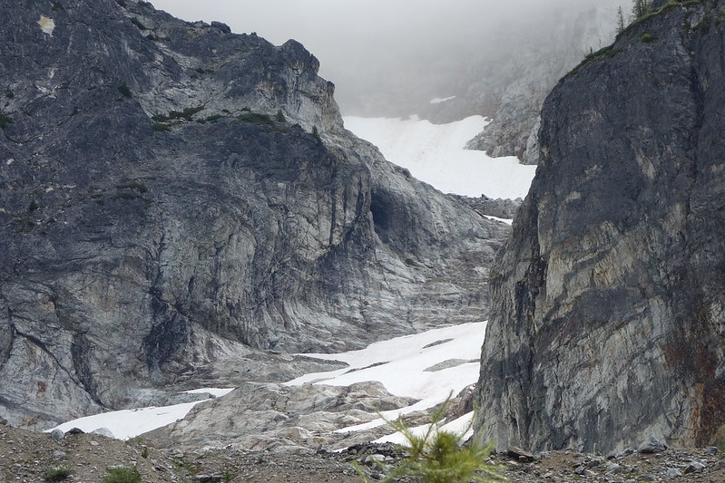
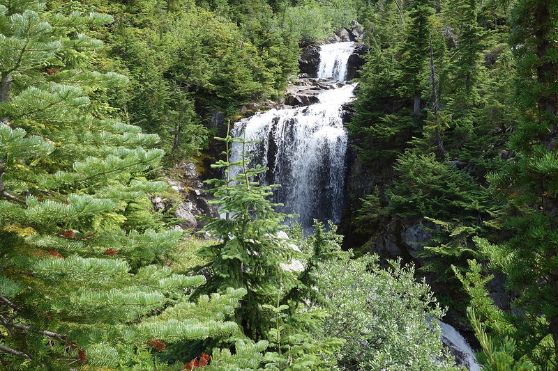
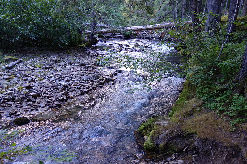
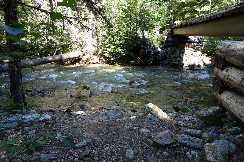
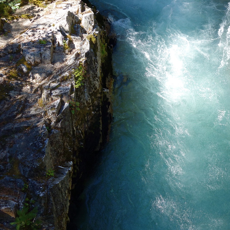
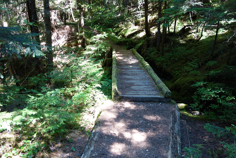
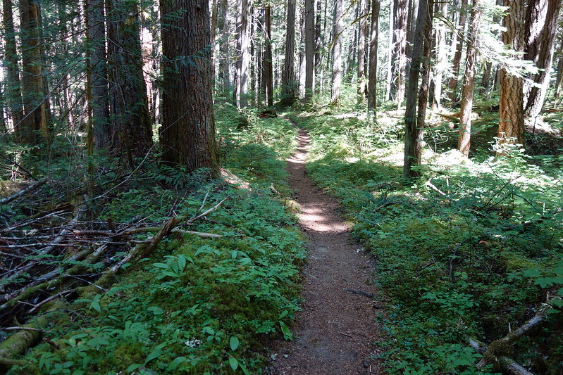
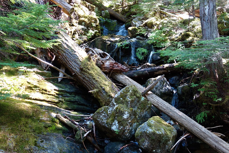
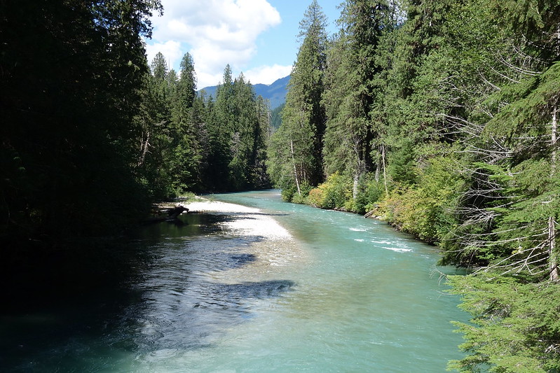
The first few miles from camp were surprisingly steep, switchbacking down, following Fischer Creek's cascades into a deep canyon, surrounded on either side by tall ridges. But then it was just mellow walking through deep forest along Thunder Creek's bottomless blue pools.
I'd started out around eleven, thinking that I could stretch ten miles into at least five or six hours, but despite frequent breaks, it only took a bit over two hours to hit Thunder Camp, just over two miles out from Diablo Lake. I guess I was excited.
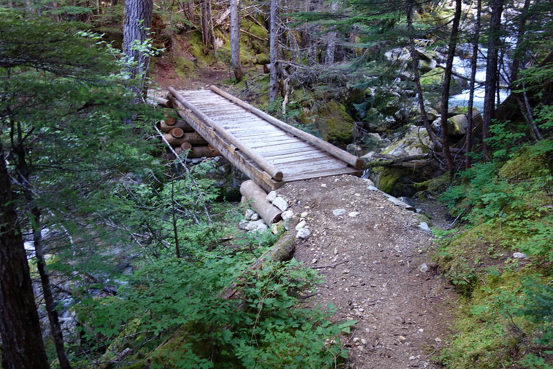
I stopped at a broad bridge over Thunder Creek - now a proper river, in the process of becoming a lake - undid the waist and sternum straps on my pack, and treated the last couple miles like a valedictory lap.
From the bridge, the trail became wide and flat, and I started seeing more and more dayhikers, out from Colonial Creek Campground. Just a trickle at first, then a flood - dozens of people, out in jean shorts for short strolls to the bridge. I felt preposterously magnanimous, saying hello to everyone that passed, most of whom looked away - or, perhaps, pointed their noses away - with something very close to horror.
And then, suddenly, there was a tangle of trails, an amphitheater, and Colonial Creek's tasteless tarmac. It was only Thursday, but the place was full with campers: campers roasting hot dogs, sitting on coolers, drinking Coors in the harsh afternoon light. And there were tents everywhere: crowded against cars, against each other, caterwauling clear to the bathrooms.
I walked through in a sort of daze, "as one wakened suddenly from a beautiful dream," as though I was just waking up to a world utterly unlike the one I'd been walking through for the last forever. The world of woods and wild faded into hot cement and the smell of campfires and bug spray, and I struggled to keep or re-capture the feeling of just a few miles before.
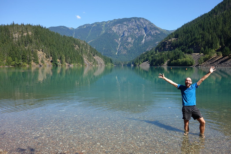
I crossed the highway and found a small easement on the south shore of Diablo Lake, where I laid out my things and went for a swim, far out toward the middle. Looking back, it was just trees again, trees and rocks and rubble. The tents and fires and coolers were hidden behind a thick canopy, and I stayed there, treading water, until my arms got tired and I did a sort of lazy backstroke back to the shore, still staring at the blue sky.
I had the easement to myself, and spent the afternoon there, lying the sun, eating the last of my food, and writing a final letter to Krista. Slowly, the reality seeped into me: I did it! What a strange month, spent all alone in the mountains.
The shock of civilization faded with the evening light, and I thought of something I'd read the night before in the final chapter of the book I found in Stehekin: "After walking on this trail for so long, I feel as if it's kind of a telegraph line - as if we're still connected in some way to every point along the trail, and to every person we've met on it."
Eventually I meandered back up to the parking lot to meet Krista, and sat on an uneven rock at the edge of an empty space, watching headlights speed by. It was comforting in a way I hadn't felt for a month, and I thought of the Roman poet Terrence: "I am human, and nothing of that which is human is alien to me." But the feeling I had was more than that. It was the feeling that I am of this world, and that nothing from this world can be alien to me. Maybe that, ultimately, is what I learned on this trip. The cars and camps and woods and wild and bears and deer and friends from a thousand far off places: they're all home, in a way.
Right on time, the headlights of our Honda hung a left and pulled in. Krista jumped out, and I jumped towards her, and she held me. "You're so bony!" And I started to cry with happiness at this home, more home than anything.