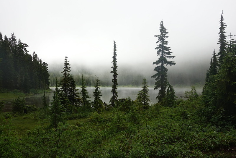
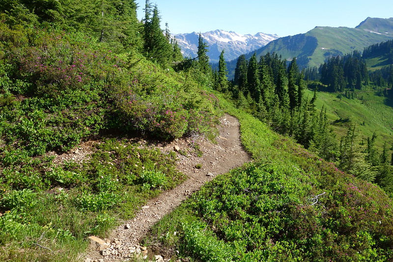
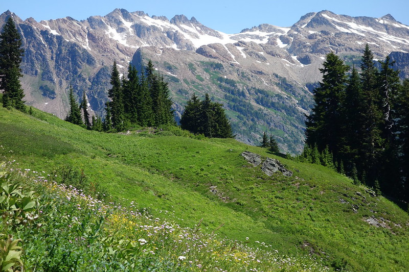
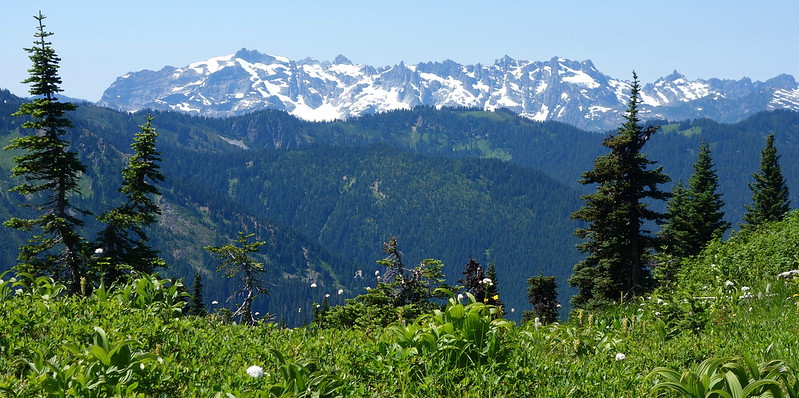
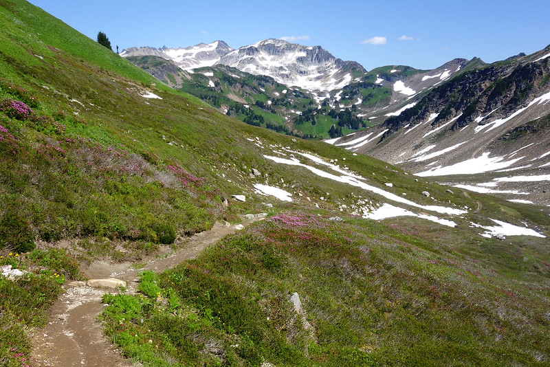
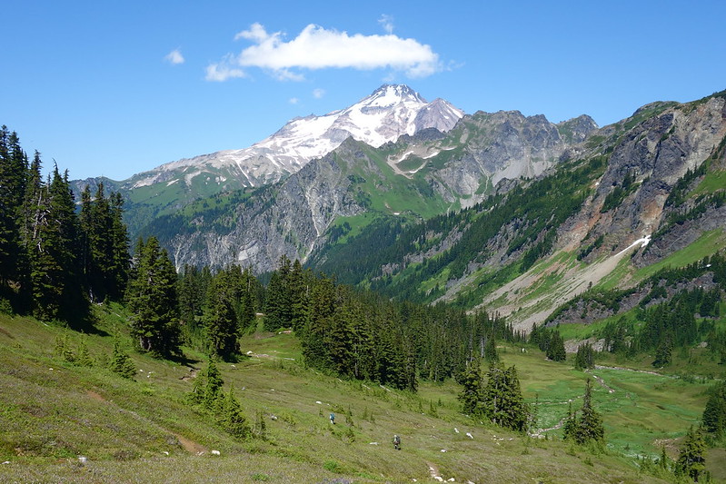
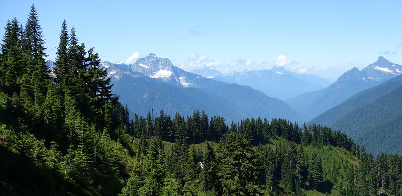
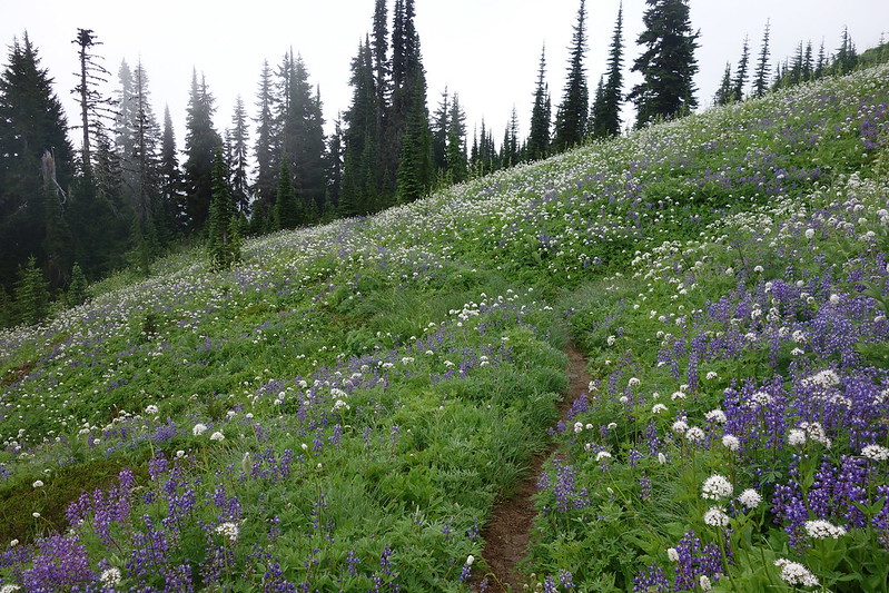
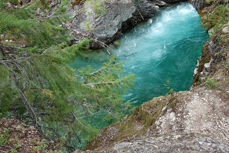
Opening picture: evening meadows, near the East Fork of Milk Creek, Glacier Peak Wilderness
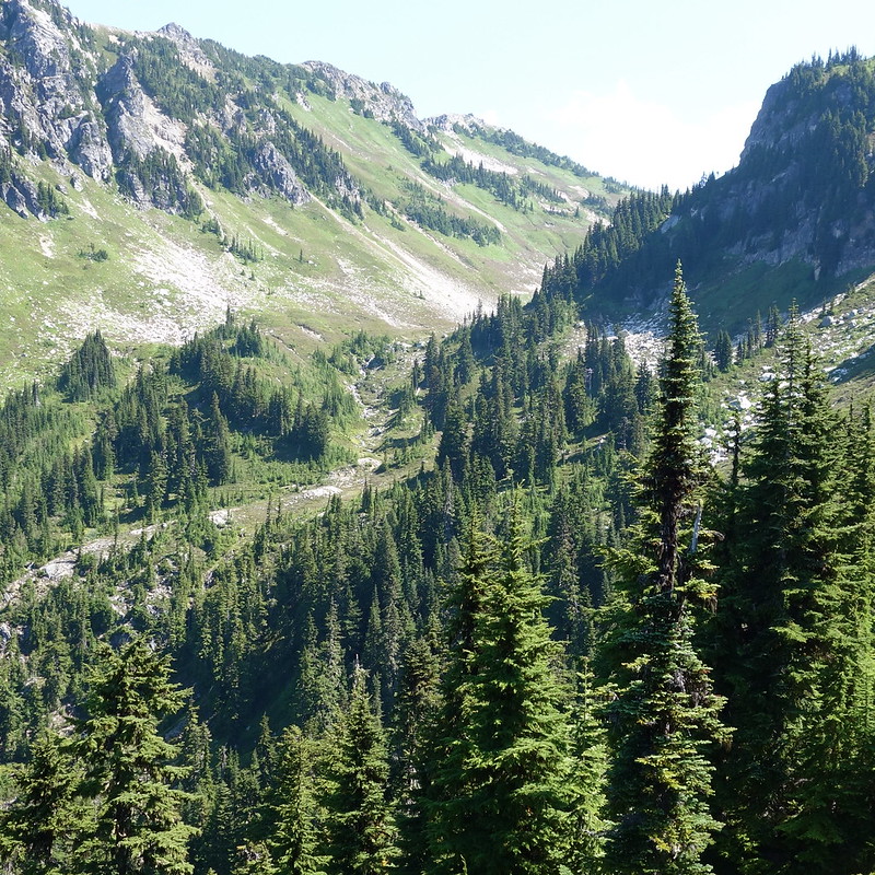
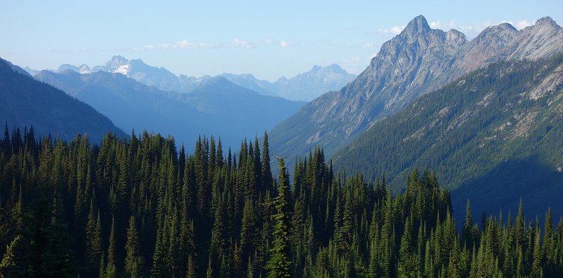
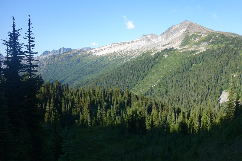
Before starting this section, northern Washington had always been sort of mythic to me: I’d driven through the North Cascades, and maybe been to Lake Chelan when I was a kid, but never really spent any concerted time up there beside that. Holy hell! It’s… it’s really just difficult to describe. I don’t think I’ve seen anything like it, save perhaps the Sierras, but even there, it’s often just granite. (Okay, “just,” but you know what I mean.) In northern Washington, it’s granite and glaciers and deep deep river valleys and sun and storms always ready to cross some distant pass and take over the skies. It’s wild in a way different, and deeper, than any other place I’ve ever been.
It’s also, unless you’re thru-hiking, kind of a pain to get to. Some of these areas are twenty or thirty miles from the nearest trailhead. It made passing through sort of tragic – when am I ever going to get here again? – but it also meant that I spent most days and nights alone, surrounded by mountains and glaciers and trees and sky.
Day 17 (Aug. 2): Stevens Pass to Lake Janus
PCT2461.6 – 2471.4 (9.8 miles + more earlier, to Stevens Pass)
On the walk into Stevens, I’d been vaguely planning on looking for some food, maybe some lunch, but the place was a ghost town when I got there. So I chased down my resupply, syphoned a half liter of questionable water from a garden hose they had lying around, and made my way across the highway in the gathering rain.
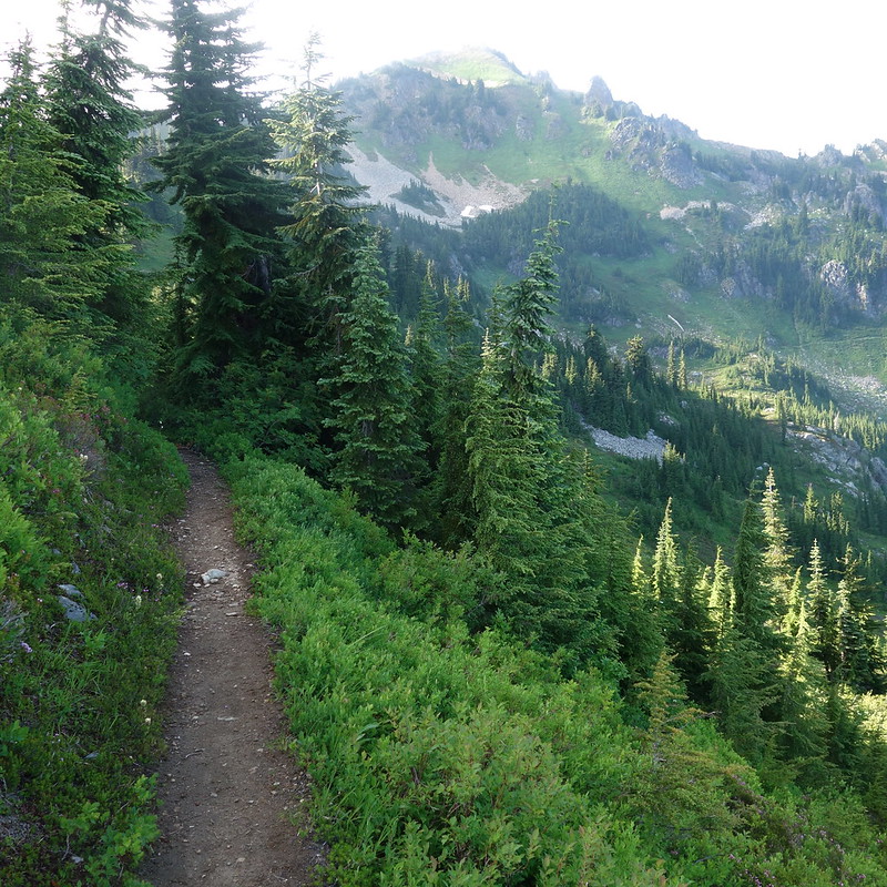
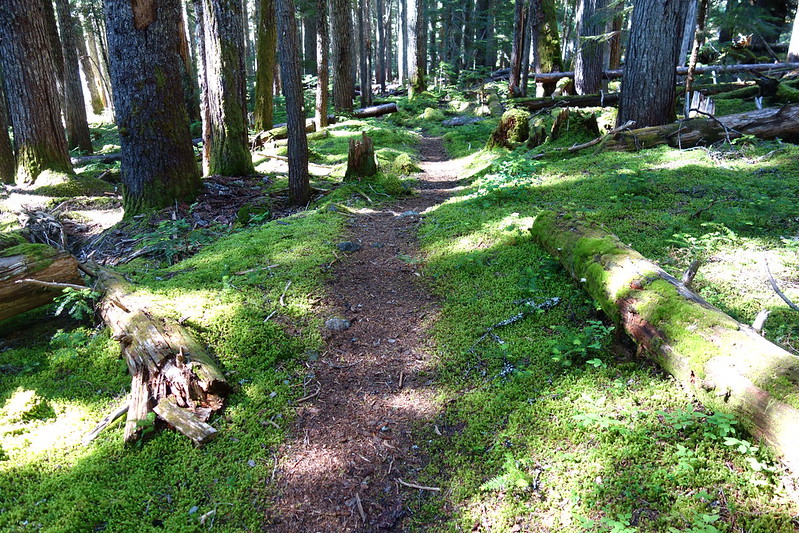
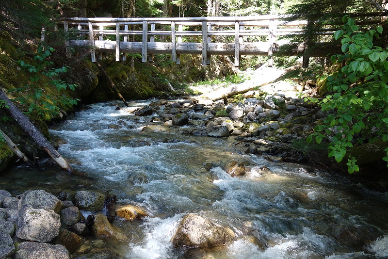
For the first few miles from the pass, the trail’s an old road that closely parallels the highway, and I listened as the storm sounds mixed with engines and horns to form a sort of low-level hum, mingled metabolisms from two different worlds.
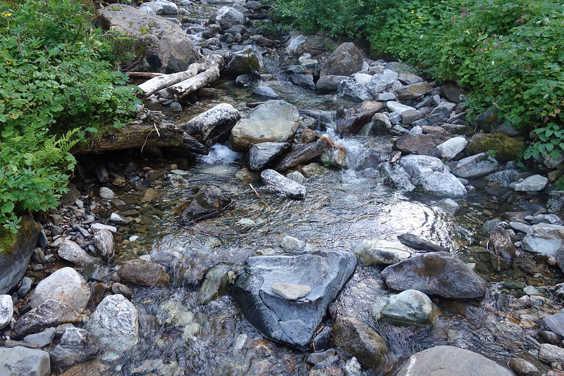
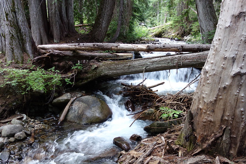
I stopped at a small, rocky creek – one of many south forks of Nason Creek – for a late breakfast, and to filter a few liters of water. Another front was coming up the valley from Leavenworth, casting a strange grey fog on the struggling trucks.
As the trail turned away from the road, I met a large group of ragged, happy young hikers – all southbounders trying to do the whole thing – planning to hitch into Leavenworth for the night. One was in sandals, seemingly without a pack, eating Go-Gurt that must have been at least a week old. One had two plastic raincoats and an ice axe and what looked suspiciously like a folding camp chair. A girl’s hair seemed to openly defy some pretty basic laws of physics. I loved them all instantly and completely. “You want to just turn around and come to Leavenworth with us?” I paused, to imagine another world. “We’re going to make, I don’t know, macaroni and cheese or something.” I apologized – “I really am sorry, in several senses” – but I had miles to make. As I was leaving, the girl yelled after me. “Hey, do you want an ice axe?” I asked, a little concerned, if there’d been steep snow. “No, but, like, it’s good for cutting salami and shit.” Then the boy with two coats called, though he didn’t look back: “You’re going to see some shit!” I spun around and answered. “You too man!”
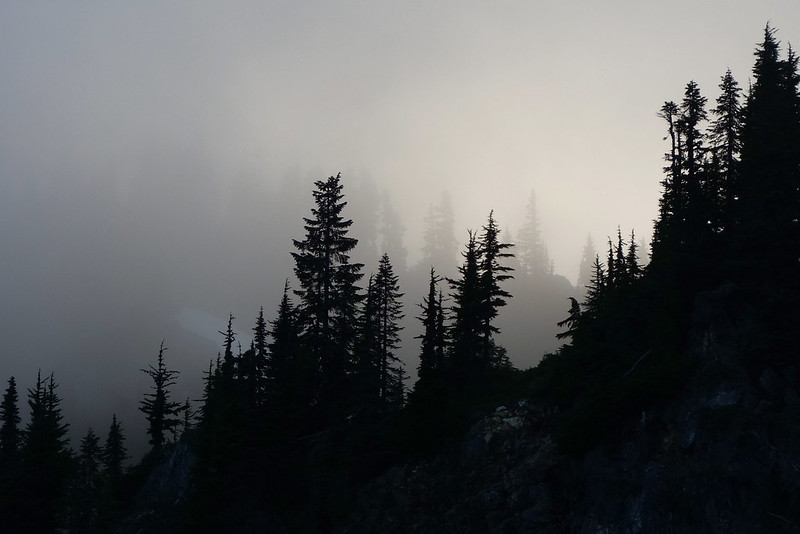
The rain got a second wind as I wound through the switchbacks below Lake Valhalla, and by the time I made it to the lake proper, it was pouring, driving down and spilling from my rain coat visor as if it were a clogged gutter in spring.
Things got still thicker as I approached Union Gap, but as I passed over the ridge I could see tiny pockets of sun far north, and hoped, in that way you hope for things you don’t expect, that maybe it would clear. It didn’t, but soon at least I was back in the woods, steeply side-hilling on overgrown trail below Union Peak and across a few forks of the Rapid River.
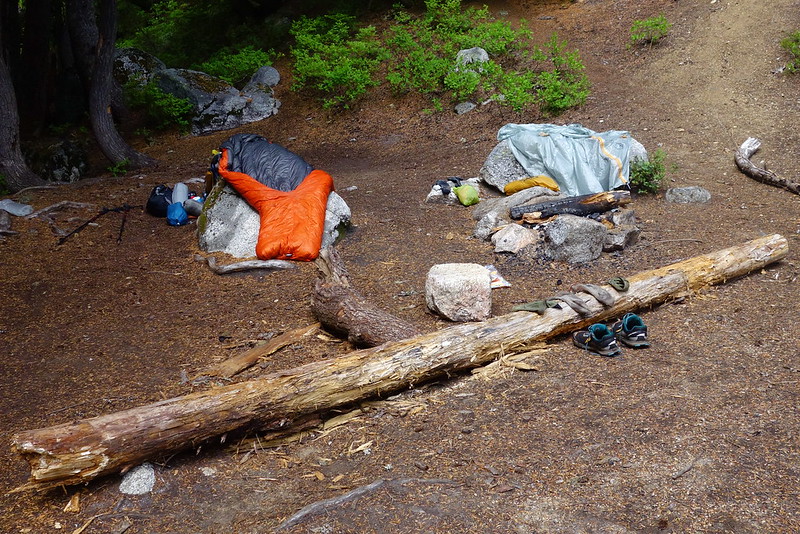
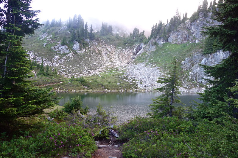
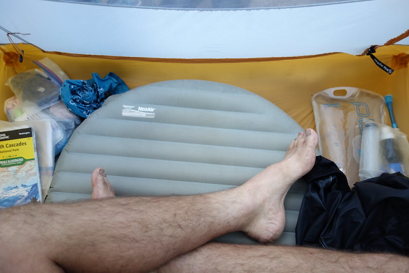
Then it was just a short hop to Lake Janus, where I found a small, over-loved, but mercifully sheltered camp, and quickly put up my tent, took a few liters of water for the night, and cursorily crammed in my camp chores between bursts of rain.
Just as I was finishing dinner, a kindly older man, who looked distinctly like Gandalf, ambled over from an unseen camp. “Hello, there.” I said howdy in my cheeriest voice. (I have a theory that one should always try to sound cheery in inverse proportion to the cheeriness of the weather.) “We didn’t realize we had a neighbor!” I apologized if I’d ruined their privacy. “No, uh…” He trailed off and I took the opportunity to put up my dinner things. Then a grand old English woman – his wife, it turned out – ambled out from the bushes to a nearby tree, looking cross with him but very happy to see me. “What’s taking so long?” she asked to no one in particular. Gandalf turned red. “Oh, uh, would you like to come visit at our camp for a spell? We’ve got a tarp set up and everything.” I told him that I would love to, and meant it.
Their camp was wonderful – a tarp for shelter, a log for sitting, even a place to put my drink – and we spent a happy couple hours chatting. They’d been on the trail for a while, since Crater Lake, doing short days and making comfortable homes each night. Gandalf asked what I did “out there.” I told him I’d just finished a PhD in political science, they he laughed. “Politics!” He stared into the gathering dark with kindly incredulity. “Speaking of politics, you know, we’re really just doing this whole hike as a way of emigrating to Canada.” I smiled, and meant it. “Even when it’s rain for weeks, the news here is always better than the news out there.”
Eventually it was too cold and dark to continue without shivering, so I thanked them for their hospitality and said my goodbyes. “You know, maybe I’ll look you up when we all get to Canada.” And I meant it. Almost.
Day 18 (Aug. 3): Lake Janus to Lake Sally Ann
PCT2471.4 – 2491 (19.6 miles)
I woke up in the indiscriminate dark to the sound of something hitting my tent vestibule. Hard. Huh. Then there were hurried hoof steps through the brush behind my tent. Then perfect silence, but for a steady stream of gentle rain on the trees and tent.
I got out to check things out. One of the stakes in front of my tent had been knocked out, but things were otherwise untouched, and I stared for a while into the foggy dark, now more curious than scared. Maybe fifty feet away, in a thicket I’d thought impenetrable, there was a faint outline of elk antlers. And we stared at each other, the elk and I – at least I imagined we did – until it got too cold, and I returned to the tent to sleep a few more hours with a new sense of wonder.
Rain beat hard just before dawn, but I woke up to silence and sun making its weak way through the low clouds. Everything I owned was wet and I just didn’t want to deal with it, so I threw it all in my bag, said a shouted goodbye to my friends from the night before, and set out, up toward Grizzly Peak.
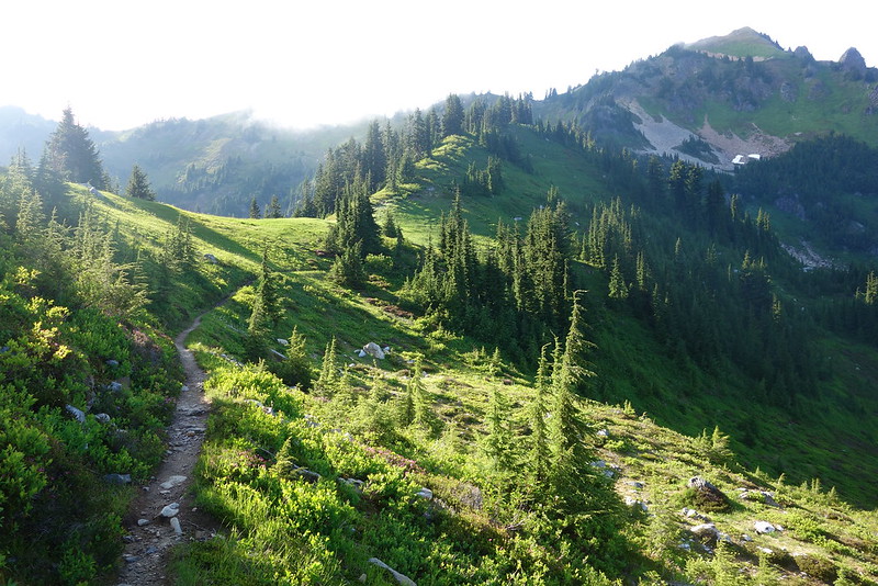
The climb from Lake Janus to Grizzly Peak isn’t so bad, all things considered – just a few miles and a few thousand feet – but it was cold and wet and I felt like molasses moving uphill. My morning Snickers helped, though, as did the sun breaking a broader path through the clouds, and soon I was on tracing the top of a gentle green ridge, up and down toward the peak.
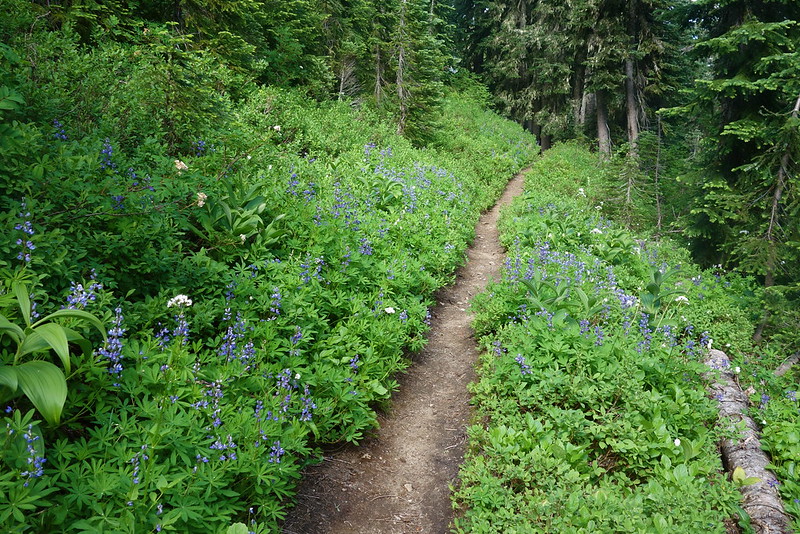
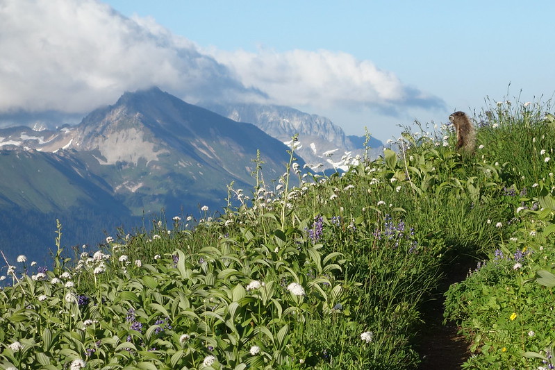
I stopped on top at an overgrown camp for breakfast and a quick rest, and was soon joined by three laughing ladies around my age, each carrying a botany book. They were naming the flowers – all of them. The lupine and lilies, bistort and bunchberry. Everything. They’d stop at every one, all bend down in a semi-circle, and take turns touching it gently, as if it were a fragile gem.
They were soaked but smiling, out for two weeks from Stevens to Stehekin, and we talked pleasantly for a while about nothing. I told them what I was up to, and they asked if I had everything I needed. I laughed and asked them the same. We all laughed, and they made me promise to say hello when I passed them “in just a few minutes.”
I sat for a while longer, feeling resplendent in the rising fog, and was just packing up when a southbound PCT hiker stopped to say hello. He was in military surplus combat boots, with triangles of duct tape around is knees. Limping. He seemed nervous: about the trail, about finishing, about how everyone he saw was in trail runners. And I tried to remember what someone had told me my first day. “It’s… everything was hard for me until last week. But now… now I feel like I could walk forever. I bet that’ll happen for you, too.”
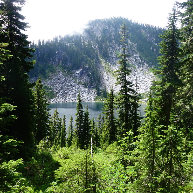
From the peak, the trail traversed high above Grizzly Lake, then descended down to Wenatchee Pass as the clouds began to lift. I stopped for an early lunch at Pear Lake, where I yard saled my soaked stuff in a tiny spot of sun, and spent a happy half hour on the side of the lake, staring across at Fortune Mountain’s high granite walls.
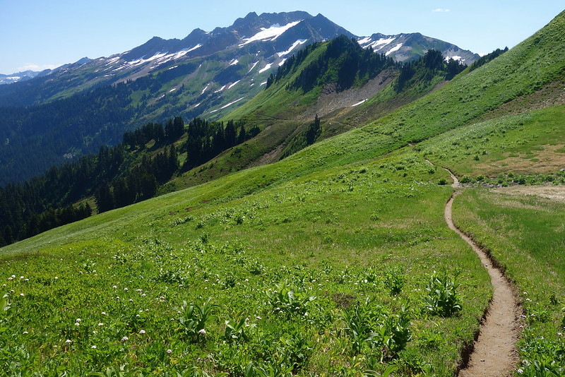
After lunch, the trail climbed to the cascade crest, and I spent the afternoon following the ridge, flitting from one side to the other, through overgrown, flower-filled meadows and rocky flats, through Saddle Gap, down to Pass Creek, up to Cady Pass, and finally further, to Skykomish Peak and Lake Sally Ann.
Just as I was starting my last climb of the day, I ran into a woman I’d met in Snoqualmie, who was headed back to Stevens. She’d hurt her knee or something, and couldn’t keep going. As she told me, she seemed perilously close to tears. I wanted to say something but I couldn’t think of anything. She finished and there was silence. “I…” I couldn’t think of anything. “I… you know, I guess sometimes turning back’s the bravest thing you can do.”
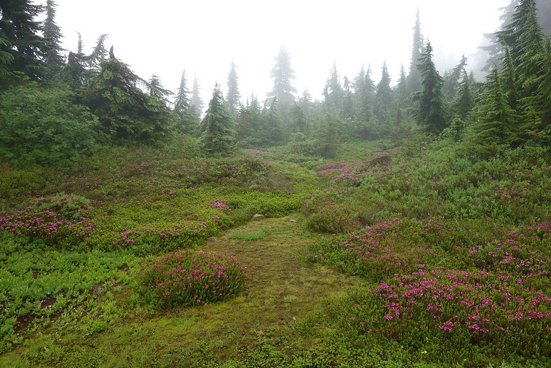
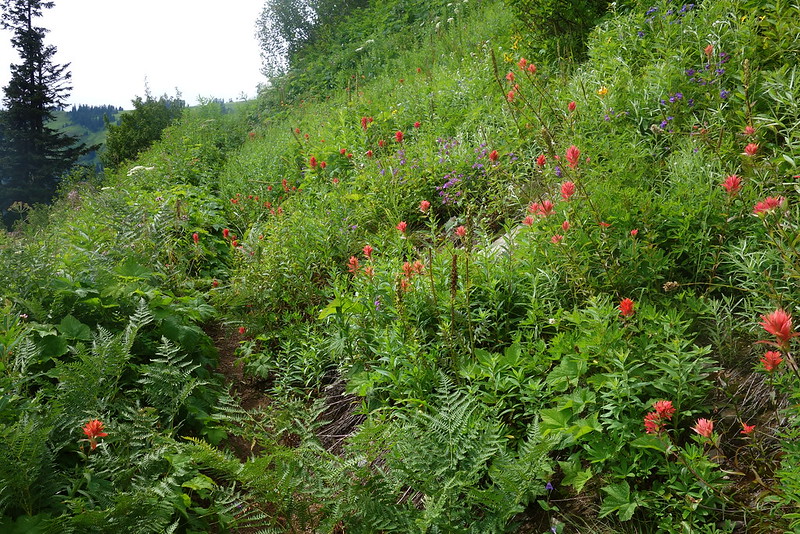
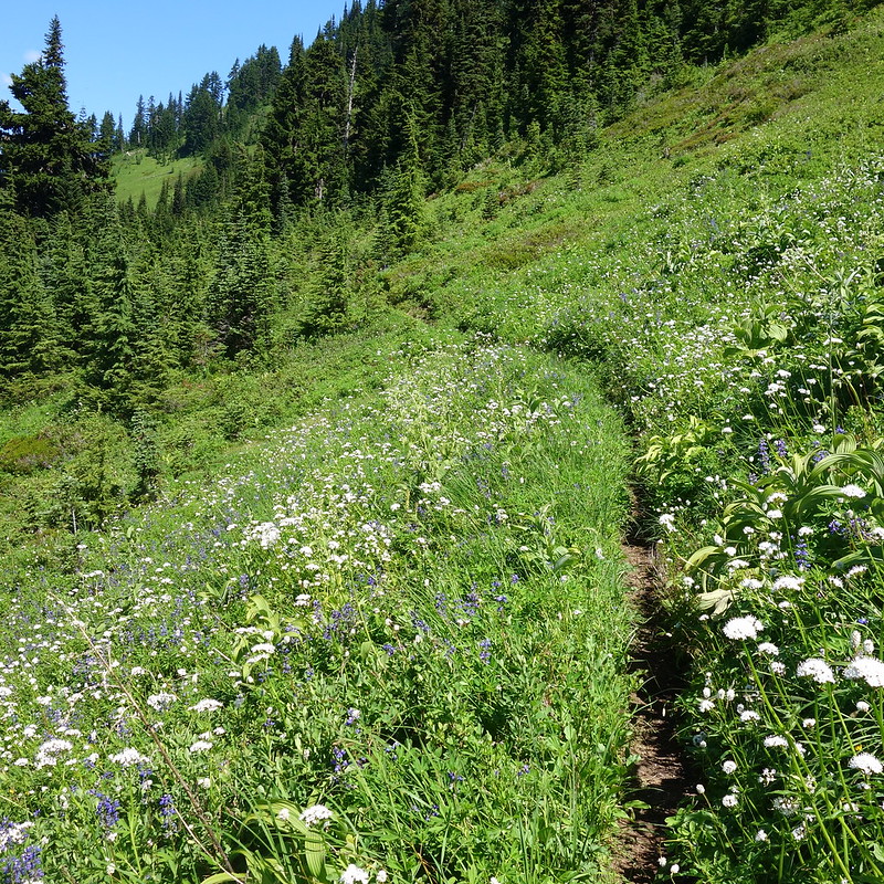
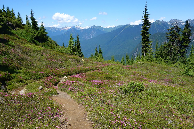
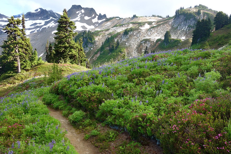
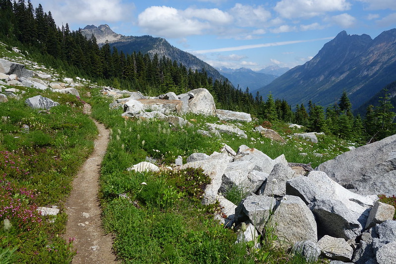
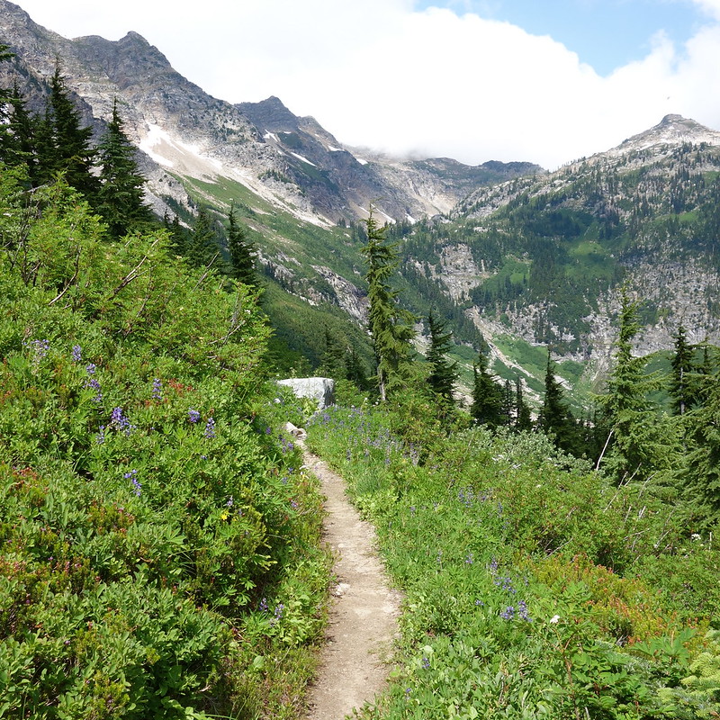
As the afternoon turned to evening and the shadows grew long, I followed the trail under Skykomish Peak, through meadows made bright by the softening light. I stopped for a while at a low saddle, sat on a smooth piece of granite, and stared at the flowers. I only knew maybe three of their names – the obvious ones: heather, lupine, painbrush… And I resolved to learn more when I got home. And I thought about how lucky I was to have made it so far without any injury to speak of. To be here, in the evening sun, among all these gems I couldn’t name.
The bugs were comically terrible at Lake Sally Ann, but I set up camp there all the same, on a high platform some ways off the trail on the north side. Marmots whistled at me as I meandered down to get evening water, and pikas chirped as the sun set and I made dinner. The night grew close and cold, but I stayed out until the bugs went in, and watched the stars come and go, as the clouds washed back and forth.
Day 19 (Aug. 4): Lake Sally Ann to Glacier Creek
PCT2491 – 2512 (21 miles)
I woke up to a ridiculous swarm of bugs surrounding my tent, and fumbled around awkwardly in my head net trying to get packed up.
From Lake Sally Ann, the trail descended a short way through bursting meadows toward the headwaters of the Little Wenatchee, before climbing up a steep several hundred feet to Wards Pass and Dishpan Gap.
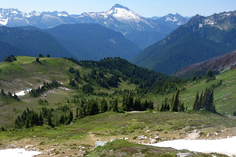
As I climbed, I looked back at the rocky spires of the Alpine Lakes – the last time I’d see them – and said a silent thank you. I have this memory – I think it’s a memory, though it’s so long ago that coiled in clouded into something more like a dream – of being a kid, hiking out of Green Lakes with my dad, and hearing him thank the mountains. There was nothing precious or affected about it. More than anything, it sounded like the sort of thing Humphrey Bogard would have said in some 40s film to a plucky dame. “Goodbye mountain, and thanks!” And so I looked back, and tried to say goodbye in my dad’s voice.
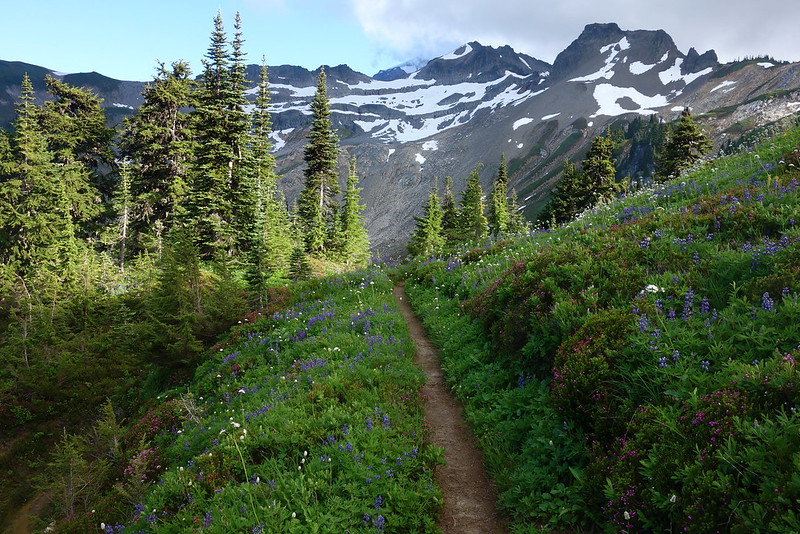
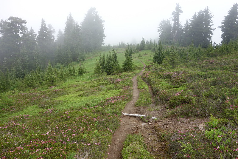
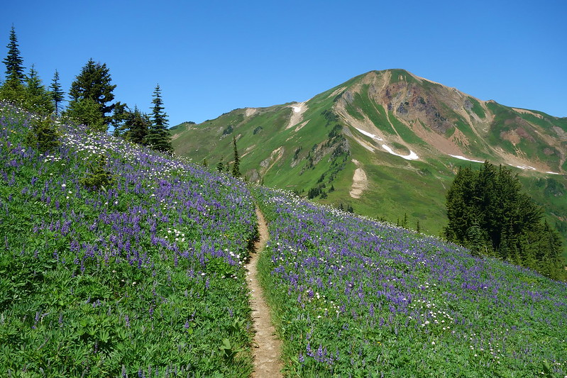
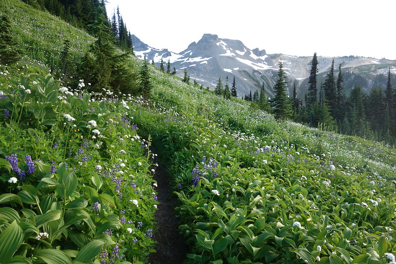
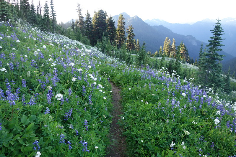
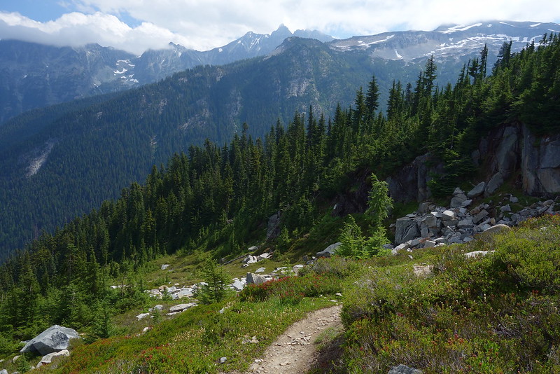
I stopped for breakfast at Dishpan Gap, where the bugs were better and there was even a minor campsite, then meandered down to Meander Meadow, up across the eastern shoulder of Kodak Peak, and north through beautiful hanging meadows into Glacier Peak proper. As the trail descended to Indian Pass, through deep, soft green friends spotted with bright red paintbrush and spiny sharp heather, everything seemed just sort of right. I put on an old Band of Horses album and skipped through, singing along.
From Indian Pass, I followed the trail up, through a deep basin thick with the smell of warm, wet flowers – like perfume, and so strong as to be almost too much – then through a little snow and a lot of lupine to White Pass. The meadows were just so beautiful, maybe the most beautiful I saw all trip.
I sat down just short of the pass, on a wooden step in the middle of the trail, and teared up for I don’t know why. These “endless numbered days,” which stretch to the horizon but melt into moments and collapse into single, shining images as I stare at my camera’s glowing screen at night: they’ll all be over before I know it. These impossibly dear ridges and valleys, the miles of blooming, buzzing meadows. The torrents and trickles, the rushing falls and glassy ponds. The rolling hills where I disappear, and which disappear, in turn, into memory. It’ll all be over before I know it.
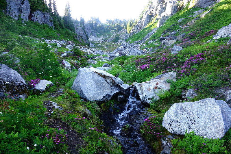
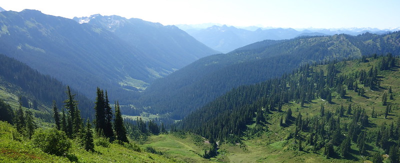
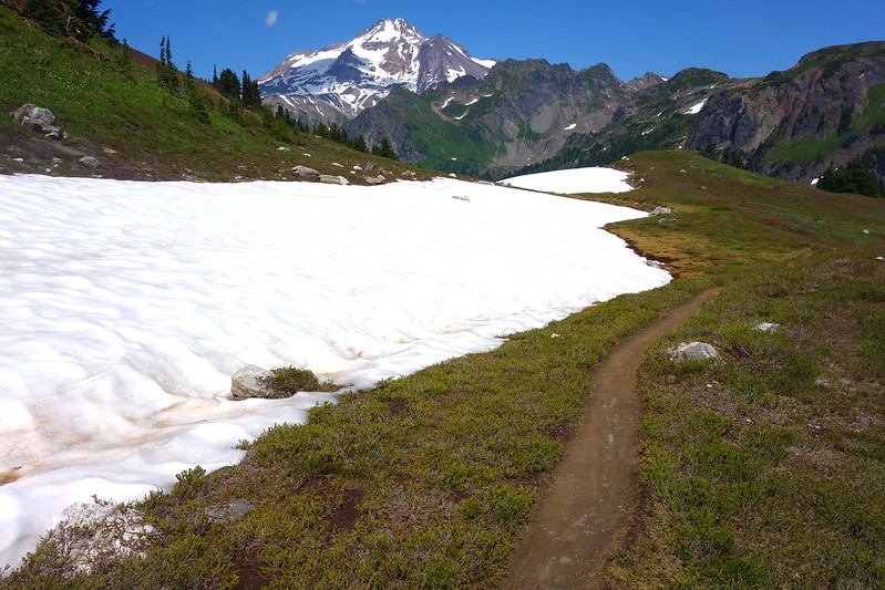
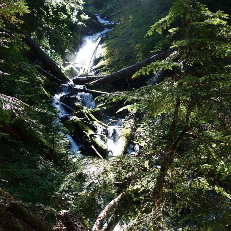
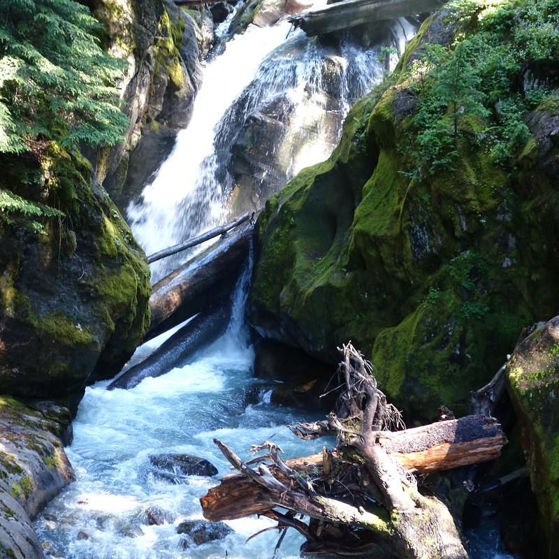
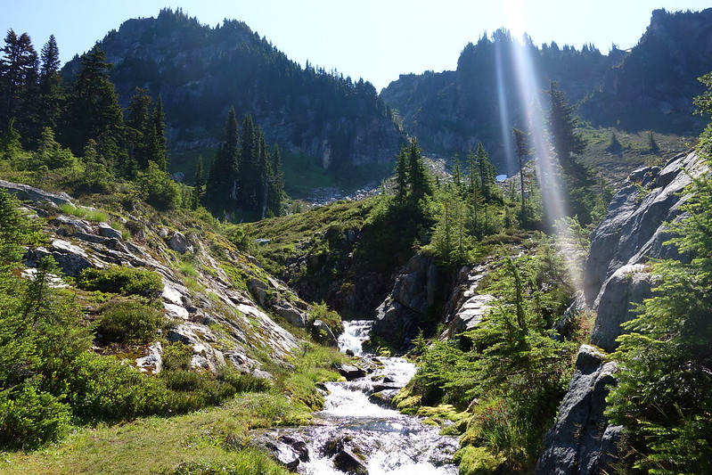
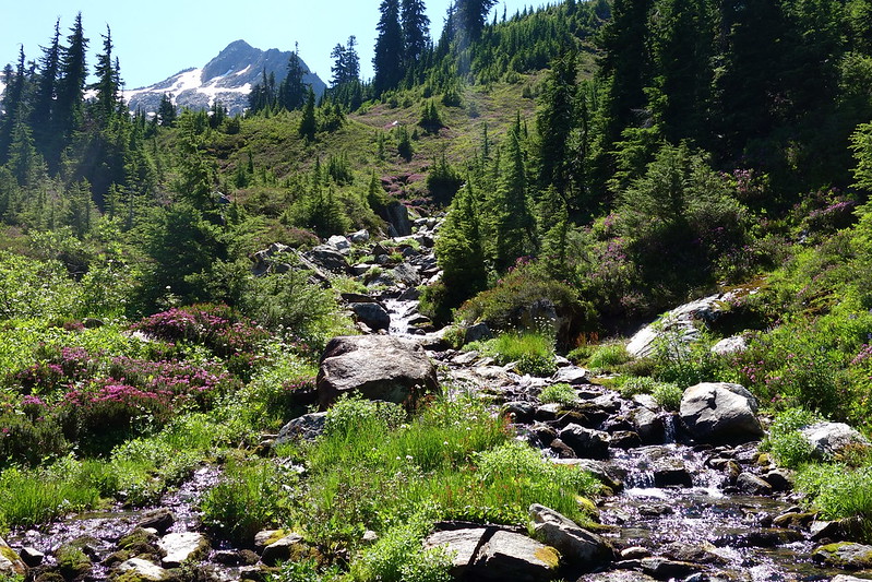
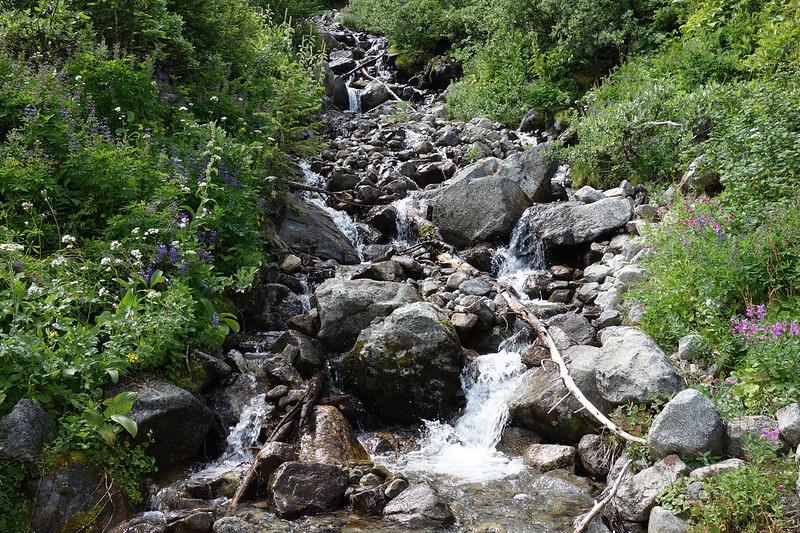
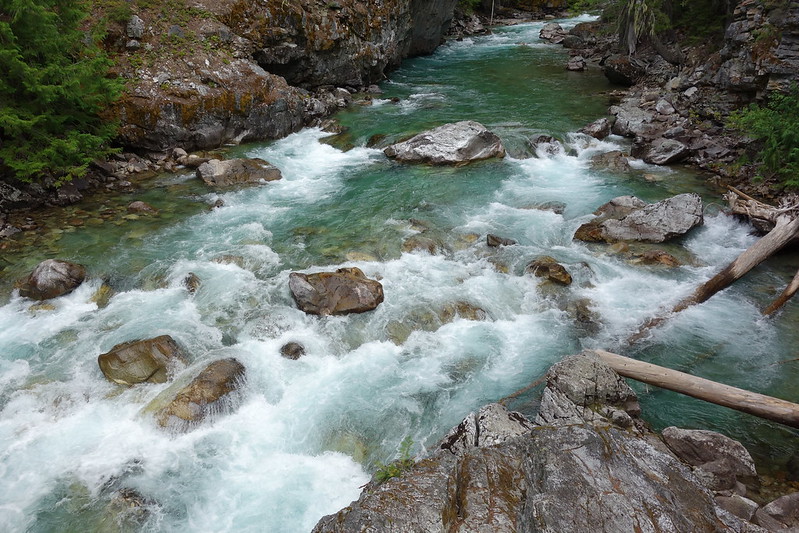
After the pass, I followed high above the Sauk River for a while, through steep meadows past a half dozen thin, fast waterfalls, then to Red Pass, and down into a deep, perfect valley – the headwaters of the White Chuck River.
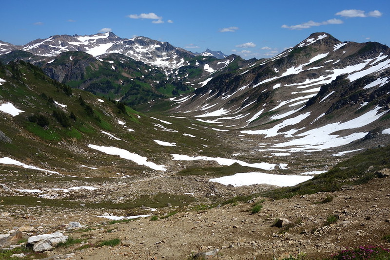
In the valley, the snow was just melting. There were thin snow bridges across some of the streams, and matted heather among the bright white rocks. And there were flies. Thousands of them, swarming every time I stopped.
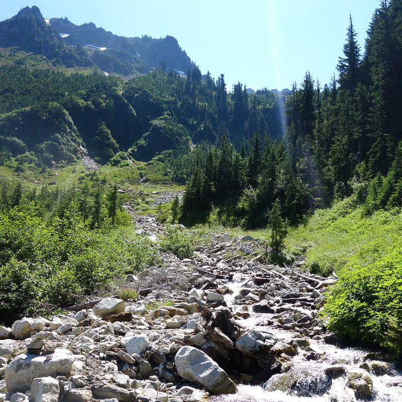
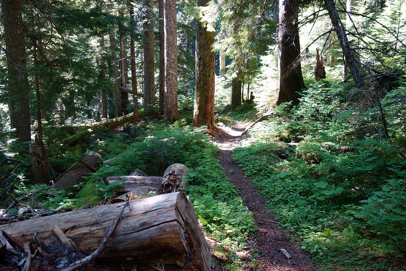
Eventually the trail reentered the trees, and dropped steeply several thousand feet, following the White Chuck River into thick forest.
This, it turned out, is the price one pays for Glacier Peak. The mountain’s too steep and glaciated for a flat trail, like the one that circles Mount Adams. Instead, the trail rises and falls through several deep valleys on its way around the southwest side – like the Sandy crossing on Timberline, over and over. But I didn’t know that yet.
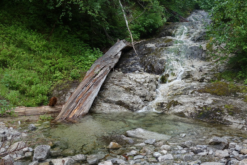
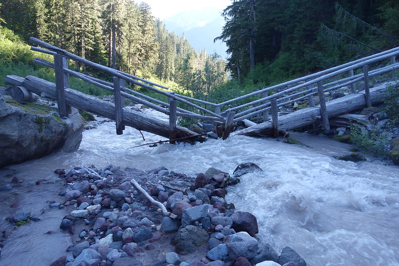
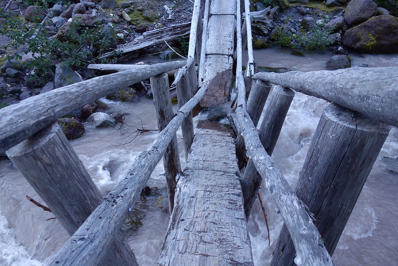
I’d been vaguely planning to camp at Sitkum Creek, but it was still early when I got there, and so I kept going, across Kennedy Creek’s famous broken bridge and up Kennedy Ridge’s steep spine a thousand feet to Glacier Creek and a deep, dripping valley filled with flowers and mossy rocks.
I made camp with an hour or so of daylight still to spare, so I washed my clothes in the creek, washed off a little myself, and watched the sun fade in the hills above my valley.
The night was cold but clear, and I slept without my rainfly, staring at the stars until late. Krista was supposed to be out that night too, up near Arrowhead Lake in the Sisters, and in her nightly letter – she’d written me a letter for every night – she talked about planning to stare at the stars, imagining me under the same sky. So I stayed up late, looking up and thinking of her.
Day 20 (Aug. 5): Glacier Creek to East Fork Milk Creek
PCT2512 – 2529 (18 miles)
So here’s the thing about sleeping in a deep, dark, dripping valley: there’ll be condensation. Like, lots of it. So I woke up early and put my stuff out to dry, as the sun slowly made its way up the creek, and dew dripped from the thousands of flowers.
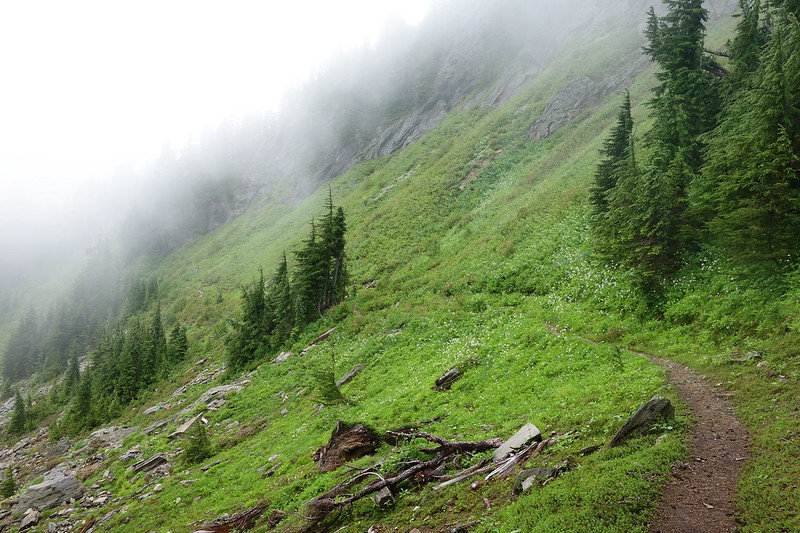
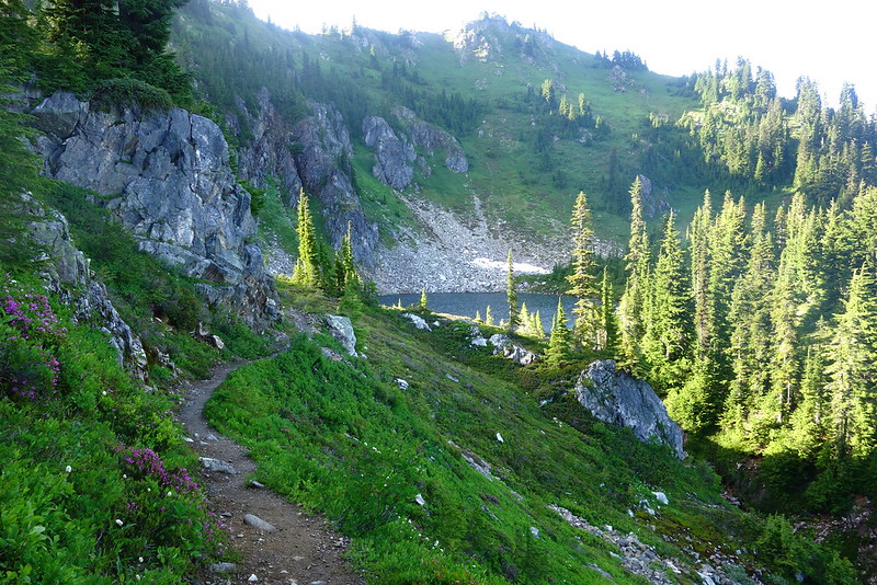
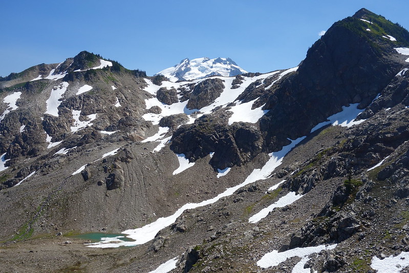
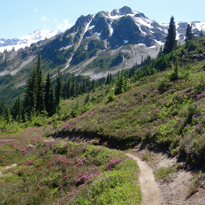
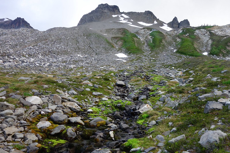
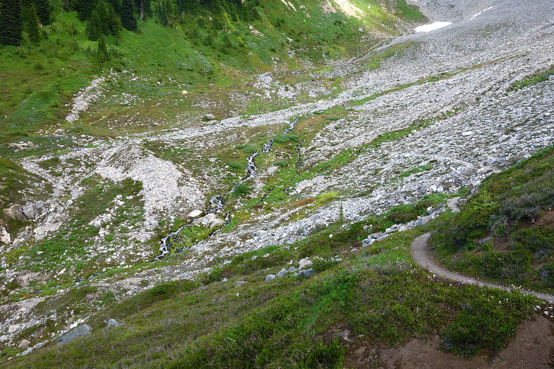
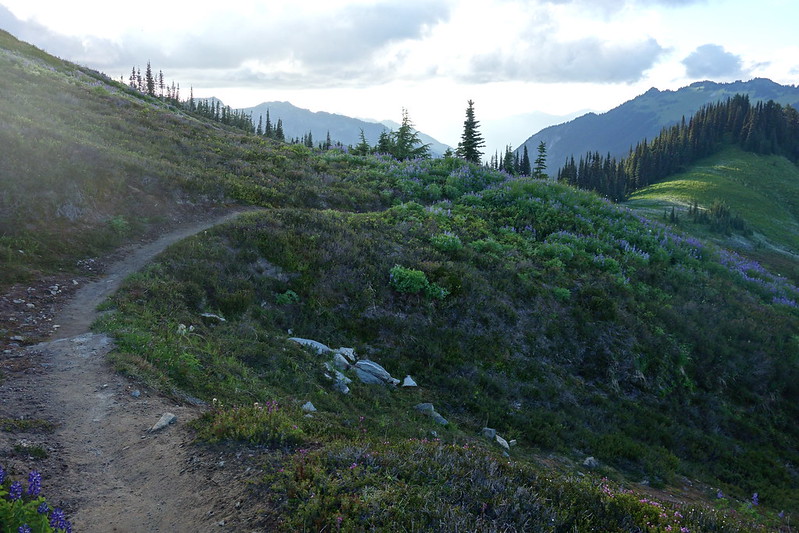
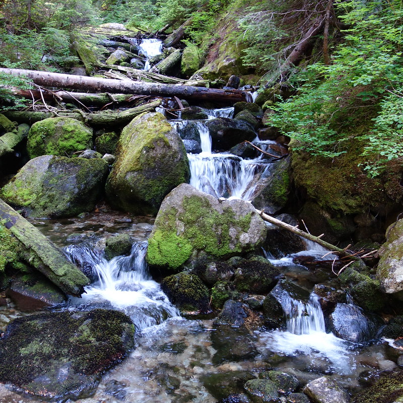
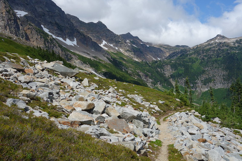
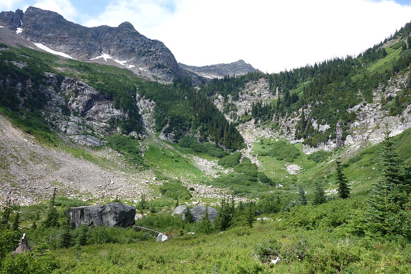
I stayed in camp until late morning, then made my way up on increasingly beautiful and decreasingly clear trail to Glacier Ridge, into Pumice Creek’s steep, gouged out gorge, and up toward Fire Creek Pass.
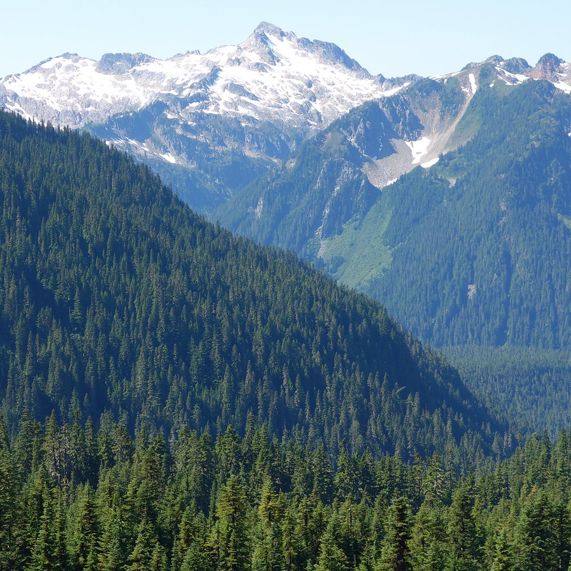
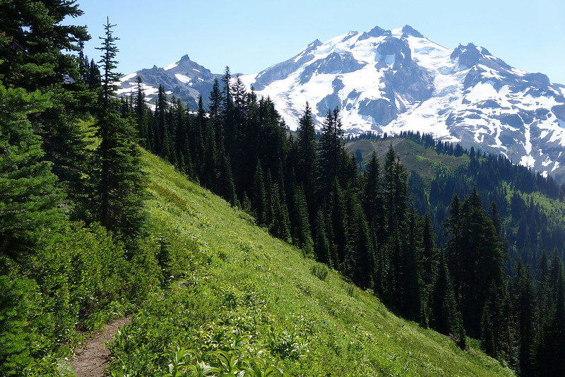
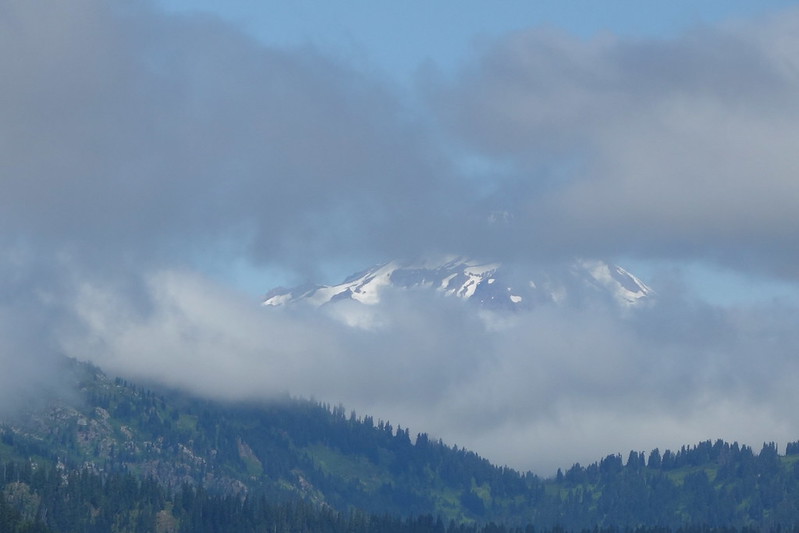
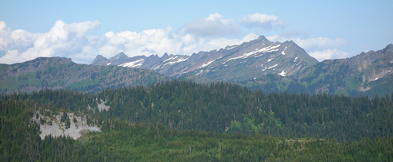
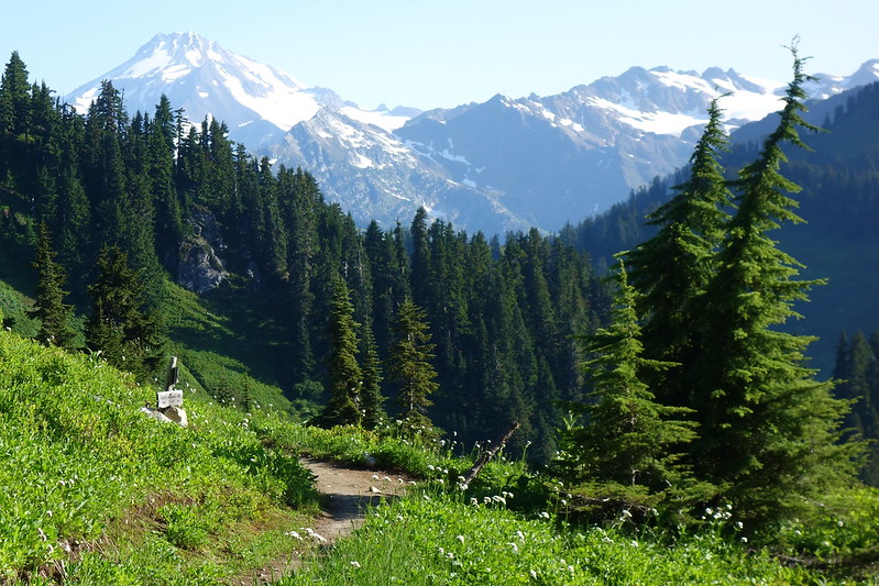
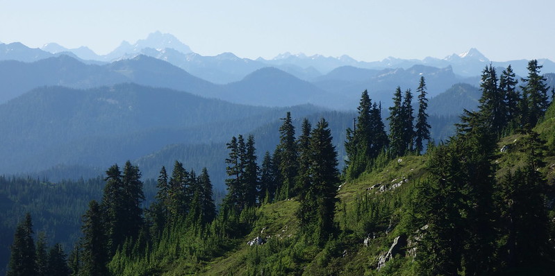
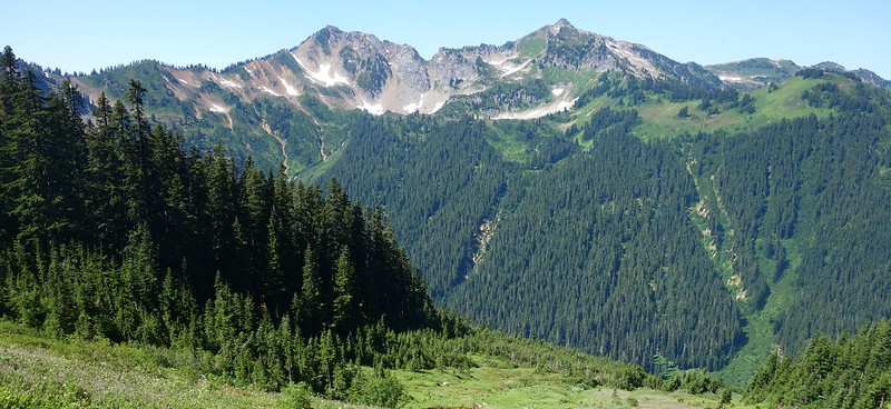
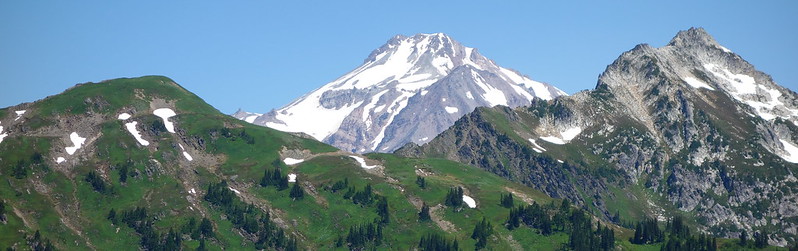
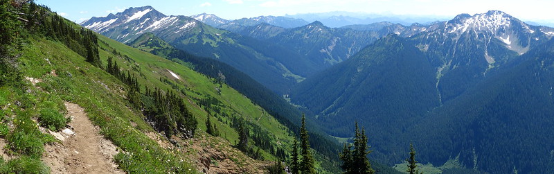
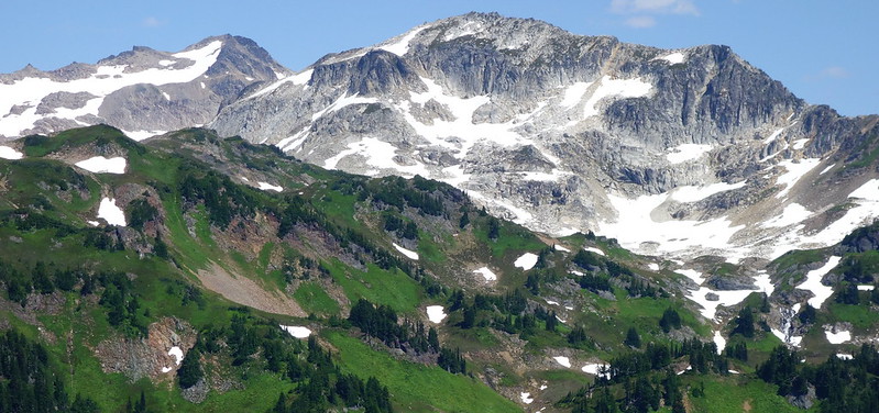
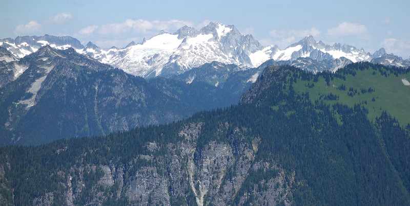
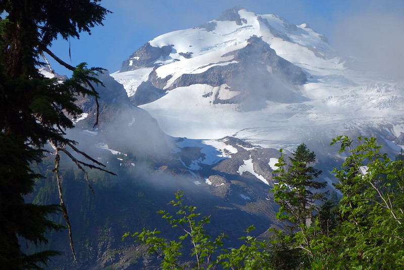
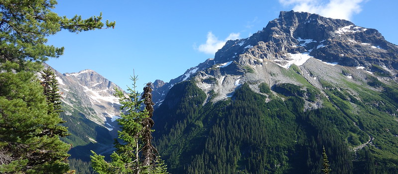
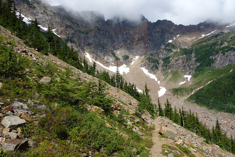
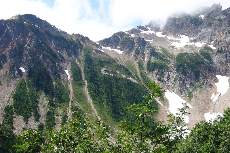
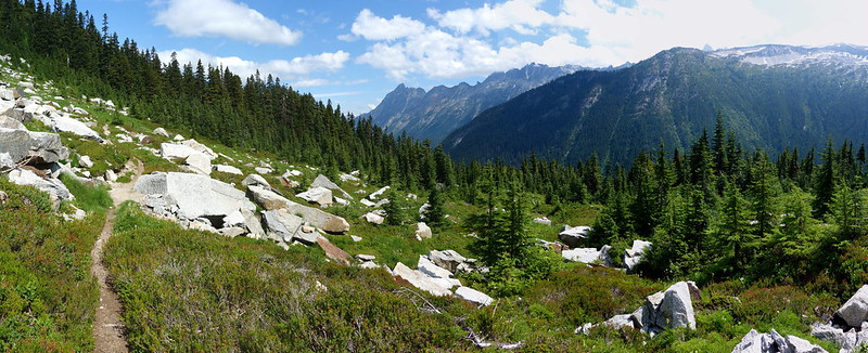
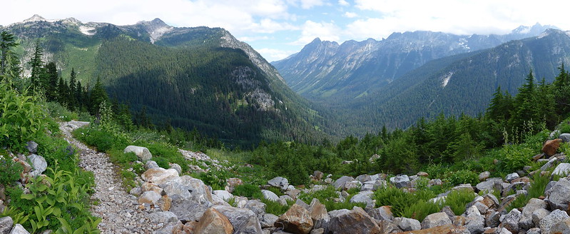
I lost the tread a few times, stumbling over blown down trees and thickets of flowers, but eventually made it up Fire Creek Pass, and got my first views into the North Cascades: rows and rows of sharp, spiny peaks stretching beyond the horizon. Northern Washington really is incredible.
The second half of the day was sort of rough. From the pass, the trail descended several thousand feet, past Mica Lake down to Milk Creek, then immediately back up a few thousand feet, on steep, eroded switchbacks.
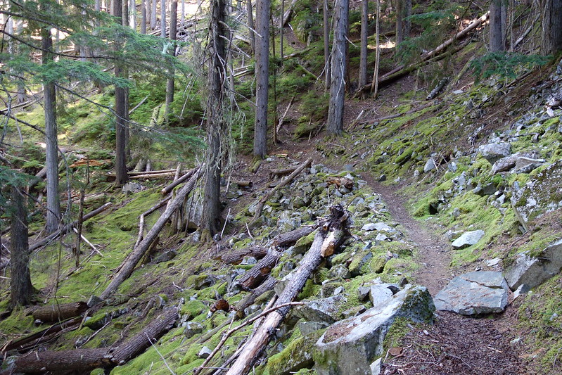
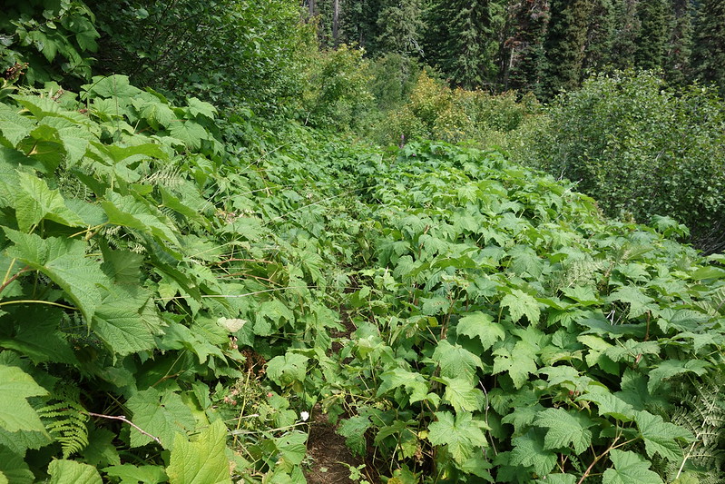
The trail climbing out from Milk Creek somehow managed to be both overgrown and eroded, sometimes persisting on nothing but steep, exposed roots under several feet of foliage.
Maybe halfway up, I passed a group of three middle aged guys, slouched down at a switchback, breathing hard, resting. I asked how it was going. “Shit, man.” There was a long pause. “I mean, shit man, but I’m doing it, right?” Right.
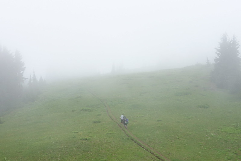
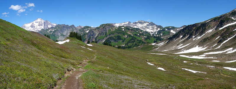
After what seemed like hours, I finally crested a ridge, the trail flattened, and I entered an endless parkland of wildflowers and gently sloping hills, leading to the East Fork of Milk Creek.
As I entered the East Fork’s massive valley, storms started to grow on the distant peaks, then on the glaciers and vistas just above, so I scrambled for my rain coat and pack cover, and decided to eat an early dinner at the creek, just in case the weather got bad enough to force me into my tent.

Storms raged all around – I could see rain pounding Grassy Point and Vista Ridge, and hear thunder somewhere south – but my little valley stayed miraculously dry, and I sat on a small ledge above the stream, eating mashed potatoes to the sound of warm summer wind.
After a small climb out of the valley, it was another series of meadows, this one full of whistling marmots, standing at attention among a blooming, buzzing confusion of flowers.
I camped on a ridge crest with a man from Germany, out for a couple months, planning to just walk until he ran out of time. He was affable and effortlessly funny in that way that almost everyone I’ve ever met from northern Europe seems to be, and we spent a pleasant, windy evening talking about work (he was a teacher too), missing our wives, and what to do with the ridiculous can of bear spray his buddies back home had made him bring. He wondered if it would work to make his freeze dried food more interesting. I told him it might have been good on my potatoes earlier.
Day 21 (Aug. 6): East Fork Milk Creek to Cloudy Pass Junction
PCT2529 – 2550.1 (21.1 miles)
The next day started with a massive descent to the Suiattle River: maybe nine miles of downhill, first switchbacking through overgrown meadows wet with morning due, then more gently through old growth forest along the river.
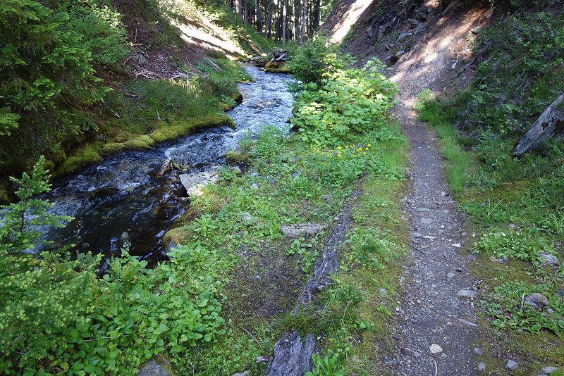
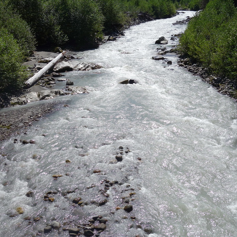
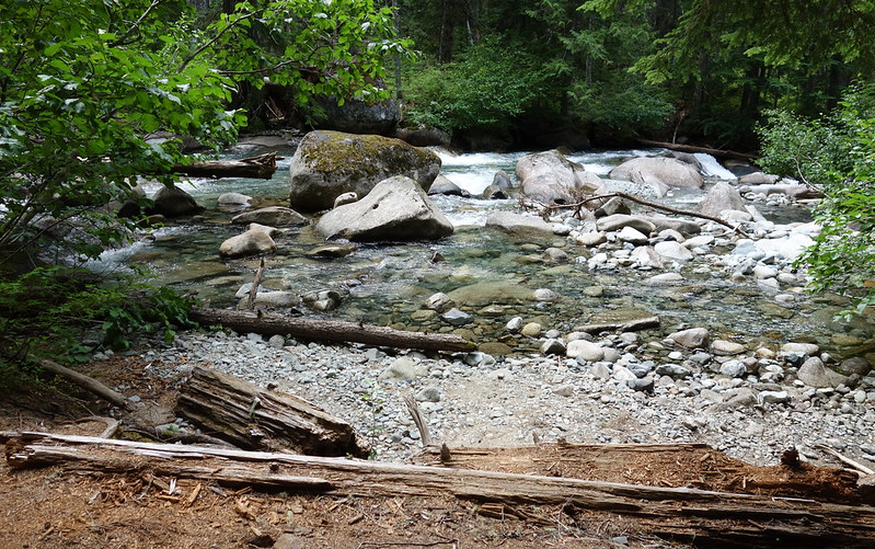
I stopped for breakfast along a small tributary stream – the river was way too silty – then continued on along the river. The area around Milk Creek is so remote that it gets very little traffic beyond PCT hikers, and the trail quality is commensurately poor. But there’s apparently a popular lateral trail somewhere near the Suiattle, and the tread through the woods was like paradise.
Without really noticing it, I’d gotten sort of fast – reliably three miles an hour on the flats and ups, and a bit faster on the downs – and I spent a pleasant, easy morning walking west to the lower river crossing, then east, back up the other side, to Miners Creek.
I stopped at the creek for snack, and to soak my feet before the long climb up to Suiattle Pass. As I sat there eating peanuts and M&Ms and thinking about ice cream, a long train of horses crossed a little downstream, struggling with heavy loads through the rocky water. The men guiding them – two gruff, square-shaped guys about my age, each decked out in several different sorts of camo – seemed utterly unconcerned, and it sort of hurt to see. I guess I identified much more with the walking horses than the sitting men.
The climb ended up not being too bad at all. It felt like the gorge: consistently up, but up on easy trail, through beautiful, cool woods, with dozens of streams helping to pass the time. I leap frogged for a bit with a proper PCTer, a young guy from Dorset so excited to meet his family and girlfriend in Canada in a few days that it was basically all he talked about.
It made me think about my finish, in just a few days: about Krista pulling up on the side of the highway in our little Honda; about going back to some hotel to shower; about spending the rest of the summer with her, taking adventures close to home; about home. On the JMT last year, I felt like I could have just kept going forever. I didn’t realize then what’s obvious now: that I only felt that way because Krista was there too, that forever’s a lot longer when you’re alone.
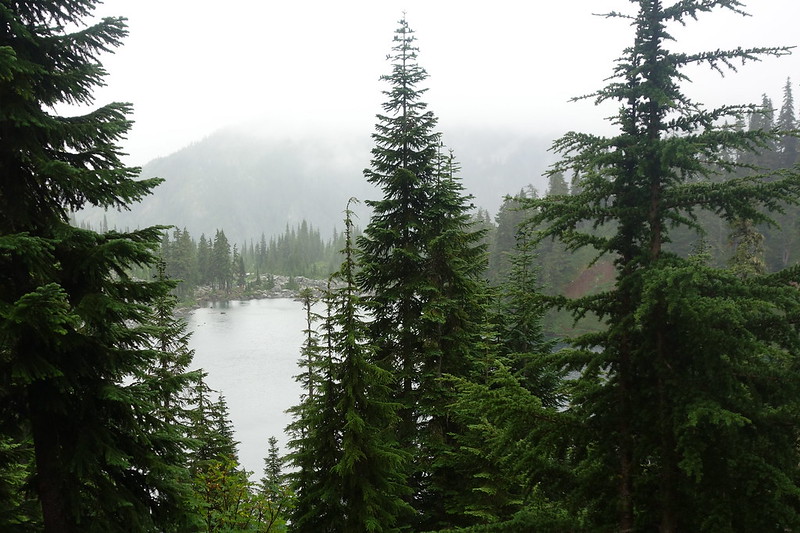
After so many difficult climbs over the last few days, Suiattle Pass was pleasantly anticlimactic: just a couple switchbacks through the forest. Before I knew it, I was descending down to the South Fork of Agnes Creek, setting up camp near the headwaters.
Day 22 (Aug. 7): Cloudy Pass Junction to Pass Creek
PCT2550.1 – 2564.3 (14.2 miles)
The night was cold and windy. Also: there were rodents. Like, a lot of them. Scurrying around the tent. At one point, a mouse or something actually scampered to the top of my tent, and just stood there for a second. Maybe playing king of the hill? I’d been hanging my food, so there was no worry there, but still: what?
I slept in late, full of strange dreams of mice, then ate breakfast in the tent, hiding from the several thousand mosquitoes who’d woken up early to see me off.
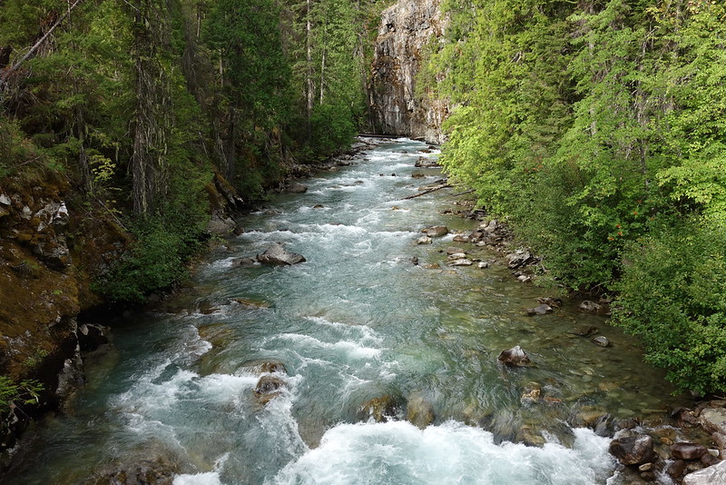
I’d sort of been thinking that the day would be just about making miles down toward Stehekin, but the South Fork Agnes valley is actually stunning: the trail traverses high above the creek, just below Sitting Bull and Saddle Bow Mountains, flanked on either side by high, rocky ridges. As it descends it contours around cavernous basins, crossing countless cascades and bright green fields.
Eventually the trail entered the woods, and was immediately overtaken by brushy Salmonberry or something, which sometimes grew as high as my head. It was rough going for a few miles.
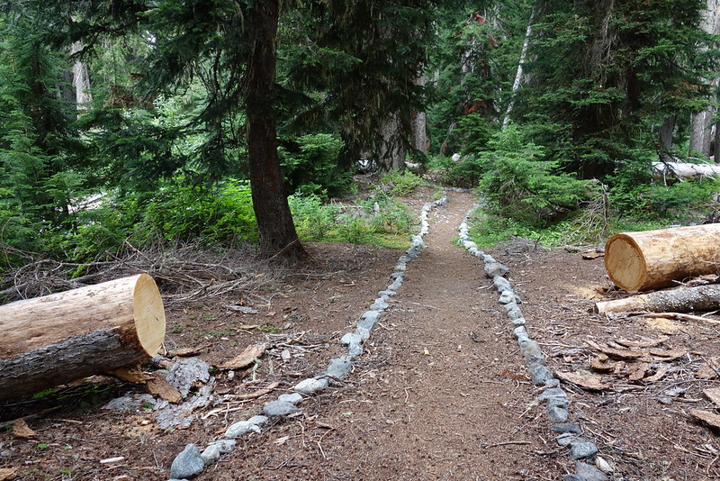
But then, as soon as I crossed the Agnes Creek, though, the trail suddenly became posh – a thick, flat path, sometimes lined with rocks just for good measure.
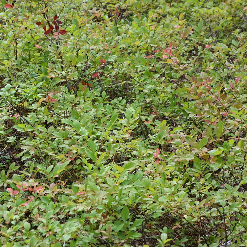
I spent the rest of the day flitting absentmindedly along the creek, over minor hills or across minor drainages, but generally just walking easily in the cool woods. Clouds came and went, threatening rain but never giving more than a light drizzle. I stopped to pick berries and take pictures, to look back up at the mountains, and finally for a late, light lunch but still ended up at camp early.
Camp was a massive set of clearings just south of Pass Creek, with room for dozens of tents but where I was the only one. I got everything set up by the early afternoon, and so spent the next several hours relaxing: picking more berries, bathing in the creek, skipping stones, and writing to Krista. I’d been writing her a letter every day, but for the last few I’d been so tired that the letters had been sort of cursory. So I sat out, under the clearing sky, and tried to write a good one. (As you may have gathered, given the opportunity, I can be sort of longwinded.)
Just as it was reaching the time at which one might contemplate the convivial pleasures of a pre-dinner drink, I heard a loud singing through the trees. Several young male voices singing an old Green Day song, “When I Come Around,” laughing at the end of each verse. As they passed, I said hello in a hospitable tone that surprised me. It was the sort of tone more often reserved for welcoming someone to your home. Maybe that’s what I thought I was doing.
After dinner I sat out late, watching the clouds turn purple then recede to reveal an ocean of stars. In the tent, I looked over my maps. I’d gone a bit over four hundred miles, and had less than fifty to go. Fifty miles used to seem so long, but now it was nothing. I traced the route so far with my finger, remembering moments along the way. They all seemed to exist at once, overlaid on each other in some great palace of memory.
Day 23 (Aug. 8): Pass Creek to High Bridge Ranger Station / Stehekin
PCT2564.3 – 2569.4 (5.1 miles)
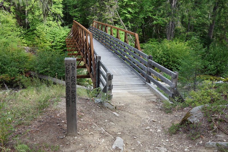
I woke up to raindrops, but it was just a few – just enough to wet down the dust – then back to sunny skies as I packed up quickly, ready for town. The five miles to Stehekin passed quickly, though mellow forest into the National Park.
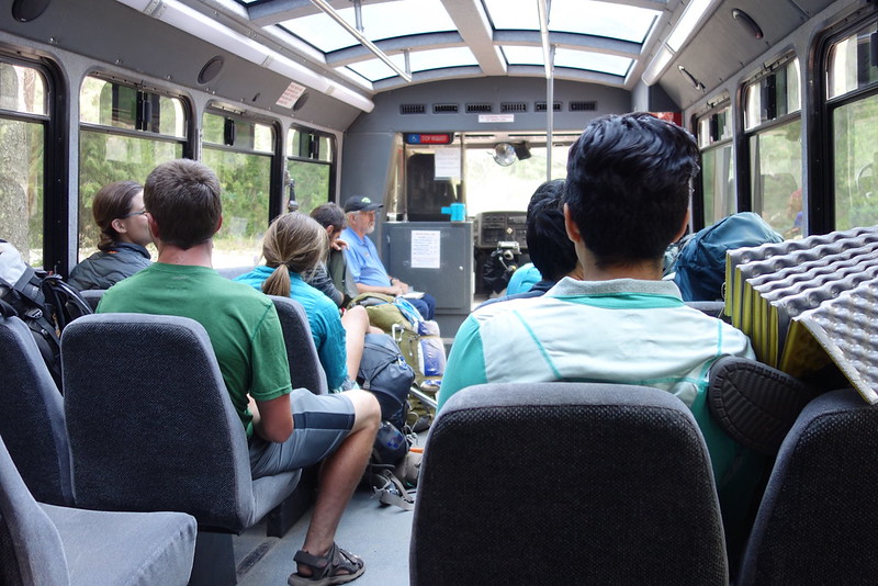
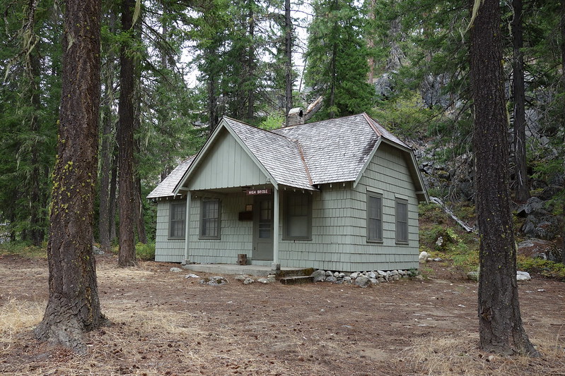
I made it to the High Bridge Ranger Station, where the bus comes to take hikers to Stehekin, much earlier than I’d meant to, and had a few hours to hang out, making breakfast and chatting with hikers as they trickled in.
The bus came around noon, and we all poured on – all hikers except for a family, two parents and a teenaged daughter out for the day. I sat down across the way, and apologized about any possible smells. “I can’t smell myself, but I’m sure I’ve grown impervious to some pretty terrible things over the last few weeks.” The mother smiled, “This is all so cool.” And so did the daughter: “I want to do something like that someday.” The dad was inscrutable until he put his arm around the girl, and smiled too. “You should.”