Wildcat Mountain - 7.03.08

This forum is used to share your experiences out on the trails.
Post Reply
User avatar
zombie
Posts: 180
Joined: May 28th, 2008, 10:03 pm
Location: Clackamas, OR

Wildcat Mountain - 7.03.08

Post by zombie » July 3rd, 2008, 11:34 pm

Waking up at 2:30 in the morning to the spectacular lightning and thunder show that was enlivening the Portland Metro area against our will gave me some doubts as to this morning's hiking weather! But, finding myself up and around again three hours later I was pleased to see the day pulling itself together. All plans back on, I headed to Wildcat Mountain.

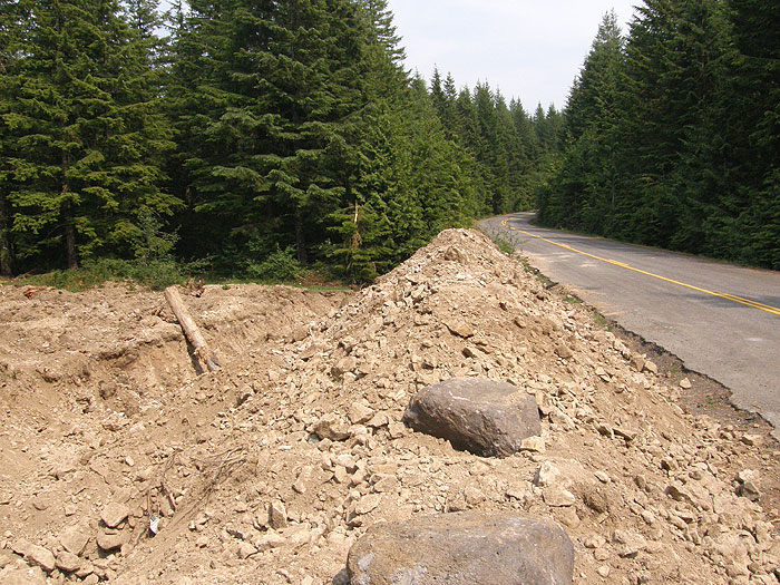
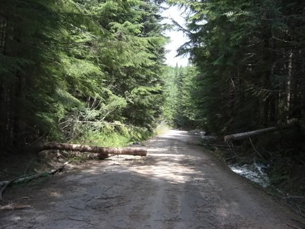
The drive out there is deceiving. Only the last half mile or so is gravel, and while certainly not good for your shocks and struts, it is possible to ease a passenger car out there fairly easy. Having a paved path all the way to a remote trailhead had me comfortable in the knowledge that I wouldn't have to rattle my brains loose for half an hour first thing in the morning. And thus the deceiving part. The hiking book I took with me with directions very simply states the proper turns and intersections...however it forgets to mention about 2/3 of the other possibilities...all of which are similar to the desired route. After two wrong turns, plowing through some snow (love my Forester), and having to get out of the car to move brush and large tree branches, I was forced to turn to the my GPS and its loaded maps to find the right turns.

Lucky for me, someone recently cut a snug space out of a blowdown that would have been a little too large to drag out of my way!

Image

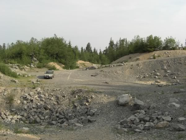
At the trailhead I was not surprised to see I was the only one. There was a large area closer to the trailhead than where I parked, but it has a large dirt berm that has seen more than a little use as a firearms backstop as evidenced by the computer cases, propane tanks, stove, milk jugs and 40,000 casings or so which were scattered around. Not wanting to risk a mid-day showing from any "enthusiasts", I parked as far away as possible.

Image

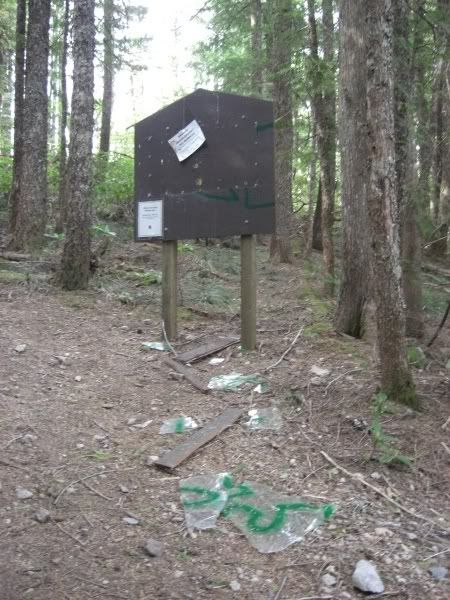
Of course, one thing I have noticed from parking at trailheads is that these "shooters" always seem to hike in as far as the first trailhead sign. It was no different here. It was nice of one such person to sign his artful handiwork!

Image

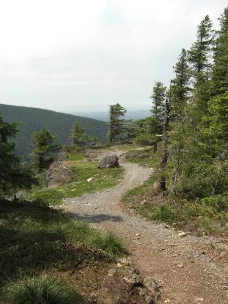
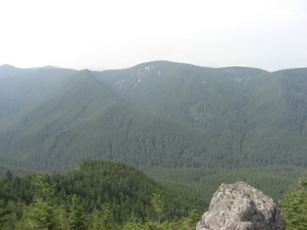
The trail started off lovely, and within the first fraction of a mile I was already being treated to some great views across Eagle Creek far below to Githens Mountain.

Image

Image

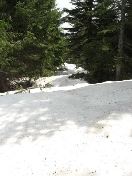
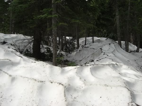
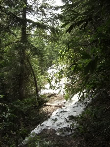
By 4,000' I was in heavy snow on the west side of the mountain. At times, the trail's location was easily made out by the spacing of the trees...and at other times, not so much.

Image

Image

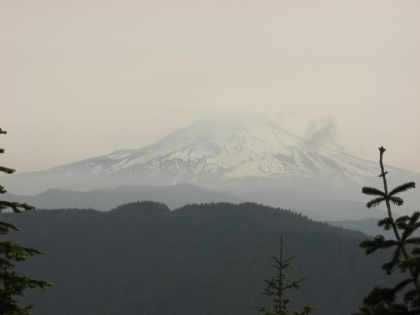
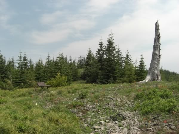
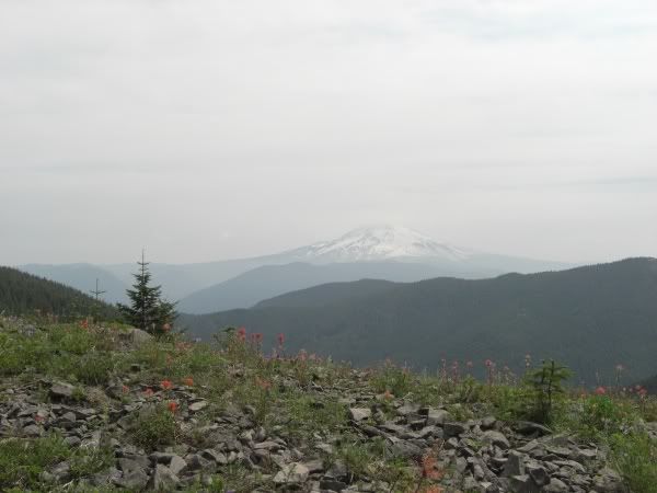
The top of Wildcat was entirely snow free; which is odd because literally 15' in any direction from the small clearing at the summit and its back to 2-4' deep. Rocks must get warm up there and melted everything away. The view to Mt. Hood showed just how much 1500 fires in California can do to our skies!

Image

Image

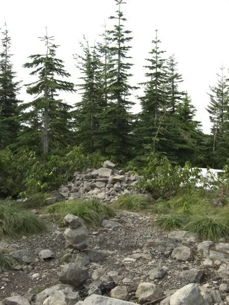
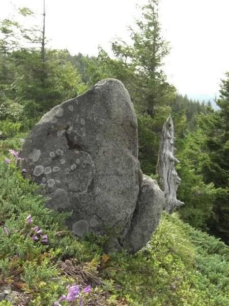
Dropping off the top, I poked my way along the ridge to the rock garden. The trail heading out this way was a mess of low use, snow and blowdown. BTW, for anyone heading up here soon, my face says "Your Welcome", but next time YOU get the spiderwebs cleared out.

Image

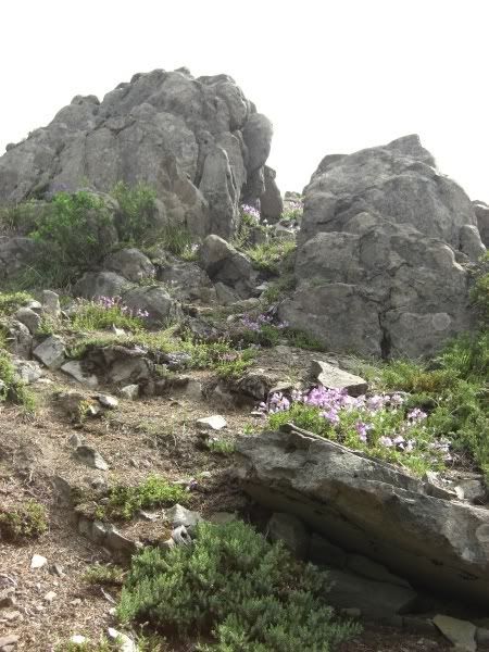
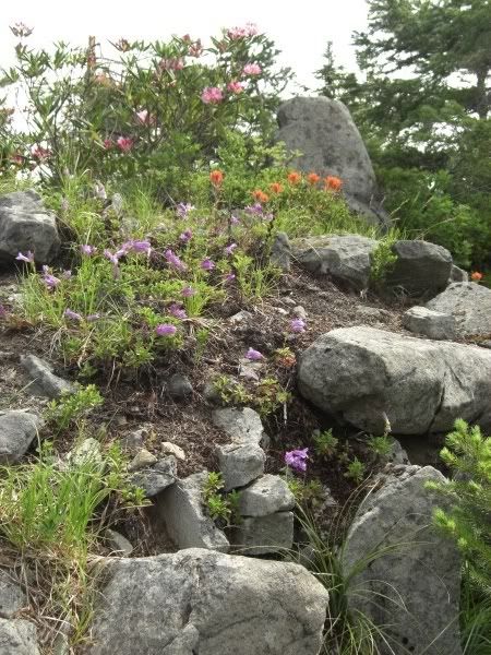
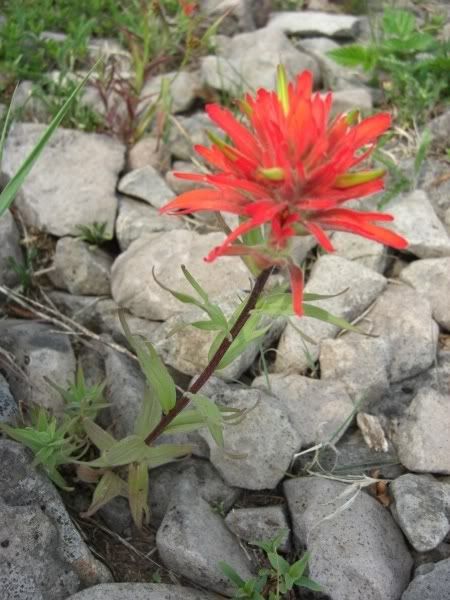
The rock garden itself was simply amazing. Without a doubt, this little spot is one of my favorite places around as of today. The flowers blooming, the bees buzzing around, the sound of water racing down below, the interesting rock formations and the views of Mt. Hood all combine in very understated fashion. Just a peaceful little place...and snow free!

Image

Image

Image

After hitting the summit and the gardens, I had just one stop left...back along the trail, past Wildcat and North up McIntyre Ridge to the bench. Thanks goes to GrannyHiker for posting a photo of this locale recently and tipping me off to it. It was another 2 mile round trip through snow, but once again, within feet of the destination it opened onto a perfect viewpoint.

Image

Image

Image

Back down to the car was a ton easier (following my own prints) and with a little help from the GPS I was on the right series of roads and out of there. I must have been a little early for critter activity in the morning, but the way out saw dozens of rabbits, some deer and a couple of Ospreys. A great morning overall...just over 7 miles total and around 2000' total elevation gain.

-aaron

User avatar
Splintercat
Posts: 8333
Joined: May 28th, 2008, 10:03 pm
Location: Portland
Contact:

Re: Wildcat Mountain - 7.03.08

Post by Splintercat » July 4th, 2008, 7:38 am

Great report, Aaron! I was up there last weekend, but turned back when I started hitting snowdrifts - kudos on your determination! I also shot a nearly identical view of the vandalized signboard. It gets a bit worse each year, despite being a good 200 yards up the (now) unsigned trailhead. What I like about this trail is how quickly you leave the ugliness of the Wildcat Quarry (and its OHVs and shooter) behind when you immediately reach the first canyon over look. That's where I spent some time admiring the penstemmon on my aborted hike.

I did have a family of OHVers up there at the quarry, with their little 6 and 8-year-olds riding around on them, no helmets, and mom and dad looking on, approvingly, of course. Yowsa!

You might have noticed this on your way up, but there's some good news on the OHV/shooter front along Wildcat Mountain Road: since my last visit about a month ago, the main shooter side has been decommission with this huge ditch and berm:

Image

Several other smaller OHV "trails" had also been cut off with deep trenches or newly-placed boulders. This work is right at the edge of the MHNF, so I'm not sure if it's courtesy the USFS or the private timber companies who own the adjacent land, but either way, it's welcome and appreciated! Maybe one of the USFS folks here can shed some light on that?

Thanks, Aaron!

Tom

User avatar
retired jerry
Posts: 14418
Joined: May 28th, 2008, 10:03 pm

Re: Wildcat Mountain - 7.03.08

Post by retired jerry » July 4th, 2008, 7:56 am

Nice report

It's interesting how Wildcat ridge has lots of snow at 4000'.

The next ridge to the East, Huckleberry, had a little snow at 4000' a week ago.

The next ridge to the East from Huckleberry, Hunchback, had no snow at 4000' a week ago.

User avatar
Don Nelsen
Posts: 4380
Joined: May 28th, 2008, 10:03 pm
Location: Vancouver, WA

Re: Wildcat Mountain - 7.03.08

Post by Don Nelsen » July 4th, 2008, 11:05 am

Nice report and pictures. Too bad about the smoke and haze from the California fires. I'm a little surprised that all the rain and thunderstorm action didn't move some it out.
"Everything works in the planning stage" - Kelly

"If you don't do it this year, you will be one year older when you do" - Warren Miller

User avatar
jeffstatt
Posts: 3820
Joined: May 28th, 2008, 10:03 pm
Location: Vancouver

Re: Wildcat Mountain - 7.03.08

Post by jeffstatt » July 10th, 2008, 8:03 pm

Well I was really curious what it looked like up there since Tom started talking about it. I'm glad you got photos of the trailhead area as well as all the nice stuff. That rock garden is cool. i can see why you liked it so much. I laughed out loud at your comment about the spider webs. I felt like Doc Oc the way I was attacking spiders on Siouxon Peek the other night!

User avatar
fettster
Posts: 1720
Joined: May 28th, 2008, 10:03 pm
Location: Hillsboro, OR

Re: Wildcat Mountain - 7.03.08

Post by fettster » July 10th, 2008, 8:49 pm

Most years we could kindly correct you and say that you must mean 'Wildcat Mountain - 6.03.08', but not this year, wow! That's depressing to see the trailhead sign, but I really like your framing on the following winding path picture. Cool shot. Nice work with the diligence to get up there too! That is interesting how neighboring ridges haven't held snow like this one.

Post Reply