Greenleaf Peak and Table Mtn loop Nov-28-2015

This forum is used to share your experiences out on the trails.
Post Reply
User avatar
CraigG
Posts: 368
Joined: April 29th, 2013, 8:06 pm

Greenleaf Peak and Table Mtn loop Nov-28-2015

Post by CraigG » November 29th, 2015, 6:31 pm

Greetings All -

Today's adventure involved visiting Greenleaf Peak and Table Mtn as part of a long hiking loop. I wish to thank those adventurers that have gone before us in vetting this loop: viewtopic.php?f=8&t=17589

Image

Our hiking group of SamL, Rigby the Hiking Dog and myself started from the Bonneville Hot Springs Resort/Spa TH. We headed up the Two Chiefs trail on a cool, crisp and windy morning:

Image

Table Mtn hiding behind the forest:

Image

Beautiful views approaching Greenleaf Falls:

Image

Image

Image

Our crossing at Greenleaf Falls wasn't too bad - a bit icy, but a suitable spot was found to jump across:

Image

Image

Instead of immediately heading up the ridge after the creek crossing, we continued around on the forest road and ran into a massive rock slide:

Image

We needed to get up on the forested cliff in the upper left of the above photo. :?:

I realized we had gone too far around the ridge, but what a view of waterfalls!

Image

Image

The rock slide we scrambled (bouldered) through seemed to be very recent. No moss, no significant growth, and the rock field seemed somewhat unstable. We crossed the rock field, climbers left and headed offtrail up the forested area to the left of the multiple waterfalls:

Image

Image

Image

Image

We passed Upper Greenleaf Falls on our left:

Image

Image

There was a nice game trail that lead us past the upper falls. We left the game path to reach the cliffs we had seen earlier:

Image

Image

Image

Image

Image

The massive rock field below the cliffs - the same field we had entered earlier:

Image

We moved inland and into the forest and encountered the camps mentioned in earlier trip reports:

Image

Image

Image

We intersected with the old forest road and continued further south, towards Greenleaf Peak:

Image

Image

We found the 'ol railroad rail with the 1887 date stamped on it:

Image

Image

Image

After crossing through the forest, we came out to the powerline alley and headed up towards Greenleaf Peak, patches of snow/ice around us in 29F air temps:

Image

It took about an hour to make the long trek up to Greenleaf Peak. Very icy on the trail leading to Greenleaf Peak summit:

Image

Some wonderful views through the forest just before we hit Greenleaf Peak:

Image

Image

Almost to Greenleaf Peak summit! Past the shack about 30 yards from the summit:

Image

"OK Dad, we are here now at the summit. It's cold and windy. Can we go now?"

Image

Greenleaf Peak is forested in so no great views from its summit. Still, we had reached our first objective!

Our way back down from the peak, past the shack - big drop off to the right:

Image

We descended the 800-900 ft ascent back to the powerline alley, had a quick bite to eat, then crossed the powerline alley:

Image

Our objective was the reach the ridge in the distance, then head left to Table Mtn:

Image

Three creeks ran through the powerline alley, including Greenleaf Creek. None of which were hard to cross.

Image

Once up on the ridge from the powerline alley, we headed south towards Table Mtn:

Image

Image

Image

Approaching the "back" (north side) of Table Mountain, patches of ice and snow on the trail:

Image

Image

Coming up the back of Table Mtn - very icy here:

Image

Image

Image

Image

Image

Walking through the north section of Table Mtn appraching the viewpoint area:

Image

Image

At the table at Table:

Image

Image

then the viewpoint at Table Mtn where it was very windy:

Image

Image

Image

Image

Then down the Westway trail and back to the car by 440pm. What a fun adventure! Must go back again to see more things up on the plateau!

Image

Image

Distance: 16.6 miles
Ascent: 5450 ft
Elapsed Time: 8:32:13
User avatar
MarsIsCobra
Posts: 569
Joined: November 27th, 2012, 7:57 pm
Location: Camas

Re: Greenleaf Peak and Table Mtn loop Nov-28-2015

Post by MarsIsCobra » November 29th, 2015, 8:53 pm

really enjoyed this post, thanks

User avatar
VanMarmot
Posts: 1924
Joined: May 28th, 2008, 10:03 pm
Contact:

Re: Greenleaf Peak and Table Mtn loop Nov-28-2015

Post by VanMarmot » November 30th, 2015, 7:09 am

Nice! :D Rigby the Hiking Dog is one tough little dog dude! Clearly my cat is NEVER going to show such ethusiasm for anything other than food, naps, and a good poop. And there's now a table on Table?

User avatar
CraigG
Posts: 368
Joined: April 29th, 2013, 8:06 pm

Re: Greenleaf Peak and Table Mtn loop Nov-28-2015

Post by CraigG » November 30th, 2015, 7:31 am

VanMarmot wrote:Nice! :D Rigby the Hiking Dog is one tough little dog dude! Clearly my cat is NEVER going to show such ethusiasm for anything other than food, naps, and a good poop. And there's now a table on Table?
Thanks for the reply.

Yes - there is a table on Table, at the summit junction. Someone hauled it all the way up there.

The Westway trail has noticeably more erosion than I remember 2 years ago.

Rigby is a little beat up from bouldering, but he should be OK in no time.

User avatar
Splintercat
Posts: 8333
Joined: May 28th, 2008, 10:03 pm
Location: Portland
Contact:

Re: Greenleaf Peak and Table Mtn loop Nov-28-2015

Post by Splintercat » November 30th, 2015, 7:45 am

Cool report, Craig! The slide is, indeed, very new -- just a few years ago -- and a mini-version of the one that created the Cascades. Don Nelsen scouted it just after it happened and posted some photos here. Hard to believe nobody heard or saw it, given the proximity to Stevenson!

Thanks for posting!

Tom :)

User avatar
CraigG
Posts: 368
Joined: April 29th, 2013, 8:06 pm

Re: Greenleaf Peak and Table Mtn loop Nov-28-2015

Post by CraigG » November 30th, 2015, 8:00 am

Splintercat wrote:Cool report, Craig! The slide is, indeed, very new -- just a few years ago -- and a mini-version of the one that created the Cascades. Don Nelsen scouted it just after it happened and posted some photos here. Hard to believe nobody heard or saw it, given the proximity to Stevenson!

Thanks for posting!

Tom :)
Thanks Tom!

When we scrambled up the first ridge from the rockfield, we could hear small rocks coming down. Possibly in the streams and/or because of the strong east winds. Either way, that whole area is still moving. Still, an amazing sight! There was a rather well-marked game path up the right/east side of Greenleaf Falls. Without that, we would have spent a lot of energy getting up to the plateau.

Sincerely,
CraigG

User avatar
bobcat
Posts: 2768
Joined: August 1st, 2011, 7:51 am
Location: SW Portland

Re: Greenleaf Peak and Table Mtn loop Nov-28-2015

Post by bobcat » December 3rd, 2015, 5:44 am

Great, detailed report! I've been contemplating this loop - now I don't have to try so hard. Very nicely laid out!

User avatar
Rustygoat
Posts: 507
Joined: August 27th, 2012, 2:28 pm
Location: SE Portland

Re: Greenleaf Peak and Table Mtn loop Nov-28-2015

Post by Rustygoat » December 4th, 2015, 5:10 pm

Great report Craig, I just missed you that day as I was at the falls. Thanks for sharing :)
Tim

Chasing waterfalls can be addictive.
NW Off-trail Waterfalls -Facebook Group

User avatar
CraigG
Posts: 368
Joined: April 29th, 2013, 8:06 pm

Re: Greenleaf Peak and Table Mtn loop Nov-28-2015

Post by CraigG » December 4th, 2015, 5:23 pm

Rustygoat wrote:Great report Craig, I just missed you that day as I was at the falls. Thanks for sharing :)
You are welcome! That is quite a scramble on the west side of the falls!

User avatar
woodswalker
Posts: 835
Joined: November 25th, 2012, 4:51 pm

Re: Greenleaf Peak and Table Mtn loop Nov-28-2015

Post by woodswalker » December 5th, 2015, 8:21 am

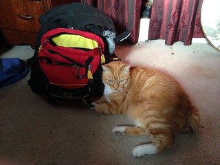
Great report! I've been curious about the north approach to Table, but I'm not letting myself explore it until I have a chance to climb it from the south. As for cats I find them very helpful in packing for the day. That is when they aren't sleeping on my wool sweaters. Thanks for posting this. I've been curious about the Greeenleaf Basin for awhile.
Image

Woodswalker

Post Reply