
Starting at the bottom, the recovering Gnarl Fire zone caught my eye:
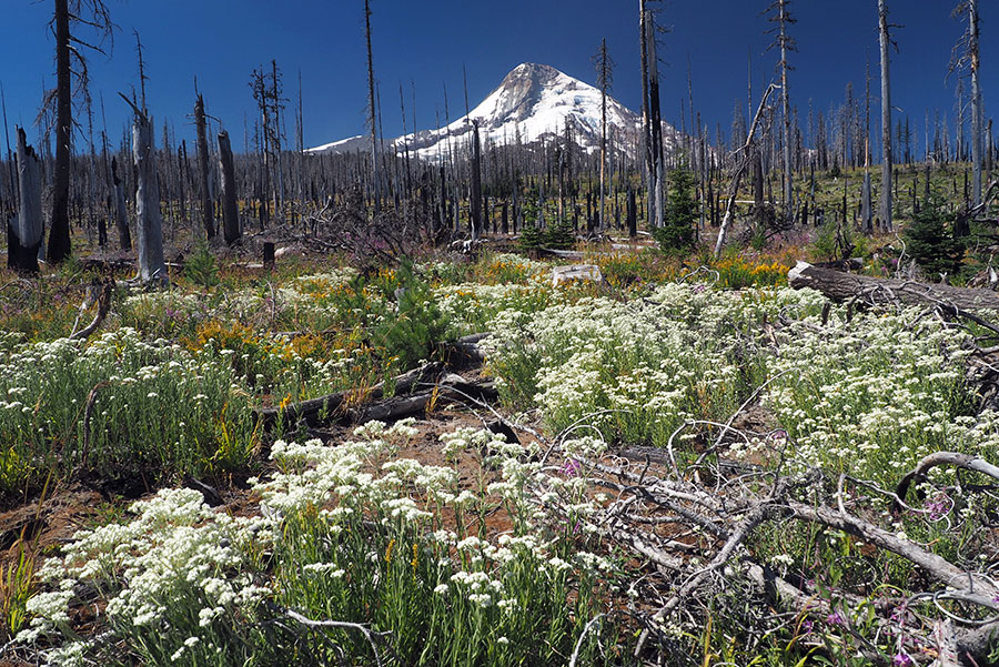
I've enjoyed watching the recovery -- and have learned a lot about a process I thought I already knew something about! For example, the dry summer this year has been devastating for young conifers in both the Gnarl and Dollar Fire zones, which helped me understand why recovery is often very slow in these harsh environments for young trees.
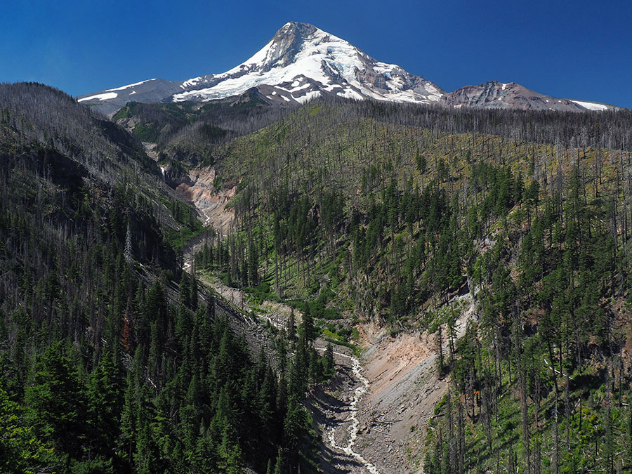
The next stop was at Inspiration Point, a regular for me -- in part to track the ongoing changes to the Eliot Branch canyon, but also because people have been stopping here for the view for well over a century, and I love that sense of history:
While there, I noticed the little memorial stone for "Stephen" had been kicked loose and was laying in the middle of the boot path -- so, I moved it to a safer spot and washed off some of the mud in respect for whoever this person was:
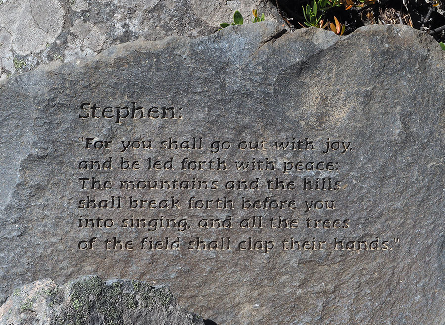
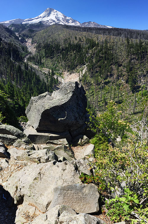
...Stephen's memorial stone in its new, hopefully more secure spot -- a rather spectacular place for visitors to reflect, no doubt:
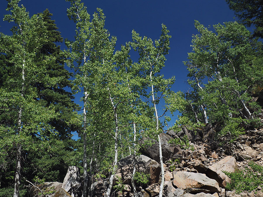
This one is a bit out of order, as I actually made this stop on the way out -- but I finally photographed the picturesque (and oddly located) Aspen grove along the lower section of the Cloud Cap Road:
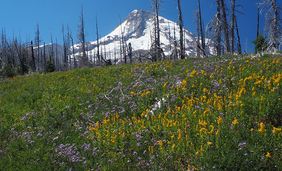
My next stop was at the original (and official) Ghost Ridge, where the wildflowers were winding down - mostly goldenrod and pearly everlasting at that point in our drought summer:
Found some interesting rock outcrops on the canyon side of the ridge, too -- love exploring that area!
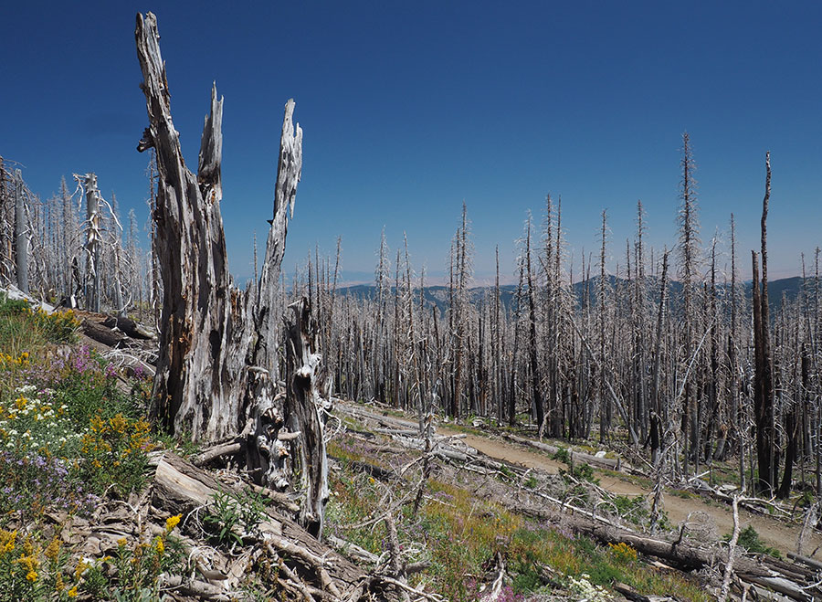
Another fire recovery scene a bit further along, just below the Cloud Cap/Tilly Jane junction -- I just really liked this stump (because it's a spintercat tree!), the flowers and the backdrop of the old road, the fire zone and the high desert, in the far distance:
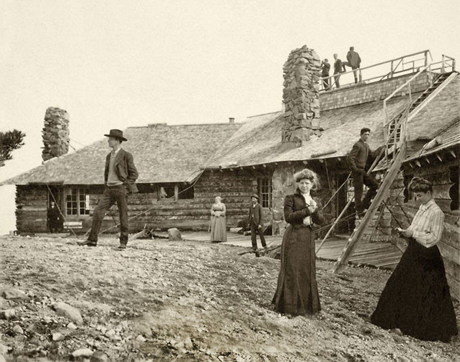
Once at Cloud Cap, I was hoping to do some "then and now" photos, but hadn't organized my historic photos before the trip -- so and to kind of wing it... next time! Anyway, the significance of this scene...
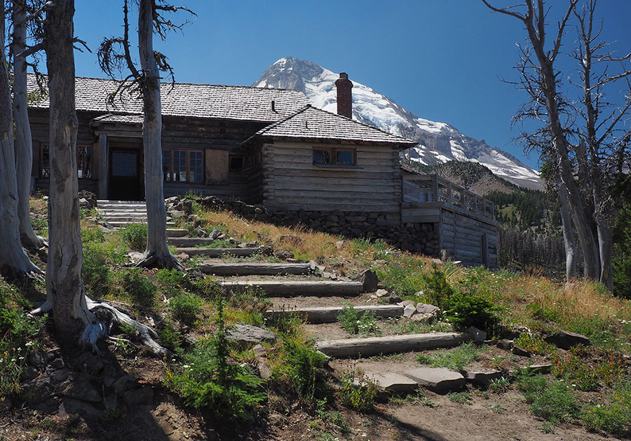
...is that it looked like this 125 years ago!
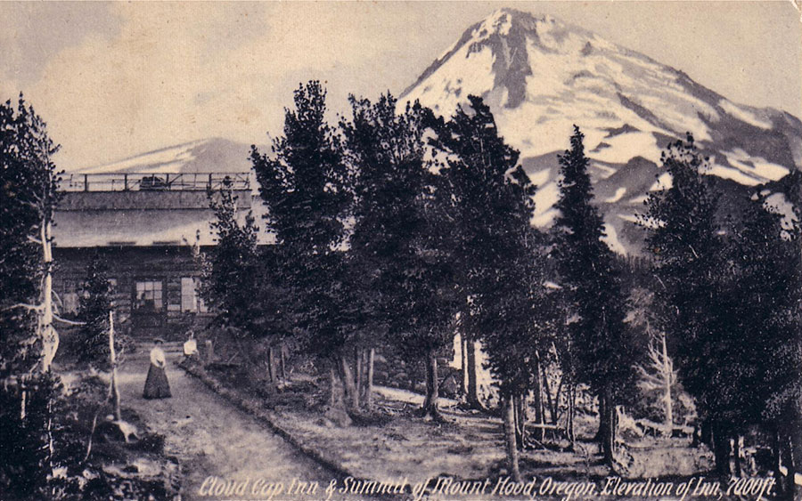
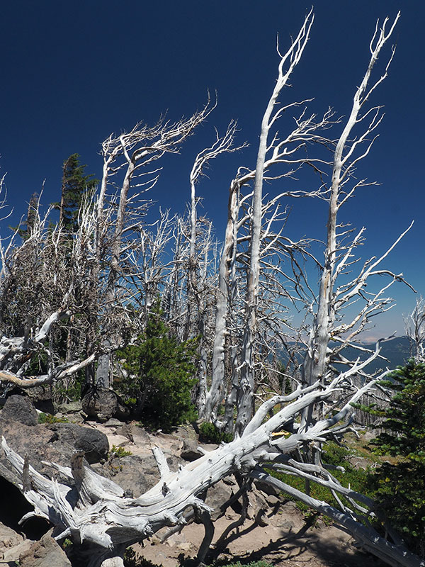
A really notable change is the die-off of whitebark pine around the lodge, of course, though I was encouraged to see some young trees growing among the ghost trees.
This view is a pano:
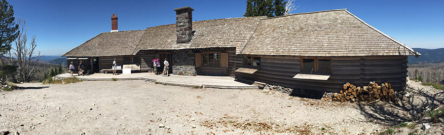
...attempting to capture this scene -- I'll have to do this one again:
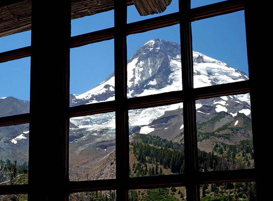
A couple more views of the windows, since they were open for the day! From the outside...
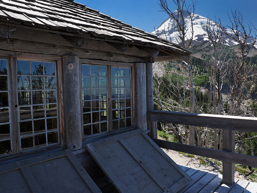
And from the inside...
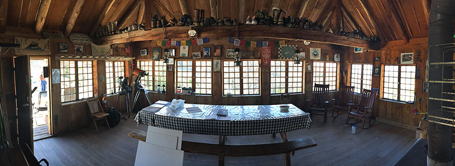
And while I was inside, a pano of the dining room -- my favorite space in the inn:
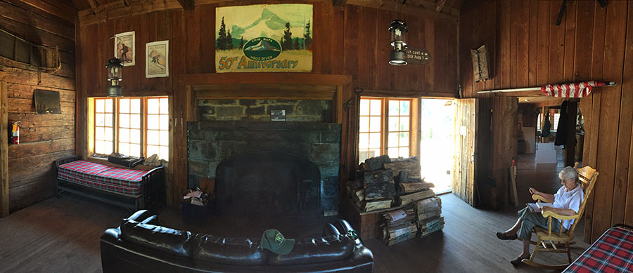
...and one of the living room, complete with a USFS guide in a rocking chair...
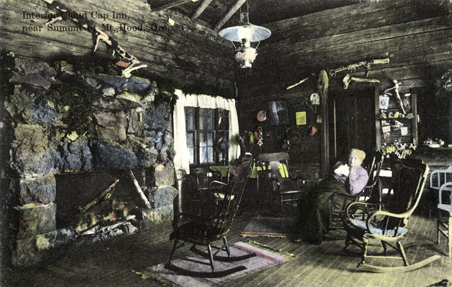
...that reminded me a lot of Sarah Langille in this 1890s view:
After exploring the lodge for awhile, I finished my ramble at the old viewpoint, located at the end of a short path behind the lodge... through this ghost forest of whitebark pine skeletons...
...to a spot where countless people have posed for a picture with WyEast... and a fair number have had their ashes scattered, too:
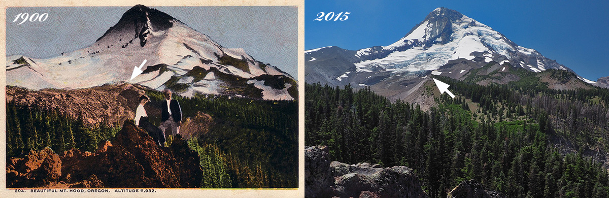
The photo on the right is from around 1900, and this pair shows just how much the Eliot Glacier has receded in the past century -- what looks like a moraine in the old photo (partly because it was colorized that way) beyond the trees on the left is actually the terminus of the glacier at the time, about where the last version of the Eliot crossing on the Timberline Trail was located (where the ropes are today). It's somewhat mind-blowing to think that the toe of the glacier at the time filled the valley nearly to the top of the moraines..! Wow! (the arrows point to the same spot on the west moraine, for reference)
So, that's my July Cloud Cap ramble... now I gotta head back downstairs and work on the drywall....
Tom


