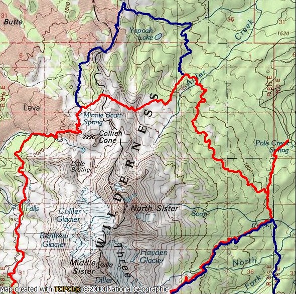
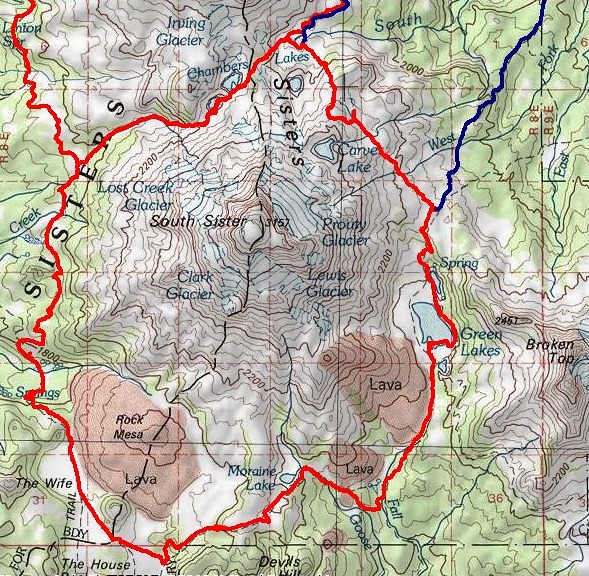
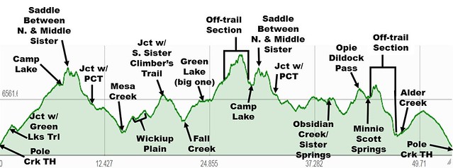
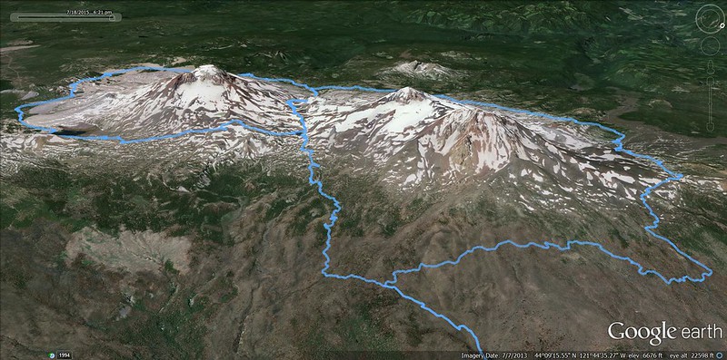
Brad is going to supply all the detailed stats for our hike but here's the different loop in a nutshell: From the Pole Ck TH, past Camp Lake to the PCT via Chambers Lakes. Then S on the PCT and other trails around South Sister, then N on Trail 17 past Green Lakes to 7000'; from there XC to Camp Lake. Then deja vu all over again back to the PCT via Chambers Lakes but now N on the PCT to Minnie Scott Spring and from there E XC to Trail 4070 on the east side, then back to the Pole Ck TH. This looked doable from the contour maps, but we had no idea if the two XC sections wouldn't cliff us out or have other no-go features. The actual trip took us three days: red track is day 1, yellow track in day 2, black track is day 3.

DAY 1: Pole Ck TH to Mesa Ck (~14 mi, ~2200' EG)
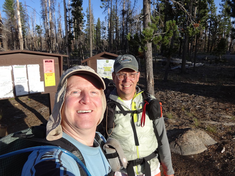
We got an early start and headed up Trail 4072 through the depressing remains of the Pole Ck fire. Brad was packing light (no stove) while I need the reassurance of a hot coffee in the morning (hence a stove).

We took Trail 4074 toward Camp Lake. Where it crosses the S Fk of Whychus Ck,

we met a gentleman who made some jokes about our having GPSs while trying to convince Brad that this was really Soap Ck.

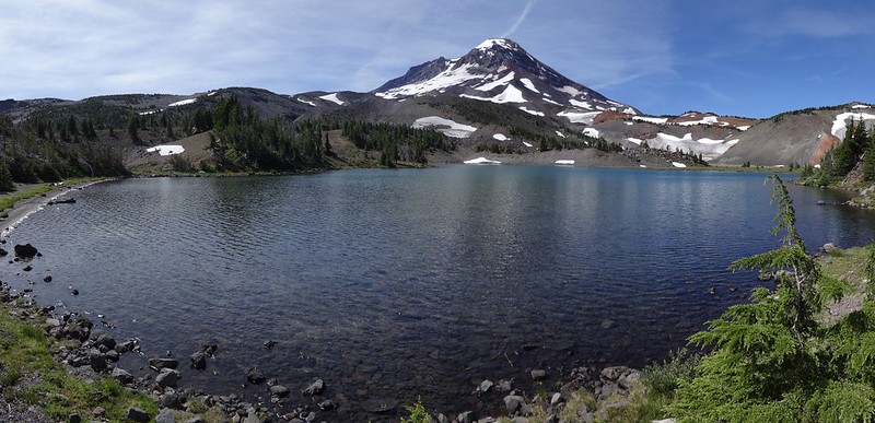
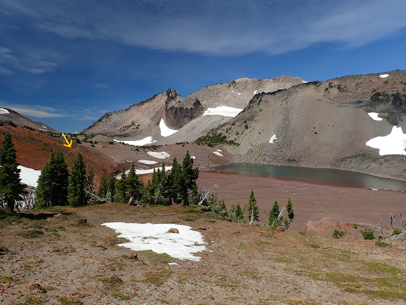
We got to Camp Lake where the start of the user trail to the PCT was pretty obvious (arrow), as was South Sister. Actually that whole trail was pretty obvious and easy to follow.

The immediate climb up from the lake is a bit of a grunt,

but soon crosses the divide (arrow) and drops past the first lake.

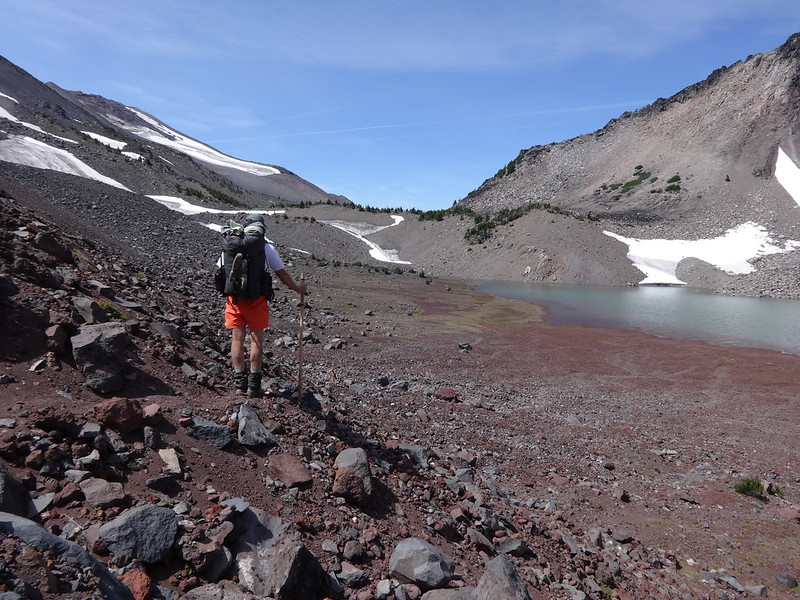
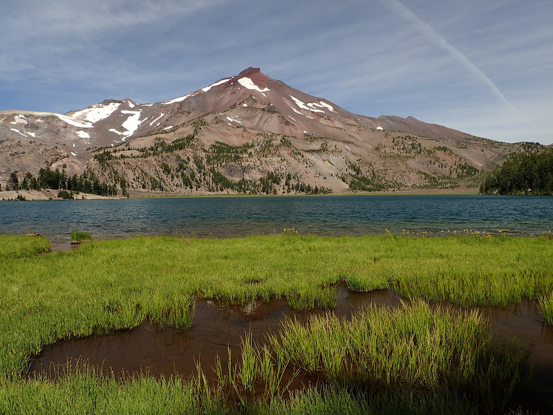
The Chambers Lakes drainage is a destination in its own right, with lakes formed by moraines, varied volcanic colors, all presided over by South and Middle Sister.

The user trail (arrow) runs along the S side of the drainage past one lake,
and then the next,

before finally cresting with a view of The Husband out to the W,
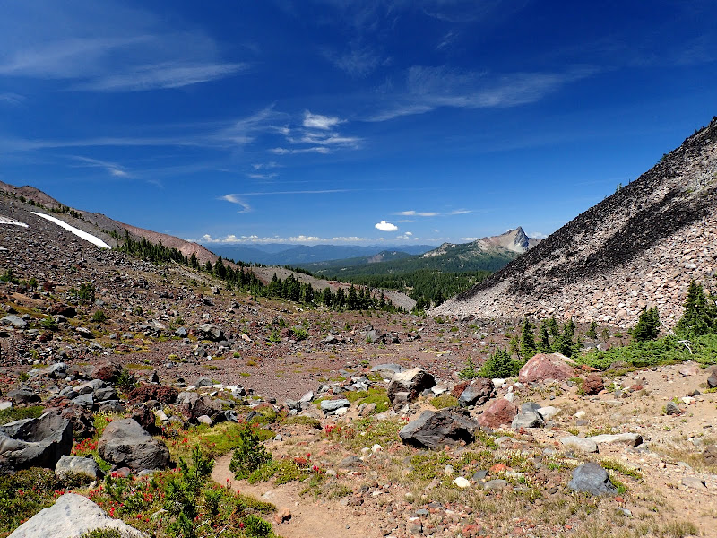
and then descending the Separation Ck drainage to an unsigned junction with the PCT.

Separation Ck was dry at the PCT (wet but silty higher up) and Brad wasn't keen on water quality in Reese Lake, so we went S on the PCT to find a great little camp spot on a small meadow just above Mesa Ck.

DAY 2: Mesa Ck to Camp Lk (~15 mi, ~2200' EG)
The next morning, we went S on the PCT,

past the Rock Mesa,
and contemplated The Wife.
Then it was Trail 17.1 around South Sister,
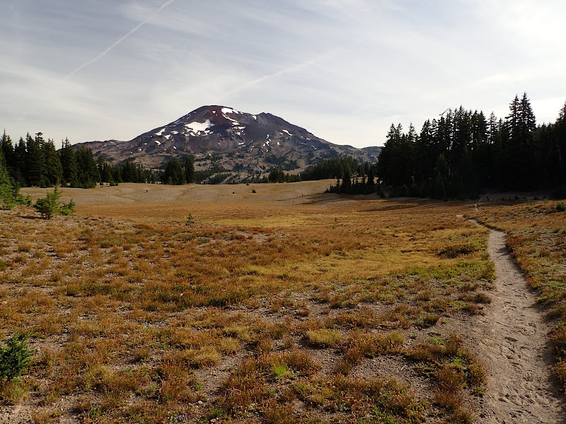
past Moraine Lk (I was surprised to find that it's now in a camping management zone
across Fall Ck,
then up Trail 17 past Green Lakes,
to the 6900' contour (where the trail starts its descent to Park Mdw). This was the first XC piece of our hike and basically we headed directly across the landscape toward a point between the two peaks on the horizon.

This proved to be pretty easy country to move through. It also had lots of meadows and water sources tucked away in it, including the upper W Fk of Park Ck.

Soon "Little Pilot Rock" came into view and we aimed just to the right of it (arrow).
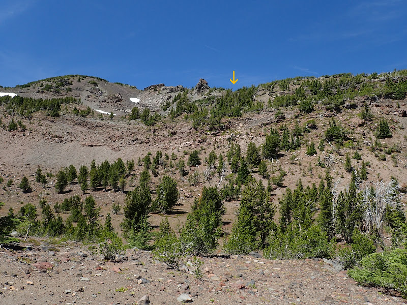
We had to negotiate a minor piece of steepness to reach Little Pilot but the view S toward Broken Top and Mt. Bachelor was unique.

The only really tricky routefinding involved by-passing a cliff, snowfield, and terminal moraine that didn't look like fun to me at all. But the route we found (arrow) got us around all that,

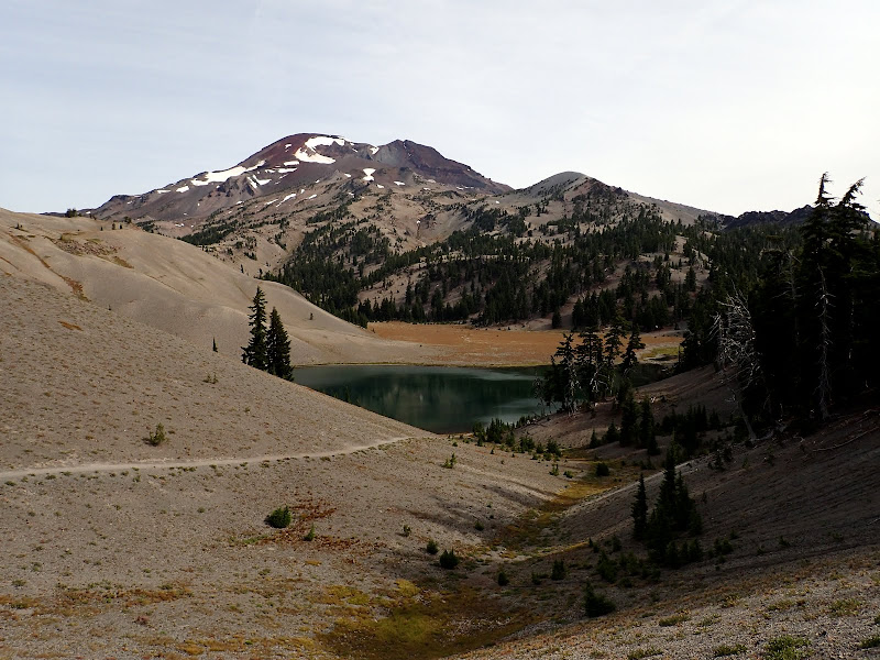
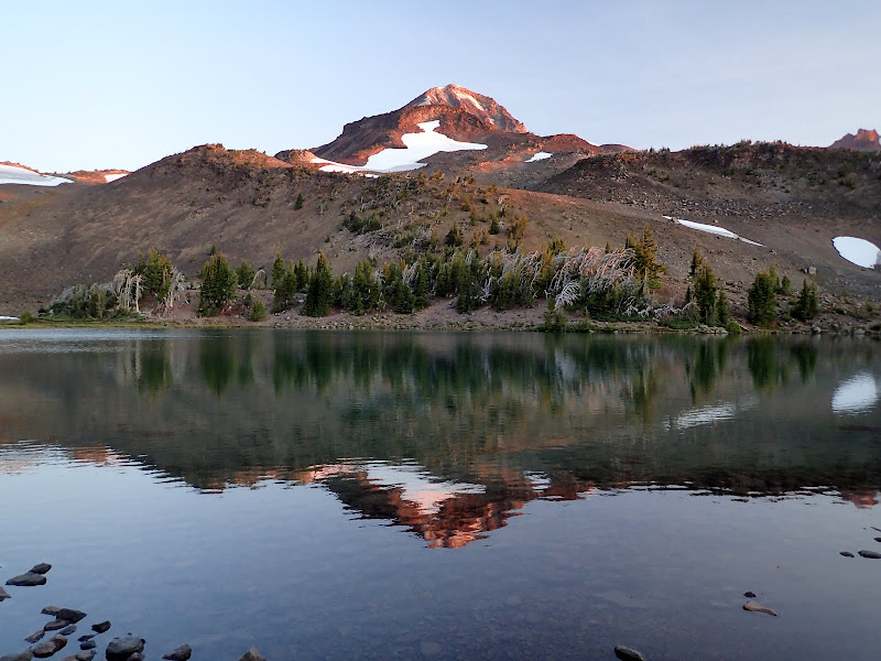
to an easy descent to Camp Lake, where we camped,

and enjoyed the sunset.


DAY 3: Camp Lk to Pole Ck TH (~24 mi, ~3000' EG)
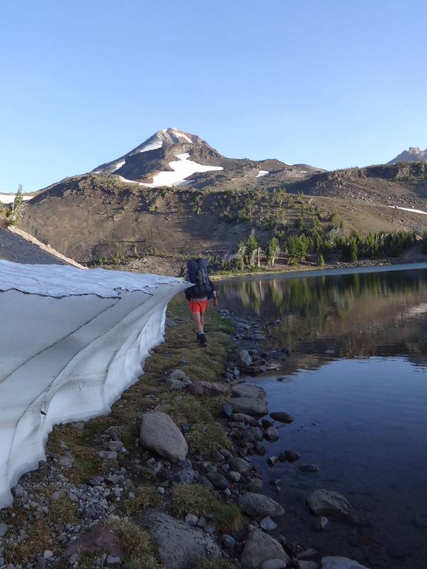
The day started peacefully, with sunrise over Middle Sister,
and South Sister.

We then retraced our steps past the Chambers Lakes,

to the PCT and then went N,

past Obsidian Falls,

up Opie Dilldock Pass,

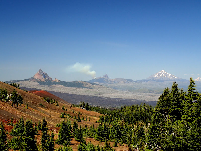
for a view of ( R > L) Hood, Jefferson, Three Finger Jack, Washington, and Belknap (note that there's no smoke on Three Finger Jack - this will change),

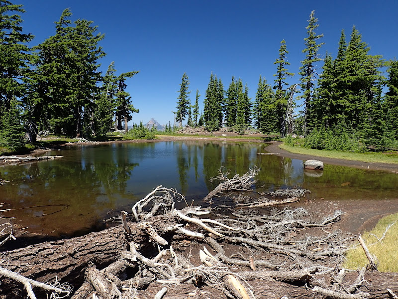
to Minnie Scott Spring. At this point we needed to find a XC way through the Ahalapam Cinder Field and over the ridge running N from North Sister. I'd sketched out a route that, from the map, looked like it might go. So we went due E from just N of the spring, past a nice little lake hidden off the PCT,
 ,
,up a hot and sweaty (but easy) cinder slope to the top of the ridge where it was immediately obvious that a fire had erupted on the W side of Three Finger in the short time we'd been climbing.
From the N-S ridge, we had to cross an E-W ridge (arrow) to gain access to the cinder fields on the E side of North Sister. We needed to trend SE across these fields to gain our objective - where Trail 4070 crosses Alder Ck.

It was easy traveling across a wide open landscape of colorful cinders,

where life persists.

The map showed one band of steep cliffs along our path toward Alder Ck and we couldn't be sure we'd find a way through those. But close observation of deer tracks pointed us to a break in the cliff (black arrow) and then an easy, cindery descent (yellow arrow) to the plain below.

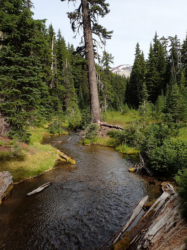
From there, it was across more cinder fields then through living and burned forest to Alder Ck.

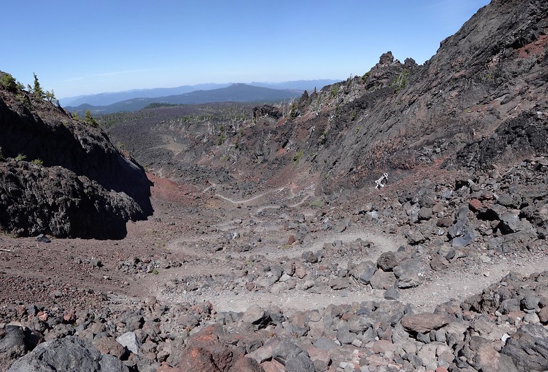
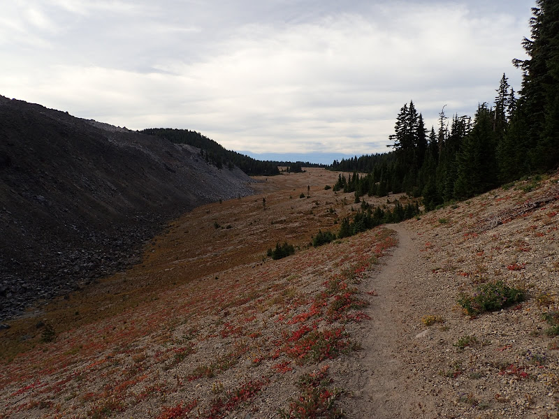
The worst part of our whole trip was Trail 4070 back to the TH - hot and dusty through burned forest and climbing for half the way. And it didn't help that we'd already put in a ~17 mi day. But we just settled our suffering into a "just keep moving" zone and, after a zombie-like 6 mi or so, were back at the cars by late afternoon. This last day was a bit on the looney side mainly because we had no on-the-ground knowledge of the XC section - so once we were into it and it was a go, we just had to keep moving. With what we know now, this adventure could be apportioned into a real nice 4-day backpack. Overall, a demanding, adventurous but really, really fun backpack through some areas of the Three Sisters Wilderness that few, if any people, have ever seen.