Siskiyou-Boundary Trail explorations (S Oregon) 25-Feb-2015

This forum is used to share your experiences out on the trails.
Post Reply
User avatar
VanMarmot
Posts: 1924
Joined: May 28th, 2008, 10:03 pm
Contact:

Siskiyou-Boundary Trail explorations (S Oregon) 25-Feb-2015

Post by VanMarmot » February 26th, 2015, 9:01 am

There is a series of trails that allow you to traverse the dramatic spine of the Siskiyou Crest along the western boundary of the Red Buttes Wilderness. This 40.6 mi long trail system has been termed the Siskiyou-Boundary Trail (Backpack #4 in Lorain's Backpacking Oregon) and the Siskiyou Crest Route (page 139 in Ruediger's The Siskiyou Crest). Parts of it are (confusingly) called the Boundary National Recreation Trail (Trail 12W47) and Trail 1207 (USFS 1207). I first became aware of this trail when we climbed Grayback Mountain (its northern terminus) last year (Grayback TR).

Image

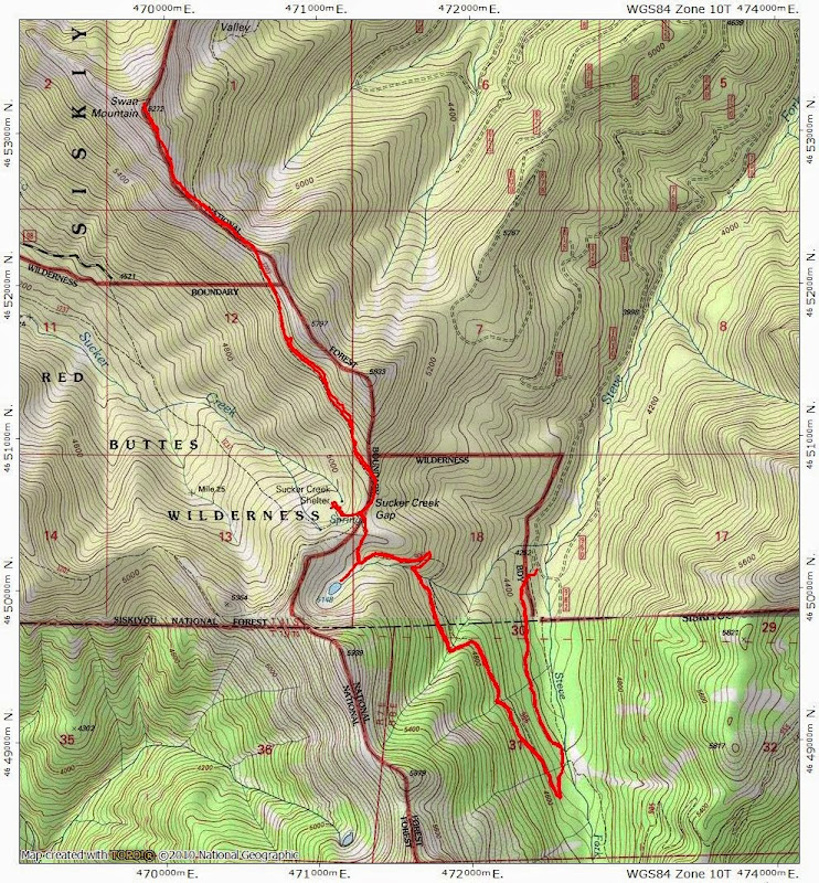
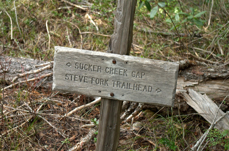
Now that we're "locals," I've been exploring parts of the trail in anticipation of a thru hike once the days get a little longer and warmer (no need to wait for the snow to melt - there isn't any). We checked out the trail S of Grayback on a recent hike to Mt. Elijah and the Oregon Caves (Mt. Elijah TR), its center section with a hike to Cedar Basin (Butte Fork TR), and it's southern terminus with a hike through Cook and Green Pass (Cook & Green TR). Today's effort was aimed at the charmingly named Sucker Gap, located N of Cedar Basin and S of Mt. Elijah. I started at the Steve Fork TH on the E side of the crest (Hike #73 in Sullivan's 100 Hikes in Southern Oregon),

Image

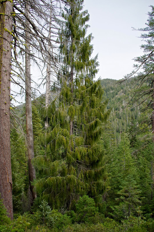
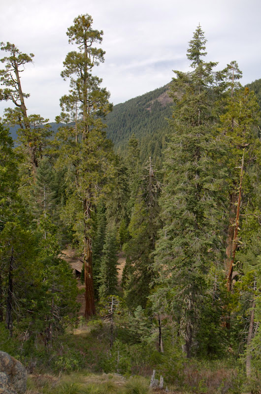
then hiked up through a lush forest, incluidng the rare Brewer's spruce,

Image

to a junction with the Boundary Trail,

Image

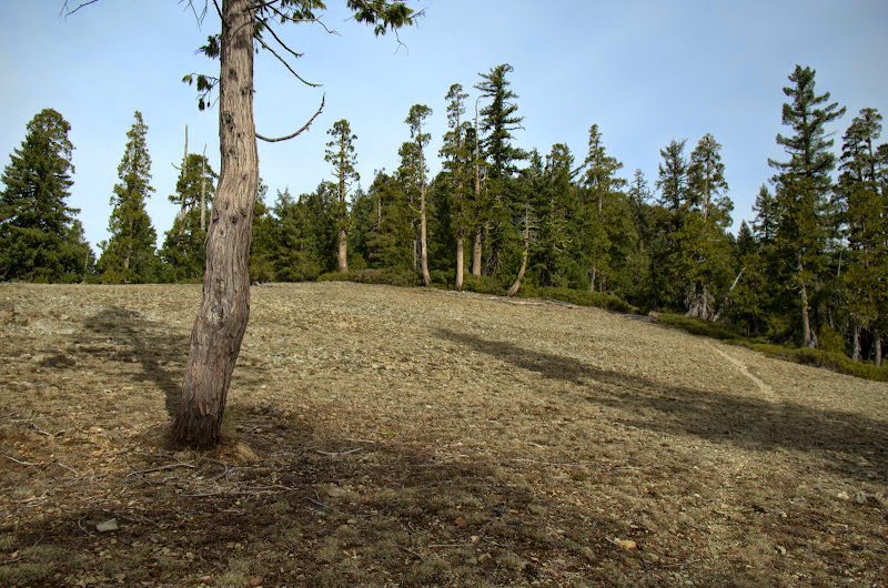
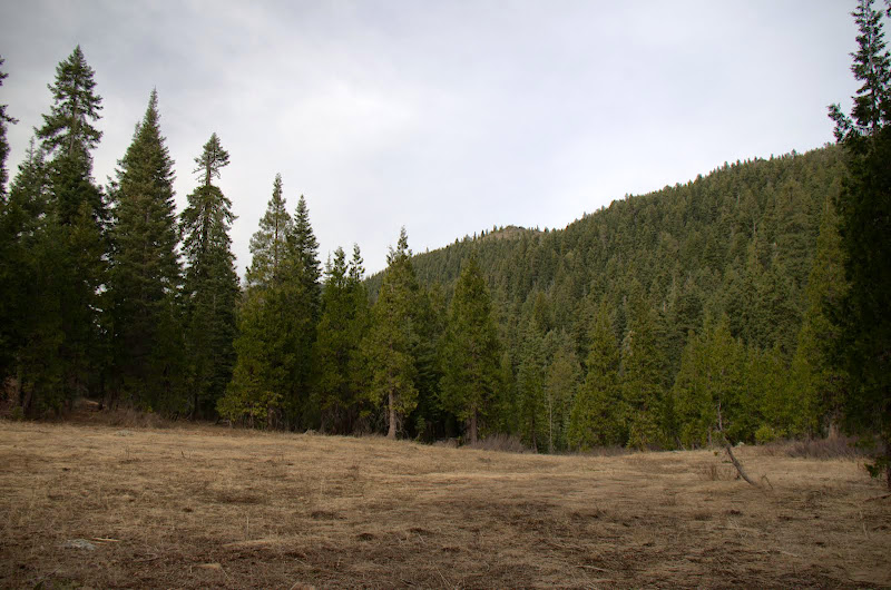
at a meadow in Sucker Gap.

Image

From there it was N through more forest on the Boundary Trail,

Image

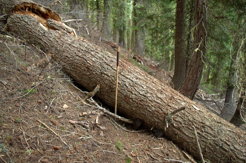
which was a good shape except for the few occassions where the forest had joined the trail (walking stick is 5' long).

Image

My goal for the day was the summit of Swan Mountain, which soon came into view,

Image

along with that of ever reliable Mt. McLoughlin.

Image

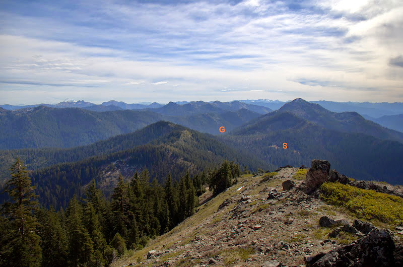
From Swan's summit, I could look S to the Gap (G) and the meadow (S) where I would later find the Sucker Creek shelter.

Image

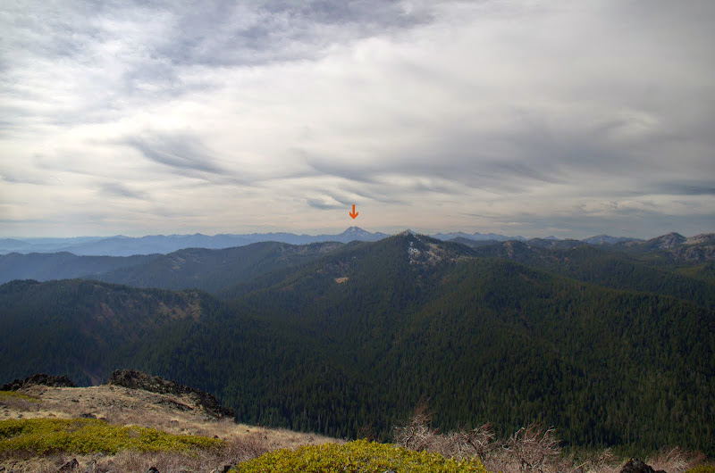
It was a day of on-and-off cloud cover, but I could see Preston Peak (arrow), the highest peak in the Siskiyou Wilderness to the SW,

Image

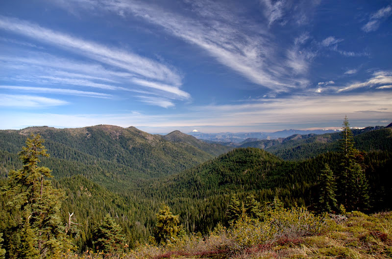
prescribed burns in the Illinois Valley and the coast range to the W,

Image

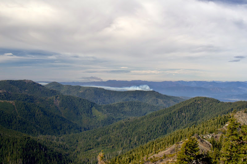
and Lake Mountain (L), Mt. Elijah (E), Craggy Mountain (C), and Grayback Mountain (G) to the N.

Image

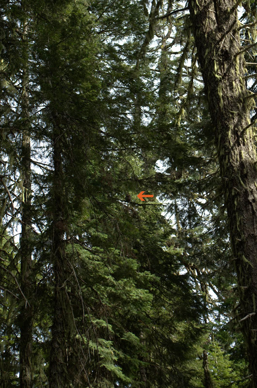
There was a lookout on Lake Mountain that blew down in 1953 and supposedly one here on Swan Mountain but there's no obvious evidence of that left. The last entry in the summit register was 2011 - which just confirms what I've been finding - that "crowds" are not a problem on many of the trails and summits in this region. After lunch on the sun washed summit, I turned back and along the way caught a quick glance of a large bird swooping through the trees and then landing high in a tree (arrow).

Image

At first I thought it was a grouse but when it swiveled its head 180 degrees, it was obviously an owl.

Image

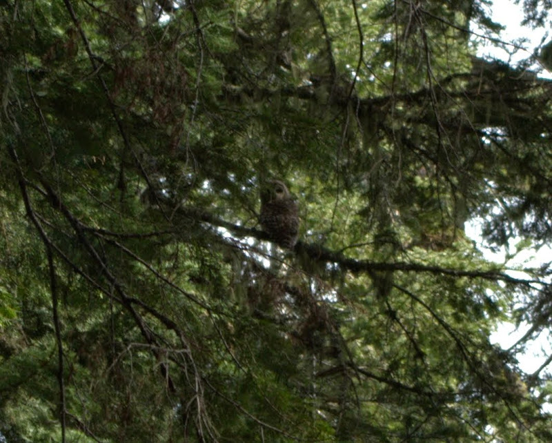
But spotted or barred? Same genus and really hard to tell apart at a distance and their ranges now essentially overlap. Since the government is busy shooting barred owls to protect spotted owls, I assume someone can tell them apart in the forest?

Image

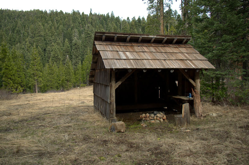
After the owl, it was on to the Sucker Creek shelter, which is below the trail,

Image

on the edge of a large meadow overlooked by Swan Mountain.

Image

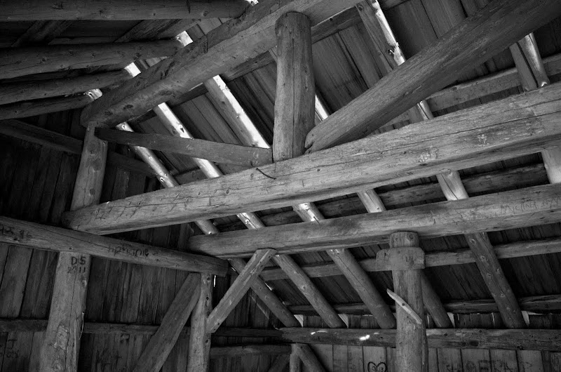
The shelter was built in the 1920s by a cattle rancher and restored in 2001 - it has a dirt floor and an elevated sleeping bench and is probably a great place to meet mice (all night long).

Image

Image

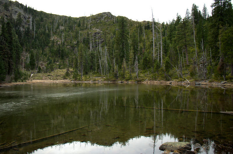
Then up and over the Gap, with a stop at a small lake just below it - unnamed on the USGS map but called "Cirque Lake" by Sullivan -

Image

before retracing my steps to the Steve Fork TH. Good hike (11 mi RT, 1800' EG) with views, history, rare trees, and rarer wildlife.

Image
Last edited by VanMarmot on February 28th, 2015, 7:36 am, edited 1 time in total.

User avatar
retired jerry
Posts: 14424
Joined: May 28th, 2008, 10:03 pm

Re: Siskiyou-Boundary Trail explorations (S Oregon) 25-Feb-2

Post by retired jerry » February 26th, 2015, 9:08 am

Some day I'm going to do a trip there, thanks for report

a little closer than trinity alps

User avatar
Don Nelsen
Posts: 4381
Joined: May 28th, 2008, 10:03 pm
Location: Vancouver, WA

Re: Siskiyou-Boundary Trail explorations (S Oregon) 25-Feb-2

Post by Don Nelsen » February 27th, 2015, 8:36 am

Very nice TR and pics. Your recent TR's have made me move the SW corner of OR to my short list of places to spend more time hiking.

Thanks,

dn
"Everything works in the planning stage" - Kelly

"If you don't do it this year, you will be one year older when you do" - Warren Miller

User avatar
VanMarmot
Posts: 1924
Joined: May 28th, 2008, 10:03 pm
Contact:

Re: Siskiyou-Boundary Trail explorations (S Oregon) 25-Feb-2

Post by VanMarmot » February 27th, 2015, 3:00 pm

Don Nelsen wrote:Very nice TR and pics. Your recent TR's have made me move the SW corner of OR to my short list of places to spend more time hiking.

Thanks,

dn
Thanks! The poor winter we've been having down here has allowed me to explore trails earlier than I had expected.

Saw you on OPB - very nice piece. I was imagining the camera people trying to keep up with you thru the forest! There must be some old RR down here for you to explore - but no promises on you finding a lost steam locomotive! ;)

User avatar
retired jerry
Posts: 14424
Joined: May 28th, 2008, 10:03 pm

Re: Siskiyou-Boundary Trail explorations (S Oregon) 25-Feb-2

Post by retired jerry » March 31st, 2015, 8:16 am

There's the Sucker Creek shelter

and the shelter three miles up the Butte Fork trail

maybe 15 miles between those

any other shelters in that area you can think of?

User avatar
VanMarmot
Posts: 1924
Joined: May 28th, 2008, 10:03 pm
Contact:

Re: Siskiyou-Boundary Trail explorations (S Oregon) 25-Feb-2

Post by VanMarmot » March 31st, 2015, 8:55 am

retired jerry wrote:There's the Sucker Creek shelter

and the shelter three miles up the Butte Fork trail

maybe 15 miles between those

any other shelters in that area you can think of?
The only other one I'm aware of is the snow survey cabin just below Grayback Mtn.

Post Reply