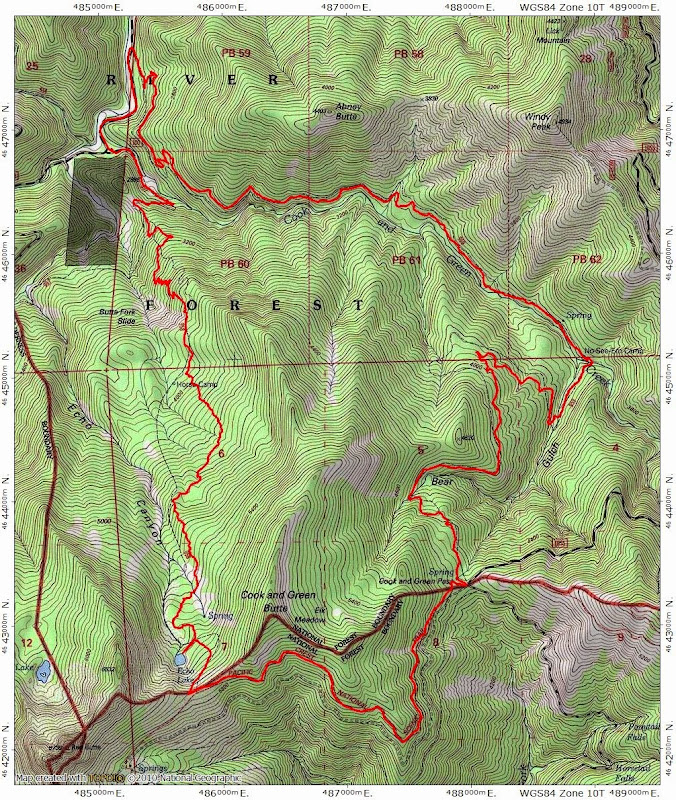
Cook and Green Loop ( S Oregon) 31-Jan-2015

This forum is used to share your experiences out on the trails.
User avatar
VanMarmot
Posts: 1924
Joined: May 28th, 2008, 10:03 pm
Contact:

Cook and Green Loop ( S Oregon) 31-Jan-2015

Post by VanMarmot » February 1st, 2015, 8:58 am

Looking (as always) for a loop hike with views, I came across the Cook and Green (USFS #959) - PCT - Horse Camp (USFS #958) loop in the Red Buttes Wilderness in Northern California. This is hike #154 in Sullivan's 100 Hikes in Southern Oregon, 3rd edition {but he has you doing the loop counter-clockwise, which I would not recommend} and Ruediger details the various botanical features of this loop in his The Siskiyou Crest. I parked at the Horse Camp TH and then walked the 0.5 mi back down FR 1040 to the Cook and Green TH. From there, the trail climbs steadily, but gently, up through a recent burn,

Image

into oak woodlands,

Image

to "No-See-Em Camp" - a small flat spot along Cook and Green Creek about 4 mi from the TH.

Image

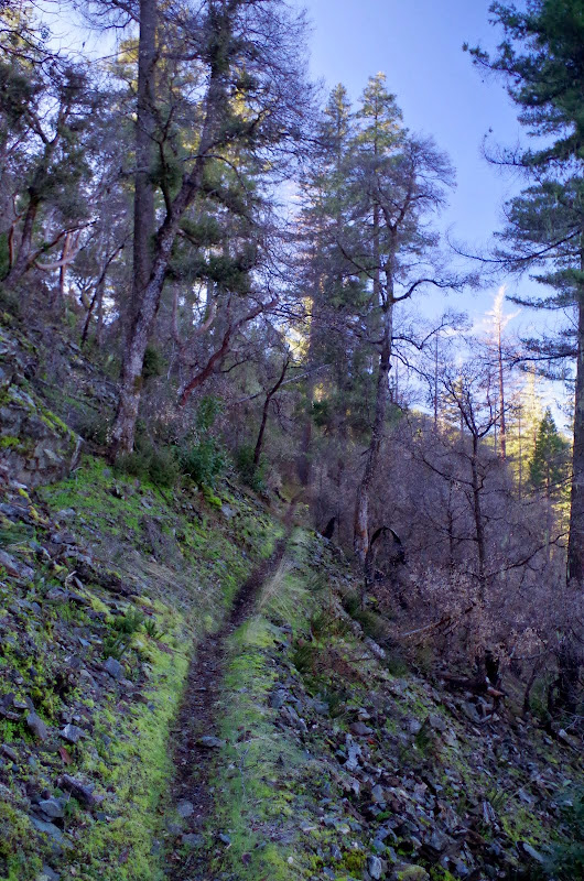
After crossing both Cook and Green and Bear Gulch Creeks, the trail starts climbing (easily - there's nothing steep about this trail) through forests of fir,

Image

across an open area sporting clumps of manzanita,

Image

and then on to its end at Cook and Green Pass and its a junction with the PCT and FR 1055.

Image

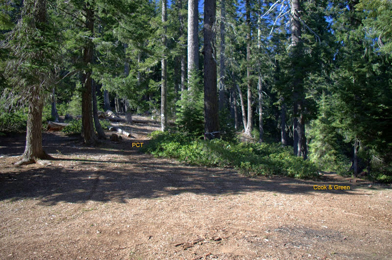
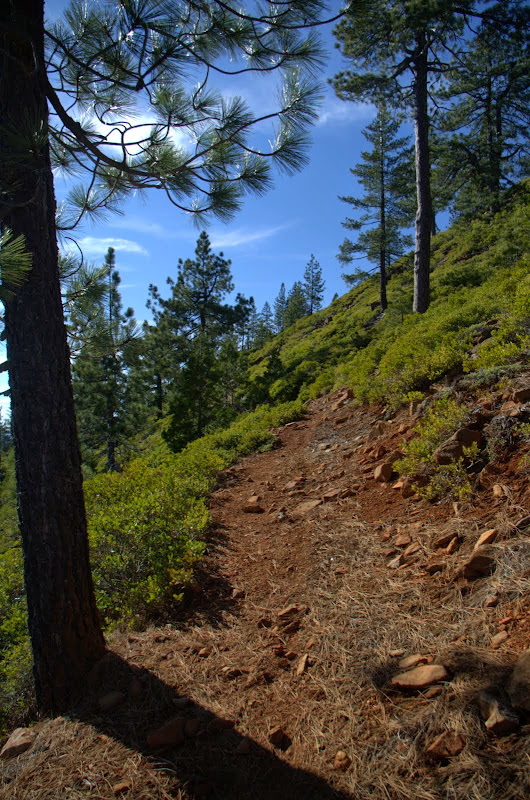
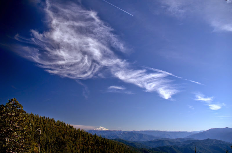
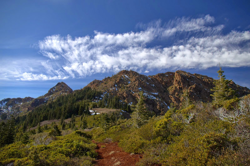
After a quick snack at the pass, I headed SW on the PCT,

Image

savoring the expansive views it offered (Mt. Shasta on the horizon),

Image

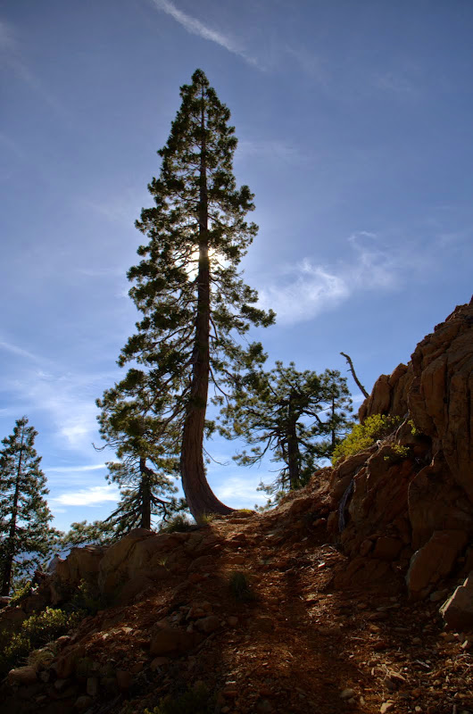
and its rocky, open character.

Image

Soon the Red Buttes came into view,

Image

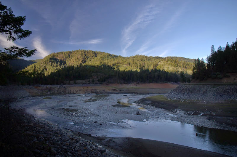
with their very depleted snow pack. That I was able to do this hike in January wearing just trail runners speaks to the 18% of "normal" snow level we're currently experiencing.

Image

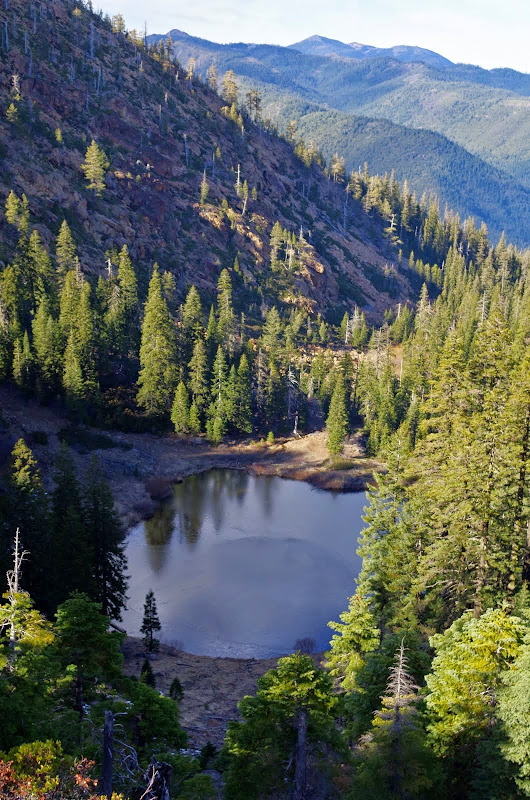
The PCT - Horse Camp trail (which leads to Echo Lake) junction is on the saddle just E of the Red Buttes.

Image

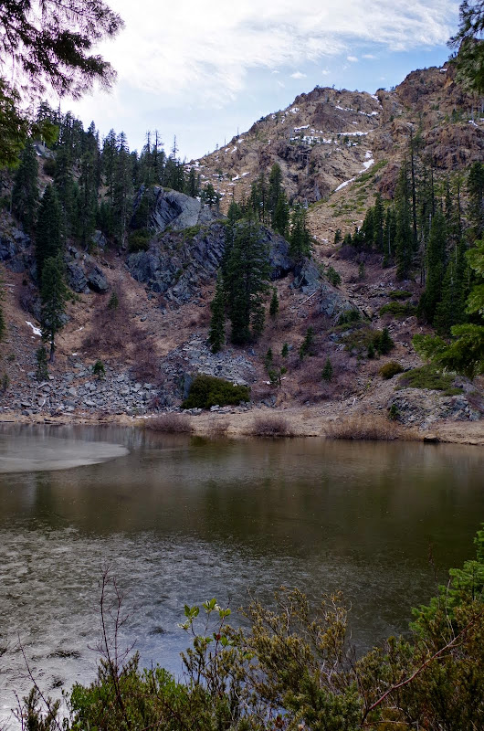
The Horse Camp trail is much steeper than the Cook and Green trail - it gains (or loses) 3500' in just 4 mi, while the Cook and Green - PCT combination takes almost 11 mi to make that gain. It is also less used and less maintained. I could see Echo Lake from the saddle,

Image

but had to negotiate a few patches of icy snow and some faint trail to actually reach the lake, with its thin coating of ice.

Image

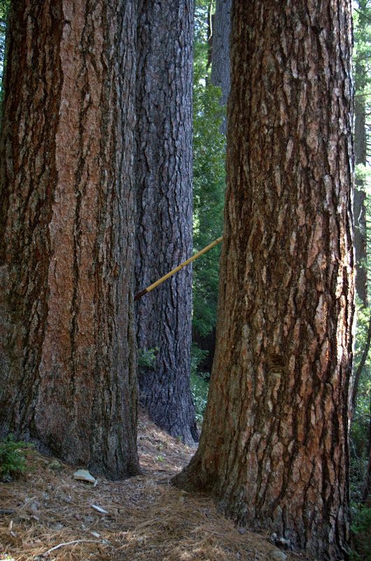
The trail became very faint below the lake,

Image

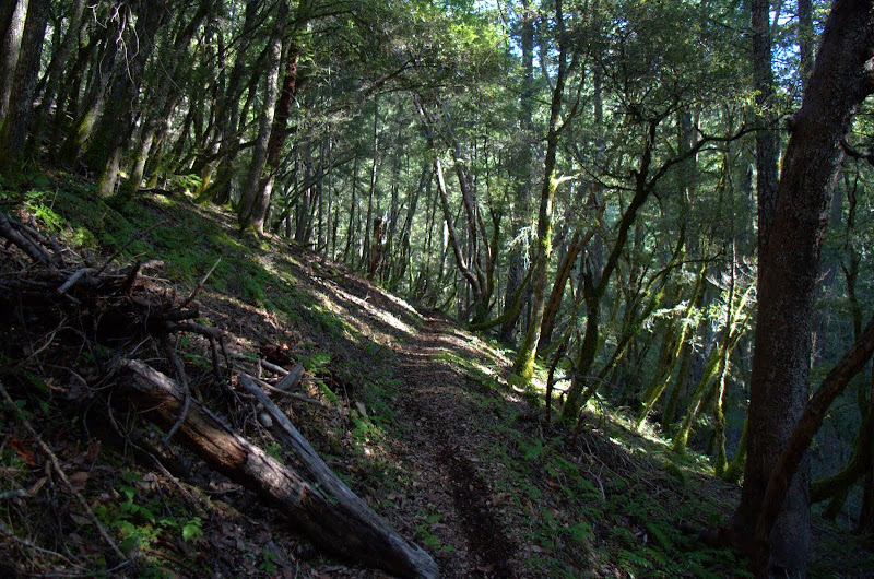
and some navigation was needed to reacquire it at about 4700'. When I later matched my actual track to the "mapped" trail alignment, it became obvious that the mapped alignment was fanciful, at best, in a few places. But from 4700' on, the trail was easy to follow and took me through several stands of ancient cedars and firs - my hiking stick is 5' long -

Image

as it worked its way down through more than a few switchbacks to the Horse Camp TH. A great loop hike (15 mi RT, 3500') with views, creeks, lakes, and ancient forests. :D

Image

Pablo had commented on one of my earlier TRs in this area (Collings Mtn) that he'd worked on the roads around Applegate Reservoir back in 1978 and that some trees that had been left standing as raptor perches. Well, they're still there, but it may be too early yet for raptors.

Image

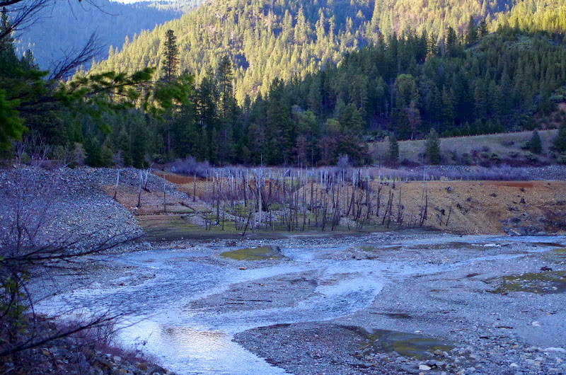
The Corps starts filling the reservoir today and since that relies on rainfall (which we're finally predicted to receive in the coming days :) ) and not snow, there's a good chance it'll look more like a lake by summer. Fingers crossed on that happening...

Image
Last edited by VanMarmot on September 12th, 2015, 3:34 pm, edited 2 times in total.

User avatar
sgyoung
Posts: 393
Joined: November 3rd, 2013, 7:30 pm
Location: Seattle

Re: Cook & Green Loop (N California) 31-Jan-2015

Post by sgyoung » February 1st, 2015, 11:06 am

What a great hike and beautiful pictures too. That looks like a really fun outing. I've never explored northern CA (or much of the state at all, despite visiting my wife's family out there fairly regularly), but your recent reports are providing a lot of great ideas for future trips.

Good luck getting some rain/snow too!

User avatar
Don Nelsen
Posts: 4381
Joined: May 28th, 2008, 10:03 pm
Location: Vancouver, WA

Re: Cook & Green Loop (N California) 31-Jan-2015

Post by Don Nelsen » February 1st, 2015, 5:04 pm

Very nice photos - you really picked a great place to retire to!

I've often been in your (new) part of the world on business trips and thought that if I were to move out of the Portland metro area, SW OR would be a good spot. You are doing a good job verifying my thoughts.

thanks,

dn
"Everything works in the planning stage" - Kelly

"If you don't do it this year, you will be one year older when you do" - Warren Miller

User avatar
VanMarmot
Posts: 1924
Joined: May 28th, 2008, 10:03 pm
Contact:

Re: Cook & Green Loop (N California) 31-Jan-2015

Post by VanMarmot » February 2nd, 2015, 7:06 am

Don Nelsen wrote:Very nice photos - you really picked a great place to retire to!

I've often been in your (new) part of the world on business trips and thought that if I were to move out of the Portland metro area, SW OR would be a good spot. You are doing a good job verifying my thoughts.

thanks,

dn
Thanks! Actually it was a business trip to the old Humboldt Bay power plant - through the very nice Medford airport - that brought Medford into our retirement thinking. We came down for long weekends - with hiking, of course - at various times for over a year before deciding. The outdoor stuff you can do down here was certainly a deciding factor (as was the extra sunshine ;) ).

User avatar
retired jerry
Posts: 14424
Joined: May 28th, 2008, 10:03 pm

Re: Cook & Green Loop ( S Oregon) 31-Jan-2015

Post by retired jerry » March 4th, 2015, 7:13 pm

I've been eyeing that

How did you get to trailhead - Applegate Road which goes west of Applegate Reservoir? And then to FS road 1040? How was 1040, gravel for regular vehicle?

Was there any campground open? Like Watkins Campground? Forest Service says it's open without services.

User avatar
VanMarmot
Posts: 1924
Joined: May 28th, 2008, 10:03 pm
Contact:

Re: Cook & Green Loop ( S Oregon) 31-Jan-2015

Post by VanMarmot » March 5th, 2015, 6:31 am

retired jerry wrote:I've been eyeing that

How did you get to trailhead - Applegate Road which goes west of Applegate Reservoir? And then to FS road 1040? How was 1040, gravel for regular vehicle?

Was there any campground open? Like Watkins Campground? Forest Service says it's open without services.
Yes - take the Applegate Road S past the reservoir, go left to FS 1040 (just across the CA border where the road goes from paved to gravel), make a sharp right on to 1040, and follow it to the TH. FS 1040 is a good gravel road that would be easy for a regular car. You'll come to the Cook & Green TH first and to the Horse Camp TH a half mile later. I did the loop by parking at Horse Camp and then walking back along 1040 to Cook & Green.

The gate at Watkins was still closed when we went by there last week but I suppose you could just park on the road and walk in. I think "no services" means that the toilet is closed. There are, however, many good "informal" campsites just off of 1040 - again, "no services", but nice sites by the river.

User avatar
retired jerry
Posts: 14424
Joined: May 28th, 2008, 10:03 pm

Re: Cook & Green Loop ( S Oregon) 31-Jan-2015

Post by retired jerry » March 5th, 2015, 6:43 am

Your loop is 15 miles. I like to do more like 40 or 50 miles. Is PCT good going north or south from your loop?

I suppose I could go back most of way down to my car and then go up Butte Fork? Azalea Lake for example.

User avatar
VanMarmot
Posts: 1924
Joined: May 28th, 2008, 10:03 pm
Contact:

Re: Cook & Green Loop ( S Oregon) 31-Jan-2015

Post by VanMarmot » March 5th, 2015, 7:27 am

retired jerry wrote:Your loop is 15 miles. I like to do more like 40 or 50 miles. Is PCT good going north or south from your loop?

I suppose I could go back most of way down to my car and then go up Butte Fork? Azalea Lake for example.
If you parked at the Horse Camp TH, then went up the Cook & Green trail to the PCT, then along the PCT to Kangaroo Spring, then N on the Boundary Trail to Azalea Lake and then descended the Butte Fork Trail back to the Horse Camp TH, you'd do about 30 miles through some of the nicest areas in the Red Buttes Wilderness. If you extended your trip with an out-and-back from Azalea Lake to Sucker Gap (camping at the little lake just E of the Gap), you add about another 16 mi for a 46-50 mile total. I haven't explored all of this route yet but the trails I have been on have been in followable to great shape. Right now, there's no snow but the springs are still flowing, so water isn't an issue. Going S from Cook & Green on the PCT will likely get you into snow.

User avatar
retired jerry
Posts: 14424
Joined: May 28th, 2008, 10:03 pm

Re: Cook & Green Loop ( S Oregon) 31-Jan-2015

Post by retired jerry » March 5th, 2015, 9:31 am

ahhh... Boundary Trail isn't on the switchback.com map, but it is on the 1980 USGS topo map

that would be perfect, thanks. good tour of the area

User avatar
miah66
Posts: 2039
Joined: July 6th, 2009, 8:00 pm

Re: Cook & Green Loop ( S Oregon) 31-Jan-2015

Post by miah66 » March 5th, 2015, 9:58 am

Jerry,

Take me with you! :lol: :mrgreen:
"The top...is not the top" - Mile...Mile & a Half

Instagram @pdxstrider

Post Reply