A Day in the Forest: Lewis River Repeat - 12-19-14
Posted: December 22nd, 2014, 11:36 pm
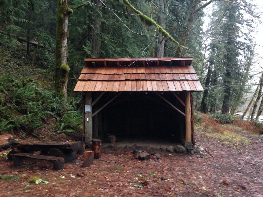
I had a great day on the Lewis River Trail last Friday as I sagged it up from the Bridge TH near Curly Creek Falls to the Upper Falls and back. The highlight of the day was rounding a corner mid-morning and running with the Elk as they took off and ran parallel just off the trail from me. It really set the stage for an awesome trip. Starting things off at the Bridge TH and the first few miles to the old Bolt Camp Shelter:
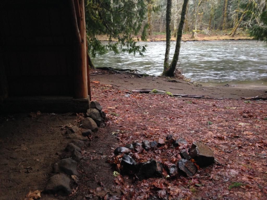
Here you can see where the most recent high water reached, with all the fresh leaves stripped clean:
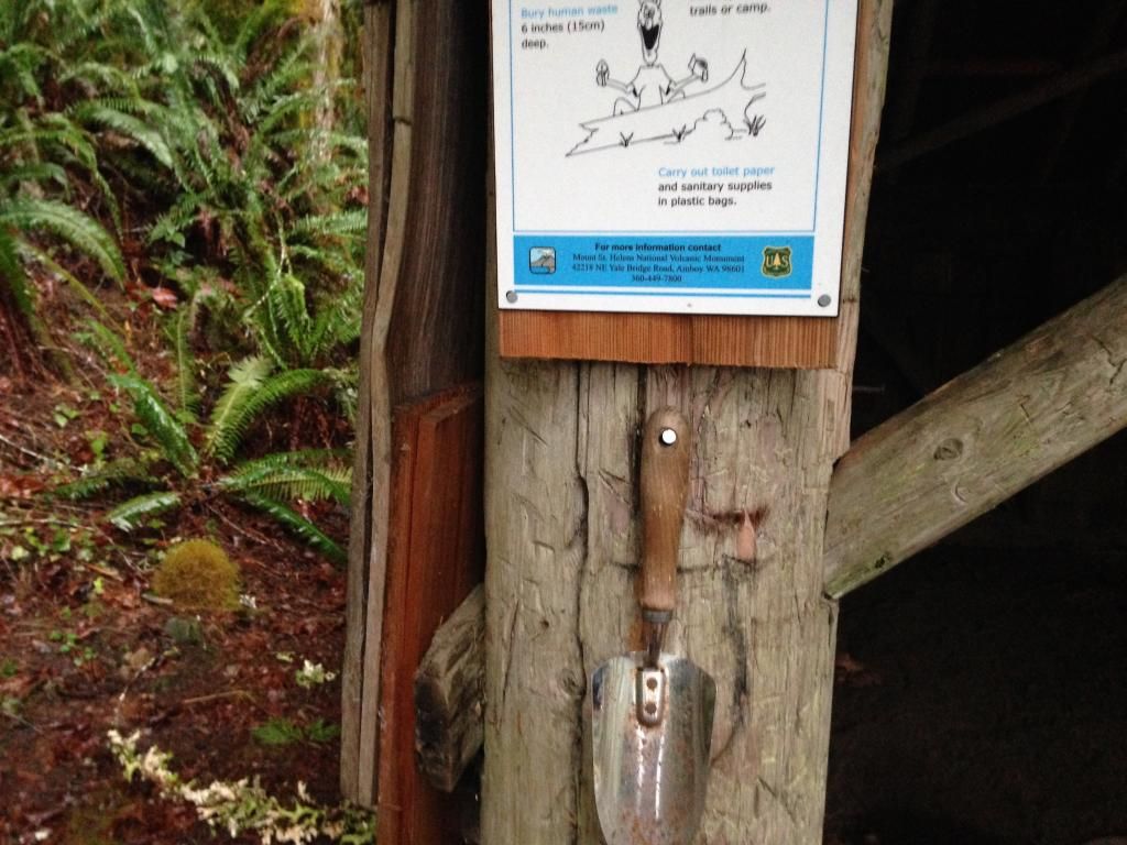
There was even a poop scoop with instructions:
Moving on from the shelter and the morning rain began to fall in a way one could appreciate, lending even sharper shades of green to the landscape:
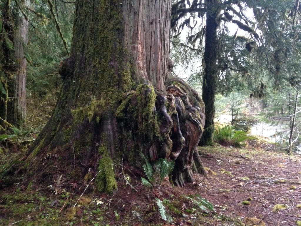
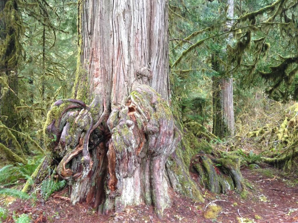
This trail side cedar is a legend in its own right:
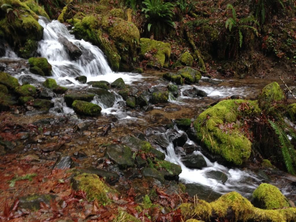
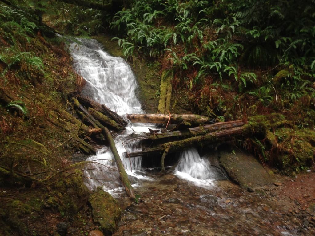
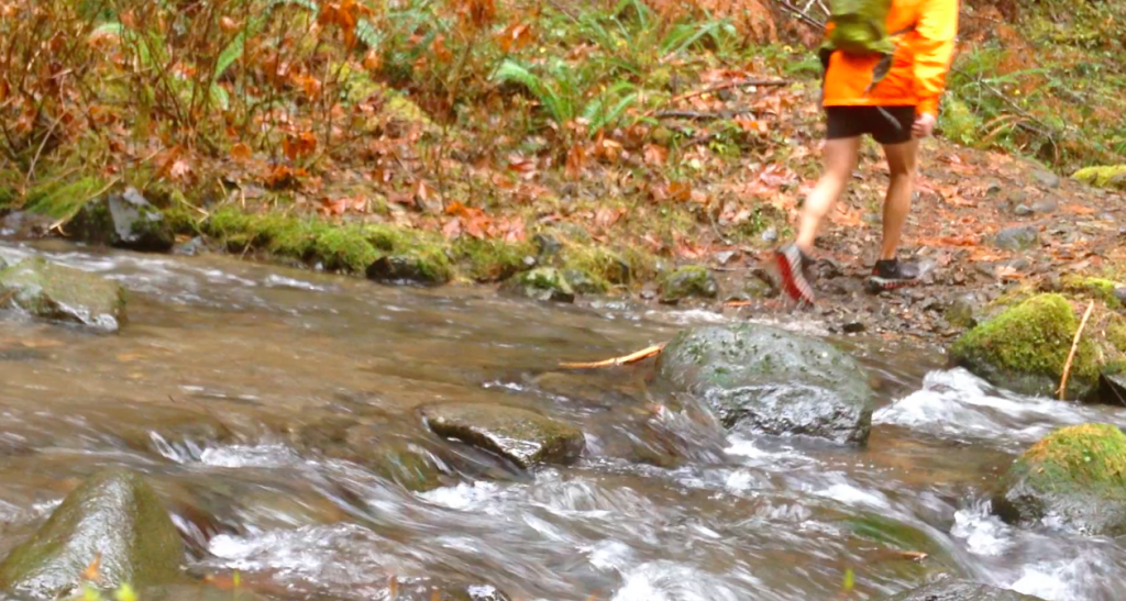
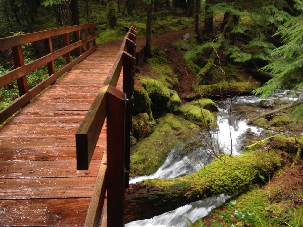
There were lots of pretty streams to cross going to and from:
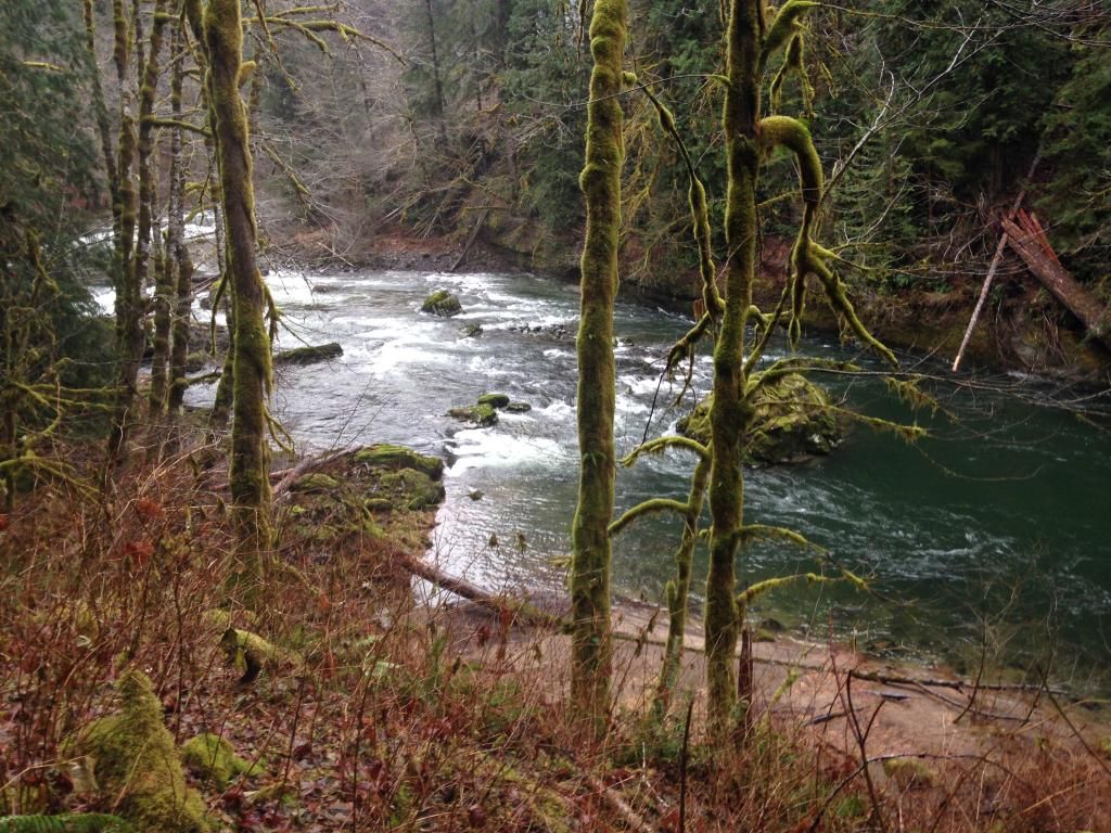
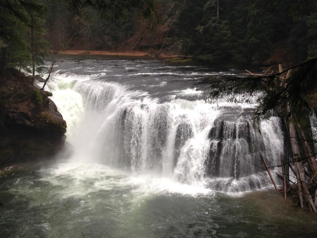
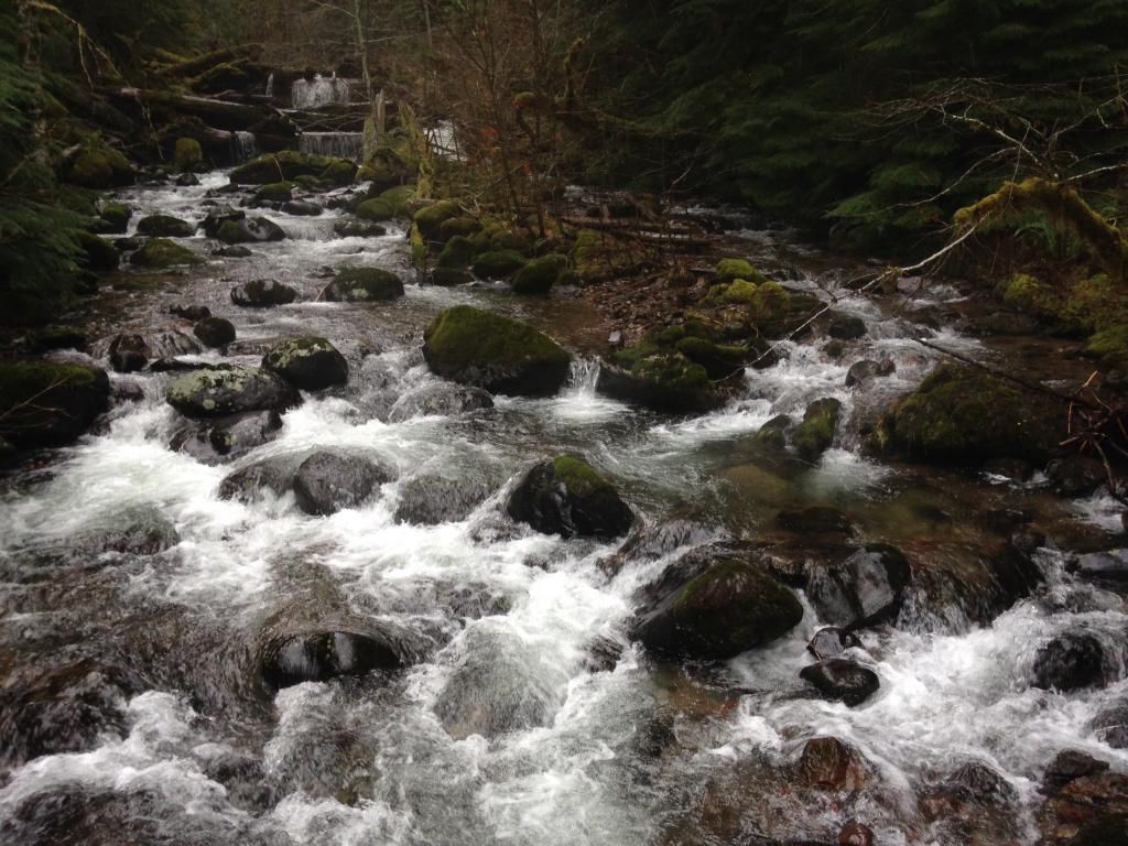
But none prettier than the river itself:
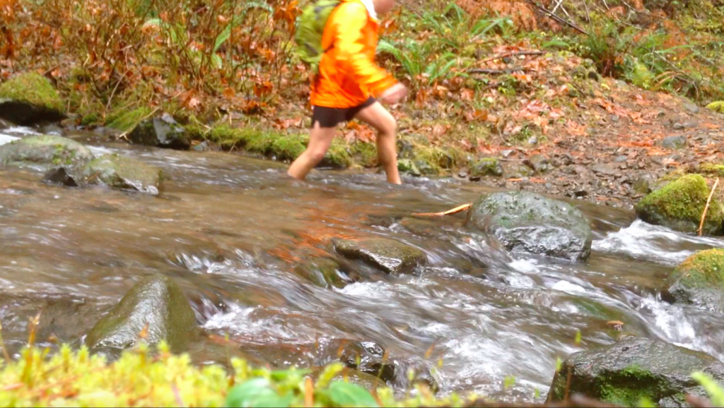
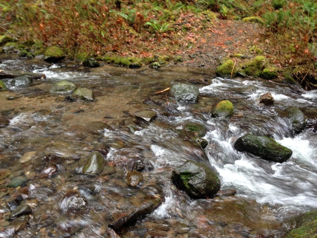
Despite all the splashing around on friday, the streams were much calmer compared to the last time Jo and I did a similar hike the year before. Spencer Creek was just above the ankle this time:
Moving across 90 and I took a nice break at the Lower Falls:
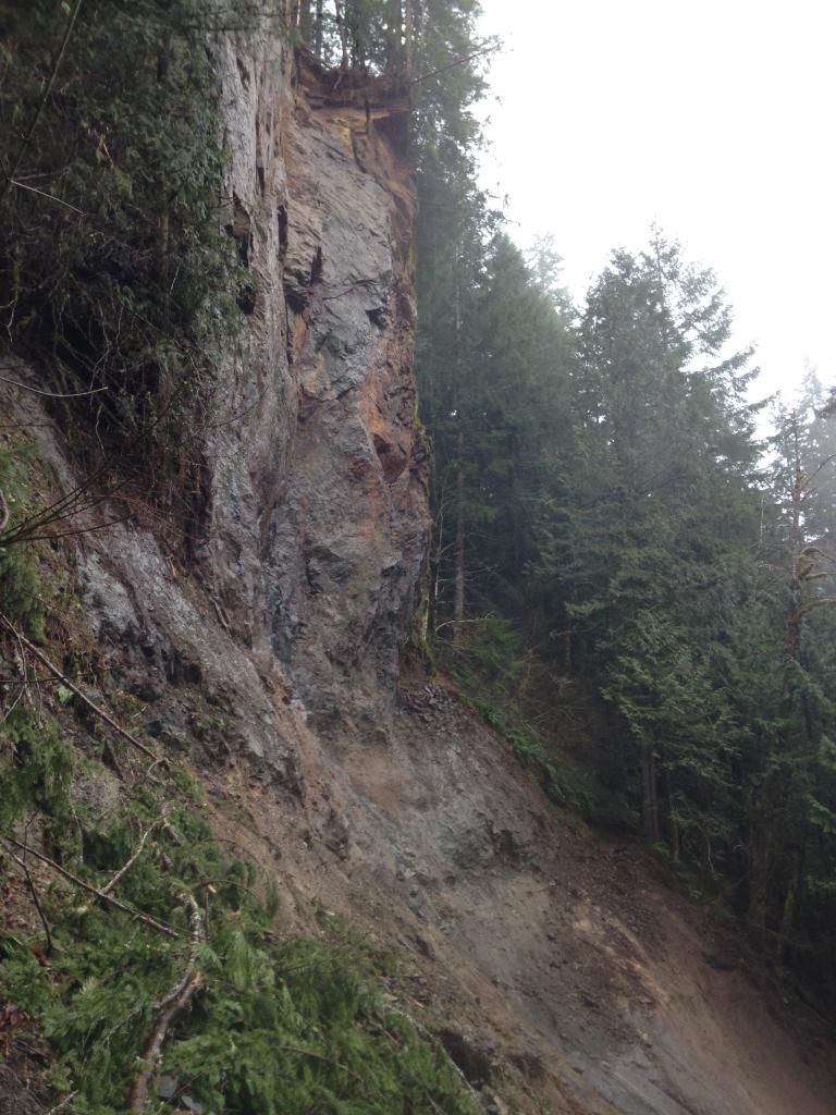
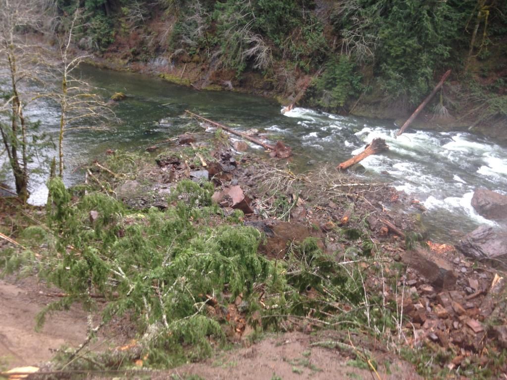
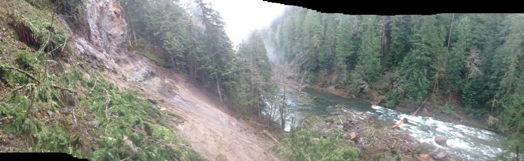
Moving on toward Middle Falls and I really just tried to focus on jogging this stretch as the rain fell harder and harder. Pretty soon I reached the huge washout near Middle Falls, which was pretty amazing to see in person as a big chunk of the canyon wall now lives in the riverbed:
Here is a pano:
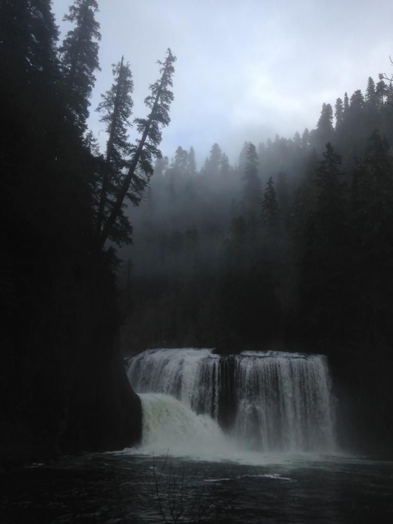
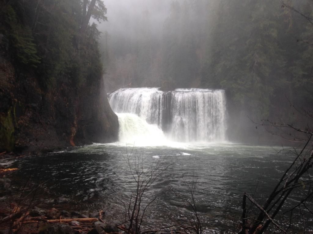
To detour around the closed section one can loop up to the Middle Falls TH and back down to the Lewis River Trail. A close second to the Elk was a few minutes at the amazing Upper Falls:
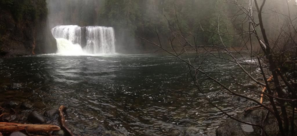
Pano:
It had taken about 3 and 1/2 hours to do the 13-14 miles over to the Upper Falls. So instead of making it a true double LRT I totally sagged out and turned around at Upper Falls to see if I could flub my way back to the TH in 3 1/2 as well
But first a picture of Alec Creek and another nearby stream:
Back on the good side of Spencer Creek and the day was clearing up:
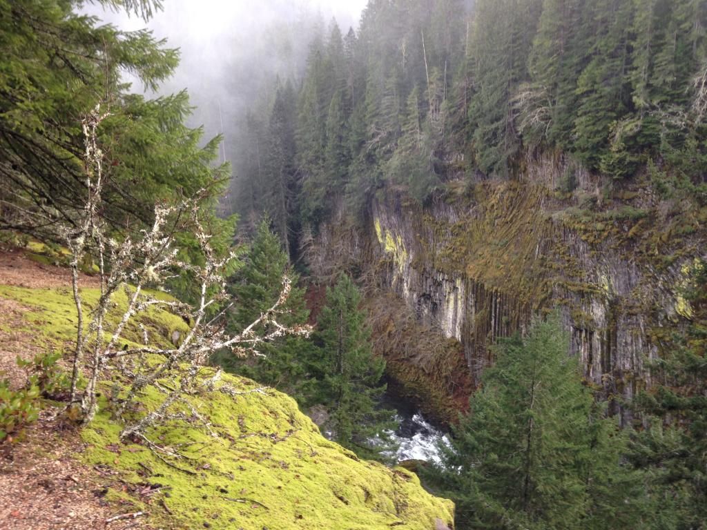
I love this viewpoint with the columnar basalt on display across the river:
Making my way back to the big cedar, huffing and puffing to keep up that holiday tortoise pace:
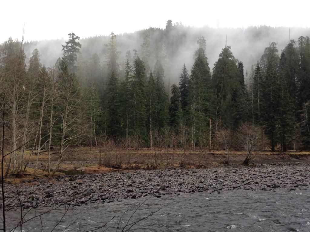
My favorite shot of the day, looking across the river to a forest in the mist:
Back at the TH after a little under 7 hours and another awesome day in the woods:

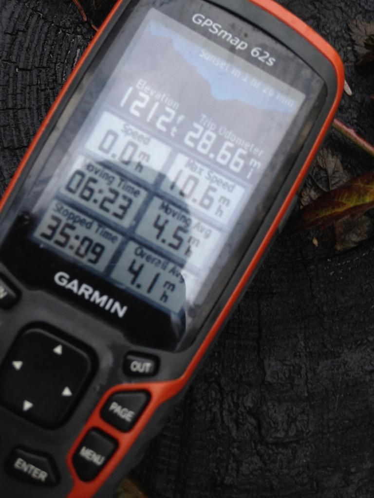
The Lewis River Trail is a real gem, not just for the epic waterfalls it visits but for all the incredible scenery the trail travels through no matter where one chooses to wander. Its hard not to feel lucky living next to such an incredible place. In terms of the numbers I think my gps overestimated the distance/eg as it read about 28.7 miles and 3500 e.g. with gpsfly reading about 27 miles and 3000 e.g. I think the gpsfly numbers are probably more accurate in terms of mileage and elevation gain but the stopped time is always somewhat off, with gpsfly reading only 10-15 minutes of stopped time When I'm able to do a near 30 miler with only a 5 or 10 minute break I might not be in the saggtortamous club anymore!

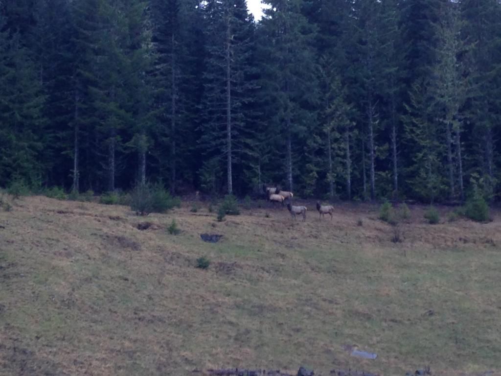
Driving back via Wind River, where the snow parks were empty and bare, I stopped to admire some Elk taking part in a late days graze above Curly Creek Road:

Here you can see where the most recent high water reached, with all the fresh leaves stripped clean:

There was even a poop scoop with instructions:

Moving on from the shelter and the morning rain began to fall in a way one could appreciate, lending even sharper shades of green to the landscape:

This trail side cedar is a legend in its own right:

There were lots of pretty streams to cross going to and from:

But none prettier than the river itself:

Despite all the splashing around on friday, the streams were much calmer compared to the last time Jo and I did a similar hike the year before. Spencer Creek was just above the ankle this time:


Moving across 90 and I took a nice break at the Lower Falls:

Moving on toward Middle Falls and I really just tried to focus on jogging this stretch as the rain fell harder and harder. Pretty soon I reached the huge washout near Middle Falls, which was pretty amazing to see in person as a big chunk of the canyon wall now lives in the riverbed:


Here is a pano:

To detour around the closed section one can loop up to the Middle Falls TH and back down to the Lewis River Trail. A close second to the Elk was a few minutes at the amazing Upper Falls:


Pano:

It had taken about 3 and 1/2 hours to do the 13-14 miles over to the Upper Falls. So instead of making it a true double LRT I totally sagged out and turned around at Upper Falls to see if I could flub my way back to the TH in 3 1/2 as well
But first a picture of Alec Creek and another nearby stream:


Back on the good side of Spencer Creek and the day was clearing up:

I love this viewpoint with the columnar basalt on display across the river:

Making my way back to the big cedar, huffing and puffing to keep up that holiday tortoise pace:

My favorite shot of the day, looking across the river to a forest in the mist:

Back at the TH after a little under 7 hours and another awesome day in the woods:


The Lewis River Trail is a real gem, not just for the epic waterfalls it visits but for all the incredible scenery the trail travels through no matter where one chooses to wander. Its hard not to feel lucky living next to such an incredible place. In terms of the numbers I think my gps overestimated the distance/eg as it read about 28.7 miles and 3500 e.g. with gpsfly reading about 27 miles and 3000 e.g. I think the gpsfly numbers are probably more accurate in terms of mileage and elevation gain but the stopped time is always somewhat off, with gpsfly reading only 10-15 minutes of stopped time
Driving back via Wind River, where the snow parks were empty and bare, I stopped to admire some Elk taking part in a late days graze above Curly Creek Road:
