Yocum to 7,000' 27-August-2014
Posted: August 29th, 2014, 6:27 am
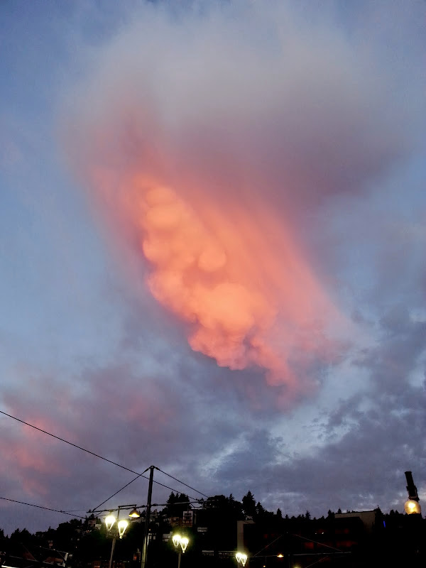
For whatever reason, getting to 7,000' on Yocum Ridge has been on my list for several years now. Usually I give it a try in late Spring, in hopes of making a fun snow climb out of it. But combinations of poor weather, poor snow, wrong gear, and sudden attacks of common sense (Wow, this sheet of ice-covered snow really is steep! And, look, there's no run-out!) have thwarted my efforts. While just going to the campsites is a great workout with amazing views, I yearned to go higher. So when Guy posted his excellent TR (here) of a recent hike to the top of the ridge, and with time to finish the list running out, I knew I had to just get on with it. So an early start from town,
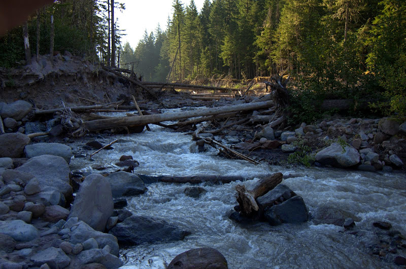
then over the logs currently substituting from the recently lost bridge,
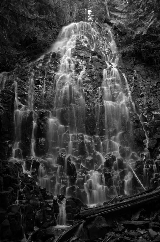
past the Falls (according to PH regulations, all hikes to Yocum Ridge must include a photo of the Falls ),
),
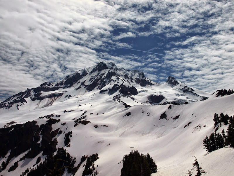
and on up to the campsites at 6,300',
which looked like this in June.
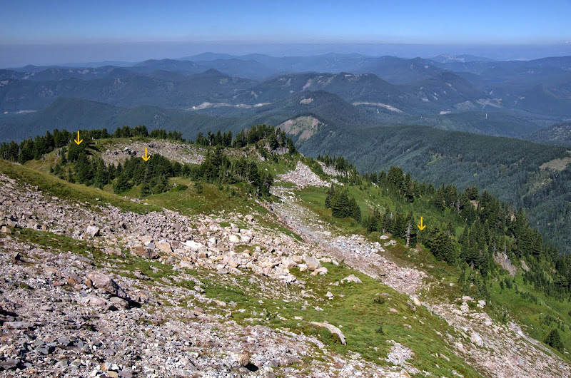
From there, it was an easy cruise up the snow-free boulder field to the upper part of the ridge, from where I could see at least three nice campsites (arrows) waiting for backpackers - two groups of which I'd pass on the way out.
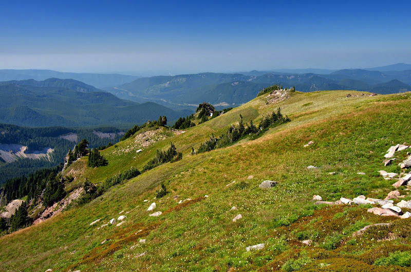
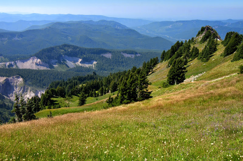
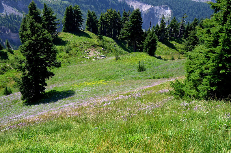
The upper ridge was an open field covered with grasses and a profusion of flowers - caught me by surprise but shouldn't have since it's a bit like a smaller version of Paradise Park to the S. Also a much less crowded version. Most of the flowers were still in good shape - only a few had started to turn the season.
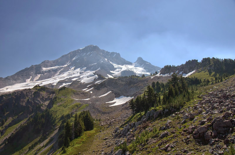
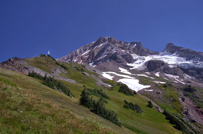
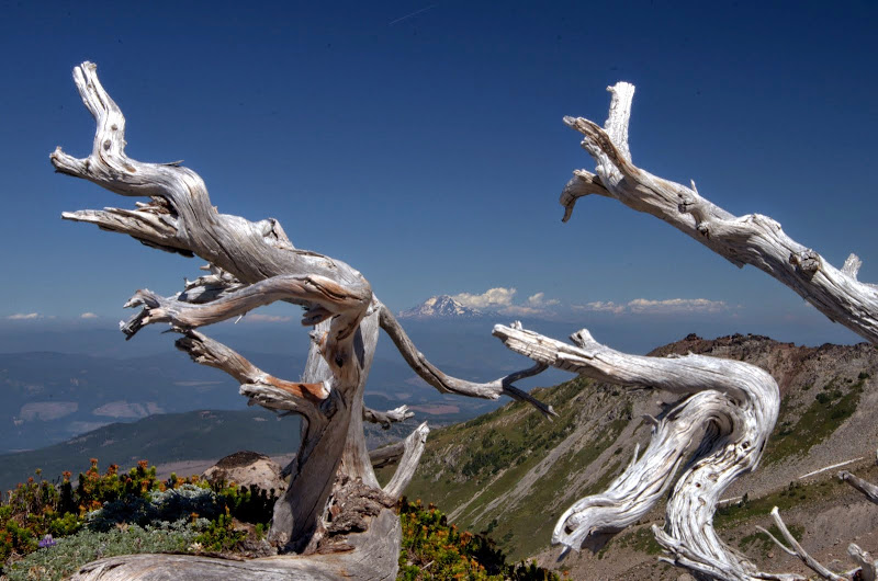
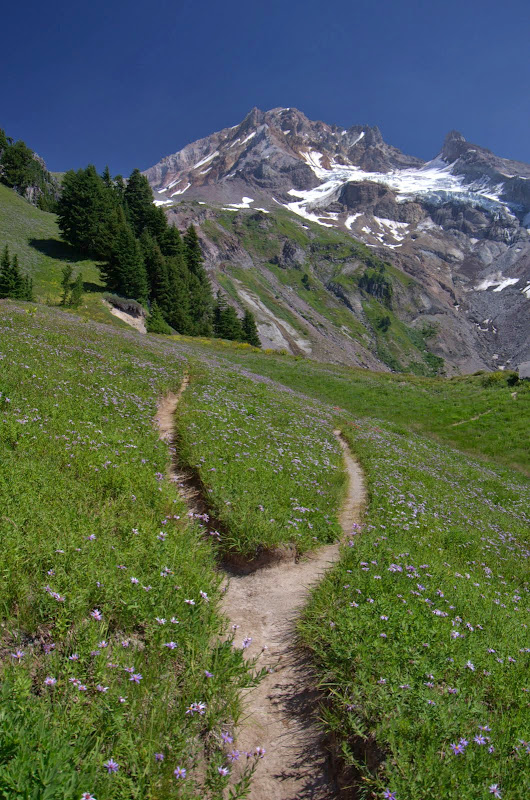
I headed up toward my designated highpoint (arrow),
with its view of Adams.
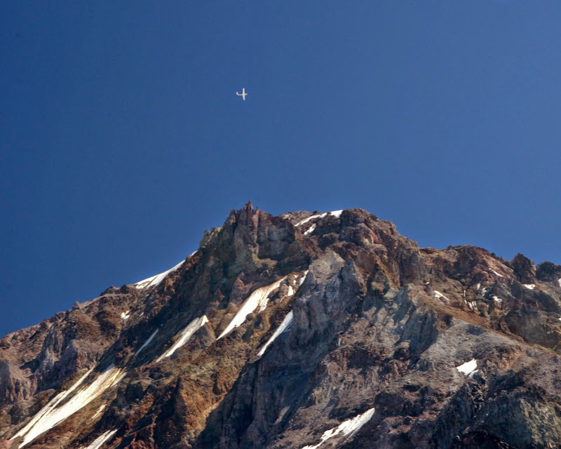
After lunch and a summit fly-by,
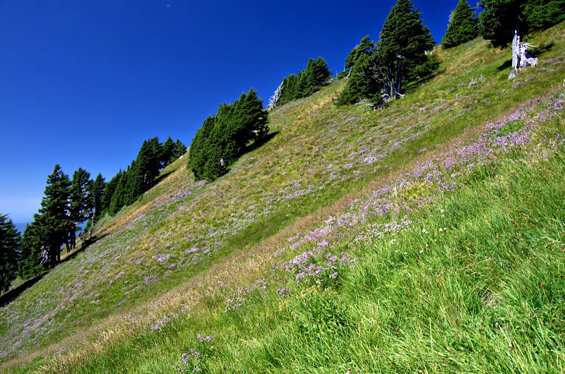
I headed down the S side of the ridge on not-to-steep grass and flower covered slopes.
This XC descent ended at 6,000' at a fork in the "official" trail (#771), which continues as a use trail from here up to the campsites.
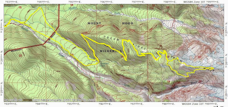
One last look at Hood and I started down. One more off the list, a few more to go, and then on to new adventures. 18 mi RT, 4700' EG.
then over the logs currently substituting from the recently lost bridge,
past the Falls (according to PH regulations, all hikes to Yocum Ridge must include a photo of the Falls
and on up to the campsites at 6,300',
which looked like this in June.
From there, it was an easy cruise up the snow-free boulder field to the upper part of the ridge, from where I could see at least three nice campsites (arrows) waiting for backpackers - two groups of which I'd pass on the way out.
The upper ridge was an open field covered with grasses and a profusion of flowers - caught me by surprise but shouldn't have since it's a bit like a smaller version of Paradise Park to the S. Also a much less crowded version. Most of the flowers were still in good shape - only a few had started to turn the season.
I headed up toward my designated highpoint (arrow),
with its view of Adams.
After lunch and a summit fly-by,
I headed down the S side of the ridge on not-to-steep grass and flower covered slopes.
This XC descent ended at 6,000' at a fork in the "official" trail (#771), which continues as a use trail from here up to the campsites.
One last look at Hood and I started down. One more off the list, a few more to go, and then on to new adventures. 18 mi RT, 4700' EG.