More MSH

This forum is used to share your experiences out on the trails.
User avatar
drm
Posts: 6152
Joined: May 28th, 2008, 10:03 pm
Location: The Dalles, OR
Contact:

More MSH

Post by drm » August 4th, 2014, 7:27 am

I car camped for two nights just outside the monument boundary to do some dayhikes on the Windy Ridge (northeast) side of the mountain. I had considered going to the Johnston Ridge side, where I've never been, but there was no camping available that I could find.

View from the Smith Canyon Overlook
Image

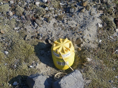
These little cylinders were all over, they are part of a research project into the below-ground magma
Image

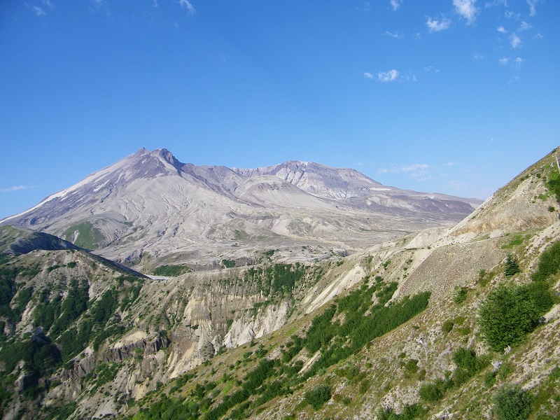
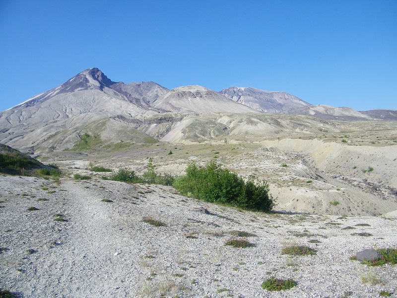
My first hike was from the end of the road at Windy Ridge, where I took a variety of trails towards Loowit Falls. This was about 9 miles total. This area is called the pumice plain and was covered in hundreds of feet of debris, slowing regrowth.

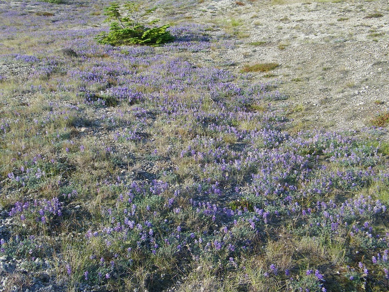
A lot of the hiking in this part of the blast zone is desert hiking
Image

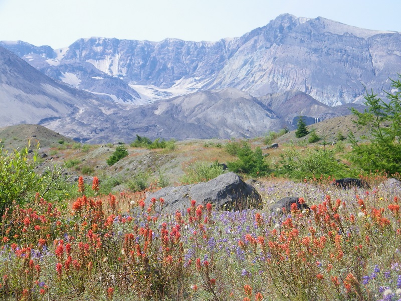
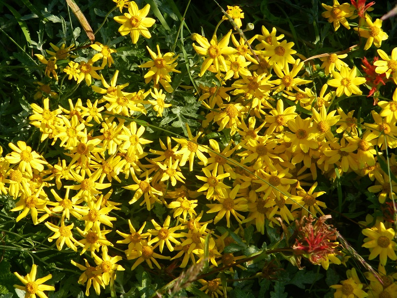
Nonethless, there were many flowers about
Image

The indian paintbrush were particularly dominent long the Truman Trail between the end of the dirt road and the Willow Springs junction
Image

And creeks flowing from snow patches in the crater, this one quite lush
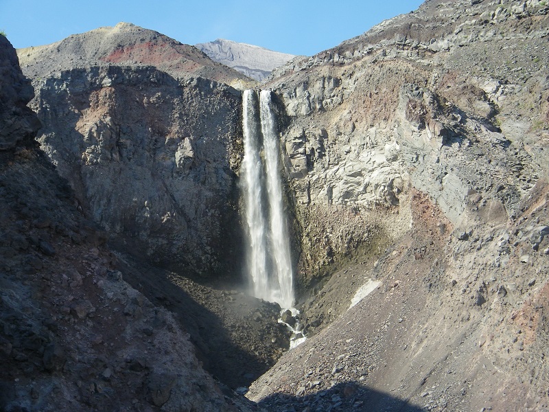
Image

Loowit Falls
Image

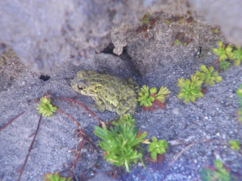
This little guy was near where I took my break next to the falls. He was less than an inch long
Image

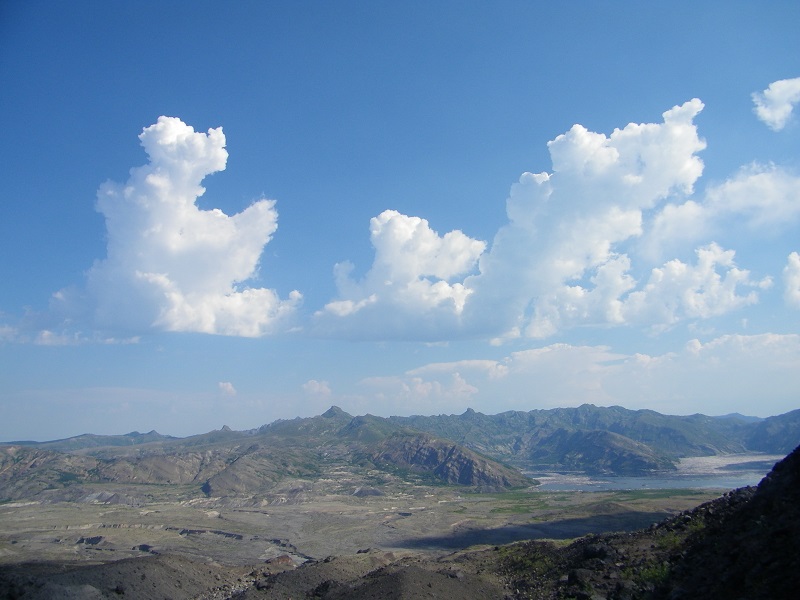
Some thunderheads formed to give some shade from the intense sun and heat, these over the Mt Margaret area. They dissipated by late morning.
Image

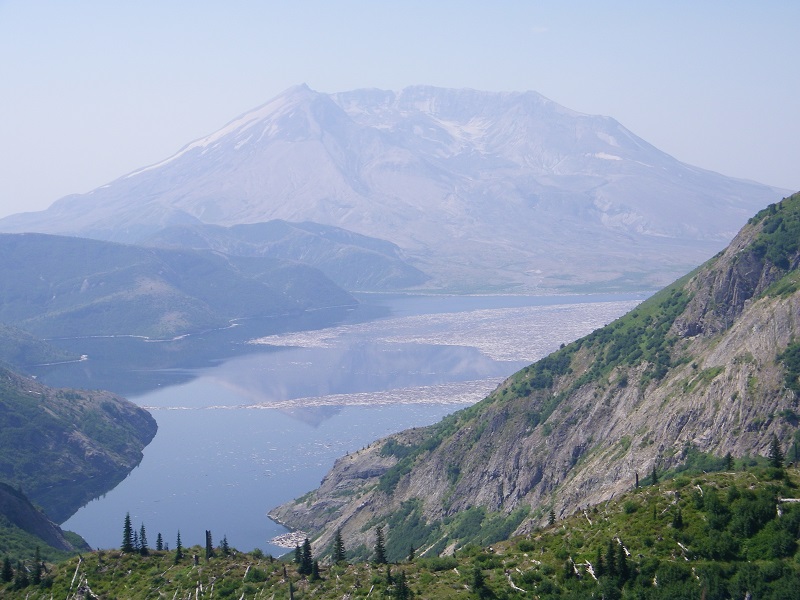
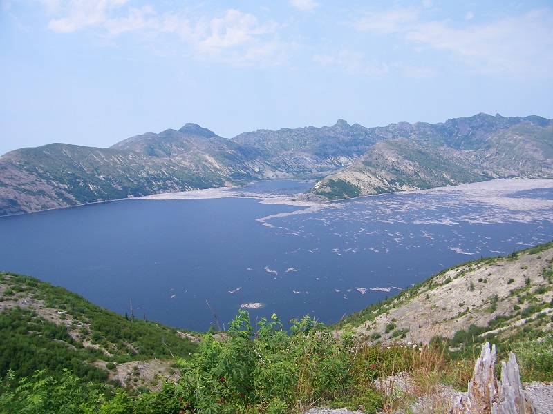
There is a stairway above Windy Ridge from which you get a good view of Spirit Lake
Image

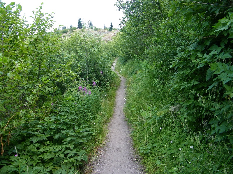
Next I hiked the Harmony Trail, which drops to the edge of Spirit Lake in a mile. It's the only place where you are officially allowed to the lake's edge. It drops down a north-facing canyon - facing away from the volcano. This shielded it from the worst affects of the blast, so it has recuperated much better and is one of the few trails with decent shade in the area.
Image

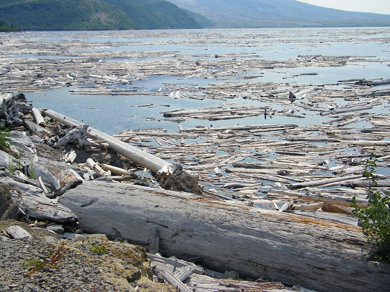
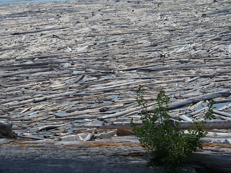
A few pictures of the log mat on Spirit Lake. A ranger told me that half of the logs have now sunk into the lake and more are doing so over time.
Image

Image

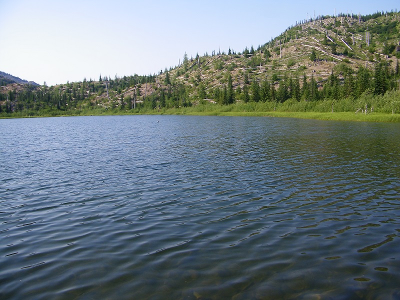
Meta Lake, a quarter mile on a paved trail, another place that was protected from he worst of the blast
Image

The next day I had planned to hike the Independence Pass loop, but the trail was closed due to a washout. After hemming and hawing over whether to give it a try anyway, I decided on the hike up to Mt Margaret via the Boundary Trail, about 5 1/4 miles one way, and 2300 feet up. Although the blast killed all the trees here, the ground was not covered by debris, so it is greener. And has nice flowers too.
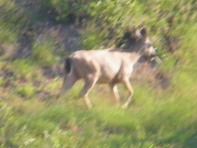
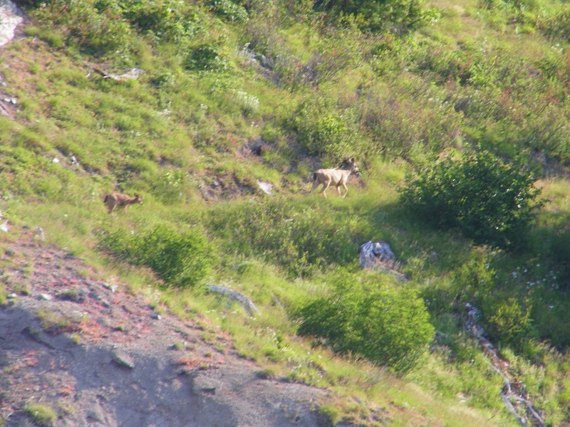
Image

A couple of elk
Image

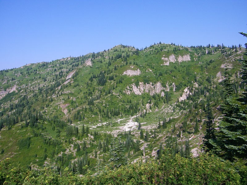
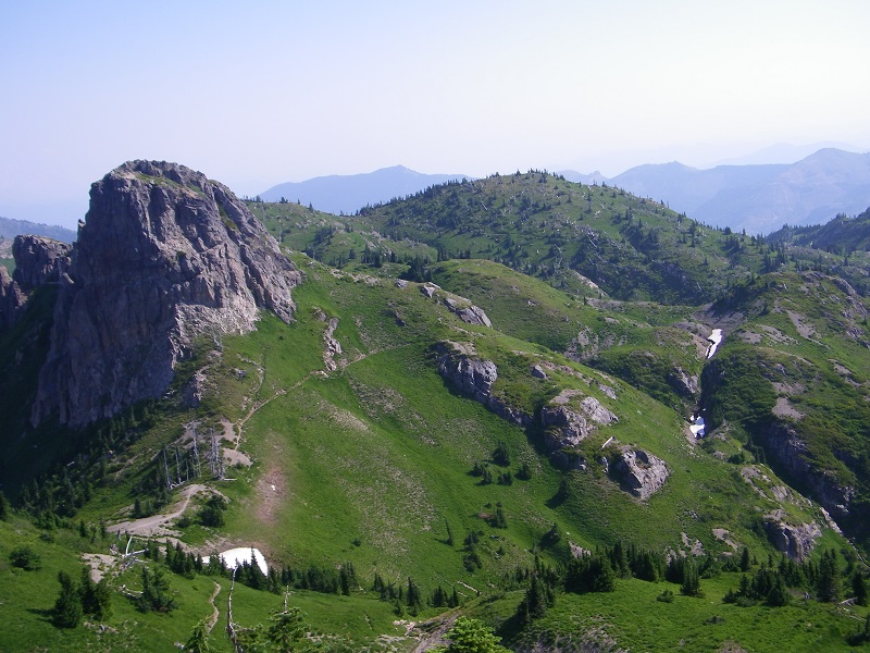
Along the ridge, notice the trail below the two peaklets
Image

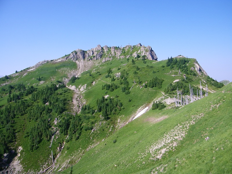
The trail approaches Mt Margaret
Image

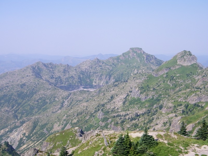
Looking across at St. Helens Lake, Coldwater Peak, and The Dome. It was extremely hazy.
Image

The way back
Image

A very hazy view from near Norway Pass
Image

User avatar
Roy
Posts: 2824
Joined: January 25th, 2010, 6:35 pm

Re: More MSH

Post by Roy » August 4th, 2014, 8:50 am

Nice tr Dean I have never hiked the Harmony trail or been down to Meta lake. been all over past Norway pass..
Three yeas ago I did the Independence pass trail because some one removed the orange tape it was not terrible then, but a couple of washouts were iffy. It seems like a trail that's going to be hard to maintain. Sean did it this year but I'm not sure he is even human :lol:

Nice tr I'm retracing some of your steps this fall ,Thanks.
The downhill of the mind is harder than the uphill of the body. - Yuichiro Miura

User avatar
mjuliana
Posts: 397
Joined: July 23rd, 2012, 2:32 pm

Re: More MSH

Post by mjuliana » August 4th, 2014, 9:04 am

Never get tired of seeing photos of this area. Loowit Falls is so cool. I read recently that they are working on a permit system to allow hikers further into the crater. That is going to be cool.
Thanks,
Mike J

User avatar
kepPNW
Posts: 6411
Joined: June 21st, 2012, 9:55 am
Location: Salmon Creek

Re: More MSH

Post by kepPNW » August 4th, 2014, 9:31 am

Sounds like a great trip! Any chance you might divulge where to setup a quickie campsite? I'd like to hit a few of the trails over there, too, but it'd be nice to economize on the drive.
Karl
Back on the trail, again...

User avatar
drm
Posts: 6152
Joined: May 28th, 2008, 10:03 pm
Location: The Dalles, OR
Contact:

Re: More MSH

Post by drm » August 4th, 2014, 1:34 pm

Roy - Given how far we drive to this area, it's not surprising that we don't get to the little and shorter trails like the one down Harmony Creek more often. That's one reason I did the trip like this - camping nearby - as it leaves time for the extra stuff.

Mike - That would be interesting - and odd - to hike even further up into the maw of the crater.

Karl - Since I drive up from the south on FR25, my first night was 20 miles out just south of Elk Pass, where I turned off on a dirt road can camped on a wide spot. The middle night however, I camped at the Bear Meadow Interpretive Site, which also has a gravel picnic area, which is where I set up - late after all the picnicers were gone. I looked and saw no signs prohibiting camping there (though there were many signs about the need for a NWFP) and my impression is that as long as you're not blocking roads or access, and there are no signs prohibiting it, you can camp. I also took my tent down long before any breakfast picnicers would arrive. There were a modest number of mosquitoes there. No swarm, but more than I'd want to for just sleeping out, particularly given how warm it was.

But there are plenty of dirt roads not much farther than would provide more privacy and the ability to set up camp earlier if you wanted that. It's odd that there are no established campgrounds anywhere near the monument.

User avatar
kepPNW
Posts: 6411
Joined: June 21st, 2012, 9:55 am
Location: Salmon Creek

Re: More MSH

Post by kepPNW » August 4th, 2014, 1:39 pm

Good info, Dean, thanks!
drm wrote:It's odd that there are no established campgrounds anywhere near the monument.
I swear, back in the mid-80s, when they first opened the road to Windy, there was at least one campground over on the east side there. Senior moment?
Karl
Back on the trail, again...

User avatar
mjuliana
Posts: 397
Joined: July 23rd, 2012, 2:32 pm

Re: More MSH

Post by mjuliana » August 4th, 2014, 3:10 pm

Here's a link to the old story that I read about the possible new hike going further into the crater: http://www.columbian.com/news/2013/aug/ ... ng-trails/
Thanks,
Mike J

User avatar
miah66
Posts: 2039
Joined: July 6th, 2009, 8:00 pm

Re: More MSH

Post by miah66 » August 5th, 2014, 2:52 pm

Not sure those are "elk" in your photo. Look like Blacktail Deer? I've never been to the edge of Spirit Lake or Meta Lake. I wasn't aware you could even approach Spirit Lake! Good to know there is actually a trail and that you can go there.
"The top...is not the top" - Mile...Mile & a Half

Instagram @pdxstrider

User avatar
drm
Posts: 6152
Joined: May 28th, 2008, 10:03 pm
Location: The Dalles, OR
Contact:

Re: More MSH

Post by drm » August 5th, 2014, 7:02 pm

miah66 wrote:Not sure those are "elk" in your photo. Look like Blacktail Deer?
Deer or elk? My initial reaction was elk because the one in front looked too big to be a deer. But on review, you might be right.

Image

User avatar
K.Wagner
Posts: 652
Joined: June 2nd, 2013, 1:25 pm
Location: Vancouver, WA

Re: More MSH

Post by K.Wagner » August 7th, 2014, 6:46 am

Great TR! Glad to read about the Harmony Trail, wasn't sure that it was actually open.

Karl, here's a link to my favorite camp spot on that side. http://www.mappingsupport.com/p/gmap4.p ... &z=15&t=t2 (at the center cross) It is on the back side of the little rock quarry just before Ryan Lake (where the 136 tag is). Nothing says: "No CAMPING", and it is a flat spot big enough for a bunch of cars and tents.
Kelly
There is no shortcut to anyplace worth going to.

PM me about the soon to be released:
Skamania 231
"How to really get off the beaten path in Skamania County"

Post Reply