West Zigzag - 7/19/14
Posted: July 21st, 2014, 7:34 am
Back in 2012 Greg and I hiked up to East Zigzag from Burnt Lake. LOVED it up there! That's now one of my all-time favorite viewpoints of Mt. Hood. Ever since I've been curious to visit West Zigzag so that was my destination on Saturday.
I would have much preferred the shorter route up to West Zigzag from the South Burnt Lake Trailhead at the end of Road 207. But by all accounts that road is absolutely atrocious. Bill Sullivan describes the road as a "rough, rocky terror." So I hiked up from East Mountain Drive instead.
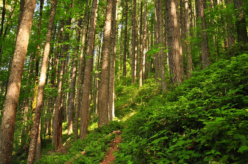
The trail climbs up Zigzag Mountain via many many switchbacks. Fortunately the trail is REALLY well-graded on those switchbacks (which my knees were grateful for on the way back down!).
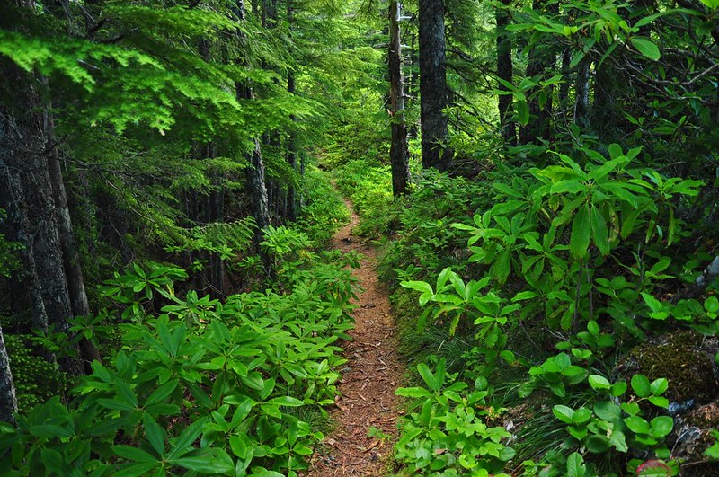
After 3+ miles of climbing through salal and ferns, the trail topped out on the ridge and I started hiking through rhododendrons and beargrass, neither of which were blooming (rhodies were done blooming and it doesn't look to be a good beargrass year here). I actually saw virtually no wildflowers on this hike.
To my dismay, the trail actually LOST elevation as it headed east, which would not be fun on the way back out. There were no views for most of the way, but with the hot day I was okay hiking in the shady forest. (My tolerance for hiking in hot weather has really plummeted in recent years! )
)
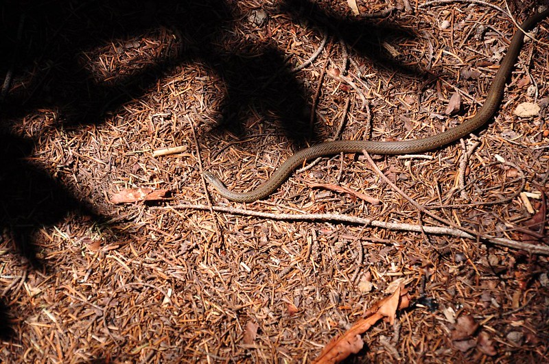
Saw about half a dozen garter snakes throughout the day. Most of them slithered off very quickly, but this guy was in no hurry to move along. I stepped over him and kept hiking and he was still laying there.
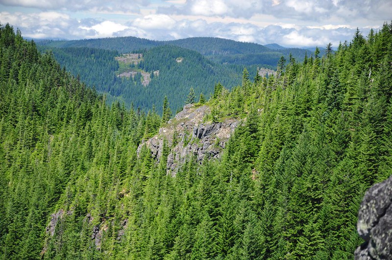
Finally, a viewpoint!
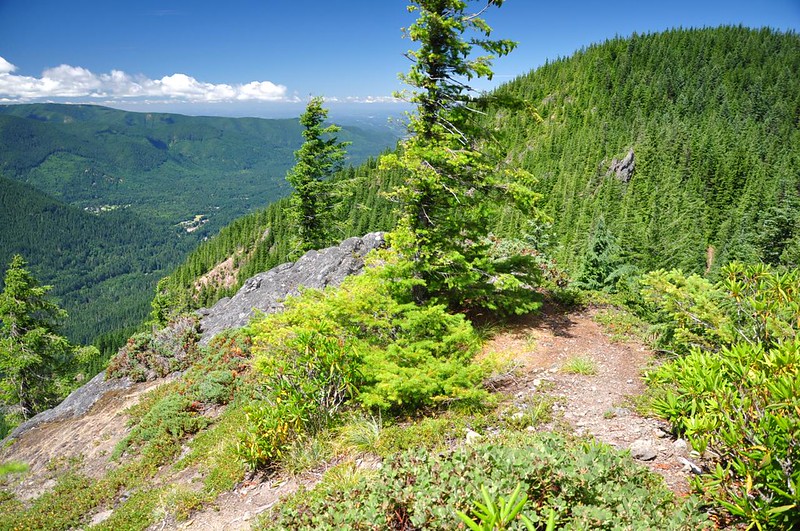
From the viewpoint you can see over to West Zigzag. That forested hump in the middle, and those rocky cliffs just below the summit of that hump...that's where the lookout was.
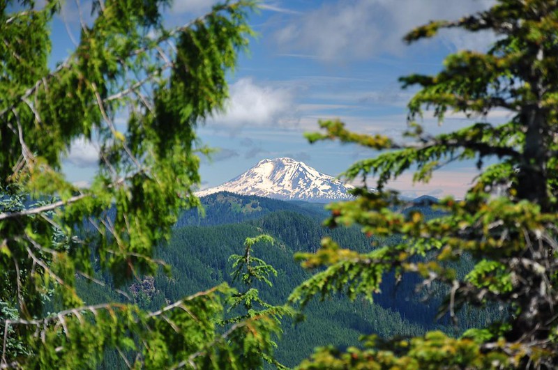
To the north I could just get a glimpse of Mt. Adams through the branches of the trees. This was the most I would ever see in a northerly direction all day.
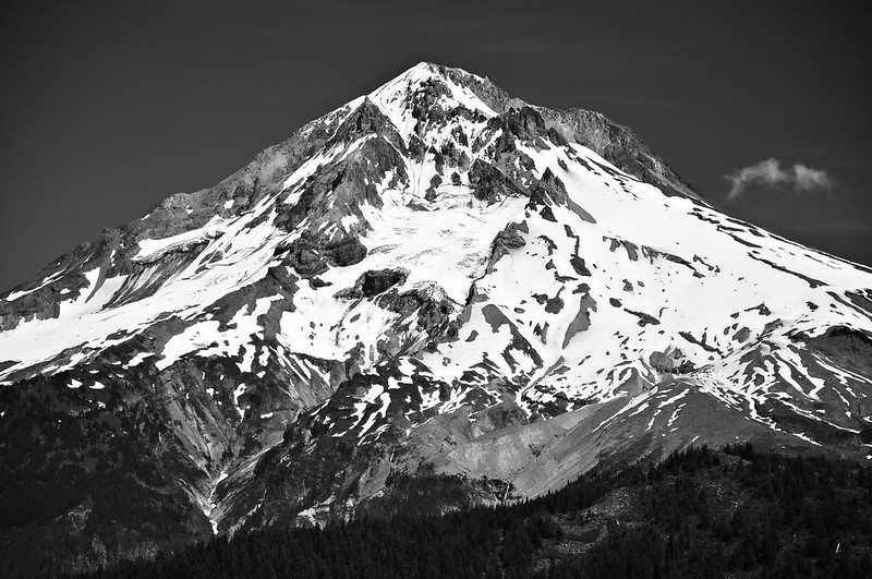
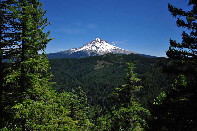
About half a mile before West Zigzag is a very nice viewpoint of Mt. Hood. It's the only spot on the whole hike from where you can see the mountain.
After a long, slow, plodding 3.5 hours I reached West Zigzag where I hung out for a little bit. I quickly concluded that East Zigzag is definitely better. FAR better views and more wildflowers too. But this spot sure wasn't bad.
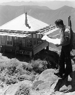
In George Henderson's book, Lonely on the Mountain, there's a picture of him at the old West Zigzag lookout.
Here is the same view today:
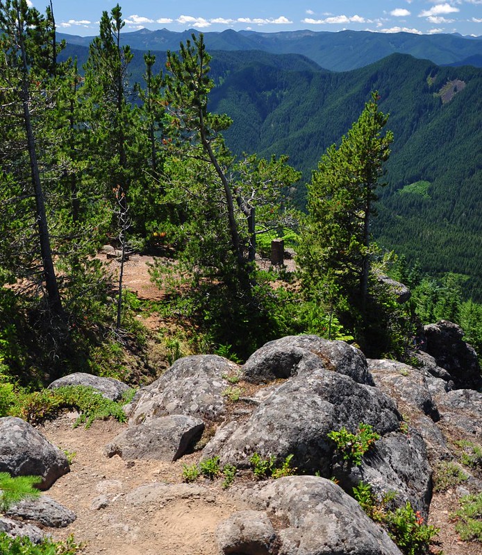
The lookout site is almost totally surrounded by trees now.
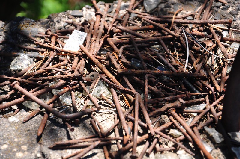
Someone has gathered up all the rusty old nails from the lookout:
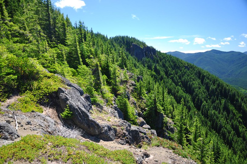
Looking back to that first viewpoint:
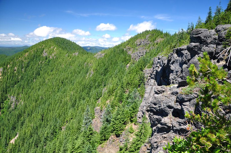
Looking west along Zigzag Mountain. Both of those bumps are higher than the lookout site, so why they didn't build it up there is a mystery.
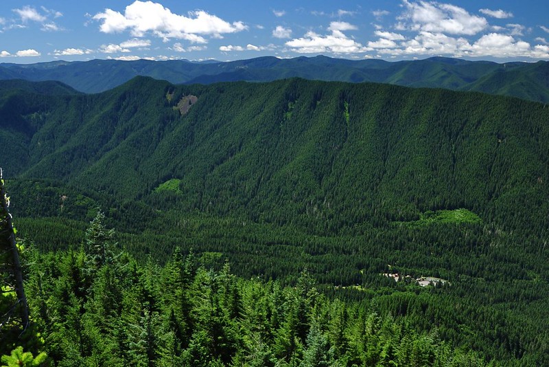
There are pretty expansive views to the south. The long forested ridge in the foreground is Flag Mountain. Highway 26 and the community of Rhododendron are down below.
Click here to see a stitched panorama shot.
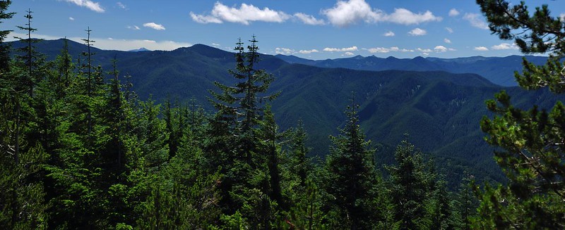
I pushed through the trees to the left of the lookout site to see what I could see to the southeast. The peak left of center (left of the twin-topped tree) is Devil's Peak. I'm not positive, but I think that the distant peak to the left of that might be Olallie Butte.
Looking southwest down the valley of the Sandy River:
I hung out for a short while then retreated back to the Mt. Hood viewpoint to hang out there.
The forested ridge in the foreground is East Zigzag. The green patches beyond, on the slopes of Mt. Hood, is Paradise Park.
Bald Mountain is always easy to pick out because, well, it's so bald!
The hike back down seemed to take forever since there aren't any distinguishing landmarks when you're descending through featureless forest. I was grateful for the gentle grade on the switchbacks.
I saw only five people the whole day. A hiker was headed down when I was headed up. I saw a backpacking couple headed up as I was headed down. And I saw two MHNF guys just before I reached West Zigzag. They said they were summer interns doing trail maintenance and had started at Timberline Lodge. This was their third and final day. They said the regular full-time trail crew was just four guys. Four guys for a whole huge national forest. I thanked them for their hard work before we parted ways.
I would have much preferred the shorter route up to West Zigzag from the South Burnt Lake Trailhead at the end of Road 207. But by all accounts that road is absolutely atrocious. Bill Sullivan describes the road as a "rough, rocky terror." So I hiked up from East Mountain Drive instead.
The trail climbs up Zigzag Mountain via many many switchbacks. Fortunately the trail is REALLY well-graded on those switchbacks (which my knees were grateful for on the way back down!).
After 3+ miles of climbing through salal and ferns, the trail topped out on the ridge and I started hiking through rhododendrons and beargrass, neither of which were blooming (rhodies were done blooming and it doesn't look to be a good beargrass year here). I actually saw virtually no wildflowers on this hike.
To my dismay, the trail actually LOST elevation as it headed east, which would not be fun on the way back out. There were no views for most of the way, but with the hot day I was okay hiking in the shady forest. (My tolerance for hiking in hot weather has really plummeted in recent years!
Saw about half a dozen garter snakes throughout the day. Most of them slithered off very quickly, but this guy was in no hurry to move along. I stepped over him and kept hiking and he was still laying there.
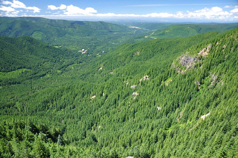
Finally, a viewpoint!
From the viewpoint you can see over to West Zigzag. That forested hump in the middle, and those rocky cliffs just below the summit of that hump...that's where the lookout was.
To the north I could just get a glimpse of Mt. Adams through the branches of the trees. This was the most I would ever see in a northerly direction all day.
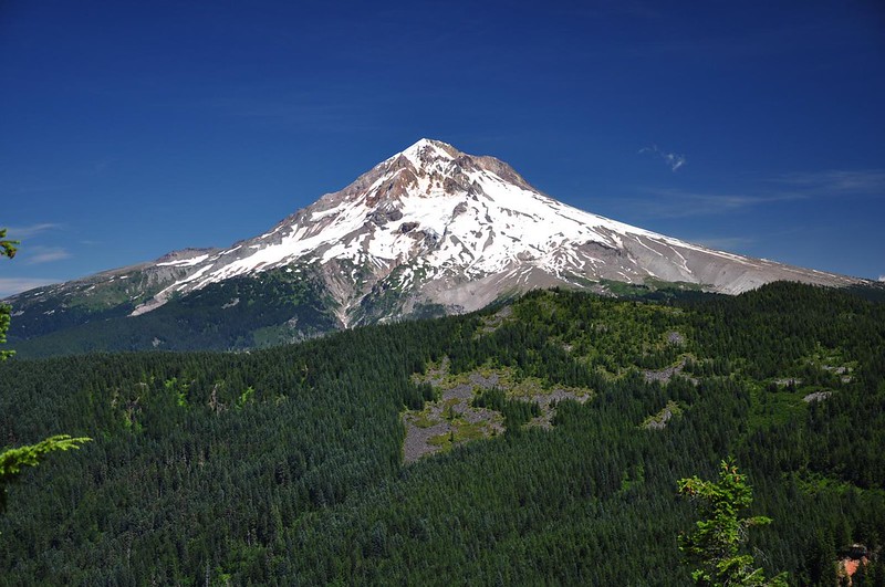
About half a mile before West Zigzag is a very nice viewpoint of Mt. Hood. It's the only spot on the whole hike from where you can see the mountain.
After a long, slow, plodding 3.5 hours I reached West Zigzag where I hung out for a little bit. I quickly concluded that East Zigzag is definitely better. FAR better views and more wildflowers too. But this spot sure wasn't bad.
In George Henderson's book, Lonely on the Mountain, there's a picture of him at the old West Zigzag lookout.
Here is the same view today:
The lookout site is almost totally surrounded by trees now.
Someone has gathered up all the rusty old nails from the lookout:
Looking back to that first viewpoint:
Looking west along Zigzag Mountain. Both of those bumps are higher than the lookout site, so why they didn't build it up there is a mystery.
There are pretty expansive views to the south. The long forested ridge in the foreground is Flag Mountain. Highway 26 and the community of Rhododendron are down below.
Click here to see a stitched panorama shot.
I pushed through the trees to the left of the lookout site to see what I could see to the southeast. The peak left of center (left of the twin-topped tree) is Devil's Peak. I'm not positive, but I think that the distant peak to the left of that might be Olallie Butte.
Looking southwest down the valley of the Sandy River:
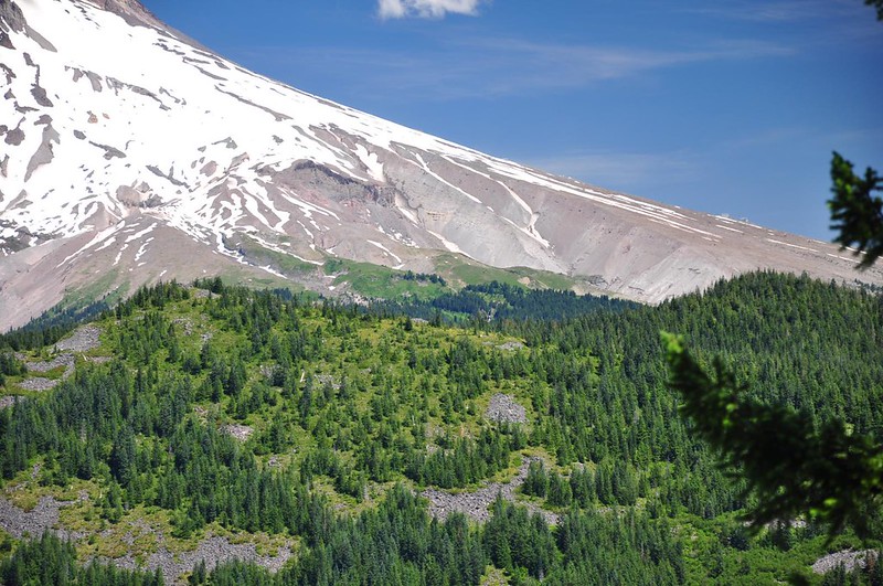
I hung out for a short while then retreated back to the Mt. Hood viewpoint to hang out there.
The forested ridge in the foreground is East Zigzag. The green patches beyond, on the slopes of Mt. Hood, is Paradise Park.
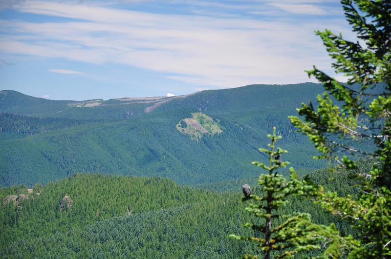
Bald Mountain is always easy to pick out because, well, it's so bald!
The hike back down seemed to take forever since there aren't any distinguishing landmarks when you're descending through featureless forest. I was grateful for the gentle grade on the switchbacks.
I saw only five people the whole day. A hiker was headed down when I was headed up. I saw a backpacking couple headed up as I was headed down. And I saw two MHNF guys just before I reached West Zigzag. They said they were summer interns doing trail maintenance and had started at Timberline Lodge. This was their third and final day. They said the regular full-time trail crew was just four guys. Four guys for a whole huge national forest. I thanked them for their hard work before we parted ways.