Grayback Mtn (S Oregon) 31-May-2014

This forum is used to share your experiences out on the trails.
Post Reply
User avatar
VanMarmot
Posts: 1924
Joined: May 28th, 2008, 10:03 pm
Contact:

Grayback Mtn (S Oregon) 31-May-2014

Post by VanMarmot » June 1st, 2014, 5:05 pm

For our last hike (this go-around) in the Medford area, we decided on a short, steep one up Grayback Mtn (supposedly named after the lice ("graybacks" :shock: ) that infested the miners during the 1850's gold rush). This is hike #71 in Sullivan's Southern Oregon guide. The access roads were a little tricky - potholes mostly - but we were soon heading up from the Upper O'Brien Creek TH through thick, old forest.

Image

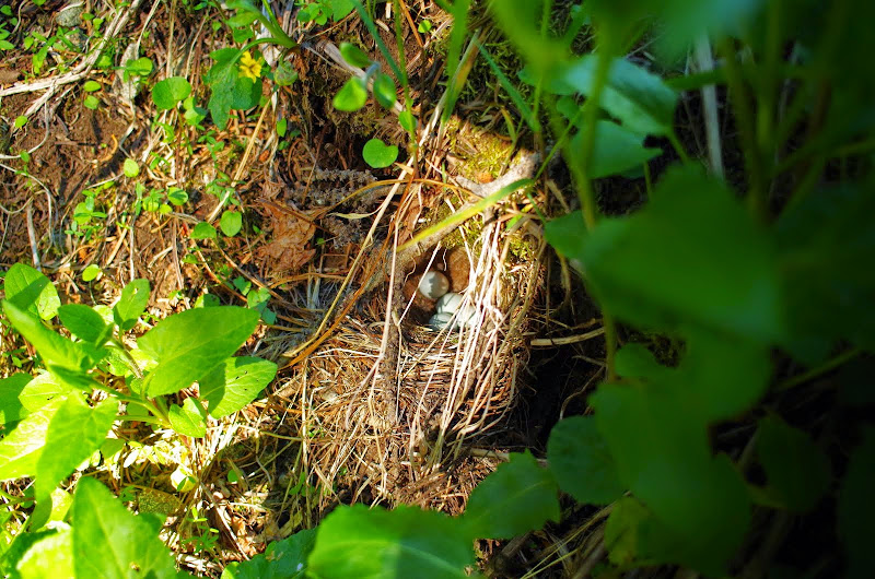
Along the way, we surprised a junco that was sitting on a nest she'd built in the sidewall of the trail!

Image

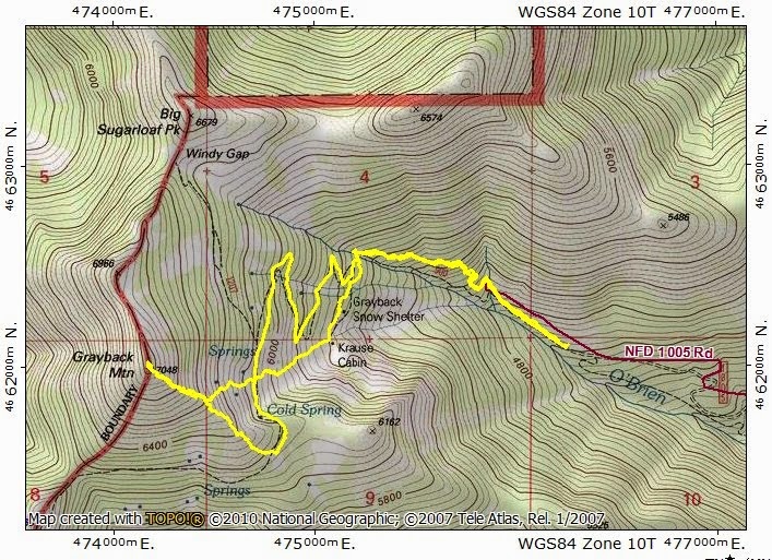
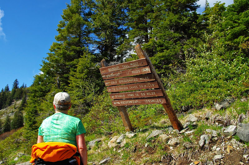
We kept on until we reached the Boundary Trail - a local 37+ mi scenic trail - and then followed it S to Grayback's SE ridge.

Image

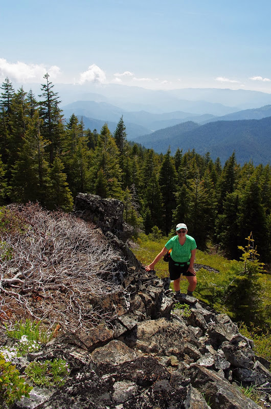
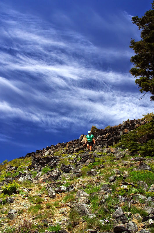
Sullivan suggests you can go directly up a meadow to the summit ridge, but that looked pretty daunting, so we went up the SE ridge instead. There was some worry about brush - manzanita can be vicious - but there wasn't much we couldn't work around and there were a good number of open boulder fields we could use to keep us out of the brush.

Image

Looking S, we could see Buck Peak (B) which towers above Azalea Lake, our destination from two days before.

Image

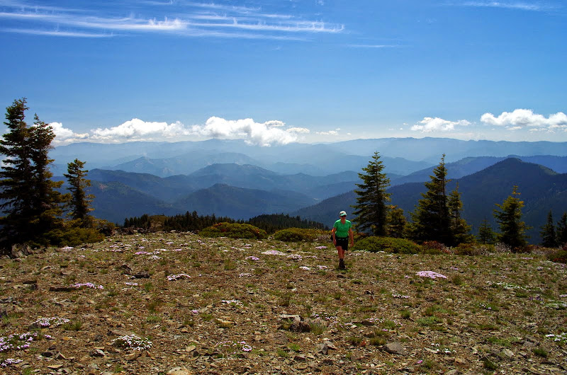
There was even on open area, carpeted with bunches of small lavender flowers.

Image

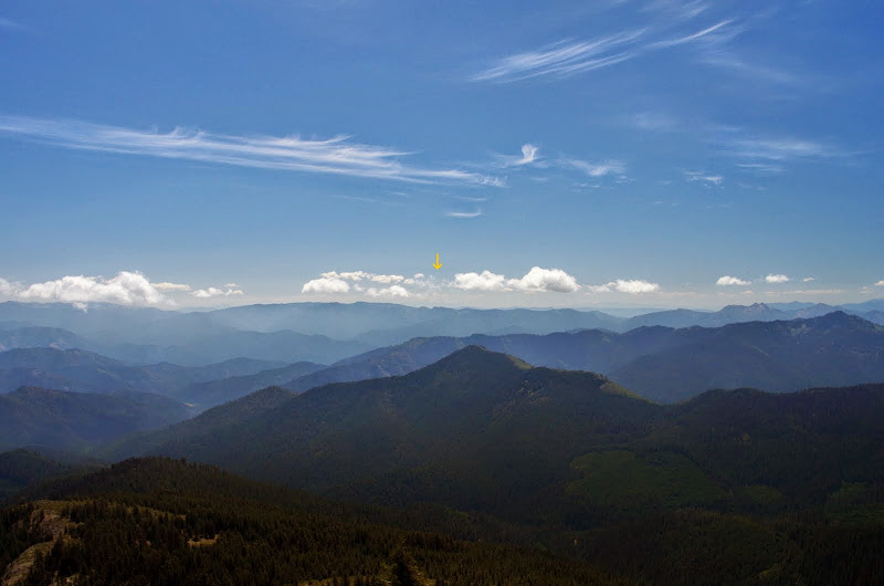
From the summit, we could barely make out Mt. Shasta (arrow) to the S (it looked pretty melted out and we were told the ski area never opened this winter),

Image

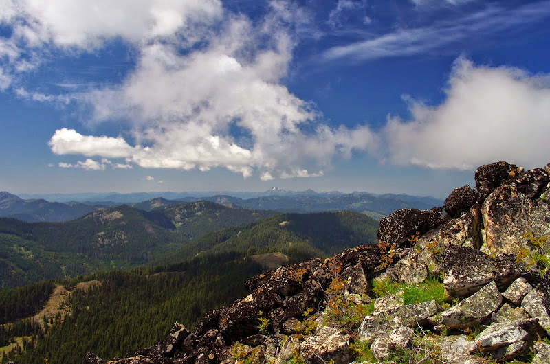
Preston Pk to the W in the Siskiyou Wilderness,

Image

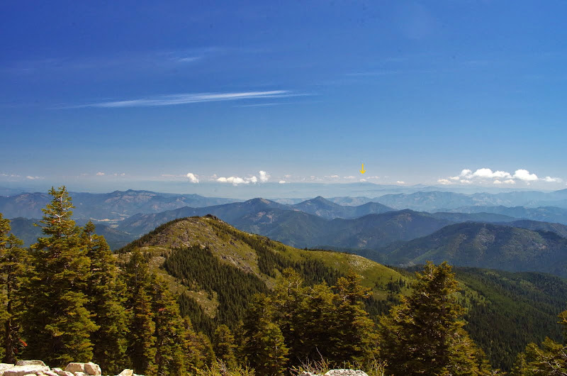
and Mt. McLoughlin (arrow) to the E.

Image

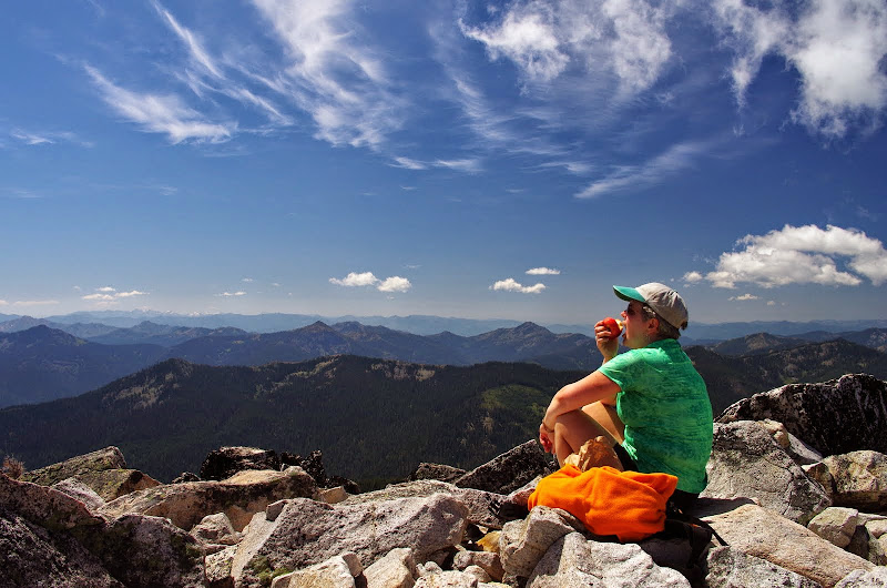
After lunch on the summit,

Image

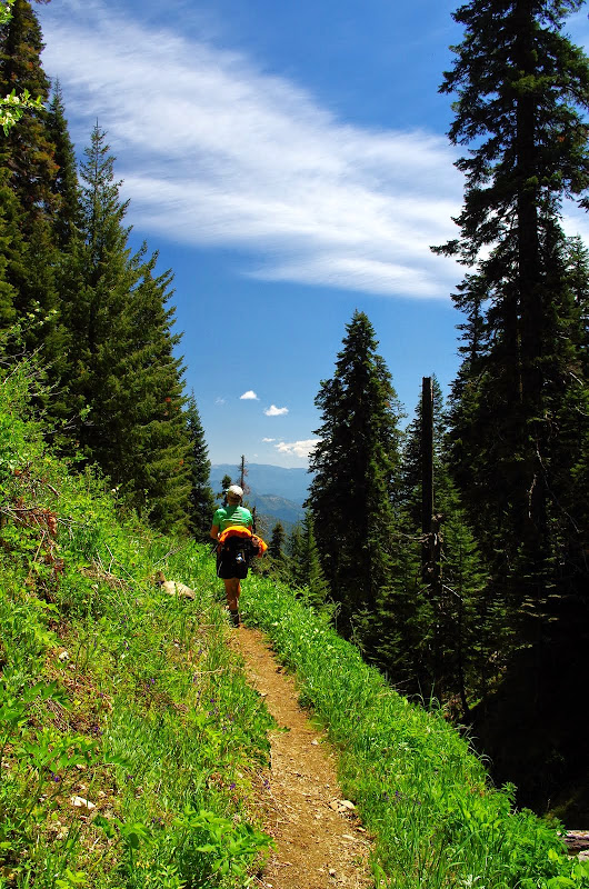
we retraced our steps part way down the ridge,

Image

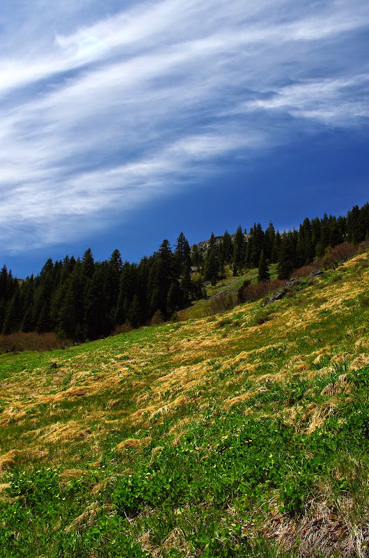
then descended directly down the meadow (much easier going down than up as suggested in the guide).

Image

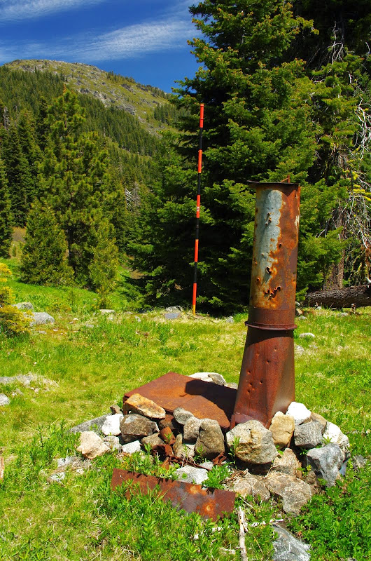
At the bottom of the meadow are the remains (an old stove) of the Krause Cabin,

Image

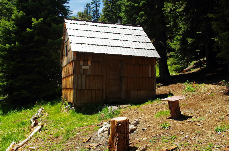
and little to the N of that is the Grayback Snow Shelter which is used by snow survey crews in the winter.

Image

After that, it was back to the TH.

Image

A short (5 mi) but steep (2400' EG) hike in beautiful country with great views under full bluebird conditions! :D

Image
Last edited by VanMarmot on January 19th, 2016, 8:44 am, edited 1 time in total.

outdoorfoodie
Posts: 22
Joined: May 20th, 2014, 5:58 am

Re: Grayback Mtn (S Oregon) 31-May-2014

Post by outdoorfoodie » June 2nd, 2014, 10:46 pm

Great photos. If you are down this way again (I live in Grants Pass) some other good ones to try are Sky Lakes, the Illinois River Trail, (and others in the Kalmiopsis) and Mt.Elijah/Bigelow Lakes.

User avatar
Splintercat
Posts: 8333
Joined: May 28th, 2008, 10:03 pm
Location: Portland
Contact:

Re: Grayback Mtn (S Oregon) 31-May-2014

Post by Splintercat » June 8th, 2014, 10:48 am

Cool report, Van - neat area! Thanks for posting (just getting caught up on a few I missed while in CA last week).

Tom :)

Post Reply