Douglas Cabin - School Canyon Loop 25-May-2014
Posted: May 26th, 2014, 7:04 am
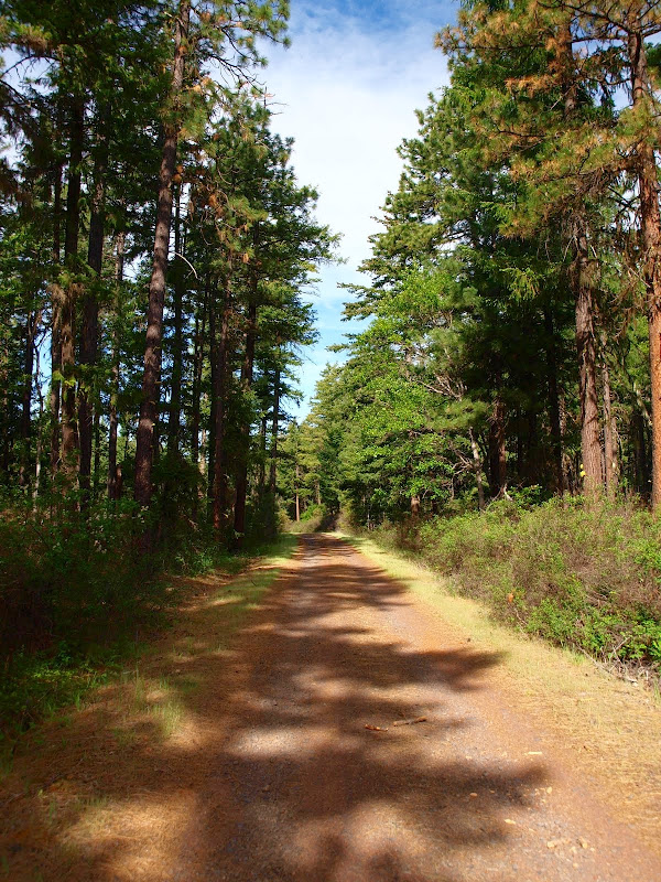
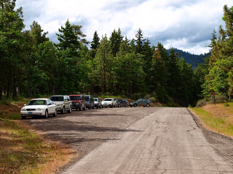
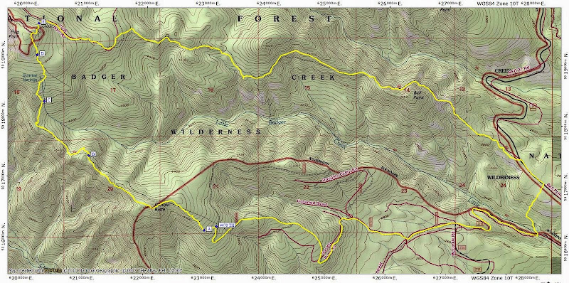
Recent TRs by Born2BBrad (March 2014) and jointhedance (May 2014) whetted my interest in hiking in the Little Badger Creek watershed. The field guide got me to bobcat's descriptions of the Douglas Cabin (#470) and Gordon Butte trails and from there a loop was born. From the Little Badger Creek TH on FR 2710, I could, with a little road walking, ascend the Douglas Cabin trail to Flag Point and, descend the School Canyon trail (#468), and then take "Romann's Cutoff" XC back to the TH. It all sounded so simple. It's quite a drive to the TH but, with an early start from Portland, I was able to start walking up FR 2710 at 0800. That took me to FR 120 which, although a little washed-out and eroded at the start, was in fine shape there after (and the gate was chained open).
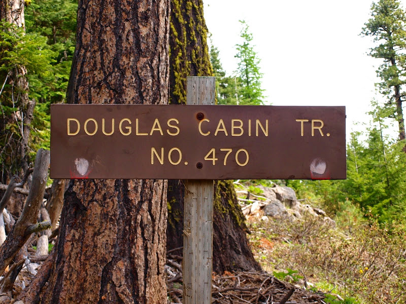
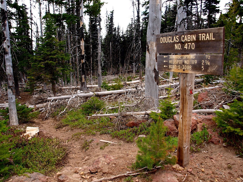
The #470 TH is well marked,
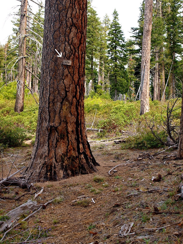
and there's even a small sign (arrow) to let you know you're on the right trail,
but after that, you're increasingly on your own. The trick at the start is to drift left (W) to the edge of the ridge (Point "A" on the map below) to where there's a good view of Jefferson and Olallie Butte. If you try to go straight as the mapped trail suggests, you'll get caught in a bunch of tortured vegetation.

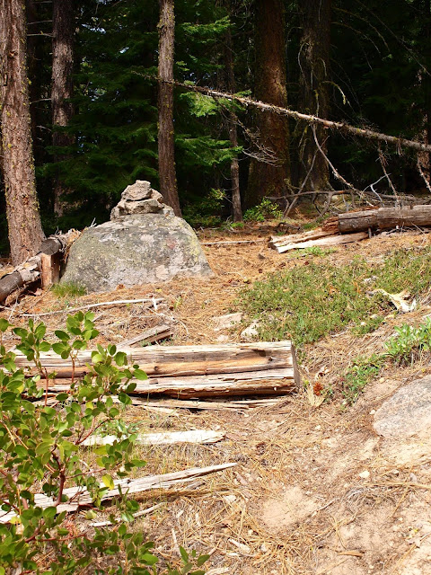
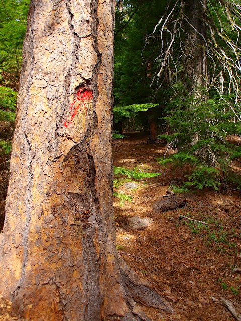
The trail was in surprising good shape for about it's first half, with cairns and spots of red paint as guides.

About 0.5 mi NW of Gordon Butte, there's a good view point for Olallie Butte, Jefferson, and the Sisters,

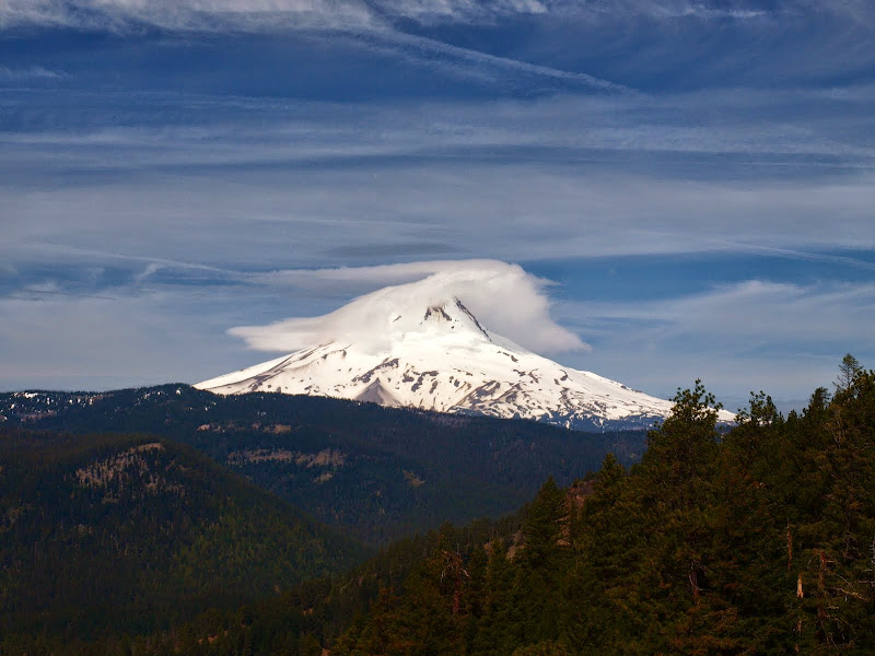
and Hood. With clouds coming in, this was my best view of it for the day.

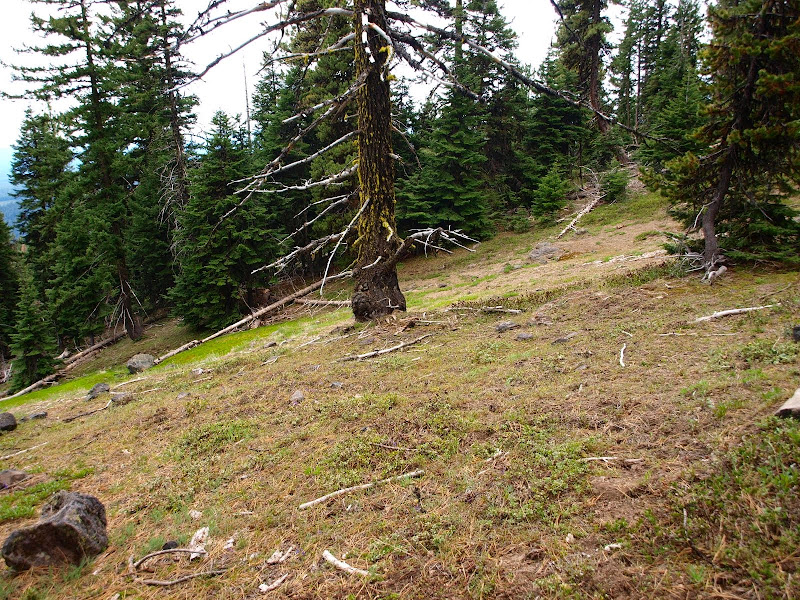
Things were going remarkably smoothly until about half way to Flag Point and my first encounter with serious blow down (Point "B" on the map). {This photo is a re-creation of that moment since I was too busy navigating then to reach for the camera.}

The trail swings up to the left here but that fine detail was lost under the fallen trees. After some searching, I was able to reacquire it and continue NW. But the red dots on the trees were growing less frequent just as the blow down was growing more onerous. Definitive sightings of the trail became less frequent too and by Point "C" on the map, I gave up trying to find it and just looked for the path of least resistance to Flag Point. It didn't help that there were a number of animal trails in the area that looked better that what was left of #470 - but didn't go toward Flag Point. Near Sunrise Springs, I broke into some welcome open ground,
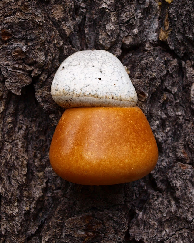
and stopped to admire a marshmallow and caramel tree fungus.
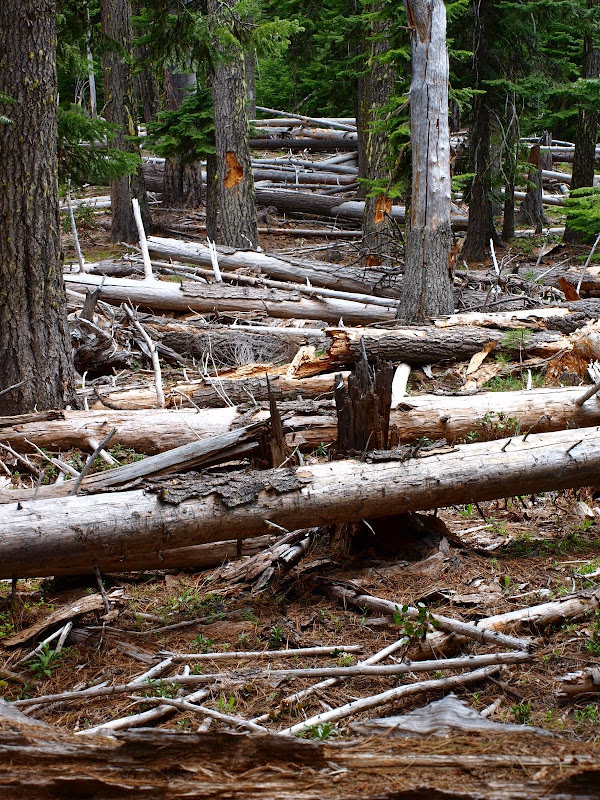
But then it was back into the blow down, which was truly bad by this point (Point "D" on the map). It was as though a whole forest had died and fallen on the trail - even the path of least resistance through this stuff was a struggle. {Another re-creation of this horror.}
It took me almost an hour to cover the last 0.5 mi to Flag Point, coming out of the forest about 100 m W of the LO.
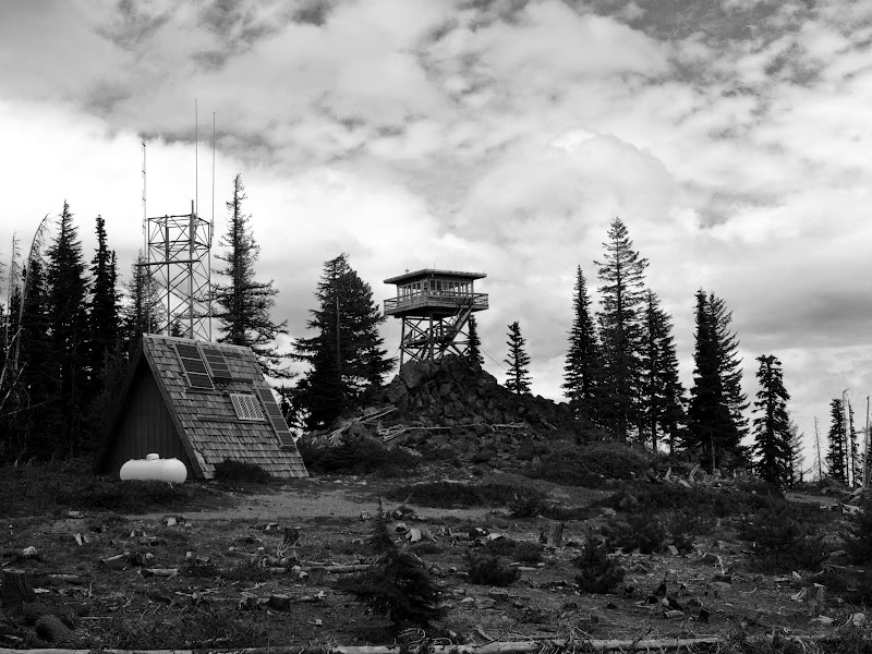
This has got to be one of the most overly optimistic and misleading signs in the forest.
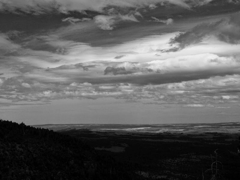
This trail is ONLY for experienced hikers who can navigate like crazy and who pay attention to where they are at all times. Fortunately, the 470 is so bad in this area (see the video linked to the field guide) that the inexperienced would likely give up before they got into trouble. But the USFS ought to either fix this trail (its lower half is in good shape) or take down these trail signs before someone gets lost and/or hurt trying to descend the 470. But for those who want (and are equipped for) an adventure, this is your trail! Rather than walk down the LO service road and back on the Little Badger Creek trail (#469), I dropped directly NE down the boulder field (Point "E" on the map) to intersect trail 469. After a quick lunch, it was E on the 469, and later the School Canyon trail (#468), to the TH. There was a little blow down on these trails but compared to what was on the 470, these two trails were superhighways! From lower on the 468, I had some great views of the expanse of Oregon that lies E of the Cascades,

and of the building clouds.
The lower part of the 468 traverses a delightful oak woodland,

before arriving at the TH on FR 27.
I don't know if this constitutes a busy day at School Canyon, but I did pass several dayhikers and there were at least two groups camped near the 468/469 trail junction, so maybe it was. A short stretch on FR 27, then Romann's Cutoff down to the Little Badger Creek trail and back to the TH by 1630. It was a long (16 mi RT, 3800' EG) and somewhat arduous day, but a GREAT adventure hike in an area new to me. But I think the USFS needs to either fix the 470 or truly decommission it because, at the moment, it could be too easily mistaken for a trail of the same general accessibility as the 468 or 469.
The #470 TH is well marked,
and there's even a small sign (arrow) to let you know you're on the right trail,
but after that, you're increasingly on your own. The trick at the start is to drift left (W) to the edge of the ridge (Point "A" on the map below) to where there's a good view of Jefferson and Olallie Butte. If you try to go straight as the mapped trail suggests, you'll get caught in a bunch of tortured vegetation.
The trail was in surprising good shape for about it's first half, with cairns and spots of red paint as guides.
About 0.5 mi NW of Gordon Butte, there's a good view point for Olallie Butte, Jefferson, and the Sisters,
and Hood. With clouds coming in, this was my best view of it for the day.
Things were going remarkably smoothly until about half way to Flag Point and my first encounter with serious blow down (Point "B" on the map). {This photo is a re-creation of that moment since I was too busy navigating then to reach for the camera.}
The trail swings up to the left here but that fine detail was lost under the fallen trees. After some searching, I was able to reacquire it and continue NW. But the red dots on the trees were growing less frequent just as the blow down was growing more onerous. Definitive sightings of the trail became less frequent too and by Point "C" on the map, I gave up trying to find it and just looked for the path of least resistance to Flag Point. It didn't help that there were a number of animal trails in the area that looked better that what was left of #470 - but didn't go toward Flag Point. Near Sunrise Springs, I broke into some welcome open ground,
and stopped to admire a marshmallow and caramel tree fungus.
But then it was back into the blow down, which was truly bad
It took me almost an hour to cover the last 0.5 mi to Flag Point, coming out of the forest about 100 m W of the LO.
This has got to be one of the most overly optimistic and misleading signs in the forest.
This trail is ONLY for experienced hikers who can navigate like crazy and who pay attention to where they are at all times. Fortunately, the 470 is so bad in this area (see the video linked to the field guide) that the inexperienced would likely give up before they got into trouble. But the USFS ought to either fix this trail (its lower half is in good shape) or take down these trail signs before someone gets lost and/or hurt trying to descend the 470. But for those who want (and are equipped for) an adventure, this is your trail! Rather than walk down the LO service road and back on the Little Badger Creek trail (#469), I dropped directly NE down the boulder field (Point "E" on the map) to intersect trail 469. After a quick lunch, it was E on the 469, and later the School Canyon trail (#468), to the TH. There was a little blow down on these trails but compared to what was on the 470, these two trails were superhighways! From lower on the 468, I had some great views of the expanse of Oregon that lies E of the Cascades,
and of the building clouds.
The lower part of the 468 traverses a delightful oak woodland,
before arriving at the TH on FR 27.
I don't know if this constitutes a busy day at School Canyon, but I did pass several dayhikers and there were at least two groups camped near the 468/469 trail junction, so maybe it was. A short stretch on FR 27, then Romann's Cutoff down to the Little Badger Creek trail and back to the TH by 1630. It was a long (16 mi RT, 3800' EG) and somewhat arduous day, but a GREAT adventure hike in an area new to me.