Table Rock / Pechuck LO Loop 21-May-2014
Posted: May 22nd, 2014, 6:43 pm
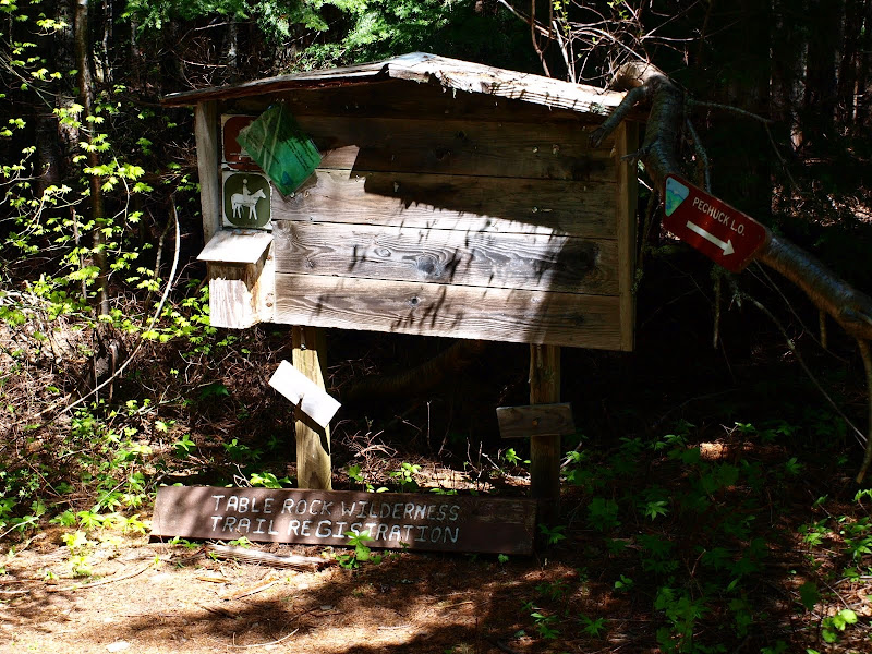
Last month I finally got around to visiting the Table Rock Wilderness after only an 18 year delay (Table Rock 22 Apr). Then I had to work up through some snow to get to Table's summit. I vowed to return. When TheHappyClark posted a TR of a recent hike to Pechuck LO (Pechuck LO), with no report of snow, I knew my time to return had returned. It was, again, pure coincidence that yesterday was a bluebird day (eventually). I started at the Image Creek TH ("access point" might be a more apt description since there's no sign, no facilities, and precious little off-road parking) and quickly gained the Image Creek Trail (an old road) which is in good condition except for when it's not.

Despite promises of sun, it was overcast, misty, and humid as I headed W on the trail.

The trail goes W to intersect with the High Ridge Trail at about 3,000' but I figured "why wait" and headed straight up for the ridge just past Deetee Creek. As I climbed, the clouds started to part,

shafts of light began penetrating the forest gloom,

and by the 3,600' level, I was above the clouds and in sunshine.

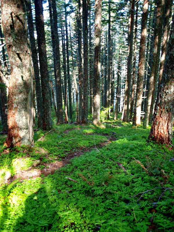
The undergrowth going up to the ridge was minimal and it was easy - but steep - walking under the trees. In short order, I intersected with the High Ridge Trail, which proved to be in great shape all the way to Pechuck LO.
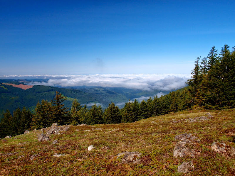
The High Ridge Trail traverses some open meadows enroute to the LO and these gave me a view of the clouds still hanging on down in the valley.
The High Ridge Trail goes mostly through forest and the warm sun had triggered all kinds of aromatic cedar-pine-forest fragrances. Wonderful! You pass out of the wilderness about 0.3 mi before the LO,
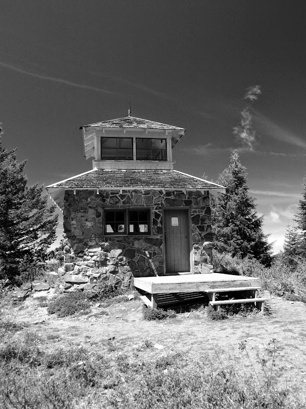
and then it's a short, steep climb up to the little LO, which was built in 1932 and has apparently been lovingly maintained ever since (Pechuck's History). This was my first visit.

I climbed up into the cupola for a view across to my next destination, Table Rock,

and of the roof over my head.

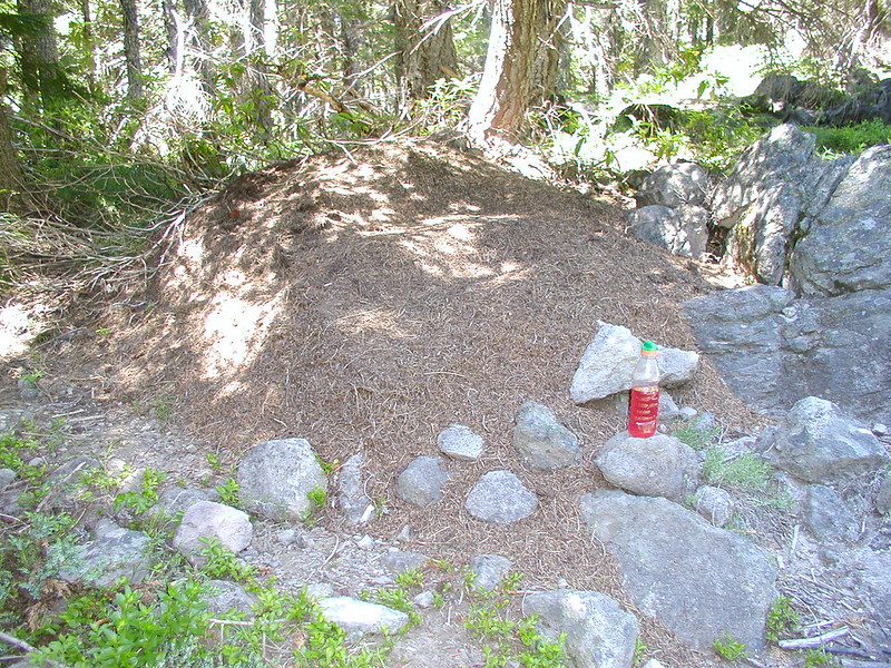
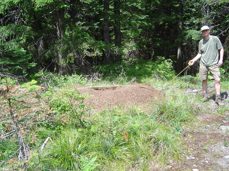
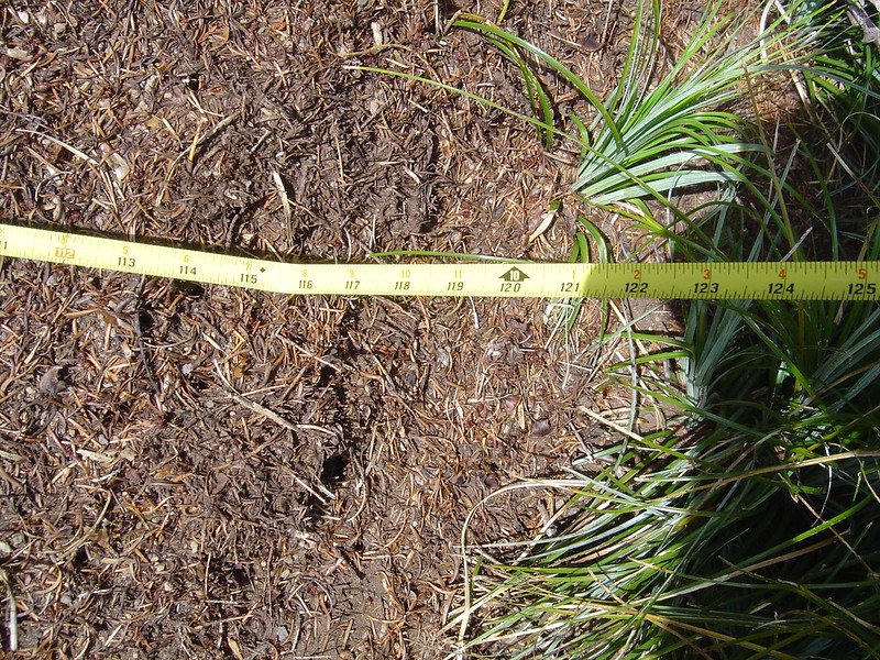
Two people (crowds!) were just reaching the LO as I was leaving, so I pushed off on the High Ridge Trail again for my return to Rooster Rock and the junction with the Saddle Trail. That trail was in tough shape in spots as it dropped sharply into the upper reaches of the Image Creek drainage and then climbed back up (somewhat sharply) to reach its junction with the Summit Trail. I'd been noticing the large, active ant nests (mounds) along the trail but finding four of them built ON the trail (arrow) was a surprise.

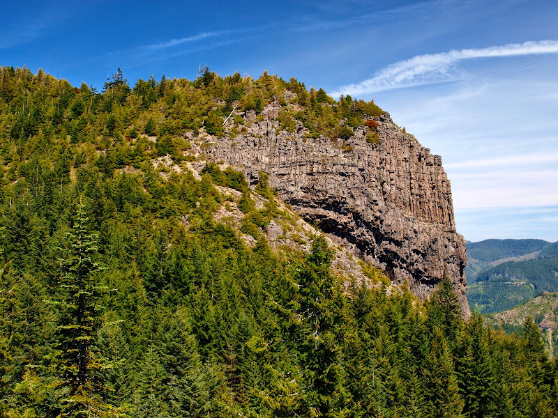
Just before reaching the junction with the Summit Trail, I got a great view of the mighty basalt prow on the E side of Table Rock.
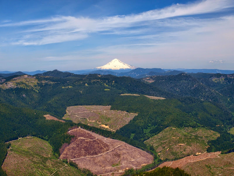
Then it was on to the summit for views of all the big peaks: Hood (with clearcuts),
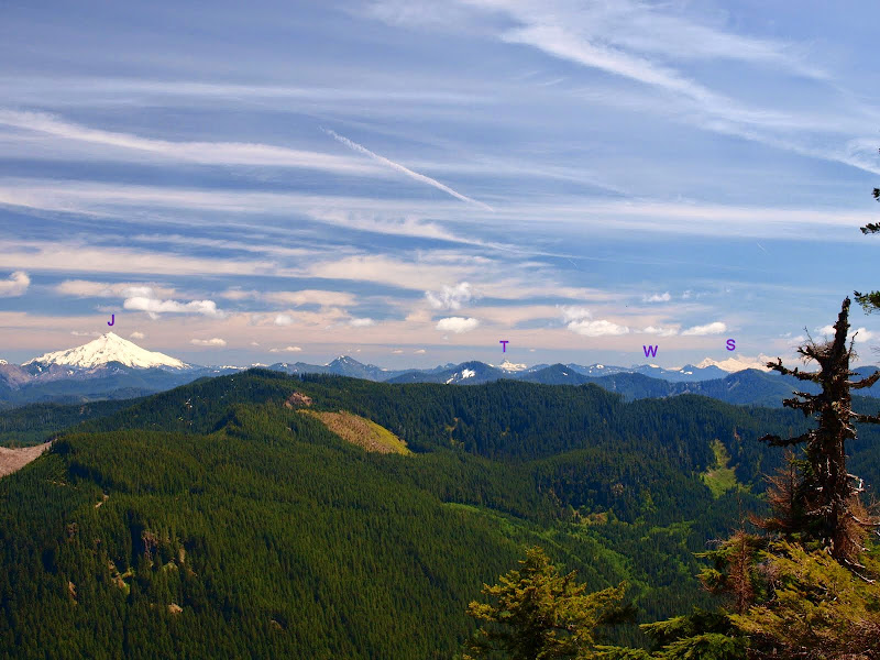
and Jefferson (J), Three Finger Jack (T), Washington (W), and the Three Sisters (S),
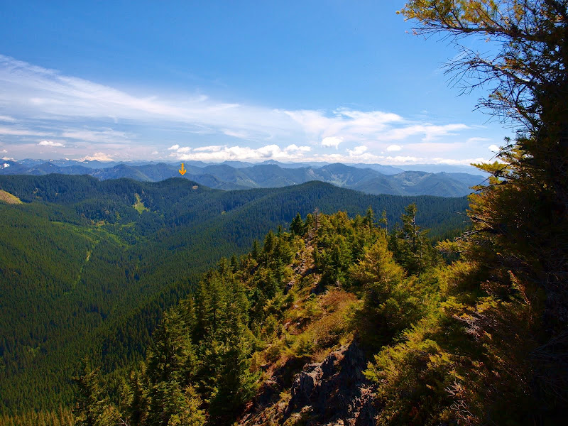
and also St. Helens and Rainier. On the way back, I could just make out Pechuck LO (arrow) on the ridge across the valley.
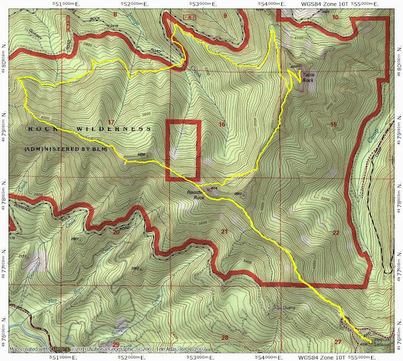
I took the Summit Trail N to a spot where it's possible (there's a use trail) to drop down to the Image Creek Trail just below, which I took back to my car. No snow anywhere. Looking at the map, I realized I'd hiked pretty much all of the higher elevations of this small, but charming wilderness. 14 mi RT, but 4700' EG because there are a lot of big ups & downs along these trails. Nothing better!
Despite promises of sun, it was overcast, misty, and humid as I headed W on the trail.
The trail goes W to intersect with the High Ridge Trail at about 3,000' but I figured "why wait" and headed straight up for the ridge just past Deetee Creek. As I climbed, the clouds started to part,
shafts of light began penetrating the forest gloom,
and by the 3,600' level, I was above the clouds and in sunshine.
The undergrowth going up to the ridge was minimal and it was easy - but steep - walking under the trees. In short order, I intersected with the High Ridge Trail, which proved to be in great shape all the way to Pechuck LO.
The High Ridge Trail traverses some open meadows enroute to the LO and these gave me a view of the clouds still hanging on down in the valley.
The High Ridge Trail goes mostly through forest and the warm sun had triggered all kinds of aromatic cedar-pine-forest fragrances. Wonderful! You pass out of the wilderness about 0.3 mi before the LO,
and then it's a short, steep climb up to the little LO, which was built in 1932 and has apparently been lovingly maintained ever since (Pechuck's History). This was my first visit.
I climbed up into the cupola for a view across to my next destination, Table Rock,
and of the roof over my head.
Two people (crowds!) were just reaching the LO as I was leaving, so I pushed off on the High Ridge Trail again for my return to Rooster Rock and the junction with the Saddle Trail. That trail was in tough shape in spots as it dropped sharply into the upper reaches of the Image Creek drainage and then climbed back up (somewhat sharply) to reach its junction with the Summit Trail. I'd been noticing the large, active ant nests (mounds) along the trail but finding four of them built ON the trail (arrow) was a surprise.
Just before reaching the junction with the Summit Trail, I got a great view of the mighty basalt prow on the E side of Table Rock.
Then it was on to the summit for views of all the big peaks: Hood (with clearcuts),
and Jefferson (J), Three Finger Jack (T), Washington (W), and the Three Sisters (S),
and also St. Helens and Rainier. On the way back, I could just make out Pechuck LO (arrow) on the ridge across the valley.
I took the Summit Trail N to a spot where it's possible (there's a use trail) to drop down to the Image Creek Trail just below, which I took back to my car. No snow anywhere. Looking at the map, I realized I'd hiked pretty much all of the higher elevations of this small, but charming wilderness. 14 mi RT, but 4700' EG because there are a lot of big ups & downs along these trails. Nothing better!